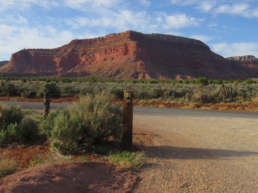
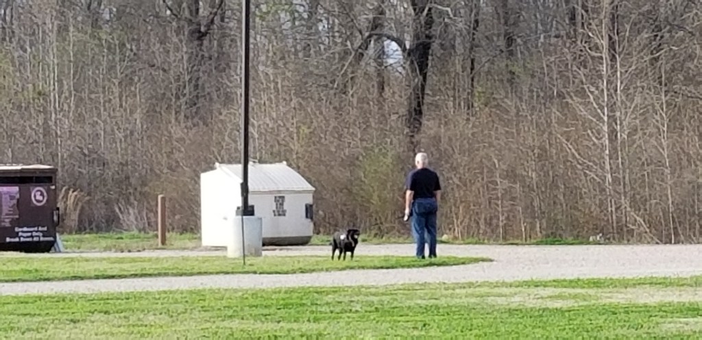
If you ever find yourself on the road between Flagstaff, Arizona and Kenab, Utah, please do not hesitate to take US State Route 89. The route has some of the most beautiful scenery we have enjoyed on a travel day. We might not have even been on the southern part of this drive, were it not for a last-minute change of plans.
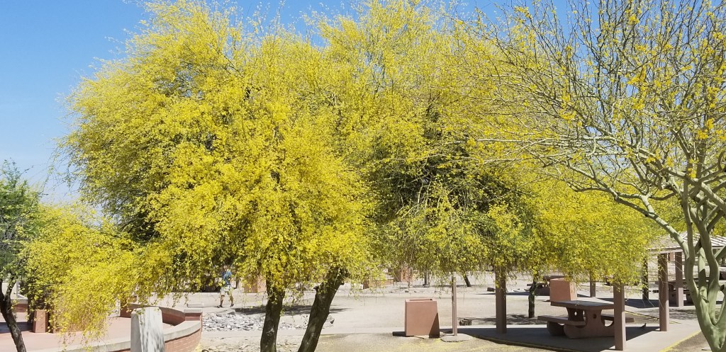
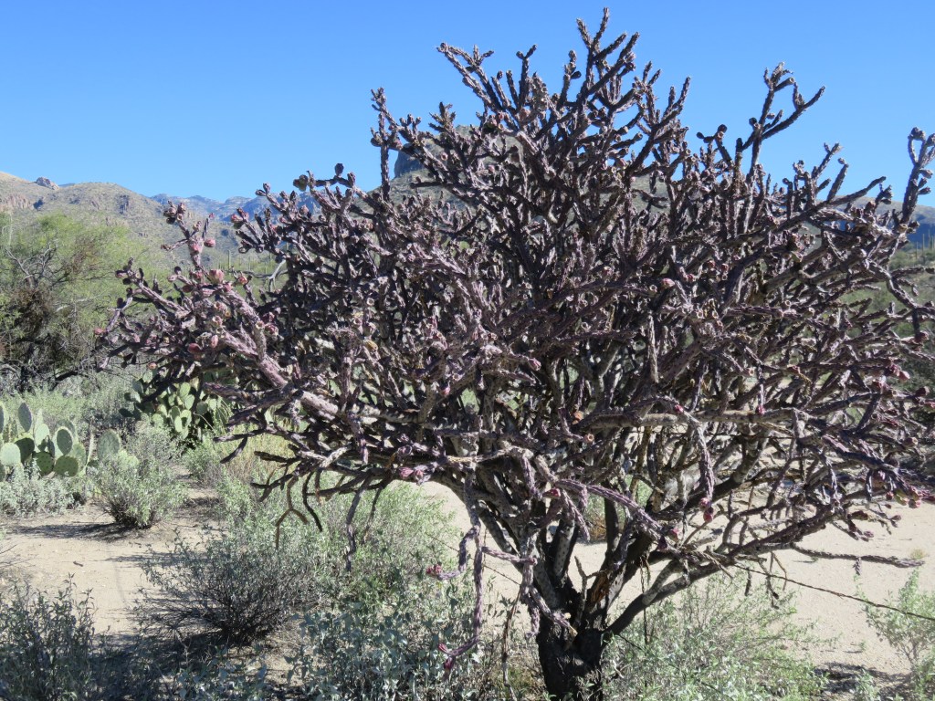
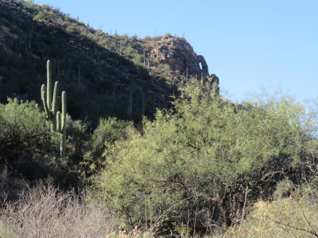
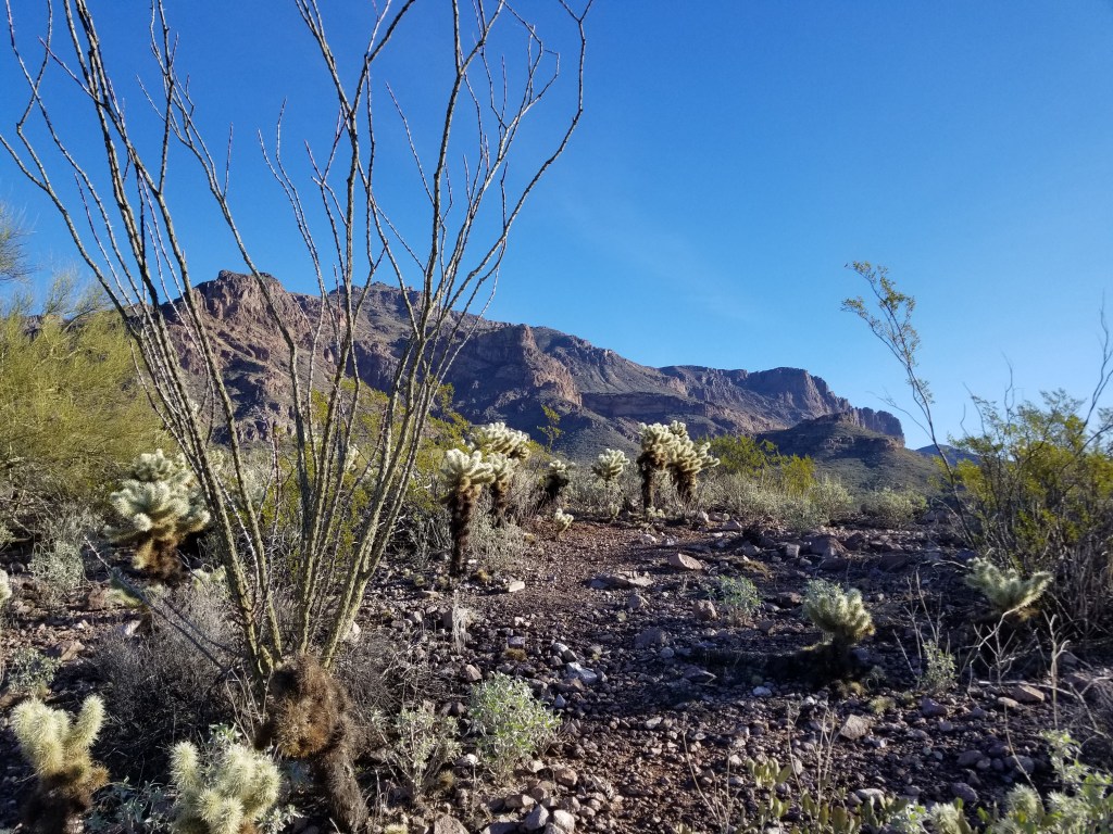
Palo Verde trees in blossom, somewhere near Tucson
To back up just a bit, on the day we were to leave Ft. Huachuca, we received news of a Covid crisis with our family in Denver. The next day I was on a plane heading from Phoenix to Denver to provide some needed day care for our grandchildren. Cal stayed at Luke Air Force Base for a week, having a time watching the F-16 and F-35 training pilots continually take off on the runway. Life turns on a dime, doesn’t it?
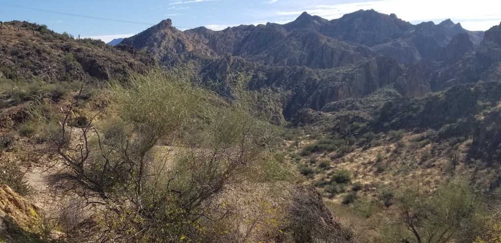
A couple of planned stays were completely eliminated, and that is how we ended up taking 89 all the way from Flagstaff to Kenab. The scenery changes here from high mountain ponderosa pine to desert shrub, rolling hills, buttes and mesas, and odd piles of rocks. There are turnoffs for both the South and North Rims of the Grand Canyon. We drove through Navajo Nation, where there were wooden stands for selling Navajo crafts. Most were empty, some falling apart, but a few were occupied selling mostly jewelry from what I could see. I’m speculating that they will disappear one day in the future, when artisans have so many other ways to take their creations to market.
There was a scenic turnoff for a beautiful overlook and off in the distance were the Vermillion Cliffs. The whole vista was a feast for the eyes. Cal could not stop because we had Sam behind us and there was no room to park.
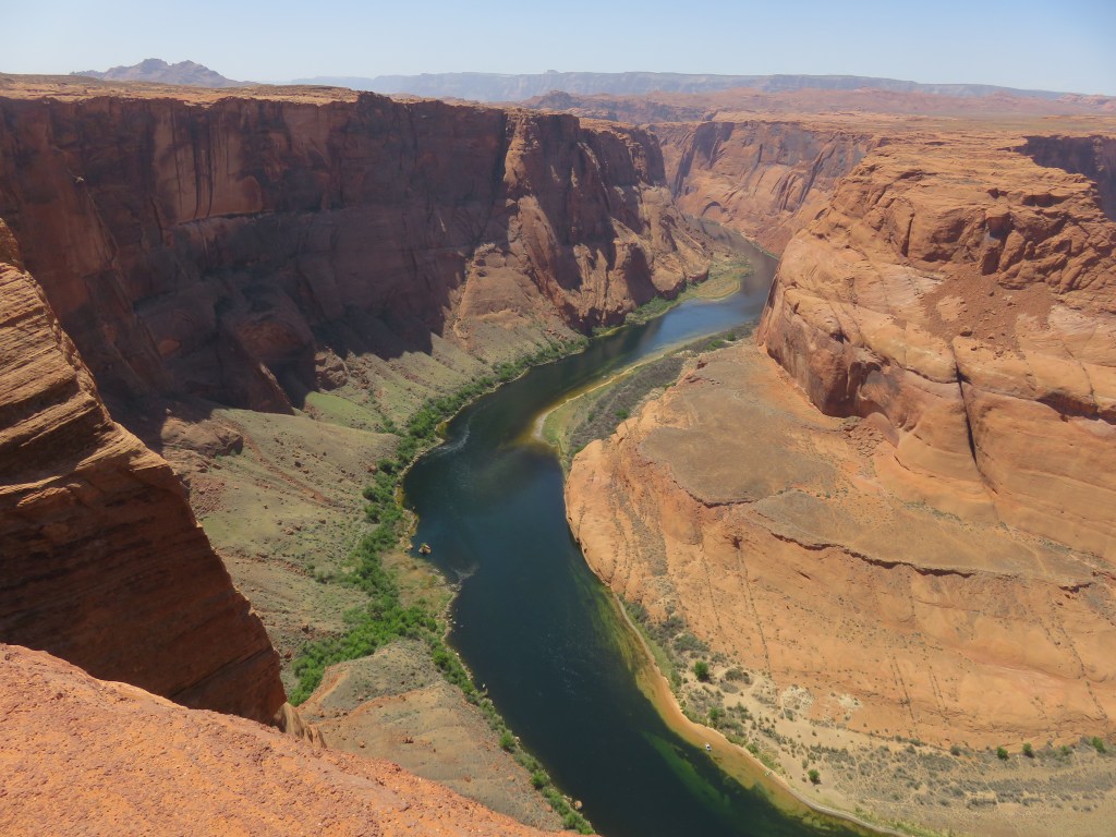
Near Page, we stopped at Horseshoe Bend. The park is run by the city of Page which charges for its huge parking lot; happily, there was room for us. We generally do not make stops on travel days, so I was surprised when Cal turned in. It was just over a half mile walk to the most amazing view:
Horseshoe Bend, on the Colorado River
In the view above, you can just barely see the Vermillion Cliffs rising in the background. Route 89-A is another scenic route for seeing them, and this road would go also to the North Rim.
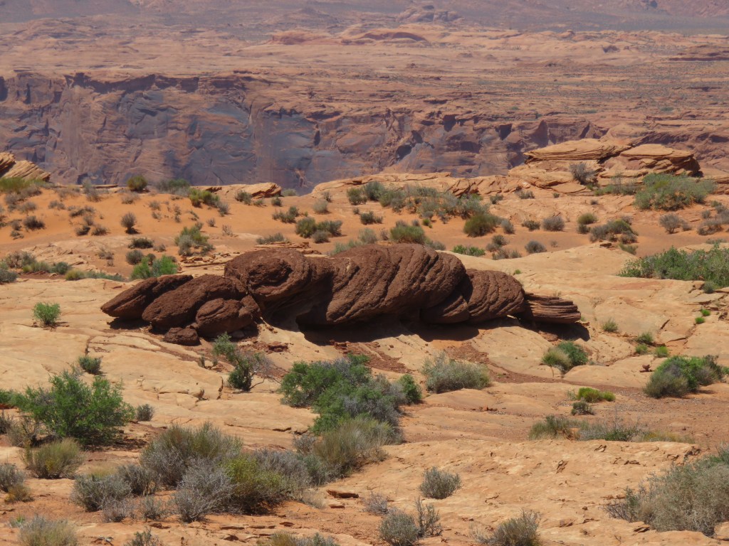
Rocks are so interesting. I saw these on our hike to Horseshoe Bend. They look just like…well, I will leave it to your imagination. I was looking around for Paul Bunyan’s ox.
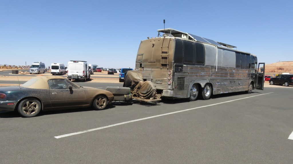
In the parking lot was this ensemble. We had crossed paths with them earlier in the day:
Someone has been doing a lot of boondocking in the desert
It looks like they have everything they need right there.
On the other side of Page, we came to Glen Canyon Dam:
We’ve been reading a lot in the news about Glen Canyon, and Lake Powell that the dam creates. The water levels are dangerously low due to a 25-year drought. If you look above the dam, the white cliffs will show you how much the water has dropped. On one side of Lake Powell, the water is completely gone. We drove for many miles past the dam and were pretty sure that we should have been seeing beautiful views of the lake. What will happen when the dam can no longer produce power or water for life downstream? These are difficult problems that are being encountered across the Southwest.
Looking downstream from the dam
We crossed over into Utah, which was our first new state in many months, except for Hawaii. We’d been in Arizona since December and were a little sad to leave the state. We will be back.
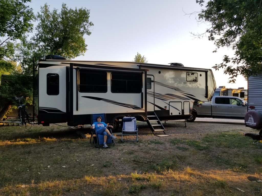
Our stay while in the Kenab area was at Dark Sky RV Park, our destination for the day. It is fairly new, family owned, and every site is designed for maximum enjoyment of the night sky. We visited a bit with Rick, “Dad” in the enterprise. He had a brief experience with towing a 5th wheel and decided that none of his sites were going to be back-ins. There is a “cocktail table” with two log seats, a regular size table with a cover, and even a propane fire pit. Lights must be off after dark. With our pull-through site, we were able to enjoy nothing but the desert.
View from our RV
We also had this view across the road! It was a fine stay in which to begin our Utah adventures.
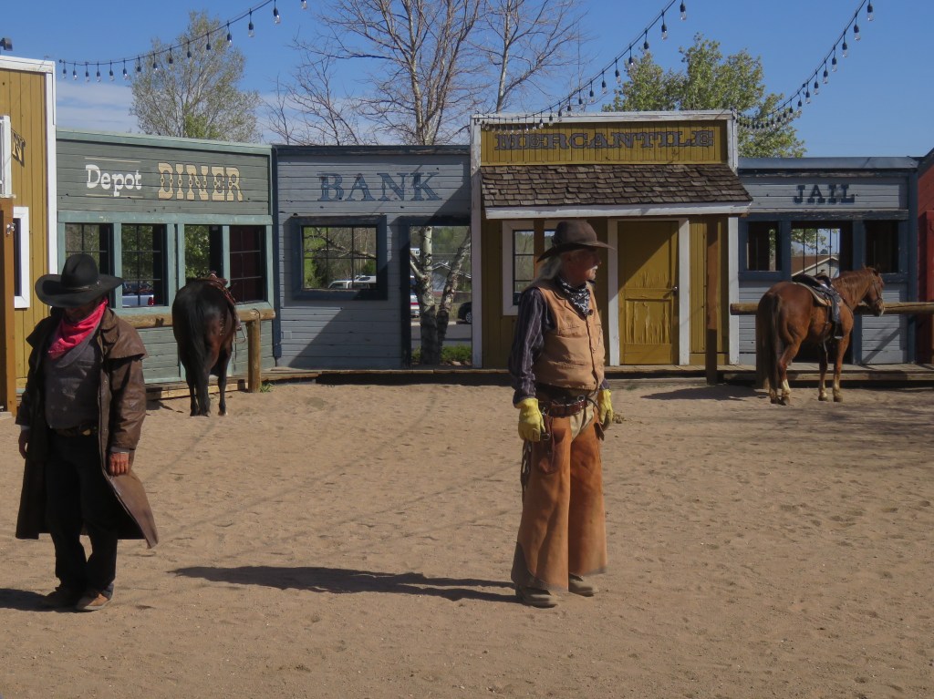
It didn’t seem right to leave Arizona without seeing the Grand Canyon. Cal and I have been there a few times in our lives, separately and together, so I looked around for a different way to see it. Riding a train seemed like a perfect idea.
The depot is in Williams and they have quite a set up: besides the train, there is a hotel with all the amenities plus the RV park where we stayed for just two nights. It was a packed park. We were right in front of some railroad tracks, separated only by a ditch and a fence. You either love the sound of the trains, or you hate them. I don’t mind if they are off in the distance, but the train horn blowing woke me up once each night.
Small price to pay for the convenience, though. We were able to walk to the depot in the morning of our excursion. Before we boarded the train, there was a shootout outside the depot. The sheriff was having a little trouble with the Cataract Creek Gang. This was a huge event; why did I not see it in the morning news?
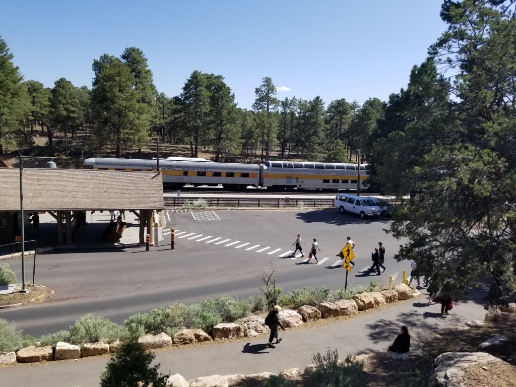
Silliness aside, we enjoyed the two hour ride up to Grand Canyon. Our host in our car told us about the trains and the scenery we were passing, there was a little snack buffet, and a singer came by with guitar in hand to entertain us with a few songs. Before we knew it, we were at the Grand Canyon Depot.
The 64-mile Grand Canyon Railway was originally completed in 1901 and was instrumental in the development of Grand Canyon Village. It was built by the Atchison, Topeka and Santa Fe Railway. With the decline of the railway, the last passengers rode the train in 1968. Developers purchased the line and restored operations again in 1989. Today the train runs 364 days a year. Our car was full and it looked like the others were too on the day we rode.
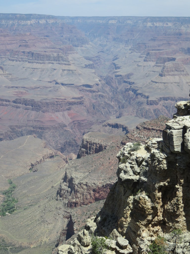
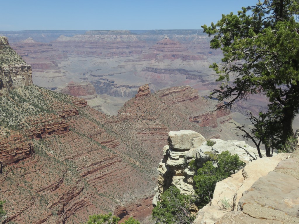
Of course, the Grand Canyon is the main attraction. We climbed up a lot of steps from the depot, and there it was. I had forgotten. Forgotten how it takes my breath away and almost brings me to tears every time I see it. I’m struck, every time, by its beauty. It truly is grand.
A National Park Service informational sign says much of what I was feeling:
“Gazing upon this view, one is struck by the canyon’s vastness. The mind struggles to comprehend it. Try to describe the canyon’s size in words. Try to measure in your mind the canyon’s depth, width, and length. Measurements like 1 mile deep, 18 miles wide, and 277 river miles long leave us scratching our heads. Perhaps the best we can do is just feel the canyon’s enormity. Measure yourself up against it. We are miniscule in comparison…”
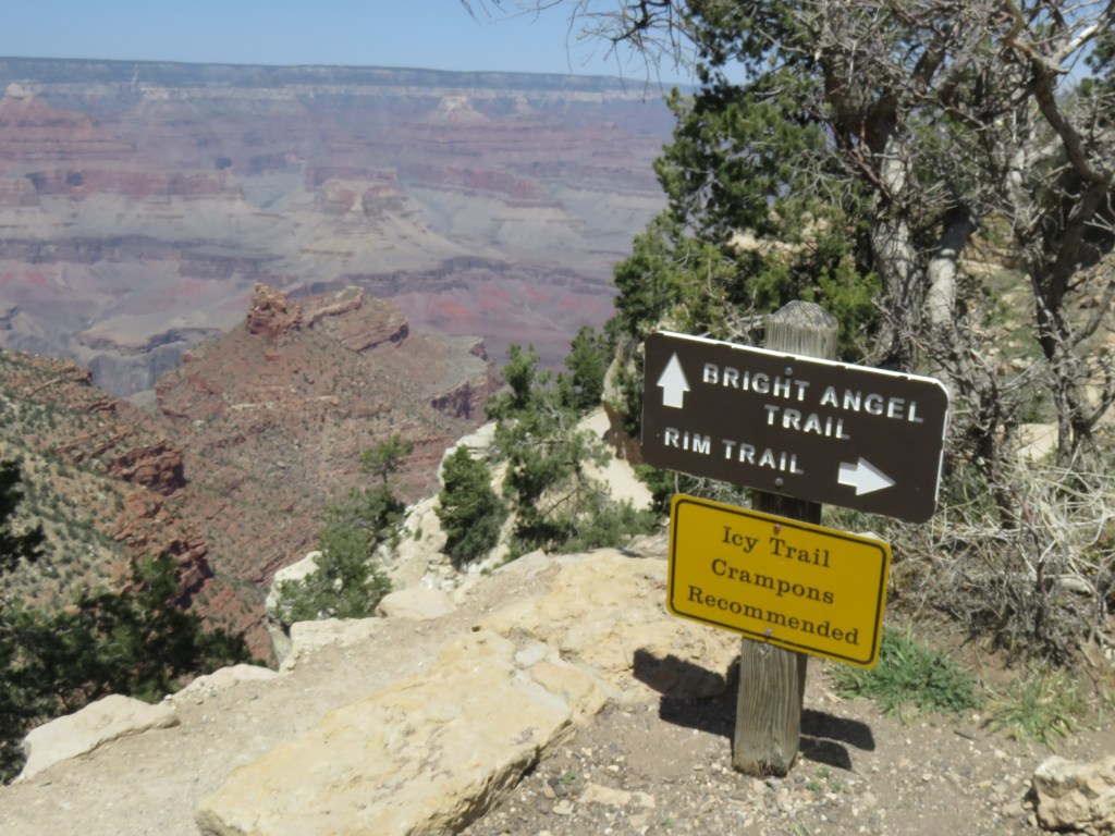
We rode the park shuttle to Hopi Point and hiked back along the Rim Trail. That was a good way to get some quiet trail time. We appreciated our host’s suggestion for this; our walk from Hopi Point was all down hill.
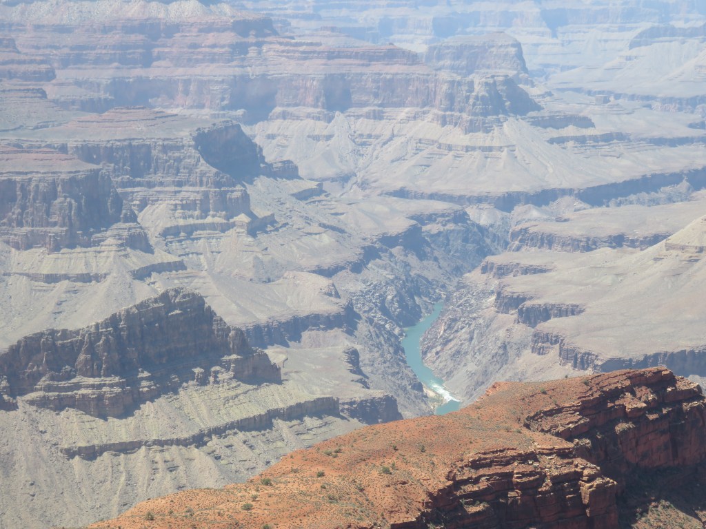
From Hopi Point, we could see the Colorado River far below.
The view of the canyon was dizzying in some spots, as there was no barrier rail in many places of this part of the trail:
Maricopa Point looked like a good viewing spot, although we did not hike over to it.
If one wants to hike down inside the canyon, Bright Angel Trail is the trail to take, and it will be four to six hours to the bottom. It is a long and strenuous hike, and hiking back up takes twice as long as venturing down. If one is overnighting, Phantom Ranch has basic accommodations at the bottom. I think it would be fun to hike down and stay at Phantom Ranch, if someone could come by and pick me up in the morning! Before we hopped on the shuttle, we passed the Bright Angel trailhead.
As we got closer to Grand Canyon Village on our hike, we could see the trail far below.
Looking down on Bright Angel Trail closer to the beginning of the trail head:
This little squirrel posed nicely for me. Or it was looking for a handout, I can’t be sure.
You wouldn’t think you’d see much wildlife so close to all the humanity around, but this bighorn sheep was oblivious.
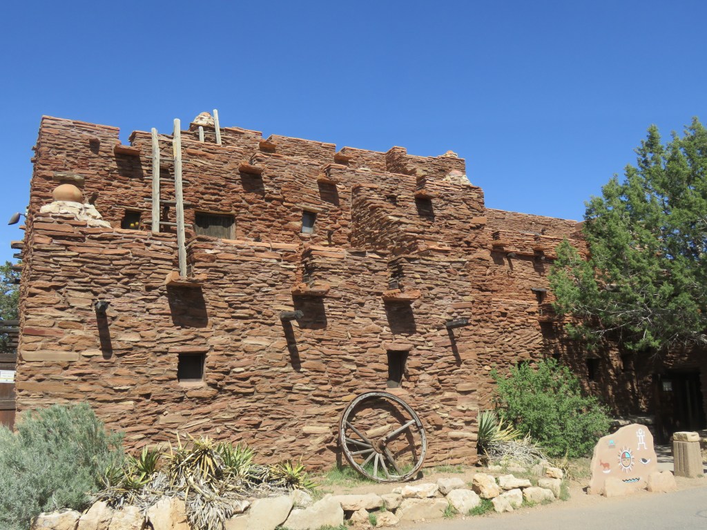
I visited Grand Canyon with my parents when I was twelve, and again in my late teens with a friend on our way back to Texas from Las Vegas. Each time, I loved to see the Hopi House on the edge of the canyon. I wondered if this was a real Hopi house. Did Hopi Indians once live here? At the time, I received no answers, or I don’t remember that I did.
Fast forward to the Internet age. Our host on the train told us that the Hopi House was designed by Mary Coulter for the Fred Harvey Company which was instrumental in promoting tourism in the canyon. In the early 1900’s, she was revolutionary in the field of architecture. Her designs blended the natural landscape with whatever building materials were local. The Hopi House was finished in 1905.
The Hopi were a native canyon tribe and at the time were considered more civilized because they lived in permanent pueblos and created beautiful arts and crafts. The Hopi House was built as a place where Hopis could work and live, and visitors could observe and purchase their goods. It’s built like a true Hopi home, where several families could live, enjoy the rooftop terraces and vistas in the evening, and enjoy the company of fellow artisans. The exception to this is that there is a door in the front on ground level; the Hopi would not have had one. At one point, three generations of one family lived here. A dance platform was built in the 30’s but the evening Hopi dances ended in the early 1970’s with resentment by many Hopi for having their culture on display for tourists. Today, we know that several tribes once lived in the Canyon, not just the Hopi, and we celebrate their cultures as well.
I found much of this information on gracahistory.org and for further reading you can visit their site with a search on “Hopi House”.
The Hopi House has been refurbished. True to its original conception, it is a shop and art gallery that sells mostly native crafts. The items for sale are beautiful, and I also tried to look past them to see the original house as it was.
My parents were also here on their honeymoon in 1938, which was probably the heyday of the Hopi house. I faintly remember my mother saying that the Indians would be sitting along side of the road selling their wares as they traveled. I would love to see the Hopi house as she saw it then.
All too soon, it was time to board the train back to Williams. We had a different singer this time, who billed himself as “The Rock-n-Roll Cowboy.” And then we were held up by the Cataract Creek Gang! We saw them on their horses as we passed and soon the train stopped. The robbers actually got away with some of our cash, which was in reality tip money.
The sheriff just before the robbers boarded our car, certain that the passengers ahead of us knew of their whereabouts
The train was great fun and we liked not having a car at the Canyon, but I would not recommend it if it would be someone’s first visit there. I was surprised that, even as a repeat visitor, our time at the Canyon felt a little short. Or maybe I just got lost in the Hopi House. Some passengers had luggage and were staying at the Canyon with a return trip the next day. I wish I had thought of that earlier! The train ride would also be a whole bunch of fun for school-age kids.
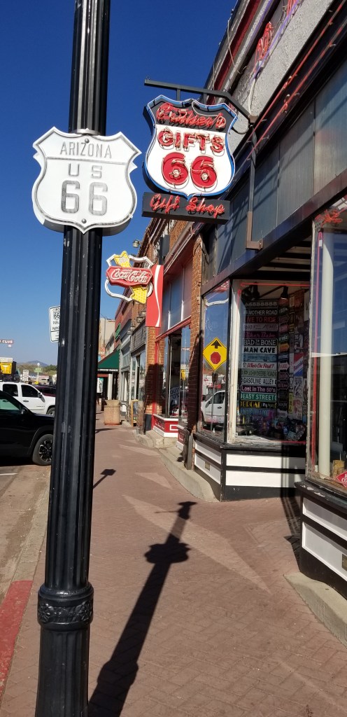
The town of Williams is on the original Route 66 and was one of the last towns to be bypassed by the highway. We were able to walk over the tracks for a little visit.
Our time in Williams was brief but with much to look forward to on the road ahead, we were ready to go. I’ll leave you with one last view of the Grand Canyon.
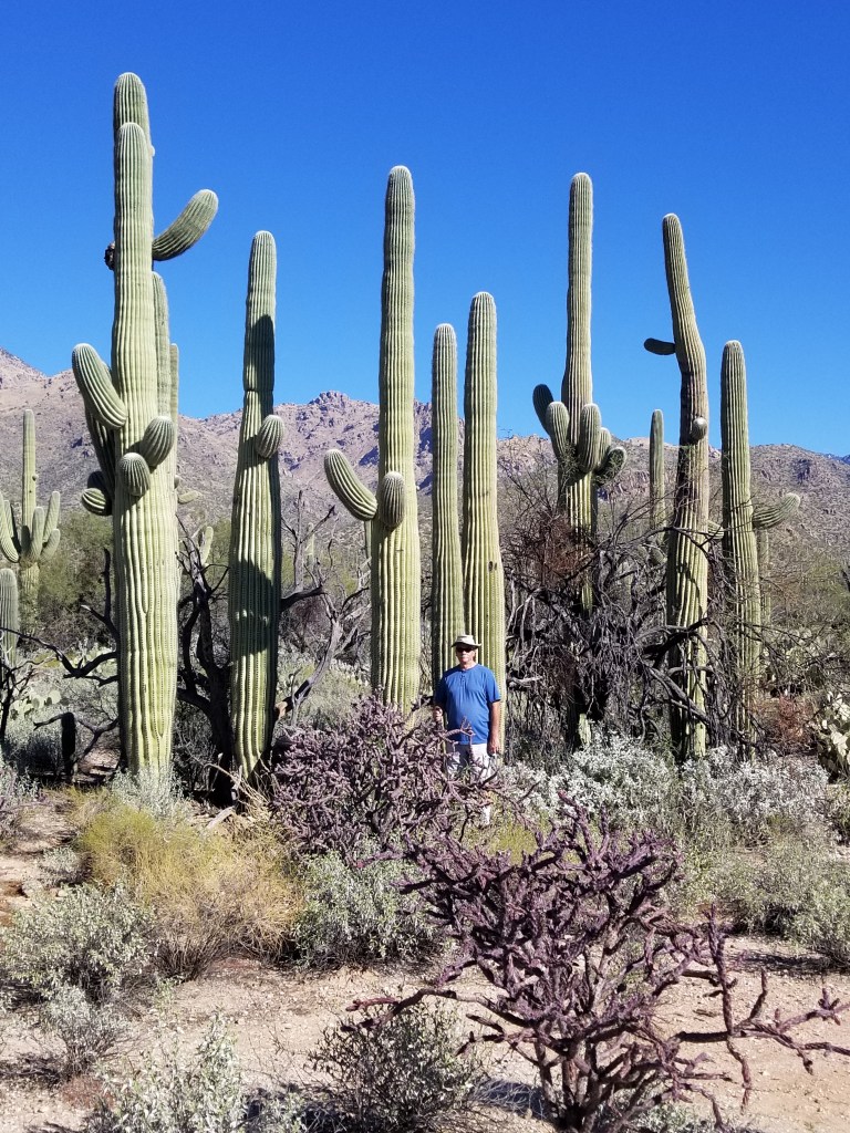
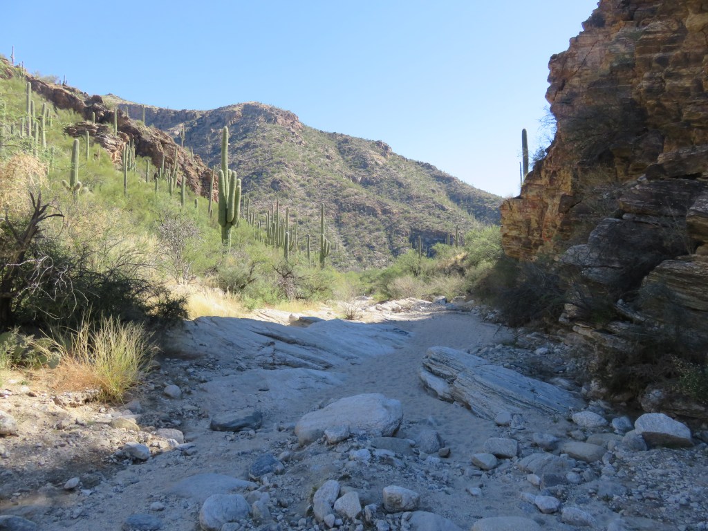
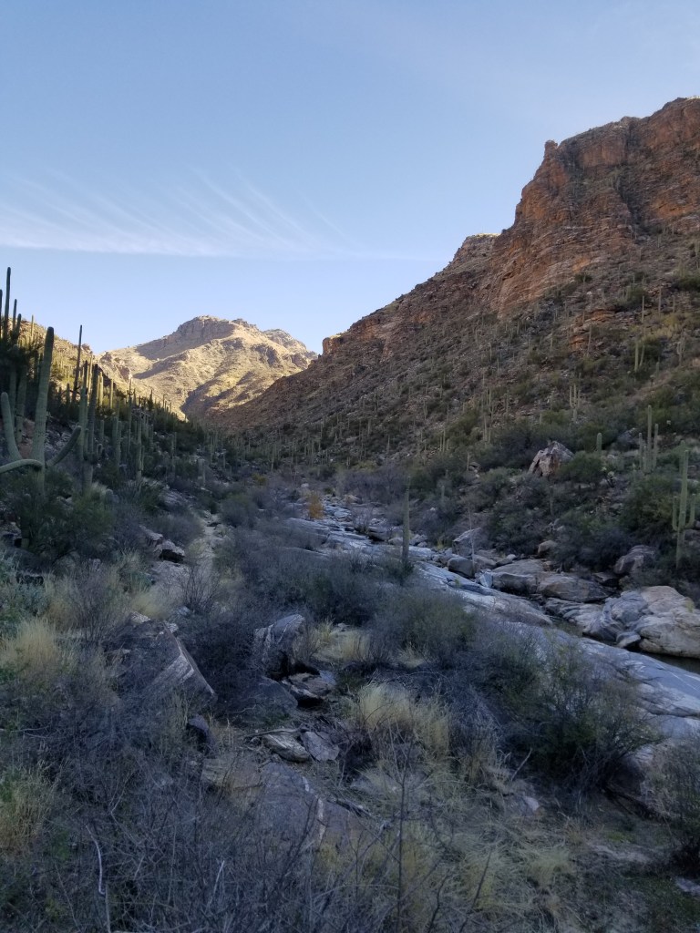
After spending a month at Gold Canyon, we moved a little further south to Tucson. This is a city we were very familiar with years ago, but time changes things and we didn’t see much that was familiar. Several people we talked to told us to go to Sabino Canyon, which was not a place we had heard of.
The proper name for this place is “Sabino Canyon Recreation Area, Coronado National Forest”. It is not far from Tucson so it is a popular place to hike. There is a whole network of trails in here. In an effort to ease congestion, a shuttle service was installed years ago. There’s a one-hour narrated 7.4-mile roundtrip tour into the upper end of the canyon, with nine stops to get off sooner to hike various trails. There is also another shuttle route with service to Bear Canyon which is shorter and not narrated.
It is an error these days to think you can just show up and ride a shuttle. When we arrived at Sabino Canyon, all the shuttles for the day were full. We should have booked ahead on-line. They’ve recently converted the pollution-belching gas shuttles to electric – but several don’t work. However, a volunteer ranger was ready for us. He mapped out a route for us from the visitor’s center with several interconnecting trails – just over two miles, he said. I think it was further than that. I had 12,000 steps on my Fitbit at the end of the day, which is about six miles.
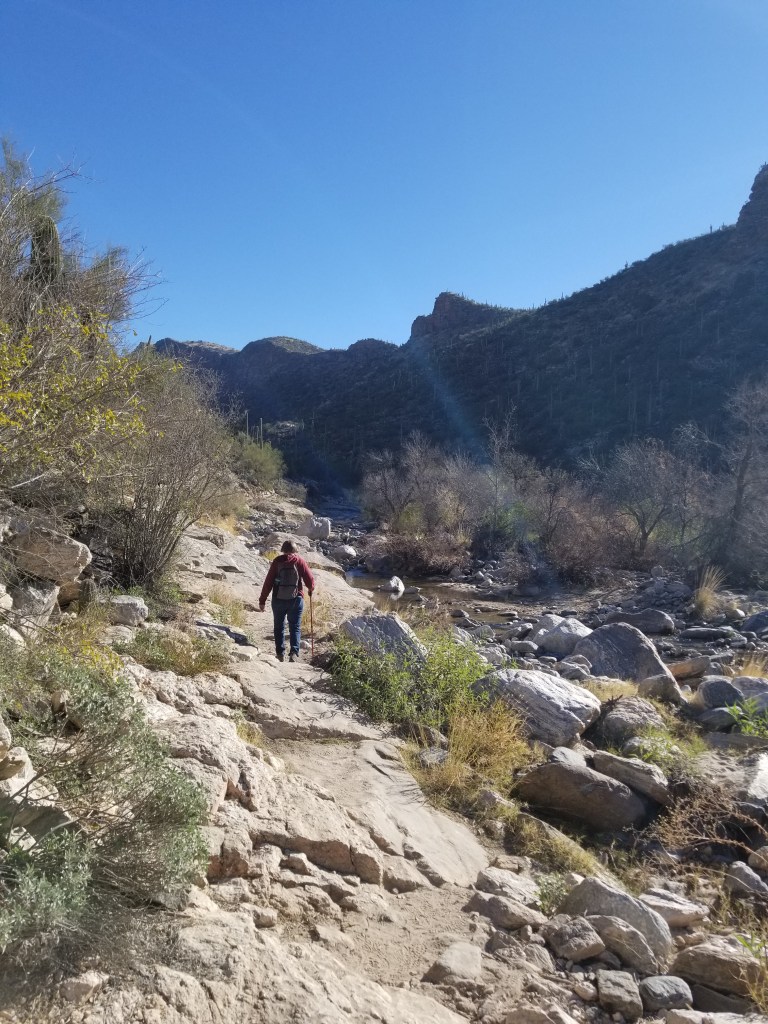
No matter, once we hit the trail we left everyone behind, and mostly had it to ourselves.
This little ledge overlooking a creekwas a great spot to have a picnic lunch
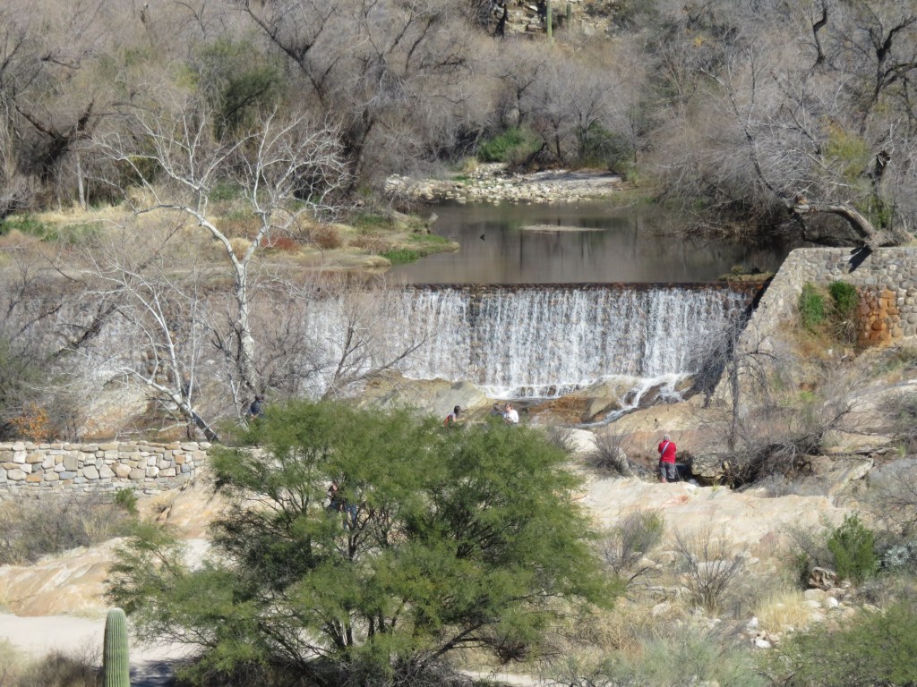
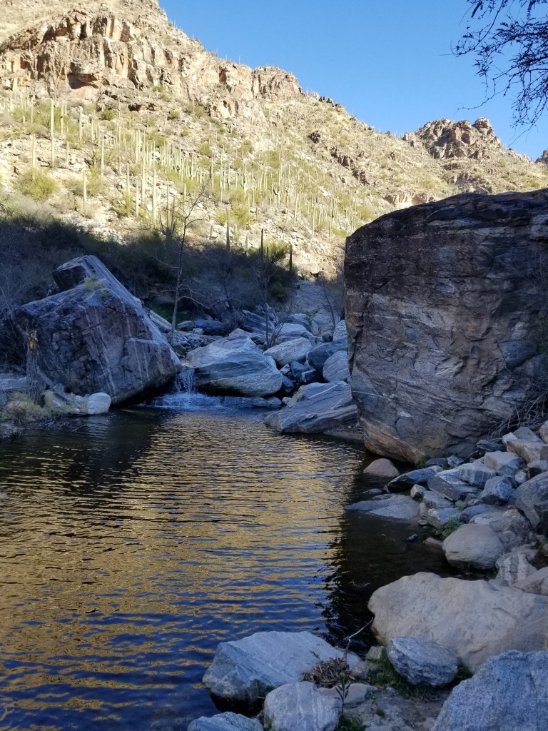
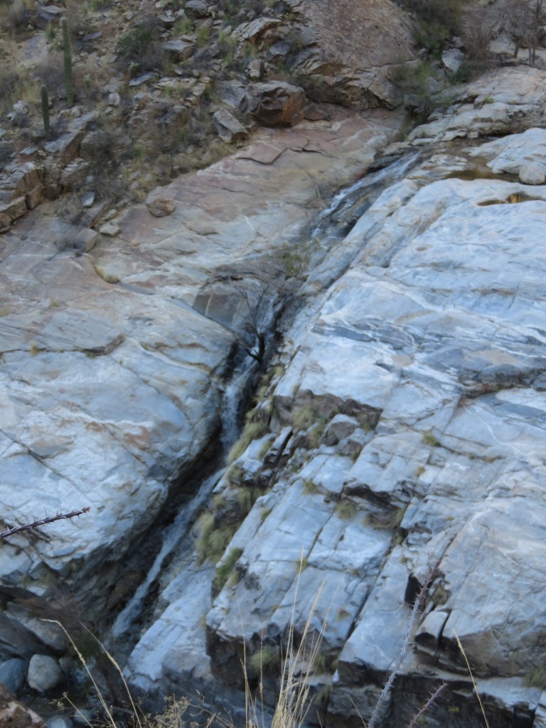
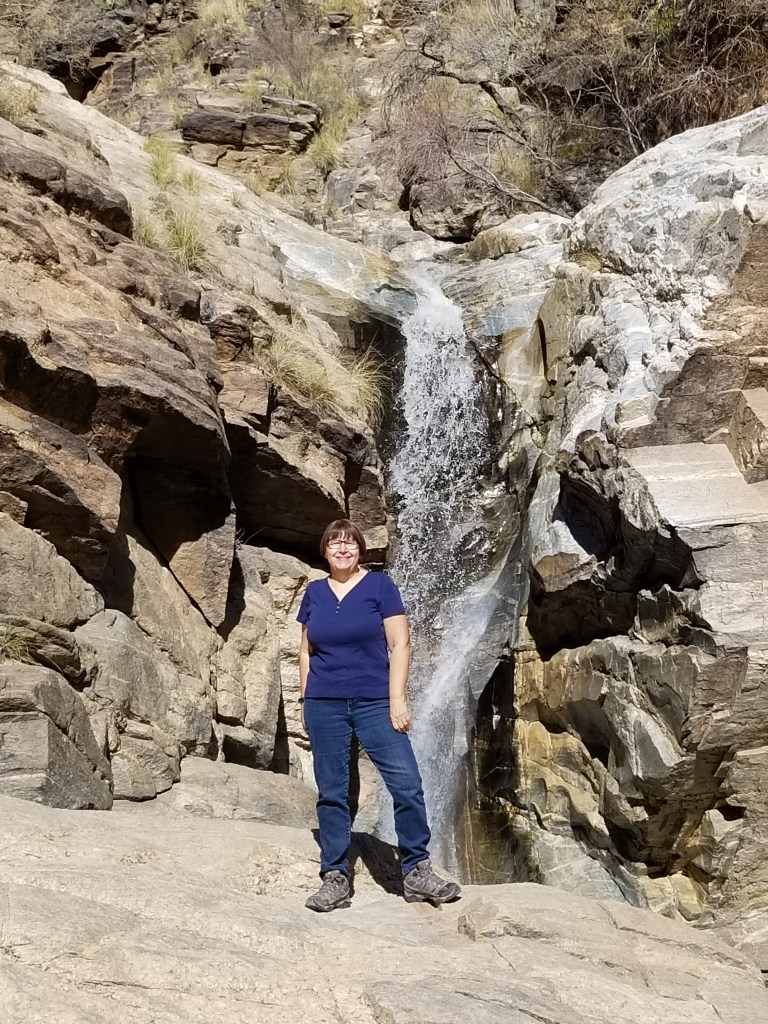
An old dam is gone, but has left a pretty waterfall
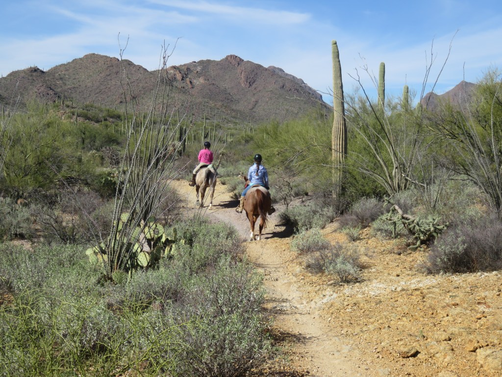
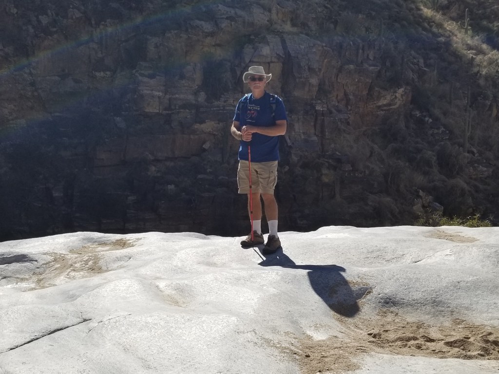
Another great way to visit the trail!
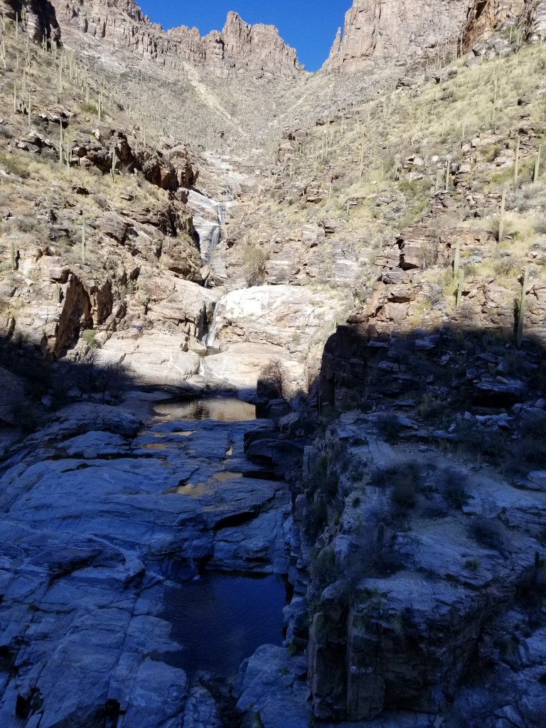
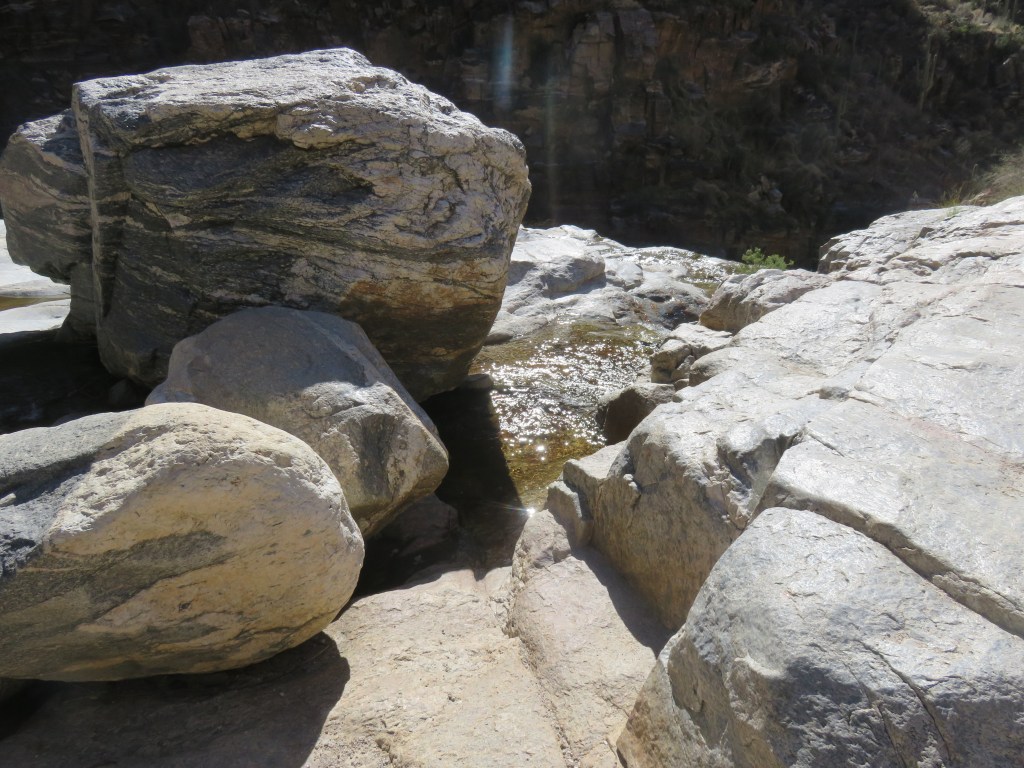
Bear Canyon Trail to Seven Falls
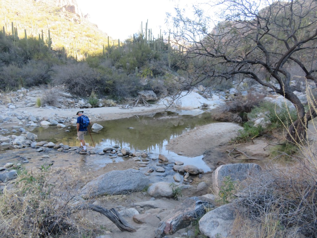
We thought our first hike at Sabino Canyon was fun, but we actually missed the one that everyone talks about: the Seven Falls hike. It was a longer trail than we had wanted on our first visit: 8.6 miles. The distance can be reduced down to about 5 miles by taking the Bear Canyon Shuttle. We returned the next week to give it a go. The Bear Canyon Shuttle isn’t as busy as the Sabino Canyon Shuttle, but I still made sure to get tickets this time.
The sun was still coming up over the higher mountain peaks as we walked.
Soon we were following a creek–
And then, we crossed the creek. And then crossed back. And back again. The river got deeper, the rocks farther apart. Finally I consulted our trail map: there are seven creek crossings before reaching Seven Falls! Which means, of course, seven crossings back, since this is an out-and-back trail.
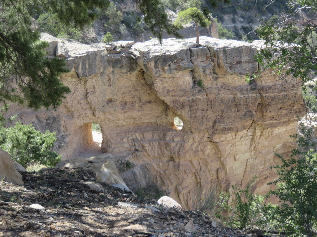
We looked back behind us, and saw an arch in the rocks:
On trails in the Southwest, I’ve learned that a sign like this means switchbacks are coming, which means going up. Shortcutting is going off-trail and climbing straight up, as opposed to the gentler zig-zagging on the trail. We did indeed hike upwards, and then around the edge of the cliffs, and the trail narrowed. It was a little treacherous, so there are no pictures on that part!
Our first glimpse of Seven Falls:
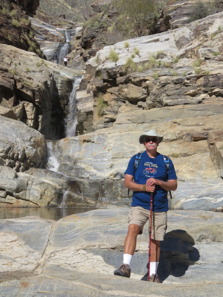
The view is breathtaking. I counted them and indeed there are seven waterfalls. The distance from top to bottom is of considerable length and couldn’t be captured on Cal’s phone or my camera well, especially with the sun in the wrong spot. Trust me…it was worth the hike and all the creek crossings. Looking at the above picture: from here, we climbed down to the right, crossed the creek, and then back up to the first rock in the sun on the left to enjoy the waterfalls and the view. In the picture below, you can see people in the bottom left, and that’s where we sat for awhile.
Coming out of the falls, we passed a group of young college students (judging by their t-shirts and ballcaps). By the time we reached the cliff above the falls, they had stripped down to bathing suits and had jumped into this pool (above) under the waterfall. This was accompanied by much whooping and hollering, as we could hear even from our vantage point! The water must have been cold!
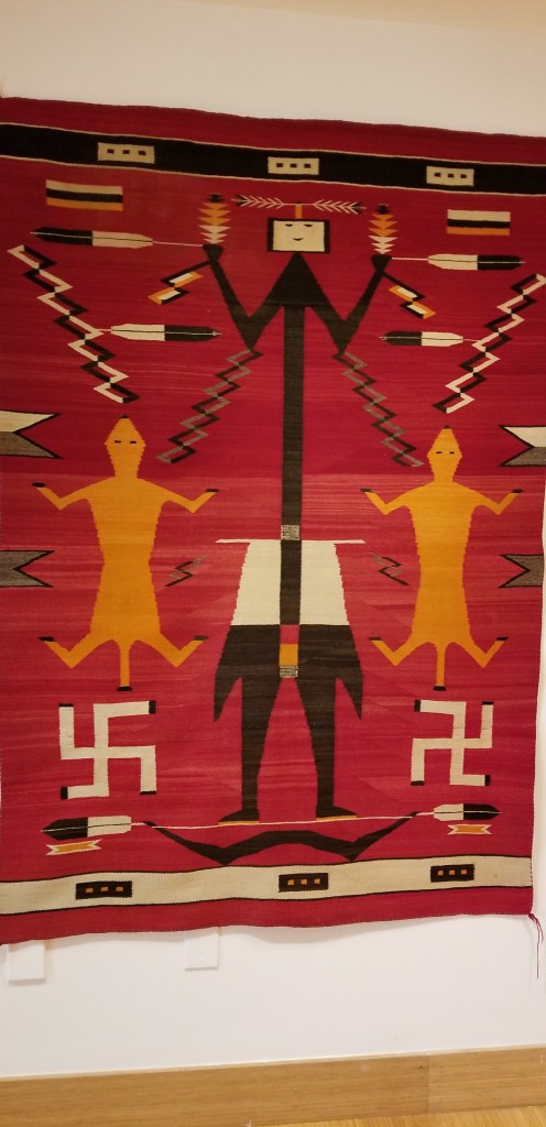
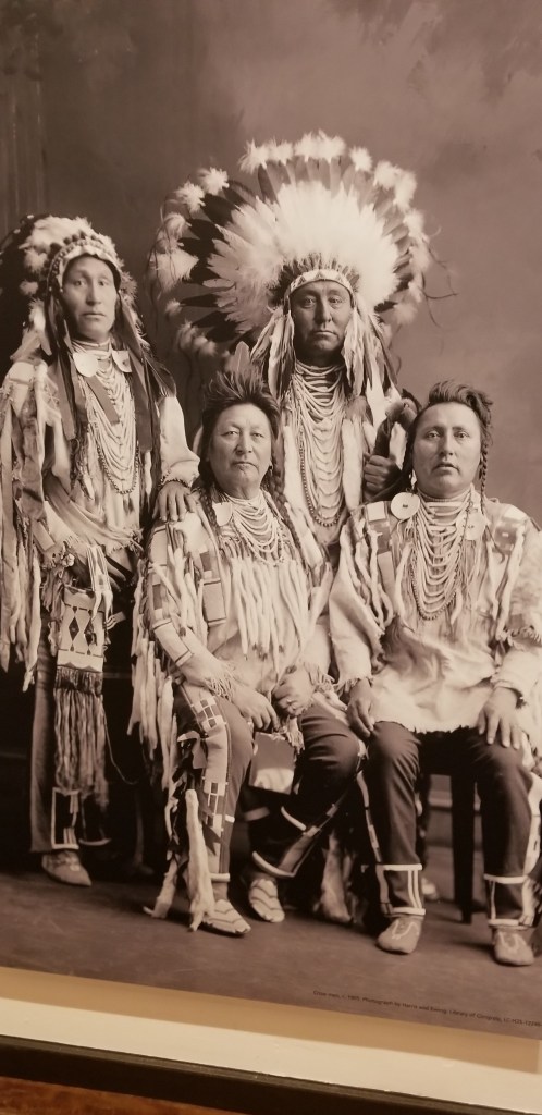
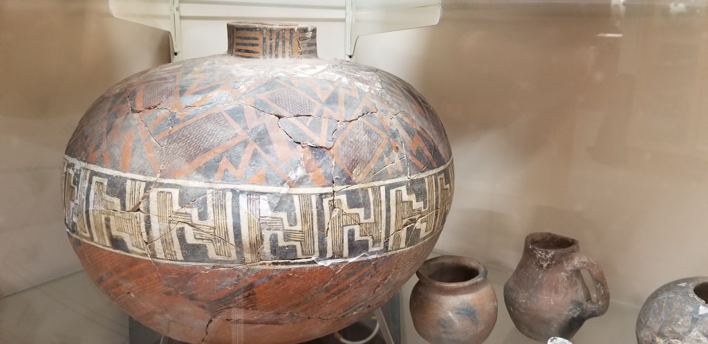
There are other places we visited in Phoenix while we were staying in Gold Canyon. And no, this picture is not more Chihuly glass. It is in the Heard Museum, which features both ancient and contemporary Native American art. We spent an enjoyable morning here on a dismal weather day.
Native Americans were using the symbol at the bottom of this tapestry long before the Nazis gave it a terrible meaning. To the Natives, it was a symbol of the sun, of the four seasons, or the four directions, depending on the tribe.
There are a lot of famous people and icons painted into this picture. See how many you can find!
There was a very sobering exhibit at the end of our visit to this museum about the Indian schools which began at the last half of the 1800’s and into the 1900’s. Children were ripped from their families to be “reeducated” so they would lose their native culture and be “assimilated”. Abuse of all kinds was rampant in these schools, and many children died of disease. Phoenix had a large one. There were success stories, but that was the exception. It made my heart sad to think of the sorrow heaped on these families.
On a sunnier day we also visited Hole-in-the-Rock, which is in Papago City Park. It’s a great place to enjoy the city, the desert, or perhaps just to watch the planes taking off at the airport.
It’s an easy .3-mile hike around the backside and up to the top.
There were surprisingly a lot of people up there enjoying a mid-week afternoon break from the city. I don’t think I’d want to be here on a weekend.
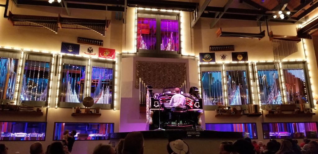
If you’re ever hungry for pizza in Mesa, Arizona, I can tell you where to go: Organ Stop Pizza. There is a Wurlitzer theater-style organ smack dab in the middle of the dining area, and the music is played daily by a revolving schedule of organists.
He played many genres of music while we were there and he took requests. The theme from Star Wars was playing while we came in…awesome!
The lights flash on the different pipes while he plays and there is also some percussion that he can control from the organ. He played the national anthem at one point. A flag came down and everyone stopped eating to stand up and sing. What a pizza joint! Not only that, but the pizza was excellent.
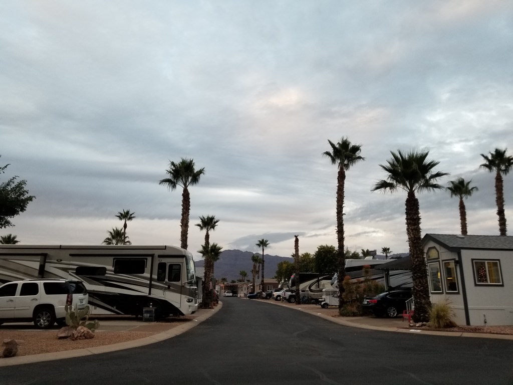
Gold Canyon is located where the freeway ends at the far western edge of Phoenix. Gold Canyon RV Resort truly lives up to the “resort” in its name. It is for people 55 and older only, and only relatively new RV’s can stay. There are also “park models” here, basically RVs that don’t move and that people can buy into. It is a place unlike any other that we have been to so far. We had seen our family for a week over Thanksgiving, but for Christmas we were on our own. I wanted a nice place to celebrate, and it was the place to be.
A street at Gold Canyon RV showing a park model on the right, and RVs mixed in.
The street above was quiet this day, but usually there are people walking their dogs or just walking or jogging, riding bicycles or golf carts, pushing a golf caddy. There is a golf course here and it runs like a pretty green ribbon throughout the resort. The residents here are very active and the resort delivered the activities. If a person doesn’t golf, no worries – there are (very busy) pickleball courts, a fitness room, lots of fitness classes, not to mention workshops for many hobbies and classes that go on all day. The resort was so large that I could get all my daily Fitbit steps in just walking the streets, and I had great fun at a line-dancing class.
Out on the street, when you passed someone, they would nearly always wave and say hello with a big smile. We were invited to join groups of people at various events, and it was interesting to hear their stories. Most people were from the upper Midwest states and came directly here for the winter to stay. Those that tired of pulling an RV after many years bought into the park models.
We enjoyed jazz by the swimming pool and a guitar player at the bistro:
There was a golf cart Christmas parade, and many of the residents of park models had their places decorated.
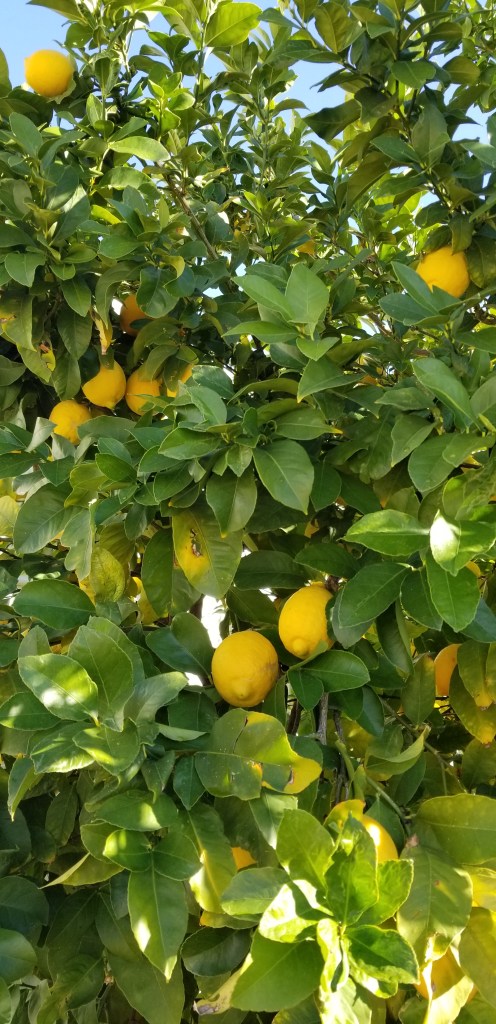
The lemon tree next door
We could get in some short hikes close by.
One day we stopped at a food truck to purchase tamales. I turned around and there was a woman unloading sacks of oranges from her truck. She’d picked them from her orchard just that morning. They looked so good and the bag was only twelve dollars so we brought one home. Later I had some buyer’s remorse – what was I going to do with all those oranges?? No worries. They were sweet, juicy, and the best oranges I have ever had. I made juice, smoothies, orange chicken, and we just ate them. Aside from four that we gave to our neighbors, we soon had them used up.
We are learning on our journey that there are all kinds of parks to stay at for all kinds of reasons. I’m a state park kind of girl. I love wide spaces and RV spots, and being out in nature. But some times, community is needed, and this community set a gold standard for us.
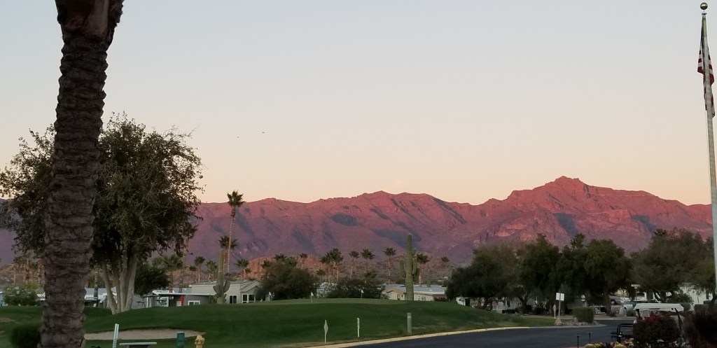
The Superstition Mountains from our RV Park in Gold Canyon, AZat sunset
We limped into Gold Canyon before Christmas, happy to have a full one-month stay to sit for awhile. It was to be the first time we didn’t move the RV for a full month since we were in Austin last April! Cal sprang into action getting a mobile tech out to our RV to replace Sam’s front left jack leg, which he’d already purchased and had at the ready. He also replaced Frodo’s hitch with one that wouldn’t take up so much battery power every time we need to hook and unhook it from Sam. Meanwhile, I was nursing a bad cold for almost a week and didn’t even want to go out the door.
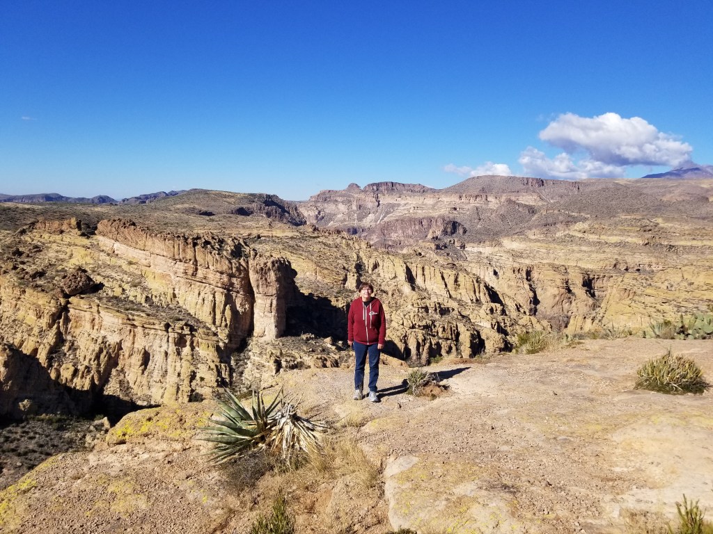
Once I was starting to get a case of cabin fever, though, we looked for something low-key to do, without a lot of walking, and decided to take a drive on the other side of the Superstitions – the side we can’t see from home. Mountains are always full of surprises. This was our view from the first turnoff:
The rugged other side of the mountain
We were driving the Apache Trail. It is an old stagecoach road and, before that, a footpath through the Superstitions by the Apaches. Ironically, when the road was paved, it was Apache labor, among other construction workers, that built it. They were starving on the new reservations and the income greatly helped them out. The forty-mile road is otherwise known as SR 88.
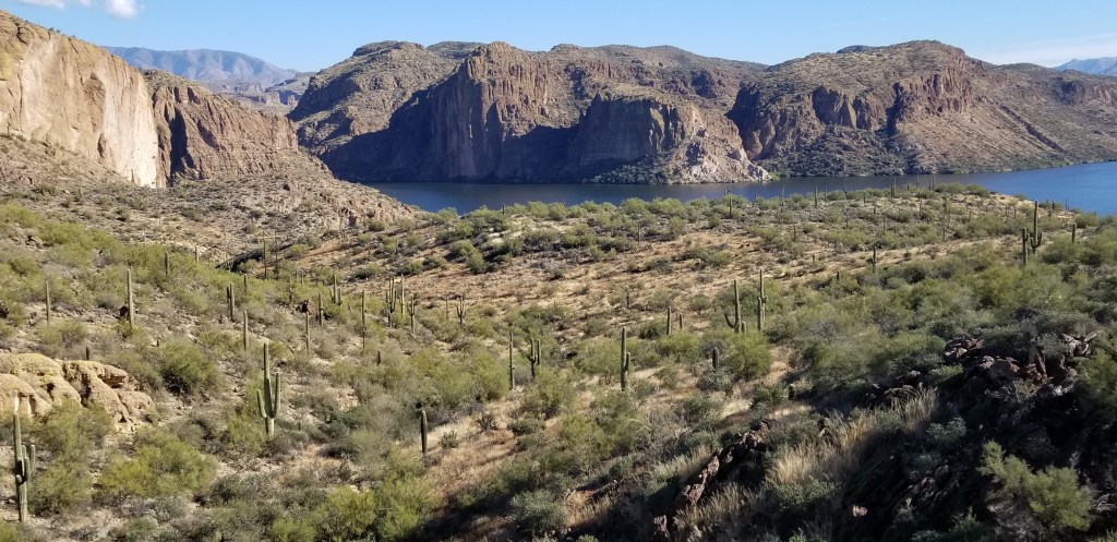
We were totally surprised to come upon a reservoir, Canyon Lake, as we rounded a corner:
The town of Tortilla Flat, population 6, is the only one on this road. The Apache trail runs right in front of a line of their original Western-style buildings with a boardwalk, and that’s about it. The town began as a stagecoach stop in 1909 and they like to brag that neither flood nor fire can take them down.
The place, and the only place, in town to have lunch is the Superstition Saloon and Restaurant. It was both fun and delicious – street tacos, for me, and a burger for Cal. The walls are papered with dollar bills, the bar stools are saddles, and the wood floors are creaky with age.
Hopefully not the original stagecoach!
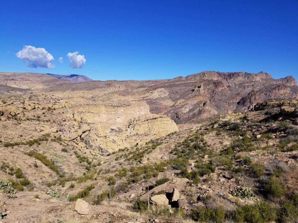
Not far past Tortilla Flat, the road turns to dirt for awhile, then it is totally closed. There was a forest fire a couple of years back that caused burn damage to the water table which in turn causes flooding whenever it rains. If you want to see the other end of the road, you have to go way around the other side of the mountain. Cal decided he was up for finishing the drive on our end, dirt road or no, so we went as far as we could. We were glad we did, because the view of the canyon below was astonishing – in our opinion, second only to the big Grand Canyon.
I took the first picture to show the work of the Apaches, which is still holding up well. If you look closely, those are the straight rows of stones to the right of the road sign. When I saw the picture, though, I realized it also shows how narrow and winding the road is here, with no guardrails!
Well…that’s the end of that!
On another day, we took a hike on our side of the mountain on the Hieroglyphic Trail. It’s a popular Phoenix area trail. On our first try ( the day after Christmas) we couldn’t even get into the parking lot. We had better luck waiting a few days and then going fairly early in the morning. We’ve learned that winter desert mornings are chilly, but we soon warm up after hiking a bit.
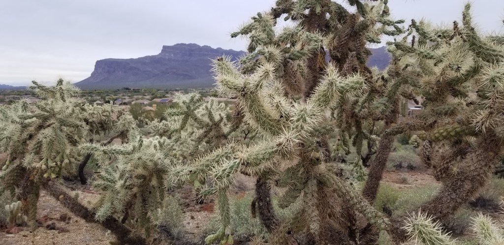
We were finally able to see our mountain close-up as we wound through saguararos, ocotillos, and teddy bear chollas.
Phoenix behind me
We have arrived!
We were astonished to see this beautiful waterfall. Everywhere we’ve been, we’ve seen nothing but dry washes, gulches and creek beds. We’ve been told about droughts and have seen very little rain. A volunteer ranger out for a hike chatted with me for awhile, and cleared up the mystery. It had poured rain all day and all night on Christmas Eve, along with some short bouts of rain before and after that period. The mountain is porous rock, and all that rain seeps down into the rock. It takes a few days, but then the water starts to run. He has seen whole years where there has been no waterfall. Unbeknownst to us, we had hit this just right, and so we were grateful we had been turned away by the packed parking lot a few days earlier!
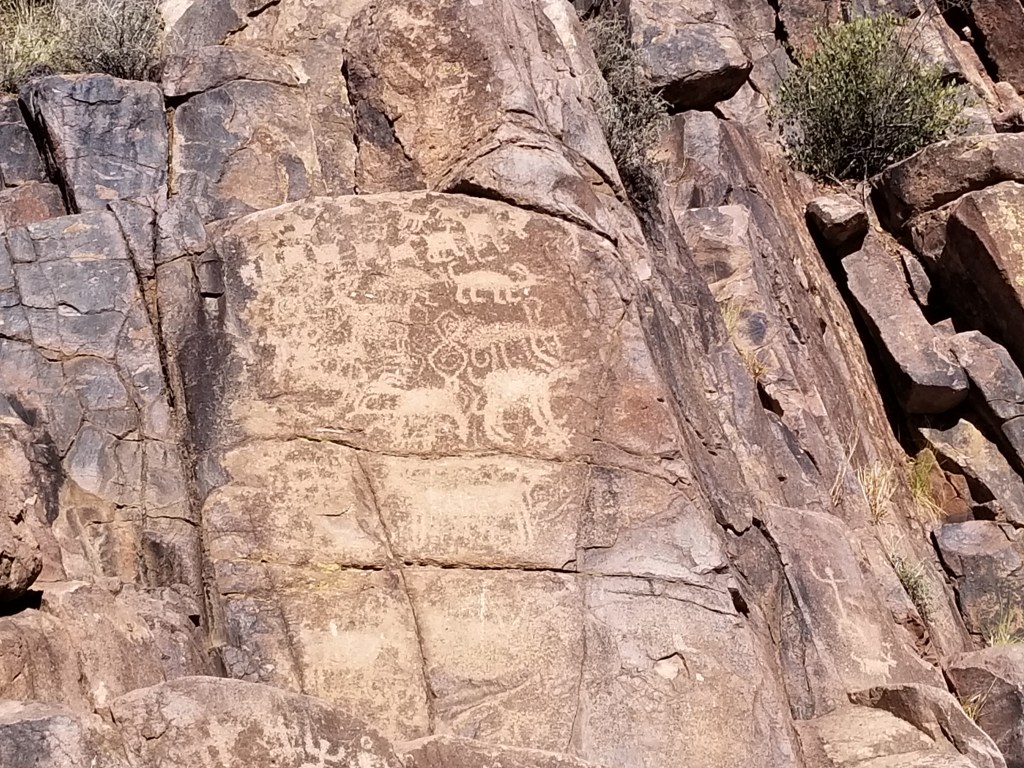
The reason I had wanted to hike this trail, though, was that I wanted to see the petroglyphs:
It bothered me that this trail is named Hieroglyphic Trail, and not Petroglyph Trail. I did a Google search later, and yes: the trail is misnamed. Hieroglyphics (boy, I sure do have a hard time spelling that, and I hope this is the last time!) are Egyptian script writings or drawings. Petroglyphs are images made by carving rock by prehistoric peoples. It’s okay, though. Maybe if the trail was correctly named it would draw too many more people to it. The petroglyphs were tucked in and around the rocks around the waterfall. You can see them above in the second waterfall picture that I posted, off to the left.
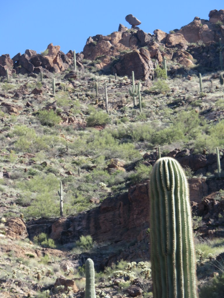
We took a minute from the beauty around us to look up, and saw a balanced rock way up high:
Here’s the closeup
All too soon, we had to come down off this little mountain paradise, and find our way back to town.
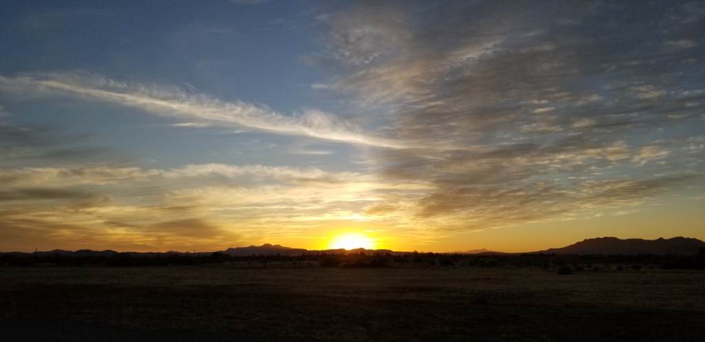
Sunset at FE Warren Air Force Base, Cheyenne, Wyoming
In the last blog’s look-ahead, I promised that I would be writing about Phoenix. If you were looking forward to that blog, you’ll have to wait for one more. I’d like to tell you about another aspect of our RVing experience before I dive into our Phoenix adventures.
Long ago, both Cal and I were in the Army. I did six years but he went for the whole enchilada – 20 years and retirement. That retirement has been a gift that keeps giving. The latest benefit that we’ve uncovered since we started RVing has been our ability to stay at RV parks, called Family Camps, that are on military bases nationwide. As with normal RV parks, some are jewels – from what I hear, mainly those that are located primarily on the east and west coasts. We’ve stayed at several now, some better than others. Usually we stay for the convenience of their location on the route we’re traveling. They are also a budget-stretcher. Family camps generally cost much less than what regular RV parks do. And like regular RV parks, they are all different.
Barksdale Air Force Base, Shreveport, LA
The funds for each camp are allocated by that base’s commander as part of “Morale, Welfare, and Recreation”, which is why each one is different. Some commanders make the camps a priority, some don’t. The current trend is for parks to be upgraded, or even rebuilt. This section of Barksdale’s family camp is brand-new. We were in the back row on the end, with a huge lawn all our own, very private. Barksdale gets the prize for most spacious site.
A bugler at military bases still sounds reveille in the morning, retreat at 5:00, and taps at the end of the day, but now it comes over a loudspeaker. At some bases at the Family Camp it is faint or not noticeable, but at Barksdale it was definitely attention-getting. 5:00 retreat is accompanied by the playing of the National Anthem. If you are outside, you have to stop what you are doing until the song is over.
Man emptying his trash, walking his dog, and standing at attention (facing the loudspeaker) for the National Anthem.
When we were in the Army, we would always check to see if it was near 5:00 before we would go outside, or else would do a dive for a door if we were outside and could go in. Especially in inclement weather. We are amused to find that on military bases and posts, old habits kick in; we do the same thing!
Air Force Bases are notorious for placing the family camps at the end of the flight runway. On our first day, this B-52 bomber zoomed over us right after the playing of the national anthem. What a show! Lest you think this was an every day occurance, this was a Friday and we were only here for the weekend. On weekends the bugle is silent and the planes don’t fly.
Kirtland Air Force Base, Albuquerque, NM
View of Sandia Mountains from the parade field and walking trail at Kirtland AFB
The reservation system is different for each family camp. At some, you can reserve a few months in advance, and usually active duty military have priority. Rightly so, since many of them use the family camps as a residence while they are making a move to or from other bases. It’s a much better place for kids, I think. Kirtland’s family camp, like many, is first come first serve. It makes me nervous, just showing up, but we had no problem getting a site.
I didn’t like our site at Kirtland. Because this is desert, the sites were gravel and close together. But again, we were here for just a couple of nights and weren’t at the site much. We visited our nephew Mike, who is stationed at Kirtland, and his wife. I’ve already blogged about our cable car ride up the Sandia mountains, and there are many other things to do in the city. Kirtland did have a walking track around the parade field within walking distance from our camp, and a great view of the mountains.
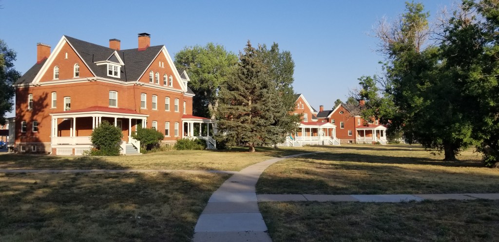
F.E. Warren Air Force Base, Cheyenne, Wyoming
Squeezed in at Warren
F.E. Warren was the most scenic base with the campground that needs the most updating. I presume it was built back in the 50’s or 60’s, when most people just had a tent or small trailer. It had the feel of a campground from my childhood. We were side-to-side with our neighbors here. There was a green area behind our RV that had a picnic table, but if you sat there, you had a nice view of everyone up and down the row.
This air base was originally built as Ft. Russell in 1867. It has gone from being an outpost on the lonely frontier to its current mission as a missile base, making it the oldest continually operating airbase. There’s a cemetery, and the graves do go all the way back to the 1800’s. What’s crazy is that the old buildings are still here, and any new construction is made to match, except for new housing. It was like staying in a living history museum. Today’s officers are still staying in those original homes. We saw this also at Barksdale and Kirtland, beautiful century homes that reflect the character of the region they are in.
Antelope could be seen at any time, even lounging on the officer quarters’ lawns in the evening:
The old entrance to the family camp
We were visiting nearby Cheyenne while here. In the evenings we enjoyed long walks in which we strolled out in nature or up to the parade field area that had the officers’ quarters and the other old buildings, including the large ones that housed the enlisted mens’ barracks back in the day. It was so peaceful, usually with hardly a soul about, and even the camp was quiet. There are some big meadows next to the camp, so perhaps one day it could be enlarged just a bit.
Only in a Family Camp…this was in the front of someone’s RV
Ft. Bliss, El Paso, Texas
Ft. Bliss was our first Army post stay. When I was still active duty it was considered an “armpit” assignment, not a place you’d want to be. It has 1,700 square miles and is home to the 1st Armored Division. The post is weirdly chopped up, with highways cutting through it. The Family Camp is an example of another one that has been beautifully updated. But – and this was a deal breaker for me – the highway is right in front of it, as you can see by looking carefully at the top picture. See that guardrail? Ummm… yes. I can put up with a lot of strange RV sites but highway noise, no. And it was loud. There were a lot of families living here, with loads of kids running up and down all the time, and that highway didn’t seem to bother anyone but me.
No matter, we were here for well over a week but only physically in the RV for two nights. We left it here while we drove up to Denver for Thanksgiving with our family. It was perfect for that, and we may do it again. We were able to leave it here, plugged in and snoozing, for a paltry $17 per day.
When we returned from Denver, we needed to go over to the commissary (grocery store) and Cal needed a haircut, because it is cheaper on post. We stopped in to the PX shopping area, which generally has two or three lunch choices, and our jaws dropped. This is the Army?? We have never seen an actual “food court” on a post or base, and this one boasted around 18 choices. Outside were many shops in an outdoor “mall”. It was truly amazing. I would surmise that your tax dollars have been poured into this facility not only because of the size of the post but also because of their participation in numerous overseas deployments.
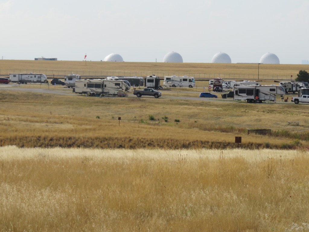
Buckley Space Force Base, Denver, CO
Out on the prairie
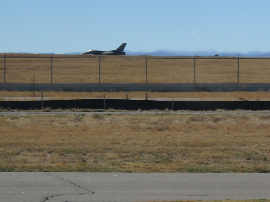
Buckley is our “home” park. We can stay here 45 days in a season, which is nice because the two state parks that we normally spend time in make us move every two weeks. Right behind the RVs in the above picture is the airfield. But what are those weird white balls?? Golf balls? Something dropped from outer space? Actually, they house huge satellite dishes used to detect missiles and other space activity, with the white aluminum shell on the outside to protect them from the weather. There are actually ropes hanging down them to aid in brushing off the snow, and they can withstand a powerful tornado.
Cal, and our grandson, love Buckley. They can watch airplanes come and go. Our grandson loves trucks and RVs, and there are no trees at Buckley, so he can see them all at once. Very exciting, along with those big white balls!
As for me, I prefer the state park. Everything is too far away for walking except for the walking path in front of the camp. For a longer stay, I begin to feel isolated and I miss seeing trees. Accountant that I am, though, I can appreciate the savings on our budget, since staying here is half the cost of a stay at the state park. We couldn’t stay here much in 2021 because earlier in the year the camp was closed to retirees due to COVID. We’ll be adding it to our mix in 2022.
US Air Force Academy, Colorado Springs, CO
I’ve saved the best for last, my favorite so far. The camp is called Peregrine Pines, aptly named for the pine forest that it is in. The campground roads wind in and around instead of being laid out in straight lines, and the park has the feel of a National Park campground. We were here only for a couple nights and definitely hope to return for a longer stay another time. It’s easy to visit the whole Colorado Springs area from here.
When I was a young soldier, my life didn’t intersect much with retirees. My friends and I would good-naturedly complain about them when we wanted to make a quick run into the commissary or PX. They would take up room in the aisles or be ahead of us in line and we had more important things to do, or so we thought. We would poke fun at retirees who spent years in the military only to take up permanent residence outside the main gates. Cal and I think it’s pretty amusing that we have become that which we once made fun of. It’s a convenience to be able to use military facilities, and a benefit that we are grateful for. We’ve met people who only stay at military camps when they travel. That would certainly be a savings, but we think there are many different places to stay on the road to experience.
Having spent the last month in Phoenix, Arizona, the Twosna Travelers are now officially snowbirds. Snowbirds are people who spend the warmer months in the upper regions of the United States and “flock” to the Southern states when it becomes cooler. We’ve spent 95% of our lives living in places with cold winters. I realized I didn’t like cold weather around the time I was in high school, while Cal has only recently arrived at this realization.
But if one is going to winter in Arizona, one has to get there first.
A lot of folks will zip from El Paso, Texas on interstate 10 to Tucson or Phoenix without giving anything a second look. We did stop in El Paso, but it was only to leave Sam (our 5th wheel trailer) plugged in and snoozing peacefully there for a week while we drove to Denver for Thanksgiving with our family. We’ll have to give El Paso more of a look another time.
On the way back from our Thanksgiving trip, we stoppedofffor dinner in a little no-name restaurant in a little no-name town just north of El Paso. This cute little house was right next to where we parked.
Deming, New Mexico
What drew me to Deming was the idea of going to Rockhound State Park, located just southeast of the town. At this park, one can just pick up rocks and keep them, unlike any other state or national park I have been to. Geodes, jasper, onyx, agates, and perlite are some of the rocks that can be found. Upon doing further research, however, I realized that the best rocks are to be found only on the remote trails, and they have already been dug pretty deeply. A person would need to have a pickax slung over their shoulder as they hiked, and some pretty good equipment back at home to split them open. Despite my interest, I have total ignorance on the subject, and would have rocks in my head to think that I should add more heavy rocks (and weight) to Sam’s load. Cal politely pointed none of this out, but let me figure it all out all on my own. So I contented myself with the nature trail in the park, and picked up a few small little rocks that fit in my pocket to add to my growing collection.
Still wanting to learn at least a little more on the subject, we stopped at a rock shop outside of the park. The ancient proprietor of the establishment was more than happy to have someone to talk about rocks with. My rocks are garden variety rhiolytes, formed as the result of (surprise, surprise) volcanic activity. He used to pull out a lot of geodes with his partner, now passed, at his claim somewhere in New Mexico called Baker Egg Mine. He had some beautifully split and polished geodes, but all I wanted was a small one that had only been split – much easier on the budget. I’m not sure that I learned much, but I still like picking up pretty little rocks. I guess I don’t need to know what they are. The small oval one fits nicely in the palm of my hand, and is surprisingly smooth.
Spring Canyon – Rockhound State Park
The funny thing about all this is, while I thought Rockhound would be the highlight of our time in Deming, the highlight for me was actually the Deming Luna Mimbres Museum, billed as “New Mexico’s largest free museum”. It is located in their old Armory, built just two months after the famous Pancho Villa Raid in 1916. It became a USO during war time, and then the museum with its repository of many collections. And yes, a large collection of…rocks.
Thundereggs straight from our rock shop proprietor’s mine
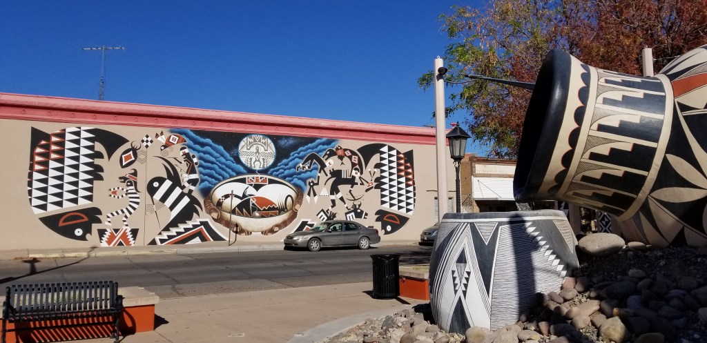
The Mimbres people lived in this area as far back as 1000 AD. Their pottery is something Deming is very proud of, as can be seen in this mural and fountain in downtown Deming:
There were pieces just like these in the museum
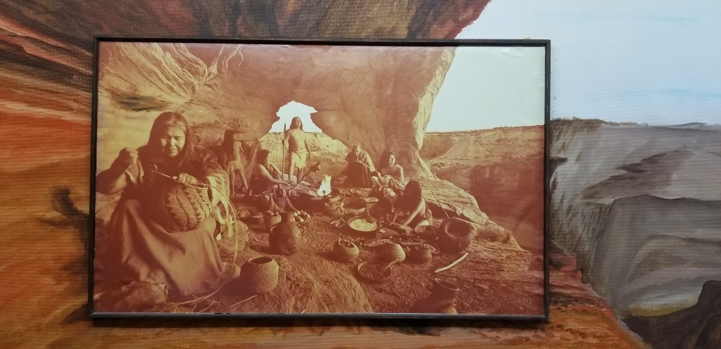
Whenever I’m under an outcropping of rock just like this, I always like to imagine how thepeople lived who took shelter there. This painting did a fine job of showing that.
The museum went on and on. There was a huge doll collection, rooms with antique furniture, storefronts showing actual Deming turn-of-the-century establishments and what would have been there, and many other varied collections from area residents over the years.
We passed some time in a couple of local wineries, and restocked our wine cellar. Lescombes Winery was a large establishment and their parking lot was so large that we could have stayed the night there (for the price of a bottle of wine or a tasting, of course). The wine was good, but we preferred the wine at Luna Rossa. They weren’t such a large commercial operation and their wines were cheaper and complementary to our (un)sophisticated wine palate.
Willcox, Arizona
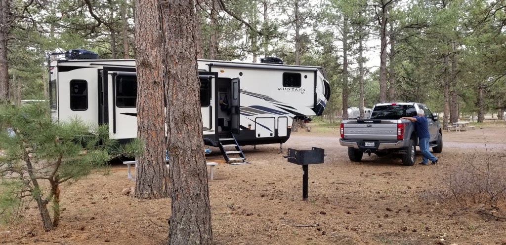
Full-time RVing, fun as it may seem, is still full of the ups and downs of ordinary life. One of the downers for us is the on-going trouble we’ve had with our left front jack erroring out during leveling, and the amount of battery power needed just to get Sam up and down off of Frodo’s (the truck’s) hitch. It got worse with every stop we made. Our stop at the Willcox KOA was supposed to be one overnight, but we canceled some plans and made the decision to stay for five, so that our arrival in Phoenix would be our last until some repairs were made.
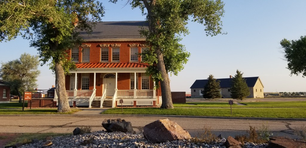
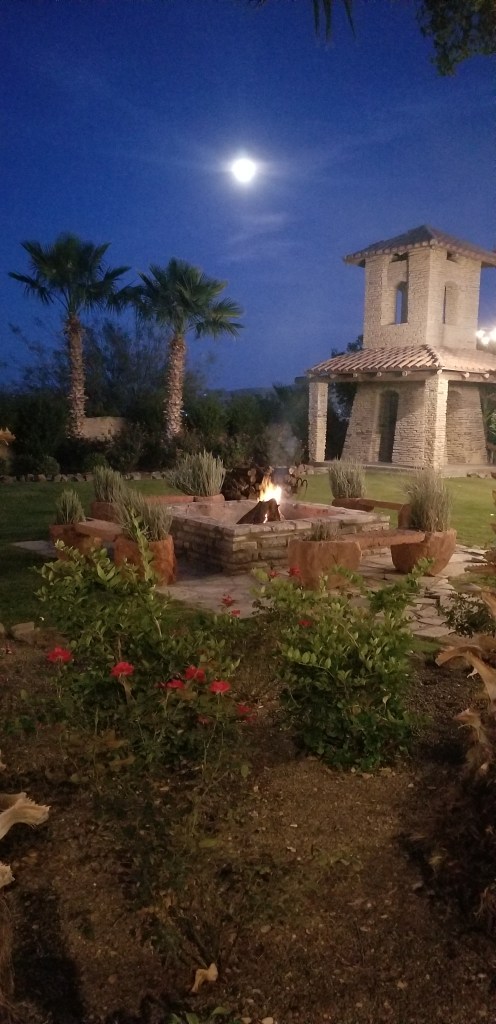
KOA parks can be good or bad, depending on who is running them. This is true especially of KOAs located just off the highways of America, usually used for only an overnight stop. The Willcox KOA is indeed off the highway, but when learning of our situation, the kind folks put us in a spot furthest away from it, with a much-coveted tree on the site. It’s pictured at the top of this post. We watched people painting and upkeeping the grounds every day. There is a restaurant (with excellent gyros) and a heated pool on-site. Just this past week, I read a newsletter from the KOA national organization which named this park a “rising star” in the franchise for 2021, and I would definitely agree.
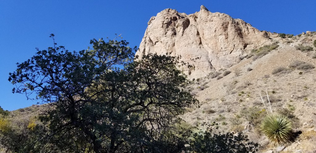
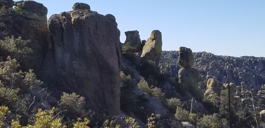
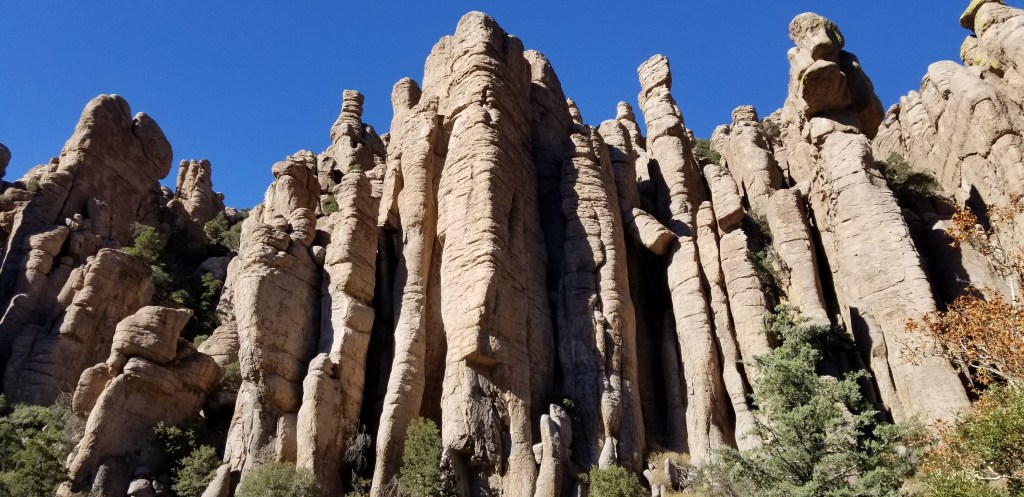
What softened the blow for having to stay in Willcox was being able to visit Chiracahua National Monument, 40 miles away. We lived in Arizona for a couple of years back in the 80’s, and one of our favorite tent-camping stories is from a weekend we spent there. One evening, a pair of skunks wandered through our site while we were sitting in our lawn chairs. We froze in place, not daring to move, as they sniffed around and actually passed right underneath us. We were lucky we didn’t get sprayed! It was fun to drive through the campground again, a wooded oasis right under the tall rock cliffs, but we wouldn’t be able to stay there in our 5th wheel. Chiracahua is an other-worldly, magical place:
The rocks at Chiracahua are in columns, pinnacles, and balanced rock
“Claret Cup” rock, which shows how impossibly a lot of the rocks are balanced.
“Organ Pipes”
We had an audience for our picnic lunch at Chiracahua:
A spotted towhee and a Mexican jay eying our lunch
Three birds, plus one in the bush. At one time we had seven birds all watching us, hoping for a handout. We had some fresh crusty bread so I hope they were happy with the crumbs we left.
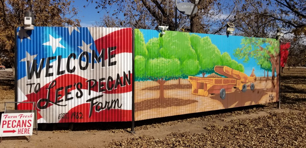
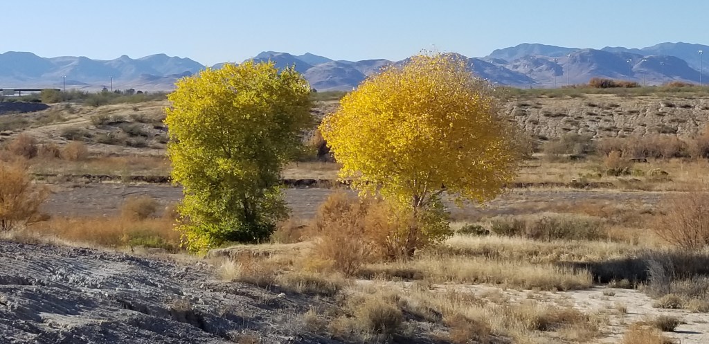
Starting in Roswell, New Mexico, but also in southwest Texas, southern New Mexico, and now Arizona, we saw a lot of pecan farms. In Roswell in early November, the leaves were still green on the trees. By the time we got to Texas, the leaves that we saw on the trees were changing color. There was a farm near our KOA, so we had a nice chat with Paul and Jackie Lee. They were happy to take us around. I’m munching on their pecans as I write. In mid-December, they were only three weeks away from harvest. This is a very small operation, so they send the picked nuts out to New Mexico and Texas for processing, then the shelled nuts are returned to them. They are then placed in one of several chest freezers for sale all year round, until the next harvest.
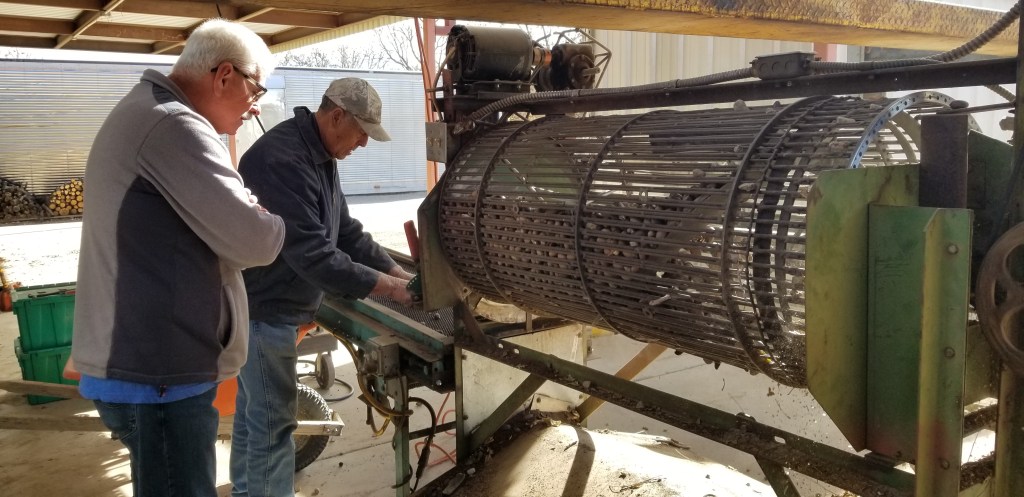
The nuts can’t be harvested until all the trees lose their leaves. Some nuts fall in the process, so when the leaves are raked, Paul puts everything (minus the leaves) into this separator to get the rocks and other debris out. He welded this contraption together himself, like so much of his equipment.
Final result..and the real harvest hasn’t even started
The orchard is the Lee’s retirement project and they planted all the trees themselves in the early 80’s. The trees are now in their prime.
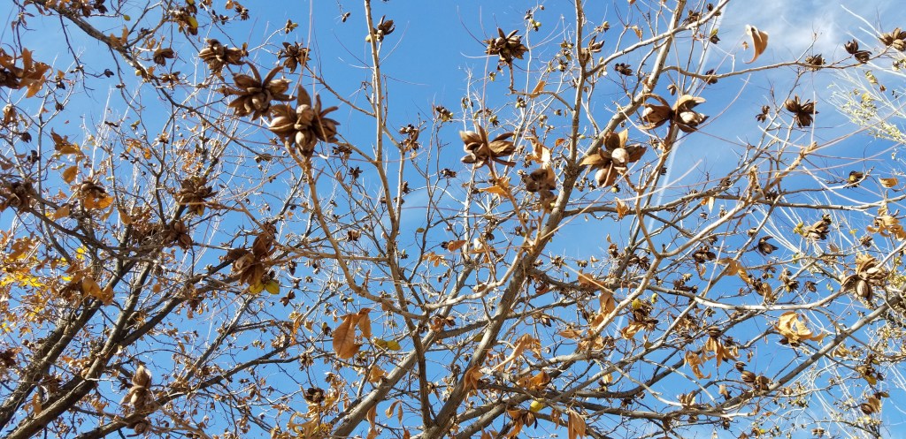
Almost ready for harvest; the outside pods have to be open, like most of these are, and the nuts inside have to be dry.They were expecting a bumper crop.
Like Deming, Willcox also has a healthy amount of wineries, but as we were already extended on our wine budget, we limited our purchases to pecans. By the way, if I have made you hungry for pecans, the Lee’s pecans can be purchased on-line. Who knew this was such a good climate for growing grapes and pecans?
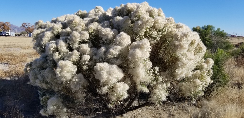
Cal was nursing a cold during our Willcox stay so this was pretty much the extent of our activities. I entertained myself with many enjoyable walks into the desert around our KOA. I’ll leave you for now with some of the pictures from those walks.
What a big, fluffy bush! The un-fluffy part looked like bittersweet, the tiny white “filler flowers” in a bouquet of flowers from the florist.
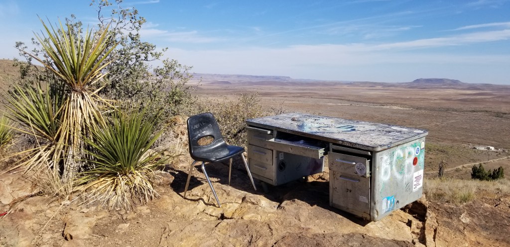
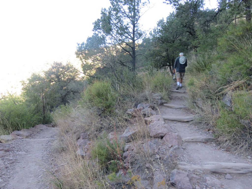
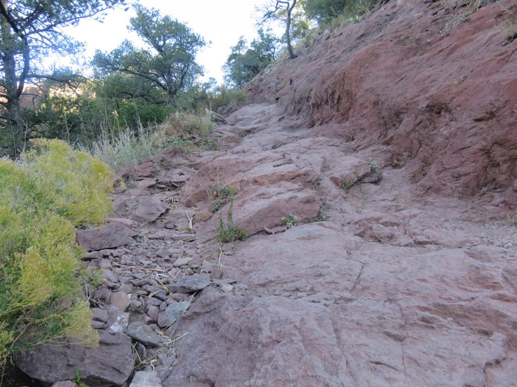
Back in the Eighties, three students decided they needed a quieter place to study than their dorm rooms at Sul Ross University. They hauled a desk and a chair all the way up the hill behind their dorm. They greatly enjoyed their spot and spent a lot of time up there. One of them accidently left his notebook in the desk, and when he returned for it, he was surprised to see a hiker had signed it. The notebook, the desk, and the chair became the stuff of legends. By now the desk has been replaced two or three times and there are several filled notebooks in a museum. I kept running into suggestions to “Hike to The Desk” in my research for this area of Texas, so we did.
It isn’t the easiest hike. The trail is only 1.3 miles to the desk, but there is a 219 foot ascent on a rocky and uneven trail. Once up at the top there are several trails crisscrossing each other and we had to ask some other hikers where to go. It is on the opposite side of the hill from the university. I couldn’t believe they hauled a metal desk all the way up there! These bicycles in a tree let us know we were finally almost there:
Cal signing us in The Notebook
On the side of The Desk
Sul Ross University and Alpine view before our final descent
Once down, we visited Museum of the Big Bend, since it was located on the university campus. Being a fan of petroglyphs, I thought this 17 foot replica of a remote petroglyph was interesting. The original was done in six colors of pigment and belongs to a hunting gathering culture dating back to 700 AD. The meaning is unknown, although archaeologists think it relates to their belief system. It looks like a lot of scribbles to me, but what do I know?
There were some very old maps, and I also liked this recreation of a general store, back in the 1800’s:
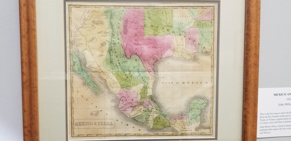
An 1836 map of Texas, the first to show the Rio Grande to the 42nd parallel
There was an art festival going on in the town, which was a huge deal before COVID hit and canceled it last year. Someone in an information booth gave us a walking tour map to see Alpine’s murals. It was fun looking at these. These were some of my favorites:
A pretty little courtyard
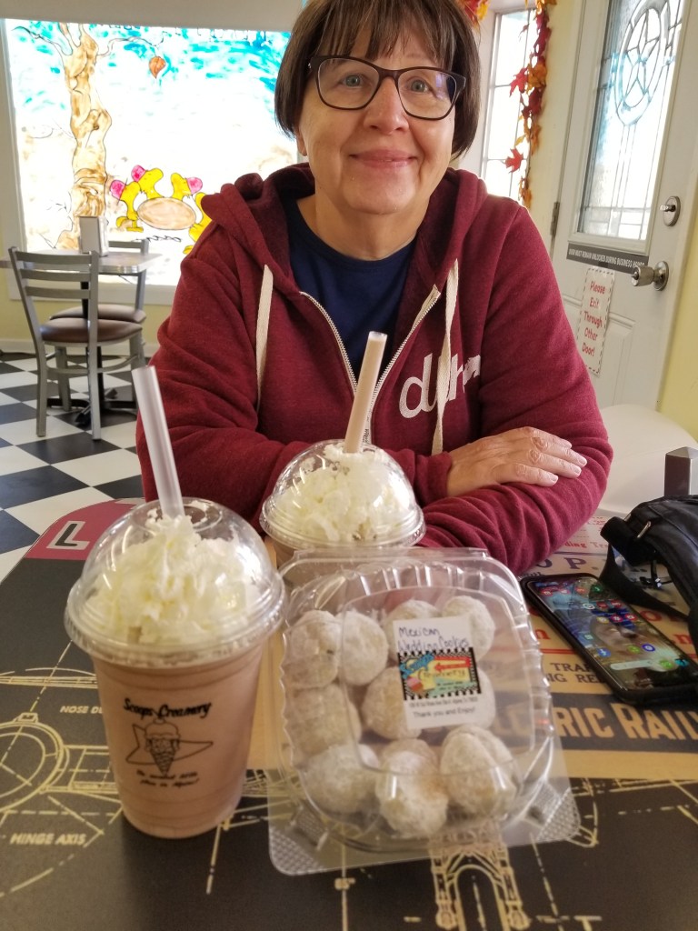
If I could pick Alpine up and move it closer to my family in Denver, I would love living there. It is a small, walkable little university town with a lot of flavor. And the milkshakes and Mexican Wedding Cakes at Scoops Creamery weren’t bad either!
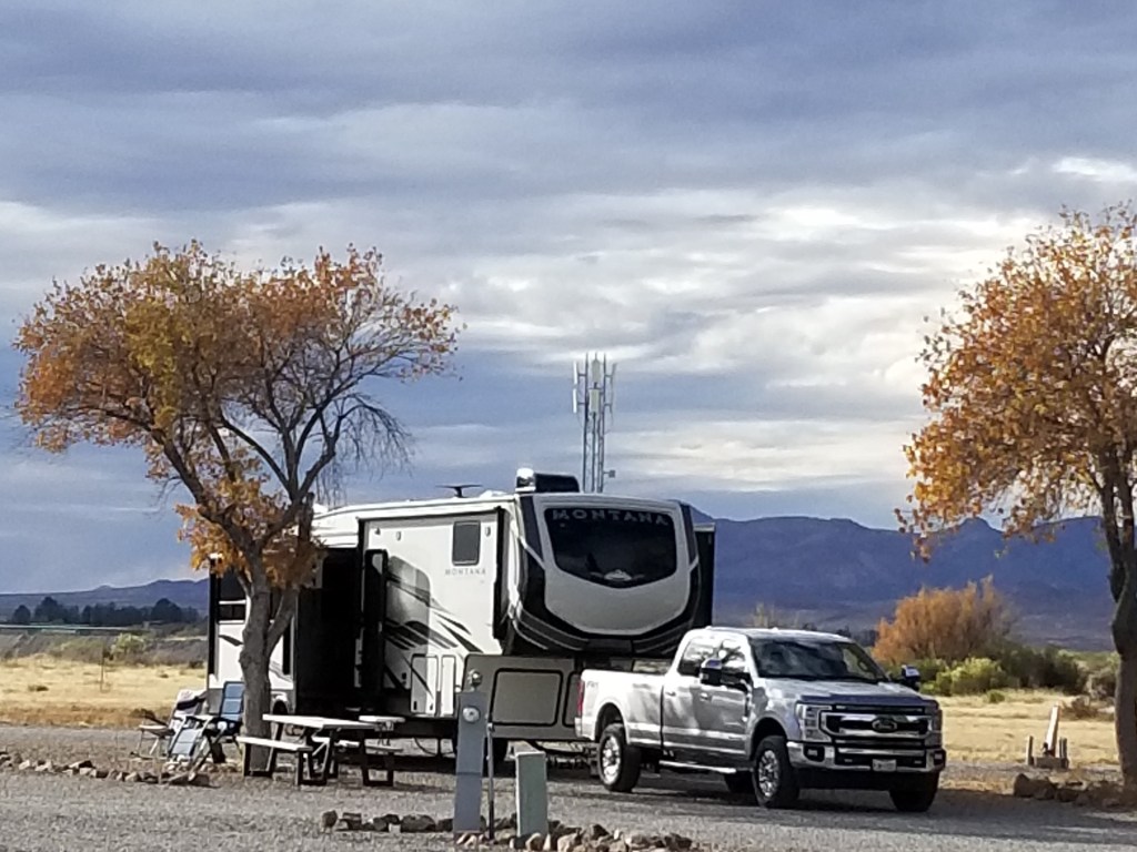
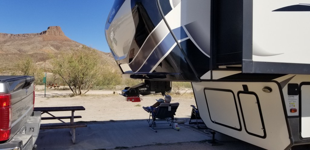
Enjoying the view of Lajitas Mesa from our RV site
Merry Christmas to all of my readers! Life is running a little slower this holiday weekend, so it seems like an opportune time to catch up on where the Twosna Travelers have been. I thought of doing a blog post from Texas to Arizona in one fell swoop, but that was entirely overwhelming.
The truth is, our time in the extreme south of Texas was absolutely golden. We loved the area, particularly the capriciousness of the landscape – flat desert with mostly all one type of cactus here, a mesa suddenly poking up there, a set of hills made out of ancient volcanic ash, canyons and hoodoos. When driving, we would find ourselves all of a sudden in the middle of the most jaw-dropping scenery. The nights were cool and the days warmed up, it never rained, and there was a new direction to head off in every time we were ready to go. If we didn’t, then Lajitas Mesa gave us a wonderful view every time we looked out our window. Here is another view with a look left of the mesa:
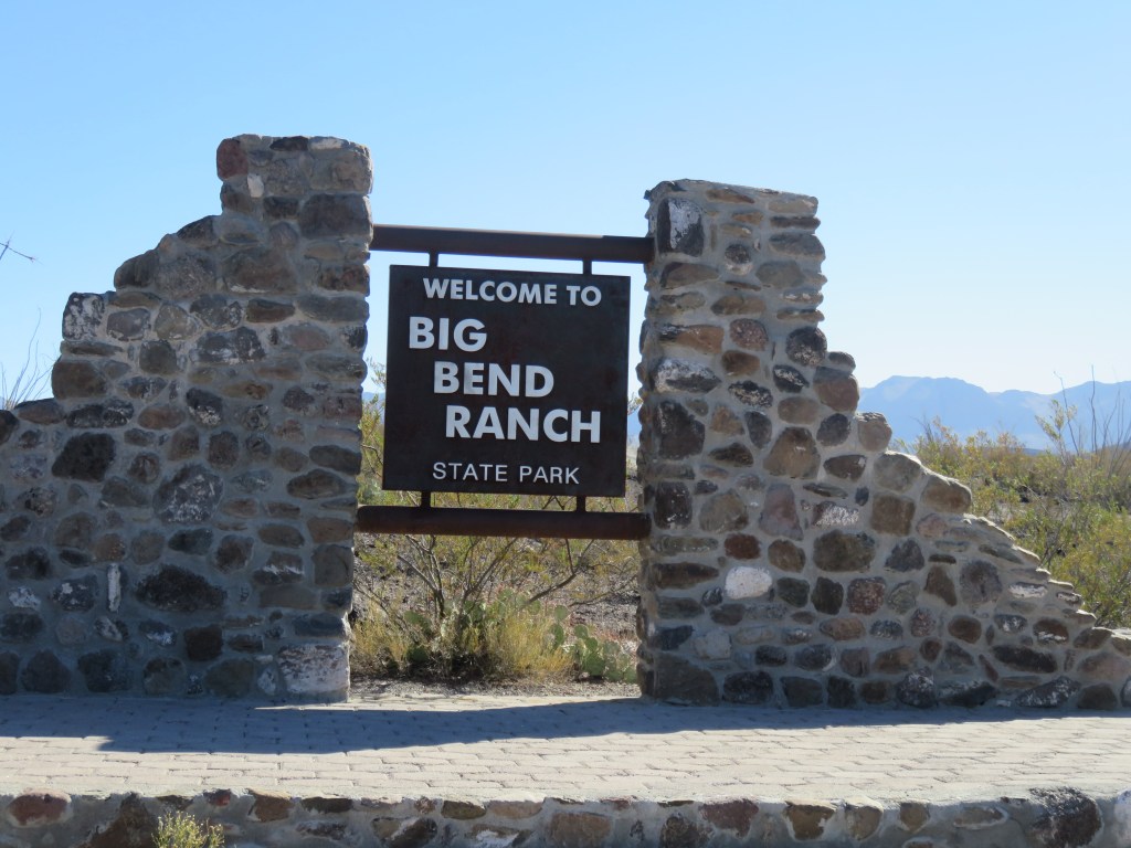
The piles of hardened volcanic ash look man-made to me, as if looking at a quarry or gravel and concrete business. The fact that they have been there millions of years makes it all the more fascinating. This view is partly in a state park. The RV park, and the resort in Lajitas that it is part of, sticks up like a thumb into Big Bend Ranch State Park, and somewhere in there is the border between the two.
It was like a moonscape, and we enjoyed some short hikes right from our RV into it:
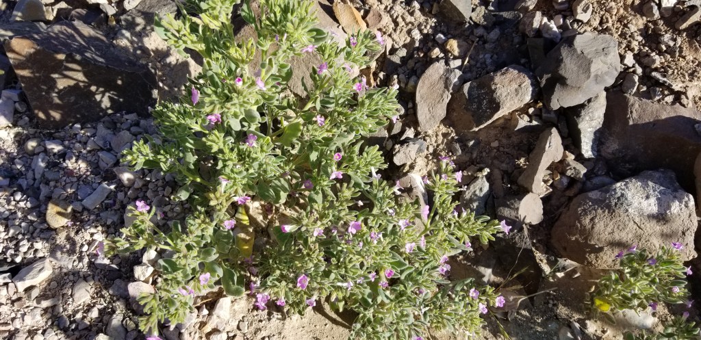
Mexican Heather growing in the wild – something I planted every year in my flower garden
A prickly pear with the biggest spines I’d ever seen. Don’t dare come close!
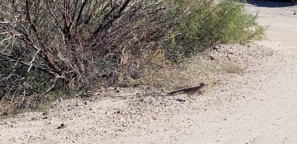
It was a thrill one day to see a road runner cross the path near our RV:
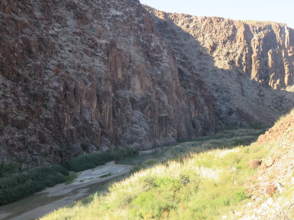
One of the highlights of our time here was the day we drove through Big Bend Ranch State Park. Its border is the Rio Grande River. The scenic road, at the very bottom of the United States, winds up and around hills and canyons, always with the river on the left (going west) so that one is always looking at Mexico on that side, and more of the state park on the right. Here are two views of the river at Madura Canyon:
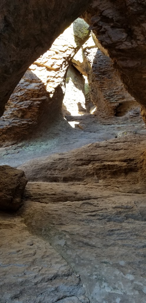
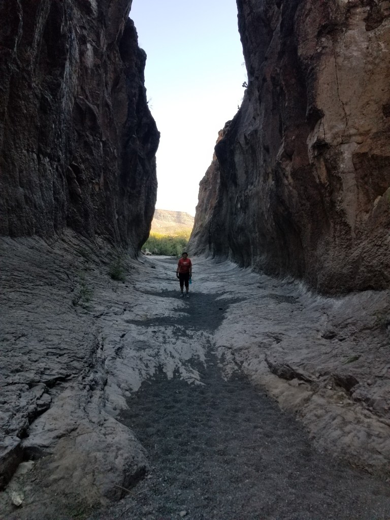
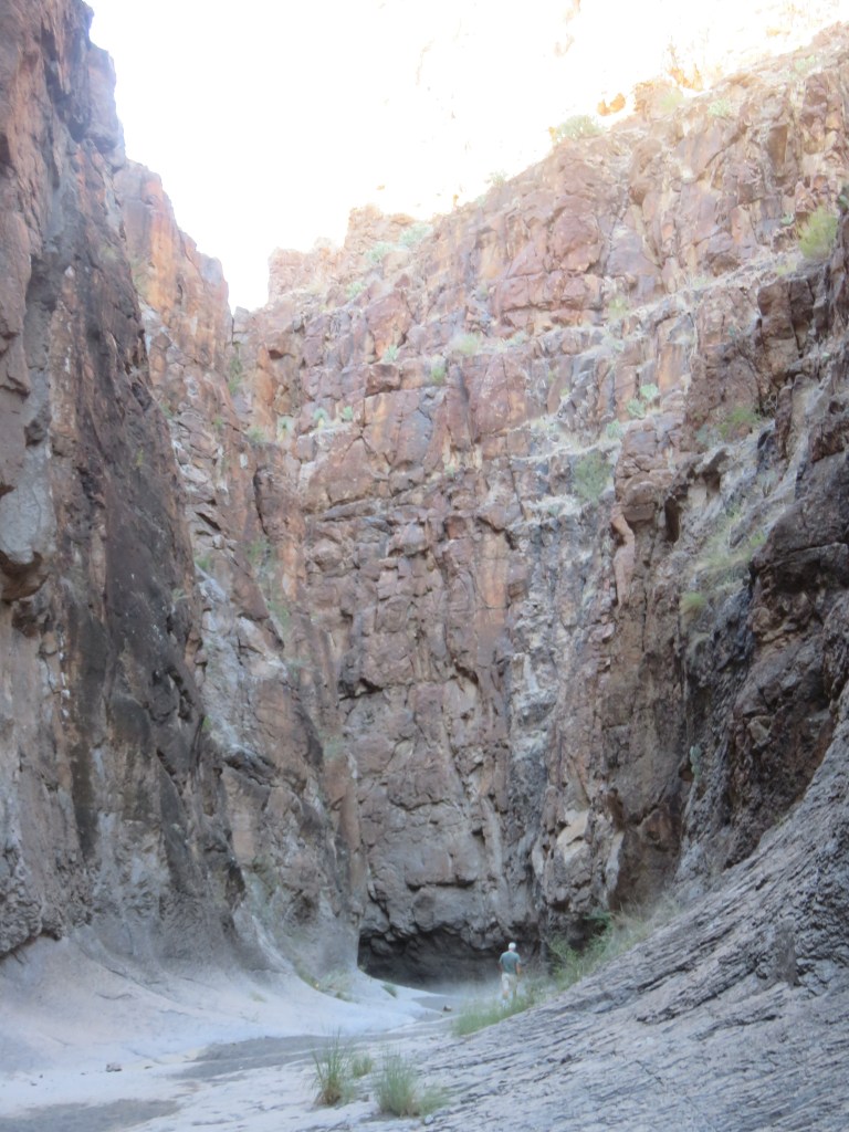
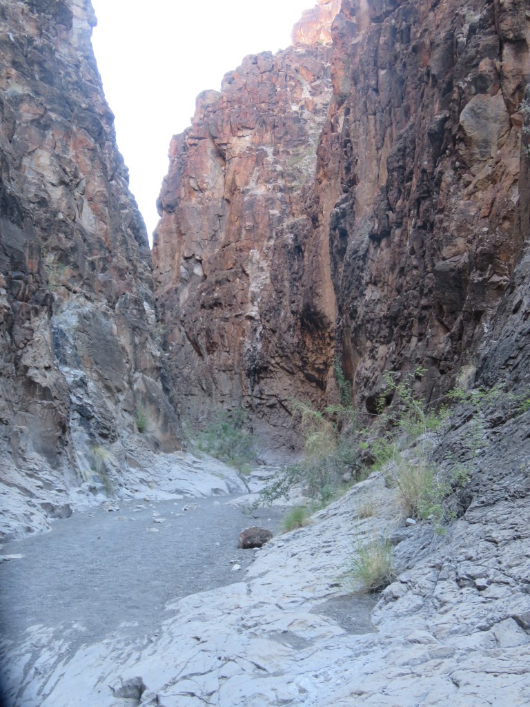
Closed Canyon was a “don’t miss” stop. It was our first slot canyon, and I’m looking forward to seeing more of these as we travel further west. It was marked as an easy-moderate trail but as the canyon walls closed in, the trail became very rocky with steep declines from one layer to the next. The rocks were slick and smooth with lots of crumbly gravel thrown in. We finally called it quits when one dropoff was so deep we couldn’t figure out how we’d get back up!
Entering the canyon – easy enough
The trail was not too bad at first
Cal looks so small compared to those canyon walls!
One of those steep dropoffs!
A place of awesome beauty which made us feel significantly small in the universe
Once back on the road, we stopped to check out a scorpion scurrying across:
From here, we entered the land of the hoodoos. Hoodoos, by definition, are tall, thin spires of rock that stick up from the desert floor. Mostly they are relatively soft rock topped by harder, less easily eroded stone that protects each column from the elements, and are formed within sedimentary rock and volcanic rock formations.
Along the road, this was our first glimpse of hoodoos, and this one looked like a shaggy dog to me:
Several hoodoos at a scenic stop
Our last stop, Ft. Leaton, was a total surprise to us. We thought it might be another western military outpost, but no…it was a trading post used from 1848 to 1884, but the last family lived here until 1925. The original owner had a Mexican wife, and after his death, she remarried and stayed on at the post. Lots of murder and mayhem went on here, and the post had a major fire in later years. Archeologists have found artifacts, and the Texas Parks and Wildlife completed a faithful restoration job. The walls are adobe and the inside rooms were cool and comfortable. A lonely state park ranger was pretty excited to show us a video and then we walked through. This was a very fascinating stop.
Ft. Leaton
A corner of the inner courtyard
The parlor, one of many rooms in the restored family area
Carretas such as these may have been the first wheeled vehicles to enter the United States when the Spanish first brought them in 1590. The wheels on this carreta are 6 feet tall!
Fully loaded carretas were so heavy that it took 10 to 12 oxen to pull them. The carretas here transported goods, most commonly Mexican silver bullion, on the Chihuahua Trail to San Antonio, Texas.
In the picture below is a fence made out of ocotillo, a common desert cactus.
The view from the bakery window
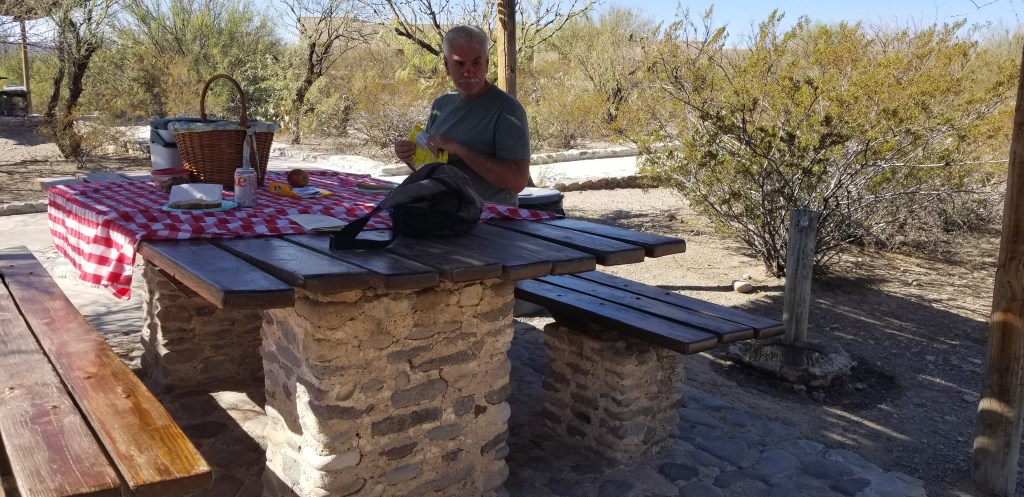
Of course, after this, a picnic was in order!
Before turning around, we decided to drive on in to Presidio, TX and discovered a grocery store! We had been deprived of a real grocery store for weeks, so this was very exciting. There was also a plethora of various dollar stores owing, we think, to the fact that Presidio is a Mexican border entry town.
The town of Terlingua was a short drive from our RV park in the other direction. It is a ghost town, but has a small artist colony which makes for some interesting shopping, and a handful of restaurants. The biggest thing that draws people to Terlingua, though, is the cemetery. It dates back to the early 1900s and is still being used. Many of the graves are of Hispanic heritage but then there is a hippie vibe to it, too.
In the early 1900’s, Terlingua was a mercury mining town and helped supply the WW1 war effort. The town was booming but there were mine accidents, gunfights, and the 1918 influenza epidemic. The town declined through the mid-1900’s and demand for Terlingua’s mercury was not repeated during WW2.
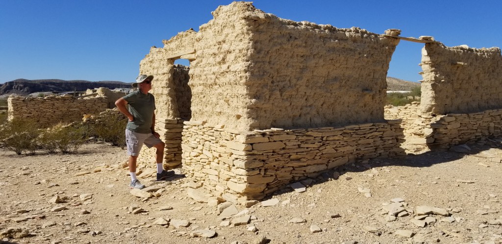
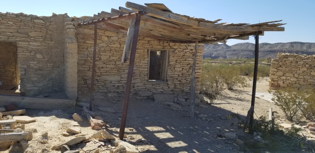
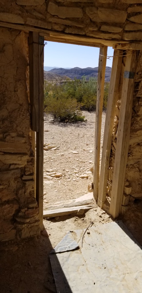
I had fun exploring the ruins of some of the houses. They were so small, and the doorways so short!
This church reminded me of one that has been in the news lately..the movie set shooting.
A 1930’s movie theatre, which is now a great place to eat, have a drink, and listen to live music. All isnot dead in Terlingua.
Our RV park, Maverick Ranch, was part of the Lajitas Golf Resort and Spa. Like a poor cousin, the park is set back across and down the road from the resort. While there was nothing at all luxurious about Maverick Ranch, you could be entertained for days at the Lajitas Golf Resort, especially if you play golf. Whatever Lajitas was before the resort was built, the tiny town is now all about the resort. There is an airport built specially to ferry in the vacationers. If you need more entertainment, there is horseback riding, ziplining, jeep tours, and a concierge to arrange whatever it is you might need. There’s also a “boardwalk” (made out of cobblestone) for shopping, although I couldn’t begin to afford anything in the shops. A couple of restaurants/bars round out the offerings.
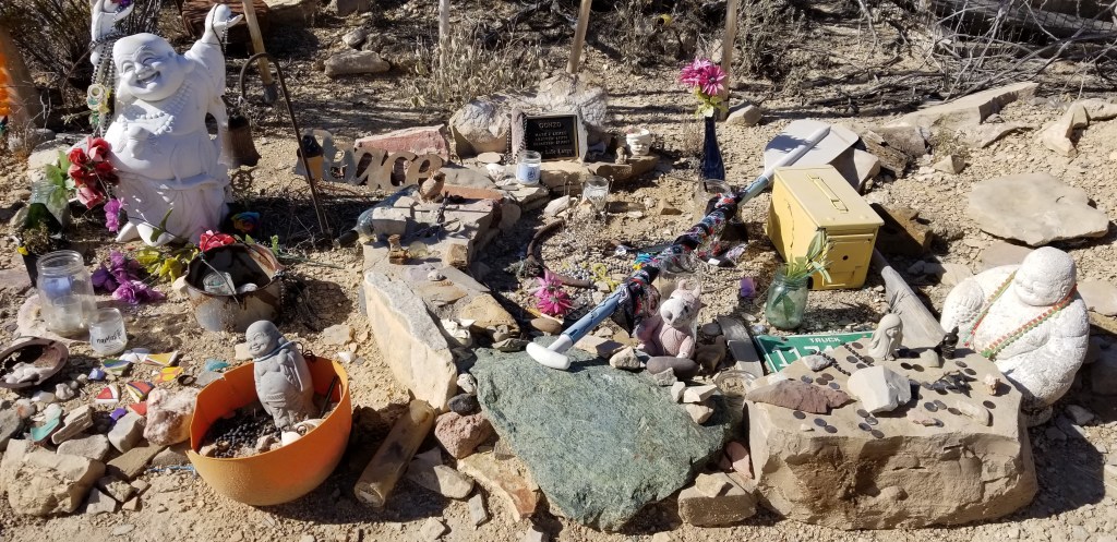
Down the long driveway from Maverick Ranch, there is a cemetery smaller than the one in Terlingua:
We made a personal call on the Mayor of Lajitas, which is… a goat:
Our last evening in Lajitas, we took a stroll under the starry skies, and a full moon, over to one of the bars at the resort. It was a great way to say farewell to an area that we had enjoyed very much. We are on the lookout for long-term places to winter in the future. If we could boost our phone and internet service, Maverick Resort would be a sure contender. Cheers!
Looking at Big Bend National Park from Terlingua Starlight Theatre, Mule’s Ears on the right
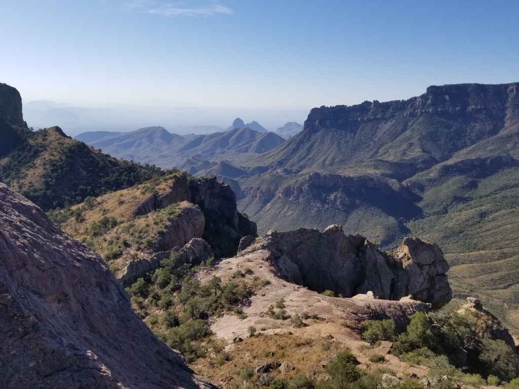
We were in Big Bend a full week, and it was barely enough to cover the highlights. Several people we talked to opted for a couple of hikes a day. Owing to the direct afternoon sunshine, and the fact that a lot of hikes necessitated a drive down bumpy rocky roads or hiking in open desert, one hike per day was enough for us. We visited the Chisos Mountains area after our Balanced Rock hike.
The Chisos Mountains go around in a circular fashion and in the middle is a slightly hilly area called “The Basin”. Big Bend operates another campground, a lodge and restaurant, and a park visitor center in the Basin, and many trailheads begin here. We didn’t even look around the Basin when we first arrived, because after the Balanced Rock hike we were looking for lunch. Several tourists were admiring this tarantula outside the restaurant.
I was opting to be cool, pretend I’d seen a lot of tarantulas in the wild in my life, and eat my lunch, but Cal had to go have a look.
There is a break in the Chisos Mountains circle called “The Window”. There is a 5.6 mile round trip trail that can be taken to it, but that would have been our second hike of the day. We opted for the quarter mile paved “Window View” trail. The view through the Window and out to the western part of the park was spectacular.
View of “The Window” from The Window View Trail, Big Bend
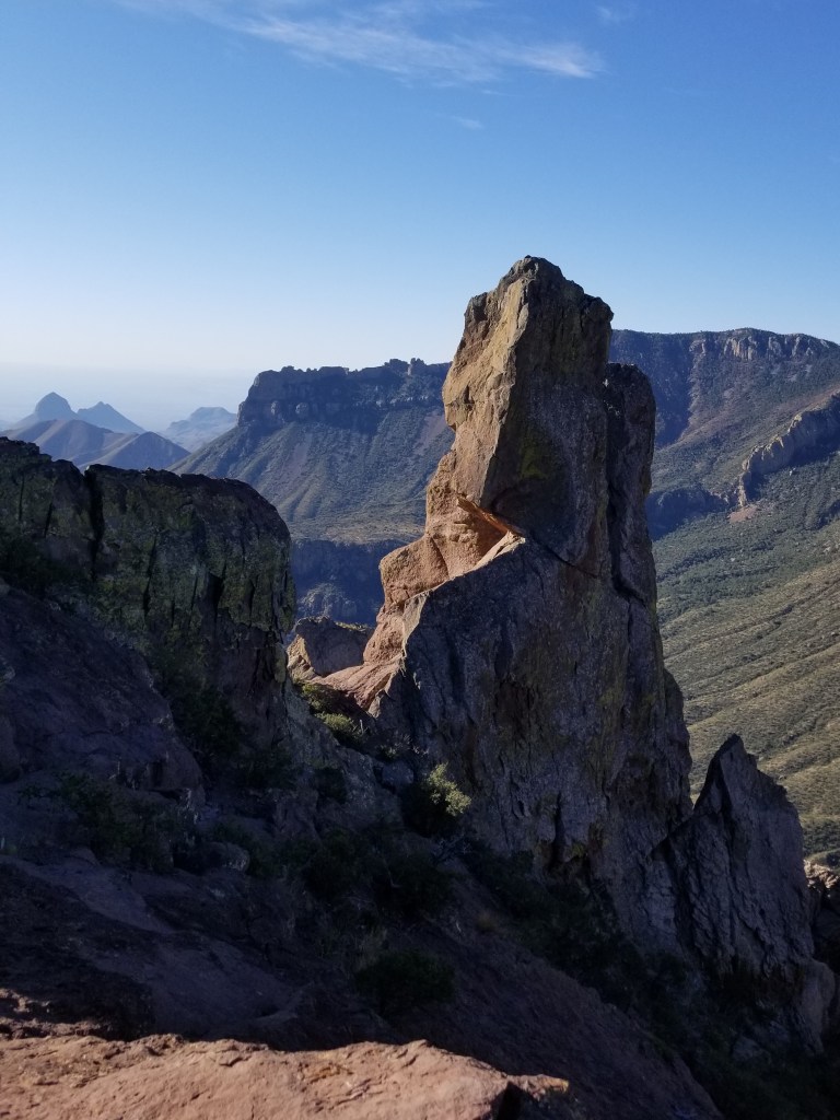
On another day, when we were fresh, we returned to the Chisos Mountains to hike the Lost Mine Trail. This trail is 4.8 miles round trip with an 1,100 foot elevation gain. It was one of those straight-up trails, but despite that, it is one of the most popular trails in the park.
There were several switchbacks, and at one point the trail was nothing but pure rock.
The trail left, and the trail right
Once we gained elevation, we were rewarded with gorgeous views of the Chisos Mountains.
I saw this same view on a postcard, and said it was a view of “Elephant Tusk”. That might be the formation in the top center of the card. It doesn’t look like an elephant tusk to me, though.
Being at this altitude and looking down on the mountain peaks was pretty exhilarating!
At the top
The only wildlife we saw was this lizard, perfectly matching the rocks it lives on.
At the top, I inched my way around the corner of the rock we were on, and dangled my feet while I looked at the view below. There was nothing but air straight down. It was a bit dizzying, so I didn’t stay for long!
In the western side of the park is another “can’t miss” hike, the Santa Elena Canyon. It is at the end of Ross Maxwell Scenic Drive, which in itself was a treat. There were many places to stop on the way, a nice way to see the park if one wasn’t inclined to do a lot of hiking. We visited the ruins of Sam Nail Ranch, an oasis of green sunk into the hills. It was supposed to be great for birding, but we didn’t see birds.
The Nail family once called this their home
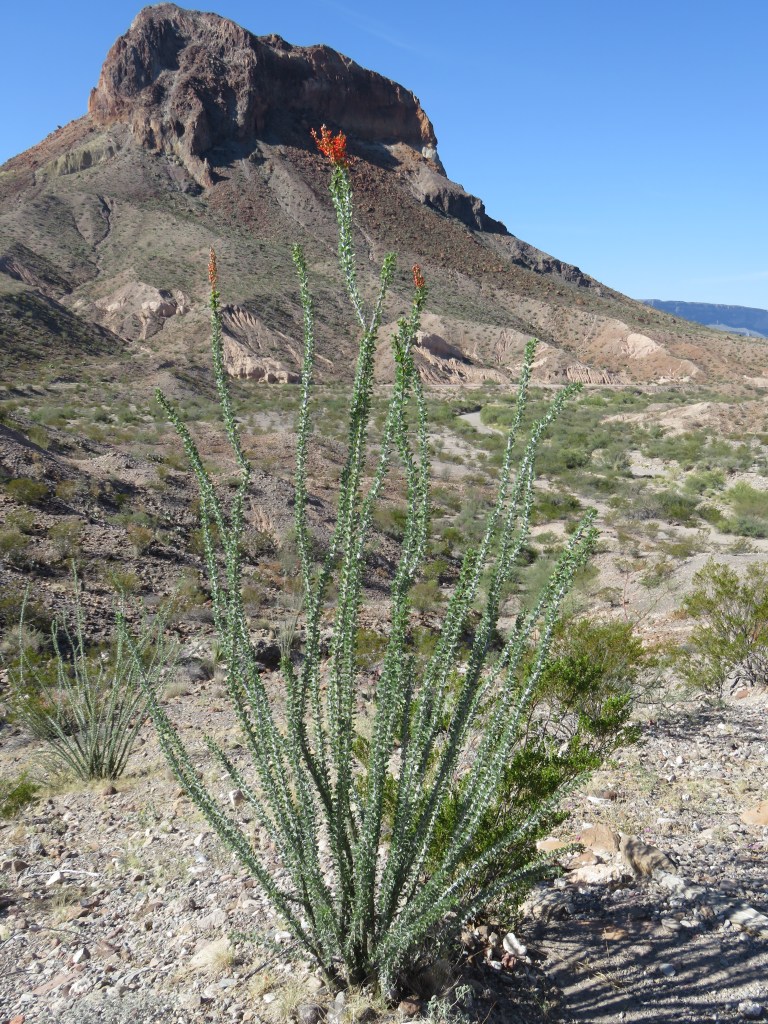
Another stop-off, this time to see “Mule’s Ears”, below
We admired the purple cactus on the way. I had never seen purple prickly pear cactus before, and there were areas where there were more purple than green.
And, a blooming ocotillo. These usually bloom in the spring, so this was a surprise. A whole area of blooming ocotillo in the desert is really a sight to see.
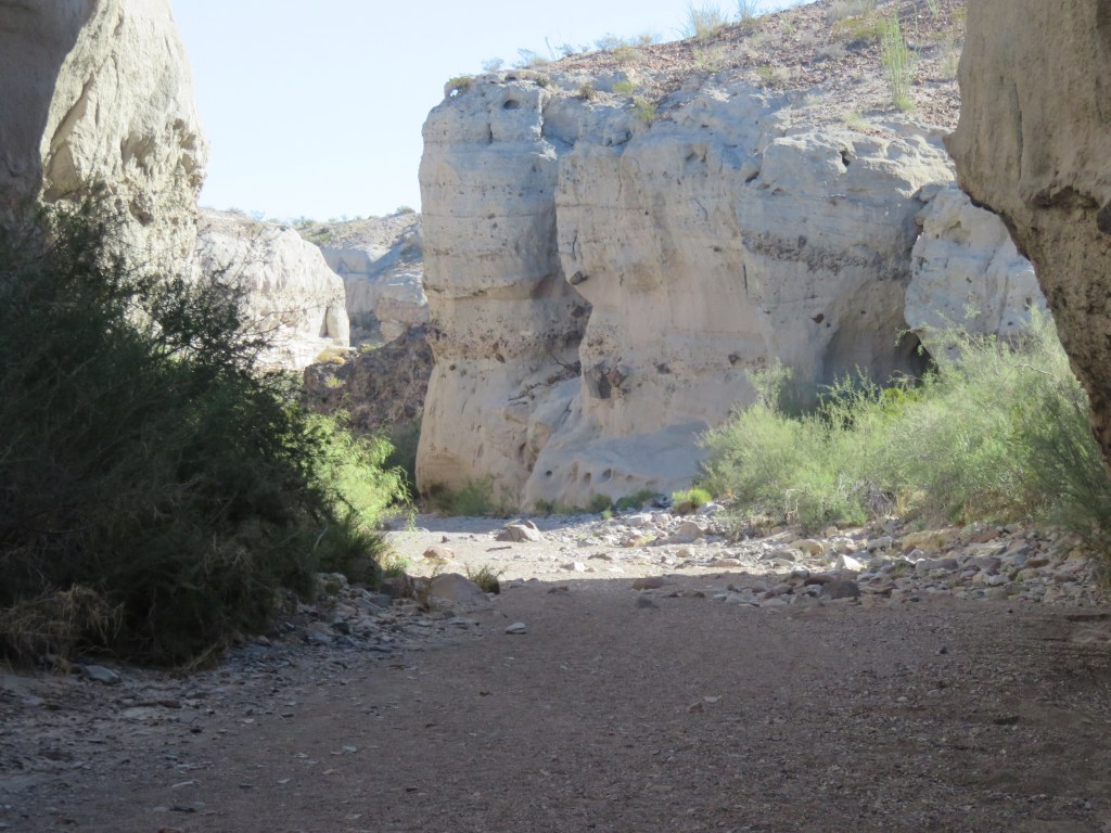
The rock behind the ocotillo is called “Cerro Castellan”, and was a landmark for those traveling along the way. We had stopped for a look at Tuff Canyon, which we ended up hiking in for a bit. The area we were driving through had seen major volcanic activity millions of years ago. There were over 20, and some minor ones, which created the landscape we were seeing. “Tuff” is hardened volcanic ash. This canyon was an unexpected surprise and I would have loved to explore it further.
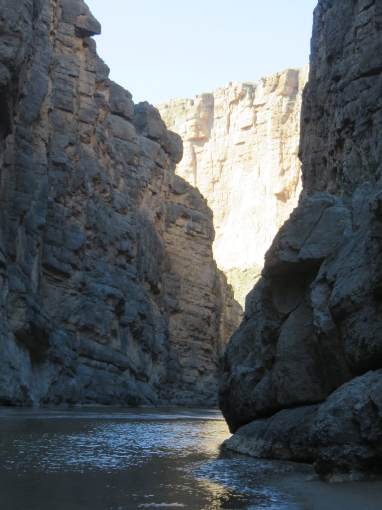
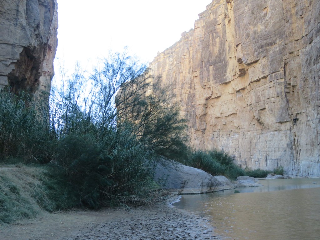
Santa Elena Canyon lies at the end of this scenic drive. At the beginning of the canyon, we had to figure out how to get around the creek that feeds into the river. The other hikers showed us the way.
We had arrived at Santa Elena Canyon. The walls on the left are Mexico, on the right is the US, and the Rio Grande River is in the middle. I had a mistaken impression we could wade over to Mexico, but it was too deep at this point.
The trail to get up and inside the canyon
Sadly, the end of the trail. We could go no further.
With Cal down the trail a bit, you can get a little perspective on how large the canyon is.
With my back to Mexico and the Rio Grande. I touched the bushes with my walking stick so…I was there
A woman we crossed paths with several times on this day seemed a little disappointed with the size of the river. “Rio Grande”, she said, “The word means big! Where is it big?” She had tried several paths on the river, and none panned out for her. Indeed, at times in the park, it seemed like no more than a trickle. It seems to me that at times when I’ve crossed over into Mexico further east than Big Bend that it was wider and deeper. Or maybe “Grande” refers to the length. Or maybe it used to be bigger? Who knows, but it was grand enough to me.
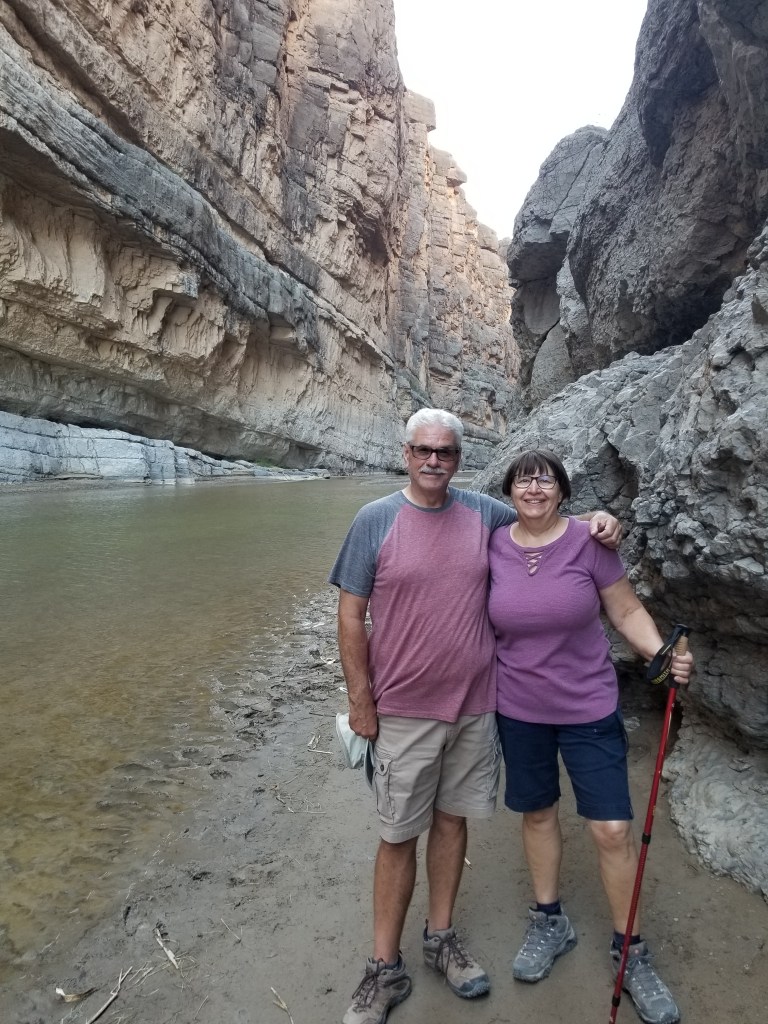
The Twosna Travelers at the very bottom of the USA
Big Bend is one of our least visited US National Parks. It’s a distance to go, even for Texans. There aren’t a lot of paved roads except for the main connectors through the park. With its combination of river, desert, and mountains, it was an amazing place to visit and I’m glad we were able to spend a week there.