Hawaii

Hangin’ on the South Side of the Big Island

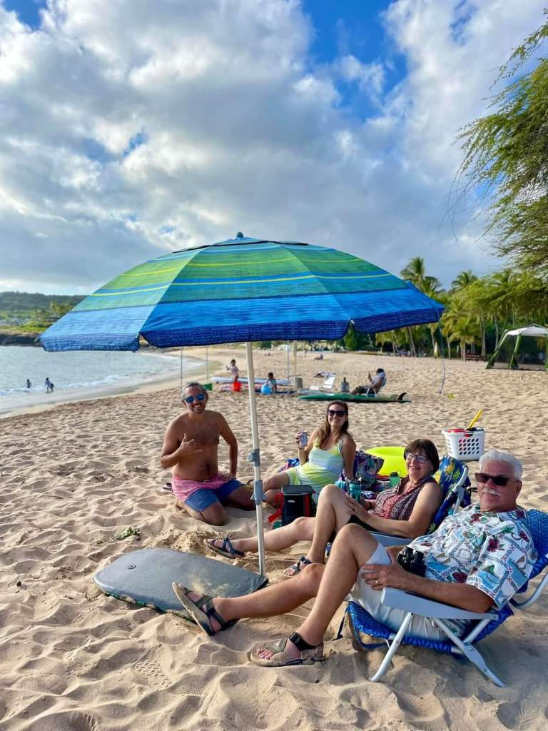
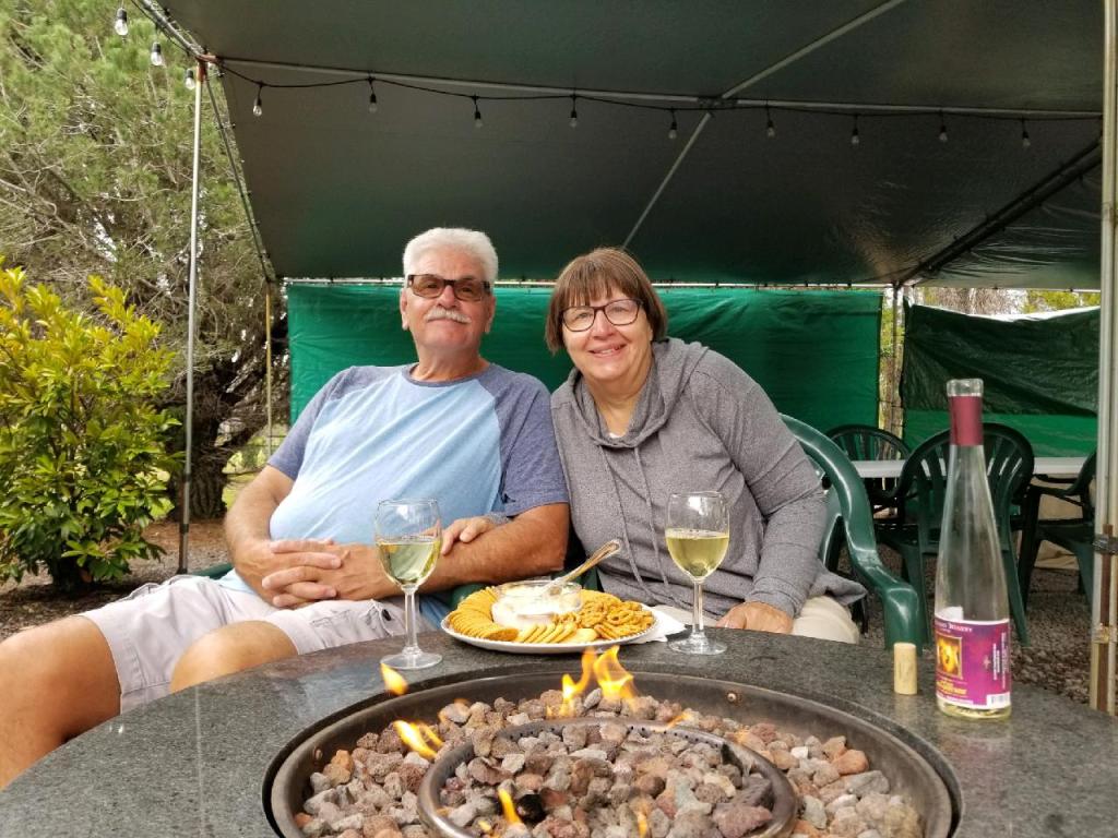
While we were staying at Volcano, we celebrated our one-year anniversary of being “location independent”. That’s a new term I’ve learned this past week, and I like it for what we are doing. I cannot say that this past year has not had its ups and downs, or a few doubts that we’re doing the right thing, although that was mostly earlier in the year. We jumped into this in the middle of Covid with hardly a look back or saying many goodbyes, because of the said pandemic. For our current situation in life, this fits. We’re enjoying it and feel blessed that we can travel as much as we can. Cheers to that!

We celebrated at Volcano’s only winery, Volcano Winery, with a guava grape wine. It is the southernmost winery in the United States. They grow their own grapes and also have tea trees, so they make their own tea. After our celebration, I had a little tea tasting, complete with a tea leaf.

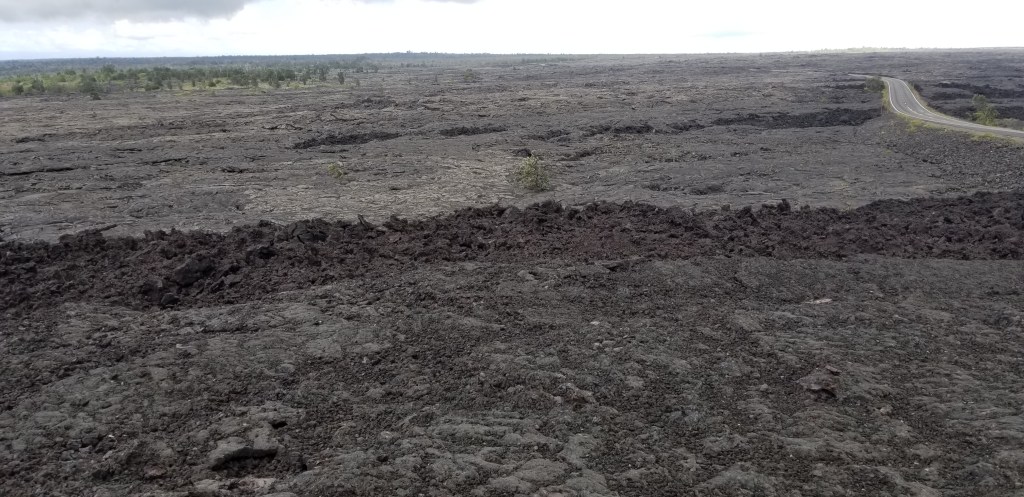
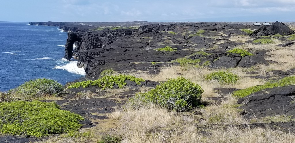
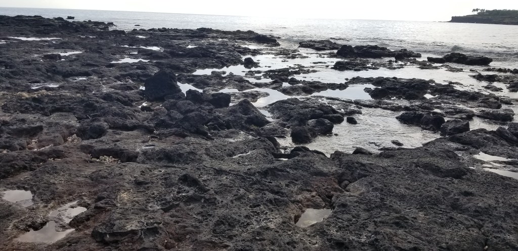
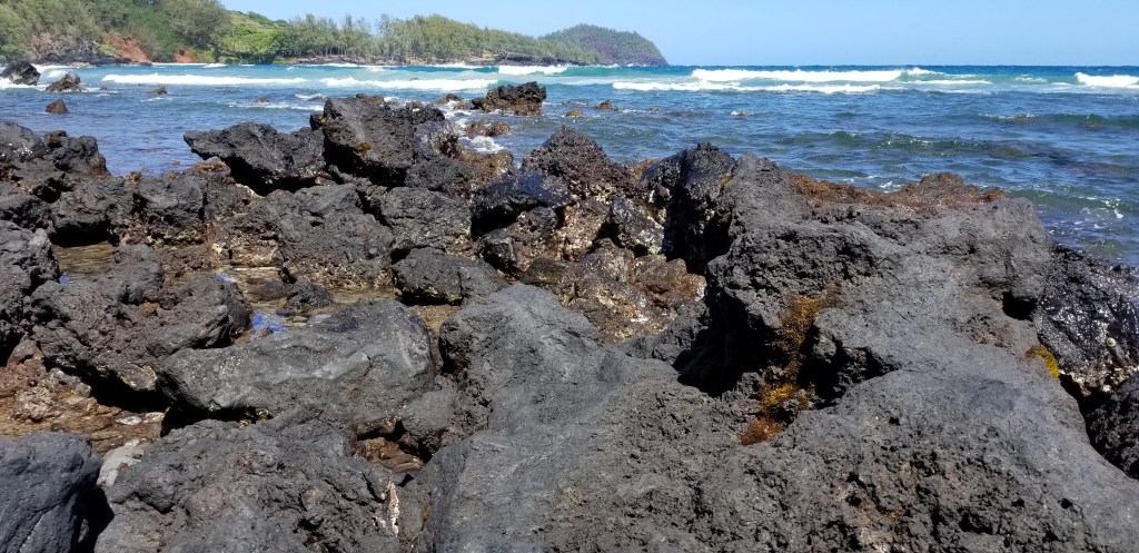
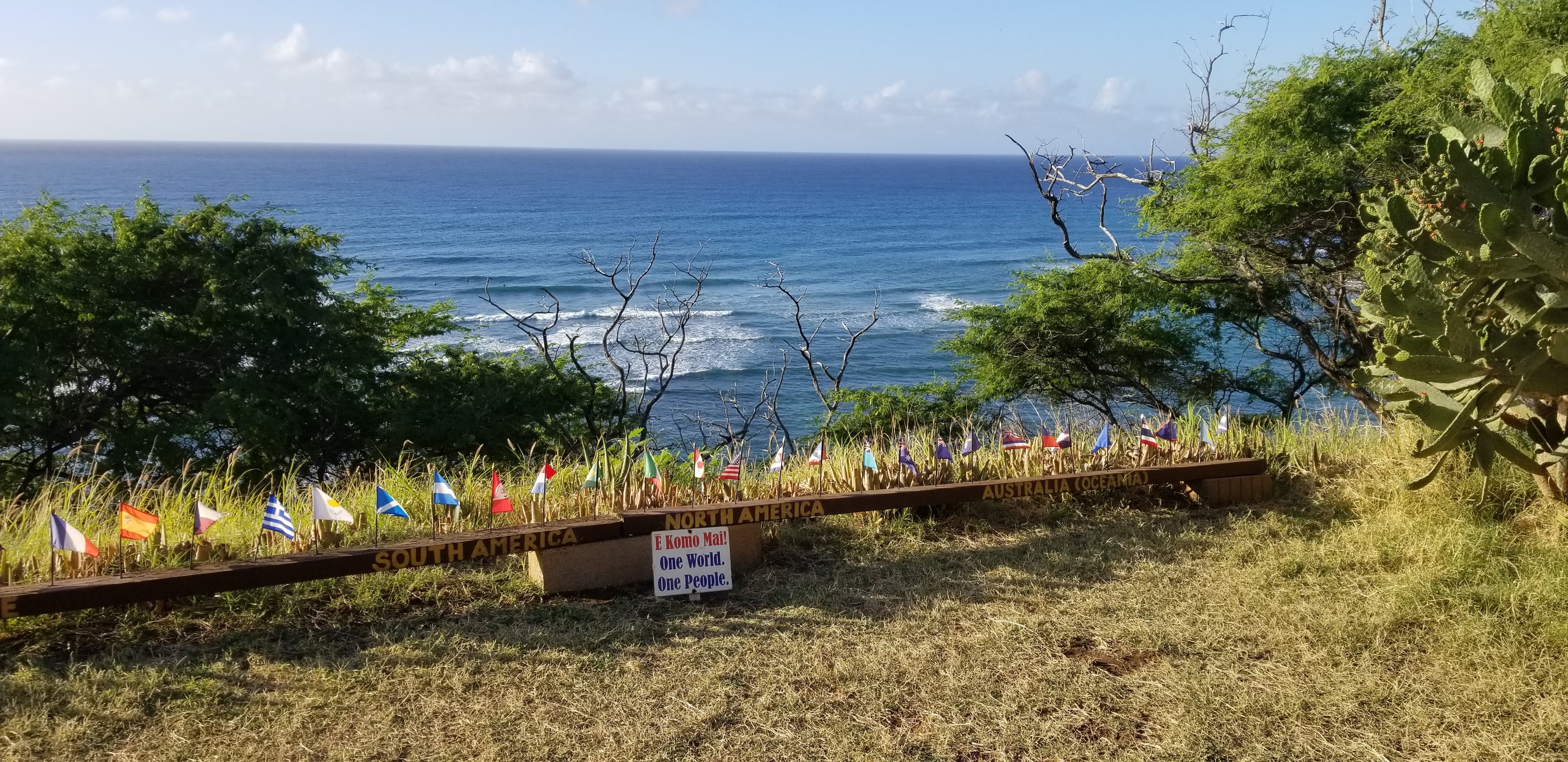
Being at the winery made me wonder: is this really the southernmost part of the United States? We’ve been to Key West, Florida, and thought we were at the southernmost place there. A Google search answered the question: Key West is the southernmost point of the contiguous United States. Lava rock at the ocean on the Big Island is the southernmost point of the whole United States. Let’s go!

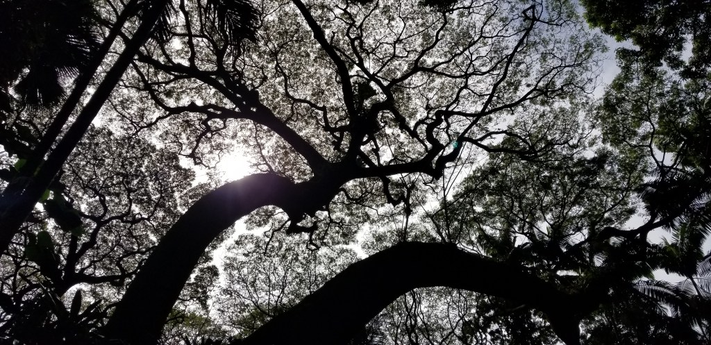
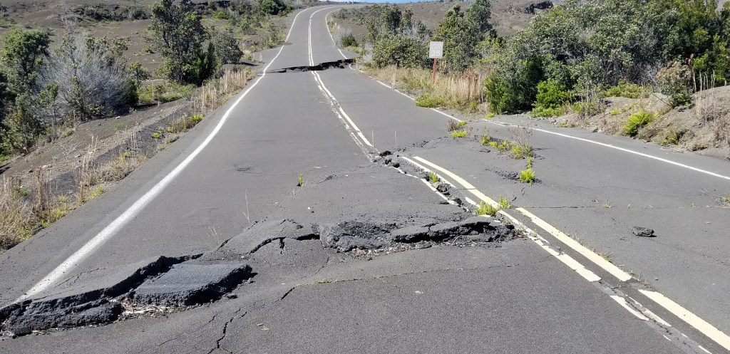
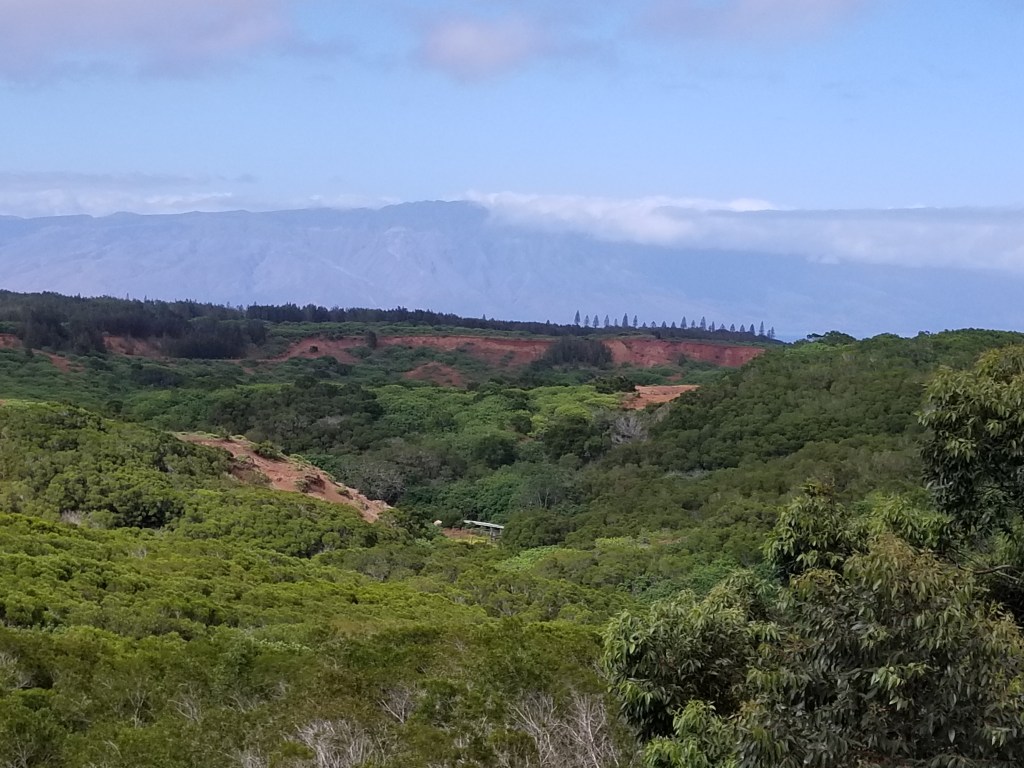
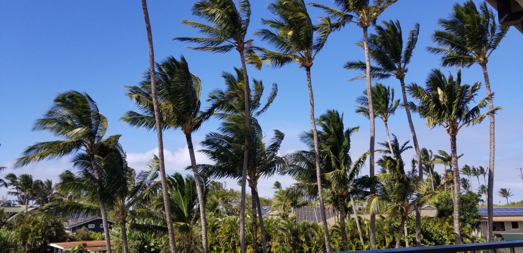
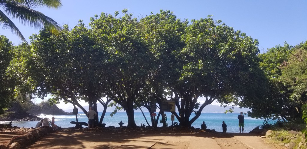
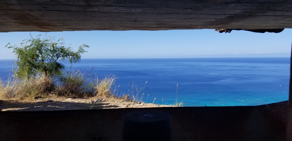
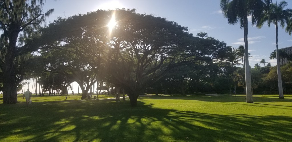
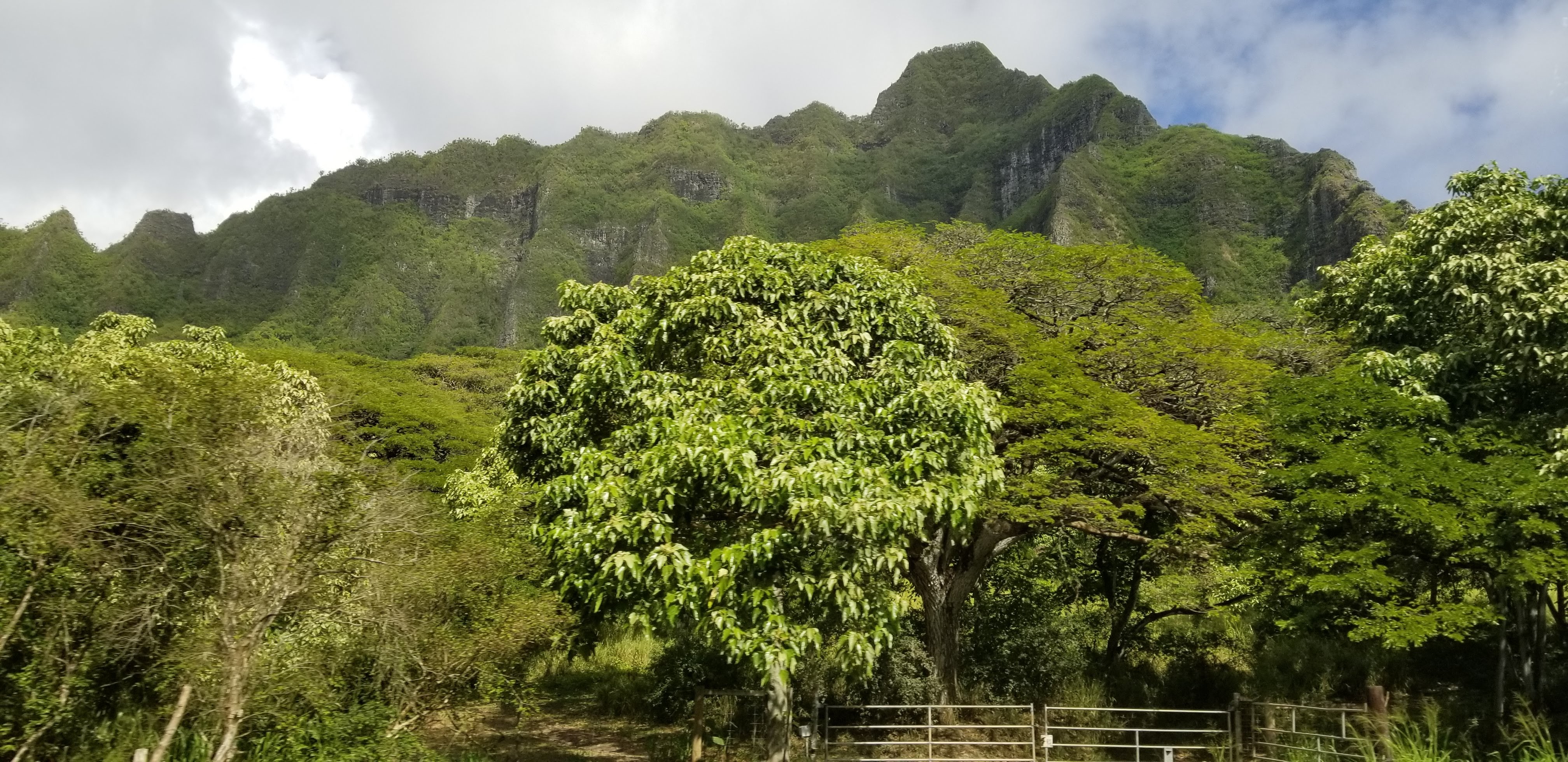
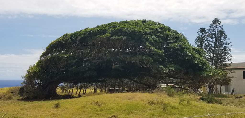
Well, we didn’t just jump up from our chairs and dive in the car, but we did go on another day. All we did was google “southernmost point” and let GPS take it from there. We passed a huge coffee farm. The couple of towns we went through got smaller. Then, windswept cattle and horse ranches. The trees were blown sideways, especially this monkeypod tree, with its trunk totally on the left side of it:

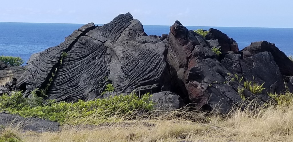
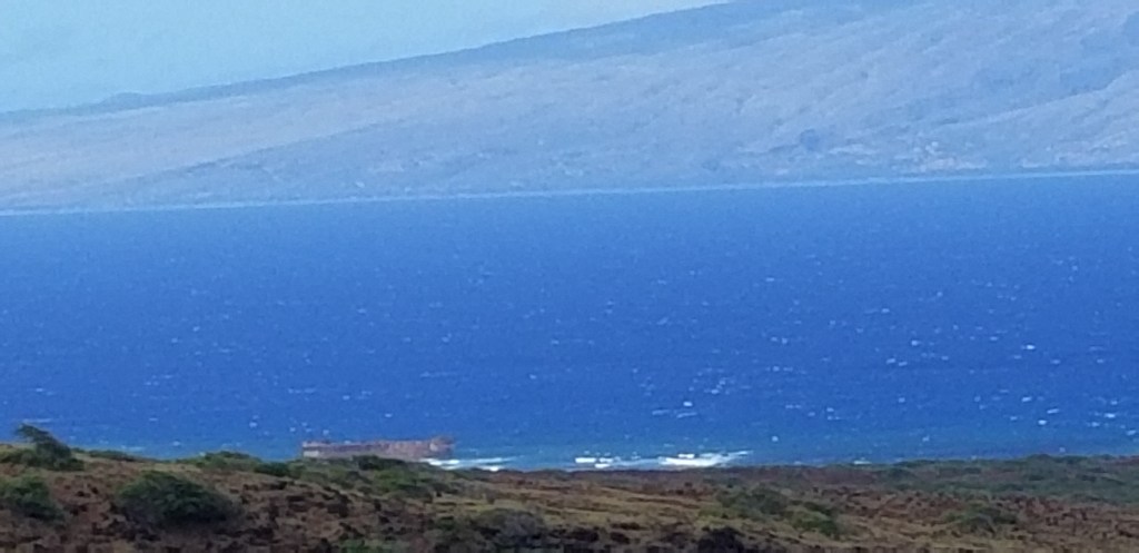
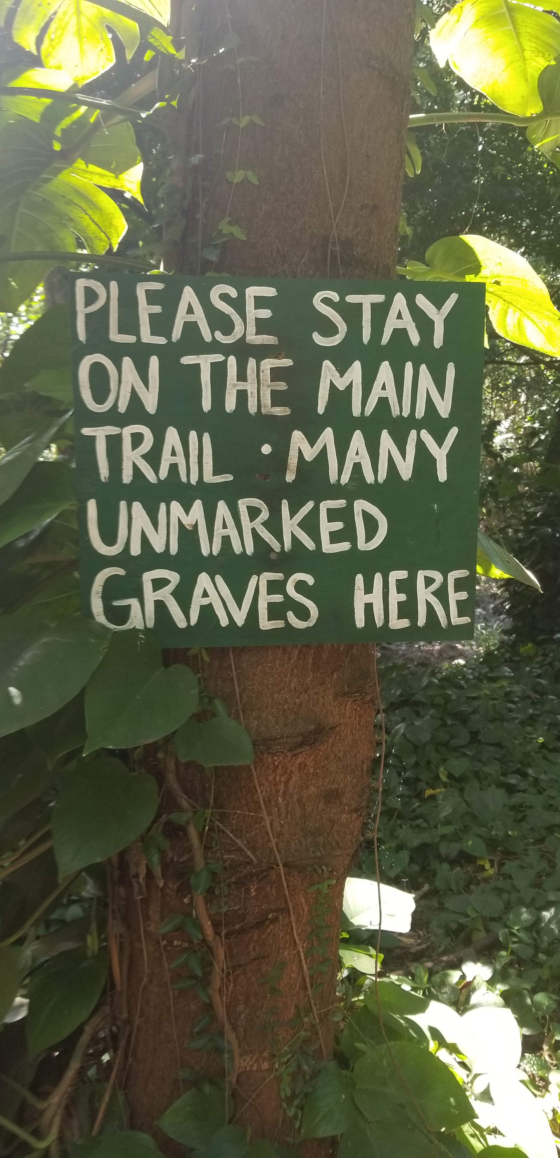
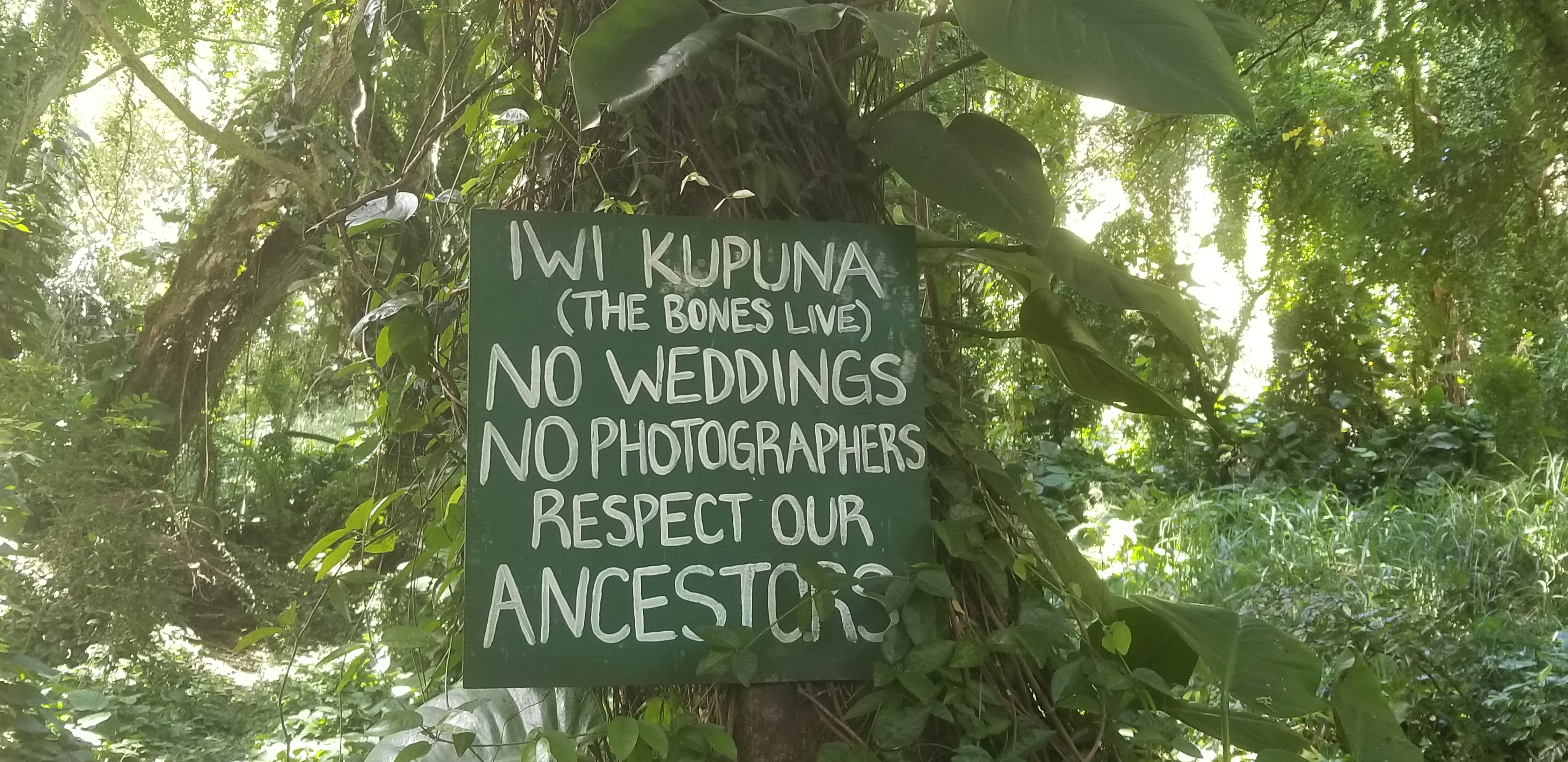
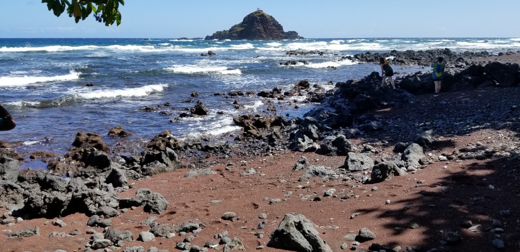
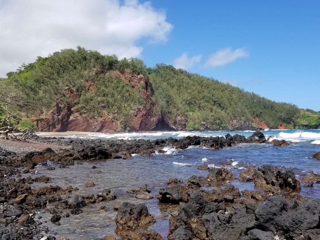
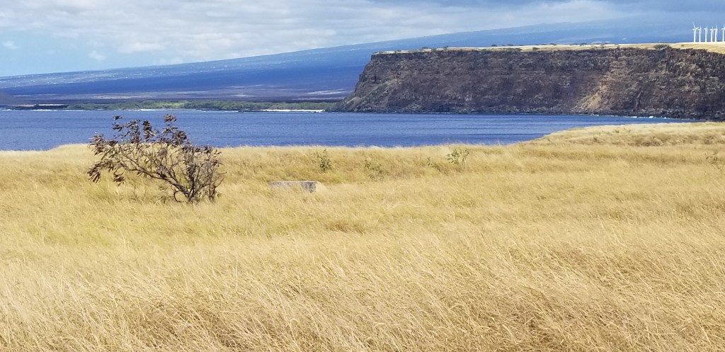
There is no sign saying “You are here!”. We questioned our GPS, but when I looked up pictures of the “Southernmost Point”, this view is what frequently comes up. The exact place is somewhere on the lava rocks. We wondered about all the cautionary signs. This spot is on a pretty substantial cliff; who would ever want to jump into the water here?

There was no fence around this hole in the ground. It was pretty fascinating to watch the water ebb and flow with the waves, and too deep to be a blowhole.

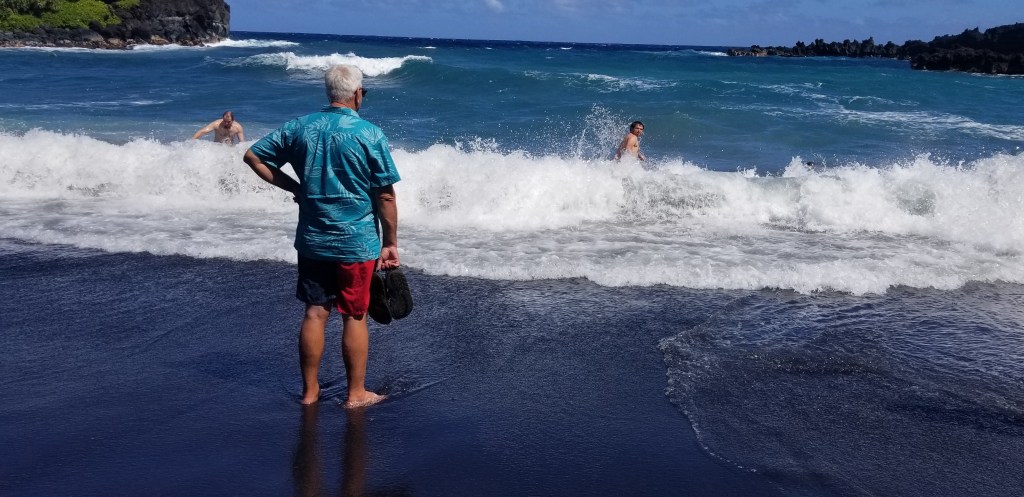
As Cal and I were peering down this hole, I started chatting with a girl nearby. I was still wondering if we were in the right place for the southernmost point. She didn’t really care about that, but she said she’d heard that there was cliff jumping here. She thought there would be more people jumping (there were none at that point). She and her friends were trying to decide whether or not to do it.

“Shall I jump?” This, despite the warnings and the memorial on the red sign!

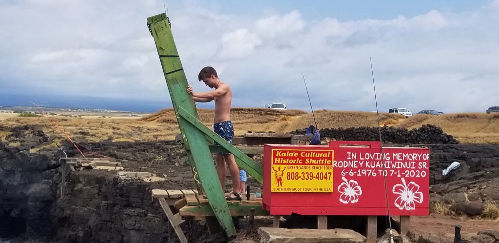
He did jump!! I didn’t catch it on camera, but I did get a picture of the girl I had been talking to:

For many reasons, just “Wow”!

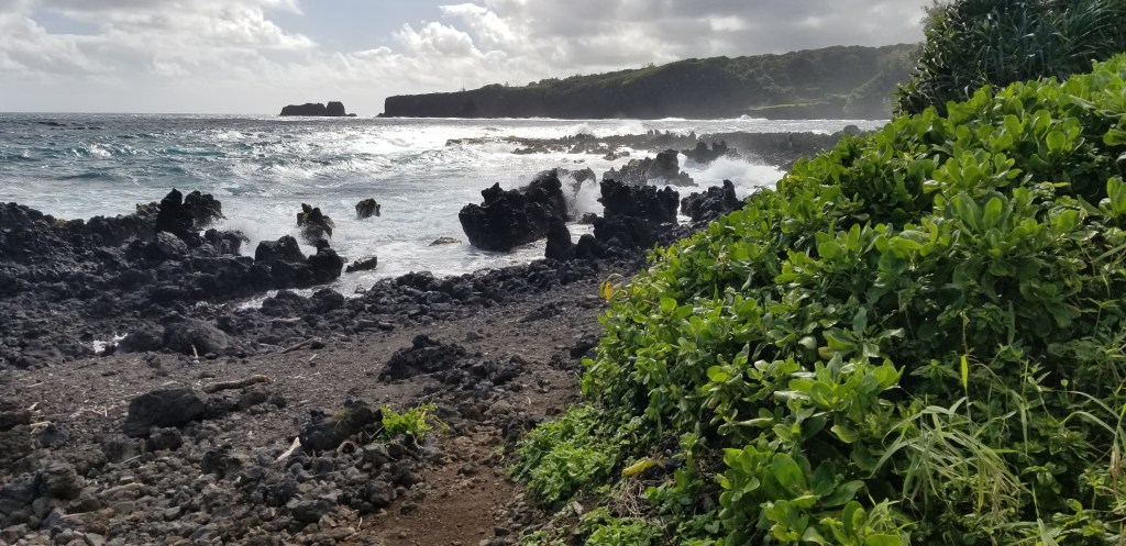
In case you are wondering, there are no rocks straight down in the ocean here, which I suppose explains its popularity for cliff jumping. These two were joined by a third young man, and his mother was right there cheering them all on. They were all wearing outer gear that made me think they were a swim team and she was their instructor but I can’t be sure of that. The group seemed to enjoy their swim in the water but the rope ladder for the climb back up looked very precarious.

Off to the other side: this is not the area anyone would want to jump down into!
A sea turtle we noticed while watching the swimmers

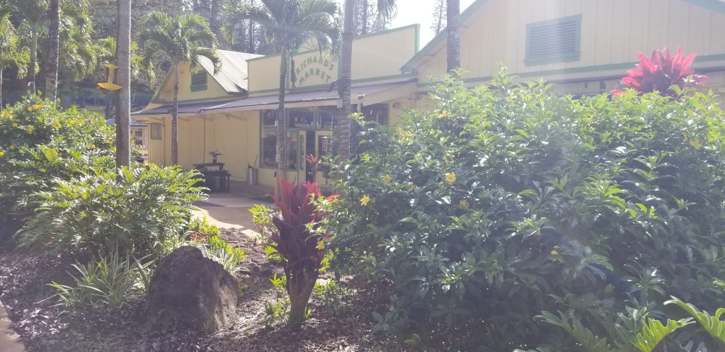
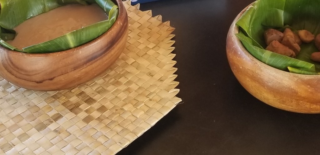
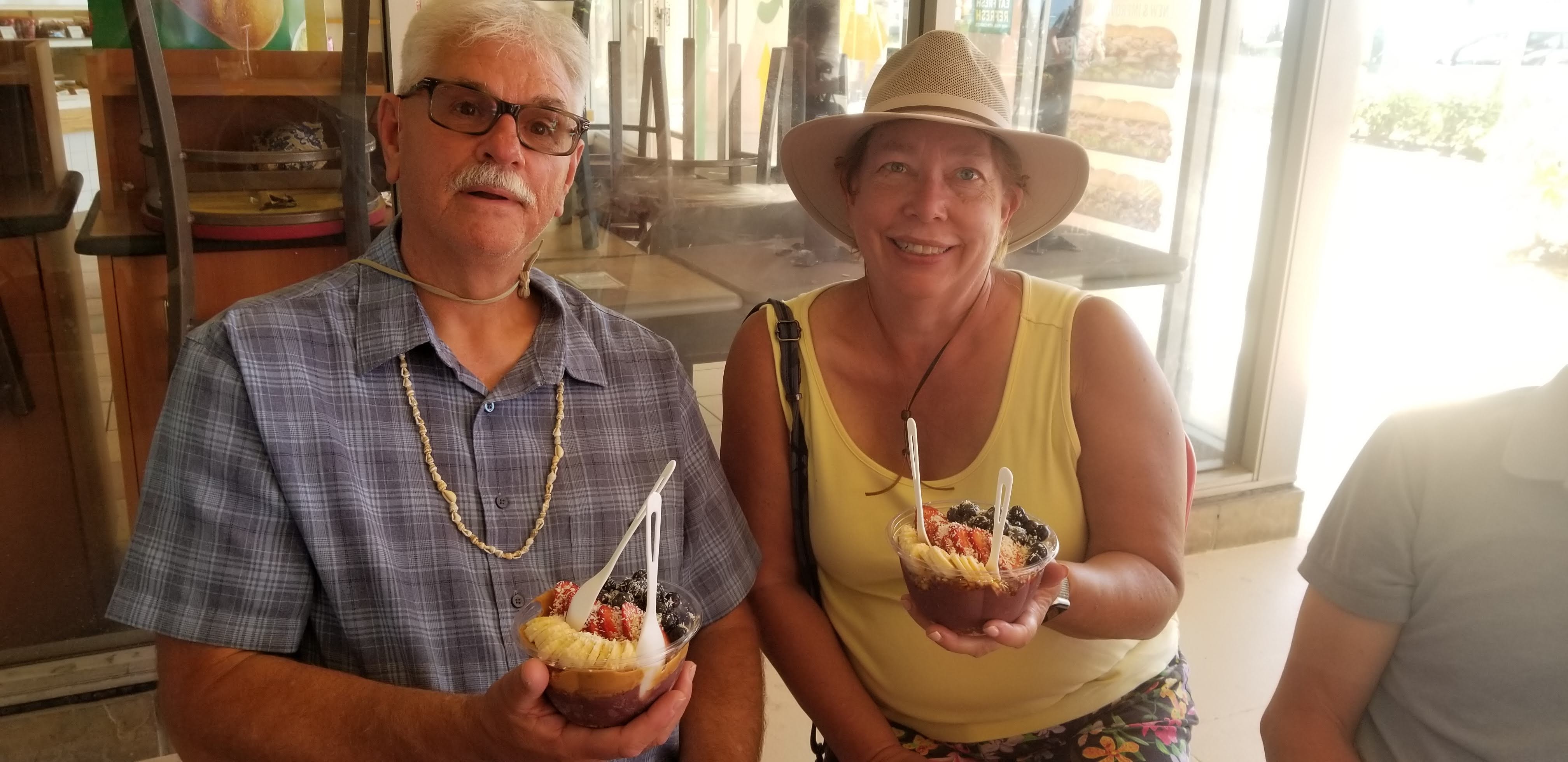
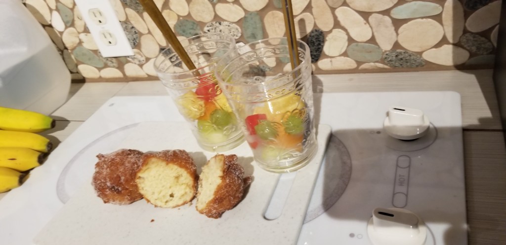
It was time for lunch at the southernmost bakery in the U.S. We had meat inside soft, fresh Hawaiian rolls with malasadas for dessert. I’ll get back to the malasadas in a bit. This place is very popular and we had quite a wait just to be able to place our lunch order.

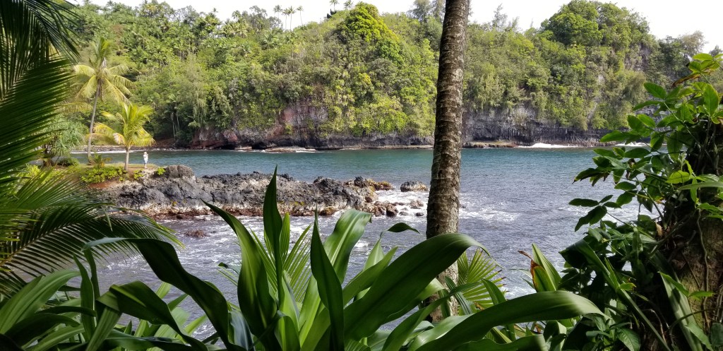
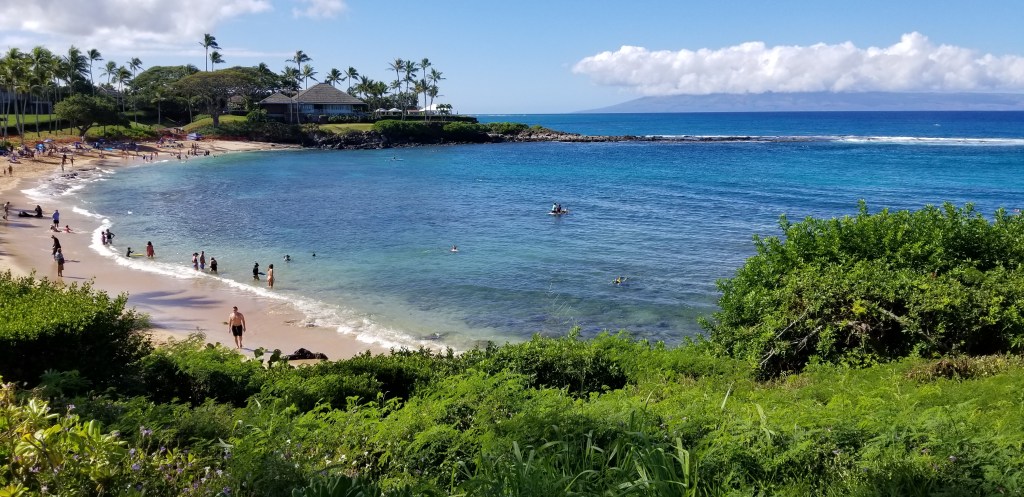
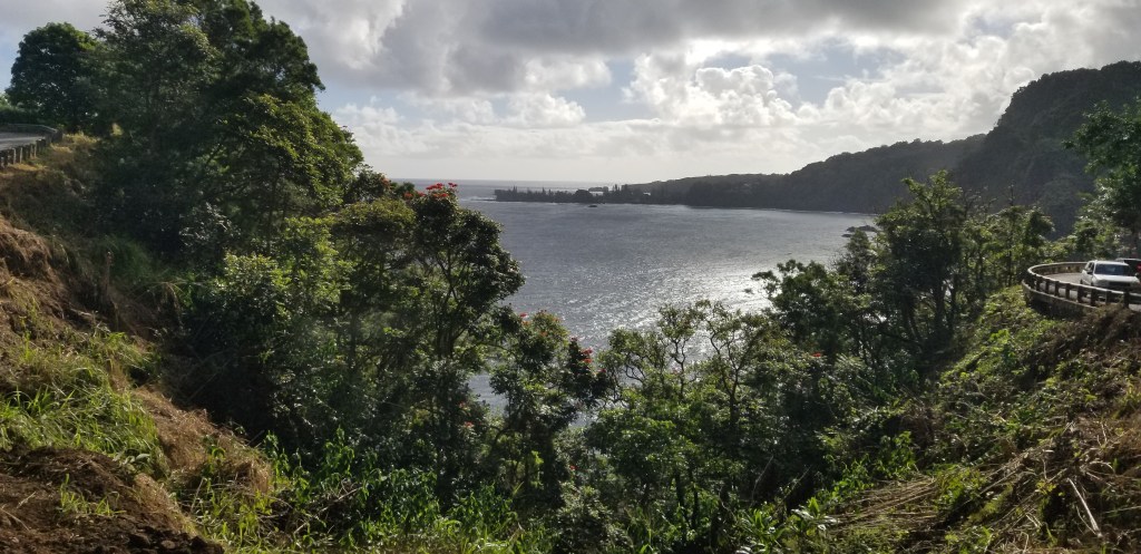
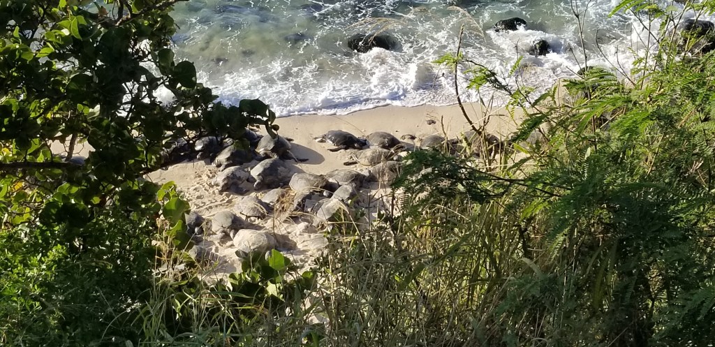
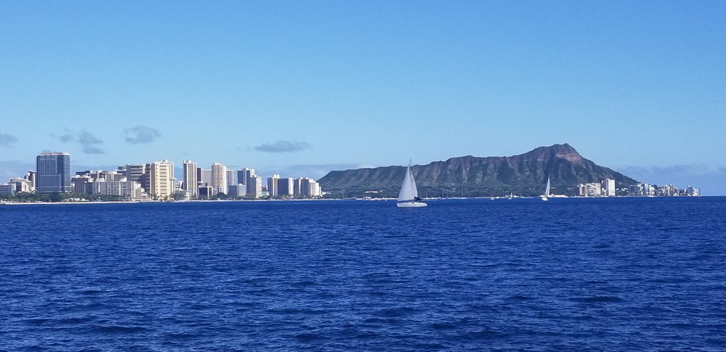
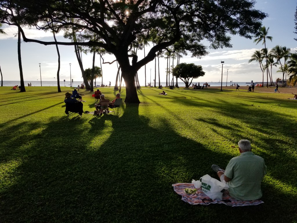
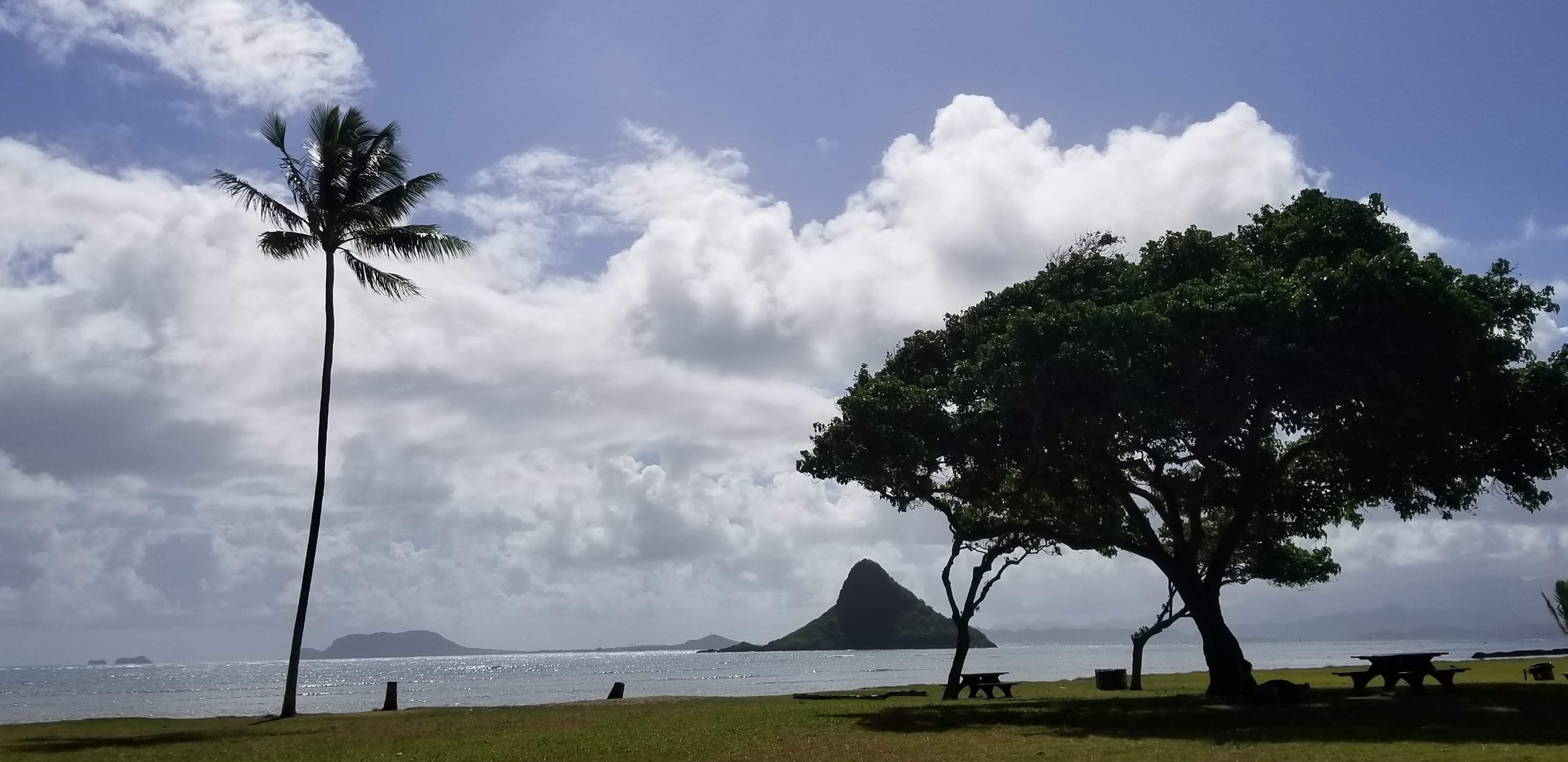
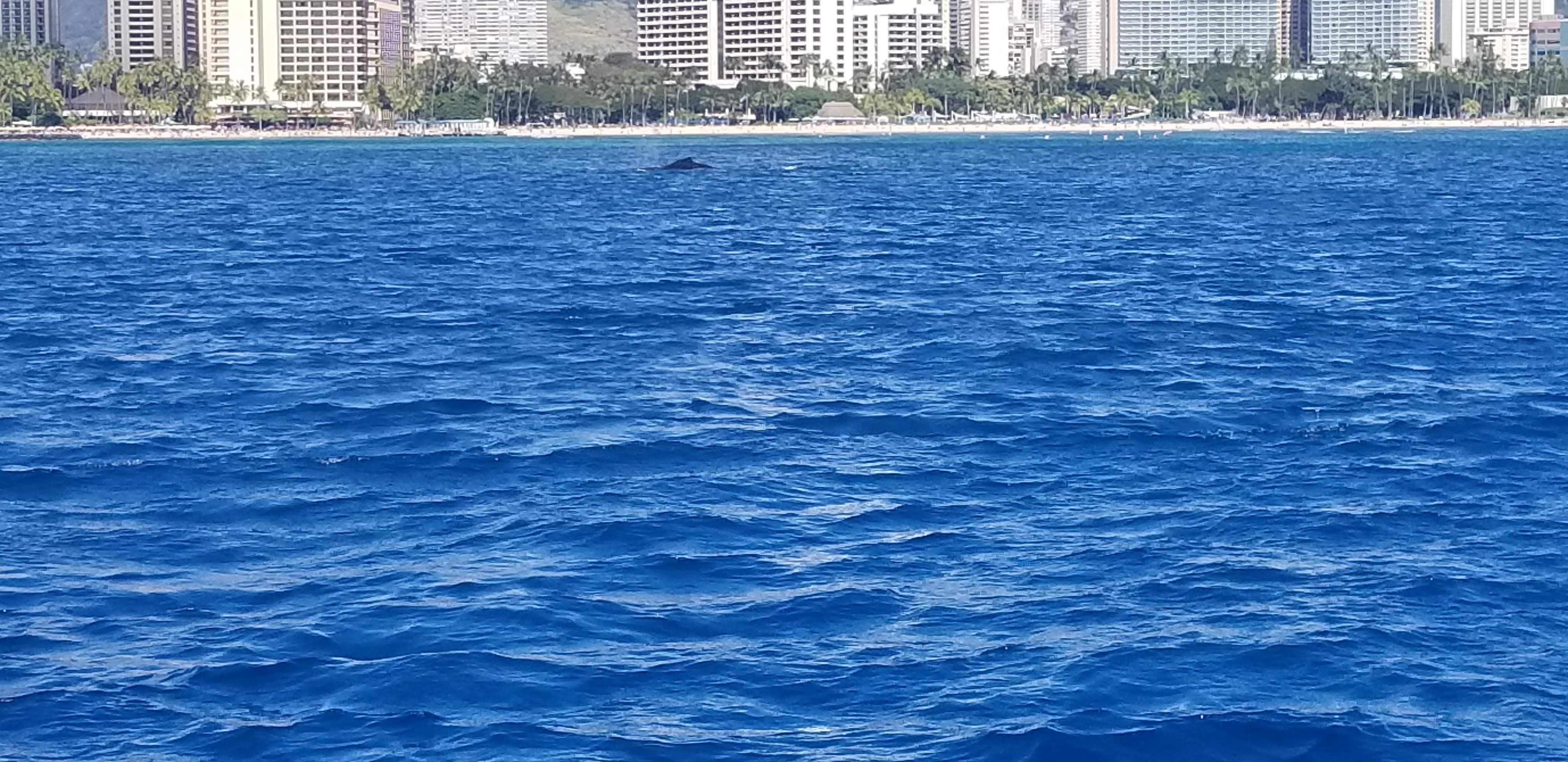
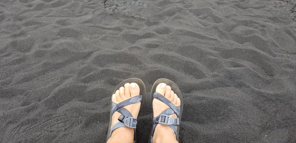
On the way back to Volcano, we stopped at Punalu’u Beach, known for its black lava sand. It was our very last beach, and a great way to end the vacation.

Back to the malasadas. We were riding with our friends Kathy and John on a highway in Honolulu when I saw a sign with a food truck way up off the road advertising them. I asked Kathy what they were, and she didn’t know, so she googled it. Definition: a fried type of doughnut. In the melting pot that is Hawaii, malasadas were brought to the Islands by the Portuguese. In Lana’i, my niece Rachel told me that there were excellent malasadas in Lahaina, Maui, and told me where to go. But we had so much good food to eat in Lahaina in a short time that we never got there.

We were coming back to Volcano one day after an outing when I saw a sign for malasadas and shouted out for Cal to stop. He’s never one to question a food stop, so he pulled a great U-turn. And there they were, two guys under a canopy, deep frying malasadas, with…pigs and chickens running free nearby. They (the guys, that is) were very nice and even gave us free samples since we’d never had them before. This is why I’ve noted in an earlier post that sometimes it felt like we were in a foreign country in this part of Hawaii!

We purchased a paper bag of traditional malasadas, easily compared to donut holes. They were excellent, pigs and chickens notwithstanding. Our malasadas were especially good washed down with pog juice, which had also become a Hawaiian favorite. So far, we can’t find pog in the continental States.

Back to Punalu’u Bakery. They had traditional malasadas, but also the filled variety. My strawberry-filled malasada was good but the filling tasted a little to me like canned pie filling, not my favorite. I kept looking longingly at Cal’s chocolate-filled malasada but he didn’t offer a sample. He thought he liked the traditional ones best. I liked them both, very different from each other.

I enjoy figuring out the origins of words, and I study Spanish. Portuguese is very similar to Spanish. “Mal” in Spanish means “bad” and “asada” means “grilled”, or “roasted”. So I’m conjecturing that the very first malasada was a complete accident.

With a toast to malasadas and pog, I’m concluding this edition of The Hawaii Chronicles. I hope you enjoyed reading about our little romp through some of the Hawaiian islands. What would we like to see if we came back? We didn’t get to Kauai, and Molokai might be interesting. I would like a return to Maui to see Haleakala National Park. People we talked to on the Big Island were surprised that we didn’t see Kona, although we were pretty happy on the southeast side, so I suppose that might be a possibility. Cal really liked Lana’i and would like to return. But then, there are so many other places in the world to go, and the US to explore, especially with our RV.

Until next time, Aloha – and Mahalo – (thank you) for reading!

Next time – back to Frodo, Sam, and Arizona!

Hawaii

A Hilo Kind of Day on the Big Island, and the Bird House

Our Bird House

When we first flew into Hilo, it was already dark, and raining. We had not seen rain since Christmas so that was surprising. We needed to rent a car. Easily done, because Hilo Airport is so small that all we had to do was step out of the airport door. There were groceries to purchase. Then, thirty miles to Volcano. As we rode, I started noticing elevation signs. By the time we arrived at our AirBnb, The Bird House, we were at 4,000 feet and solidly in the rainforest. The temperature was cooler.

In the morning, when we could see, we walked outside and got a good look at where we were. Pleasant surprise, looking at the Bird House from outside! After a few days, we noticed a pattern: mornings were generally sunny, although not the warmest, but by afternoon it would start clouding up. Usually it would be raining by late afternoon, or at least misting. It was OK. We’d had two weeks of fun in the sun in Hawaii, and we figured this week was just going to be different.

After a few days of this, and a lot of volcano activity on our part, we were ready to hop down out of our perch, warm up a bit, and see something of the island.

Preparing coconuts for sale at the Hilo Market

Our first stop was the Hilo Farmers Market. There was produce for sale which we were not used to seeing in a market.

Bright anthuriums for sale

Behind the fruits and vegetables tent was a crafter’s market. Everything was made in Hawaii. That was a good spot to finish up all of my gift shopping.

There was a tourist street near the water which looked similar to Front Street in Lahaina, Maui. We were done with all of that after Lahaina, so we skipped it and drove north of Hilo to the Hawaii Tropical Bioreserve and Garden. Compared to our elevation at the Bird House, here we were at 120 feet above sea level to start the garden visit.

Dan and Pauline Lutkenhouse purchased a little valley containing 17 acres on Onomea Bay. It was full of junk and overgrown jungle. They spent six years hacking and clearing and giving space for native plants to grow back. Dan designed a boardwalk down into the Garden over uneven terrain and large boulders, like a bridge. Dan and Pauline are gone, leaving a treasure in this non-profit preserve.

Our walk through this garden was one pleasant surprise after another. Orchids were growing on many trees, and there were other flowers such as I’ve not often seen:

Purple anthurium – I had only ever seen red before
Heliconia

We looked at Onomea Waterfalls, which goes into Onomea Stream, and right out to the bay:

A cute little gecko popped in to say hello:

I liked the effect of the sun on the picture I took of this monkeypod tree.

Finally, as always in Hawaii, ocean in view! Now we were at sea level.

Twin Rocks on Onomea Bay

Have you ever seen a cannonball tree? This was truly amazing.

We really appreciated the love and care that has gone into this garden. What a gift they have left us.

After most of the morning spent at the gardens, we headed even further north, past the village of Honumu. Japanese immigrants once harvested sugar cane here. Past Honumu, we visited Akaka Falls.

On our little hike to Akaka, there was the smaller Kahuna Falls.

Akaka Falls has a drop of 442 feet and was the most impressive of all the falls we’d seen so far on Hawaii.

We had had a huge delicious breakfast at Ken’s Pancake House in Hilo, so in the early afternoon we were still only hungry for a small snack. There were some tables for a picnic at Akaka Falls. We enjoyed our manju (soft cookies with red bean paste filling) and banana bread that we’d purchased at the Hilo market, and sweet easy-to-peel Hawaiian grown oranges. I didn’t say too much to Cal about what was inside his manju, and he thought it was pretty tasty.

This cute and furry cat came by as soon as we started eating. It didn’t want food or much attention, and promptly curled up near us for a nap. When we finished our lunch it woke up, stretched, and off it went. Pretty fine day for a cat, if you ask me.

Returning to Hilo, we drove to Rainbow Falls. The sun shines on the falls in such a way as to produce a rainbow effect. But there was no rainbow. Later I found out that the best time to see the effect is in the morning. Oh well, it was still pretty.

Back in Volcano, we loved our stay at the Bird House. It was a welcoming place. When the owners first saw it, they thought it looked like a bird house, and so all of the decor inside is bird related. There is even old-time newspaper design tile in the entry way, like you might put newspaper in the bottom of a bird cage. I thought that they must have had fun scouring the earth for every bird-design item possible, because the birds were in every nook and cranny.

This was advertised as a “tiny house”. In my mind before our arrival it kept shrinking; I had no idea how tiny it was going to feel. In actuality, I think it was slightly bigger than a typical tiny house. We had plenty of space on the first floor. The loft where we slept was spacious and we could fully stand up in it.

There were birds in a cage above us–

–and this parrot seemed to look askance at me for whatever I happened to be doing in the bathroom.

We were back at the Bird House one day for lunch, and it was warm enough to have a little picnic on the porch. There was a bird wind catcher above me and a big red bird in the yard.

But the piéce de résistance was this diorama, set into the landing on the stairs. YFlipping a switch to turned it on. It lit up, and one of the birds and the butterfly started flapping their wings. I couldn’t even dream of setting something like this inside a house, and there was so much artistry involved.

The bird theme continued outside with thanks to Mother Nature: a flock of Kalij pheasants visited our front lawn every morning and sometimes returned late afternoon.

We took some walks around our neighborhood. All the houses were different from each other, some expensive-looking, some weren’t much better than a shack. Some were right on the road, and you could hardly see some others. Most had some nice landscaping with local plants in the yard. But none were too close together, and in between, the rain forest was allowed to grow unchecked in a riot of many different trees and plants. We rated the Bird House as our favorite stay.

I would like to credit my niece Rachel for her travel suggestions. She had recently traveled to the Big Island, and most of the places that we visited and enjoyed in our Hilo day was thanks to her advice.

Next time: the south side of the Big Island

Hawaii

Visiting Kilahuea Volcano on the Big Island

Steam rising from Kilahuea, Big Island

When I was doing some Hawaii trip planning, Cal looked over my shoulder and asked “Which is the last island we’re visiting?” To which I replied, “The Big Island.” “Oh,” he said, “and which one is that?” Well, it is a little confusing. The Big Island’s correct name is the Island of Hawai’i. But it is part of the State of Hawaii, equally confusing.

It rightly earns the nickname of Big Island. Our guide for the Road to Hana tour told us that all the other seven Hawaiian islands could fit into the Big Island.

Our AirBnb was located just outside of the tiny village of Volcano, just a stone’s throw from Hawai’i Volcanoes National Park. We have a National Park pass, so we were in and out of the park several times during the week we were there. In Volcano and its surroundings, we almost had the feel of being in another country. It was a little strange to see the familiar US National Park sign when we arrived for the first time.

I’ve seen several volcanoes, but I hadn’t yet hiked on a volcano crater rim, so that’s where we started. The trail took us through the beautiful rainforest, and soon the volcano crater was in view:

The steam was also coming up from natural vents near the trail, and the smell of sulphur was in the air:

The active volcano is below this crater

The correct name for the tree below is the ‘Ohi’a Lehua, usually shortened to just Ohia. It is one of the first plants to grow in a new lava field after an eruption, reaching its roots way down into the cracks. At that point it looks like a small shrub. I saw the Ohia everywhere at Volcanoes. It is the official Big Island flower.

An Ohia flower

On Volcano’s scenic drive, we received views of craters left behind by older eruptions. The steam from the current eruption can be seen just behind this crater:

We could walk right in to Thurston Lava Tube.

We drove past sprawling lava fields from eruptions that happened years ago, where the forest is only beginning to reclaim the land:

Delicate moss, and a tiny Ohia

And finally, the ocean, with a sea arch carved from the lava flow:

No sandy beaches here!

Sometimes Nature carved intricate patterns into the cooling lava:

Do you remember, in the summer of 2018, when a subdivision called Leilani Estates was completely covered by Kilahuea’s lava flow? The slow destruction was in the news every day. The eruption was touched off by a 6.9 magnitude earthquake. 700 homes were destroyed and 2,000 people were displaced. On the plus side, the lava flow added 875 acres.

We drove over to Puna and saw what was left of Leilani Estates. In a testimony to man’s tenacity, new homes are being rebuilt, or at least structures to live in. I cannot begin to think how one would build a house over a lava bed.

There was once paved roads, trees, and a community of homes here

One evening we went out for a little night hike to see the current eruption. Kilahuea is temperamental, and no one can predict how much activity will happen each day. We were feeling a little grumbly about being out close to our bedtime, but were soon caught up in the wonder of our walk in the dark. It was just over a mile, and other people were out, so it felt like a party. The moon was bright and playing peek-a-boo with the clouds, and stars were in full view. The hike was mostly over a closed national park road.

It was not one of Kilahuea’s best nights for activity. But standing and watching for awhile, I could see how the eruption is constantly moving, ebbing and flowing. Pretty spectacular. My old phone did not do a great job of capturing the moment. I started chatting with a woman next to me, and she texted me her pictures, taken on her brand-new I-phone. What a difference!

Volcano eruption taken on my old Samsung
Volcano eruption from Lakita’s new I-Phone

So then, we had to hike back to see what it looked like by day. The first thing I was excited to see was a pair of nenes, the state bird of Hawaii.

Finally we see the whole Kilahuea Volcano – the deep black that you see in the middle is the lava lake

By day, we could see why the road was closed:

I’d suggest turning around if you’re ever driving on a road that starts cracking and splitting like this!

We had seen the volcano and its effects from every angle, except underground. You won’t find a glossy brochure about Kazamura Cave in any of the tourist information racks around Hawaii. It’s privately owned by Harry Shick; the cave sits on his land, and he gives the tours. He’s done extensive research in the cave and he’s written a book. We found out about the cave from our AirBnb host. I had to call to reserve a tour and then he e-mailed me directions. He only takes six people down at a time and once there, I had to pay in cash. It all seemed a little shady but later I found out that he just doesn’t want an excessive amount of people knowing where his property is.

Kazamura Cave is a lava tube cave with several different levels. It is the longest cave in Hawaii and at 42.5 miles surveyed, it is the longest known continuous lava cave in the world. This is not a tour cave with poured concrete floors, handrails, and lights. We had to climb up and down several ladders, wear hard hats and gloves, and strap flashlights on to belts. The tour size is small so Harry can keep an eye on everyone; he’s very protective of his cave, and rightly so.

Going up one of the many ladders in the cave
A lavafall

By Harry’s own definition, a lava tube is “a conduit which forms around flowing lava; it insulates the flow from the cooling effects of the air.” Many lava tubes and other formations make up a lava cave, left by an erupting volcano. This cave formed from an eruption that happened about 500 years ago. Everything above ground had grown back, of course. We walked through lush rainforest behind Harry’s house to get to the entrance.

Gypsum crystals

We were in the cave about two and a half hours. Harry’s knowledge and explanations, although technical, were informative. We learned about lava ropes and lava falls, the formation of the gypsum crystals, lavacicles, straws, and dribble spires.

Lavacicles

Harry documents every tiny creature that finds its way into the cave. A young man in our group, Wilson, was always falling behind and examining everything closely with fascination. Wilson had a great camera and gets the credit for some of the pictures I have posted here. He also found this plant hopper, which is no bigger than a grain of rice. Harry has a camera that takes microscopic pictures, and I took a picture of Harry’s picture.

This little plant hopper will only survive in the cave if it finds roots to feed on

We originally weren’t sure what we were getting into with this cave exploring venture, but it was a whole lot of fun! We learned a lot and this put a lot of the volcano activity that we had been seeing into perspective.

If the whole subject of lava caves truly interests you, you can find Harry’s book on Amazon.

Next time – a Hilo day on the Big Island

Hawaii

The little island of Lana’i

Puu Pehe – Sweetheart Rock in Lanai

We were in the early stages of Hawaii trip planning last year when my niece Rachel’s husband, Ben, became the pastor of the United Church of Christ congregation in Lana’i City, Lana’i. Although Ben arrived ahead of the family, by early summer they and their two daughters Eliza and Emi were settled in, and Rachel started work for the Lanai school system. We didn’t want to miss seeing them, so we inserted a night’s stay in Lana’i into the middle of our Maui week.

Lana’i is the smallest inhabited island in the Hawaiian islands and is roughly shaped like an apostrophe. In the early 1920’s it was purchased by Dole Corporation and became the largest pineapple plantation in the United States. The pineapples are gone now. Business magnate Larry Ellison owns the whole island. He took over an existing Four Seasons hotel, and is now trying to transform it into a more health-and-wellness-focused enterprise.

You can get to Lana’i two ways: by airplane, or by ferry from Lahaina in Maui. We chose the latter option, and joined the day-trippers heading for the beach on Lana’i with their coolers and beach chairs. Several people were also headed to the Four Seasons with enormous suitcases. The ferry takes about an hour, and we enjoyed the ride.

A look back at Maui and Lahaina

On the ferry to and from Lana’i, we spotted many whales. On a whale watch tour, the boat stops when a whale is sighted so that everyone can watch it, ooh and aah, and take pictures. A ferry boat doesn’t stop or try to get close. When we first saw a whale on the ferry, I tried to angle for the best picture. For the most part, they were too far away. I gave up, and discovered that I really enjoyed seeing them a lot more without trying to get a picture when they appeared over the water. I just let the whales be, observed them, and scouted for others in the sea.

A puff of water on the glistening sea is all I captured of this whale before I put the phone down.

When we arrived in Lana’i, Ben and his youngest daughter Emi were there to greet us. It was about eight miles up from the harbor to the town of Lana’i City. “City” is really a misnomer for this little village without any stoplights!

The UCC church, with their home – the parsonage – on the right.
Dole Park, across from the parsonage, looking much like the Wisconsin that they left behind

The businesses of Lana’i City are the “houses” lining the park.

The court house!
One of the two grocery stores

The groceries on Lana’i come by barge. If the barge runs late the week that it is expected, the store shelves start to run thin.

Ben and Rachel drove us up further on the mountain for some great views.

Maybe you can just make out the “shipwreck” on Shipwreck Beach at the bottom of this picture. It’s an abandoned barge.
The “breezeway” between the islands of Molokai and Maui
Former pineapple fields
Ben, Rachel, Eliza, Emi, and…wait! What’s Cal doing in the family photo??

We visited Lana’i cemetery.

While we were there, Rachel and Ben did some great “tag teaming”. From the cemetery, we went off with Ben and the girls to hike a trail that Ben wanted to explore and hadn’t been on yet. Rachel met us at the bottom, when we finished, so that we didn’t need to make a round-trip hike back up the mountain.

Rainbow Bark Eucalyptus trees, the first that Ben had seen on the island
Looking down on Lana’i City

The picture above gives a closer view of the Cook pine trees. I’d seen them on the other islands, but not as much as I did on Lana’i. They are what gives the island that “Wisconsin” feel.

Remember that scene at the beginning of the “Sound of Music” where Maria twirled and burst out with “The hills are alive!”? That’s exactly what this little meadow full of wildflowers felt like. We had been hiking through the woods, and then came upon this. In actuality, it is the old golf course for the Four Seasons. We could see golf balls embedded in the path. Larry Ellison has already transformed part of it into two different ropes courses. I think this one looks like an absolute blast:

Has it happened that you saw something on Facebook, and years later, it still stuck in your mind? That happened for me when I saw the Lana’i Cat Sanctuary posted several years ago. The founder, Kathy Carroll, was dismayed about the number of feral cats running all over the island. Having the cats at the sanctuary not only cares for their health but also controls the numbers, and protects the bird population. There are over 600 cats at the sanctuary. Seeing it on Facebook was one of those “ohhh, I wish I could visit” moments and I was purely tickled that I could see all those cats, and the sanctuary, in person!

Joy!

You could adopt the cats, and I picked out a couple that I would have loved to take home, but Rachel and I agreed that any cat would be happier here. Lots of friends to play with, people that visit for affection and attention, trees and structures to climb on, hammocks and other warm places to nap, and food to eat…what’s not to love?

Two cats in a mango tree
A volunteer came into one of the enclosures we were in, and all the cats in there came running!

I could post a whole lot more cat pictures but I will spare you for now. I was delighted to meet Kathy in her husband Mike’s art gallery in Lana’i City, and we purchased one of his pictures to put in our our RV.

My roots are in the midwestern United States. I can’t imagine being able to enjoy every Sunday afternoon at the beach, but that’s what Ben, Rachel, and their girls do. What a great place for kids to grow up. They got into suits, packed up snorkeling and beach gear, food, and off we went to Hulopo’e Beach. Rachel walked us up onto the bluffs, where we were standing on ancient lava flows, for the view of Sweetheart Rock that you see at the top of this blog.

We had fun exploring the tide pools. The more I looked, the more I found: brightly colored fish in the deeper pools, sea cucumbers and anemones clinging to the rocks, crabs, and shells. There is more life in a tide pool than you can ever imagine.

The tide pools at Hulopo’e Beach

By the time we returned to the beach, there was not much time before we needed to catch the ferry, so we didn’t change into our suits. As I’ve said in earlier blogs, we have our suits, but we’re never in the sea!

A great photo taken by Eliza

A large part of Ben’s congregation is made up of families from the Micronesian island of Kosrae. They are mostly employed by the Four Seasons hotel. It happened that on the Sunday morning we worshipped with them, they were celebrating Ben’s one-year anniversary. This was followed by a potluck lunch. Because of Covid, several of the ladies prepared plates for everyone and delivered them out to the church lawn. Mixed in with some of the typical food on my plate were several Kosraean delicacies. It was another of those times when I had no idea what I was eating, but it was all delicious.

Of course, the pastor’s family received a lot of the extra food. Rachel packed a little box for each of us along with an American cupcake. When we arrived off the ferry and back in Lahaina, we dined sumptuously under the big banyan tree. It was a wonderful finish to our Lana’i weekend, and we are very grateful to our hosts for having us. It’s always special to share family time in unexpected places!

Next time – our last stop, the Big Island

Hawaii

All Around Maui

Palm trees blowing in the wind near Paia, Maui

Trip planning for our stay in Maui sort of evolved. We ended up staying in two different places during our week in Maui. In Paia, on the eastern side, we were at the beginning of the Hana Highway. Paia tends to get a lot of high winds and is the wetter side of the island, although we didn’t see rain when we were there. Later in the week we moved to Lahaina, on the northwest side, which is where all the hotels and famous beaches are.

There were two small beaches on either side of our condo near Paia and, to our delight, both included sea turtles.

The sea turtles can look like large rocks if you’re not paying attention. We were enjoying some time on the other beach near us when we realized that we were sharing the beach with the turtles.

We discovered the Paia Fish Market restaurant in Waikiki and loved it for the delicious seafood at a reasonable (for Hawaii) price, as well as the Happy Hour mai tais. They have a handful of restaurants around the Hawaiian islands, and we were able to walk to another one in Paia. In Waikiki, I had a blackened mahi mahi over a salad, and it was the best. This shrimp dinner, however, ran a close second.

In Lahaina, we stayed at a Bed and Breakfast, and could walk into town. The first thing that caught my eye in Lahaina was this ancient banyan tree.

It is just one tree, spread over the courthouse lawn by way of aerial roots, and is over a century old. It is the largest banyan tree in the U.S.

I would have loved to delve into the history of Lahaina a little more, but there wasn’t time. The historical buildings we passed on our walk into town were all closed on the day we were there. This was the Seaman’s House, built in 1833, on the commission of King Kamehameha III. A little later it became a hospital for sailors. In the early 1800’s, Lahaina was the capital of the Kingdom of Hawaii. The main road, Front Street, dates back to that time. The street now is typically packed by tourists for shopping and dining.

North of Lahaina, we hiked the Kapalua Coastal Trail. The beach at Kapalua Bay has been rated as one of the world’s best.

We walked on lava beds left by ancient volcanoes, and looked across the water to the island of Molokai.

The boardwalk on this part of the trail was built to protect sensitive dunes. It overlooked beautiful Oneloa Bay.

The trail ended at D.T. Fleming State Park. The beach here has also been rated one of the world’s best, and here we were treated to another view of Molokai.

We took a drive up the northwest side of Maui.

We turned around after seeing Nakalele Blowhole.

Although the drive around Maui’s north shore was nowhere near as challenging as the road to Hana, it did involve some curves and twists and we had been adventuring for a good part of the day. Cal pulled over at a trailhead for a break. The trail at our stop was too inviting, though, so I went off to explore. Thanks to a guidebook I looked at later, I found out I had been in the Honolua Valley, on the trail to Honolua Beach

The forest was hushed, with no sounds except bird songs and rooster calls breaking through the stillness. There was just a little bit of creepiness. Would you keep going if you saw these signs? My curiosity won the day. I’m happy it did, because this walk was one of my best memories of Maui. The light filtering through the majestic trees made it a place of indescribable beauty, and I had to stop and take in the awe of that moment in that place.

I did finally find the beach. It was almost entirely enclosed by the bay, and very rocky.

Back in Lahaina, we attended a luau. Old Lahaina Luau was highly recommended by our bed and breakfast owners. That was maybe because it was within a short walk from there, but still, we enjoyed the evening.

There were several courses to the meal and more food than I could eat. I tried to pace myself and not eat everything in each course, but the deliciousness kept coming. This is not an inclusive list, but the meal included: taro chips with taro hummus, poke, guava rolls with honey butter, roasted pumpkin, a “luau pork” plate which included laulau – pork wrapped in a lu’au leaf and other pork meat, and that came with bland poi to soak up the saltiness, an “entree” plate of chicken, steak, and fish, and a dessert plate which included a mango coconut bombe. Whew! I was feeling bad about all the food I was returning uneaten. Our server reassured me that the luau company has a farm where they grow all their own food. The uneaten food returns to the pigs on the farm. Those must be some fat pigs!

The luau dancers were very entertaining. I can’t imagine knowing how to hula, and then doing it well enough to perform it every night as they do. They were a fine finish to our week in Maui.

Next time – We visit the tiny island of Lanai

Hawaii

The Road to Hana, Maui

The Hana Highway, or “the road to Hana”, runs for 52 miles down the eastern side of Maui from the city of Kahului to the little village of Hana. The scenery contains lush and tropical rainforest with breathtaking ocean views. But here’s the kicker: the road is winding and narrow, with 59 mostly one-lane bridges and 620 curves. That’s just one way. Once you get to Hana you have to turn around and do it all over again unless you have a high-clearance vehicle. The road deteriorates into dirt after Hana.

The road to Hana captured my imagination long ago. It was the main thing I wanted to do on Maui. Other people might come to Maui for its world-famous beaches or sunrise on Haleakala, but for me it was that road. We rented a car on Maui but I was not about to subject Cal to the wicked drive; we both wanted to just enjoy it. I found an Airbnb in Paia, on the road to Hana, nine miles from the Kahului airport where we flew in, thinking that would be a handy place for a tour to pick us up.

I booked the tour through Valley Isle Tours and found out that there was no pick up in Paia. Tours do not generally just pick people up off the street, they pick up at hotels. I realized when we arrived that there are no big resort hotels in Paia and, anyway, our tour started out with breakfast at the Maui Tropical Plantation. We had to drive there, on the other side of Kahului, to meet our group. Almost everyone else had already been picked up at the tourist hotels on the east side of Maui. No matter to us, Paia was a beautiful stay in and of itself.

We had a delicious continental breakfast at the Maui Tropical Plantation.

This is called “The Gear Pond” and contains equipment salvaged from two sugar mills. Back in the day, sugar cane production was an important source of income for Maui.

There were twelve of us in a van with huge windows for our tour. Nothing much bigger than a van would fit on the road. We set off, back past Kahului, past Paia, and we waved hello to our condo.

We made a first quick stop to view some beautiful rainbow bark eucalyptus trees. They were brought to Maui as a wood burning source for the sugar industry, and are now considered invasive. The bark of the tree sheds annually to expose the green inner bark. As it matures, it changes into different colors.

We drove on, with rainforest on one side, ocean on the other.

Our next stop was Aunt Sandy’s for banana bread. Munching on banana bread while enjoying the sights is a don’t-miss thing on the Hana Highway. Our little loaf was still warm from the oven.

Ke’anae Park is just down from Aunt Sandy’s.

Back on the road, we went through a switchback with a beautiful waterfall.

We had some time to wander around more waterfalls at Puaa Koa State Park. On our way back, later in the day, this was a swim stop. People were in the water here and we watched a couple brave souls jump from the top of the falls.

I stopped to admire a red ti leaf, and put myself in the picture to show how tall it was. Residents use the red ti leaf for landscaping.

I guess looking at waterfalls makes you hungry again, because next up was a stop at Coconut Glen’s for ice cream. Of course we had to sample some because they make their own. I had one scoop each of the coconut and pineapple banana. Lots of coconuts were laying around to make more ice cream for the tourists.

Cal is always happy when he has a dish of ice cream in his hands!

There are only a handful of red sand beaches in the world, and we went to one of them. The cinder cone hill above Kaihalulu Beach has iron in it and is constantly eroding.

Crabby but cute!

After our lunch stop we headed to Waianapanapa State Park for its black sand beach. This park was my favorite in the day for its stunning beauty.

The lava rock here was huge and in interesting formations.

We had changed into swim suits because this was supposed to be a beach stop. Upon getting down to the beach, we discovered that the waves were too rough and only the bravest were willing to negotiate them. As usual, we are always ready for a swim but we never end up in the water.

No matter, there was a lava tube here which I wanted to explore.

It was a little scary at first only because I didn’t know where it was going to come out. I was on my own with this one because Cal was more interested in watching the wave action. It was high and wide enough for several people to be in there at once. At first there was only a shaft of light from the entrance, but then the tube curved around and ended at the water. Wow! That was pretty amazing.

The guide had kept up a running patter of conversation all day about what we had been seeing. He was an incredible font of information about every mile on the road that we covered, including names of all the plants and trees, native Hawaiian culture, and family members that lived on the road and that he had spent time with as a child. We drove through Hana, a picturesque little town. It would be fun to stay in a Bed and Breakfast in Hana, but I wouldn’t want to have to drive the road to get there. We passed a taro farm. After all the taro I had seen or eaten to that point, it was interesting to see.

On the ride back, however, our guide largely fell silent and made us listen to his crooning along with the music he played over the loudspeakers. I suppose you have to do what you need to do when you drive the road to Hana every day. We did have one more stop and, ironically, it was not far from our condo. We were able to see sea turtles here.

There were cars and people everywhere, but these turtles had found a quiet and secluded spot. The beach here was popular for windsurfing.

What a spectacular day we had on the road to Hana. Cal was very happy he didn’t have to drive!

Next time – more Maui adventures!

Hawaii

Diamond Head, Pearl Harbor, and back to Waikiki – Oahu

Diamond Head Crater: Photo by Nick Michael on Pexels.com

Hiking Diamond Head crater was at the top of my list for Oahu; a bucket list item, if I had a bucket list. I pulled this picture off the WordPress site to give you a better picture of what the crater looks like. I’ve never taken Uber to a trailhead to hike, but that’s what we did. And the Uber driver knew just where to drop us off. We walked through a tunnel to the inside of the crater:

After we paid our entrance fee, we were on the trail. Right away we started going up from the crater floor. The trail is only .8 mile long, but it is steep. Once we climbed high enough, we could see over the crater to Honolulu.

Ocean in view and a precarious lookout

Diamond Head was used for military coastal defense from the early 1900’s right up through the 1960’s, and on the crater floor are two buildings still in use. This tunnel was used for fire control.

This hike was beginning to feel like a fun obstacle course.

A view of Waikiki from Diamond Head
Looking out to sea from a military pillbox
Diamond Head Lighthouse

Later on in the day we went on the whale watch that I’ve already blogged about and saw Diamond Head from the sea. It was pretty amazing to think we had just been on top that morning.

We couldn’t leave Oahu without paying our respects to the sailors and marines who lost their lives on the Arizona and at Pearl Harbor when it was bombed by the Japanese on December 7, 1941. Pearl Harbor is a national monument called “World War II Valor in the Pacific”.

Pearl Harbor Memorial, Ford Island

The memorial is sitting directly over the remains of the ship. We rode a boat over to the memorial, and then we could walk inside and look down on it.

The base of gun turret # 3

There was a lot to ponder while on the Arizona and at Pearl Harbor. We watched active duty military ships leave the Harbor. At the time we were here, war clouds were just starting to gather in Ukraine. I worried about what Putin was going to do, while at the same time feeling the weight of the events that happened here.

The USS Bowfin

We also went through a submarine, the USS Bowfin, which saw action during WWII. She was nicknamed “The Pearl Harbor Avenger”.

The spaces inside were pretty cramped!
How could anyone work in this tiny kitchen?
On the Bowfin

We did it all at Pearl Harbor, including the USS Missouri. It was possible to walk around most of the ship, above and below decks.

The Arizona memorial as seen from atop the Missouri. An active-duty naval ship can be seen at top right.

The Missouri was commissioned in 1944 and was the last battleship built. Her guns were fired in WWII, the Korean War, and the Gulf War. Her biggest claim to fame, however, is that the documents ending the war with Japan were signed on her deck in Tokyo Bay.

Exploring below the decks was the most interesting part for me. There would be thousands of men living on this ship for months at a time, and bunks were stuffed into every nook and cranny.

A room dedicated to supplying everyone with enough bread

The Missouri was decommissioned in 1992, and so it was a bit of a time machine from that era. We came to the Finance Office, where sailors could get all their money-related items taken care of. I was in Finance when I was in the Army, so this room looked very familiar! I could picture myself at one of those IBM Selectrics on an identical desk typing checks. My time was a little earlier, though, so I had no computer, and used earlier model calculators.

We slowed our pace way down for our last day or two in Oahu with a picnic dinner at Ft. Derussy Park, some time on the beach, and a last meal of shrimp in Waikiki.

An acacia koa tree. I enjoyed seeing many of these while on Oahu; some were massive.
Shrimp dinner, complete with pigeon
The “cultural area” at the Honolulu airport

Next time – On to Maui

Hawaii

Polynesian Cultural Center – Oahu

A postcard from the Polynesian Cultural Center

Is the Polynesian Cultural Center a tourist trap?

Let me explain first what it is, in the words of the PCC themselves: “The purpose of the Polynesian Cultural Center is three-fold: 1) to protect and promote the beautiful cultures of Polynesia; 2) to support our student workers as they gain a degree that will assist them and their home nations to progress and thrive; and 3) to share the spirit of aloha with the world.” It has been run by the Church of Jesus Christ of Latter Day Saints since 1963. Brigham Young University – Hawaii is next to the PCC.

Simply put, there are six Polynesian “islands” to move through in the afternoon, a buffet dinner or a luau, and an evening show. The villages are Tonga, Samoa, Tahiti, Aotearoa (New Zealand), Fiji, and Hawai’i. There are also tourist shops, food trucks, and restaurants in the front.

The first village we visited was Samoa. We watched a funny guy splitting coconuts (he had a lot of good jokes), another shimmying up a palm tree lickety-split for said coconuts, and another making a dish out of green bananas and coconut milk. It would be like mashed potatoes, he said. It had to cook over a fire. We didn’t get back to Samoa for a sample.

Here’s our tree climber

Each island has a presentation, either on the hour or half hour. You can wander around in between, but you really get a feel for everything by attending as many island presentations as possible. When I started paying attention to the schedule, it was easier to figure out what to do.

In another island we watched a “villager” make poi out of taro. Taro is still a staple on the islands and it is a root vegetable comparable to potatoes. Poi is baked taro pounded to a paste. I had a sample and it’s pretty bland.

Servin’ up the poi
Dishes of poi and taro

On the island of Hawai’i, there were young male hula dancers to watch. As explained, their dance was pre-European contact, which meant no ukeleles. They were accompanied by vigorous drumming.

Also on Hawaii, we looked at the Iosepa (Joseph). It is a 57 foot double hulled sailing canoe, made for the open sean, which was built by two master carvers with assistance by Brigham Young students. The voyage to Hawai’i by ancient Polynesians was 2,400 miles long and was accomplished by canoes such as this, called a wa’a kaulua. The canoe is navigated only by the stars and has been out to sea. It was huge, and I couldn’t stand anywhere to get a picture of the whole thing.

We walked by a chief’s hut and stopped in:

On the wall were pictures of past Hawai’ian kings and the queen:

We hopped on a “canoe” for a ride through the islands.

The yellow flowers are the Hawaiian hibiscus, the state flower
I thought this gentleman walking by looked quite stately and elegant

In Tahiti, we attended a wedding ceremony and renewed our vows. Our own tradition in weddings is to say “Yes, I will take you to be my spouse”. In Tahiti the question is “Will you ever leave this woman you love?” and the answer is “No!” We were in the back of the crowd, so there are no pictures, but I did get one of the band, and the priest after the ceremony.

Tonga is the only island out of the six that was never colonized by any other country. We listened to drumming there, although I was a little disappointed that they used mostly audience participation for their presentation.

We looked at some native Tonga crafts:

We had purchased a package which included entrance to the islands, a buffet dinner, and the evening show. Another option was to attend a luau. We passed on the luau not only because it was so expensive, but also because we were planning to go to a luau elsewhere. I later heard, though, that the PCC’s luau is the one in all the islands that is most culturally authentic. Maybe another time.

I have no idea what was on my buffet plate. I tried everything that I was unfamiliar with along with some macaroni and cheese in case the native foods didn’t pan out. As it happened, I was too full to eat the mac and cheese. I tried some different types of poke. By Merriam Webster’s definition, poke is a Hawaiian salad made typically from cubed pieces of raw seafood (such as tuna) marinated with soy sauce and sesame oil and mixed with onions or other ingredients. I had a fish poke, and a shrimp poke. Along with that, there was some ahi sashimi (raw tuna), a guava roll, and a whole lot of other stuff that I don’t remember the names of. It was all delicious.

The evening show as called “Ha (line over the a) – Breath of Life”. There were no pictures allowed so I have uploaded a picture of the program. The story line of the show follows a young boy from birth through his life. Each stage of life is on one of the six islands. It was a great show. The dancing, songs, and special effects were beautiful. There were fire dancers, fire eaters, and an act where they were jumping and sitting on fire, putting the fires out. How did they do that? The boy was in Tahiti when he married, so there was the Tahitian wedding ceremony. There was hula dancing, of course. 400 different costumes are worn nightly.

Back to my original question: is the PCC a tourist trap? When I was looking for more detail on it, I read just a few negative reviews on Trip Advisor that called it that. Most reviews were overwhelmingly positive. It’s not an inexpensive day, but the buffet and show are, in my opinion, top quality and great entertainment. If you just skim the surface of the various islands, or visit the shops at the front of the complex, you might think it is. I learned a lot, though, and appreciated both the professionalism and the effort to keep these cultures alive in an authentic way. Plus, it was just a lot of fun!

Next time: Diamond Head

Hawaii

Circling Oahu’s North Shore

Near Halona Blowhole, Oahu

We did not rent a car in Oahu, figuring that we could easily work out some sort of transportation for wherever we wanted to go. To visit the North Shore of Oahu, we signed up for a tour. Cal likes the ease of not having to drive, and I like having someone point out what we are seeing. We chose a small group tour, less than 20 people, so we were riding around in a van as opposed to a huge bus.

Our very first stop was not far from Waikiki, at the Diamond Head lookout, for a great view over Kuilei Cliffs. Diamond Head was up and behind us here, and it is where throngs of people stood to watch Amelia Earhart be the first person to fly solo from Hawaii on the US mainland in 1935. A marker here commemorates the occasion.

The waters off Kuilei Cliffs are popular for surfing, and people from all over the world come to surf. The spot is also known as “Seven Continents” for that reason.

There were surfers in the water, but they look like tiny dots from this vantage point.

Next stop: Halona Blowhole. If I’ve ever seen a blowhole before, I don’t remember it, and it is pretty fascinating to watch.

A blowhole is a sea cave in which water is forced landwards and upwards by the action of the waves. The water comes up through the hole, and creates a dramatic geyser effect. Above, the hole only has a small puff of water to the right of the bottom-most person that is standing there, like steam through a teakettle, but then the big wave that you see creates the geyser in the picture below.

Whoosh! It was fun to watch how high the water would go!

We had a stop at the “Tropical Farms of Hawaii”. It’s billed as a stop at a macademia nut farm, but their trees aren’t here. This is really just an outlet. I’ve been on tours before where they make these commercial stops and I always see them as a bid to get our tourist dollars. They know us tourists are going to spend money, and usually we oblige. They had many flavors of packaged macadamia nuts with samples for us. I would rather have been able to see the trees, but the nuts were delicious. The honey roasted and the cinnamon sugar were our favorites. They also had some coffee samples.

While waiting for our group, I walked around outside and admired this bird of paradise:

This thicket of greenery was so tall:

Chinaman’s Hat is a basalt island named for its resemblance to the peasants hats worn in rural China. The Hawaiian name is Mokoli’i, which means “little lizard”. I just call it beautiful.

We were at Kualoa Regional Beach Park to see Mokolii

As we rode up the coast we passed beach homes, parks, and gorgeous ocean scenes. We had to remember to look out the other side of the bus, the mountain side, which was just as beautiful:

Lunch on this tour was a stop at a shrimp farm. We received an incredibly huge pile of shrimp, which we had to peel, plus rice, corn, and a wedge of pineapple. This was one of my favorite meals on our trip.

We had a long stop at Hale’iwa beach. We were supposed to snorkel to see turtles, but the waves were deemed to be too high. When we arrived at the beach, it was decided that it was okay, but by that time we had left our suits back in the van. We missed the boat on this one, but we enjoyed the beach anyway. And we did see turtles.

Hale’iwa Beach

Watching the waves, we caught sight of a flipper here, a foot there, and occasionally a head bobbing up. Then – full view!

While driving, we had gone past excellent surfing beaches: Hale’iwa Alii Beach Park, Sunset Beach, and Banzai Pipeline, which was having a competition while we drove by. We also passed Waimea Bay, which put the Beach Boys song “Surfin’ USA” in my head for a while. There were many surfers and paddle boarders on Hale’iwa as well.

We still had plenty of time because this was a long stop. Cal wanted ice cream, so we walked over to a nearby beach town. I enjoyed looking at some of the murals painted on the buildings while we were there.

Last stop: the Dole Plantation. Pineapples used to be a huge cash crop in Hawaii. In 1901, James Dole opened the first pineapple plantation, named the Hawaiian Pineapple Company. The Hawaiian Islands were exclusive producers of pineapple until the 1960’s, when pineapples began to be available in other nations around the globe. It is still grown here in Oahu, but mainly for Hawaiian and US consumption.

I could have learned all this on their train tour, but as I realized when we arrived, there was no time for the train tour. I had wanted to see pineapples growing in a field but our stop here was only 15 minutes. I guess I should have done my homework better on this one, but it was only a minor disappointment. We stood in line to share a Dole Whip, which is the thing to do. They are absolutely, delectably delicious and a cool refreshing treat on a hot day. I found them available everywhere both in Oahu and Maui.

There were some gardens next to the gift shop and treat truck, and we raced through. I was able to see some pineapple plants with a pineapple growing on one of them. Only one, but better than none.

We ate a lot of pineapple in Hawaii, of course, and every bite that I tasted was so sweet and juicy.

In the garden, it was interesting to see what cacao trees look like:

I caught this chicken strutting its stuff in the Dole Garden. I mentioned that we heard roosters crowing from our condo in the previous Oahu post. We saw feral chickens running all over Hawaii. The first chickens were a red jungle fowl brought several hundred years ago by Polynesians colonizing Hawaii. Chickens were also brought to Hawaii from the European colonists, cross bred with the Polynesian chickens, and escaped from coops during hurricanes. They’re fun for the tourists, not so fun for people that own property.

It was a long drive back to Honolulu. We arrived just in time for rush hour traffic, happy that someone else was doing the driving!

Next time: Polynesian Cultural Center

Hawaii

First Days – Oahu

Waikiki and Diamond Head

Admittedly, blogging while being in a beautiful destination such as Hawaii was impossible for me. As I’m writing this, we are still here, but the trip is winding down. It’s getting easier to find some time for it.

To reel it all back to the beginning – we started in Oahu and landed smack dab in Tourist Zone Central, in the Waikiki I had always heard about and never been. It was beautiful and I soaked up the scenes that I had only ever seen pictures of.

We heard many times that it was not as crowded as pre-Covid. The Japanese are not visiting right now, and they used to be a big part of the tourist crowds. We moved as we wanted to, but masks were a must for transportation and inside restaurants and stores.

Our condo was a couple of blocks away from most of the hotels and shopping district, and sat to the side of the Ala Wai canal:

The view from the balcony, 19th floor

We liked being high in the air in order to survey our kingdom. Despite the height, we could hear roosters crowing in the dark every morning.

Just down from our condo, we could walk into Fort Derussy Beach Park, with beautiful trees and flowers.

A spider lily

The park opens on to Waikiki beach, and we joined that day’s crowd of people to enjoy the sunset, plus the gift of a rainbow over Diamond Head:

On our first full day, we met with our friends Kathy and John to catch up on plenty of years past, and to go to the Honolulu zoo together.

Photo credit : Kathy Jarvis

We were all hot and tired, so ice cream was in order. At a little ice cream stand, Kathy talked us into an acai bowl. We had seen these the night before on the beach. Cal wanted some ice cream and we saw a sign that said “healthy treats”. Cal and “healthy treats” just don’t go together, so we passed. With Kathy’s recommendation, though, we gave it a try. The bowl that Cal and I shared had organic acai, blueberries, strawberries, bananas, granola, honey, coconut, and peanut butter, and it was delicious.

Cal and Kathy with their acai bowls

A few days later, we met up with their whole family for a whale watch. Whale watching, if you’ve never been, involves a whole lot of waiting for whales to show themselves. And when they do, it is breathlessly exciting. There are many whales in the waters off Hawaii right now. It’s their winter break, and they come to mate, calve, and nurse their young after making the 3,000 mile trip from Alaska. They’ve been gorging themselves in Alaska, and don’t need to eat when in the warmer waters of Hawaii. On a whale watch, the boat is required to maintain a 100-yard radius from the whales when they are seen.

The first indication that a whale is nearby is the puff of water that is coming out of its blowhole. They are above water only briefly unless you are lucky to see them totally jumping full body in the air. I’m a very amateur photographer, and all I have on hand at present is my phone. I try to be prepared for that special moment but what I get is a whole lot of pictures of nothing but water!

See the whale in the water?
I got the whale’s tail this time!

The whales were hanging around not far off of Waikiki Beach and the one we were watching came very close to some kayakers. If a whale is spotted, boats have to stay outside a 100-yard radius to watch it. Nothing can stop the whale from coming closer to the boat, however. We weren’t that lucky this time.

While waiting for whales and enjoying the boat ride, though, it was fun to get pictures of the family, and Kathy and John’s very cute granddaughters, Hanna and Kate.

Hanna and her Dad, Nick. Photo Credit: Kathy Jarvis
Kate, the ship’s captain! Photo credit: Kathy Jarvis
Enjoying our whale watch! Photo credit: Kathy Jarvis
Coming back into port

The Hawaiian word for humpback whale is kohola, with a line over the a. Their culture sees the whale as an ancient being, revered as a physical manifestation of Kanaloa, god of the sea.

Next time – traveling to Oahu’s north shore