
We limped into Gold Canyon before Christmas, happy to have a full one-month stay to sit for awhile. It was to be the first time we didn’t move the RV for a full month since we were in Austin last April! Cal sprang into action getting a mobile tech out to our RV to replace Sam’s front left jack leg, which he’d already purchased and had at the ready. He also replaced Frodo’s hitch with one that wouldn’t take up so much battery power every time we need to hook and unhook it from Sam. Meanwhile, I was nursing a bad cold for almost a week and didn’t even want to go out the door.
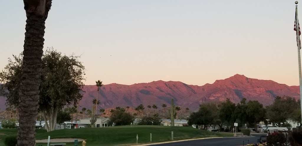
Once I was starting to get a case of cabin fever, though, we looked for something low-key to do, without a lot of walking, and decided to take a drive on the other side of the Superstitions – the side we can’t see from home. Mountains are always full of surprises. This was our view from the first turnoff:
We were driving the Apache Trail. It is an old stagecoach road and, before that, a footpath through the Superstitions by the Apaches. Ironically, when the road was paved, it was Apache labor, among other construction workers, that built it. They were starving on the new reservations and the income greatly helped them out. The forty-mile road is otherwise known as SR 88.
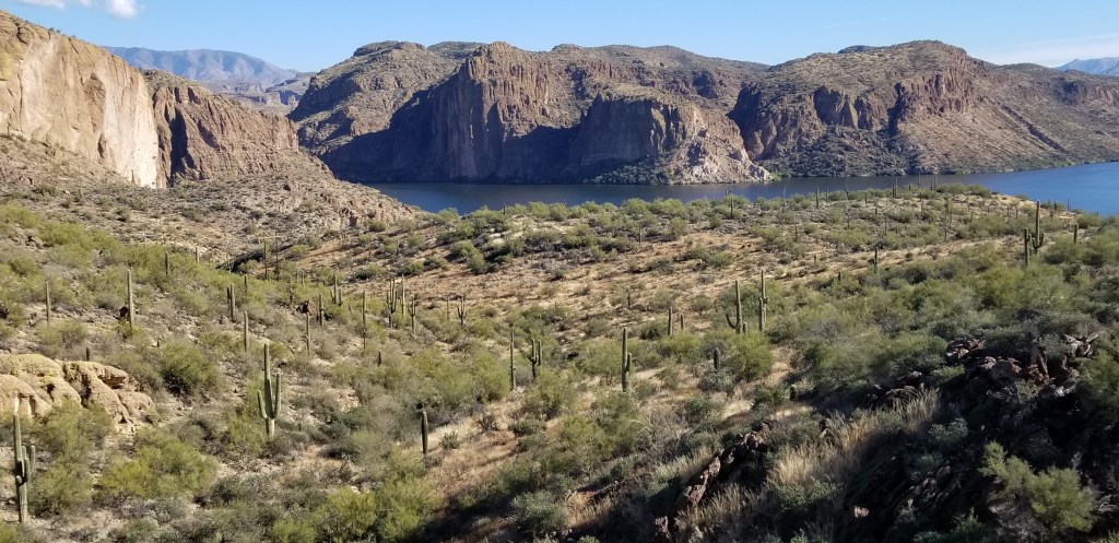
We were totally surprised to come upon a reservoir, Canyon Lake, as we rounded a corner:

The town of Tortilla Flat, population 6, is the only one on this road. The Apache trail runs right in front of a line of their original Western-style buildings with a boardwalk, and that’s about it. The town began as a stagecoach stop in 1909 and they like to brag that neither flood nor fire can take them down.
The place, and the only place, in town to have lunch is the Superstition Saloon and Restaurant. It was both fun and delicious – street tacos, for me, and a burger for Cal. The walls are papered with dollar bills, the bar stools are saddles, and the wood floors are creaky with age.


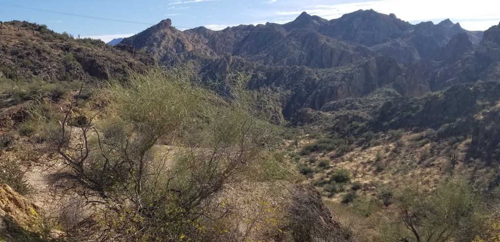
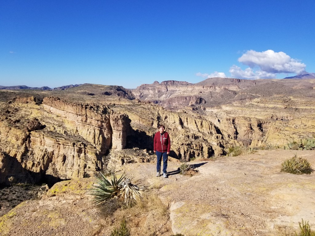
Not far past Tortilla Flat, the road turns to dirt for awhile, then it is totally closed. There was a forest fire a couple of years back that caused burn damage to the water table which in turn causes flooding whenever it rains. If you want to see the other end of the road, you have to go way around the other side of the mountain. Cal decided he was up for finishing the drive on our end, dirt road or no, so we went as far as we could. We were glad we did, because the view of the canyon below was astonishing – in our opinion, second only to the big Grand Canyon.
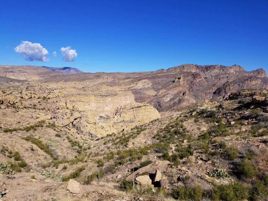
I took the first picture to show the work of the Apaches, which is still holding up well. If you look closely, those are the straight rows of stones to the right of the road sign. When I saw the picture, though, I realized it also shows how narrow and winding the road is here, with no guardrails!


On another day, we took a hike on our side of the mountain on the Hieroglyphic Trail. It’s a popular Phoenix area trail. On our first try ( the day after Christmas) we couldn’t even get into the parking lot. We had better luck waiting a few days and then going fairly early in the morning. We’ve learned that winter desert mornings are chilly, but we soon warm up after hiking a bit.

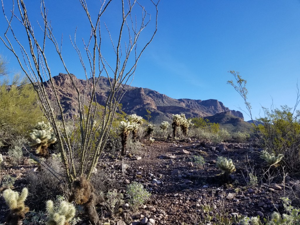
We were finally able to see our mountain close-up as we wound through saguararos, ocotillos, and teddy bear chollas.


We were astonished to see this beautiful waterfall. Everywhere we’ve been, we’ve seen nothing but dry washes, gulches and creek beds. We’ve been told about droughts and have seen very little rain. A volunteer ranger out for a hike chatted with me for awhile, and cleared up the mystery. It had poured rain all day and all night on Christmas Eve, along with some short bouts of rain before and after that period. The mountain is porous rock, and all that rain seeps down into the rock. It takes a few days, but then the water starts to run. He has seen whole years where there has been no waterfall. Unbeknownst to us, we had hit this just right, and so we were grateful we had been turned away by the packed parking lot a few days earlier!
The reason I had wanted to hike this trail, though, was that I wanted to see the petroglyphs:

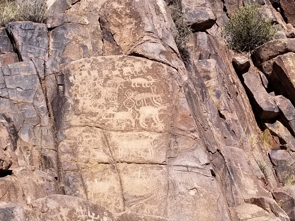

It bothered me that this trail is named Hieroglyphic Trail, and not Petroglyph Trail. I did a Google search later, and yes: the trail is misnamed. Hieroglyphics (boy, I sure do have a hard time spelling that, and I hope this is the last time!) are Egyptian script writings or drawings. Petroglyphs are images made by carving rock by prehistoric peoples. It’s okay, though. Maybe if the trail was correctly named it would draw too many more people to it. The petroglyphs were tucked in and around the rocks around the waterfall. You can see them above in the second waterfall picture that I posted, off to the left.
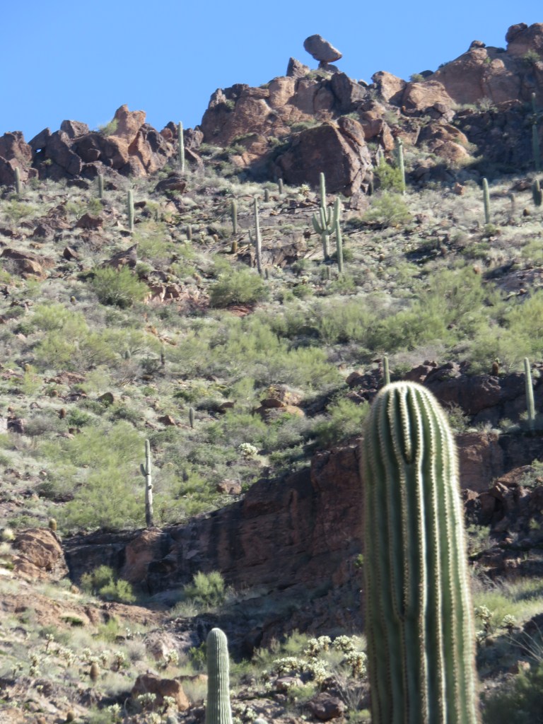
We took a minute from the beauty around us to look up, and saw a balanced rock way up high:


All too soon, we had to come down off this little mountain paradise, and find our way back to town.
Next time: Wright and Chihuly

What great hiking! So many pretty, interesting spots – especially the balanced rock. Looking forward to your next post!
LikeLiked by 1 person
Thank you, Betty!
LikeLike