USTravel

Passing Time in El Paso, Texas

View of El Paso, with Juarez in the distance, from McKelligon Canyon

Huddled in our blankets in front of our fireplace in the cold November nights of New Mexico, we stalked the Weather Channel for a warmer place that would be still be a days driving distance from Denver. El Paso was consistently several degrees warmer. It’s a funny thing, too, because El Paso, Texas lies only approximately 50 miles to the south of Las Cruces, New Mexico. We knew where we had to go. We were going to go there anyway, but our arrival at our site in El Paso was about three weeks earlier than we originally planned.

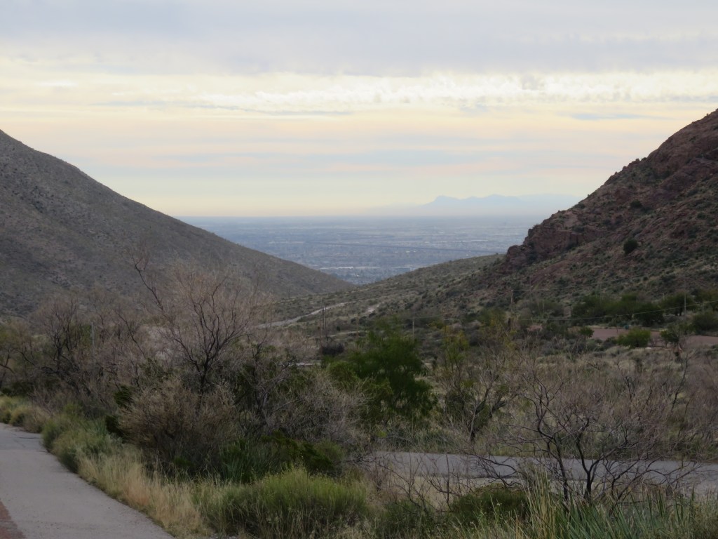
At the very tip of the nose of Texas, on its far western side, lies the city of El Paso. Franklin Mountain rises up and pushes down into it like a thumb. The city has crept up and around the tip of that thumb. El Paso is limited in its growth southward by the Mexican city of Juarez, from which migrants poured during the months of November and December 2022. Driving along I-10 reveals a tale of two cities: Juarez, looking a little less prosperous and with a lining of smog along its mountainside, and El Paso, with its chain restaurants and hotels lining the expressway. If you look closely, you can see the immense border wall which snakes down and around, dividing Mexico and the United States.

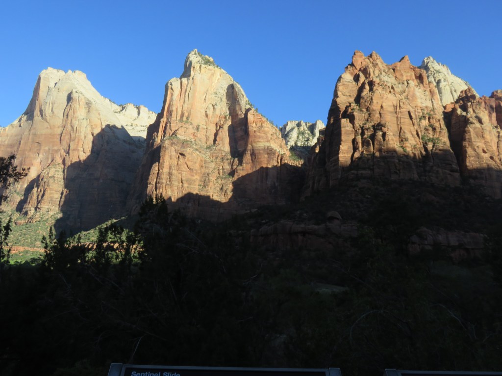
On the northeastern side of the mountain lies sprawling Ft. Bliss, the Army’s second largest base, containing 1.1 million acres. It is so big that it is chopped up by the roads that pass through it, notably SR 54 that passes in front of the RV park. Were it not for that highway, this would be a great place to sit. Behind the park, Franklin Mountain rises up and provides a lovely backdrop. All around the mountain, development never rises much higher than this. I suspect that much of the land is owned by either the federal government or the state of Texas.

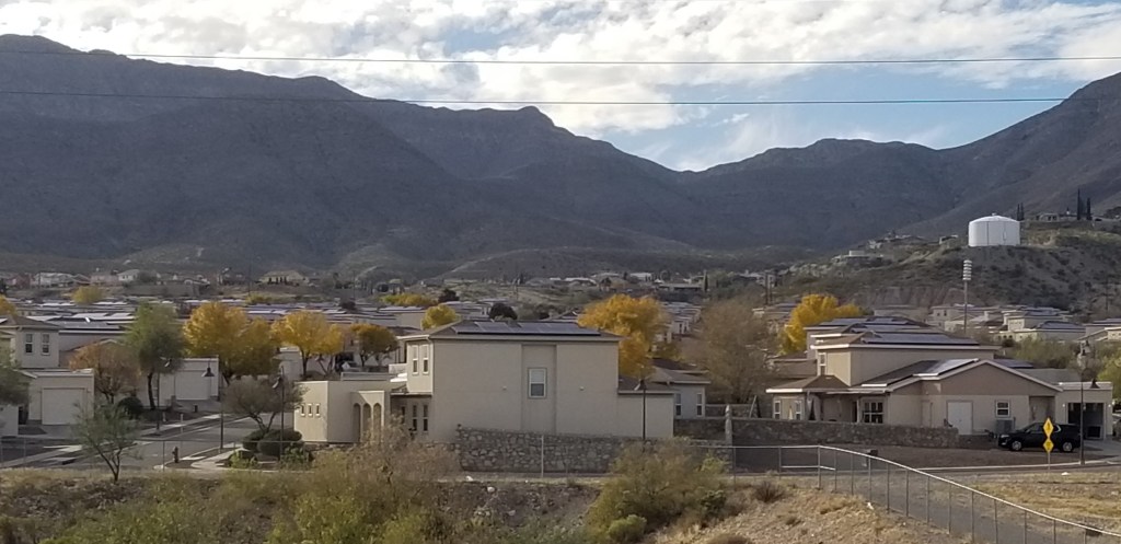
On some of my daily walks, I tried to get behind the buildings and up into the hills, but it was just too far. In the foreground of this picture is one of Ft. Bliss’s housing areas and behind that is a fence.

I’ve written about Ft. Bliss in a blog post about some of the military bases we stayed in, so I’ll not go on further about it. If interested, I’ve included the post here: https://twosnatravels.com/2022/01/29/military-family-camping/.

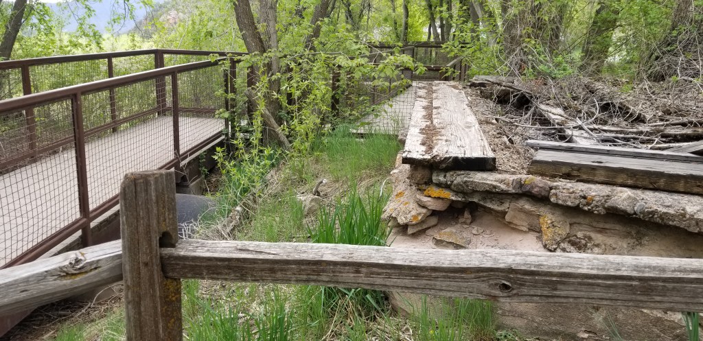
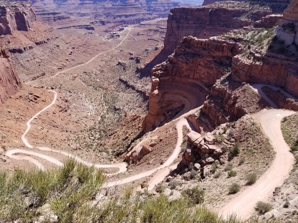
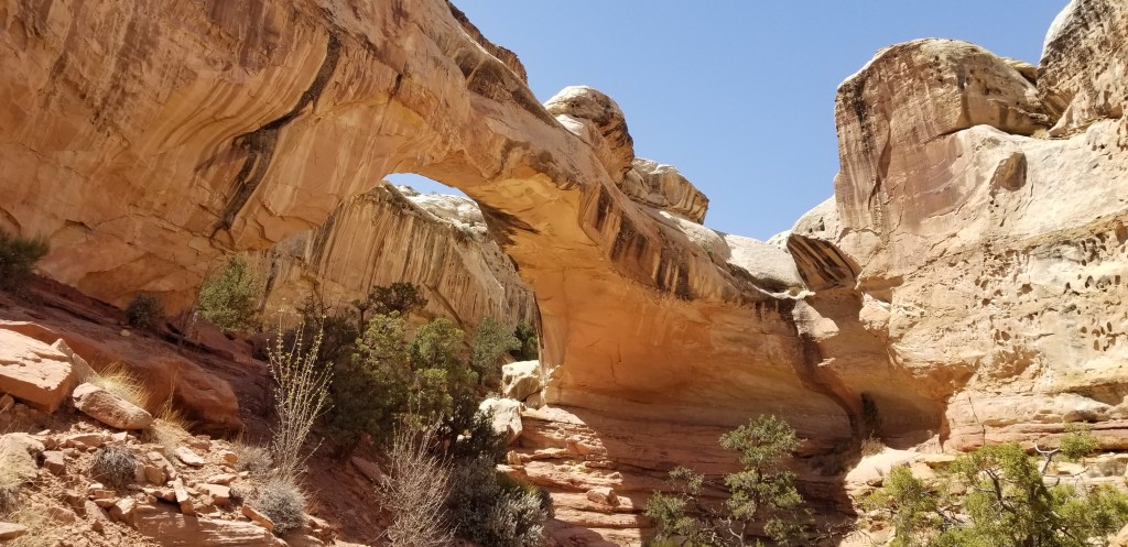
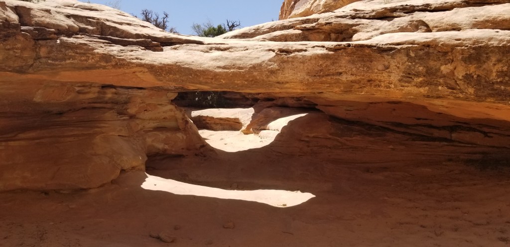
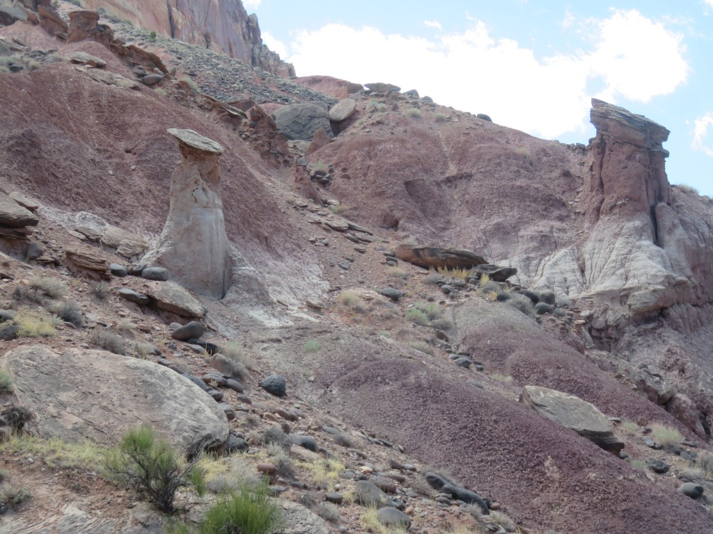
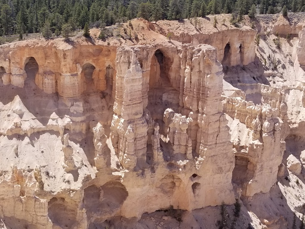
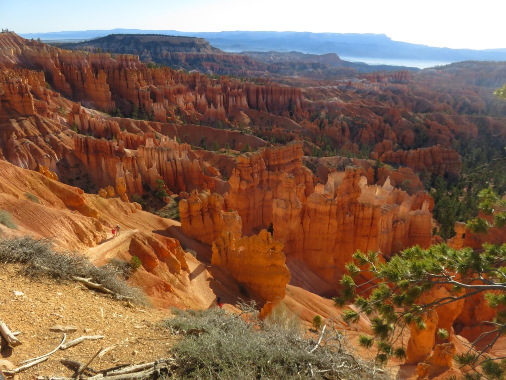
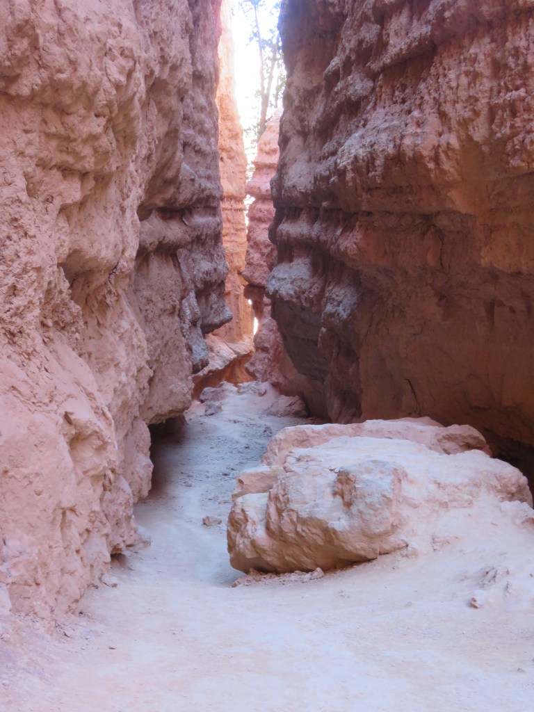
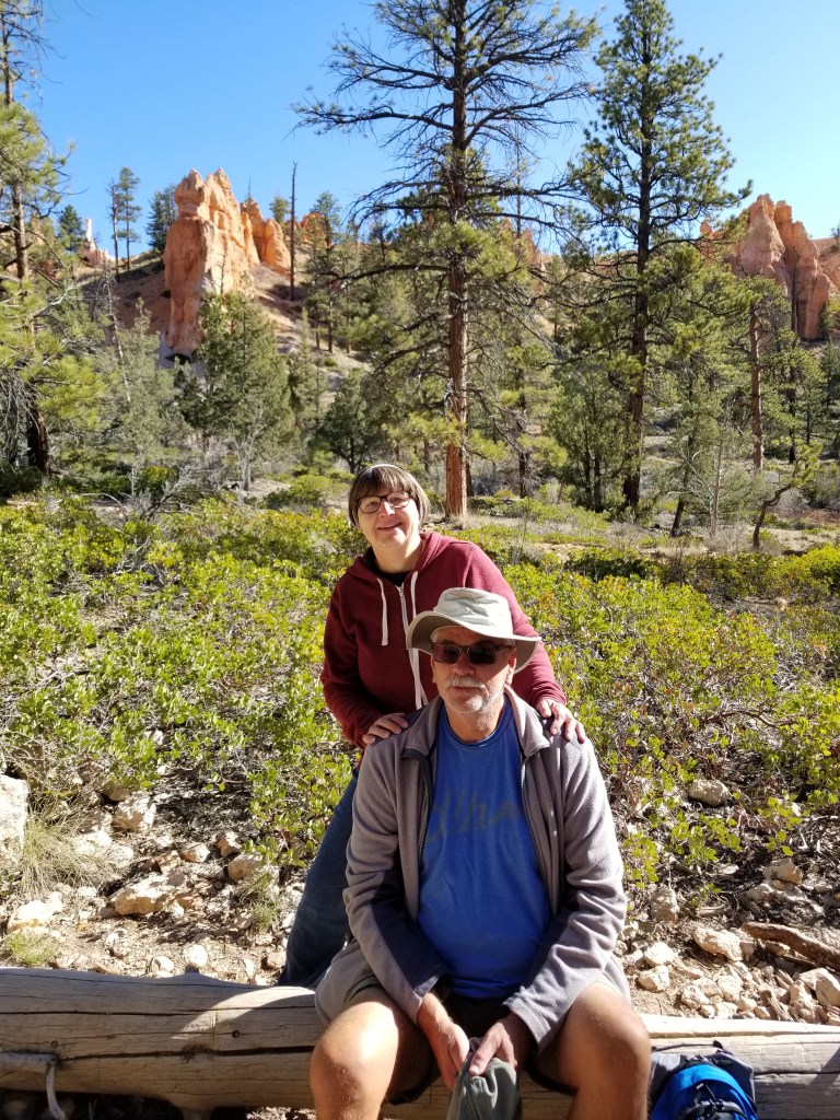
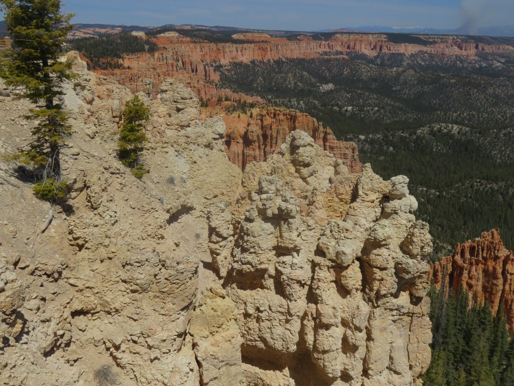
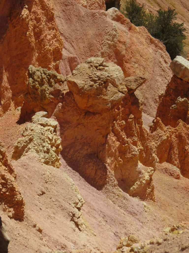
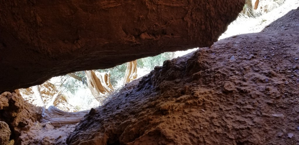
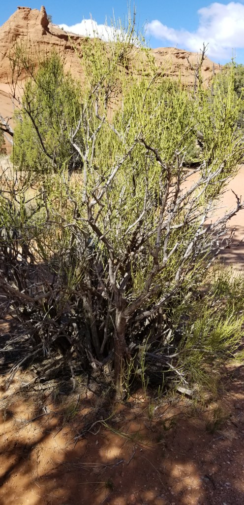
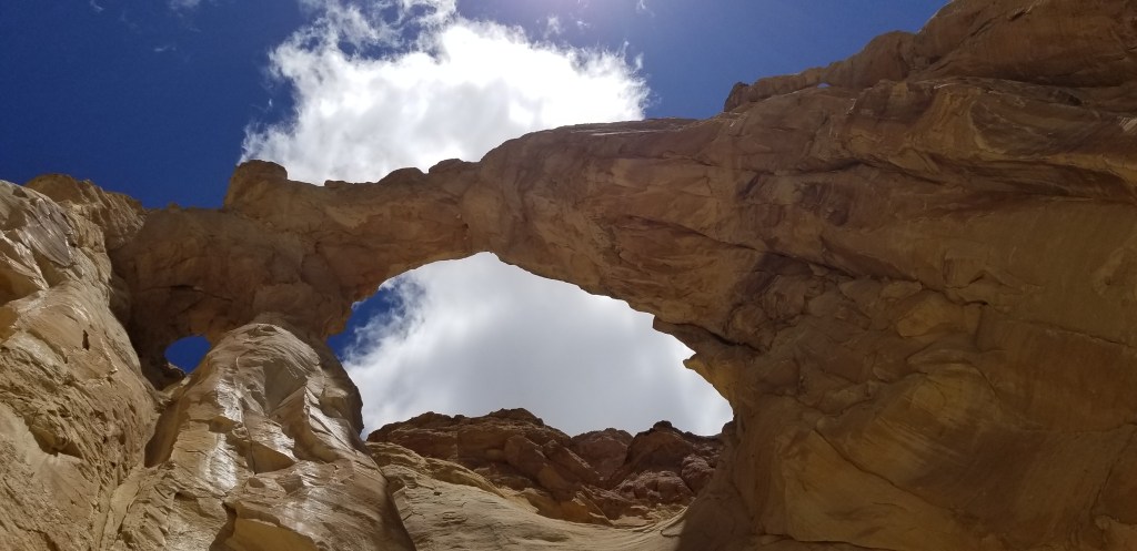
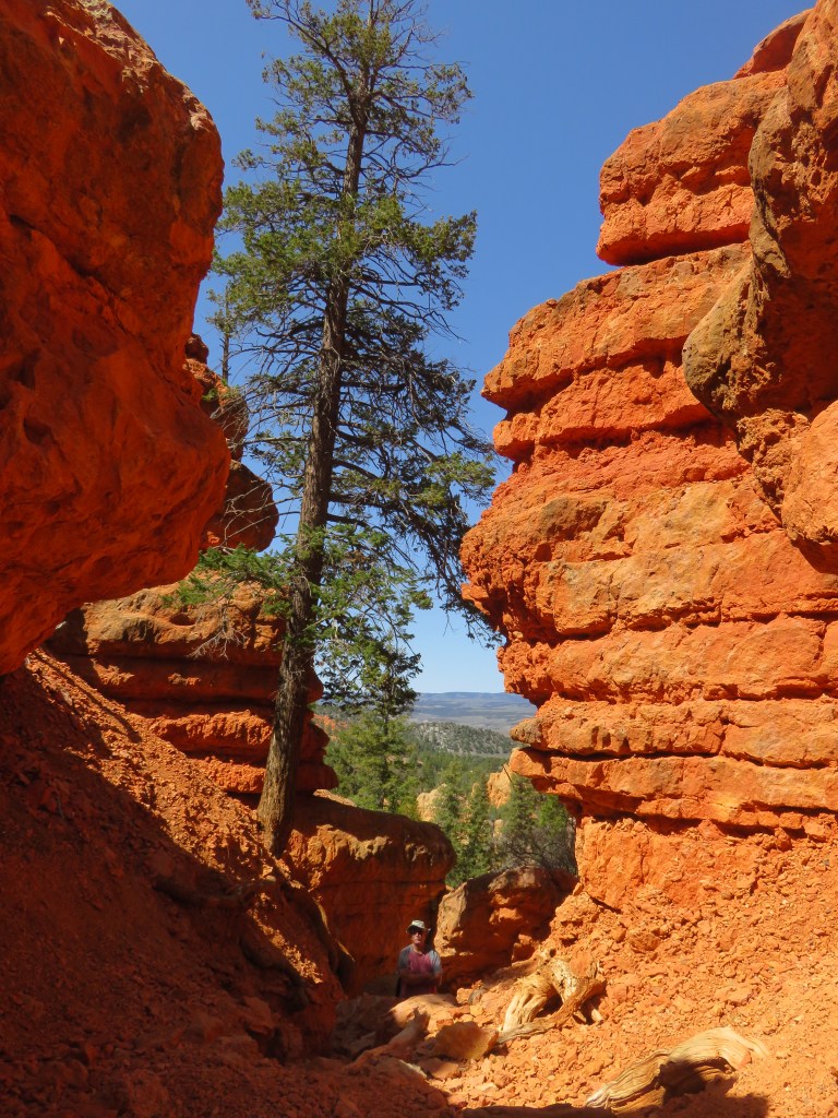
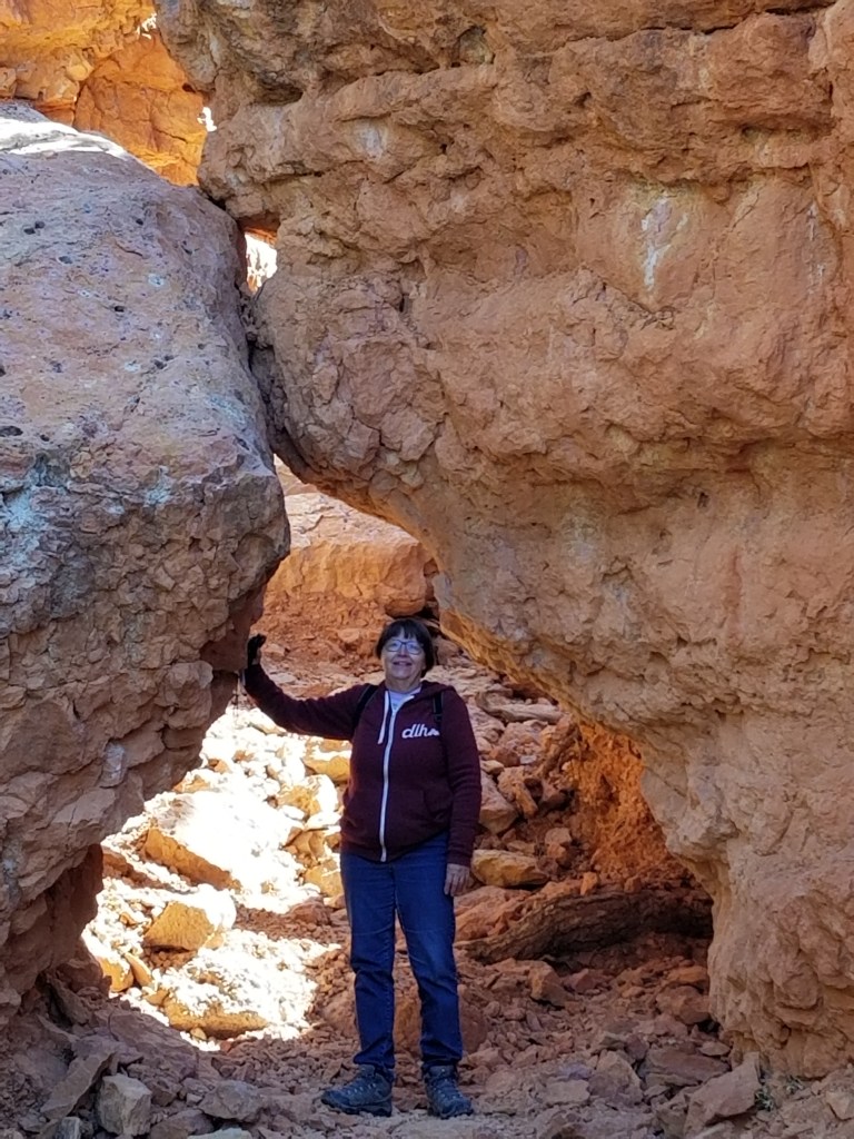
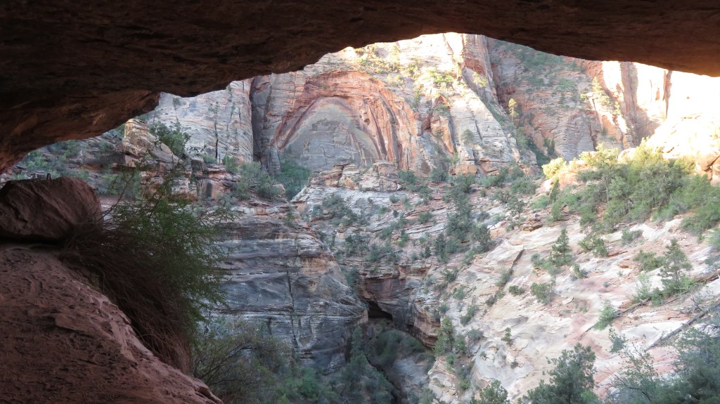
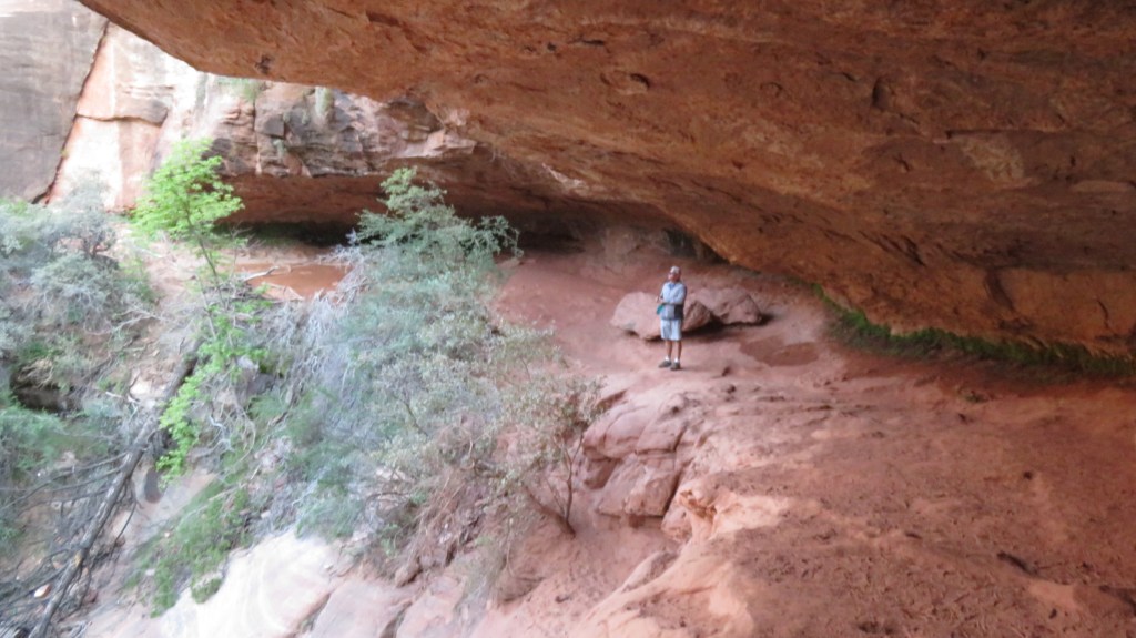
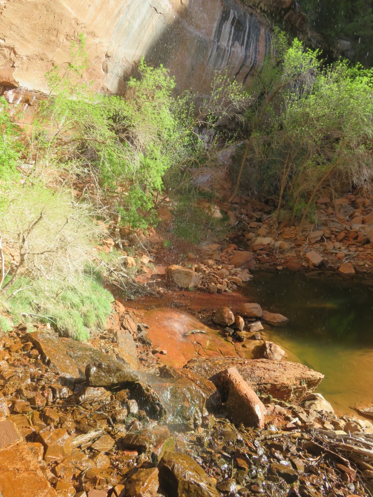
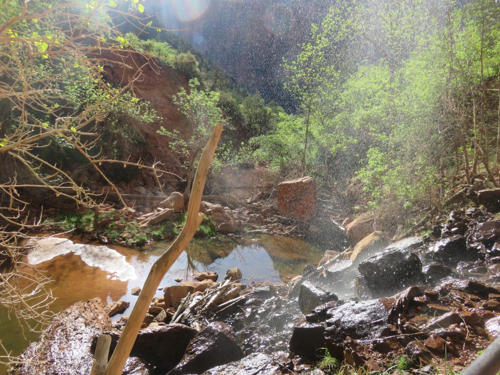
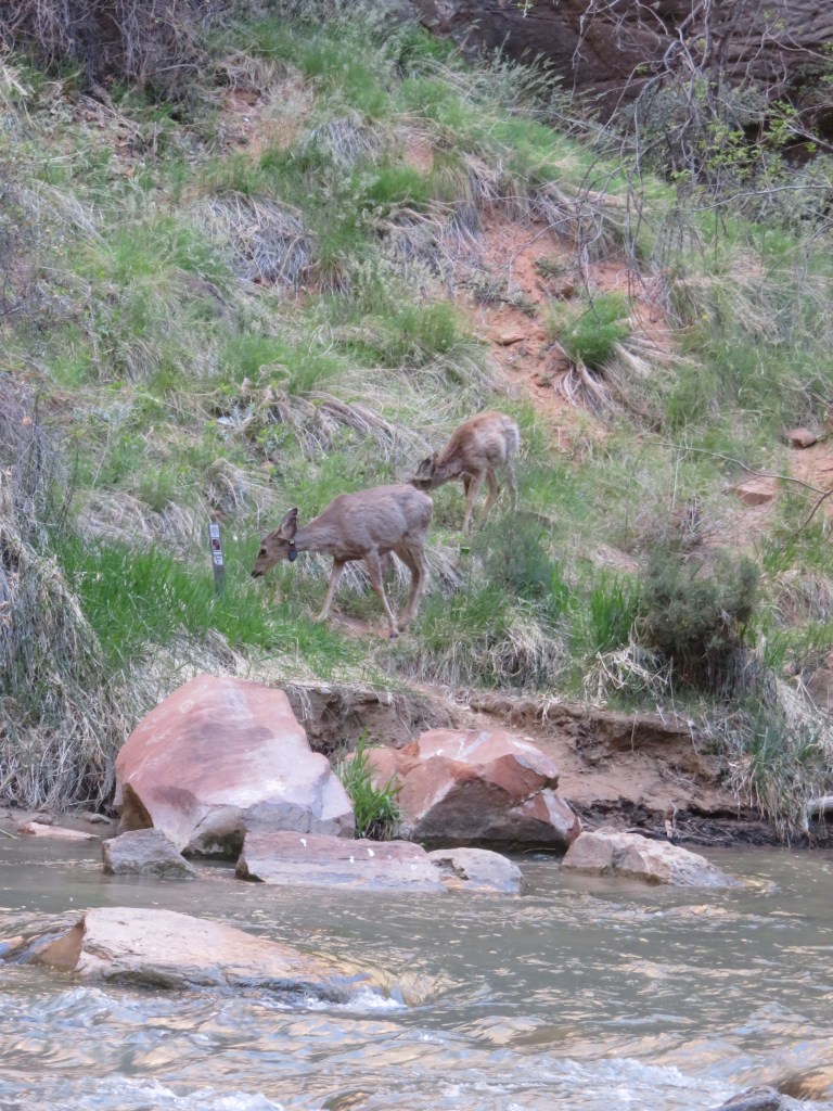
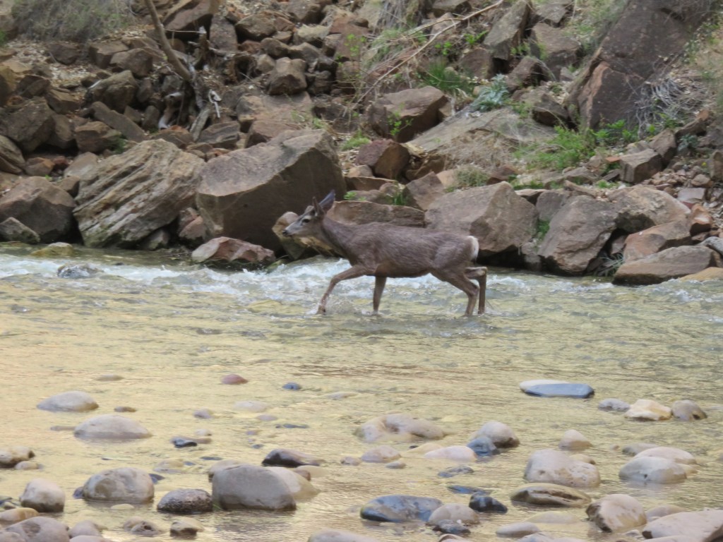
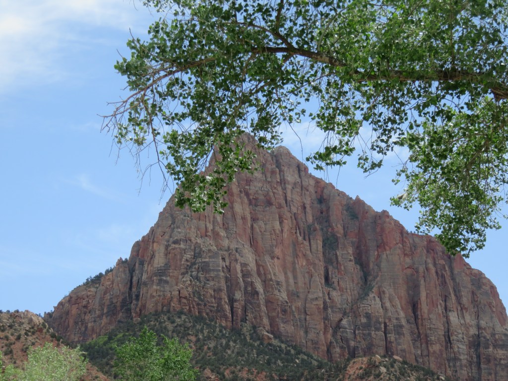
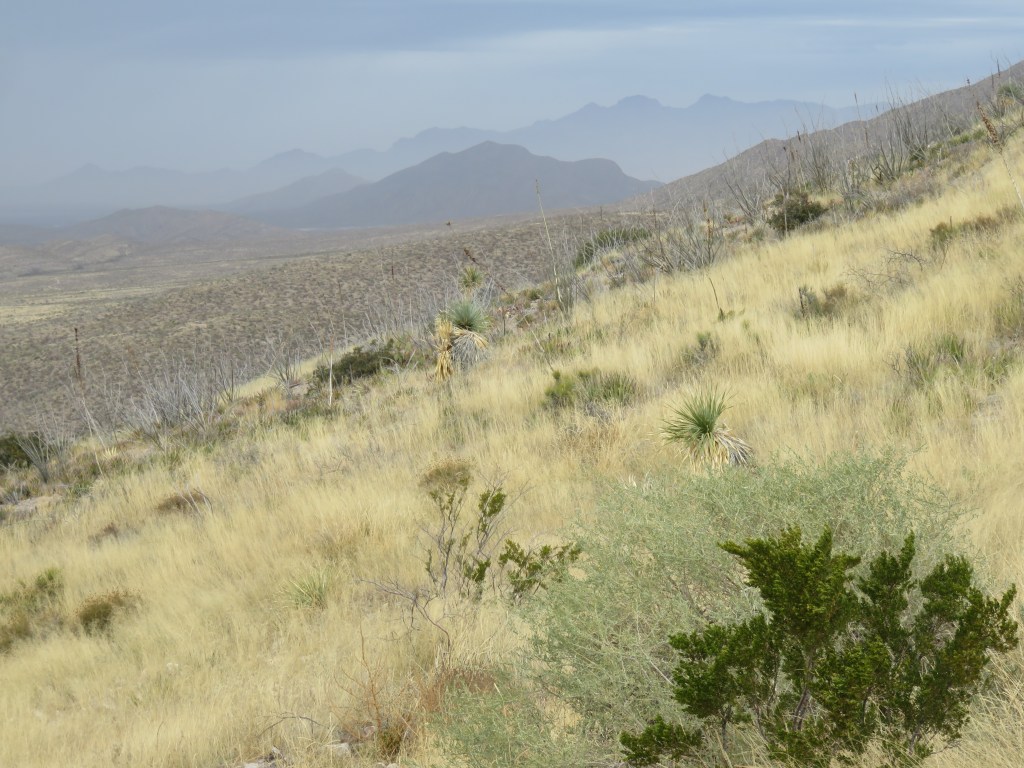
There was plenty of time to explore, so one of the first things we did was hike in the Franklin Mountains.

It was silent on the mountain, until the sound of birds broke through. We stood there for awhile, trying to figure out where the sound was coming from, until this gaggle of geese flew over us. They circled above our heads for quite awhile. Maybe, just like people, they were having an argument about which direction was best for their migration journey? There was quite a discussion, as evidenced by all their honking. Finally they fixed their formation and flew off. Adios amigoose!

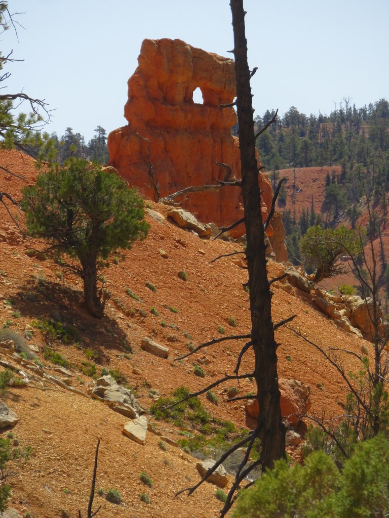
If you want to drive to a destination in El Paso that is on the other side of the mountain from where you are, it can take some time to go around on the highway. The single other option is to travel on the only road that cuts through it, which is beautiful Transmountain Road. Franklin State Park, where we hiked, is on that road. Going from west to east, at the end of Transmountain road, sits the National Border Patrol Museum. We thought it might be interesting, so we paid a visit.

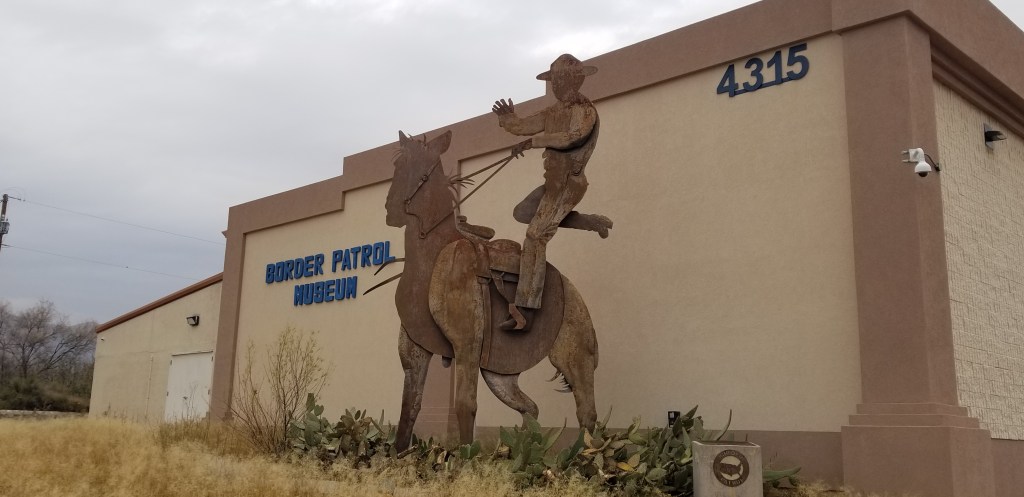
The thing that struck me most about this museum is a reminder that the United States borders do not only encompass our border with Mexico, which is what comes to mind when I think about Border Patrol. Those who work for Border Patrol have to be ready for winter conditions up on the border with Canada, and also oceanic borders in other places. The museum is small and didn’t take us long to go through. It is a good place to learn about those who protect all of our borders.

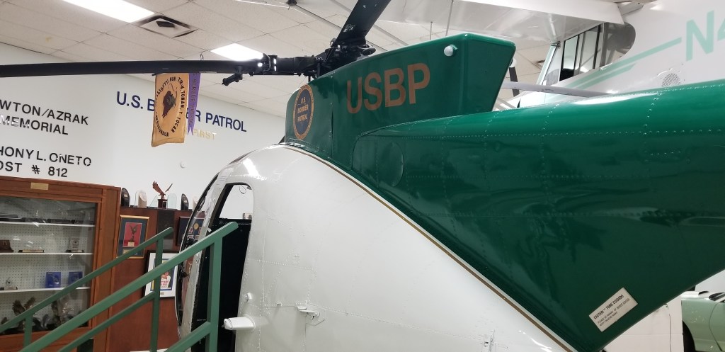
Border Patrol agents have to keep an eye out for motorized hang gliders, which are used for drug smuggling. We learned about the many ways that people try to smuggle all manner of things – and people – into the United States. Helicopters are needed, of course.

After we visited the museum, Cal made an attempt to see how high up we could drive into the mountains from our side (not very far). We passed a migrant detention center and observed many people walking around in the fenced back yard. One man was holding a baby. It is an image that stayed in my mind and put a very human face on the current migration crisis happening in this city.

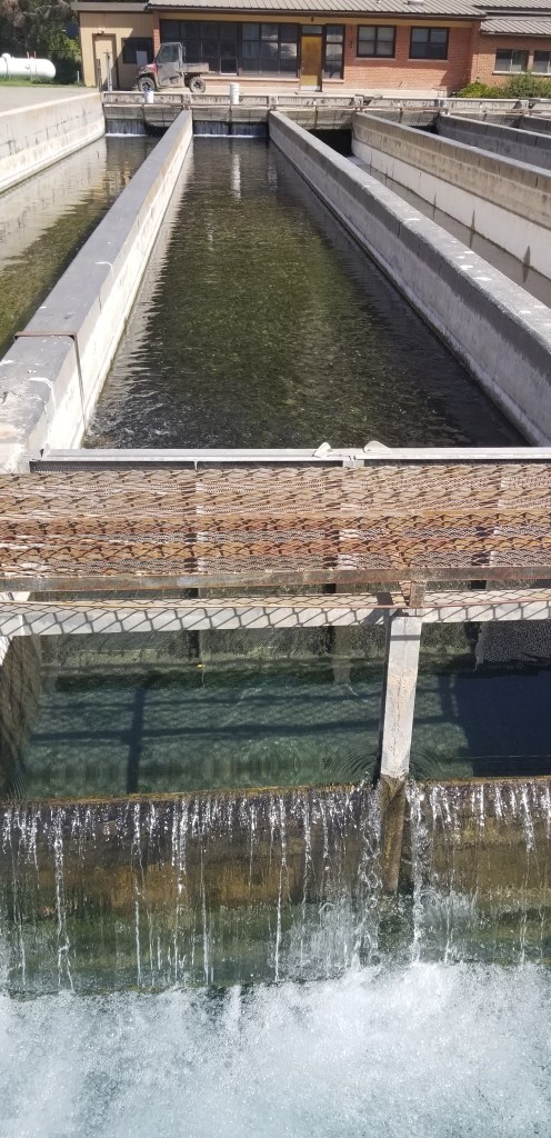
We made a stop at Keystone Park and El Paso’s Botanical Garden one morning. Keystone Park needs a lot of love, as it doesn’t seem to be well maintained. It is a narrow strip of wetlands on a short trail located between a busy road and I-10, which is amazing given this light-industrial location. There were many birds to see, which made it worthwhile, and then the Botanical Garden can be accessed from this trail.

The birds would take flight and move to another section of wetland when I tried to take just a step closer, so I couldn’t get a closeup shot of them. But I did like this view of the mountains reflected in this picture. Our RV was on the other side of the mountain from here.

The garden was small, but a lot was packed in. It provided plants from the Chihuahuan desert and a peek into some past history.

In one area, there were pretty mosaics set into the wall:

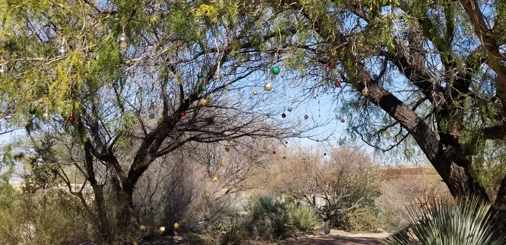
I liked how they had decorated, just a little, for Christmas:

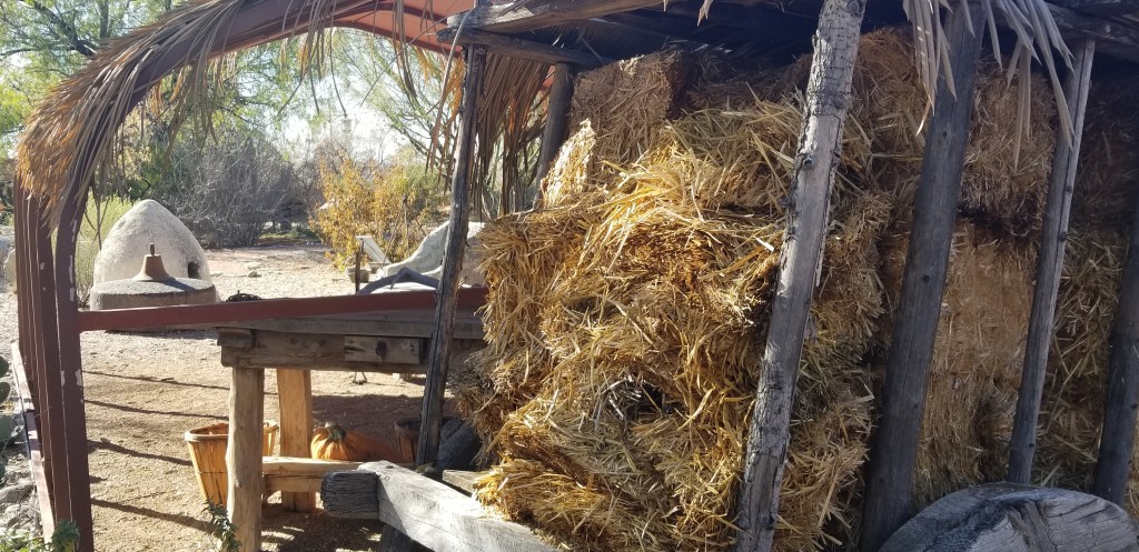
The garden also had a set up of a “paraje” which was an encampment along the Camino Real. This dates back to the 1600’s, when New Mexico was a Spanish colony. The trail covered the distance between Mexico and Santa Fe along what was originally a Pueblo Indian trail. The Spanish were setting up military outposts and needed to move both equipment and missionaries. Parajes were located every 10 or 15 miles to give shelter, rest and water to the livestock and and travelers as well.

The plan for the day was that if we had time, Cal would drop me off at Whoopee Bowl Antique Mall up the highway, and he would go to Camping World while I was there. We have such an exciting life!

I had read about Whoopee Bowl, and I love to poke around antique malls, so I wanted to check this out. If this is the sort of thing you enjoy, it is not to be missed if you are ever in El Paso. I’m always amazed at all the junk…excuse me…stuff that people collect. Whoopee Bowl takes antique malls to a whole ‘nother level.

The above picture is up on the second level. After checking out this massive place and returning down to the first floor, I found a room I hadn’t been in. There was huge fish aquarium, a blazing fire going in a massive brick fireplace, and a rousing game of poker going on.

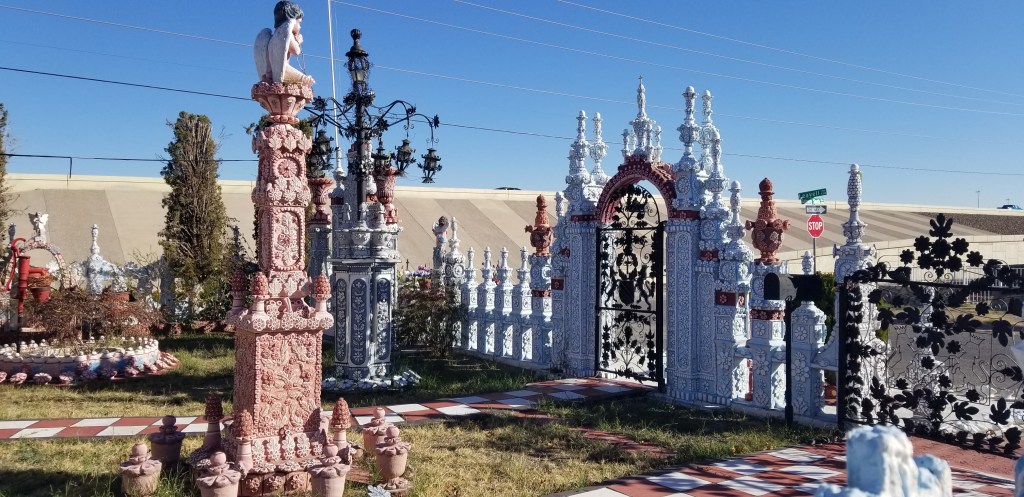
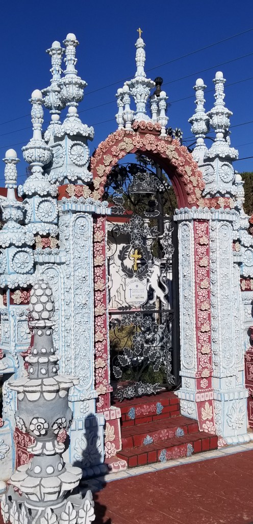
Atlas Obscura is a guide, both on-line and in book form, to all sorts of quirky and interesting places that one might normally miss. They don’t list the Whoopee Bowl, maybe because it is a business. But they do list the Casa de Azucar, which translated from Spanish means House of Sugar. It was just down from where we were staying and made for a good walk.

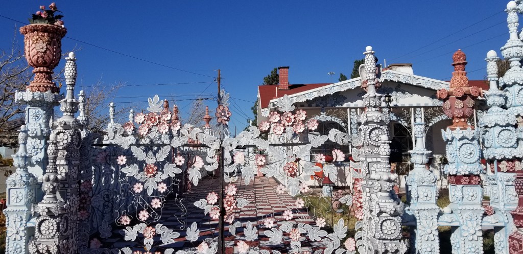
It is a testament to one man’s love for both his wife and his Catholic church. Rufino Loya started building this confection of decoration around his little house and kept at it for 25 years. He died just this past August at the age of 88 years. I hope someone will keep taking care of it.

Also just up the road, two artists were working on a mural on a concrete retaining wall. I enjoyed walking by and checking their progress.

Our time in El Paso was also about catching up on chores for me and RV maintenance for Cal. The less-glamorous side of RV life is that we do have to stay on top of everything that one would normally do in their lives. Some things had not been taken care of since before our trip to Europe. It being Christmas time, there was also gift buying, Christmas cards to write, and other things that one does to get ready for the holiday. Our RV park had a club house with a kitchen I could use, and I baked some Christmas cookies there.

Just a few days before Thanksgiving, we made a last-minute decision to visit our family in Denver, so we went drove there without the RV for both the Thanksgiving and Christmas holidays.

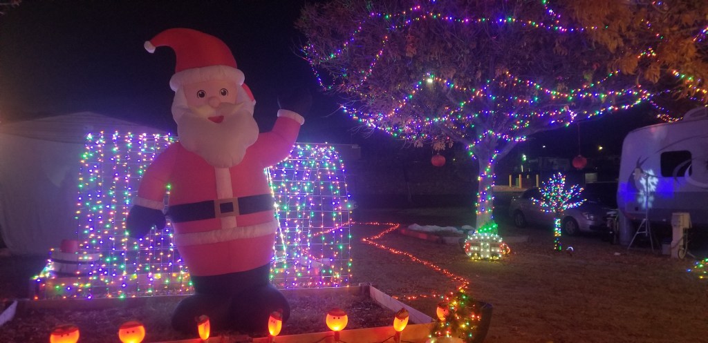
Almost every evening while we stayed here, though, we walked together through the little streets of the RV park. It was fairly large so I could get a good number of steps in. When the sun goes down, the temperature plummets, so at times we had to make sure we got our walk in before dinner. For awhile we enjoyed a full moon. There was also a little Christmas wonderland set up by our camp hosts.

And, of course, we paid a visit to Santa!

Like a coin which has two sides, we were happy to refuge here, and also happy when it was finally time to move on down the road.

Next time – zipping across the state of Texas in five days

USTravel

Mountain bliss in Western Colorado

Imagine listening to the sounds here: nothing but the birds singing. The lake below is sparkling and blue. Through a gap in the foothills behind the lake you can see the beautiful green and snow-capped mountain peaks beyond. This splendid vision is called Rifle Gap State Park and it lies in western Colorado.

We had come from Moab, one of the best places in the United States for ATV’ing and off-roading in all of its many forms. Our large RV park was crowded and there was a gathering spot by the entrance for any off-road excursions. Any other park in town was full because of an off-roading event.

In true Utah form, our park was also “landscaped” with lots of rocks, gravel, dust and dirt. The park owners made an effort by watering our little patch of iris, but nothing could take away the road noise. It was handy for seeing the national parks, because we didn’t have to drive into Moab, but I was happy to see that our reserved site at Rifle Gap was open one night earlier.

There’s not a lot going on at Rifle Gap and that was fine with us. The water level in the small lake is low. There is boating, but mainly for fishing. Campground loops line the edges of lake like pearls on a necklace. Our loop rose up from the lake in a zig zag fashion, and our site was at the top of a hill. We decided that our site, and the one next to us, were the best and most private in the park.

There would normally be water covering the area in the top left of this picture. Unfortunately, this has been a common sight in the West.

Rifle Falls State Park is not far from Rifle Gap, and driving there, you pass through a pretty little mountain valley dotted with picturesque farms, a winding creek, and improbably, an old golf course. It is another small park, but we hear it is impossibly crowded on the weekends. No wonder, because it is a lovely spot to visit. We were glad we were there on a weekday.

I had not expected something so breathtakingly beautiful.

You can walk behind the falls—

—and along the cliff walls on either side of the waterfall, there are small caves you could wander in and out of. As you can imagine, I really enjoyed this part.

Cal is giving some perspective on the size of a couple of the cave openings. He’s a little claustrophobic, so didn’t join me inside them.

Up on top of the falls, there is a walkway.

Up here, there are “wooden diversion structures”. There was a hydroelectric plant here in the first half of the 1900’s, and these housed the pipes that carried water down to the powerhouse. Around the turn of the century, there was also a resort hotel near here, and the owner charged folks a quarter (about $5.00 today) to visit the falls. Now that it is a state park, we were able to visit without charge because we have an annual Colorado state parks pass.

The view from above the falls
One last view of the falls

Not far from Rifle Falls State Park is the Rifle Falls Fish Hatchery, which supplies trout not only for the creek here and in Rifle Gap State Park, but in many other lakes, streams, ponds, and reservoirs. In some remote areas, they drop the fish by helicopter or small airplane. What a shock for a fish!

We always enjoy walking around the ponds in a hatchery to look at fish in their various stages of development. This hatchery has capacity to produce five million fish per year, but is only producing less than half of that currently. Whirling disease is currently a problem with cold water fish, such as trout. The hatchery is only utilizing spring water (versus surface water) to reduce contamination, which lowers their capacity. I also learned that they stock fish for kid’s fishing derbies. That’s great! It gives the kids more of a chance to catch a fish.

There was actually one other state park in this area, Harvey Gap, but all it contained was a large boat launch area. The lake looked similar to Rifle Gap, although it didn’t seem as shallow.

This was a relaxing interlude between our Utah travels and our arrival in Denver for part of the summer. We were treated to more mountain views along the drive to Denver, and I’ll leave you for now with this view of the Rockies from Breckenridge.

Next time: summer in Denver

USTravel

Canyons, Arches and Goblins – Eastern Utah

Delicate Arch, Arches National Park

Feeling like someone whose family vacation slides have gone on too long, I’m wrapping up our travels through Utah mostly in one blog. Suffice to say that we loved seeing all five of the Utah national parks, three state parks, national forests and one national monument that we visited. The rock formations were amazing, and all different. We tried not to pick favorites, because every park had a flavor all its own. The highlights:

GOBLIN VALLEY STATE PARK

Goblins, mushrooms, hobbit houses? In a place you can explore and not have to stay on a trail? Sign me up, please! Nature is at her playful best here.

This little area did look like a hobbit village to me

As the name implies, these magical rock formations sit in a valley and the area where anyone is free to explore (after paying the $20.00 park pass) covers about 3 square miles. There are other trails in this park but we found that by the time we were done wandering about, it was time for our picnic lunch in a shelter overlooking the valley. There is something about Goblins that makes you feel like you are twelve years old again.

A face-off in silhouette

The area that is now Goblin Valley was once a muddy tidal flat on an inland sea, back in the Jurassic period. Waves deposited sand and silt. Erosion, wind and rain over millennia hardened the shapes into Entrada sandstone, as we have seen in other parks, and the goblins. They are ever-changing.

Further back in the valley, the cliffs were full of small caves and little nooks and crannies.

Impossibly, wildflowers grow here, too:

A formation called the The Three Sisters. Was there ever a fourth, that fell off her pedestal?

Canyonlands National Park

Our last stay was in Moab, where we visited these final parks. Canyonlands didn’t take much time. Our usual drive-through, stopping at places of interest and doing minimal walking to them, took only a couple of hours. It looked like a miniature Grand Canyon. In the heart of the Colorado Plateau, the Green and Colorado rivers carved the canyons.

There are four districts to Canyonlands, and although they all have desert landscape, they are all different from each other. The rivers divide the districts and there are no roads that connect them. We visited the Island in the Sky District, which is closest to Moab.

A precarious picnic spot with a million dollar view

It seemed like every park we had been to had their trophy arch or natural bridge, and Canyonlands was no exception:

Mesa Arch

The picture below is of Upheaval Dome, which is a scientific mystery. It is a circular depression about two miles wide. Was it a violent meteor impact that cracked the rock and formed the crater, or was it the effect of time, cracking and splitting the rock that was originally a salt dome? I love a good mystery, and I hope they can find something conclusive. Right now they are leaning toward the meteor theory. When I peered down into the crater, I decided that there a lot of interesting things going on here, geologically.

Dead Horse State Park

Dead Horse completes time spent at Canyonlands. They are right next door to each other, and complement each other well. At Dead Horse, you pay the $20 park fee for a view, but it’s a pretty awesome view:

The Colorado has done its work here, and given us a view much like Horseshoe Bend in Arizona. Here, there is a grand view of the canyon to go with it.

The East Rim Trail was a pleasant stroll for looking down into the canyon.

When scrolling through my phone, I found a list of the “Top Things to See in Moab”. Included in this list were the Solar Evaporation Ponds at Intrepid Potash mine. The ponds can be viewed in or out of Deadhorse. Salts are part of the rock formations, and water is pumped into the mine to dissolve the salt. The salt water is then pumped sent into the ponds for evaporation, and a blue dye is added to speed the process. At certain times of the year, the blue shows up more brilliantly. From Dead Horse you can just barely see the ponds, and I zoomed in as far as I could to catch this picture.

As I was gazing out, trying to decide what I thought about the ponds, a woman standing next to me commented: “Spoils the view, doesn’t it?” I guess it all depends on what you have come to see. I would tend to agree with her though. What is the salt in the end of the process used for? Fertilizer.

Arches National Park

Arches didn’t make the top 10 of most visited parks for 2021, but the numbers are growing. It was the only Utah park for which we had to make reservations to get in. I chose the 6 to 7 AM timeframe.  The park is actually open 24 hours a day, and before 6 AM you don’t need a reservation.  We were glad that we came as early as we did.

There are some interesting rock formations here.  This one was in the Courthouse Towers area, and looked to me like a small group of people on the lookout:

There is Balanced Rock, made more famous by Edward Abbey in his book “Desert Solitaire”:

But the star of the show, to me, was the Arches.  We spent a lot of time at the Windows section where we could see Double Arch, North and South Window Arches, and Turret Arch.  Cal enjoyed the trails going up to these arches, and I enjoyed doing my best to climb right up under them. Our time in the Windows was actually timeless.  We were out of the truck and walking, had no thought to what we were going to do next, and were awed by the Arches, the sun coming up, and the beauty of the day.  Best of all, and especially at first, we were just a teeny bit ahead of the crowd.

South Window
Both South and North Window in the morning light

Everyone politely waits for their turn at getting a photo snapped of themselves under the Arch.  There are always willing folks to take our picture, because of course we will then take theirs. We stayed at South Window for a bit, absorbing the view, and we were actually photographed several times.

All you had to do from the Windows Arches was to turn around, and there was Turret Arch.

Turret Arch, with its “bonus” little window on the left

We had criss-crossed paths a couple of times with three Hispanic folks from Florida, originally Colombia. I practiced my Spanish, even though two of them spoke pretty good English. One of them was having too much fun with her camera, and took several pictures of us as well.  This one was her idea:

We coincidentally ran into these folks again at another trail in Arches, and then again the next day at Dead Horse, although the woman didn’t offer to snap any more pictures of us. Maybe her excitement had worn off by then.

My favorite here was Double Arch, which is what we were looking at at the time.  I tried to get underneath it, but the rock in the final ascent was just too tricky. Double Arch is massive and absolutely breathtaking, and the view changes with every step closer that you take.

You can just barely see me in blue, almost to the top of this climb, but the final stretch was too steep.

The bonus to getting up early to visit Arches in May, if you like flowers, is being able to see the evening primrose still in bloom. When the sun starts to burn brightly, the flowers close and the blooms are pink.

We also visited Sand Dunes Arch. It was a short walk, and half the fun was trying to get anywhere in the soft sand:

Sand Dunes Arch

The last arch for the day: Landscape Arch, which looks like an elephant with its trunk stretched out.

A bit of trivia: so far, over 2,000 arches have been counted in Arches National Park.

On our very last day in the Moab area, we used our second early-morning Arches reservation to visit Delicate Arch, the iconic Utah arch that you see in the top photo. The trail is about 1.5 miles one-way to the arch, and ascends almost from the beginning. It was probably about 6:15 AM when we arrived, and we passed plenty of people who were already returning from their ascent.

We passed Wolfe Ranch, a remote settlement that was farmed for about a decade during the turn of the century:

Just past the Wolfe Ranch was Ute rock art, dating from between 1650-1850. John Wolfe may have enjoyed showing this to any visitors that came by:

Part of our hike was on slickrock. Cal is shown here descending the rock, after we had visited the arch:

Finally, a very narrow path to the top with no fence to keep you from tumbling off the cliff! Again, this view is actually taken from the descent perspective.

A turn in our narrow pathway, and the stunning Delicate Arch came into view:

Perfection! An absolutely grand finish to our journey through Utah!

Finally, I have to give a shout out to these fine books, which I purchased from Barnes and Noble just before we hit the road:

They don’t include information that changes often, like hours of operation, shuttle times or advance reservation requirements, so the books should be relevant for a long time. The National Parks book was invaluable for guiding us through the parks and telling us which stops were worthwhile and which not, some hikes that were good, and other things to do. We used it exclusively to guide us on our drive through a couple of the Utah parks. It has information in it that the parks brochures do not. The State Parks book only has a few of the best parks in each state. Dead Horse and Goblin, as well as Kodachrome which I blogged earlier, are in here. I have not used the Secrets book much. It seems like some of that information requires drives on rugged roads or hikes that are a bit longer than we usually take.

Next time – we visit a “Tourist Attraction”

USTravel

The village of Fruita – Capitol Reef NP

The first time I heard of Fruita was when I was looking for sites for our RV. Capitol Reef’s little historic village has a campground, and you can see a little corner of it next to the horse pasture. There are orchards with 2,000 apple, peach, pear, apricot, cherrry and plum trees all over Fruita, and in the summer, anyone is free to pick the fruit. Now that sounds like fun!

Of course, it wasn’t summer yet and the trees didn’t even begin to have fruit on them. The campground doesn’t have any hookups. We drove through it. The sites were wide but right next to each other, and seemed a little more crowded even than ours at Wonderland. I liked that the campground was in the trees, with one of the orchards right next door. It would be fun to stay for a couple of days in the summer and just go over and pick the fruit.

The Mormons settled Fruita in the 1880’s. The fields were already there, abandoned by the Fremont Indians 700 years ago. The Mormons built irrigation systems to bring water from the Fremont River and Sulphur Creek, and they’re still used today to water the pastures and orchards. In its heyday, in the early 1900’s, there were as many as 10 families here. The town still had residents as recently as the 1960’s, but by then most of the Mormons had moved on.

The Gifford house, which you can see behind the horse above, is the last one remaining in Fruita. The Gifford farm lies in the heart of the Fruita valley, a desert oasis described by Wallace Stegner (a Western novelist) as “…a sudden, intensely green little valley among the cliffs of the Waterpocket Fold, opulent with cherries, peaches, and apples in season, inhabited by a few families who were about equally good Mormons and good frontiersmen and good farmers.” The home was originally built in 1908 by Calvin Pendleton, a polygamist with two wives. The Gifford family purchased the home in 1928 and lived and farmed there as recently as 1969.

Family treasures in the Gifford House

Today the Gifford House has a bakery and small gift shop with locally produced items, and only one small room has a tiny museum about the family who lived there. These are the things I like to look at from families long gone: the mundane stuff of daily life, and the family photos.

In the shop, there are cinnamon rolls every morning, which were gone by the time we were there, close to noon. They also sell fresh pies, which are conveniently sized for 2 or 3 people to feast on. We were able to purchase a couple of those, one of which we devoured with our picnic lunch. We also loaded up on specialty food items, which are great for gifts and to have in our pantry: jars of cherry salsa, jam, soup, and pancake syrup.

Capitol Reef’s visitor center lies at the entrance to Fruita. There is also a blacksmith shop that can be seen. We made a stop at the village schoolhouse, which sits on Route 24. A typical class would have been around 8 to 26 students, and the classes grew smaller as the years went on. The children were needed for the farm, so school was in session only from November to April.

A peek into the schoolhouse through one of the windows
Fruita Schoolhouse

A small orchard sits next to the schoolhouse.

Not in Fruita, but on the far eastern side of Capitol Reef as you enter the park, lies the Behunin Cabin. In my previous post, I noted how Elijah Behunin had led a team of men to clear the boulders in Capitol Gorge. Same busy guy. He tried to start a farm next to the Fremont River, and built this cabin for his family in the early 1800’s…with no less than 11 of his 13 children. It was only big enough for he, his wife, Tabitha Jane, and the two youngest to sleep in. The boys slept in an alcove in the rocks above the cabin, and the girls slept in the wagon bed. What did they do when it got really cold? I’d like to know what Tabitha thought about this cabin.

Unfortunately, the close proximity to the river caused the crops to flood. After only a year, the family moved to Fruita and became one of the first settlers to live there. I hope he built Tabitha a bigger house.

There is certainly more to Capitol Reef than I had originally thought, and what Fruita had to offer made for an interesting – and delicious! – diversion from the gorgeous scenery all around.

Next time – Goblin Valley State Park

USTravel

Capitol Reef National Park

Route 24 crosses Capitol Reef from east to west and covers the heart of the park in only 20 miles or so. This is what travelers see if they are just passing through. The park is long and narrow, so most of the rest is back country. We talked to some people who didn’t even stop in the park because they were on their way to other places, and vacation days are short. Here’s a little secret, if you’re still paying at the gate to get into a National Park: there is no gate at this one. At the visitor’s center, they don’t even care if you pay.

How did Capitol Reef get its name? It all started with a wrinkle in the Earth…sounds like the stuff of science fiction, doesn’t it? The land that is now called Capitol Reef changed over the millennia from oceans to desert and swamps to riverbeds, laying down a thick layer of sedimentary rock. Around 50 to 70 million years ago, an ancient fault lifted the rock and rather than cracking, the rock layers folded over the fault. As with all the rock we have seen, erosion sculpted these rock layers with the forces of rain, flash flooding, and freeze-thaw cycles, to create the one-sided Waterpocket Fold.

Coming from the East, as early explorers and settlers did, the line of cliffs of the Fold looks like a difficult barrier to pass through, like a barrier reef in an ocean. It stretches north to south for a hundred miles. The pioneers thought the rock monolith in my picture below looked like the dome at the nation’s capitol building. The name “Capitol Reef” was born.

There’s a dichotomy to writing about this park, because not only is there the natural beauty of the Waterpocket Fold, but there is also the history of the people who settled here – the Mormons – who called their village Fruta. Before them were the ancestors of modern day Zuni, Hopi, and Paiute tribes. In this blog I will write about our exploration of the park, and then will cover Fruita in the next.

Passing through Fruita and only stopping at the Visitor’s Center at the beginning, we drove the 16-mile round-trip Scenic Drive. On our left was the face of the Fold; on our right was desert scrub. The picture at the top of the blog shows the abrupt change in the landscape.

The Scenic Drive was once a wagonway called the “Blue Dugway” and was used by natives and outlaws alike. Later it became a pioneer throughway.

A strange and colorful landscape

At the end of the scenic road was fun time for Cal: a two mile spur road that was once the main road through the reef before 1962, when Route 24 was completed. It passes through Capitol Gorge, and is all dirt and gravel.

The towering walls of the gorge pressed in closely through here. My active imagination saw Indians at the top of the cliffs lying in wait for us, like an old Western movie.

On the signboard at the end of the road through the gorge was this picture of cars making their way through, back in the day:

Before cars were in existence, way back in 1883, a man named Elijah C. Behunin led a group of men to clear boulders for this passageway so that wagons could come through. It took them eight days. Remember his name, you’ll see it again in my next blog!

Finally, even this road petered out, and so we hiked the Canyon Gorge trail a mile further in. We saw pioneer registers carved into the cliffs here. There are Indian petroglyphs, too, but we didn’t see them.

An old road signpost, maybe? Or a mark above someone’s grave?

It is easy to see the effect that water has on the rocks; this gorge is prone to flash flooding.

After some debate, we veered off to explore the Tanks trail. But we couldn’t find the tanks, which are pockets of fresh water, because the trail wasn’t marked well. From there, though, there was a nice view of the Gorge.

Back to Route 24, on another day, we explored some turn-offs that looked interesting. One of them was Hickman Bridge, which is a 133-foot natural bridge.

Hiking to Hickman Bridge, we passed this set of two miniature natural bridges.

And, let’s throw in a couple of hoodoos, just for fun:

The hoodoos were located near the Fruita Historic District.

Mother Nature did a fine job of sculpting this park, and there were so many things we didn’t see: Chimney Rock and the Goosenecks Trail, a drive down the Grand Wash Road with a view of Cassidy Arch, and a short trail from a Route 24 turnoff to see some petroglyphs. I don’t know if we’ll ever return, but the pies at the Gifford House would be enough to lure us back! I’ll explain about that…next time!

Next time – Fruita Historical Village in Capitol Reef NP

USTravel

Scenic Route 12 and Wonderland in Utah

The road reaches every place; the shortcut, only one.

James Richardson

“Should we do it or not?”

That was the question of the week while we were staying in the Bryce area. Route 12 was the most direct way to our next location in Torrey, Utah. It is has been designated as an “All American Road” as one of the most beautiful scenic drives in the United States. It is 124 miles long. It is also a narrow two lane road with many curves, hairpin turns, and steep grades – a challenge when pulling a 5th wheel. I combed our RVin’g Facebook groups for other travelers’ input. One RVer’s advice: “just stay between the lines and you’ll be fine.” Well…okay! But in reality, I left this decision up to Cal, since he’s the driver, and he decided he could give it a go.

The western side of Route 12 starts at Panguitch and proceeds through the tunnels at Red Canyon that I blogged about earlier. It passes the turnoff to Bryce NP, and then the road to Kodachrome SP. All of that just in the first 25 miles! Heading east past Kodachrome, we were on new territory.

With Sam in tow behind Frodo, we don’t usually make stops on travel day. We were told, however, that Kiva Coffeehouse is a great stop for blackberry muffins. They have a large circular lot for RV’s, so we gave it a try. The rumors were true. The muffins were great, and so was the view.

This was a busy little spot. The Escalante River flows through here, so there are river activities, as well as a trailhead.

At Yonder Escalante, you could stay in a little cabin, in one of ten Airstream trailers, or park your own RV, all in the middle of a gorgeous landscape. We passed this cute resort on the grounds of an old drive-in theatre and thought it might be a fun place for an overnight or two, while taking in some of the sights that we missed on Route 12. There was Escalante Petrified State Park, Escalante Canyons, and the highly rated Anasazi Park Museum, not to mention some beautiful overlooks. In the Dixie National Forest, there is an overlook at the road’s summit of 9,000 feet, with contrasting stands of fir and aspen.

One of many ranches on the road

Route 12 ends in Torrey and right there at the end, where it intersects with Route 24, was our RV park for the next few days.

I booked Wonderland RV reluctantly. It was the best park with hookups in this area that we could find, and was recommended to us. The national park and a state park not too far away only had basic sites, no hookups. There is a lot of free national land (BLM) that one could park on. I wish we could do this, but for a stay of more than 2 or 3 nights it just doesn’t work. So Cal and I conferred, and found a site that was not right on the busy road or already occupied. But when we arrived, at first, I was so disappointed. It was a very narrow site! I always wish the people who build RV parks could just give us a little more space.

Wonderland is a fairly new park. It’s situated on the back end of a family ranch and is owned by the same family. The small park was thoughtfully designed, albeit with the narrow sites, and it filled up every night. We saw them spending time on maintenance and making sure the grass was watered in between our sites and around the park, which was something we appreciated in this land of rock and dirt. We thought this was probably a gold mine for them; what a way to use the “back forty” of the ranch land!

The view out our bedroom window is what saved the stay. There were horses, cattle, and a bison in the field. If we had parked just three or four sites down, we would have had a scenic view of the shower house. We mostly had full sightseeing days while we were here so we weren’t at home too much.

Appropriately, on Mother’s Day one of the cows gave birth through the night. Two other cows had already had their calves. They, the bison, and the mother huddled around the new baby anxiously, but it hadn’t yet stood up. Both the bison and the mother licked the calf continuously until the mother got fed up and shooed the bison away. We, and many other park residents, watched and chatted at the fence, but I eventually went on to do other things. We were at home on this day, and Cal reported that the calf finally stood up around noon. He spoke with the owner later, and found out that all of the cows plus the bison had been impregnated by the same bull. The bison still had a couple of weeks to go before her birth.

We also had evening visitors at our site.

Wonderland had some creative places to stay. How would you like to spend the night in this little wagon?

Next time – Capitol Reef National Park

USTravel

Bryce Canyon National Park

Bryce! There are not enough adjectives to describe this park. It’s truly amazing. If by chance you are planning a trip to Utah and don’t know which national parks to visit, Bryce should not be the one that gets cut from the list, in my humble opinion.

Our visit to Cedar Breaks was shorter than we had anticipated because of the cold. The weather had warmed up when we arrived home and a beautiful afternoon was before us, so we hopped on the park shuttle for our first visit to Bryce. Stopping at the visitor center, a park ranger told us that for some great views, Bryce Point was the place to start. We followed her instructions and got off the shuttle there, walking the rim trail down to Inspiration Point before getting back on the shuttle. The first glimpses were astounding.

This formation of hoodoos looked just like a castle fortress.

Where our home was sitting for these few days, we joined in a happy hour with our neighbors, and they outlined the perfect Bryce hike that they had been on. Start at Sunset Point, go down the Wall Street portion of the Navajo Loop, into the Queen’s garden trail, back at Sunrise Point, and hike on the rim back to Sunset.

Temperatures were in the 30’s on the morning of our planned Bryce hike day. I procrastinated, wishing desperately that it were warmer. Cal was running circles around me getting ready for our day. If we set a depart time, he doesn’t waver from it. I layered up, we hit the trail, and I was glad we stuck to the plan. This was the sight that greeted us when we set out:

Our neighbors thought it would be better to hike down to Wall Street rather than going up at the end, as they had. It is switch-back after switch-back from the canyon rim all the way down to the bottom:

This is just the lower half of the downward trail. If Cal is bundled up like this, you know it’s cold!
Heading into Wall Street

The next two pictures are inside Wall Street:

At the end of Wall Street, hoodoo heaven

Looking for information about one national park or another, I came across a blogger (I don’t know who, so if it was you, please let me know and I’ll give credit!) who stated:

“In the Grand Canyon you are looking down at the rocks,

In Zion you are looking up at the rocks,

In Bryce you are in the rocks.”

So true, but in Bryce, only if you take a hike!

Many ancient trees on the trail were twisted and gnarled, as this one was

After awhile I finally warmed up and we found a log off the path to sit and strip layers down. Cal was zipping off the bottom portion of his pants when a couple came along and asked, “Would you like us to take your picture?” I looked around, not thinking it was a particularly photogenic spot, but said “Sure!” And we liked the one they took. They even graciously took it from Cal’s knees up, so you can’t see that he still has one pant leg only partially off.

The couple was from Arkansas and later we met another from Switzerland. We crossed paths frequently with both couples and found many things in common as we hiked. Finding people to walk with always makes a hike more fun.

Queen’s Garden has a lot of hoodoos, but this one has been famous for decades because it resembles a statue of Queen Victoria in London. The sun was in the wrong place for a photo, but it is below, and I think it looks like she is sitting backwards on a resting camel.

The hoodoos on the rest of the hike were simply stunning. All one has to do is turn a bit, or take another step, and there is a totally different view.

A thin wall of rock, such as this, is called a “fin”. At some point in the future, it will be eroded by wind and rain, perhaps forming a new hoodoo.
The smile on my face says it all…this was the best hike ever!
Turning off the trail, I looked back to see this sign. I really didn’t think the trail was THAT bad! Good thing I had my boots on!

As the morning went on, the crowds picked up. Climbing back up to the rim, we decided our neighbors’ advice was very, very good.

The National Park Service calls this park “poetry in stone”. Some excerpts from the brochure: “Stand at the rim in early morning and experience the chilly dawn, crystalline blue sky, and rocks ablaze with the ruddy light of sunrise.. the sun arcing across the sky casts a kaleidocope of slowly altered hues and shifting shadows over the land… At Bryce Canyon the forces of weathering and erosion never rest, not even for a day.”

Bryce is a collection of giant natural amphitheaters. It contains the largest number of hoodoos in the world. Because of its remote location, it doesn’t receive as many visitors as Zion or Grand Canyon. It didn’t seem remote to me, but then, it was pretty much on our route going east.

The shuttle at Bryce goes as far as Bryce Point. Like Zion, it doesn’t require reservations. Unlike Zion, the road continues past the last stop for another 17 miles. We drove out to the end, which is at Rainbow Point. On the way, we passed miles of devastation from a recent fire. I’ve seen this before in the West, and it always leaves me feeling sad. It takes decades for a forest to recover from a fire.

On the way to Rainbow Point, the cars thinned out and so did the air. The elevation here is 9,100 feet. It wasn’t as high as Cedar Breaks, so we weren’t in as much snow, but high enough to feel as if we were on top of the world. The air was quiet and all we could hear was the cries of a hawk circling above us. It was so good to just stand there, look out, and contemplate the view, which was well worth the drive.

Looking out over the Paunsaugunt Plateau

On the way back, a sign pointed to a view point for Natural Bridge, and we were glad we made this stop:

Underneath the bridge, could it be…Yoda?

“Did you see Bryce?” If the answer is “Yes!”, everyone just smiles. The park and all its wonders was unforgettable, and I continue to love the surprises, and the natural beauty, of our national parks.

Next time: Scenic Route 12

USTravel

Southwest Utah Travels

Cedar Breaks National Monument

Cedar Breaks is a natural amphitheater which looks a bit like the Grand Canyon with some hoodoos thrown in. It sits at 10,000 feet above sea level, a fact we may not have thought enough about when planning to visit. It was early May and the road to Cedar Breaks had only recently been open for the summer. It is covered in snow and impassable through the winter. We chose the coldest day of our Bryce area stay for a visit to this park, reasoning that if it was too cold we’d just enjoy the drive in the truck. It was 55 miles from where we were staying.

As we climbed, the temperature dipped down into the upper 20’s. We stopped at the first viewpoint, and the cold hit us with a frigid blast as we stepped out of the truck. Brrrr! There was ice on the walkway to the overlook.

Aside from a family with a snowsuit-clad toddler, there was no one out here but us. Unless, of course, you count this little marmot, who looked as cold as we were.

It seemed we were visiting in a period between ski season and hiking season.

We looked for the visitor center and finally decided it was a boarded-up log building. The signs hadn’t even been put up for the summer! The views from the overlooks were outstanding, though, and that made the drive up here worthwhile.

Outside the park, I saw piles of volcanic rock as we drove by, which reminded me of Big Island of Hawaii. It looked like the volcano had just happened.

We had packed a picnic lunch but it was too cold outside for a picnic. We lunched in the truck with a fine view of Lake Panguitch.

Kodachrome Basin State Park

I had Paul Simon songs running through my head while we were in this area. It started with the hoodoos. “Now who do… Whoooooo do you think you’re fooling?” (She loves me like a rock!) When Cal and I would start talking about Kodachrome Basin State Park, I would be singing “Kodachrome, they give us those nice bright colors” in my head for days.

I tried to secure a spot for our RV in this park, so we were talking about it early on. There aren’t very many sites here that have the full hookups that we need, though, and of course they were already gone when I tried to reserve a spot the very first day that I could. This park wasn’t far from where we ended up staying. We took a hike on the Angel’s Palace Trail, and on the Nature Trail across the road from that.

The sandstone chimneys in this park change in color with the day’s light and shadow. Together with the blues in the sky and the green of the trees, the color and contrast led the National Geographic Society to name this park Kodachrome in 1949. Of course, they secured permission from Kodak Film first. I would venture to say that as time goes on, no one will know what Kodachrome is unless they Google it first.

Cal is posing in this photo to show you how tall this “sedimentary pipe” is. The geology of the Utah rock layers is pretty fascinating stuff to me. There was an inland sea here 180 million years ago which deposited solid layers of white gypsum. Layered on top of it is the Entrada Formation, fine grained sandstone laid down during the Jurassic Period of time. The formation Cal is standing next to, as with so many that we saw throughout Utah and this park, is Entrada Formation Rock. This era in time is also responsible for the formation of “slickrock”, seen in the lower right corner of the middle picture above.

I chose the trail because it was not too long (1.5 miles one way), and had little side trails for observation and exploration. A small downside was that, because of the side trails, we kept losing the main trail. The signage was not great. Add to that the wind, and I mean knock-your-socks-off, sudden-gusty kind of wind. Cal led the way on this precarious overlook. You can see the trail jutting out from the right. He had just started venturing out when the wind almost knocked off his hat and he grabbed it just in time. I’m an adventurous sort, but I really didn’t want to get blown off that trail when there was no where to go but down. A long way down.

Exploring little caves and nooks farther down in the canyon is more my style.

As we traveled through Utah, we came across expansive green valleys with pretty rivers flowing in and and out. This is the country the Mormons settled long ago. It was easy to picture them coming through in their wagon trains, settling the fertile valleys with cattle ranches, farms and orchards. Descendants of those first families still live here. Sometimes I would find traces of those pioneers, as in the description of this plant:

It is called “Mormon Tea”. The leaves and stems were used by native Americans and Mormons as a medicinal brew for all sorts of ailments, and also a substitute for coffee and tea.

We often saw old cabins here and there, and I would always wonder about the people who had built them and the families that may have lived there. This one was on the road just outside of Kodachrome.

Due to the wind, we ate yet another picnic lunch in the truck, but we had this gorgeous view to go with our tuna salad and crackers:

Grosvenor Arch

Getting to Grosvenor Arch involves driving 10 miles down red-dirt Cotton Canyon Road. We debated doing this as we were munching our lunch, because the road begins directly to the right of the Kodachrome sign up above. Cal decided to go for it. The road turned out to be not nearly as bad as some other dirt (rock) roads we have been on, and was very scenic. Then up a hill, and around a bend, and the arch was a very welcome sight to see.

Grosvenor is actually a double arch. You can see the smaller one to the left of the larger one. Both sit 150 feet up off the ground.

It’s hard to figure how many days to stay in one area. We allowed five nights for this corner of Utah, and were glad that we did.

Those who contemplate the beauty of the earth find reserves of strength that will endure as long as life lasts.

Rachel Carson, conservationist and marine biologist

Next time: Bryce Canyon National Park

USTravel

Red Canyon, Utah

We drove our RV through these two tunnels! Our Garmin is set to reroute us if there are bridges on our route lower than 13 feet 8 inches, but when it reroutes us, it doesn’t tell us why. We saw no low bridges on our trucker’s atlas, so we ignored Garmin’s route since it was about 75 miles longer. The second tunnel is 13 feet 6 inches, which we can make with no problem. Still, it really made me nervous, especially with Garmin screaming at us to turn around. Cal, unfazed, straddled the lane divider and easily cruised right on through the center.

Our stay in the Bryce area was our coldest. Early morning temperatures dipped down into the upper 20’s and took its time warming back up for the day. High winds added to the chill. We looked at the forecast for the week and decided to save Bryce National Park for later on when it would be warmer and explore all the other natural places around us first.

The tunnel that struck such fear in me was in Red Canyon. There were mixed emotions going on here: besides the tunnel, we were suddenly in the middle of the most amazing landscape: hoodoos and rock spires of brilliant red sandstone set against the green pines. It wasn’t too far from where we were staying, so a visit (without the RV) was the first thing Cal wanted to do the next day.

The nice folks at the visitors center were so helpful in mapping out a trail for us. It was 2.2 miles long and covered the Pink Ledges, the Hoodoo, and the Birdseye Trails.

Hoodoos: columns, pinnacles or pillars of rock that have variable thickness and a totem pole shaped appearance.

Forest Service, Red Canyon

We first saw hoodoos way back in Big Bend NP, Texas, but nothing like we saw here or would see in Bryce NP. Besides the formations, there was that awesome red rock:

The bright red rock throughout the canyon comes from tiny iron particles embedded in limestone.

Hoodoos on a hill
A wooden park sign helpfully pointed out that this is a camel.

Red Canyon made me feel like I was ten years old again. There were plenty of nooks and crannies to explore. I climbed up to this point only to discover there was more to discover behind the rocks!

This park was a great initiation for all the things there were to see and do here, and it was a favorite. I’m not sure I’d want to go back through that tunnel with the RV, though!

Next time – more to explore near Bryce

USTravel

Zion National Park

We set out for Zion, forty miles from our home, early in the morning when it was still dark. We’d heard about how busy the parks are, and it was a Saturday. This picture of the park and its sign were taken on the way out of the park, when we were going back home.

Dawn was just breaking over the rocks when we entered the park. Seeing the huge boulders looming above us as the sun climbed higher, we knew it was going to be a special day. Not far inside the East Gate we stopped for our first adventure at the Canyon Overlook trail. This is one of the oldest trails in the park. The trail was only a mile in, but the surface was rocky and we had to climb a bit. It was probably a good thing that we missed the sunrise because we might have tumbled down a cliff if we hadn’t been able to see! This was the only time in the day that we were looking down. For most of the visit to Zion, we were looking up while passing through the bottom of Zion Canyon.

View from under an overhang; is that a cave over there?
Walking the plank around a cliff

We were hiking above the narrows of Pine Creek, which forms a “T” with Zion Canyon at the end. There is a view of Zion at the top right of the above picture, and the road we would be taking into it. Looking back on this hike later, we were so glad we did it. It felt the most like our normal hiking in nature, had the fewest people, and was the only one that we went on all day that wasn’t either nicely paved or soft dirt. The morning was quiet, and the beauty was all around us.

Back on the road, we soon disappeared into this tunnel. Like the trail we had just hiked, it was completed in 1930 and is 1.1 miles long. There are a few great windows cut into the mountain, but otherwise there are no lights and no ventilation.

The road through Zion Canyon itself is closed, and the only way to experience it is to ride a shuttle from the visitors center. This we did, getting off at stops that we were interested in, which made for a relaxing day of exploration. The shuttle comes and goes every few minutes, is included with the cost of getting into the park (actually, our Lifetime Pass), and doesn’t need advance reservations. We were still early so there was no wait.

We got off to look at the Court of Patriarchs. From left to right, they are Abraham, Isaac, and Jacob, named by a Methodist minister.

We were always craning our necks to view the immense sandstone rocks overhead, beautiful in their various colors of tan, ochre, and white. The Virgin River carved this park millions of years ago.

The next shuttle stop was for Emerald Pools; we took the hike to Lower Emerald Pool.

Picture taken from a bridge on our way to Emerald Pools

The water dripping from the high cliffs glistened in the morning light. Emerald Pools is named for the color of the algae that grows here. At the top of the cliff are streaks in various colors; those are caused by water passing through the natural chemicals in the rocks. You can also see this effect in the photo at top of the blog.

Looking up at a wet, mossy cliffside

Back on the shuttle again, we rode to the end of the road and took the Riverside Walk. The crowds were growing. This is a very popular trail.

The two most popular trails at Zion are Angel’s Landing and the Narrows. Although strenuous because it is a high altitude climb up the rocks, Angel’s Landing now requires a permit because the trail has often been so crowded. Riverside Trail leads right into the Narrows, where the cliff walls rise high above the river on both sides. The hike is totally in the Virgin River, and it’s possible to follow it for several miles. That would have required us to rent equipment, something we did not want to do on this Zion exploration day.

This couple is unwittingly modeling the equipment that can be rented for the Narrows: waterproof coveralls and backpack, shoes, and thick wooden walking poles. The rocks are large in the Narrows and I’ve heard the walk can be compared to walking on slippery bowling balls. In April, the water is waist deep farther up the canyon. It looks like great adventure. That’s for next time – if we don’t wait too many years to return, that is!

The view above the river gives a hint of how beautiful it must be up in the Narrows

There was a steady stream of folks heading into the Narrows, and it picked up as we watched. Later, as we hiked back, Riverside Trail was even more packed with people on their way in than it was when we came. I would not like to be here in the middle of summer. Looking at the view up the river, though, it must be an incredible hike.

There was all kinds of merchandise for sale in the Visitors Center with the logo “I hiked the Narrows!” So Cal took my picture here in the river, so I can also say “I hiked the Narrows!”

Unbelievable for all the people around, but a couple of deer appeared for their morning walk. One of them wore a tracking collar. They looked like they were used to this scene, and were careful about where they were fording the river.

Back on the shuttle bus, Zion Lodge was a great place to stop for snacks and to supplement the lunch we had packed. As the day wore on, the shuttles became full, but never so bad that we had to wait in a long line for them. We agreed that the last day of April was a very good day for a visit.

The Watchman
The Great Arch – a blind arch, since it is recessed into the cliff

Zion is a very easy way to experience a National Park, if one doesn’t have a lot of hiking experience. With the shuttle and the paved paths, it’s possible to have a relaxing day at the park. With all the trails added up, we walked about 6.5 miles in the day. It was very easy walking except for Canyon Overlook trail. As with all National Parks, arriving early or later in the day is key. We recently spoke to someone who said Zion is his favorite park. The only thing he did in Zion was to hike Angel’s Landing, awesome in itself. His day was very different than ours!

Next time – exploring near Bryce National Park, Utah