

Feeling like someone whose family vacation slides have gone on too long, I’m wrapping up our travels through Utah mostly in one blog. Suffice to say that we loved seeing all five of the Utah national parks, three state parks, national forests and one national monument that we visited. The rock formations were amazing, and all different. We tried not to pick favorites, because every park had a flavor all its own. The highlights:
GOBLIN VALLEY STATE PARK

Goblins, mushrooms, hobbit houses? In a place you can explore and not have to stay on a trail? Sign me up, please! Nature is at her playful best here.

As the name implies, these magical rock formations sit in a valley and the area where anyone is free to explore (after paying the $20.00 park pass) covers about 3 square miles. There are other trails in this park but we found that by the time we were done wandering about, it was time for our picnic lunch in a shelter overlooking the valley. There is something about Goblins that makes you feel like you are twelve years old again.
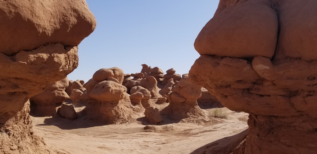
The area that is now Goblin Valley was once a muddy tidal flat on an inland sea, back in the Jurassic period. Waves deposited sand and silt. Erosion, wind and rain over millennia hardened the shapes into Entrada sandstone, as we have seen in other parks, and the goblins. They are ever-changing.
Further back in the valley, the cliffs were full of small caves and little nooks and crannies.


Impossibly, wildflowers grow here, too:


Canyonlands National Park

Our last stay was in Moab, where we visited these final parks. Canyonlands didn’t take much time. Our usual drive-through, stopping at places of interest and doing minimal walking to them, took only a couple of hours. It looked like a miniature Grand Canyon. In the heart of the Colorado Plateau, the Green and Colorado rivers carved the canyons.
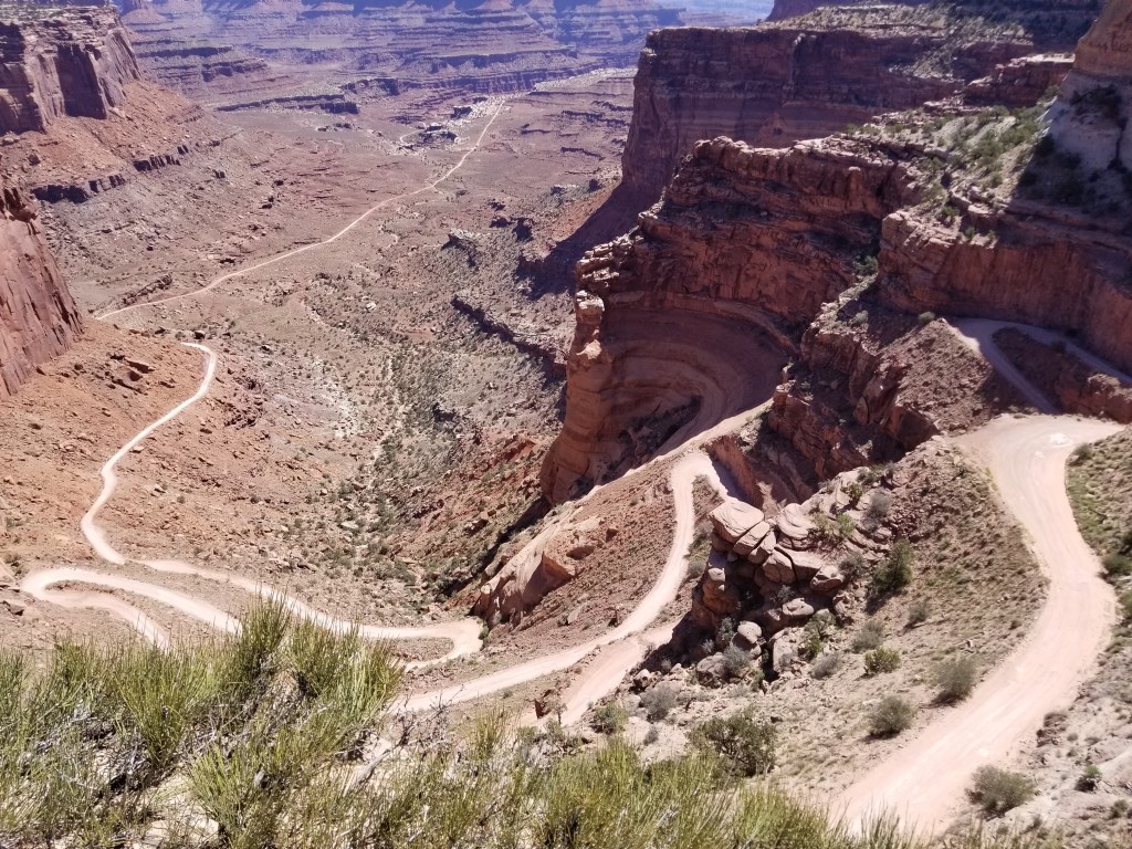
There are four districts to Canyonlands, and although they all have desert landscape, they are all different from each other. The rivers divide the districts and there are no roads that connect them. We visited the Island in the Sky District, which is closest to Moab.

It seemed like every park we had been to had their trophy arch or natural bridge, and Canyonlands was no exception:

The picture below is of Upheaval Dome, which is a scientific mystery. It is a circular depression about two miles wide. Was it a violent meteor impact that cracked the rock and formed the crater, or was it the effect of time, cracking and splitting the rock that was originally a salt dome? I love a good mystery, and I hope they can find something conclusive. Right now they are leaning toward the meteor theory. When I peered down into the crater, I decided that there a lot of interesting things going on here, geologically.

Dead Horse State Park
Dead Horse completes time spent at Canyonlands. They are right next door to each other, and complement each other well. At Dead Horse, you pay the $20 park fee for a view, but it’s a pretty awesome view:

The Colorado has done its work here, and given us a view much like Horseshoe Bend in Arizona. Here, there is a grand view of the canyon to go with it.
The East Rim Trail was a pleasant stroll for looking down into the canyon.
When scrolling through my phone, I found a list of the “Top Things to See in Moab”. Included in this list were the Solar Evaporation Ponds at Intrepid Potash mine. The ponds can be viewed in or out of Deadhorse. Salts are part of the rock formations, and water is pumped into the mine to dissolve the salt. The salt water is then pumped sent into the ponds for evaporation, and a blue dye is added to speed the process. At certain times of the year, the blue shows up more brilliantly. From Dead Horse you can just barely see the ponds, and I zoomed in as far as I could to catch this picture.

As I was gazing out, trying to decide what I thought about the ponds, a woman standing next to me commented: “Spoils the view, doesn’t it?” I guess it all depends on what you have come to see. I would tend to agree with her though. What is the salt in the end of the process used for? Fertilizer.
Arches National Park
Arches didn’t make the top 10 of most visited parks for 2021, but the numbers are growing. It was the only Utah park for which we had to make reservations to get in. I chose the 6 to 7 AM timeframe. The park is actually open 24 hours a day, and before 6 AM you don’t need a reservation. We were glad that we came as early as we did.
There are some interesting rock formations here. This one was in the Courthouse Towers area, and looked to me like a small group of people on the lookout:

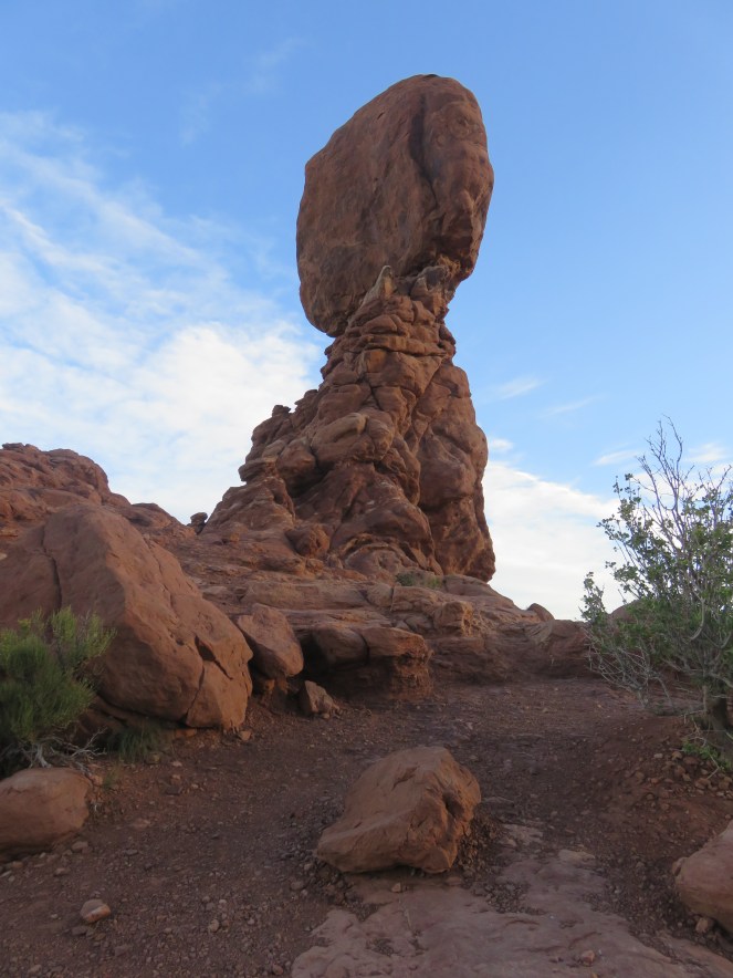
There is Balanced Rock, made more famous by Edward Abbey in his book “Desert Solitaire”:
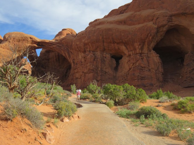
But the star of the show, to me, was the Arches. We spent a lot of time at the Windows section where we could see Double Arch, North and South Window Arches, and Turret Arch. Cal enjoyed the trails going up to these arches, and I enjoyed doing my best to climb right up under them. Our time in the Windows was actually timeless. We were out of the truck and walking, had no thought to what we were going to do next, and were awed by the Arches, the sun coming up, and the beauty of the day. Best of all, and especially at first, we were just a teeny bit ahead of the crowd.


Everyone politely waits for their turn at getting a photo snapped of themselves under the Arch. There are always willing folks to take our picture, because of course we will then take theirs. We stayed at South Window for a bit, absorbing the view, and we were actually photographed several times.

All you had to do from the Windows Arches was to turn around, and there was Turret Arch.

We had criss-crossed paths a couple of times with three Hispanic folks from Florida, originally Colombia. I practiced my Spanish, even though two of them spoke pretty good English. One of them was having too much fun with her camera, and took several pictures of us as well. This one was her idea:

We coincidentally ran into these folks again at another trail in Arches, and then again the next day at Dead Horse, although the woman didn’t offer to snap any more pictures of us. Maybe her excitement had worn off by then.
My favorite here was Double Arch, which is what we were looking at at the time. I tried to get underneath it, but the rock in the final ascent was just too tricky. Double Arch is massive and absolutely breathtaking, and the view changes with every step closer that you take.


The bonus to getting up early to visit Arches in May, if you like flowers, is being able to see the evening primrose still in bloom. When the sun starts to burn brightly, the flowers close and the blooms are pink.

We also visited Sand Dunes Arch. It was a short walk, and half the fun was trying to get anywhere in the soft sand:


The last arch for the day: Landscape Arch, which looks like an elephant with its trunk stretched out.

A bit of trivia: so far, over 2,000 arches have been counted in Arches National Park.
On our very last day in the Moab area, we used our second early-morning Arches reservation to visit Delicate Arch, the iconic Utah arch that you see in the top photo. The trail is about 1.5 miles one-way to the arch, and ascends almost from the beginning. It was probably about 6:15 AM when we arrived, and we passed plenty of people who were already returning from their ascent.
We passed Wolfe Ranch, a remote settlement that was farmed for about a decade during the turn of the century:
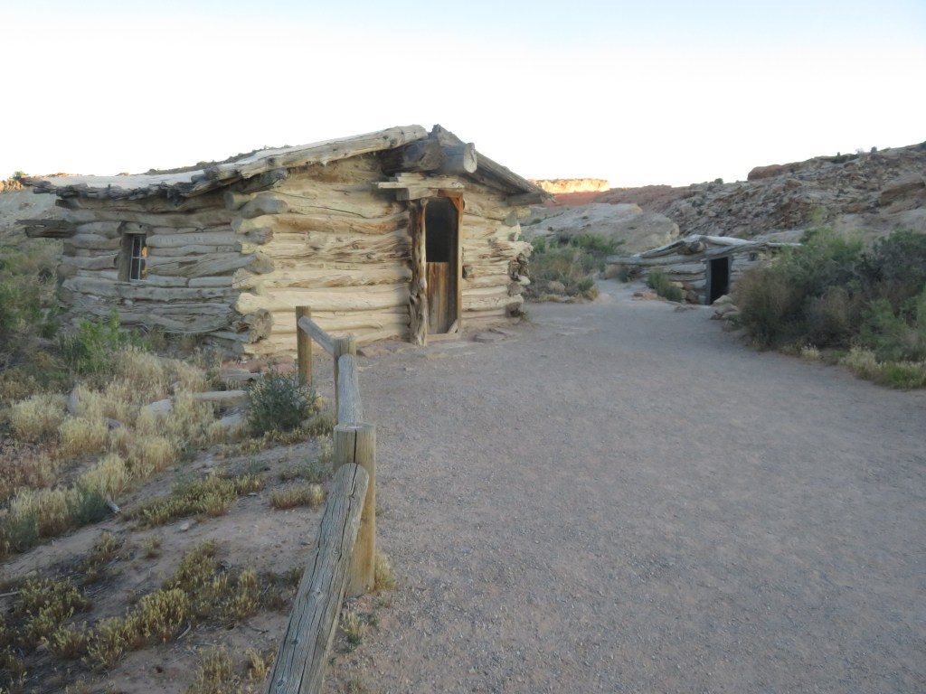
Just past the Wolfe Ranch was Ute rock art, dating from between 1650-1850. John Wolfe may have enjoyed showing this to any visitors that came by:

Part of our hike was on slickrock. Cal is shown here descending the rock, after we had visited the arch:

Finally, a very narrow path to the top with no fence to keep you from tumbling off the cliff! Again, this view is actually taken from the descent perspective.

A turn in our narrow pathway, and the stunning Delicate Arch came into view:


Perfection! An absolutely grand finish to our journey through Utah!
Finally, I have to give a shout out to these fine books, which I purchased from Barnes and Noble just before we hit the road:
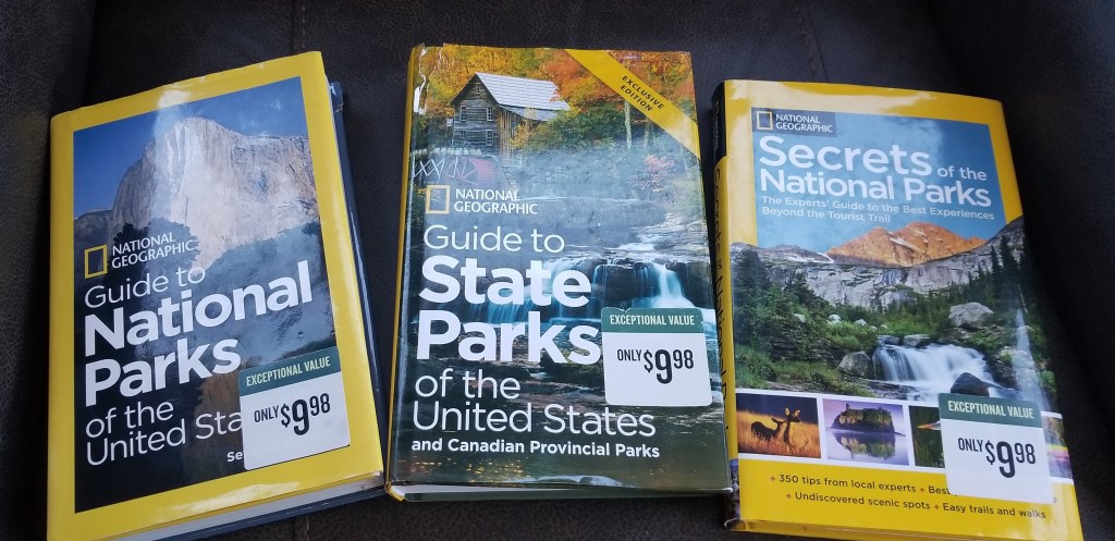
They don’t include information that changes often, like hours of operation, shuttle times or advance reservation requirements, so the books should be relevant for a long time. The National Parks book was invaluable for guiding us through the parks and telling us which stops were worthwhile and which not, some hikes that were good, and other things to do. We used it exclusively to guide us on our drive through a couple of the Utah parks. It has information in it that the parks brochures do not. The State Parks book only has a few of the best parks in each state. Dead Horse and Goblin, as well as Kodachrome which I blogged earlier, are in here. I have not used the Secrets book much. It seems like some of that information requires drives on rugged roads or hikes that are a bit longer than we usually take.
Next time – we visit a “Tourist Attraction”

What an interesting collage! The Goblin Valley state park looks really fun. I had not heard of this place. I did visit Arches NP – about 40 years ago. I remember it was very desolate, and we hiked to delicate arch. And there were signs everywhere (with a skull and crossbones) saying not to drink the water. Thanks for taking me there again. And thanks for the reminder about those books. We have some which were given to us as gifts. Safe travels!
LikeLiked by 1 person
The world has found Arches, so it probably wouldn’t seem so desolate to you now! And no skull and crossbones signs. I guess everyone has waterbottles now. Glad you enjoyed the post. Yes, for national parks especially, the book is invaluable.
LikeLike