
Cedar Breaks National Monument
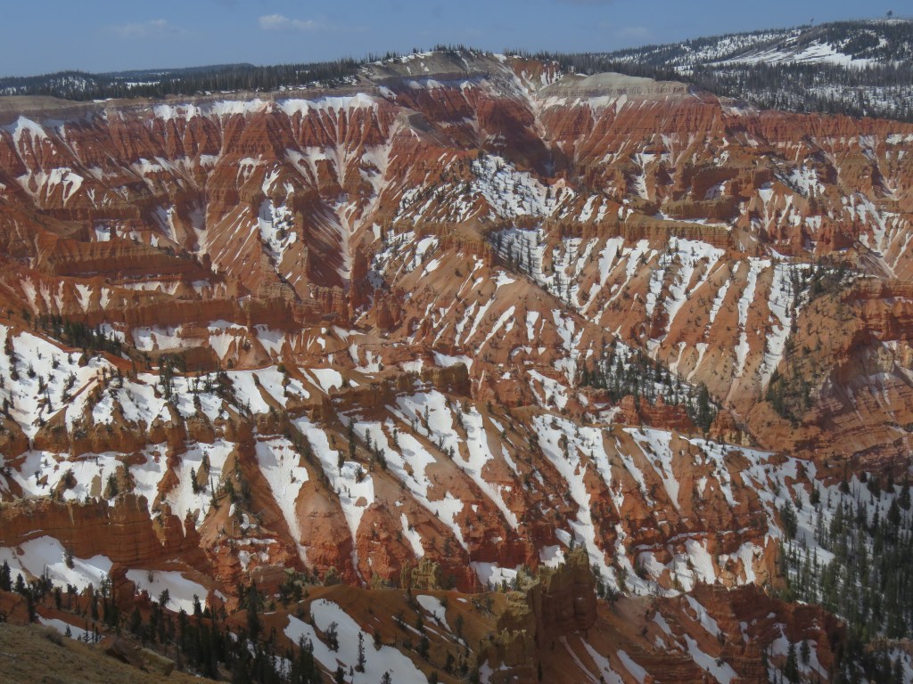
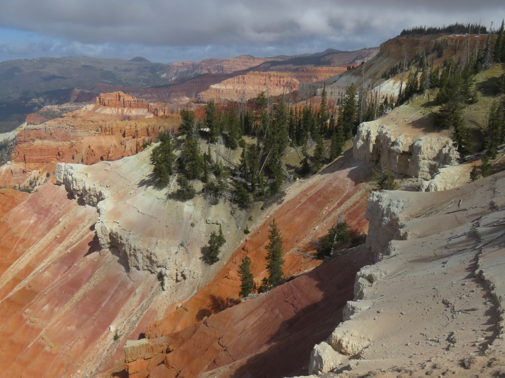
Cedar Breaks is a natural amphitheater which looks a bit like the Grand Canyon with some hoodoos thrown in. It sits at 10,000 feet above sea level, a fact we may not have thought enough about when planning to visit. It was early May and the road to Cedar Breaks had only recently been open for the summer. It is covered in snow and impassable through the winter. We chose the coldest day of our Bryce area stay for a visit to this park, reasoning that if it was too cold we’d just enjoy the drive in the truck. It was 55 miles from where we were staying.
As we climbed, the temperature dipped down into the upper 20’s. We stopped at the first viewpoint, and the cold hit us with a frigid blast as we stepped out of the truck. Brrrr! There was ice on the walkway to the overlook.

Aside from a family with a snowsuit-clad toddler, there was no one out here but us. Unless, of course, you count this little marmot, who looked as cold as we were.

It seemed we were visiting in a period between ski season and hiking season.

We looked for the visitor center and finally decided it was a boarded-up log building. The signs hadn’t even been put up for the summer! The views from the overlooks were outstanding, though, and that made the drive up here worthwhile.

Outside the park, I saw piles of volcanic rock as we drove by, which reminded me of Big Island of Hawaii. It looked like the volcano had just happened.

We had packed a picnic lunch but it was too cold outside for a picnic. We lunched in the truck with a fine view of Lake Panguitch.

Kodachrome Basin State Park
I had Paul Simon songs running through my head while we were in this area. It started with the hoodoos. “Now who do… Whoooooo do you think you’re fooling?” (She loves me like a rock!) When Cal and I would start talking about Kodachrome Basin State Park, I would be singing “Kodachrome, they give us those nice bright colors” in my head for days.
I tried to secure a spot for our RV in this park, so we were talking about it early on. There aren’t very many sites here that have the full hookups that we need, though, and of course they were already gone when I tried to reserve a spot the very first day that I could. This park wasn’t far from where we ended up staying. We took a hike on the Angel’s Palace Trail, and on the Nature Trail across the road from that.

The sandstone chimneys in this park change in color with the day’s light and shadow. Together with the blues in the sky and the green of the trees, the color and contrast led the National Geographic Society to name this park Kodachrome in 1949. Of course, they secured permission from Kodak Film first. I would venture to say that as time goes on, no one will know what Kodachrome is unless they Google it first.


Cal is posing in this photo to show you how tall this “sedimentary pipe” is. The geology of the Utah rock layers is pretty fascinating stuff to me. There was an inland sea here 180 million years ago which deposited solid layers of white gypsum. Layered on top of it is the Entrada Formation, fine grained sandstone laid down during the Jurassic Period of time. The formation Cal is standing next to, as with so many that we saw throughout Utah and this park, is Entrada Formation Rock. This era in time is also responsible for the formation of “slickrock”, seen in the lower right corner of the middle picture above.

I chose the trail because it was not too long (1.5 miles one way), and had little side trails for observation and exploration. A small downside was that, because of the side trails, we kept losing the main trail. The signage was not great. Add to that the wind, and I mean knock-your-socks-off, sudden-gusty kind of wind. Cal led the way on this precarious overlook. You can see the trail jutting out from the right. He had just started venturing out when the wind almost knocked off his hat and he grabbed it just in time. I’m an adventurous sort, but I really didn’t want to get blown off that trail when there was no where to go but down. A long way down.
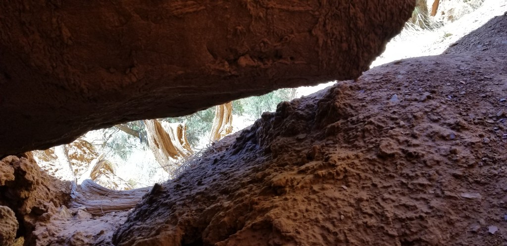
Exploring little caves and nooks farther down in the canyon is more my style.
As we traveled through Utah, we came across expansive green valleys with pretty rivers flowing in and and out. This is the country the Mormons settled long ago. It was easy to picture them coming through in their wagon trains, settling the fertile valleys with cattle ranches, farms and orchards. Descendants of those first families still live here. Sometimes I would find traces of those pioneers, as in the description of this plant:
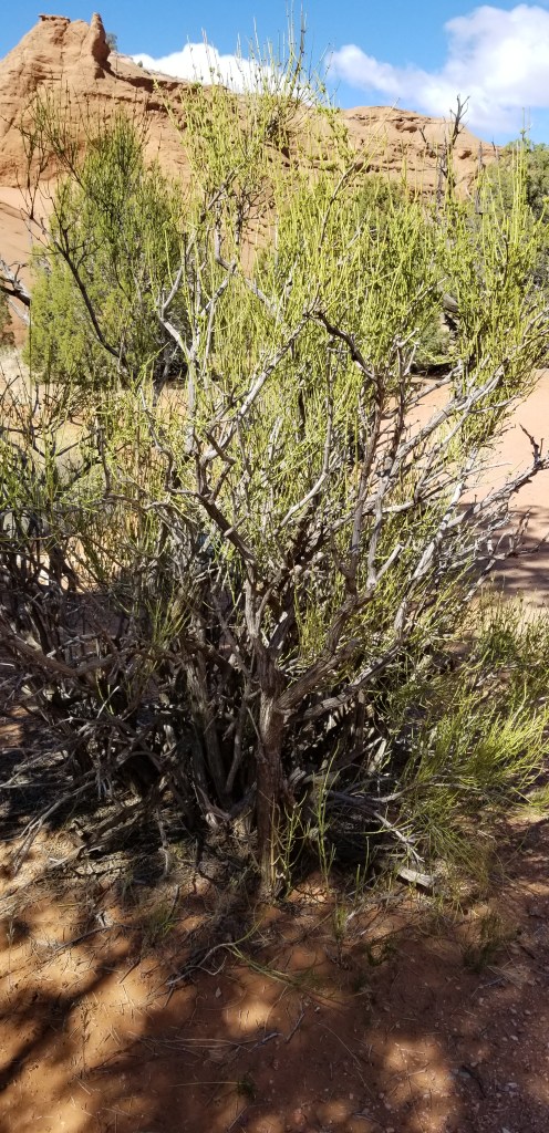
It is called “Mormon Tea”. The leaves and stems were used by native Americans and Mormons as a medicinal brew for all sorts of ailments, and also a substitute for coffee and tea.
We often saw old cabins here and there, and I would always wonder about the people who had built them and the families that may have lived there. This one was on the road just outside of Kodachrome.

Due to the wind, we ate yet another picnic lunch in the truck, but we had this gorgeous view to go with our tuna salad and crackers:

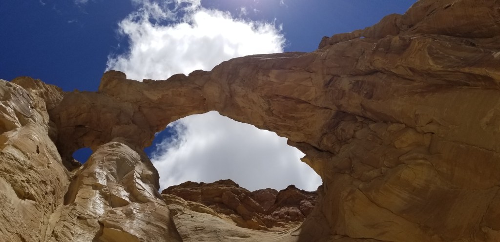
Grosvenor Arch

Getting to Grosvenor Arch involves driving 10 miles down red-dirt Cotton Canyon Road. We debated doing this as we were munching our lunch, because the road begins directly to the right of the Kodachrome sign up above. Cal decided to go for it. The road turned out to be not nearly as bad as some other dirt (rock) roads we have been on, and was very scenic. Then up a hill, and around a bend, and the arch was a very welcome sight to see.

Grosvenor is actually a double arch. You can see the smaller one to the left of the larger one. Both sit 150 feet up off the ground.
It’s hard to figure how many days to stay in one area. We allowed five nights for this corner of Utah, and were glad that we did.
“Those who contemplate the beauty of the earth find reserves of strength that will endure as long as life lasts.“
Rachel Carson, conservationist and marine biologist
Next time: Bryce Canyon National Park

Such unique and interesting land formations! I was glad to see the scale of the sedimentary pipe. Is there any information about the cabins – like when it was built? Were there others? Your pictures are beautiful!
LikeLiked by 1 person
I took the picture from the truck as we were driving, so no information on this one is available. But there will be another one coming up that I will have some information on. Thank you!
LikeLiked by 1 person