USTravel

Capitol Reef National Park

Route 24 crosses Capitol Reef from east to west and covers the heart of the park in only 20 miles or so. This is what travelers see if they are just passing through. The park is long and narrow, so most of the rest is back country. We talked to some people who didn’t even stop in the park because they were on their way to other places, and vacation days are short. Here’s a little secret, if you’re still paying at the gate to get into a National Park: there is no gate at this one. At the visitor’s center, they don’t even care if you pay.

How did Capitol Reef get its name? It all started with a wrinkle in the Earth…sounds like the stuff of science fiction, doesn’t it? The land that is now called Capitol Reef changed over the millennia from oceans to desert and swamps to riverbeds, laying down a thick layer of sedimentary rock. Around 50 to 70 million years ago, an ancient fault lifted the rock and rather than cracking, the rock layers folded over the fault. As with all the rock we have seen, erosion sculpted these rock layers with the forces of rain, flash flooding, and freeze-thaw cycles, to create the one-sided Waterpocket Fold.

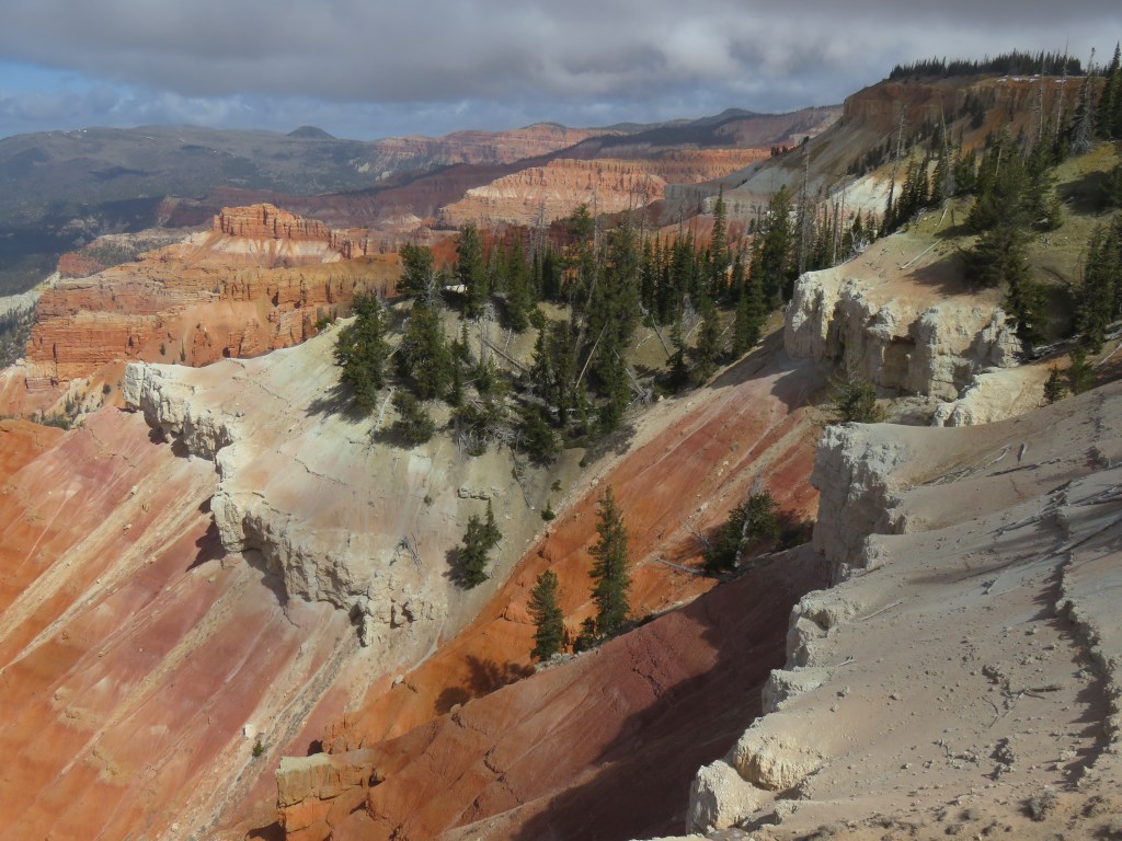
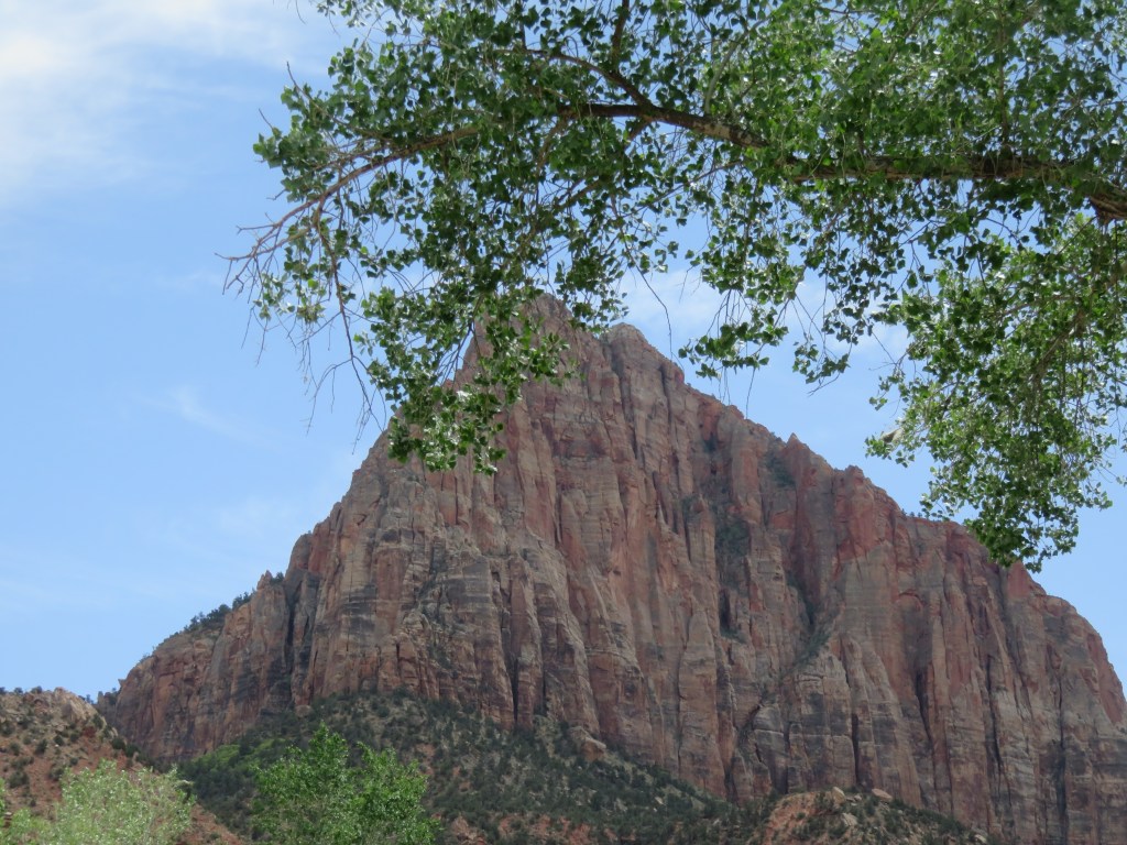
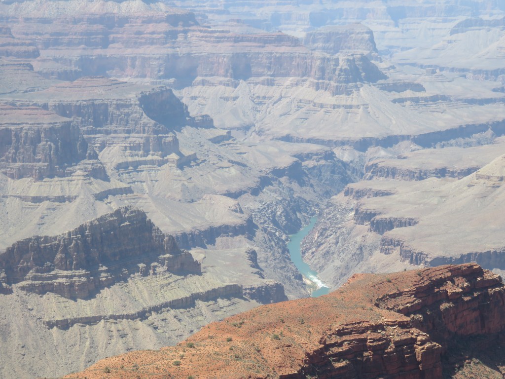
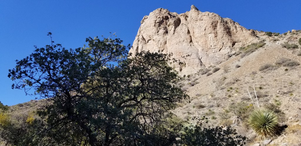
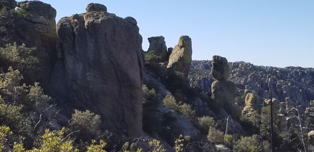
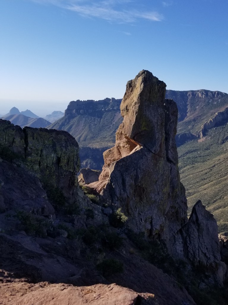
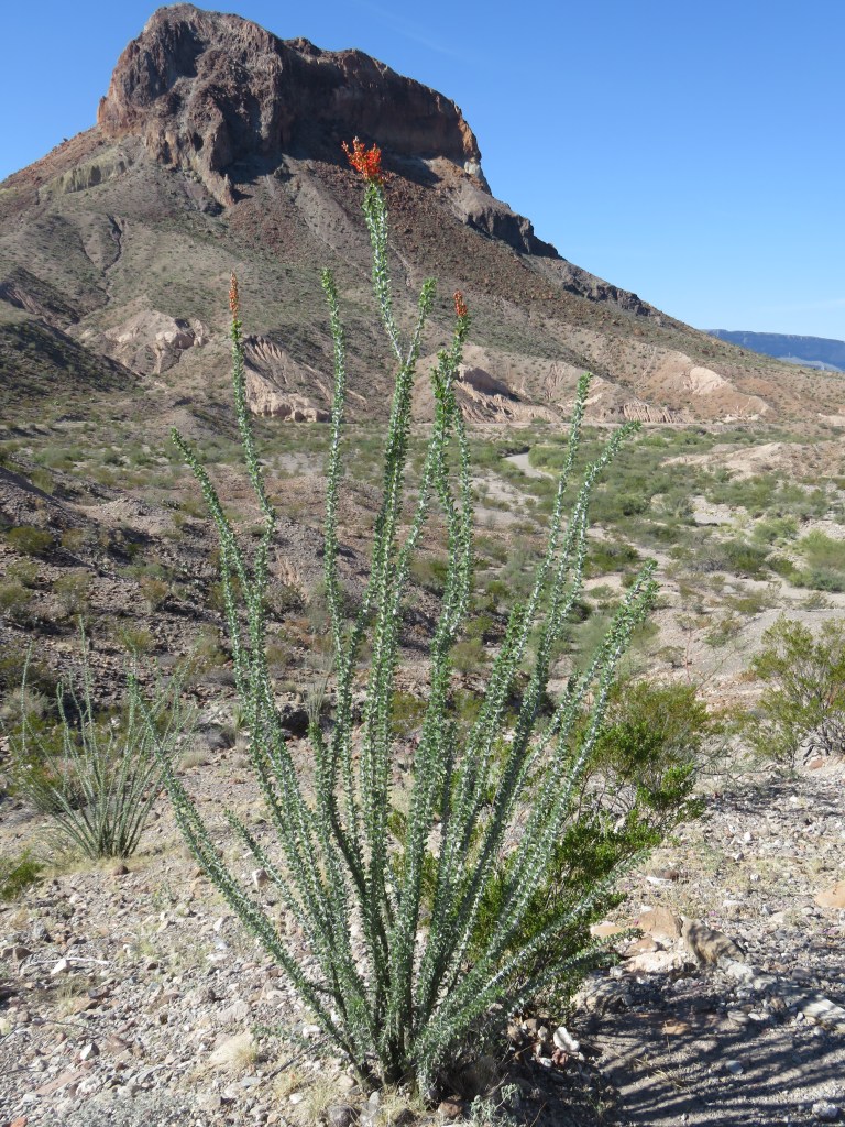
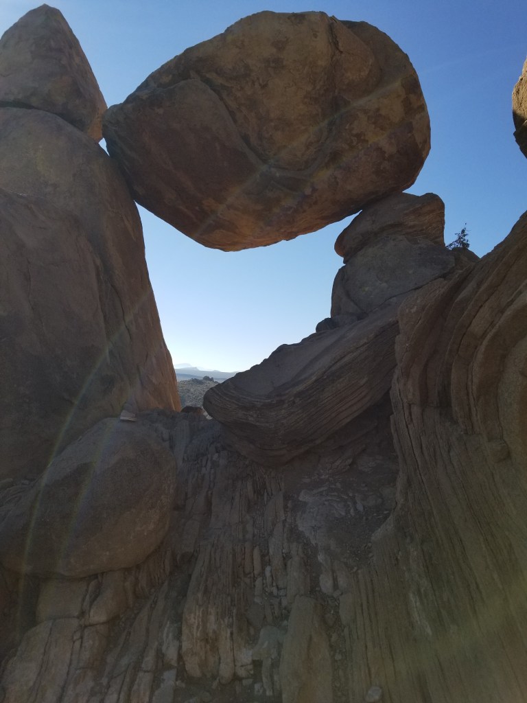
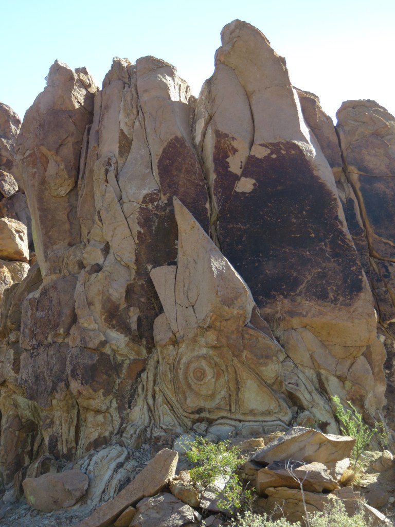
Coming from the East, as early explorers and settlers did, the line of cliffs of the Fold looks like a difficult barrier to pass through, like a barrier reef in an ocean. It stretches north to south for a hundred miles. The pioneers thought the rock monolith in my picture below looked like the dome at the nation’s capitol building. The name “Capitol Reef” was born.

There’s a dichotomy to writing about this park, because not only is there the natural beauty of the Waterpocket Fold, but there is also the history of the people who settled here – the Mormons – who called their village Fruta. Before them were the ancestors of modern day Zuni, Hopi, and Paiute tribes. In this blog I will write about our exploration of the park, and then will cover Fruita in the next.

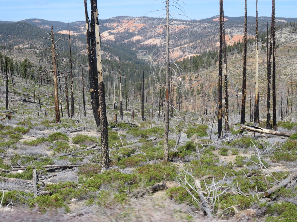
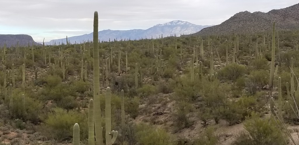
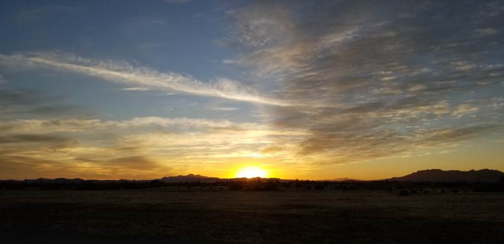
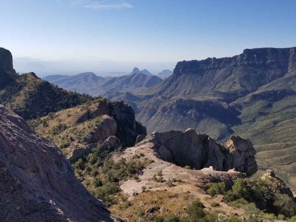
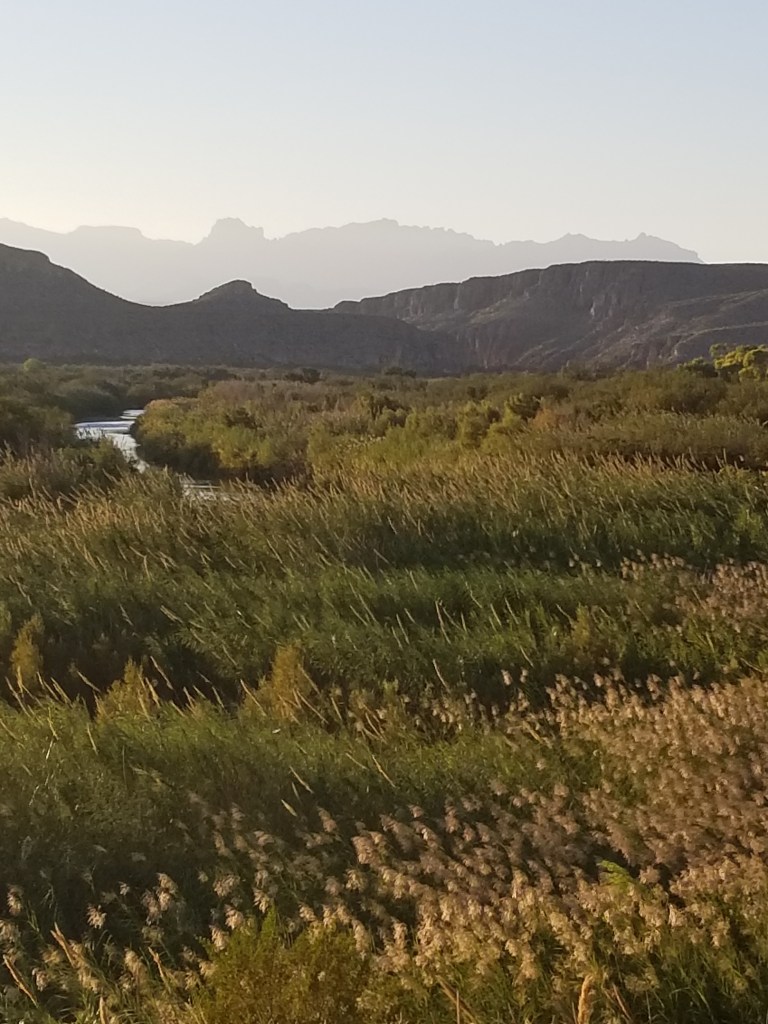
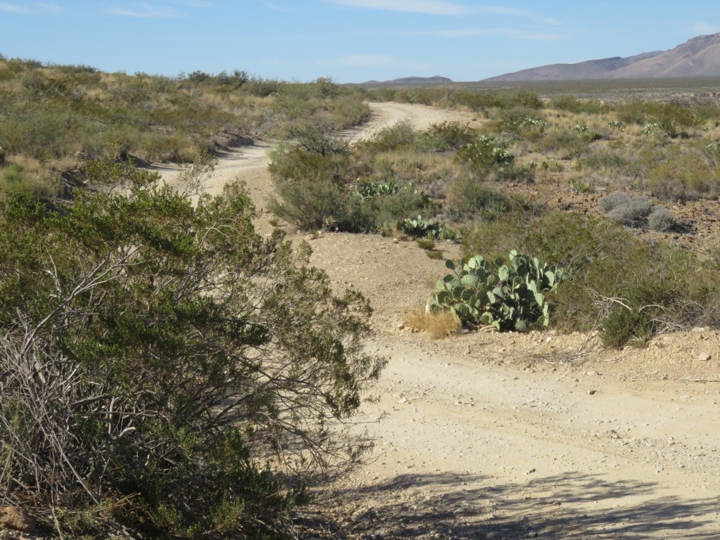
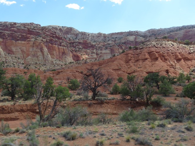
Passing through Fruita and only stopping at the Visitor’s Center at the beginning, we drove the 16-mile round-trip Scenic Drive. On our left was the face of the Fold; on our right was desert scrub. The picture at the top of the blog shows the abrupt change in the landscape.

The Scenic Drive was once a wagonway called the “Blue Dugway” and was used by natives and outlaws alike. Later it became a pioneer throughway.

A strange and colorful landscape

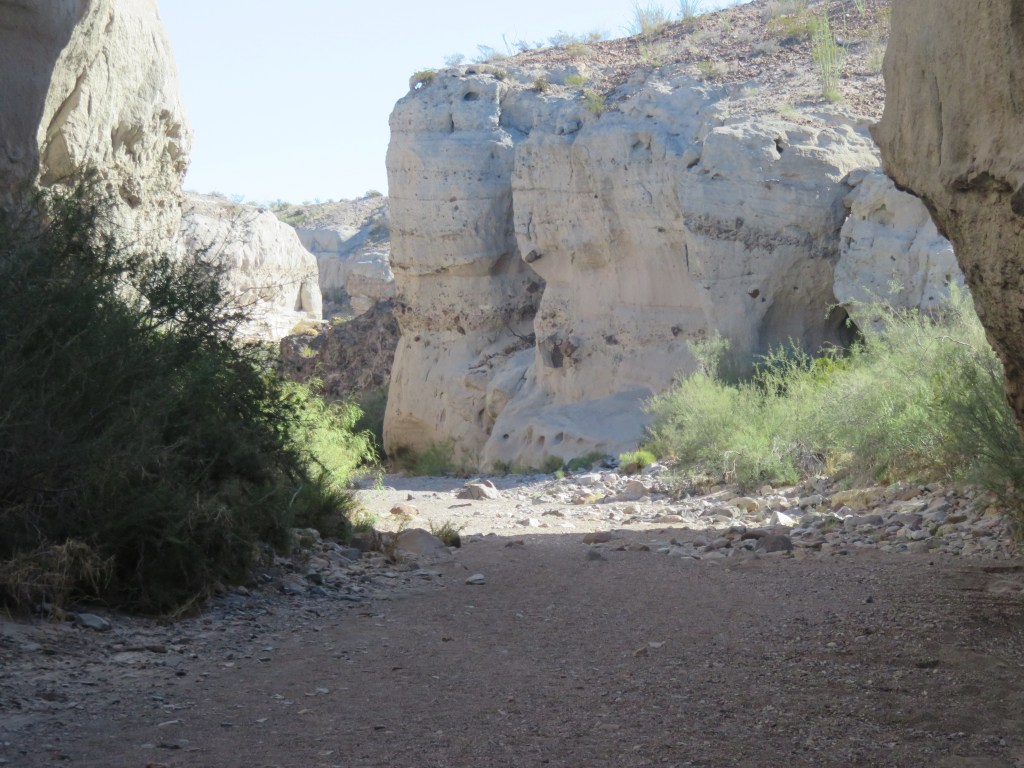
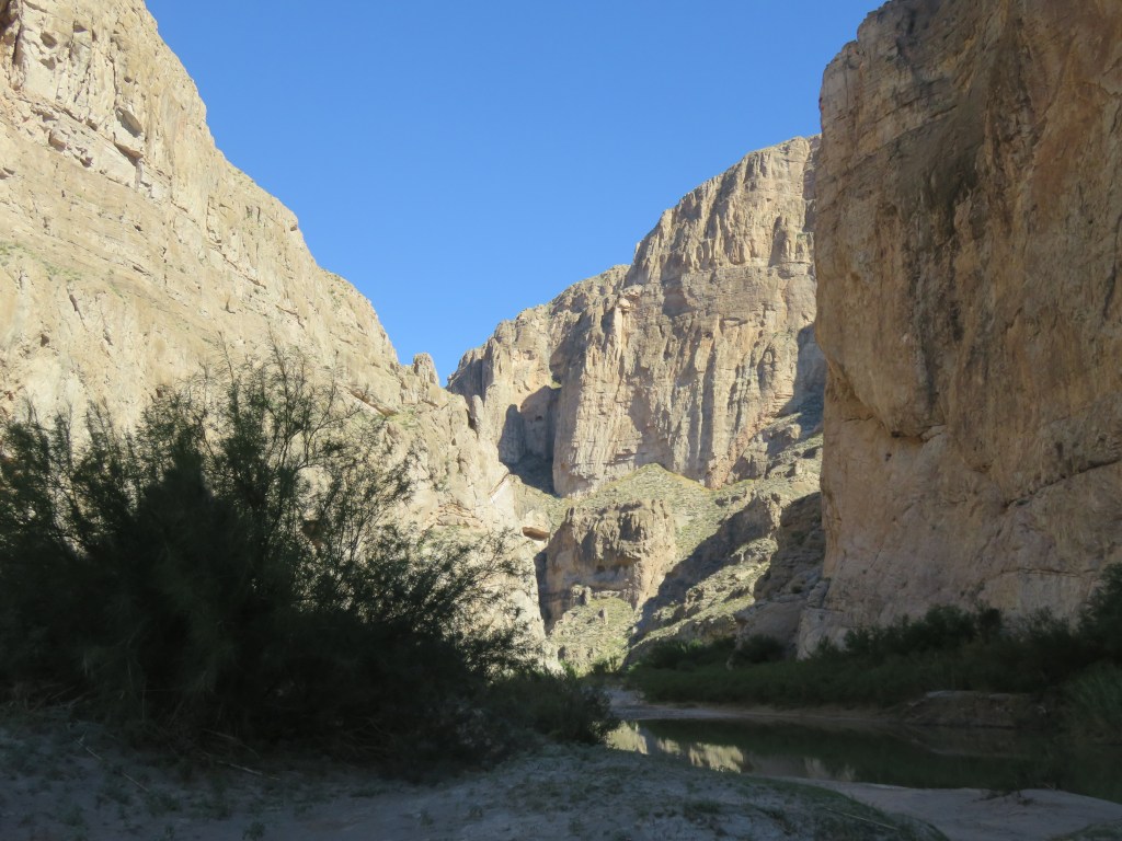
At the end of the scenic road was fun time for Cal: a two mile spur road that was once the main road through the reef before 1962, when Route 24 was completed. It passes through Capitol Gorge, and is all dirt and gravel.

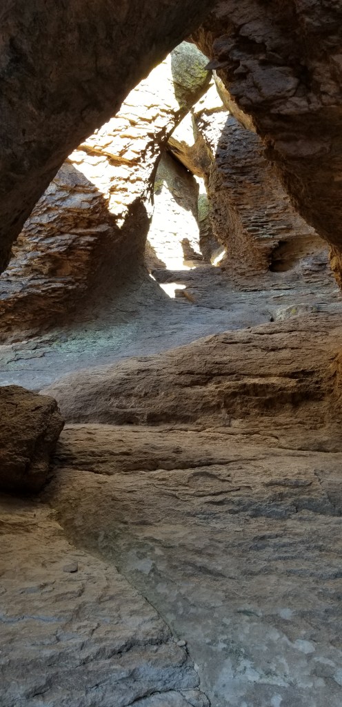
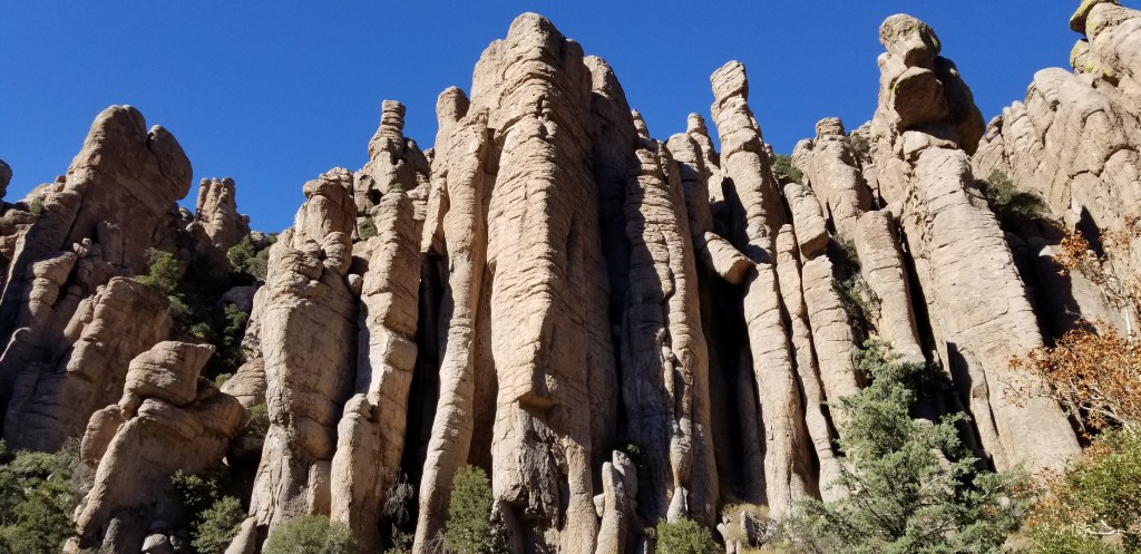
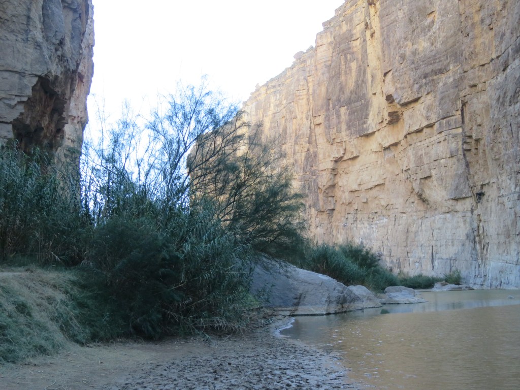
The towering walls of the gorge pressed in closely through here. My active imagination saw Indians at the top of the cliffs lying in wait for us, like an old Western movie.

On the signboard at the end of the road through the gorge was this picture of cars making their way through, back in the day:

Before cars were in existence, way back in 1883, a man named Elijah C. Behunin led a group of men to clear boulders for this passageway so that wagons could come through. It took them eight days. Remember his name, you’ll see it again in my next blog!

Finally, even this road petered out, and so we hiked the Canyon Gorge trail a mile further in. We saw pioneer registers carved into the cliffs here. There are Indian petroglyphs, too, but we didn’t see them.

An old road signpost, maybe? Or a mark above someone’s grave?

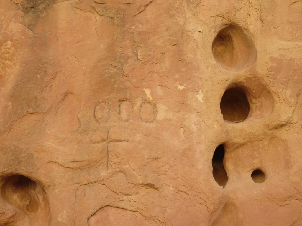
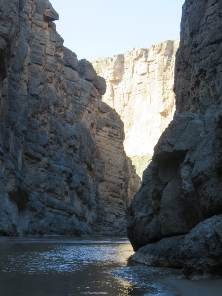
It is easy to see the effect that water has on the rocks; this gorge is prone to flash flooding.

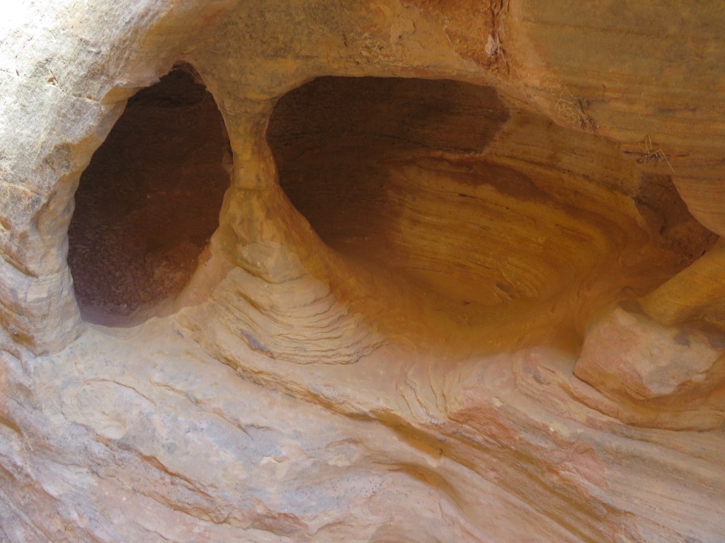
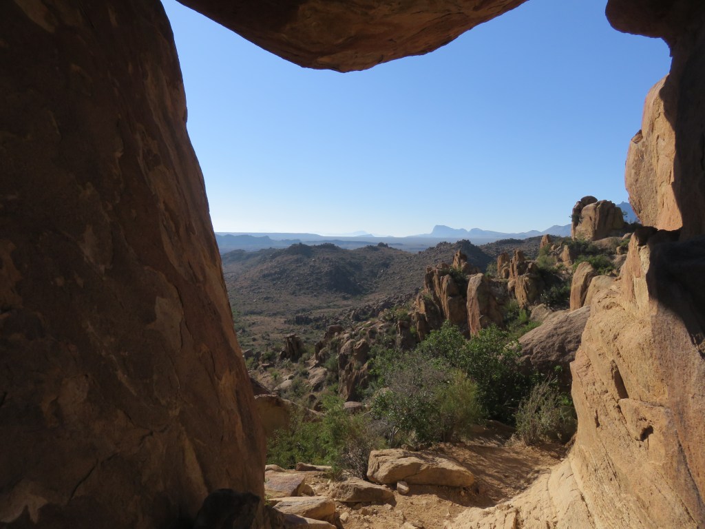
After some debate, we veered off to explore the Tanks trail. But we couldn’t find the tanks, which are pockets of fresh water, because the trail wasn’t marked well. From there, though, there was a nice view of the Gorge.

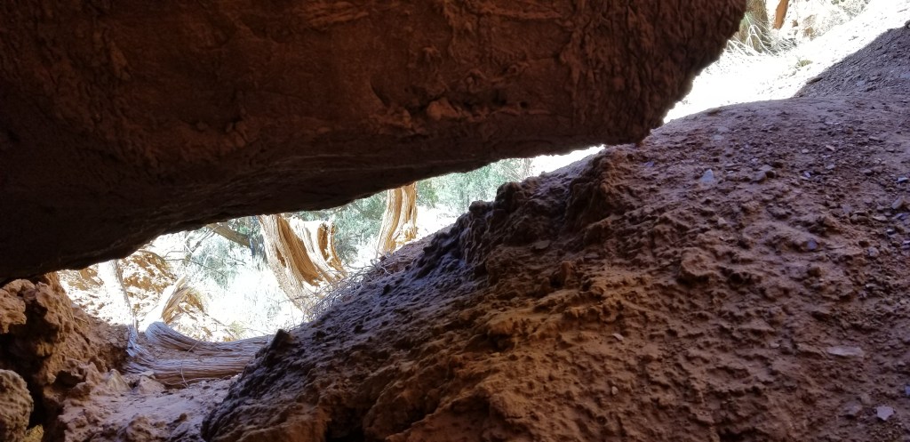
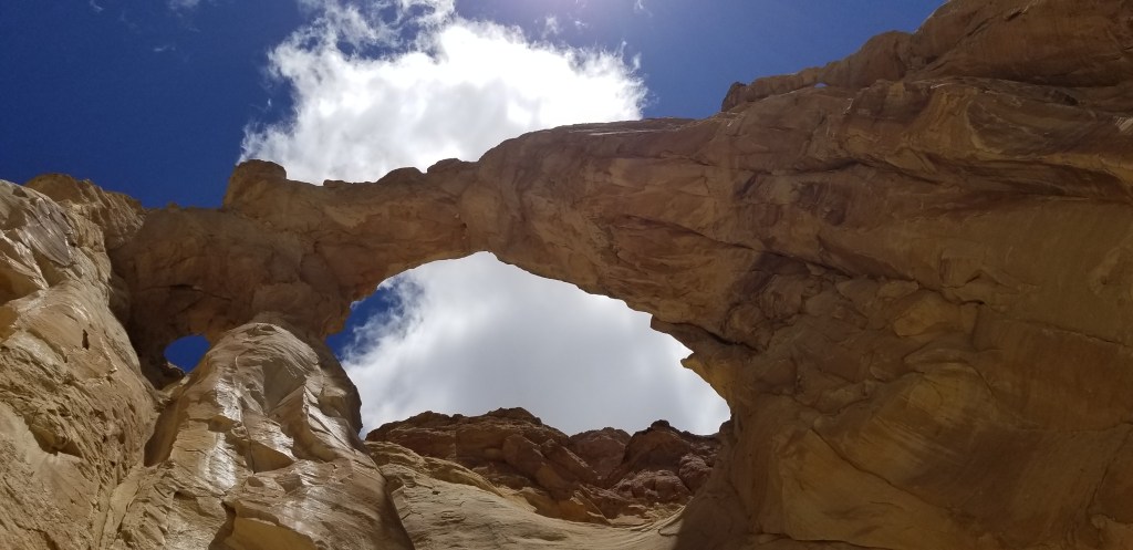
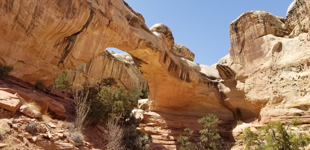
Back to Route 24, on another day, we explored some turn-offs that looked interesting. One of them was Hickman Bridge, which is a 133-foot natural bridge.

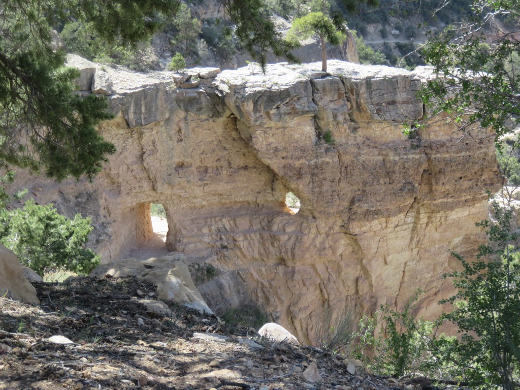
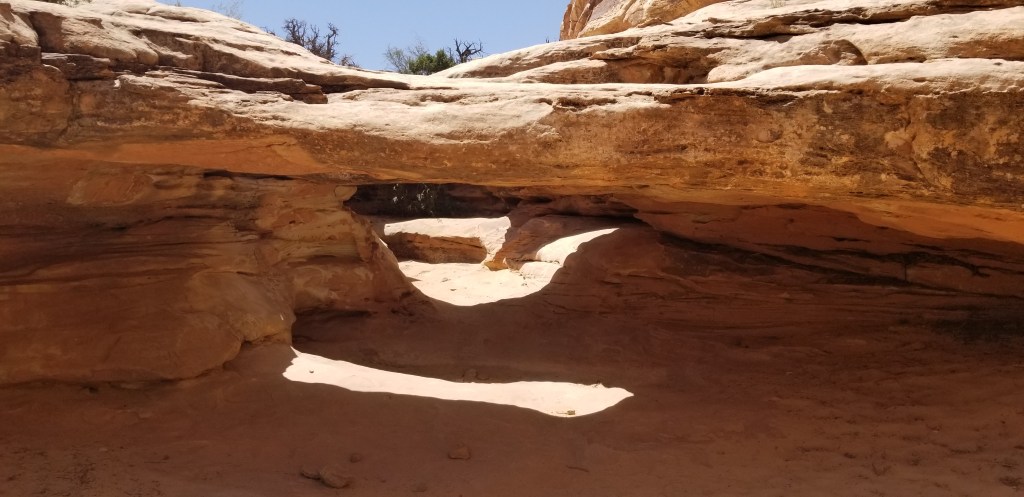
Hiking to Hickman Bridge, we passed this set of two miniature natural bridges.

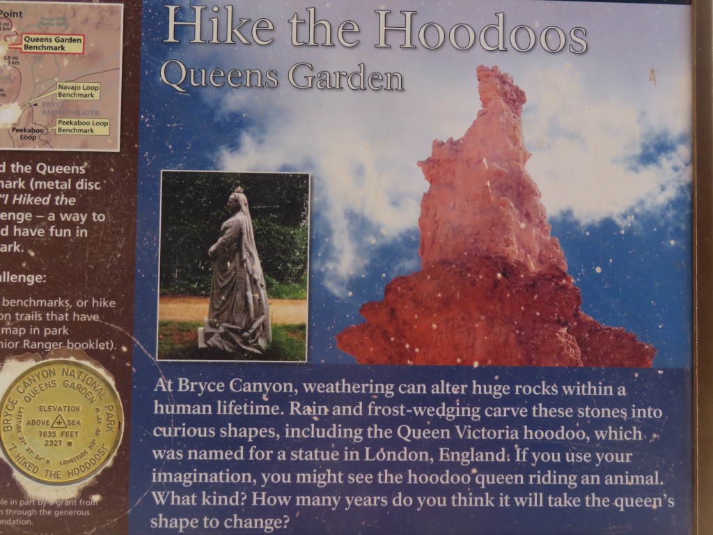
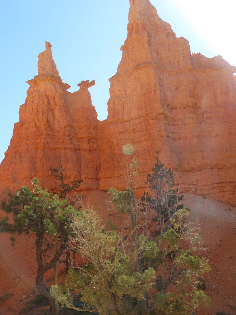
And, let’s throw in a couple of hoodoos, just for fun:

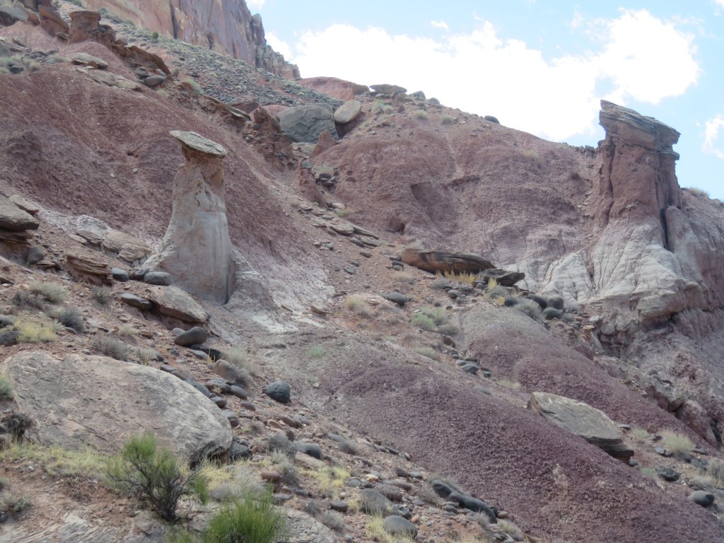
The hoodoos were located near the Fruita Historic District.

Mother Nature did a fine job of sculpting this park, and there were so many things we didn’t see: Chimney Rock and the Goosenecks Trail, a drive down the Grand Wash Road with a view of Cassidy Arch, and a short trail from a Route 24 turnoff to see some petroglyphs. I don’t know if we’ll ever return, but the pies at the Gifford House would be enough to lure us back! I’ll explain about that…next time!

Next time – Fruita Historical Village in Capitol Reef NP

USTravel

Bryce Canyon National Park

Bryce! There are not enough adjectives to describe this park. It’s truly amazing. If by chance you are planning a trip to Utah and don’t know which national parks to visit, Bryce should not be the one that gets cut from the list, in my humble opinion.

Our visit to Cedar Breaks was shorter than we had anticipated because of the cold. The weather had warmed up when we arrived home and a beautiful afternoon was before us, so we hopped on the park shuttle for our first visit to Bryce. Stopping at the visitor center, a park ranger told us that for some great views, Bryce Point was the place to start. We followed her instructions and got off the shuttle there, walking the rim trail down to Inspiration Point before getting back on the shuttle. The first glimpses were astounding.

This formation of hoodoos looked just like a castle fortress.

Where our home was sitting for these few days, we joined in a happy hour with our neighbors, and they outlined the perfect Bryce hike that they had been on. Start at Sunset Point, go down the Wall Street portion of the Navajo Loop, into the Queen’s garden trail, back at Sunrise Point, and hike on the rim back to Sunset.

Temperatures were in the 30’s on the morning of our planned Bryce hike day. I procrastinated, wishing desperately that it were warmer. Cal was running circles around me getting ready for our day. If we set a depart time, he doesn’t waver from it. I layered up, we hit the trail, and I was glad we stuck to the plan. This was the sight that greeted us when we set out:

Our neighbors thought it would be better to hike down to Wall Street rather than going up at the end, as they had. It is switch-back after switch-back from the canyon rim all the way down to the bottom:

This is just the lower half of the downward trail. If Cal is bundled up like this, you know it’s cold!
Heading into Wall Street

The next two pictures are inside Wall Street:

At the end of Wall Street, hoodoo heaven

Looking for information about one national park or another, I came across a blogger (I don’t know who, so if it was you, please let me know and I’ll give credit!) who stated:

“In the Grand Canyon you are looking down at the rocks,

In Zion you are looking up at the rocks,

In Bryce you are in the rocks.”

So true, but in Bryce, only if you take a hike!

Many ancient trees on the trail were twisted and gnarled, as this one was

After awhile I finally warmed up and we found a log off the path to sit and strip layers down. Cal was zipping off the bottom portion of his pants when a couple came along and asked, “Would you like us to take your picture?” I looked around, not thinking it was a particularly photogenic spot, but said “Sure!” And we liked the one they took. They even graciously took it from Cal’s knees up, so you can’t see that he still has one pant leg only partially off.

The couple was from Arkansas and later we met another from Switzerland. We crossed paths frequently with both couples and found many things in common as we hiked. Finding people to walk with always makes a hike more fun.

Queen’s Garden has a lot of hoodoos, but this one has been famous for decades because it resembles a statue of Queen Victoria in London. The sun was in the wrong place for a photo, but it is below, and I think it looks like she is sitting backwards on a resting camel.

The hoodoos on the rest of the hike were simply stunning. All one has to do is turn a bit, or take another step, and there is a totally different view.

A thin wall of rock, such as this, is called a “fin”. At some point in the future, it will be eroded by wind and rain, perhaps forming a new hoodoo.
The smile on my face says it all…this was the best hike ever!
Turning off the trail, I looked back to see this sign. I really didn’t think the trail was THAT bad! Good thing I had my boots on!

As the morning went on, the crowds picked up. Climbing back up to the rim, we decided our neighbors’ advice was very, very good.

The National Park Service calls this park “poetry in stone”. Some excerpts from the brochure: “Stand at the rim in early morning and experience the chilly dawn, crystalline blue sky, and rocks ablaze with the ruddy light of sunrise.. the sun arcing across the sky casts a kaleidocope of slowly altered hues and shifting shadows over the land… At Bryce Canyon the forces of weathering and erosion never rest, not even for a day.”

Bryce is a collection of giant natural amphitheaters. It contains the largest number of hoodoos in the world. Because of its remote location, it doesn’t receive as many visitors as Zion or Grand Canyon. It didn’t seem remote to me, but then, it was pretty much on our route going east.

The shuttle at Bryce goes as far as Bryce Point. Like Zion, it doesn’t require reservations. Unlike Zion, the road continues past the last stop for another 17 miles. We drove out to the end, which is at Rainbow Point. On the way, we passed miles of devastation from a recent fire. I’ve seen this before in the West, and it always leaves me feeling sad. It takes decades for a forest to recover from a fire.

On the way to Rainbow Point, the cars thinned out and so did the air. The elevation here is 9,100 feet. It wasn’t as high as Cedar Breaks, so we weren’t in as much snow, but high enough to feel as if we were on top of the world. The air was quiet and all we could hear was the cries of a hawk circling above us. It was so good to just stand there, look out, and contemplate the view, which was well worth the drive.

Looking out over the Paunsaugunt Plateau

On the way back, a sign pointed to a view point for Natural Bridge, and we were glad we made this stop:

Underneath the bridge, could it be…Yoda?

“Did you see Bryce?” If the answer is “Yes!”, everyone just smiles. The park and all its wonders was unforgettable, and I continue to love the surprises, and the natural beauty, of our national parks.

Next time: Scenic Route 12

USTravel

Southwest Utah Travels

Cedar Breaks National Monument

Cedar Breaks is a natural amphitheater which looks a bit like the Grand Canyon with some hoodoos thrown in. It sits at 10,000 feet above sea level, a fact we may not have thought enough about when planning to visit. It was early May and the road to Cedar Breaks had only recently been open for the summer. It is covered in snow and impassable through the winter. We chose the coldest day of our Bryce area stay for a visit to this park, reasoning that if it was too cold we’d just enjoy the drive in the truck. It was 55 miles from where we were staying.

As we climbed, the temperature dipped down into the upper 20’s. We stopped at the first viewpoint, and the cold hit us with a frigid blast as we stepped out of the truck. Brrrr! There was ice on the walkway to the overlook.

Aside from a family with a snowsuit-clad toddler, there was no one out here but us. Unless, of course, you count this little marmot, who looked as cold as we were.

It seemed we were visiting in a period between ski season and hiking season.

We looked for the visitor center and finally decided it was a boarded-up log building. The signs hadn’t even been put up for the summer! The views from the overlooks were outstanding, though, and that made the drive up here worthwhile.

Outside the park, I saw piles of volcanic rock as we drove by, which reminded me of Big Island of Hawaii. It looked like the volcano had just happened.

We had packed a picnic lunch but it was too cold outside for a picnic. We lunched in the truck with a fine view of Lake Panguitch.

Kodachrome Basin State Park

I had Paul Simon songs running through my head while we were in this area. It started with the hoodoos. “Now who do… Whoooooo do you think you’re fooling?” (She loves me like a rock!) When Cal and I would start talking about Kodachrome Basin State Park, I would be singing “Kodachrome, they give us those nice bright colors” in my head for days.

I tried to secure a spot for our RV in this park, so we were talking about it early on. There aren’t very many sites here that have the full hookups that we need, though, and of course they were already gone when I tried to reserve a spot the very first day that I could. This park wasn’t far from where we ended up staying. We took a hike on the Angel’s Palace Trail, and on the Nature Trail across the road from that.

The sandstone chimneys in this park change in color with the day’s light and shadow. Together with the blues in the sky and the green of the trees, the color and contrast led the National Geographic Society to name this park Kodachrome in 1949. Of course, they secured permission from Kodak Film first. I would venture to say that as time goes on, no one will know what Kodachrome is unless they Google it first.

Cal is posing in this photo to show you how tall this “sedimentary pipe” is. The geology of the Utah rock layers is pretty fascinating stuff to me. There was an inland sea here 180 million years ago which deposited solid layers of white gypsum. Layered on top of it is the Entrada Formation, fine grained sandstone laid down during the Jurassic Period of time. The formation Cal is standing next to, as with so many that we saw throughout Utah and this park, is Entrada Formation Rock. This era in time is also responsible for the formation of “slickrock”, seen in the lower right corner of the middle picture above.

I chose the trail because it was not too long (1.5 miles one way), and had little side trails for observation and exploration. A small downside was that, because of the side trails, we kept losing the main trail. The signage was not great. Add to that the wind, and I mean knock-your-socks-off, sudden-gusty kind of wind. Cal led the way on this precarious overlook. You can see the trail jutting out from the right. He had just started venturing out when the wind almost knocked off his hat and he grabbed it just in time. I’m an adventurous sort, but I really didn’t want to get blown off that trail when there was no where to go but down. A long way down.

Exploring little caves and nooks farther down in the canyon is more my style.

As we traveled through Utah, we came across expansive green valleys with pretty rivers flowing in and and out. This is the country the Mormons settled long ago. It was easy to picture them coming through in their wagon trains, settling the fertile valleys with cattle ranches, farms and orchards. Descendants of those first families still live here. Sometimes I would find traces of those pioneers, as in the description of this plant:

It is called “Mormon Tea”. The leaves and stems were used by native Americans and Mormons as a medicinal brew for all sorts of ailments, and also a substitute for coffee and tea.

We often saw old cabins here and there, and I would always wonder about the people who had built them and the families that may have lived there. This one was on the road just outside of Kodachrome.

Due to the wind, we ate yet another picnic lunch in the truck, but we had this gorgeous view to go with our tuna salad and crackers:

Grosvenor Arch

Getting to Grosvenor Arch involves driving 10 miles down red-dirt Cotton Canyon Road. We debated doing this as we were munching our lunch, because the road begins directly to the right of the Kodachrome sign up above. Cal decided to go for it. The road turned out to be not nearly as bad as some other dirt (rock) roads we have been on, and was very scenic. Then up a hill, and around a bend, and the arch was a very welcome sight to see.

Grosvenor is actually a double arch. You can see the smaller one to the left of the larger one. Both sit 150 feet up off the ground.

It’s hard to figure how many days to stay in one area. We allowed five nights for this corner of Utah, and were glad that we did.

Those who contemplate the beauty of the earth find reserves of strength that will endure as long as life lasts.

Rachel Carson, conservationist and marine biologist

Next time: Bryce Canyon National Park

USTravel

Zion National Park

We set out for Zion, forty miles from our home, early in the morning when it was still dark. We’d heard about how busy the parks are, and it was a Saturday. This picture of the park and its sign were taken on the way out of the park, when we were going back home.

Dawn was just breaking over the rocks when we entered the park. Seeing the huge boulders looming above us as the sun climbed higher, we knew it was going to be a special day. Not far inside the East Gate we stopped for our first adventure at the Canyon Overlook trail. This is one of the oldest trails in the park. The trail was only a mile in, but the surface was rocky and we had to climb a bit. It was probably a good thing that we missed the sunrise because we might have tumbled down a cliff if we hadn’t been able to see! This was the only time in the day that we were looking down. For most of the visit to Zion, we were looking up while passing through the bottom of Zion Canyon.

View from under an overhang; is that a cave over there?
Walking the plank around a cliff

We were hiking above the narrows of Pine Creek, which forms a “T” with Zion Canyon at the end. There is a view of Zion at the top right of the above picture, and the road we would be taking into it. Looking back on this hike later, we were so glad we did it. It felt the most like our normal hiking in nature, had the fewest people, and was the only one that we went on all day that wasn’t either nicely paved or soft dirt. The morning was quiet, and the beauty was all around us.

Back on the road, we soon disappeared into this tunnel. Like the trail we had just hiked, it was completed in 1930 and is 1.1 miles long. There are a few great windows cut into the mountain, but otherwise there are no lights and no ventilation.

The road through Zion Canyon itself is closed, and the only way to experience it is to ride a shuttle from the visitors center. This we did, getting off at stops that we were interested in, which made for a relaxing day of exploration. The shuttle comes and goes every few minutes, is included with the cost of getting into the park (actually, our Lifetime Pass), and doesn’t need advance reservations. We were still early so there was no wait.

We got off to look at the Court of Patriarchs. From left to right, they are Abraham, Isaac, and Jacob, named by a Methodist minister.

We were always craning our necks to view the immense sandstone rocks overhead, beautiful in their various colors of tan, ochre, and white. The Virgin River carved this park millions of years ago.

The next shuttle stop was for Emerald Pools; we took the hike to Lower Emerald Pool.

Picture taken from a bridge on our way to Emerald Pools

The water dripping from the high cliffs glistened in the morning light. Emerald Pools is named for the color of the algae that grows here. At the top of the cliff are streaks in various colors; those are caused by water passing through the natural chemicals in the rocks. You can also see this effect in the photo at top of the blog.

Looking up at a wet, mossy cliffside

Back on the shuttle again, we rode to the end of the road and took the Riverside Walk. The crowds were growing. This is a very popular trail.

The two most popular trails at Zion are Angel’s Landing and the Narrows. Although strenuous because it is a high altitude climb up the rocks, Angel’s Landing now requires a permit because the trail has often been so crowded. Riverside Trail leads right into the Narrows, where the cliff walls rise high above the river on both sides. The hike is totally in the Virgin River, and it’s possible to follow it for several miles. That would have required us to rent equipment, something we did not want to do on this Zion exploration day.

This couple is unwittingly modeling the equipment that can be rented for the Narrows: waterproof coveralls and backpack, shoes, and thick wooden walking poles. The rocks are large in the Narrows and I’ve heard the walk can be compared to walking on slippery bowling balls. In April, the water is waist deep farther up the canyon. It looks like great adventure. That’s for next time – if we don’t wait too many years to return, that is!

The view above the river gives a hint of how beautiful it must be up in the Narrows

There was a steady stream of folks heading into the Narrows, and it picked up as we watched. Later, as we hiked back, Riverside Trail was even more packed with people on their way in than it was when we came. I would not like to be here in the middle of summer. Looking at the view up the river, though, it must be an incredible hike.

There was all kinds of merchandise for sale in the Visitors Center with the logo “I hiked the Narrows!” So Cal took my picture here in the river, so I can also say “I hiked the Narrows!”

Unbelievable for all the people around, but a couple of deer appeared for their morning walk. One of them wore a tracking collar. They looked like they were used to this scene, and were careful about where they were fording the river.

Back on the shuttle bus, Zion Lodge was a great place to stop for snacks and to supplement the lunch we had packed. As the day wore on, the shuttles became full, but never so bad that we had to wait in a long line for them. We agreed that the last day of April was a very good day for a visit.

The Watchman
The Great Arch – a blind arch, since it is recessed into the cliff

Zion is a very easy way to experience a National Park, if one doesn’t have a lot of hiking experience. With the shuttle and the paved paths, it’s possible to have a relaxing day at the park. With all the trails added up, we walked about 6.5 miles in the day. It was very easy walking except for Canyon Overlook trail. As with all National Parks, arriving early or later in the day is key. We recently spoke to someone who said Zion is his favorite park. The only thing he did in Zion was to hike Angel’s Landing, awesome in itself. His day was very different than ours!

Next time – exploring near Bryce National Park, Utah

USTravel

Riding the Rails to Grand Canyon National Park

It didn’t seem right to leave Arizona without seeing the Grand Canyon. Cal and I have been there a few times in our lives, separately and together, so I looked around for a different way to see it. Riding a train seemed like a perfect idea.

The depot is in Williams and they have quite a set up: besides the train, there is a hotel with all the amenities plus the RV park where we stayed for just two nights. It was a packed park. We were right in front of some railroad tracks, separated only by a ditch and a fence. You either love the sound of the trains, or you hate them. I don’t mind if they are off in the distance, but the train horn blowing woke me up once each night.

Small price to pay for the convenience, though. We were able to walk to the depot in the morning of our excursion. Before we boarded the train, there was a shootout outside the depot. The sheriff was having a little trouble with the Cataract Creek Gang. This was a huge event; why did I not see it in the morning news?

Silliness aside, we enjoyed the two hour ride up to Grand Canyon. Our host in our car told us about the trains and the scenery we were passing, there was a little snack buffet, and a singer came by with guitar in hand to entertain us with a few songs. Before we knew it, we were at the Grand Canyon Depot.

The 64-mile Grand Canyon Railway was originally completed in 1901 and was instrumental in the development of Grand Canyon Village. It was built by the Atchison, Topeka and Santa Fe Railway. With the decline of the railway, the last passengers rode the train in 1968. Developers purchased the line and restored operations again in 1989. Today the train runs 364 days a year. Our car was full and it looked like the others were too on the day we rode.

Of course, the Grand Canyon is the main attraction. We climbed up a lot of steps from the depot, and there it was. I had forgotten. Forgotten how it takes my breath away and almost brings me to tears every time I see it. I’m struck, every time, by its beauty. It truly is grand.

A National Park Service informational sign says much of what I was feeling:

Gazing upon this view, one is struck by the canyon’s vastness. The mind struggles to comprehend it. Try to describe the canyon’s size in words. Try to measure in your mind the canyon’s depth, width, and length. Measurements like 1 mile deep, 18 miles wide, and 277 river miles long leave us scratching our heads. Perhaps the best we can do is just feel the canyon’s enormity. Measure yourself up against it. We are miniscule in comparison…”

We rode the park shuttle to Hopi Point and hiked back along the Rim Trail. That was a good way to get some quiet trail time. We appreciated our host’s suggestion for this; our walk from Hopi Point was all down hill.

From Hopi Point, we could see the Colorado River far below.

The view of the canyon was dizzying in some spots, as there was no barrier rail in many places of this part of the trail:

Maricopa Point looked like a good viewing spot, although we did not hike over to it.

If one wants to hike down inside the canyon, Bright Angel Trail is the trail to take, and it will be four to six hours to the bottom. It is a long and strenuous hike, and hiking back up takes twice as long as venturing down. If one is overnighting, Phantom Ranch has basic accommodations at the bottom. I think it would be fun to hike down and stay at Phantom Ranch, if someone could come by and pick me up in the morning! Before we hopped on the shuttle, we passed the Bright Angel trailhead.

As we got closer to Grand Canyon Village on our hike, we could see the trail far below.

Looking down on Bright Angel Trail closer to the beginning of the trail head:

This little squirrel posed nicely for me. Or it was looking for a handout, I can’t be sure.

You wouldn’t think you’d see much wildlife so close to all the humanity around, but this bighorn sheep was oblivious.

I visited Grand Canyon with my parents when I was twelve, and again in my late teens with a friend on our way back to Texas from Las Vegas. Each time, I loved to see the Hopi House on the edge of the canyon. I wondered if this was a real Hopi house. Did Hopi Indians once live here? At the time, I received no answers, or I don’t remember that I did.

Fast forward to the Internet age. Our host on the train told us that the Hopi House was designed by Mary Coulter for the Fred Harvey Company which was instrumental in promoting tourism in the canyon. In the early 1900’s, she was revolutionary in the field of architecture. Her designs blended the natural landscape with whatever building materials were local. The Hopi House was finished in 1905.

The Hopi were a native canyon tribe and at the time were considered more civilized because they lived in permanent pueblos and created beautiful arts and crafts. The Hopi House was built as a place where Hopis could work and live, and visitors could observe and purchase their goods. It’s built like a true Hopi home, where several families could live, enjoy the rooftop terraces and vistas in the evening, and enjoy the company of fellow artisans. The exception to this is that there is a door in the front on ground level; the Hopi would not have had one. At one point, three generations of one family lived here. A dance platform was built in the 30’s but the evening Hopi dances ended in the early 1970’s with resentment by many Hopi for having their culture on display for tourists. Today, we know that several tribes once lived in the Canyon, not just the Hopi, and we celebrate their cultures as well.

I found much of this information on gracahistory.org and for further reading you can visit their site with a search on “Hopi House”.

The Hopi House has been refurbished. True to its original conception, it is a shop and art gallery that sells mostly native crafts. The items for sale are beautiful, and I also tried to look past them to see the original house as it was.

My parents were also here on their honeymoon in 1938, which was probably the heyday of the Hopi house. I faintly remember my mother saying that the Indians would be sitting along side of the road selling their wares as they traveled. I would love to see the Hopi house as she saw it then.

All too soon, it was time to board the train back to Williams. We had a different singer this time, who billed himself as “The Rock-n-Roll Cowboy.” And then we were held up by the Cataract Creek Gang! We saw them on their horses as we passed and soon the train stopped. The robbers actually got away with some of our cash, which was in reality tip money.

The sheriff just before the robbers boarded our car, certain that the passengers ahead of us knew of their whereabouts

The train was great fun and we liked not having a car at the Canyon, but I would not recommend it if it would be someone’s first visit there. I was surprised that, even as a repeat visitor, our time at the Canyon felt a little short. Or maybe I just got lost in the Hopi House. Some passengers had luggage and were staying at the Canyon with a return trip the next day. I wish I had thought of that earlier! The train ride would also be a whole bunch of fun for school-age kids.

The town of Williams is on the original Route 66 and was one of the last towns to be bypassed by the highway. We were able to walk over the tracks for a little visit.

Our time in Williams was brief but with much to look forward to on the road ahead, we were ready to go. I’ll leave you with one last view of the Grand Canyon.

Next time: on the road to Utah

Hawaii

Visiting Kilahuea Volcano on the Big Island

Steam rising from Kilahuea, Big Island

When I was doing some Hawaii trip planning, Cal looked over my shoulder and asked “Which is the last island we’re visiting?” To which I replied, “The Big Island.” “Oh,” he said, “and which one is that?” Well, it is a little confusing. The Big Island’s correct name is the Island of Hawai’i. But it is part of the State of Hawaii, equally confusing.

It rightly earns the nickname of Big Island. Our guide for the Road to Hana tour told us that all the other seven Hawaiian islands could fit into the Big Island.

Our AirBnb was located just outside of the tiny village of Volcano, just a stone’s throw from Hawai’i Volcanoes National Park. We have a National Park pass, so we were in and out of the park several times during the week we were there. In Volcano and its surroundings, we almost had the feel of being in another country. It was a little strange to see the familiar US National Park sign when we arrived for the first time.

I’ve seen several volcanoes, but I hadn’t yet hiked on a volcano crater rim, so that’s where we started. The trail took us through the beautiful rainforest, and soon the volcano crater was in view:

The steam was also coming up from natural vents near the trail, and the smell of sulphur was in the air:

The active volcano is below this crater

The correct name for the tree below is the ‘Ohi’a Lehua, usually shortened to just Ohia. It is one of the first plants to grow in a new lava field after an eruption, reaching its roots way down into the cracks. At that point it looks like a small shrub. I saw the Ohia everywhere at Volcanoes. It is the official Big Island flower.

An Ohia flower

On Volcano’s scenic drive, we received views of craters left behind by older eruptions. The steam from the current eruption can be seen just behind this crater:

We could walk right in to Thurston Lava Tube.

We drove past sprawling lava fields from eruptions that happened years ago, where the forest is only beginning to reclaim the land:

Delicate moss, and a tiny Ohia

And finally, the ocean, with a sea arch carved from the lava flow:

No sandy beaches here!

Sometimes Nature carved intricate patterns into the cooling lava:

Do you remember, in the summer of 2018, when a subdivision called Leilani Estates was completely covered by Kilahuea’s lava flow? The slow destruction was in the news every day. The eruption was touched off by a 6.9 magnitude earthquake. 700 homes were destroyed and 2,000 people were displaced. On the plus side, the lava flow added 875 acres.

We drove over to Puna and saw what was left of Leilani Estates. In a testimony to man’s tenacity, new homes are being rebuilt, or at least structures to live in. I cannot begin to think how one would build a house over a lava bed.

There was once paved roads, trees, and a community of homes here

One evening we went out for a little night hike to see the current eruption. Kilahuea is temperamental, and no one can predict how much activity will happen each day. We were feeling a little grumbly about being out close to our bedtime, but were soon caught up in the wonder of our walk in the dark. It was just over a mile, and other people were out, so it felt like a party. The moon was bright and playing peek-a-boo with the clouds, and stars were in full view. The hike was mostly over a closed national park road.

It was not one of Kilahuea’s best nights for activity. But standing and watching for awhile, I could see how the eruption is constantly moving, ebbing and flowing. Pretty spectacular. My old phone did not do a great job of capturing the moment. I started chatting with a woman next to me, and she texted me her pictures, taken on her brand-new I-phone. What a difference!

Volcano eruption taken on my old Samsung
Volcano eruption from Lakita’s new I-Phone

So then, we had to hike back to see what it looked like by day. The first thing I was excited to see was a pair of nenes, the state bird of Hawaii.

Finally we see the whole Kilahuea Volcano – the deep black that you see in the middle is the lava lake

By day, we could see why the road was closed:

I’d suggest turning around if you’re ever driving on a road that starts cracking and splitting like this!

We had seen the volcano and its effects from every angle, except underground. You won’t find a glossy brochure about Kazamura Cave in any of the tourist information racks around Hawaii. It’s privately owned by Harry Shick; the cave sits on his land, and he gives the tours. He’s done extensive research in the cave and he’s written a book. We found out about the cave from our AirBnb host. I had to call to reserve a tour and then he e-mailed me directions. He only takes six people down at a time and once there, I had to pay in cash. It all seemed a little shady but later I found out that he just doesn’t want an excessive amount of people knowing where his property is.

Kazamura Cave is a lava tube cave with several different levels. It is the longest cave in Hawaii and at 42.5 miles surveyed, it is the longest known continuous lava cave in the world. This is not a tour cave with poured concrete floors, handrails, and lights. We had to climb up and down several ladders, wear hard hats and gloves, and strap flashlights on to belts. The tour size is small so Harry can keep an eye on everyone; he’s very protective of his cave, and rightly so.

Going up one of the many ladders in the cave
A lavafall

By Harry’s own definition, a lava tube is “a conduit which forms around flowing lava; it insulates the flow from the cooling effects of the air.” Many lava tubes and other formations make up a lava cave, left by an erupting volcano. This cave formed from an eruption that happened about 500 years ago. Everything above ground had grown back, of course. We walked through lush rainforest behind Harry’s house to get to the entrance.

Gypsum crystals

We were in the cave about two and a half hours. Harry’s knowledge and explanations, although technical, were informative. We learned about lava ropes and lava falls, the formation of the gypsum crystals, lavacicles, straws, and dribble spires.

Lavacicles

Harry documents every tiny creature that finds its way into the cave. A young man in our group, Wilson, was always falling behind and examining everything closely with fascination. Wilson had a great camera and gets the credit for some of the pictures I have posted here. He also found this plant hopper, which is no bigger than a grain of rice. Harry has a camera that takes microscopic pictures, and I took a picture of Harry’s picture.

This little plant hopper will only survive in the cave if it finds roots to feed on

We originally weren’t sure what we were getting into with this cave exploring venture, but it was a whole lot of fun! We learned a lot and this put a lot of the volcano activity that we had been seeing into perspective.

If the whole subject of lava caves truly interests you, you can find Harry’s book on Amazon.

Next time – a Hilo day on the Big Island

USTravel

Saguaros in the Desert, and An Announcement

Saguaro National Park West, Tucson, Arizona

Saguaro cactuses have been all around us during our stays in both the Phoenix and Tucson areas. They are the sentinels of the desert and I never tire of seeing them. They don’t all grow straight and tall, with two or more arms up. Just as humans do, they all have their personalities, and it began to be fun to look for the “different” ones.

First, I have for you five fun saguaro facts:

Saguaro National Park East, Tucson
  1. Young saguaros can best survive when “nursed” by trees which shelter them. Above, these saguaros in Saguaro National Park East are being sheltered by a palo verde tree.

2. Saguaros only grow an inch or two in their first six to eight years. These “babies” are really older than you would think.

Saguaros and the Superstition Mountains near Phoenix

3. It may be 70 years before they sprout branches, or arms. These saguaros near the Superstitions are very, very old. And, some saguaros never sprout arms.

Saguaro National Park East

4. Saguaros reach full height of about 40-50 feet at about age 150. The tallest can be as high as 75 feet. How old do you think this saguaro, with its many arms, is?

Sonora Desert Museum, Tucson

5. Birds find food and homes in saguaros. Raptors perch on the tallest branches to search for prey. The long beak on this little fellow seems well suited for saguaro drilling!

My favorite saguaros:

Teddy Bear Saguaro
Saguaro Stacks
Saguaro on the Rocks
Bunny Ears Saguaro
Dead Saguaro ( and most of these others don’t have arms. From a distance, they look like telephone poles)
Dead Saguaro 2, with a flair
Confused Saguaro

The best is last. This is a “crested saguaro” which lives at the Desert Museum in Phoenix. It’s a very rare mutation, and there are only about 2,500 of them spread throughout the saguaro habitation zone. I only saw one other during our time here, and it was not nearly this beautiful. I happened to catch it at sunset.

Glam Saguaro

An Announcement

We are leaving the land of the saguaros for awhile and going to Hawaii! Frodo and Sam will be going into storage for a month. This is a long-planned, Covid-delayed retirement celebration. We will be in Hawaii three weeks before going to Denver for some time with our grandchildren.

I am hoping to not go totally dark with this blog during that time, and would like to think that I may blog while I am there. But I’d rather live the journey while I’m there than to be holed up and on a computer, of course! If all else fails, I will be back, and will write about the whole trip then.

Aloha!

Next time – Hawaii!

USTravel

Rocks, Wine and Pecans in the Southwest

Having spent the last month in Phoenix, Arizona, the Twosna Travelers are now officially snowbirds. Snowbirds are people who spend the warmer months in the upper regions of the United States and “flock” to the Southern states when it becomes cooler. We’ve spent 95% of our lives living in places with cold winters. I realized I didn’t like cold weather around the time I was in high school, while Cal has only recently arrived at this realization.

But if one is going to winter in Arizona, one has to get there first.

A lot of folks will zip from El Paso, Texas on interstate 10 to Tucson or Phoenix without giving anything a second look. We did stop in El Paso, but it was only to leave Sam (our 5th wheel trailer) plugged in and snoozing peacefully there for a week while we drove to Denver for Thanksgiving with our family. We’ll have to give El Paso more of a look another time.

On the way back from our Thanksgiving trip, we stopped off for dinner in a little no-name restaurant in a little no-name town just north of El Paso. This cute little house was right next to where we parked.

Deming, New Mexico

What drew me to Deming was the idea of going to Rockhound State Park, located just southeast of the town. At this park, one can just pick up rocks and keep them, unlike any other state or national park I have been to. Geodes, jasper, onyx, agates, and perlite are some of the rocks that can be found. Upon doing further research, however, I realized that the best rocks are to be found only on the remote trails, and they have already been dug pretty deeply. A person would need to have a pickax slung over their shoulder as they hiked, and some pretty good equipment back at home to split them open. Despite my interest, I have total ignorance on the subject, and would have rocks in my head to think that I should add more heavy rocks (and weight) to Sam’s load. Cal politely pointed none of this out, but let me figure it all out all on my own. So I contented myself with the nature trail in the park, and picked up a few small little rocks that fit in my pocket to add to my growing collection.

Still wanting to learn at least a little more on the subject, we stopped at a rock shop outside of the park. The ancient proprietor of the establishment was more than happy to have someone to talk about rocks with. My rocks are garden variety rhiolytes, formed as the result of (surprise, surprise) volcanic activity. He used to pull out a lot of geodes with his partner, now passed, at his claim somewhere in New Mexico called Baker Egg Mine. He had some beautifully split and polished geodes, but all I wanted was a small one that had only been split – much easier on the budget. I’m not sure that I learned much, but I still like picking up pretty little rocks. I guess I don’t need to know what they are. The small oval one fits nicely in the palm of my hand, and is surprisingly smooth.

Spring Canyon – Rockhound State Park

The funny thing about all this is, while I thought Rockhound would be the highlight of our time in Deming, the highlight for me was actually the Deming Luna Mimbres Museum, billed as “New Mexico’s largest free museum”. It is located in their old Armory, built just two months after the famous Pancho Villa Raid in 1916. It became a USO during war time, and then the museum with its repository of many collections. And yes, a large collection of…rocks.

Thundereggs straight from our rock shop proprietor’s mine

The Mimbres people lived in this area as far back as 1000 AD. Their pottery is something Deming is very proud of, as can be seen in this mural and fountain in downtown Deming:

There were pieces just like these in the museum

Whenever I’m under an outcropping of rock just like this, I always like to imagine how the people lived who took shelter there. This painting did a fine job of showing that.

The museum went on and on. There was a huge doll collection, rooms with antique furniture, storefronts showing actual Deming turn-of-the-century establishments and what would have been there, and many other varied collections from area residents over the years.

We passed some time in a couple of local wineries, and restocked our wine cellar. Lescombes Winery was a large establishment and their parking lot was so large that we could have stayed the night there (for the price of a bottle of wine or a tasting, of course). The wine was good, but we preferred the wine at Luna Rossa. They weren’t such a large commercial operation and their wines were cheaper and complementary to our (un)sophisticated wine palate.

Willcox, Arizona

Full-time RVing, fun as it may seem, is still full of the ups and downs of ordinary life. One of the downers for us is the on-going trouble we’ve had with our left front jack erroring out during leveling, and the amount of battery power needed just to get Sam up and down off of Frodo’s (the truck’s) hitch. It got worse with every stop we made. Our stop at the Willcox KOA was supposed to be one overnight, but we canceled some plans and made the decision to stay for five, so that our arrival in Phoenix would be our last until some repairs were made.

KOA parks can be good or bad, depending on who is running them. This is true especially of KOAs located just off the highways of America, usually used for only an overnight stop. The Willcox KOA is indeed off the highway, but when learning of our situation, the kind folks put us in a spot furthest away from it, with a much-coveted tree on the site. It’s pictured at the top of this post. We watched people painting and upkeeping the grounds every day. There is a restaurant (with excellent gyros) and a heated pool on-site. Just this past week, I read a newsletter from the KOA national organization which named this park a “rising star” in the franchise for 2021, and I would definitely agree.

What softened the blow for having to stay in Willcox was being able to visit Chiracahua National Monument, 40 miles away. We lived in Arizona for a couple of years back in the 80’s, and one of our favorite tent-camping stories is from a weekend we spent there. One evening, a pair of skunks wandered through our site while we were sitting in our lawn chairs. We froze in place, not daring to move, as they sniffed around and actually passed right underneath us. We were lucky we didn’t get sprayed! It was fun to drive through the campground again, a wooded oasis right under the tall rock cliffs, but we wouldn’t be able to stay there in our 5th wheel. Chiracahua is an other-worldly, magical place:

The rocks at Chiracahua are in columns, pinnacles, and balanced rock
“Claret Cup” rock, which shows how impossibly a lot of the rocks are balanced.
“Organ Pipes”

We had an audience for our picnic lunch at Chiracahua:

A spotted towhee and a Mexican jay eying our lunch
Three birds, plus one in the bush. At one time we had seven birds all watching us, hoping for a handout. We had some fresh crusty bread so I hope they were happy with the crumbs we left.

Starting in Roswell, New Mexico, but also in southwest Texas, southern New Mexico, and now Arizona, we saw a lot of pecan farms. In Roswell in early November, the leaves were still green on the trees. By the time we got to Texas, the leaves that we saw on the trees were changing color. There was a farm near our KOA, so we had a nice chat with Paul and Jackie Lee. They were happy to take us around. I’m munching on their pecans as I write. In mid-December, they were only three weeks away from harvest. This is a very small operation, so they send the picked nuts out to New Mexico and Texas for processing, then the shelled nuts are returned to them. They are then placed in one of several chest freezers for sale all year round, until the next harvest.

The nuts can’t be harvested until all the trees lose their leaves. Some nuts fall in the process, so when the leaves are raked, Paul puts everything (minus the leaves) into this separator to get the rocks and other debris out. He welded this contraption together himself, like so much of his equipment.
Final result..and the real harvest hasn’t even started
The orchard is the Lee’s retirement project and they planted all the trees themselves in the early 80’s. The trees are now in their prime.
Almost ready for harvest; the outside pods have to be open, like most of these are, and the nuts inside have to be dry. They were expecting a bumper crop.

Like Deming, Willcox also has a healthy amount of wineries, but as we were already extended on our wine budget, we limited our purchases to pecans. By the way, if I have made you hungry for pecans, the Lee’s pecans can be purchased on-line. Who knew this was such a good climate for growing grapes and pecans?

Cal was nursing a cold during our Willcox stay so this was pretty much the extent of our activities. I entertained myself with many enjoyable walks into the desert around our KOA. I’ll leave you for now with some of the pictures from those walks.

What a big, fluffy bush! The un-fluffy part looked like bittersweet, the tiny white “filler flowers” in a bouquet of flowers from the florist.
A very late autumn burst of color

Next time – Phoenix!

USTravel

Big Bend National Park – Chisos Mountains and Santa Elena Canyon

Chisos Mountains, Big Bend National Park

We were in Big Bend a full week, and it was barely enough to cover the highlights. Several people we talked to opted for a couple of hikes a day. Owing to the direct afternoon sunshine, and the fact that a lot of hikes necessitated a drive down bumpy rocky roads or hiking in open desert, one hike per day was enough for us. We visited the Chisos Mountains area after our Balanced Rock hike.

The Chisos Mountains go around in a circular fashion and in the middle is a slightly hilly area called “The Basin”. Big Bend operates another campground, a lodge and restaurant, and a park visitor center in the Basin, and many trailheads begin here. We didn’t even look around the Basin when we first arrived, because after the Balanced Rock hike we were looking for lunch. Several tourists were admiring this tarantula outside the restaurant.

I was opting to be cool, pretend I’d seen a lot of tarantulas in the wild in my life, and eat my lunch, but Cal had to go have a look.

There is a break in the Chisos Mountains circle called “The Window”. There is a 5.6 mile round trip trail that can be taken to it, but that would have been our second hike of the day. We opted for the quarter mile paved “Window View” trail. The view through the Window and out to the western part of the park was spectacular.

View of “The Window” from The Window View Trail, Big Bend

On another day, when we were fresh, we returned to the Chisos Mountains to hike the Lost Mine Trail. This trail is 4.8 miles round trip with an 1,100 foot elevation gain. It was one of those straight-up trails, but despite that, it is one of the most popular trails in the park.

There were several switchbacks, and at one point the trail was nothing but pure rock.

The trail left, and the trail right

Once we gained elevation, we were rewarded with gorgeous views of the Chisos Mountains.

I saw this same view on a postcard, and said it was a view of “Elephant Tusk”. That might be the formation in the top center of the card. It doesn’t look like an elephant tusk to me, though.
Being at this altitude and looking down on the mountain peaks was pretty exhilarating!
At the top
The only wildlife we saw was this lizard, perfectly matching the rocks it lives on.

At the top, I inched my way around the corner of the rock we were on, and dangled my feet while I looked at the view below. There was nothing but air straight down. It was a bit dizzying, so I didn’t stay for long!

In the western side of the park is another “can’t miss” hike, the Santa Elena Canyon. It is at the end of Ross Maxwell Scenic Drive, which in itself was a treat. There were many places to stop on the way, a nice way to see the park if one wasn’t inclined to do a lot of hiking. We visited the ruins of Sam Nail Ranch, an oasis of green sunk into the hills. It was supposed to be great for birding, but we didn’t see birds.

The Nail family once called this their home

Another stop-off, this time to see “Mule’s Ears”, below

We admired the purple cactus on the way. I had never seen purple prickly pear cactus before, and there were areas where there were more purple than green.

And, a blooming ocotillo. These usually bloom in the spring, so this was a surprise. A whole area of blooming ocotillo in the desert is really a sight to see.

The rock behind the ocotillo is called “Cerro Castellan”, and was a landmark for those traveling along the way. We had stopped for a look at Tuff Canyon, which we ended up hiking in for a bit. The area we were driving through had seen major volcanic activity millions of years ago. There were over 20, and some minor ones, which created the landscape we were seeing. “Tuff” is hardened volcanic ash. This canyon was an unexpected surprise and I would have loved to explore it further.

Santa Elena Canyon lies at the end of this scenic drive. At the beginning of the canyon, we had to figure out how to get around the creek that feeds into the river. The other hikers showed us the way.

We had arrived at Santa Elena Canyon. The walls on the left are Mexico, on the right is the US, and the Rio Grande River is in the middle. I had a mistaken impression we could wade over to Mexico, but it was too deep at this point.

The trail to get up and inside the canyon
Sadly, the end of the trail. We could go no further.
With Cal down the trail a bit, you can get a little perspective on how large the canyon is.
With my back to Mexico and the Rio Grande. I touched the bushes with my walking stick so…I was there

A woman we crossed paths with several times on this day seemed a little disappointed with the size of the river. “Rio Grande”, she said, “The word means big! Where is it big?” She had tried several paths on the river, and none panned out for her. Indeed, at times in the park, it seemed like no more than a trickle. It seems to me that at times when I’ve crossed over into Mexico further east than Big Bend that it was wider and deeper. Or maybe “Grande” refers to the length. Or maybe it used to be bigger? Who knows, but it was grand enough to me.

The Twosna Travelers at the very bottom of the USA

Big Bend is one of our least visited US National Parks. It’s a distance to go, even for Texans. There aren’t a lot of paved roads except for the main connectors through the park. With its combination of river, desert, and mountains, it was an amazing place to visit and I’m glad we were able to spend a week there.

Next time – Big Bend Ranch State Park

USTravel

Big Bend National Park, Texas

Blessed are the curious, for they shall have adventures.

-Lovell Drachman

Sierra del Carmen mountains in Mexico, Big Bend

From Denver, down we went to escape the coming of winter just as fast as we could: Raton Pass and Roswell, New Mexico; Guadalupe National Park, Texas. The weather stayed in the 40’s, fog and low hanging clouds. I was excited to return to the Guadalupes and thought we’d have a picnic lunch and maybe a little hike there. It was windy and cold so we ate a quick lunch in the truck.

Guadalupe Mountains: there’s a mountain out there somewhere!

Then Van Horn, Marfa and Alpine, Texas. The towns kept getting smaller and the scenery by the road more beautiful. Marathon, Texas; then 39 miles to the gate of Big Bend; 26 miles from there to Panther Junction in the park; and then, finally, 20 miles more to our RV site in Rio Grande village. It took us 4 days driving an average of 200 miles to arrive. That sign looked pretty good.

I was hoping this tunnel would be fine for our RV and luckily, it was.

You can see the Sierra del Carmen mountains peeking over the top of tunnel on the right. A picture of them is also at the top of this post, and brown/grey is their normal color. They are at the far east of the park, and at their feet is the Rio Grande River. That means that these mountains are actually in Mexico. We were closer to the mountains in our site, and the beautiful thing about them is that the sun turns them a beautiful pink as it sets. We enjoyed this show every evening while we were there.

We took the “nature hike” at an adjoining campground for our first look at the Rio Grande.

That’s Mexico over there behind Cal and the Rio Grande
A peek at the Rio with the Chisos Mountains behind
I discovered I really, really like to take pictures of all the various cactii

When we returned to our RV area, there was a coyote yapping in the parking lot. I don’t know what its problem was, but then we saw a few javelinas grazing just beyond our RV. Then, walking just beyond the RV’s over to an adjoining meadow, horses grazing! We were very excited to see all the wildlife and were hopeful this would continue every evening, but that was the best show. We learned from a ranger later that the horses weren’t wild, but belong to Mexicans just over the border. They just let them wander and graze until they want them. Unfortunately, the only good picture I got was of the javelinas.

These two javelinas posed nicely for me, although they wouldn’t stand right next to each other!

Boquillas Canyon, in the Sierra del Carmens, was also close to us so we took a hike there.

Along the hike to Boquillas, the Mexicans across the border had items left for sale in many places. Most everything was $10, and you would leave your money in a container. Near Boquillas, you could cross the Rio Grande over to a little village called Boquillas del Carmen in a rowboat for $5. Once there you could shop for a handmade item, or have a lunch in a couple of restaurants. Sadly, this operation was shutdown for COVID when we were there, and this cut off a good source of income for these people. But they are very enterprising, so this was their way of keeping a little money coming in. This fellow let me know his wife’s tamales were very delicious, so we purchased a couple of bags. He was right, they were excellent. And I’m happy to report that the Boquillas del Carmen crossing has been reopened since we left the Big Bend area.

I watched these guys, over in Mexico, setting up a volleyball net. I think they were surreptitiously keeping an eye on their merchandise.

Also close to us was Hot Springs. Cal got his first experience on the Big Bend side roads in getting there.

It was a one way loop with steep dropoffs.

Hot Springs was actually a little resort from the 20’s to the 40’s.

The old “motor court
Petroglyphs on the way to the hot springs
An immense yucca tree; you can see how large it is by looking for Cal on the left.
Here I am, taking a soak in the hot springs. It was very hot! The resort had built a spring house around it which is gone now, but the foundation of it is good for sitting on.
The hot springs, and the Rio Grande next to it, was a popular swimming hole and an enterprising woman over on the Mexican side was taking advantage. This was a large group of partying Americans who were suddenly hungry for tacos and tamales.

Many people who love the national parks bemoan the fact that sites which were once little-known are being publicized by influencers on social media. They are becoming more crowded and, in some places, becoming literally trampled over by excessive usage. I see this as a double-edge sword. It’s not great that we couldn’t find a parking spot just to take a hike in Rocky Mountain National Park. But necessity has led the Park Service to create a park shuttle service. The overusage in the parks is leading to some pretty creative and innovative ideas. Social media, namely a National Parks Facebook group that I am in, led me to this next spot in Big Bend. Park literature didn’t show a picture of it, only to name the trail. It is this spot: Balanced Rock, on the Grapevine Hills Trail. Once I saw a picture of it, I wanted to find it.

Cal usually obliges my curiosity about things, but heading to this trail necessitated a 7-mile drive down a dirt road in the desert which became more “washboardy” the farther down it we went. After a lot of bouncing around I was relieved when we finally arrived, since his good humor was just starting to dissipate.

“THAT ROAD”

The trail was 2.2 miles and very easy except the last 1/4 mile, which was straight up. We enjoyed the scenery along the way.

Breakfast time-this deer only momentarily stopped its munching
I think this is a claret cup cactus, sitting way up high on the rocks

The last 1/4 mile involved clambering up rocks with hands and knees in places. It was an accomplishment to arrive at the top!

We had to climb up this trail, and then back down

What a grand adventure. I will continue our exploration of the park in my next post, because there is still so much to see!

Next time: Chisos Mountains and Santa Elena Canyon in Big Bend National Park