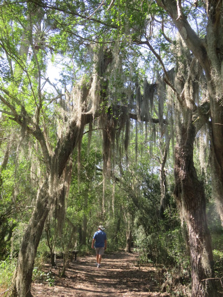
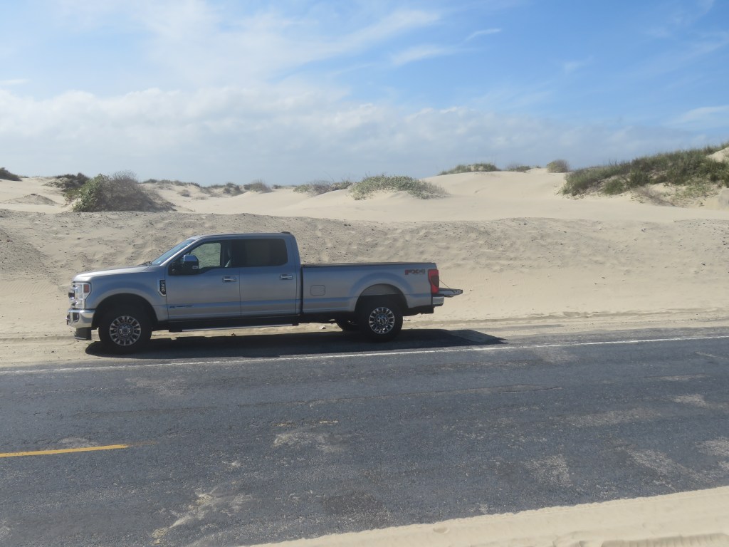
West of Austin–a bounty of beautiful hills, rivers, parks, historic towns, wineries, and destinations for a day or more. Instead of jamming everything together in my usual fashion, I decided to write a series of three shorter blogs about three destinations in this area. Muleshoe Bend Recreation Area will be the first.
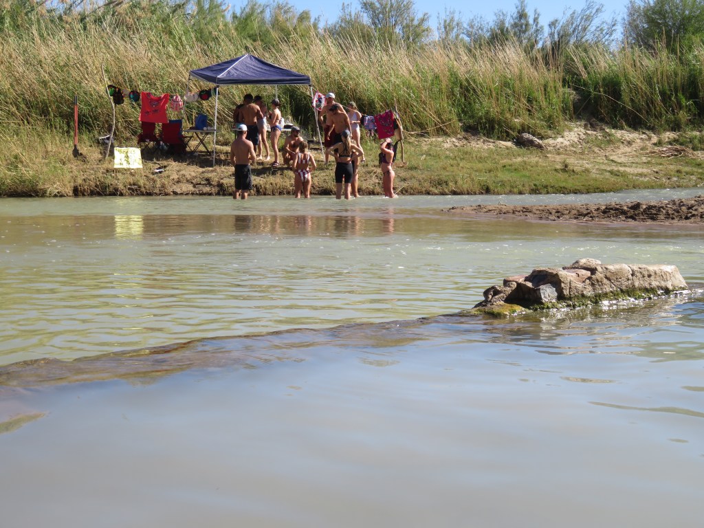
We started to see them when we were in Corpus Christi. And then, driving into central Texas, they carpeted the roads and the fields. Beautiful swaths of color: blue, orange, pink, white. Sometimes just one color, sometimes two or more mixed in. Texas’s highways and byways in the spring are not to be missed. What am I talking about? The wildflowers, of course! If you have not been to Texas in late March or early April, it should really be on your calendar for next year. And now, I can tell you where the Shangri La of Texas wildflowers is: Muleshoe Bend Recreation Area.
Muleshoe Bend is an LCRA park, the same as South Shore Lake Bastrop where we had stayed earlier. LCRA stands for Lower Colorado River Authority, a non-profit public utility that provides water stewardship and electric energy. While at South Shore, I picked up a little magazine that listed all of the LCRA parks. Next to the write-up for Muleshoe Bend was a glossy picture of fields of bluebonnets. Wildflower heaven! This was to be our first weekday trip for our Austin stay; the flowers along the roadways seemed to be at their height of blooming and I did not want to miss them.
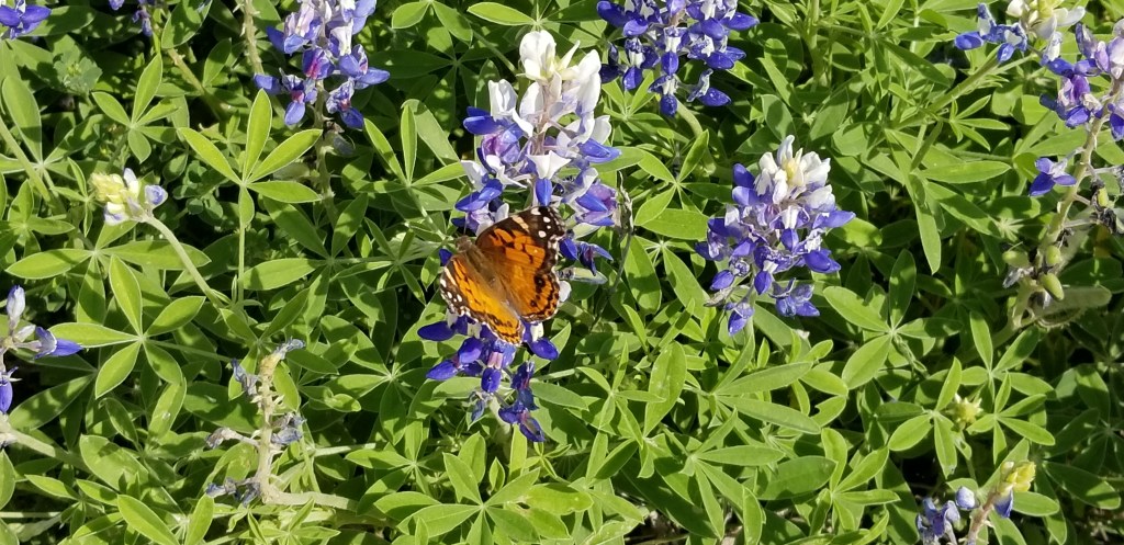
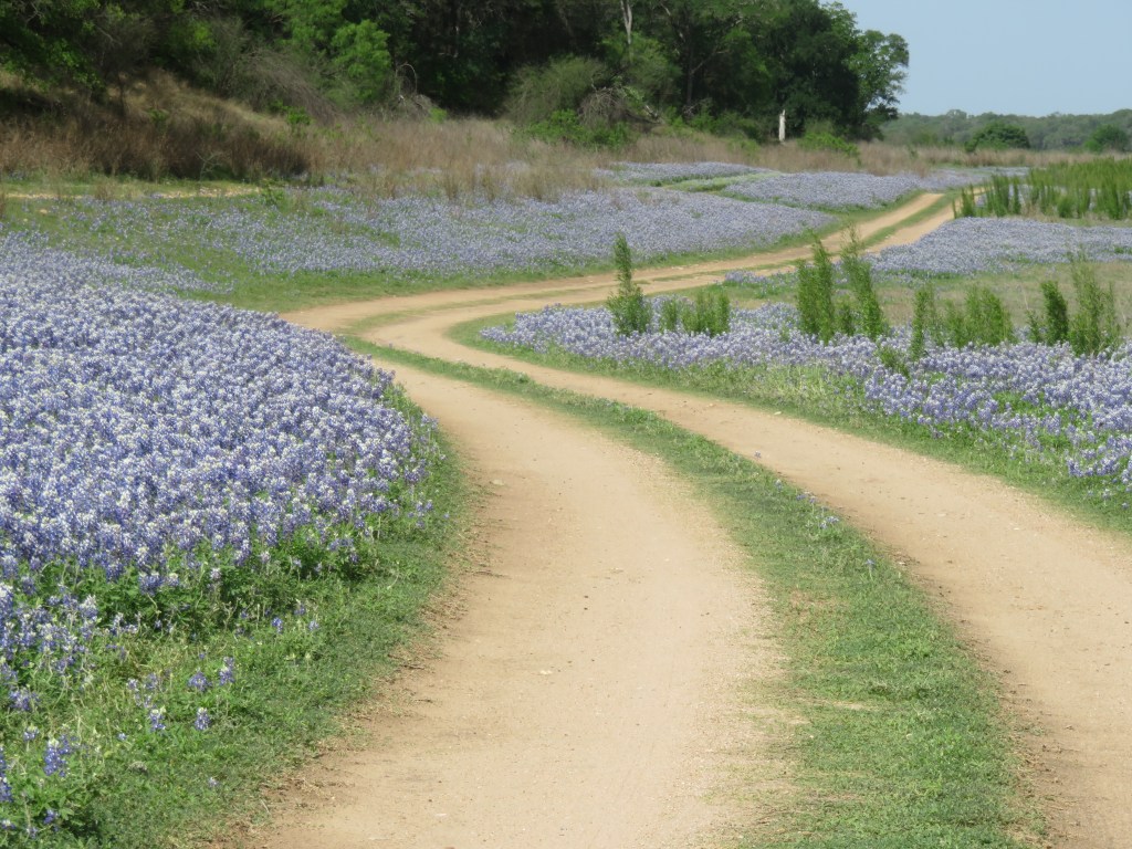
I didn’t know if the magazine had overhyped the flowers. Arriving in the park, we stopped to look at a map and found a trail to hike. While looking at the map, I noticed a small handmade sign close to the ground that said just: “Flowers”, with an arrow. We decided to follow that first. The road was dirt, dry and dusty. There were more signs so we kept going. And then, this:
The picture above was my first look, and it was only in one direction. There was more! Here I am, as happy as can be, in those beautiful bluebonnets:
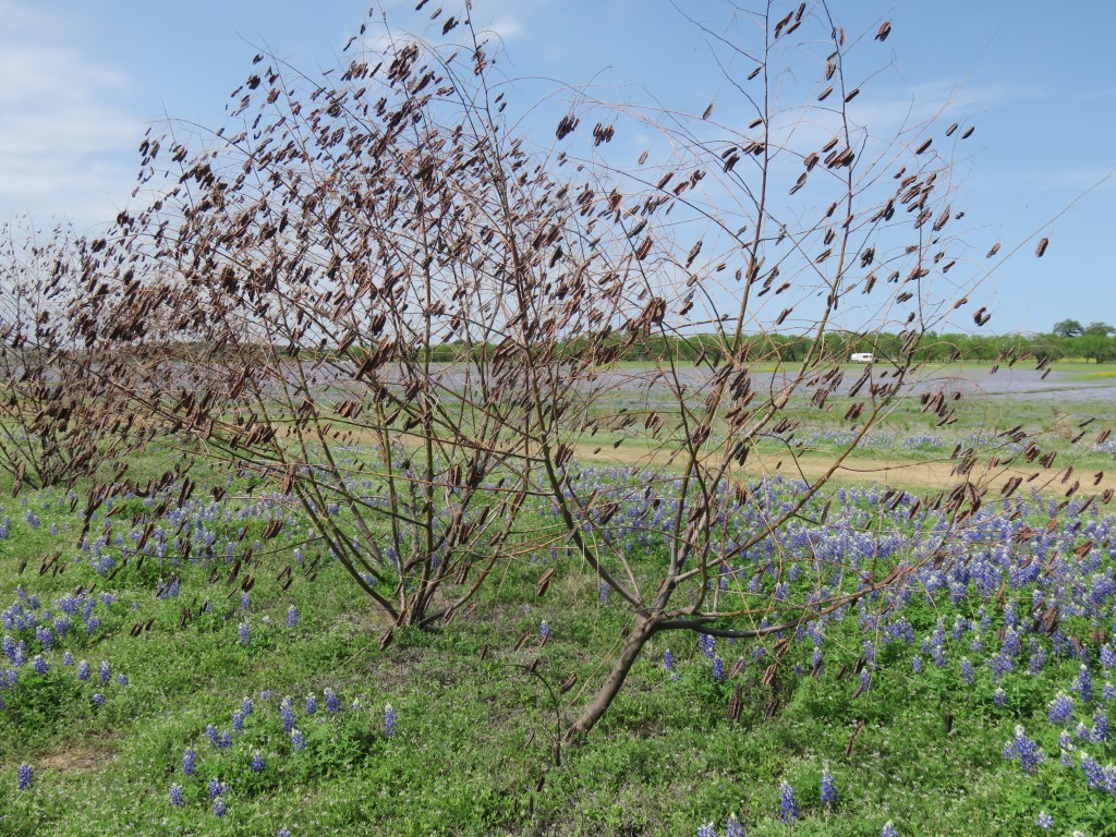
All was quiet here, except for the seed pods on these bushes clacking in the wind:
We hiked, we took in the flowers and the views, listened to the wind and the pods and the birds, watched tiny butterflies flit about, and I took the time just to be still with the camera put away. A place like this is good for the soul.
The whole huge area is bounded on one side by the Colorado River. The river here was very low when we visited. There are a few houses on the bluff high above. It looked like the steps behind their houses were supposed to go down to boat docks in the river below, but the docks are sitting on weeds. It’s been a long time since the river has been at capacity. You can see one or two houses in the background of this photo:
The river is still there, although you can’t see it in the above picture. Here is a better view below. In light of all the beautiful flowers, I wasn’t focused on taking pictures of it.
We abandoned the trail we were going to hike. There is another, going through the flowers and around the hillside, that we ended up on while flower gazing. Or maybe it’s a park road, I don’t know.
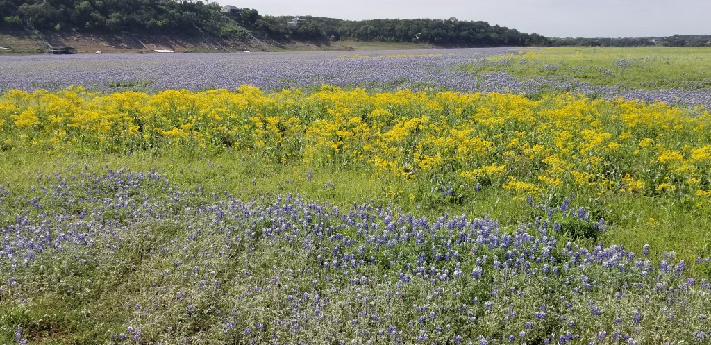
There was an eye-catching area filled with white prickly poppies, too.
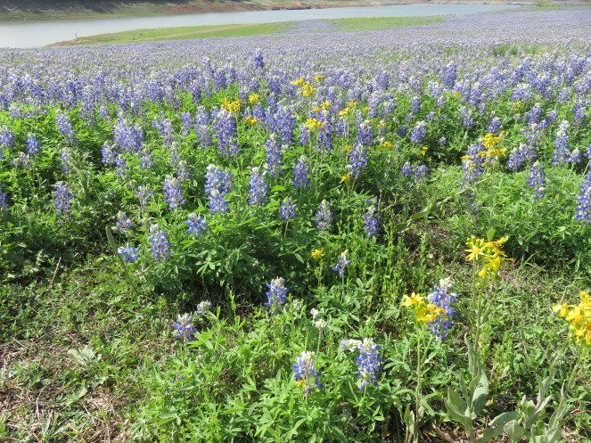
I thought that seeing the massive splendor of all of the flowers here was almost as good as visiting the monarch butterflies in their migrating place in Mexico this past early March. And that is saying a lot.
I wouldn’t come here on a Saturday or Sunday, though! I’m sure that on the weekend, with flowers in bloom, that this place is packed.
My never-ending quest for a warm winter is what led me to book a stay in Harlingen this past January and February. Harlingen is almost as south as you can go without bumping into Mexico.
The town is part of an area known as the Rio Grande Valley. The “valley”, or the RGV as it’s sometimes called, is bounded by South Padre Island on the east to Mission on the west. This whole area sits just north of the Mexican border. It’s not really a valley, but mostly part of a flat scrubby coastal plain.
The RGV is a popular place for “snow birds” from northern states like Michigan, Wisconsin and Minnesota, and the whole area has a plethora of RV parks. The snow birds are welcome here; they have a huge positive effect on the local economy. I have posted about all of our trips down to the Gulf; what else is there to do?
Plenty, as we found out. I will try in this blog to give you a little flavor of what our life here was like.
Closest to us and just a short ride on our new e-bikes (more on that later) was a large Iwo Jima monument. I took a picture of Cal in front of it just to show how he was dwarfed by it.
The original statue is in Arlington Cemetery. The sculptor, Dr. Felix W. de Weldon, gifted this full-size model of his statue to the Marine Military Academy across the street. It is 32 feet high. It is made of molding plaster prior for casting in bronze; the constant temperature and humidity here were thought to be perfect for its preservation. All of the conflicts that our country has been in are etched around the base of the statue.
Still on our bikes, after seeing the memorial we also drove right past the Valley Airport doors. That’s how small it is! I flew out of this airport when I went to New Orleans. It only has seven gates.
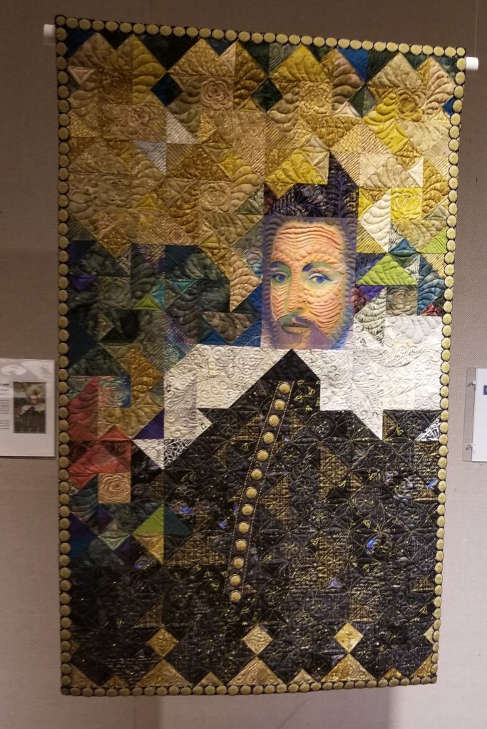
Harlingen Arts and Heritage Museum was also near our park. They had a quilt show in their exhibition area. The quilt show had a Shakespearean theme and this quilt was inspired by the bard himself.
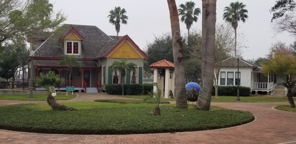
Stepping outside the exhibit and entrance, we could see the 1904 home of Lon C. Hill, along with other historic buildings. According to the museum brochure, Lon was a “lawyer, store keeper, hotel owner, farmer, sugar mill owner, developer, builder, brick kiln owner, canal builder, Statesman, pioneer and visionary.” What a busy guy! His wife died when he built the home, leaving him with eight children.
Len’s house is on the left
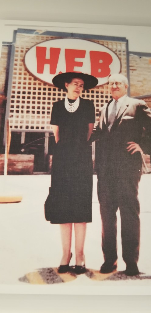
One of the things we love about Texas is being able to grocery shop at HEB. To me, it is the best grocery store chain of anywhere we have been. How can you complain about a store with a tortilla bakery? But what does the abbreviation mean?
It is explained at the historical museum here. The H.E. Butt family donated the building housing the museum to the city back in 1967. Howard Edward Butt took over management of the family grocery store from his mother, Florence T. Butt, in 1919. She founded it and ran it for fourteen years, so why isn’t the store named for her? Well, that’s a mystery. Howard and his wife are in this somewhat grainy picture.
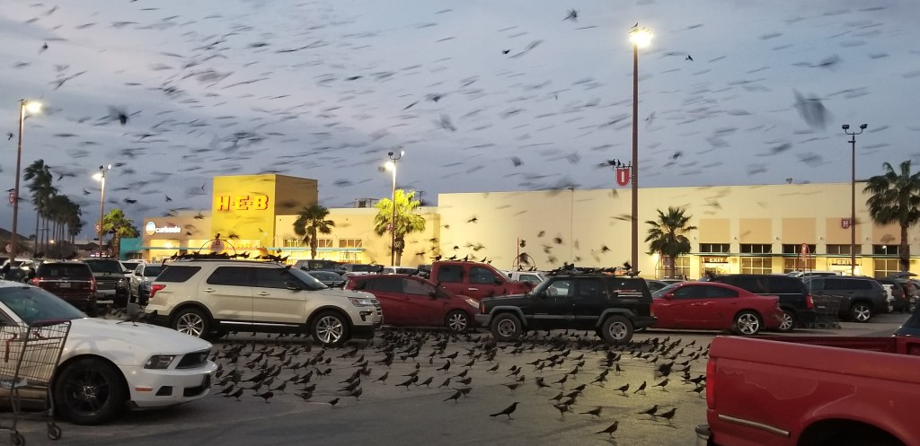
Shopping at our local HEB one evening, the grackles totally took over the parking lot. It was raining birds! We even saw the parking lot on the evening news the next night. It was the time of year when grackles come from where ever they are all day and congregate. I guess even grackles like to shop at HEB.
Speaking of birds, there are plenty of places to go see them in the valley. The area is part of the migration flyway for birds. We took a walk in Hugh Ramsey Nature Center in Harlingen and came upon a yellow-throated warbler that you can see in the branches below, keeping an eye on the two turtles below.
At the beginning of our Hugh Ramsey walk, we spotted a couple of javelinas in the underbrush. That was exciting, until at the end we found the whole herd!
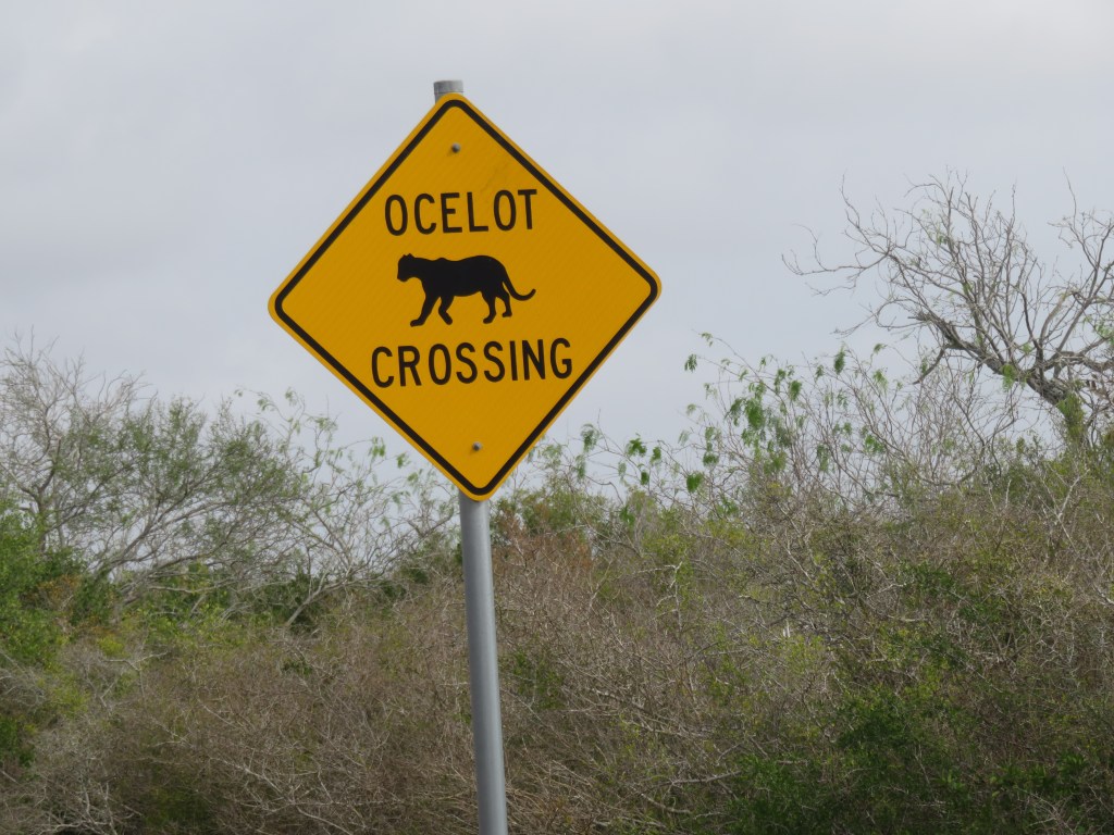
I hoped to find more wildlife at Laguna Atascosa National Wildlife Refuge, about 30 miles from our park and a place we walked twice. A sign at the beginning of the park road was promising:
I would have loved to see an ocelot, but I knew it would be a stretch. Much later, we watched a nature show about the wildlife of Texas and were able to see what this cute little cat looks like. Laguna Atascosa is only one of two of their remaining habitats in Texas, and only 100 are known to exist in the entire United States. This wildlife refuge is trying hard to encourage their reproduction but they have a lot of predators; it’s not an easy task for an ocelot mother to raise a kitten to adulthood.
A huge part of their mission is to provide habitat for wintering water birds, and other migratory birds. It is a bird watching destination for those who enjoy the hobby. We saw green jays at one of the feeding stations at Laguna Atascosa. I suppose if I wanted to be a serious bird watcher, I’d need to get to the refuge a little earlier in the day.
Most of this park is coastal wetlands. We did see egrets in the large lake here, and an alligator, but it was far in the distance.
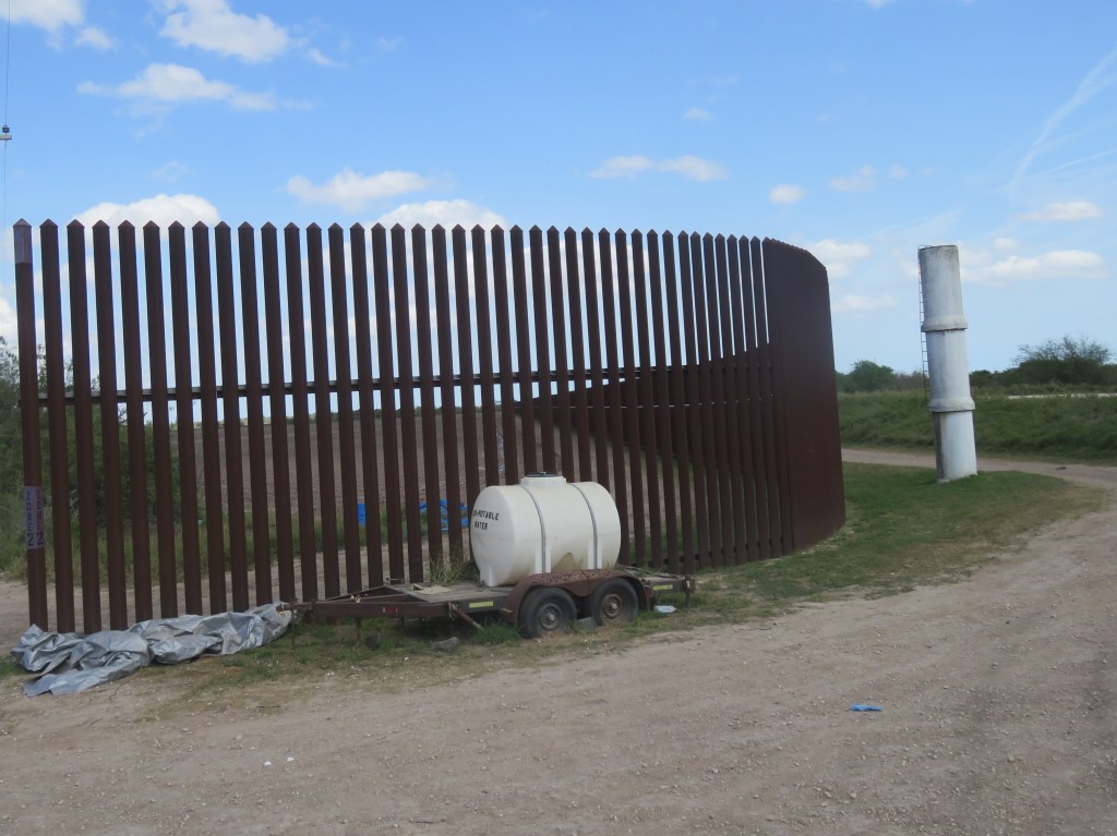
On another day we headed down to Sabal Palms Preserve, which is the last remaining stand of the great sabal palms that used to cover the area. An interesting part of visiting this preserve, as we discovered, is that it is right on the border with Mexico. We drove right past the fence.
Passing through this fence was a little confusing but somehow we were still in the United States. Two members of the National Guard were sitting on the levee by their truck as we passed. Sabal Palms closes right at 5:00 and the gates are then securely locked. There is plenty of illegal border activity here, as we later found out.
Long ago, before land was cleared for farming and there was no international border, there were about 60,000 acres of Sabal Palm forest along the Rio Grand River. Now there is less than 100 acres.
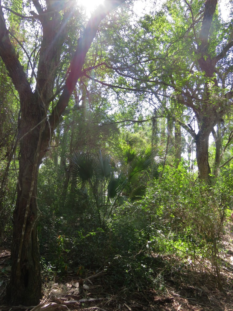
In my working days, I was thrilled when I vacationed somewhere during a long winter where I was able to see palm trees. Now I’m happy to see palm trees all winter long. They and other trees lined the beautiful trails in this park.
Part of the draw for Sabal Palms is the Rabb Plantation House. It was once part of Rancho San Tomas, which covered 20,000 acres. The house served as the headquarters for the ranch and was an architectural shift from typical ranch homes of the early 1900’s era. We were able to look around the first floor inside.
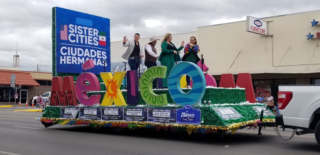
On one of our first Saturdays in the area we drove all the way past McAllen to Mission, on the west side of the RGV, for the Citrus Festival and Parade. It was good small town fun.
The best thing about the Citrus Festival was that we were able to buy two large bags of fresh citrus – one orange, one grapefruit – for $5.00. What a steal!
Harlingen still has a fairly vibrant old downtown, which was another thing that scored points with me. There is a smattering of thrift shops, antique malls, and other specialty shops, plus some eating establishments. Once a month on a Saturday, the streets are blocked off for Market Days. Vendors under their canopies line the streets. There is music and plenty of good Mexican and other food to be had, too.
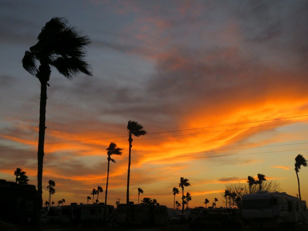
I guess if one drawback can be given about the area, it is the wind. We learned to gauge the weather by very windy, not too windy, and not windy at all. I got used to it because I discovered I didn’t mind the wind as long as it was warm – which it usually was, even in the evenings.
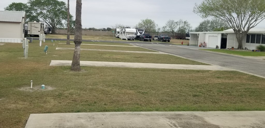
The sites next to us were empty most of the winter so we had a good back yard view. The park is bordered on three sides by farm land and it felt like being out in the country.
When we were at home in Tropic Winds, there were many things to do. I attended yoga and line dancing classes. Cal was outside a lot and chatted with all the neighbors around us. A fruit-and-vegetable truck showed up on Mondays. There were sometimes music concerts to listen to, and few special dinners. The spaghetti dinner put on by the woodworking group is a twice-annual event that everyone looks forward to. The spaghetti is delicious and prizes are handed out throughout the evening.
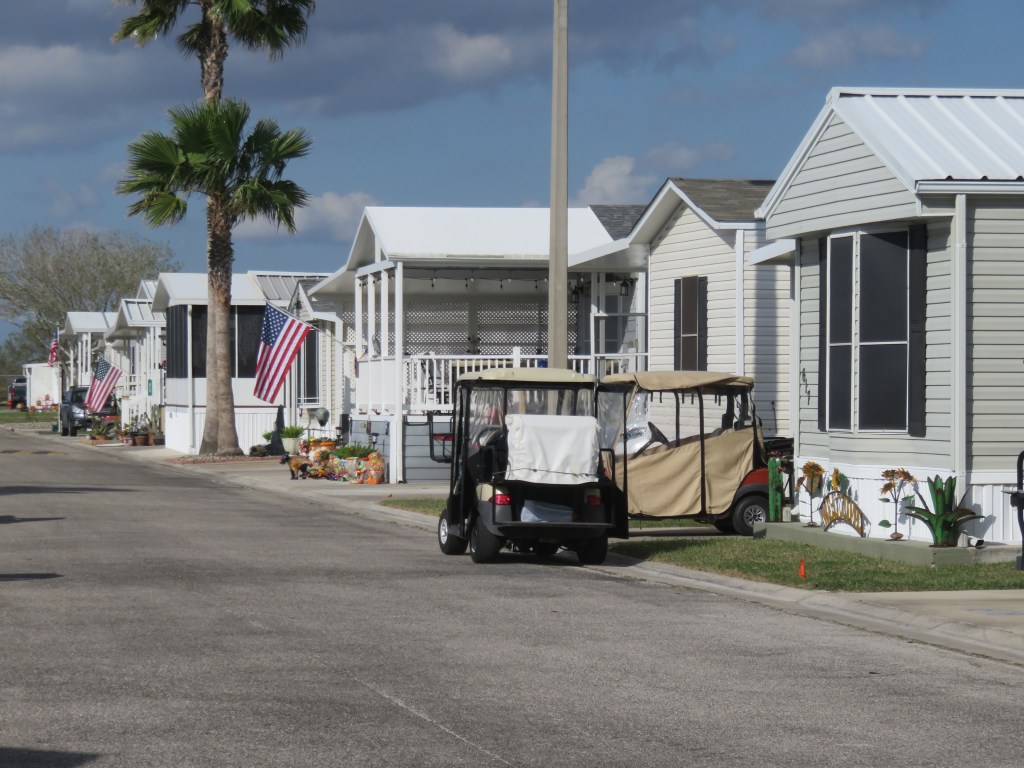
There are all kinds of ways to RV and we discovered last winter in Phoenix that settling down in a park like this for just a month or two during the winter gives us the community that we don’t have the rest of the year. The permanent park model and manufactured homes that lined the street across from our RV area made the place feel a little bit like the quintessential small town. As I walked the little streets I’d most always be greeted by everyone passing by, whether they were walking the dog or riding their bike or golf cart.
In the late afternoons, friends gather around RV sites, on front porches, or around someone’s golf cart when they are passing by.
Everyone decorates their little home in their own particular style.
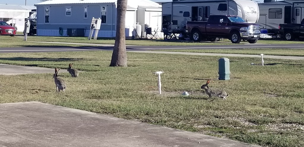
Jackrabbits make their home here, too. These RV sites were empty most of the winter and I always looked forward to seeing how many were out playing or basking in the sun.
Anywhere and any way you call it, there’s no place like home.
The day after we arrived at our winter spot in Harlingen, our park activities department hosted a free doughnuts and coffee morning. Not one to ever turn down a free doughnut, Cal set off to the main hall to take part. He disappeared for quite a while. Just when I was starting to wonder what happened, he returned with tickets for a 4 hour cruise, a Branson-style Kenny Rogers sound-alike concert by a gentleman named Rick McEwan, and a brochure for a tour to Mexico. Neither he nor I connected beforehand that it was an event where options for things to do for the winter were presented. It turned out to be an expensive doughnut!
Booking the actual date of the cruise with Osprey Cruises proved to be difficult because it was hard to find a day when the weather was optimal. That was part of the reason for the two-night stay in South Padre Island which was the subject of my last post. We were to cruise on the morning of the day we checked out of the hotel. The cruise leaves at 9AM and passengers are to arrive at 8:30, so we thought we would spare ourselves a long early morning drive. As it happened, though, it was more windy than usual that morning and a storm was predicted. The cruise company canceled the tour.
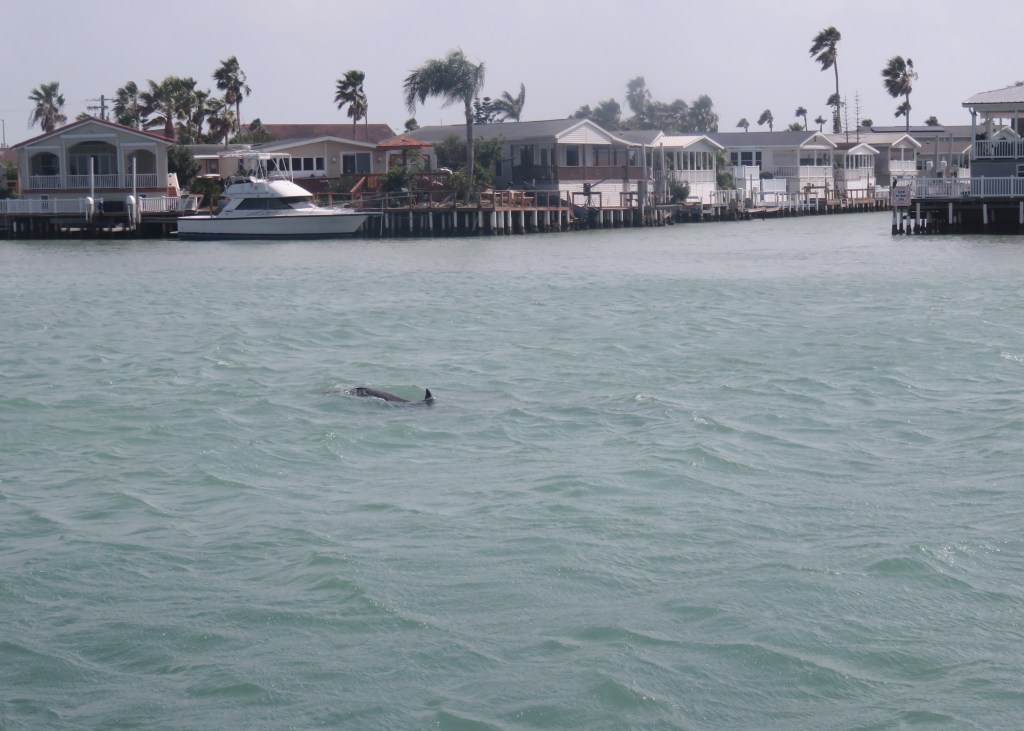
We finally found a good weather morning just over a week before our departure from Harlingen. We took off from the dock at Port Isabel–
and cruised under the Causeway bridge through the Laguna Madre. It was so exciting to see dolphins for the first and only time on our visit to the Gulf. It’s hard to get good pictures of them, but you can see one in the picture below.
We went past a rotating bridge, which opened its gate for us.
And then, we were inside the Port of Brownsville waterway. The deepwater shipping channel is 17 miles long and 42 feet deep with 40,000 acres surrounding it. After we went through the bridge, the boat passed through miles of sand and brush. We could see a protected island that is prohibited for us humans to enter and it was full of bird life.
Many birds also filled the shore line.
We soon came to the shipping boneyard. Huge rectangles are cut out of the hulking ships. Those rectangles are cut and ground into steel pellets and reused.
There is currently even a military ship being scrapped. The Kittyhawk is one of the great diesel aircraft carriers built in the 60’s and the last to be decomissioned. It is here being taken apart bit by bit. I could still imagine the sailors waving on board the decks.
There is a lot of scrap to be processed. I enjoyed watching everyone hard at work while we just cruised on by.
There are little pretty little tugboats to be seen. I liked this one which reminded me of St. Joseph, Missouri, in the state I used to call home.
At the other end of vessel life, ships are being built here, too. This one will go to Hawaii. It is to be a container ship for a large shipping corporation there.
There are docking spots for ships to stop and unload goods or just to have a lay by. This ship holds the immense blades that will be installed on windmill farms.
It was time to visit the Brownsville Shrimp Basin. Shrimp boats need repairs, too, and some are in dry dock for that reason, or for a new coat of paint.
You would think that shrimp boats would be out catching shrimp on a workday, but many were docked as we went through the Basin. Currently, it is too expensive for the small-time operators to purchase gas. It costs about $75,000.00 to fill up the tank on a shrimp boat! It is hard to catch enough shrimp to recoup that cost.
And then, the Big Shrimp Handoff: we pulled in to Texas Gold Shrimp Company and two men were waiting there to hand us two big containers of shrimp. No sooner said than done, and we were off again.
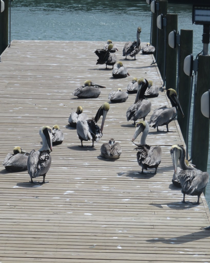
We caught all the action from the best seat in the house: the front of the boat. From our position, it felt like we were the only ones on the cruise. It was definitely windy, cool to start, and once in a while we were splashed, but we persevered and the morning warmed up as it went on. Going in and out of the shipping area, there was a long period where we were just sailing with nothing more special than sand and the sea to see. The captain stopped his narration at times to play 70’s music ( what I call Boomer Music). Going out I was munching a doughnut. Coming back I was tucking into a nice bowl of peel and eat shrimp with a cup of pina colada. The dolphins were playing again, and pelicans awaited our return at the dock. Could life get any better than that?
Oh, and the Rick McEwan concert? He was great, and we enjoyed our evening very much.
Next time – about that brochure for a tour to Mexico…
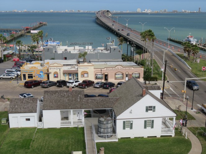
Port Isabel and the Queen Isabella Causeway leading to South Padre Island, as seen from Port Isabel Lighthouse
During our Texas stay, we made three trips down to South Padre. On our first, Cal had the brilliant idea of staying a couple of nights so we could be here for more than just one day. It didn’t take us long to get reservations booked after that suggestion. Our second visit, then, was our little mini vacation-away-from-our-permanent-vacation. The morning of the first day was our visit to Boca Chica that was in my previous blog.
South Padre Island lies just off the coast of extreme south Texas. The water in between the mainland and the island is part of the Intracoastal Waterway which goes all the way around the Gulf to the Mississippi River at New Orleans. It is also the southern part of the Laguna Madre, a long and shallow lagoon. Port Isabel is the last town before the bridge to the island.
We stopped at Port Isabel Lighthouse just before getting on the bridge.
Construction on the lighthouse was completed and lamps were lit in 1853. There was a period of stoppage during the Civil War. During that time, both sides used the lighthouse for observation. The last battle of the Civil War happened near here, more than a month after Lee’s surrender at Appomattox.
We climbed up 75 stairs and 3 ladders before we arrived at the top. There we were rewarded with the view that you see at the beginning of this blog. It was also interesting to get a look at the multifaceted lens. For those interested in such details, it is a reproduction of a 3rd Order Fresnel Lens. It was installed just this past December so that the lighthouse was lit for the first time in 117 years at that time. That must have been a sight to see!
Being able to stay on the island meant that we didn’t need to get up super early to get a good start on our day. We visited South Padre Island Birding Center. This was an excellent stop. We started in their museum, which was mostly a very cute and adorable collection of baby alligators and turtles. Directly outside were some adult versions of the same. These animals are not able to be rehabilitated in the wild so they make their home here.
Big Padre and his little buddy
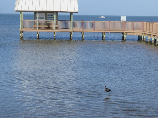
There were about a half mile of boardwalks over fifty acres of wetlands, with many various birds that could be seen.
An egret on a fishing expedition
From the boardwalk, we could look over the salt marsh, and down into the shallow waters where we could see the reason for the assortment of birds – there was an abundance of fish in all sizes.
The interesting thing about the Laguna Madre is that it is hypersaline, meaning that it is saltier than the ocean. There are only five other lagoons like it in the world. The water evaporates faster than freshwater flows into it because of the dry climate, its shallowness, and the fact that it has no significant river source.
A gathering of ducks and roseate spoonbills
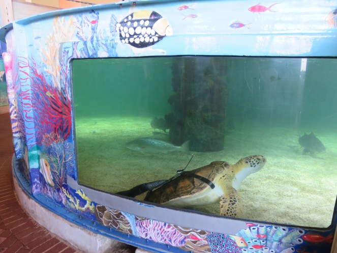
Right next door to the birding center is Sea Turtle Inc., which is a refuge and hospital for sea turtles. South Padre Island is a nesting hotspot for Kemp’s Ridley turtles. The center also has several Green turtles. In 2022, they were able to rehabilitate and release 89 turtles, and protect 7,403 hatchlings. We were able to see large tanks of turtles who were not able to be released back into the wild.
Gerry, an Atlantic Green, who is a permanent resident
I was impressed at their ingenuity in giving the turtle below a new lease on life. Allison was missing three out of four of her flippers due to a predator attack, and all she could do was swim in left circles. The staff at the rehab center rigged up a brace so she can swim freely, although she cannot be released back into the wild.
Their hospital is under a tent while a brand new facility is under construction. They have smaller tanks in the hospital for those turtles who are still in states of rehabilitation. When it is exceptionally cold, sea turtles become cold-stunned. They are then weak and inactive, floating to the surface and washing up on the island. There is only a short period of time when they can be rescued. This past December a cold period happened where the organization rescued many turtles, and we saw five in the hospital which were still not yet ready to be released back into the wild from that event.
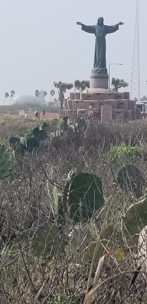
On our final trip out to South Padre we went out to the rock jetty where most of the turtles are found. It is on the very southern tip of the island in Isla Blanca County Park. It extends way out to sea. We did not see any turtles, but near the jetty is this statue:
It is a memorial to fisherman lost at sea. If you look closely on the left, you will see a grounded weather balloon.
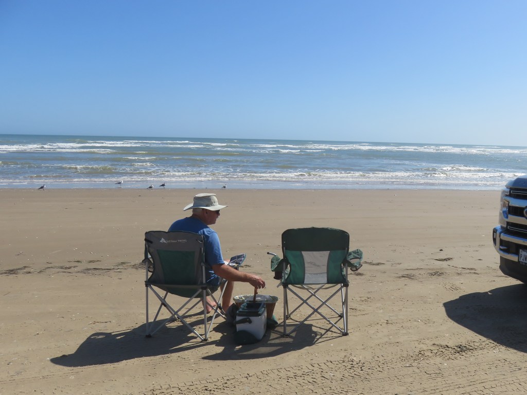
Certainly, the main thing about going to the island is the beach! Driving all the way north of the island, the hotels and condos recede into the rearview mirror, and all that’s left is the dunes and the sea. That’s just the way it ought to be. The road just ends. You can drive on the beach and we could have turned around and headed to the last beach access, but that would have been too easy. We just parked the truck and hiked through the dunes with our Subway sandwiches and lawn chairs.
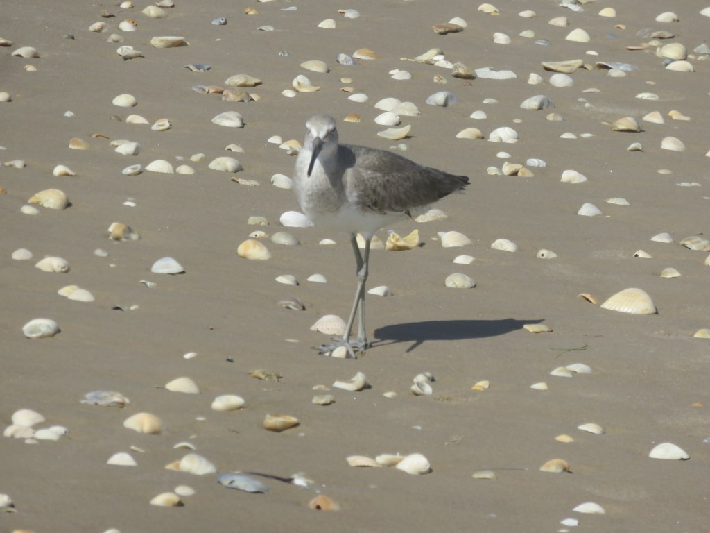
This friendly little bird led the way for quite a while on my beach walk
Next time – a cruise through the Port of Brownsville
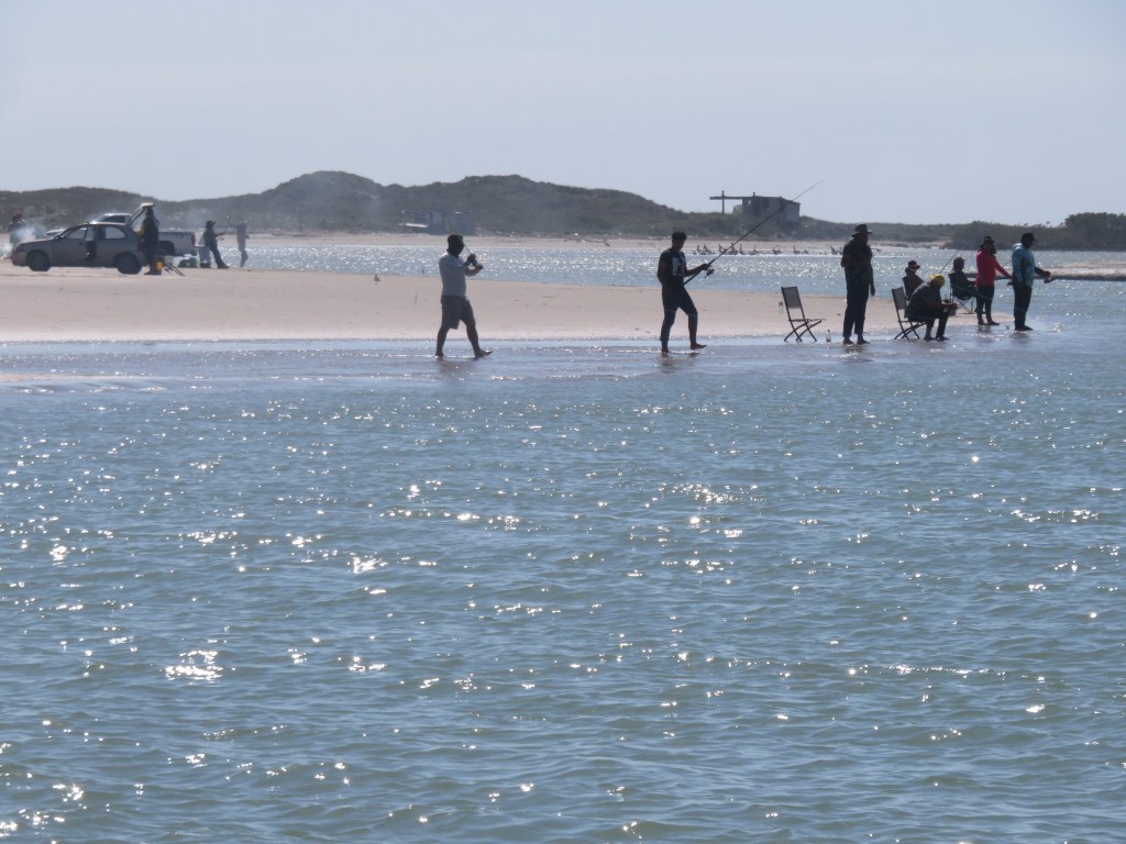
An almost-two month stay from January to March in Harlingen, Texas offered several opportunities for trips down to the Gulf of Mexico. The area lies at the southernmost tip of Texas. From our park, it was an hour drive. On our second trip in that direction, we headed to the nature preserve at Boca Chica Beach. You can’t go any further south in Texas, or the United States, on the Gulf than Boca Chica.
Rocket launch fans would know this area as the home of SpaceX. Indeed, as we headed down the road toward Boca Chica, we couldn’t miss seeing the rockets sitting in place. There are days that SpaceX closes the road for a launch or to move their rockets around. We didn’t know that we should have checked first to see if the road was open, so I guess we were lucky that we could pass through.
I took the picture on top from our truck as we were driving by.
Then, further down the road, another site:
The road ends at Boca Chica Beach. The beach itself is drivable. A right turn from the road’s end, and there you are. I was conflicted about SpaceX. On the one hand it is exciting and interesting to see. On the other hand, I didn’t like seeing it from an otherwise pristine beach that had been all natural until they arrived.
SpaceX as seen from the beach
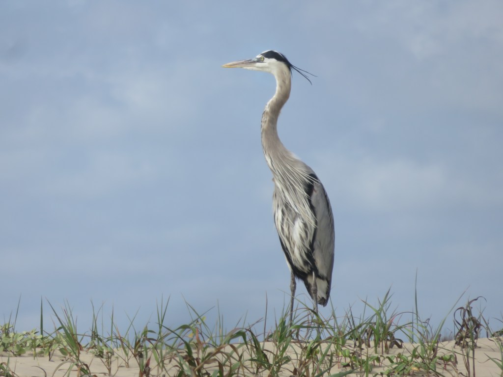
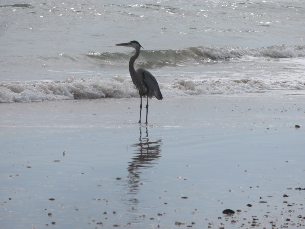
I turned my back to it and just enjoyed the beach. A great blue heron stood sentinel, as if to reassure me that all was still okay in his world.
There were long stretches of beach that were deserted except for the birds:
We talked to some park rangers who were congregated for a chat. They informed us that if we drove further down the beach we would see a lighthouse. Off we went, and thankfully left SpaceX in the distance behind us. It was about a mile or two down, and once we arrived, we found people again.
I must have missed something the rangers said (or they assumed we knew), because the lighthouse is in Mexico. And here is the mouth of the Rio Grande. It never ceases to amaze me how many times we cross paths with this river. The lighthouse is off in the distance, but you may be able to see it in this picture.
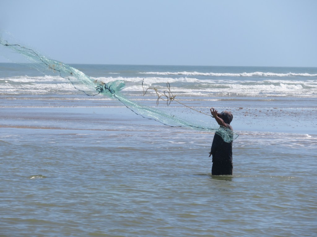
The Rio Grande makes its way west in the picture below. The river is very deep where it meets the ocean; the fishing must be good.
A fisherman casting his net
A pair of pelicans observed the action from the American side. The land right up to the river is still part of the Boca Chica Wildlife Refuge.
We had a picnic lunch on the beach before making our way out to further adventures. It had been a great beach morning at Boca Chica.
Life is good.
I was going to put all of our Boca Chica and South Padre adventures in one blog, but it would have proved to be very long. Our Boca Chica morning was part of a trip to South Padre Island. That will be for next time!
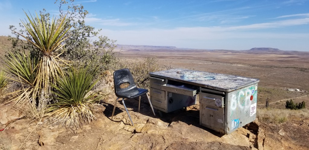
Back in the Eighties, three students decided they needed a quieter place to study than their dorm rooms at Sul Ross University. They hauled a desk and a chair all the way up the hill behind their dorm. They greatly enjoyed their spot and spent a lot of time up there. One of them accidently left his notebook in the desk, and when he returned for it, he was surprised to see a hiker had signed it. The notebook, the desk, and the chair became the stuff of legends. By now the desk has been replaced two or three times and there are several filled notebooks in a museum. I kept running into suggestions to “Hike to The Desk” in my research for this area of Texas, so we did.
It isn’t the easiest hike. The trail is only 1.3 miles to the desk, but there is a 219 foot ascent on a rocky and uneven trail. Once up at the top there are several trails crisscrossing each other and we had to ask some other hikers where to go. It is on the opposite side of the hill from the university. I couldn’t believe they hauled a metal desk all the way up there! These bicycles in a tree let us know we were finally almost there:
Cal signing us in The Notebook
On the side of The Desk
Sul Ross University and Alpine view before our final descent
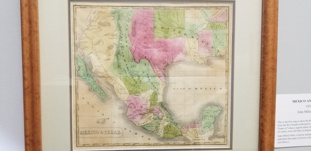
Once down, we visited Museum of the Big Bend, since it was located on the university campus. Being a fan of petroglyphs, I thought this 17 foot replica of a remote petroglyph was interesting. The original was done in six colors of pigment and belongs to a hunting gathering culture dating back to 700 AD. The meaning is unknown, although archaeologists think it relates to their belief system. It looks like a lot of scribbles to me, but what do I know?
There were some very old maps, and I also liked this recreation of a general store, back in the 1800’s:
An 1836 map of Texas, the first to show the Rio Grande to the 42nd parallel
There was an art festival going on in the town, which was a huge deal before COVID hit and canceled it last year. Someone in an information booth gave us a walking tour map to see Alpine’s murals. It was fun looking at these. These were some of my favorites:
A pretty little courtyard
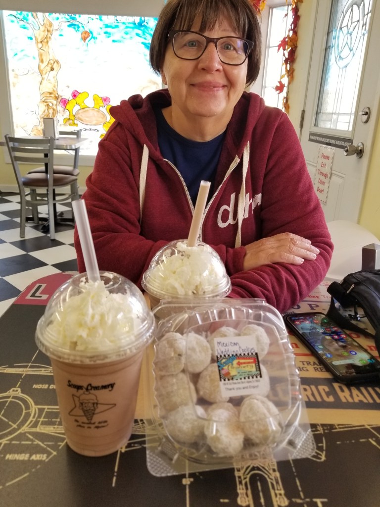
If I could pick Alpine up and move it closer to my family in Denver, I would love living there. It is a small, walkable little university town with a lot of flavor. And the milkshakes and Mexican Wedding Cakes at Scoops Creamery weren’t bad either!
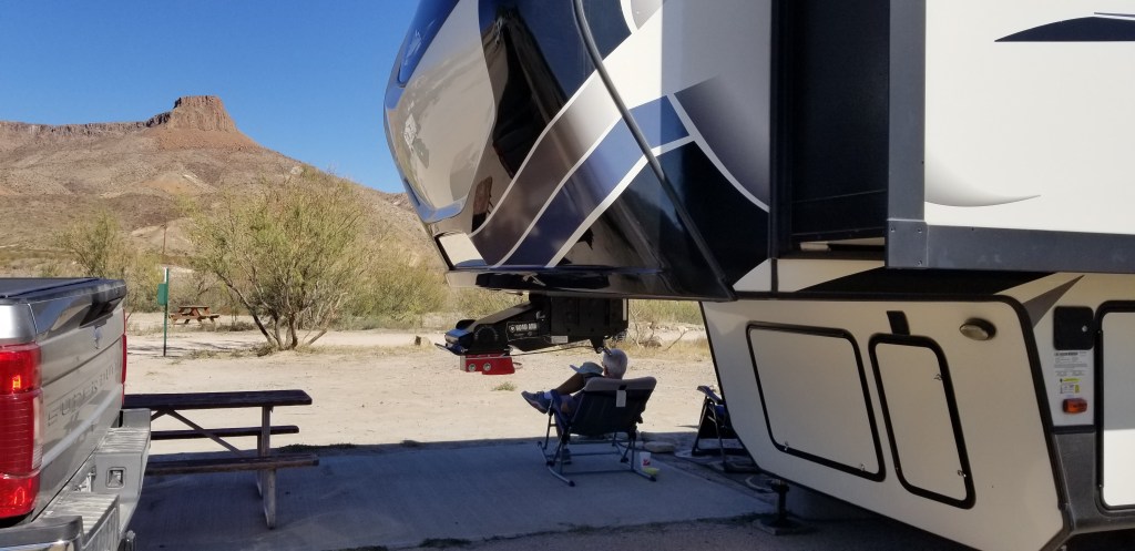
Enjoying the view of Lajitas Mesa from our RV site
Merry Christmas to all of my readers! Life is running a little slower this holiday weekend, so it seems like an opportune time to catch up on where the Twosna Travelers have been. I thought of doing a blog post from Texas to Arizona in one fell swoop, but that was entirely overwhelming.
The truth is, our time in the extreme south of Texas was absolutely golden. We loved the area, particularly the capriciousness of the landscape – flat desert with mostly all one type of cactus here, a mesa suddenly poking up there, a set of hills made out of ancient volcanic ash, canyons and hoodoos. When driving, we would find ourselves all of a sudden in the middle of the most jaw-dropping scenery. The nights were cool and the days warmed up, it never rained, and there was a new direction to head off in every time we were ready to go. If we didn’t, then Lajitas Mesa gave us a wonderful view every time we looked out our window. Here is another view with a look left of the mesa:
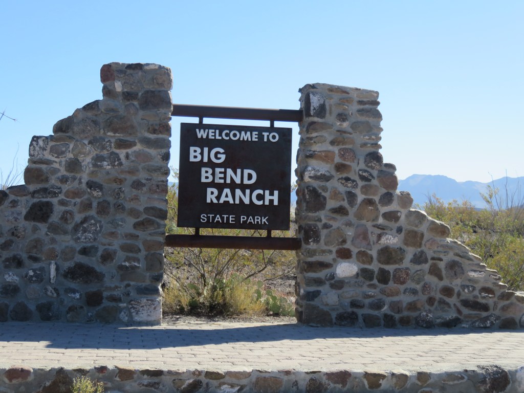
The piles of hardened volcanic ash look man-made to me, as if looking at a quarry or gravel and concrete business. The fact that they have been there millions of years makes it all the more fascinating. This view is partly in a state park. The RV park, and the resort in Lajitas that it is part of, sticks up like a thumb into Big Bend Ranch State Park, and somewhere in there is the border between the two.
It was like a moonscape, and we enjoyed some short hikes right from our RV into it:
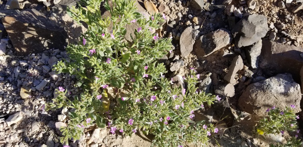
Mexican Heather growing in the wild – something I planted every year in my flower garden
A prickly pear with the biggest spines I’d ever seen. Don’t dare come close!
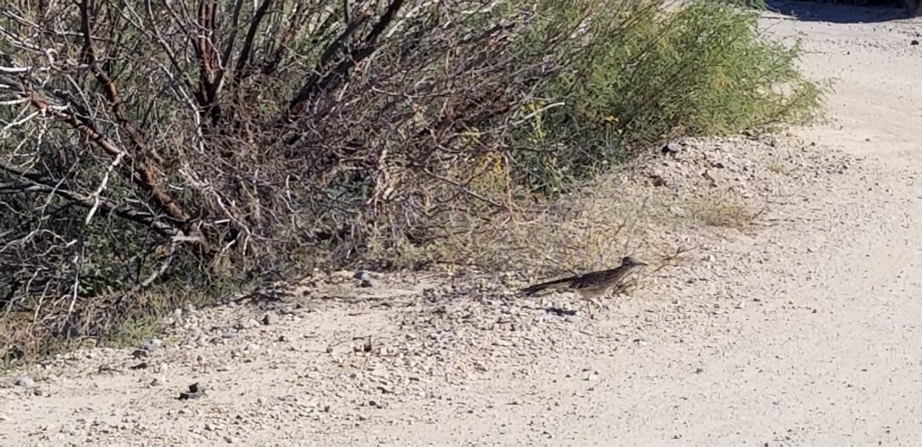
It was a thrill one day to see a road runner cross the path near our RV:
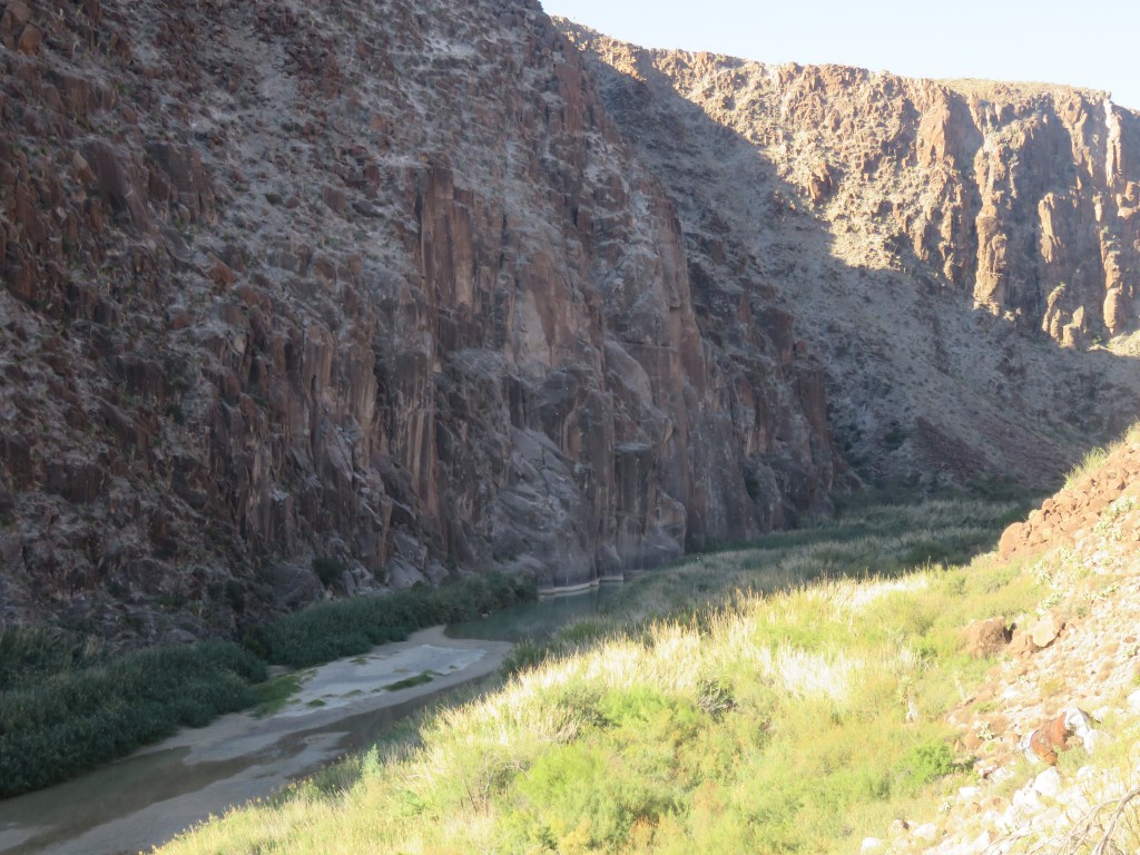
One of the highlights of our time here was the day we drove through Big Bend Ranch State Park. Its border is the Rio Grande River. The scenic road, at the very bottom of the United States, winds up and around hills and canyons, always with the river on the left (going west) so that one is always looking at Mexico on that side, and more of the state park on the right. Here are two views of the river at Madura Canyon:
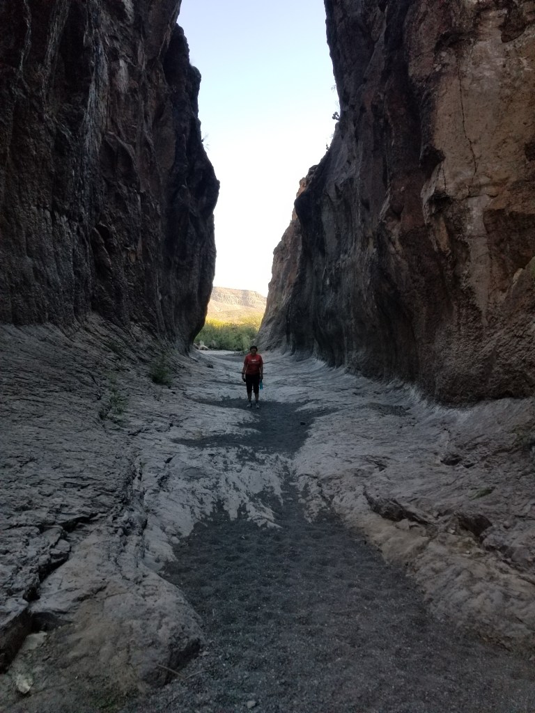
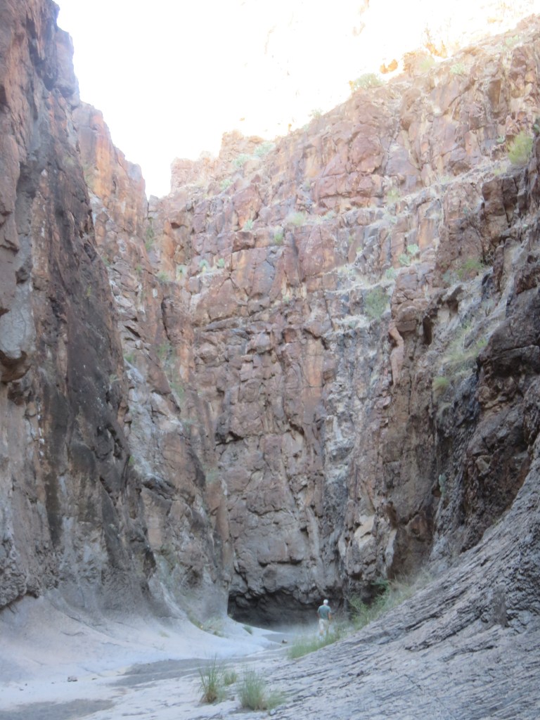
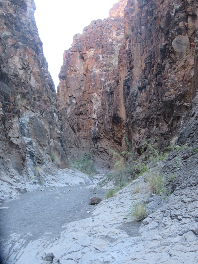
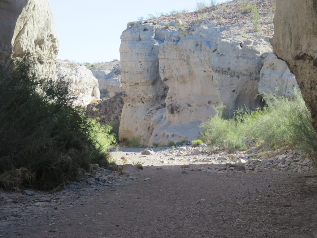
Closed Canyon was a “don’t miss” stop. It was our first slot canyon, and I’m looking forward to seeing more of these as we travel further west. It was marked as an easy-moderate trail but as the canyon walls closed in, the trail became very rocky with steep declines from one layer to the next. The rocks were slick and smooth with lots of crumbly gravel thrown in. We finally called it quits when one dropoff was so deep we couldn’t figure out how we’d get back up!
Entering the canyon – easy enough
The trail was not too bad at first
Cal looks so small compared to those canyon walls!
One of those steep dropoffs!
A place of awesome beauty which made us feel significantly small in the universe
Once back on the road, we stopped to check out a scorpion scurrying across:
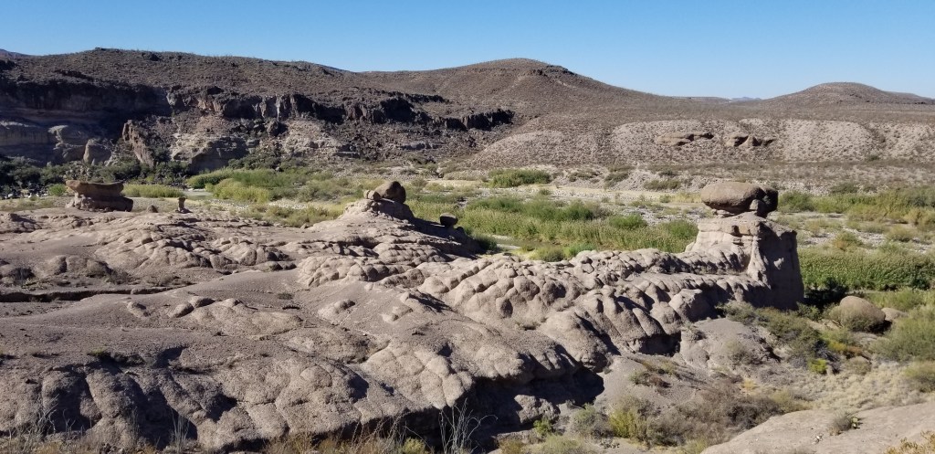
From here, we entered the land of the hoodoos. Hoodoos, by definition, are tall, thin spires of rock that stick up from the desert floor. Mostly they are relatively soft rock topped by harder, less easily eroded stone that protects each column from the elements, and are formed within sedimentary rock and volcanic rock formations.
Along the road, this was our first glimpse of hoodoos, and this one looked like a shaggy dog to me:
Several hoodoos at a scenic stop
Our last stop, Ft. Leaton, was a total surprise to us. We thought it might be another western military outpost, but no…it was a trading post used from 1848 to 1884, but the last family lived here until 1925. The original owner had a Mexican wife, and after his death, she remarried and stayed on at the post. Lots of murder and mayhem went on here, and the post had a major fire in later years. Archeologists have found artifacts, and the Texas Parks and Wildlife completed a faithful restoration job. The walls are adobe and the inside rooms were cool and comfortable. A lonely state park ranger was pretty excited to show us a video and then we walked through. This was a very fascinating stop.
Ft. Leaton
A corner of the inner courtyard
The parlor, one of many rooms in the restored family area
Carretas such as these may have been the first wheeled vehicles to enter the United States when the Spanish first brought them in 1590. The wheels on this carreta are 6 feet tall!
Fully loaded carretas were so heavy that it took 10 to 12 oxen to pull them. The carretas here transported goods, most commonly Mexican silver bullion, on the Chihuahua Trail to San Antonio, Texas.
In the picture below is a fence made out of ocotillo, a common desert cactus.
The view from the bakery window
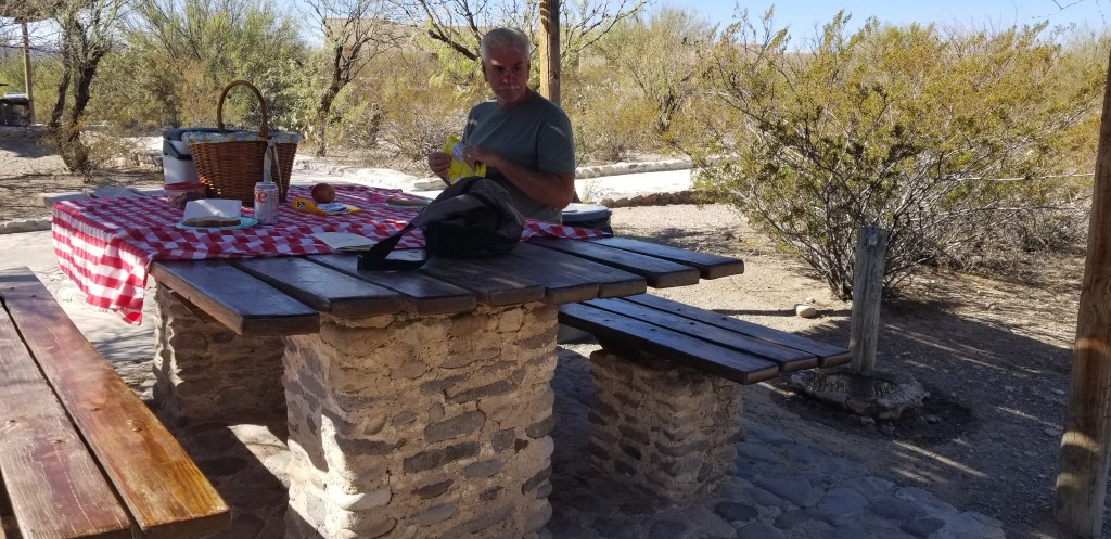
Of course, after this, a picnic was in order!
Before turning around, we decided to drive on in to Presidio, TX and discovered a grocery store! We had been deprived of a real grocery store for weeks, so this was very exciting. There was also a plethora of various dollar stores owing, we think, to the fact that Presidio is a Mexican border entry town.
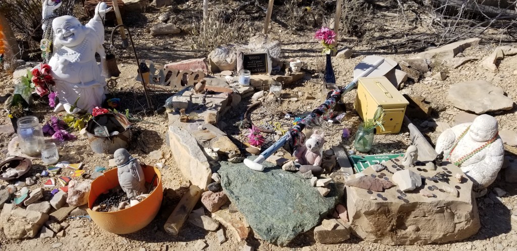
The town of Terlingua was a short drive from our RV park in the other direction. It is a ghost town, but has a small artist colony which makes for some interesting shopping, and a handful of restaurants. The biggest thing that draws people to Terlingua, though, is the cemetery. It dates back to the early 1900s and is still being used. Many of the graves are of Hispanic heritage but then there is a hippie vibe to it, too.
In the early 1900’s, Terlingua was a mercury mining town and helped supply the WW1 war effort. The town was booming but there were mine accidents, gunfights, and the 1918 influenza epidemic. The town declined through the mid-1900’s and demand for Terlingua’s mercury was not repeated during WW2.
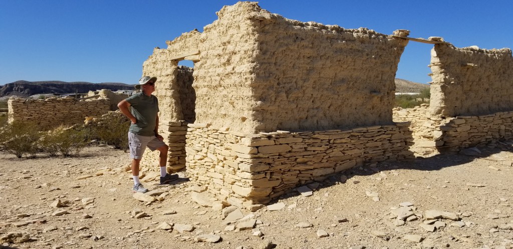
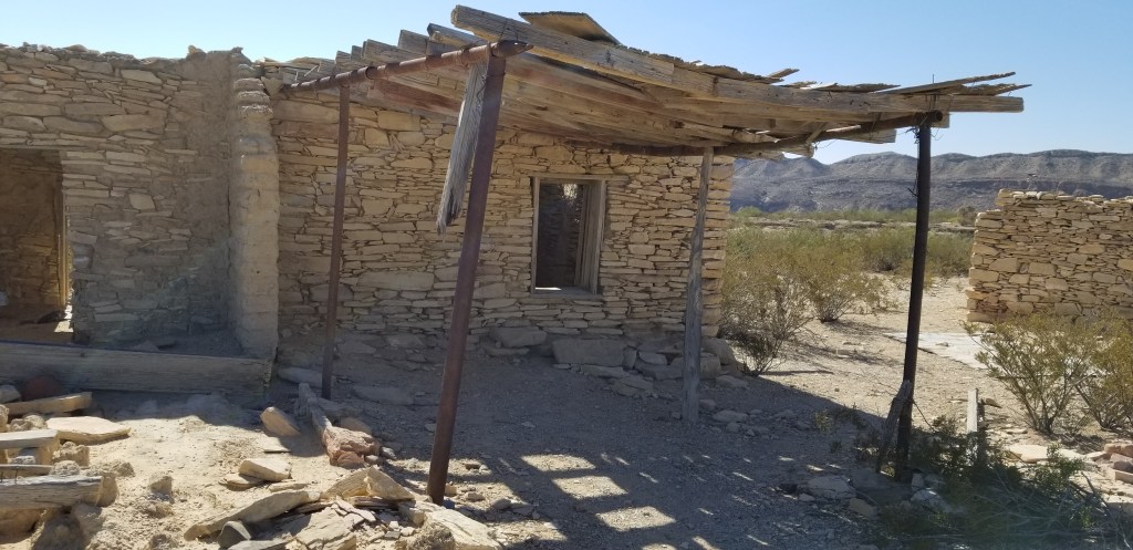
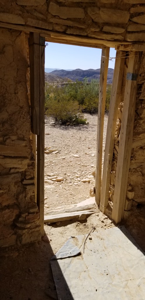
I had fun exploring the ruins of some of the houses. They were so small, and the doorways so short!
This church reminded me of one that has been in the news lately..the movie set shooting.
A 1930’s movie theatre, which is now a great place to eat, have a drink, and listen to live music. All isnot dead in Terlingua.
Our RV park, Maverick Ranch, was part of the Lajitas Golf Resort and Spa. Like a poor cousin, the park is set back across and down the road from the resort. While there was nothing at all luxurious about Maverick Ranch, you could be entertained for days at the Lajitas Golf Resort, especially if you play golf. Whatever Lajitas was before the resort was built, the tiny town is now all about the resort. There is an airport built specially to ferry in the vacationers. If you need more entertainment, there is horseback riding, ziplining, jeep tours, and a concierge to arrange whatever it is you might need. There’s also a “boardwalk” (made out of cobblestone) for shopping, although I couldn’t begin to afford anything in the shops. A couple of restaurants/bars round out the offerings.
Down the long driveway from Maverick Ranch, there is a cemetery smaller than the one in Terlingua:
We made a personal call on the Mayor of Lajitas, which is… a goat:
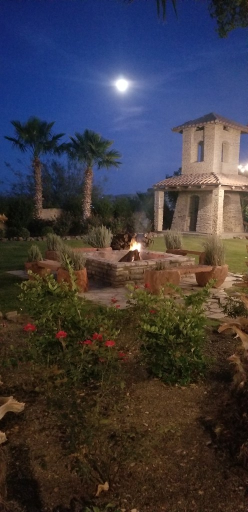
Our last evening in Lajitas, we took a stroll under the starry skies, and a full moon, over to one of the bars at the resort. It was a great way to say farewell to an area that we had enjoyed very much. We are on the lookout for long-term places to winter in the future. If we could boost our phone and internet service, Maverick Resort would be a sure contender. Cheers!
Looking at Big Bend National Park from Terlingua Starlight Theatre, Mule’s Ears on the right
We were in Big Bend a full week, and it was barely enough to cover the highlights. Several people we talked to opted for a couple of hikes a day. Owing to the direct afternoon sunshine, and the fact that a lot of hikes necessitated a drive down bumpy rocky roads or hiking in open desert, one hike per day was enough for us. We visited the Chisos Mountains area after our Balanced Rock hike.
The Chisos Mountains go around in a circular fashion and in the middle is a slightly hilly area called “The Basin”. Big Bend operates another campground, a lodge and restaurant, and a park visitor center in the Basin, and many trailheads begin here. We didn’t even look around the Basin when we first arrived, because after the Balanced Rock hike we were looking for lunch. Several tourists were admiring this tarantula outside the restaurant.
I was opting to be cool, pretend I’d seen a lot of tarantulas in the wild in my life, and eat my lunch, but Cal had to go have a look.
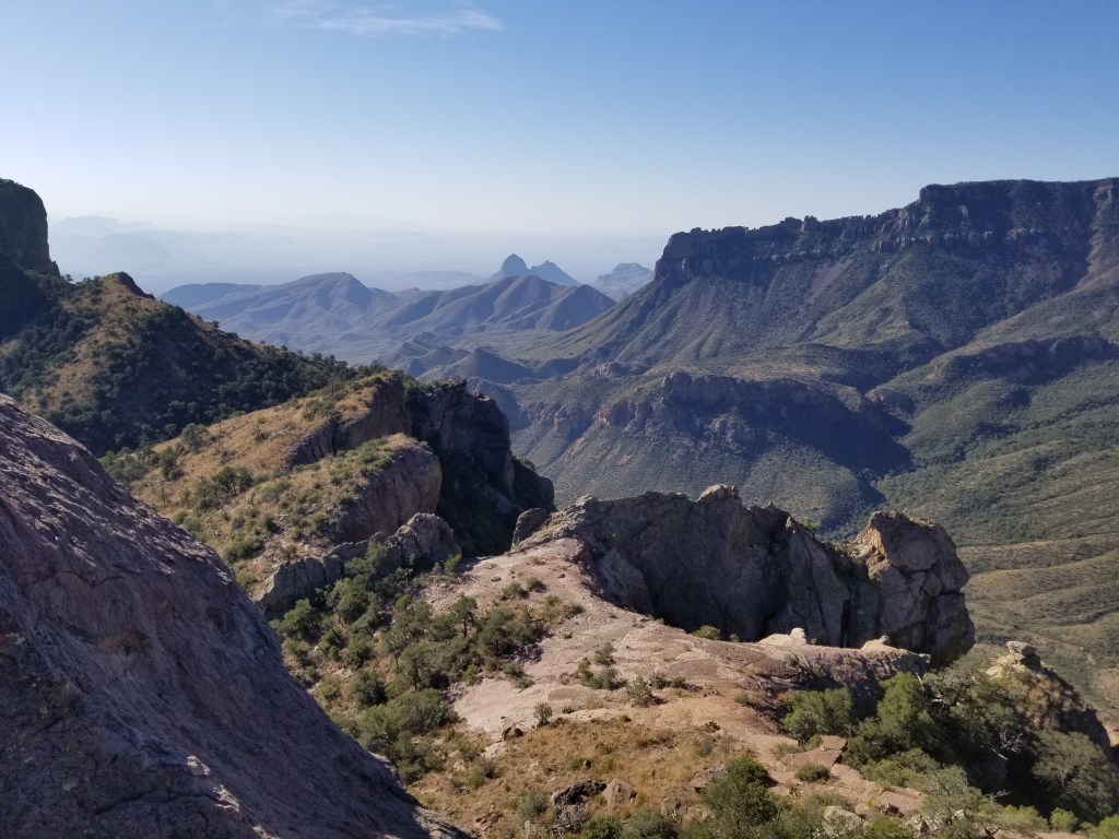
There is a break in the Chisos Mountains circle called “The Window”. There is a 5.6 mile round trip trail that can be taken to it, but that would have been our second hike of the day. We opted for the quarter mile paved “Window View” trail. The view through the Window and out to the western part of the park was spectacular.
View of “The Window” from The Window View Trail, Big Bend
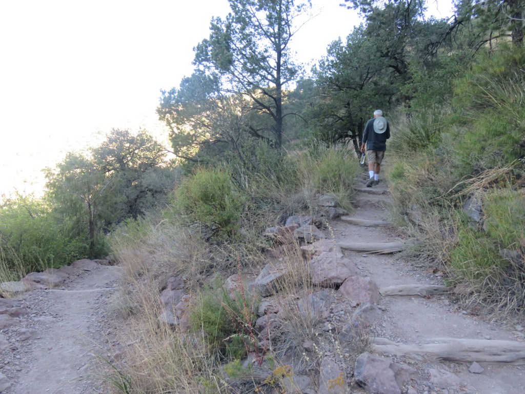
On another day, when we were fresh, we returned to the Chisos Mountains to hike the Lost Mine Trail. This trail is 4.8 miles round trip with an 1,100 foot elevation gain. It was one of those straight-up trails, but despite that, it is one of the most popular trails in the park.
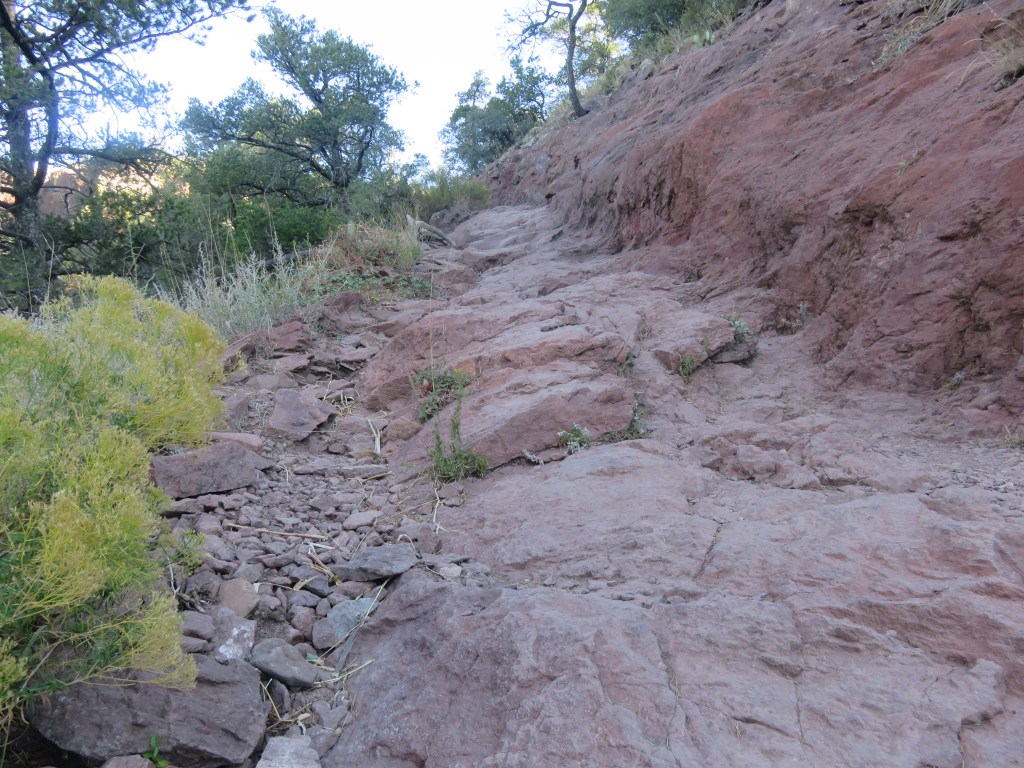
There were several switchbacks, and at one point the trail was nothing but pure rock.
The trail left, and the trail right
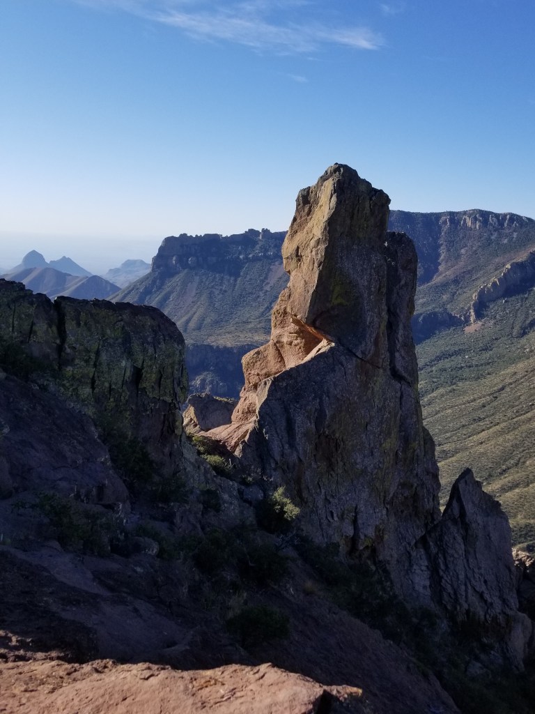
Once we gained elevation, we were rewarded with gorgeous views of the Chisos Mountains.
I saw this same view on a postcard, and said it was a view of “Elephant Tusk”. That might be the formation in the top center of the card. It doesn’t look like an elephant tusk to me, though.
Being at this altitude and looking down on the mountain peaks was pretty exhilarating!
At the top
The only wildlife we saw was this lizard, perfectly matching the rocks it lives on.
At the top, I inched my way around the corner of the rock we were on, and dangled my feet while I looked at the view below. There was nothing but air straight down. It was a bit dizzying, so I didn’t stay for long!
In the western side of the park is another “can’t miss” hike, the Santa Elena Canyon. It is at the end of Ross Maxwell Scenic Drive, which in itself was a treat. There were many places to stop on the way, a nice way to see the park if one wasn’t inclined to do a lot of hiking. We visited the ruins of Sam Nail Ranch, an oasis of green sunk into the hills. It was supposed to be great for birding, but we didn’t see birds.
The Nail family once called this their home
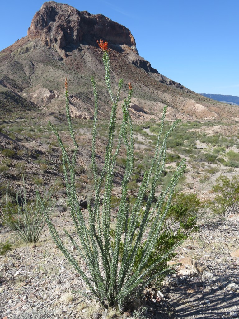
Another stop-off, this time to see “Mule’s Ears”, below
We admired the purple cactus on the way. I had never seen purple prickly pear cactus before, and there were areas where there were more purple than green.
And, a blooming ocotillo. These usually bloom in the spring, so this was a surprise. A whole area of blooming ocotillo in the desert is really a sight to see.
The rock behind the ocotillo is called “Cerro Castellan”, and was a landmark for those traveling along the way. We had stopped for a look at Tuff Canyon, which we ended up hiking in for a bit. The area we were driving through had seen major volcanic activity millions of years ago. There were over 20, and some minor ones, which created the landscape we were seeing. “Tuff” is hardened volcanic ash. This canyon was an unexpected surprise and I would have loved to explore it further.
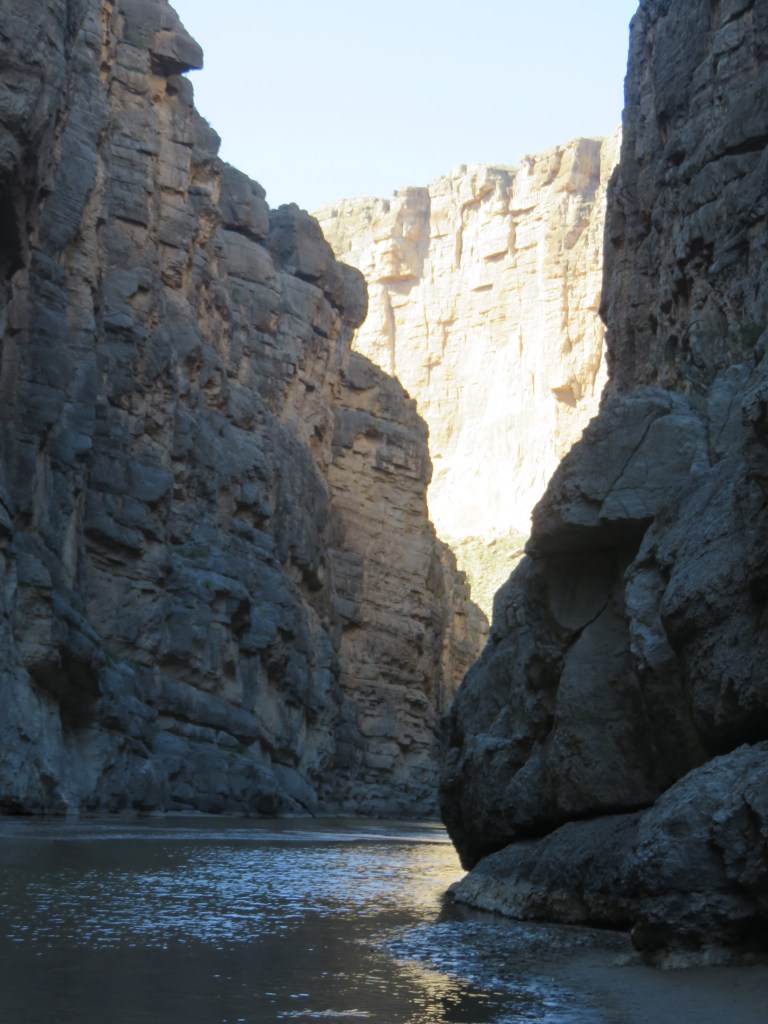
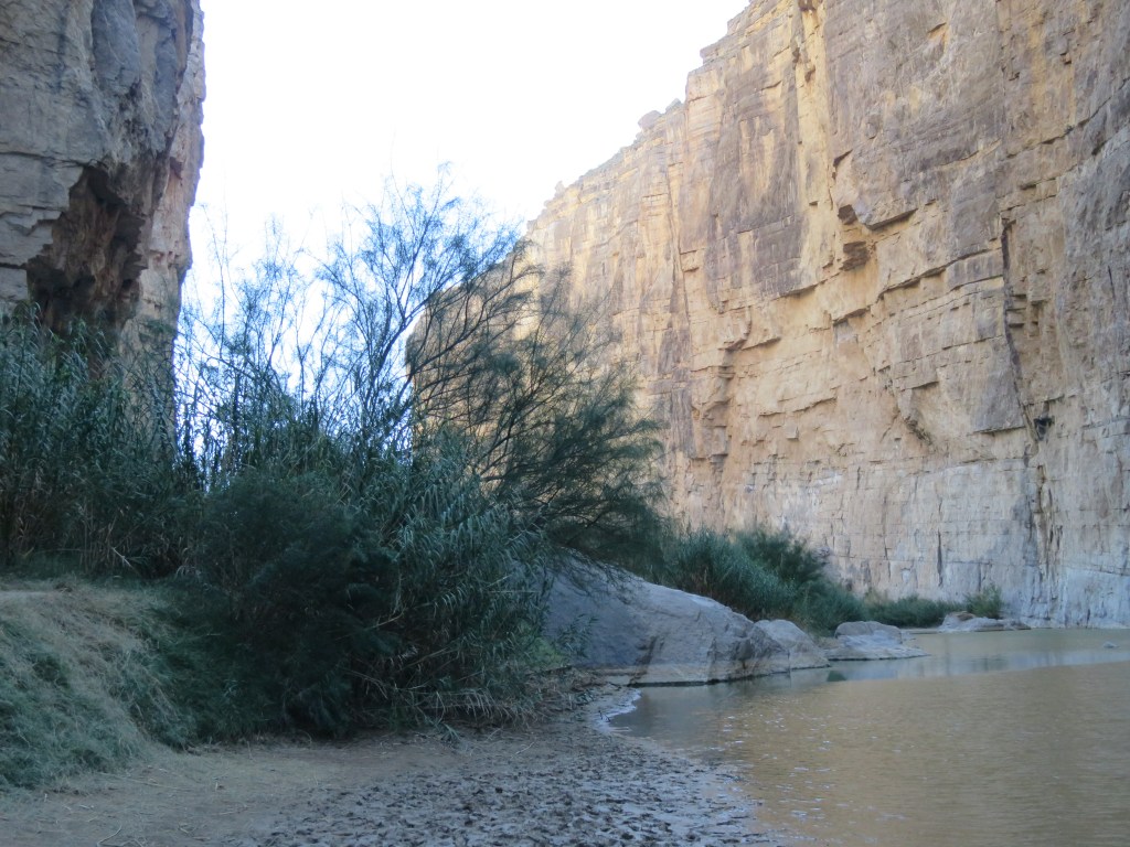
Santa Elena Canyon lies at the end of this scenic drive. At the beginning of the canyon, we had to figure out how to get around the creek that feeds into the river. The other hikers showed us the way.
We had arrived at Santa Elena Canyon. The walls on the left are Mexico, on the right is the US, and the Rio Grande River is in the middle. I had a mistaken impression we could wade over to Mexico, but it was too deep at this point.
The trail to get up and inside the canyon
Sadly, the end of the trail. We could go no further.
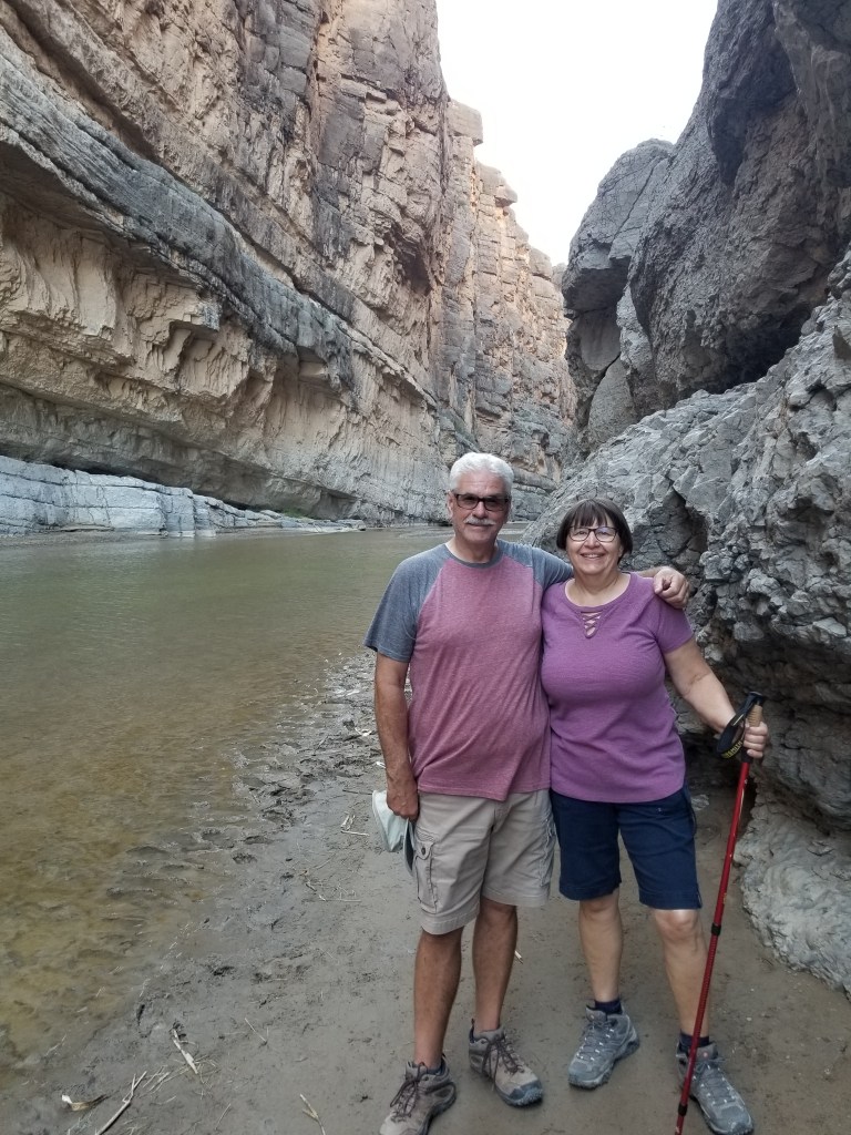
With Cal down the trail a bit, you can get a little perspective on how large the canyon is.
With my back to Mexico and the Rio Grande. I touched the bushes with my walking stick so…I was there
A woman we crossed paths with several times on this day seemed a little disappointed with the size of the river. “Rio Grande”, she said, “The word means big! Where is it big?” She had tried several paths on the river, and none panned out for her. Indeed, at times in the park, it seemed like no more than a trickle. It seems to me that at times when I’ve crossed over into Mexico further east than Big Bend that it was wider and deeper. Or maybe “Grande” refers to the length. Or maybe it used to be bigger? Who knows, but it was grand enough to me.
The Twosna Travelers at the very bottom of the USA
Big Bend is one of our least visited US National Parks. It’s a distance to go, even for Texans. There aren’t a lot of paved roads except for the main connectors through the park. With its combination of river, desert, and mountains, it was an amazing place to visit and I’m glad we were able to spend a week there.
Blessed are the curious, for they shall have adventures.
-Lovell Drachman
Sierra del Carmen mountains in Mexico, Big Bend
From Denver, down we went to escape the coming of winter just as fast as we could: Raton Pass and Roswell, New Mexico; Guadalupe National Park, Texas. The weather stayed in the 40’s, fog and low hanging clouds. I was excited to return to the Guadalupes and thought we’d have a picnic lunch and maybe a little hike there. It was windy and cold so we ate a quick lunch in the truck.
Guadalupe Mountains: there’s a mountain out there somewhere!
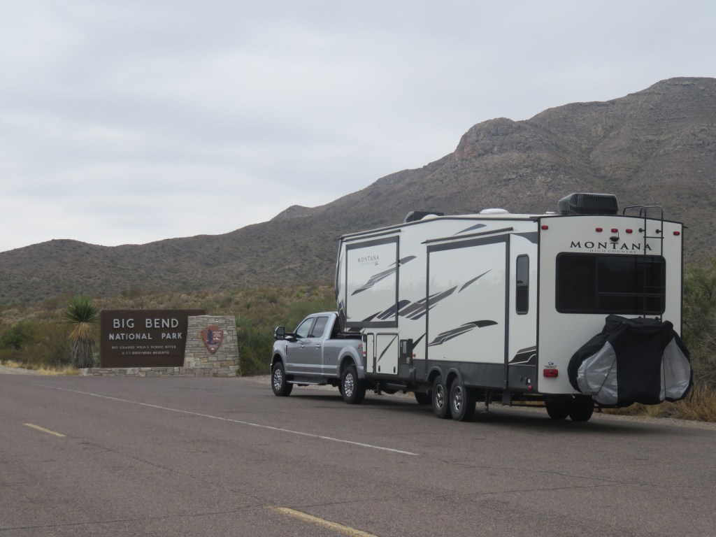
Then Van Horn, Marfa and Alpine, Texas. The towns kept getting smaller and the scenery by the road more beautiful. Marathon, Texas; then 39 miles to the gate of Big Bend; 26 miles from there to Panther Junction in the park; and then, finally, 20 miles more to our RV site in Rio Grande village. It took us 4 days driving an average of 200 miles to arrive. That sign looked pretty good.
I was hoping this tunnel would be fine for our RV and luckily, it was.
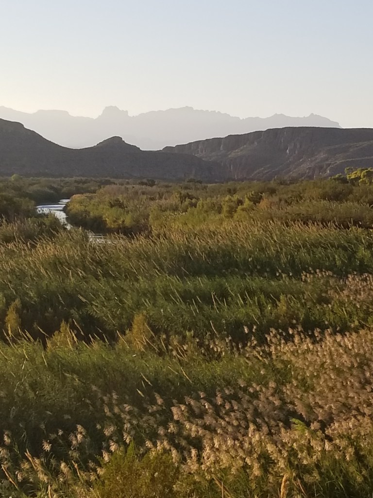
You can see the Sierra del Carmen mountains peeking over the top of tunnel on the right. A picture of them is also at the top of this post, and brown/grey is their normal color. They are at the far east of the park, and at their feet is the Rio Grande River. That means that these mountains are actually in Mexico. We were closer to the mountains in our site, and the beautiful thing about them is that the sun turns them a beautiful pink as it sets. We enjoyed this show every evening while we were there.
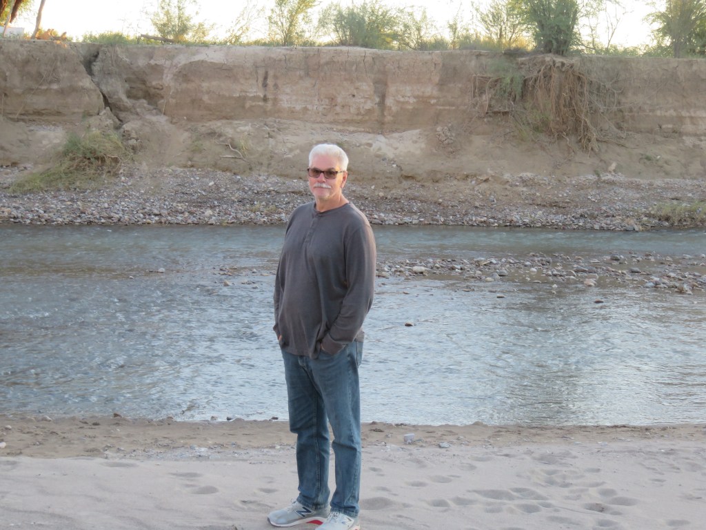
We took the “nature hike” at an adjoining campground for our first look at the Rio Grande.
That’s Mexico over there behind Cal and the Rio Grande
A peek at the Rio with the Chisos Mountains behind
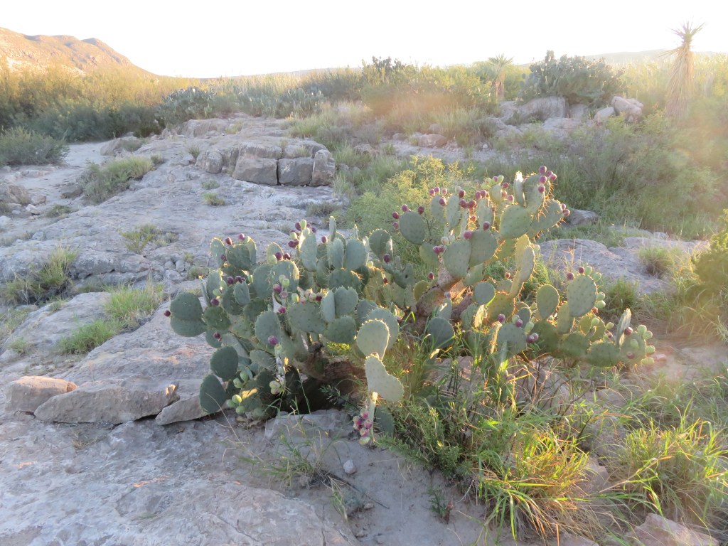
I discovered I really, really like to take pictures of all the various cactii
When we returned to our RV area, there was a coyote yapping in the parking lot. I don’t know what its problem was, but then we saw a few javelinas grazing just beyond our RV. Then, walking just beyond the RV’s over to an adjoining meadow, horses grazing! We were very excited to see all the wildlife and were hopeful this would continue every evening, but that was the best show. We learned from a ranger later that the horses weren’t wild, but belong to Mexicans just over the border. They just let them wander and graze until they want them. Unfortunately, the only good picture I got was of the javelinas.
These two javelinas posed nicely for me, although they wouldn’t stand right next to each other!
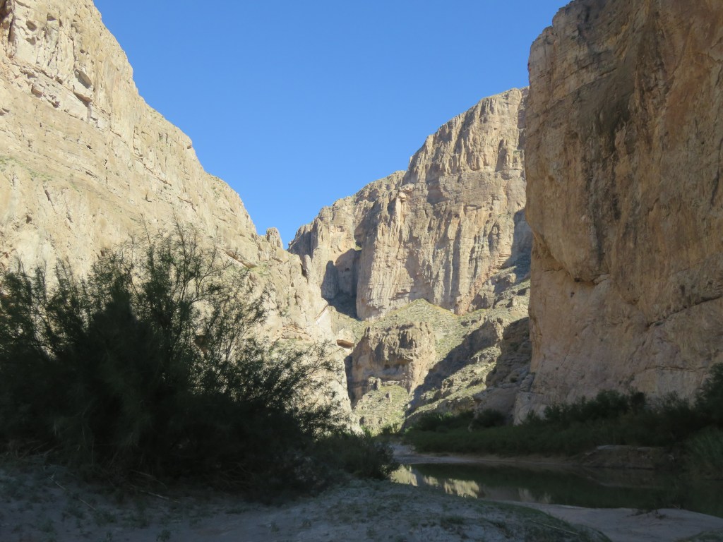
Boquillas Canyon, in the Sierra del Carmens, was also close to us so we took a hike there.
Along the hike to Boquillas, the Mexicans across the border had items left for sale in many places. Most everything was $10, and you would leave your money in a container. Near Boquillas, you could cross the Rio Grande over to a little village called Boquillas del Carmen in a rowboat for $5. Once there you could shop for a handmade item, or have a lunch in a couple of restaurants. Sadly, this operation was shutdown for COVID when we were there, and this cut off a good source of income for these people. But they are very enterprising, so this was their way of keeping a little money coming in. This fellow let me know his wife’s tamales were very delicious, so we purchased a couple of bags. He was right, they were excellent. And I’m happy to report that the Boquillas del Carmen crossing has been reopened since we left the Big Bend area.
I watched these guys, over in Mexico, setting up a volleyball net. I think they were surreptitiously keeping an eye on their merchandise.
Also close to us was Hot Springs. Cal got his first experience on the Big Bend side roads in getting there.
It was a one way loop with steep dropoffs.
Hot Springs was actually a little resort from the 20’s to the 40’s.
“The old “motor court“
Petroglyphs on the wayto the hot springs
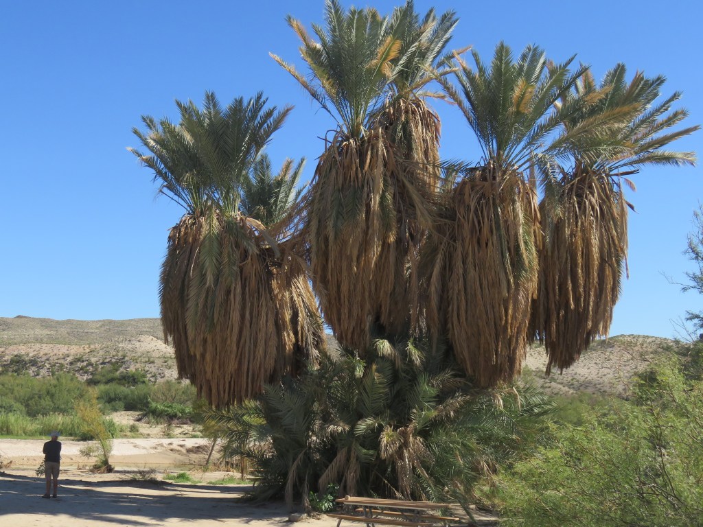
An immense yucca tree; you can see how large it is by looking for Cal on the left.
Here I am, taking a soak in the hot springs. It was very hot! The resort had built a spring house around it which is gone now, but the foundation of it is good for sitting on.
The hot springs, and the Rio Grande next to it, was a popular swimming hole and an enterprising woman over on the Mexican side was taking advantage. This was a large group of partying Americans who were suddenly hungry for tacos and tamales.
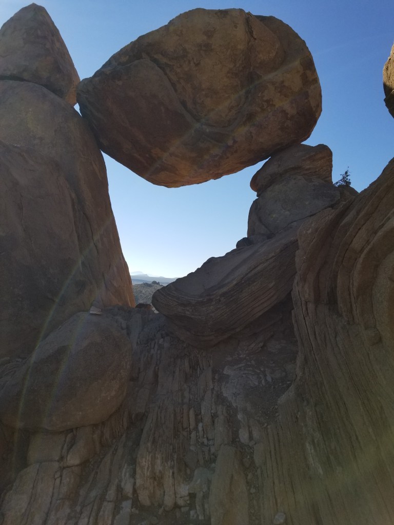
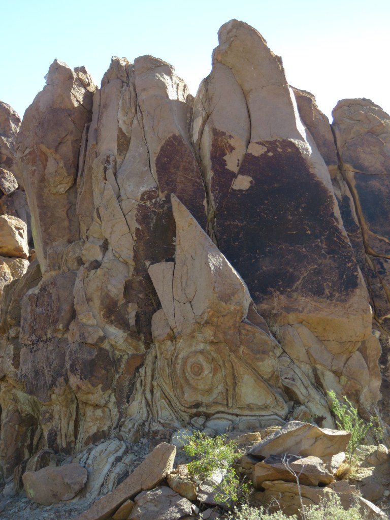
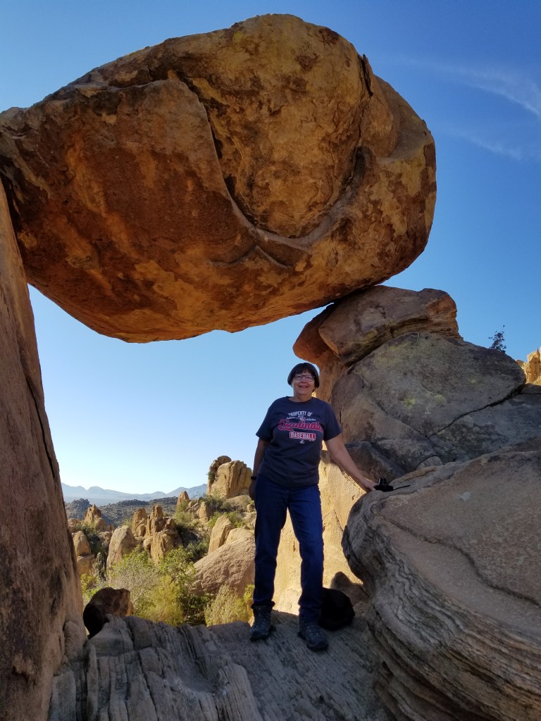
Many people who love the national parks bemoan the fact that sites which were once little-known are being publicized by influencers on social media. They are becoming more crowded and, in some places, becoming literally trampled over by excessive usage. I see this as a double-edge sword. It’s not great that we couldn’t find a parking spot just to take a hike in Rocky Mountain National Park. But necessity has led the Park Service to create a park shuttle service. The overusage in the parks is leading to some pretty creative and innovative ideas. Social media, namely a National Parks Facebook group that I am in, led me to this next spot in Big Bend. Park literature didn’t show a picture of it, only to name the trail. It is this spot: Balanced Rock, on the Grapevine Hills Trail. Once I saw a picture of it, I wanted to find it.
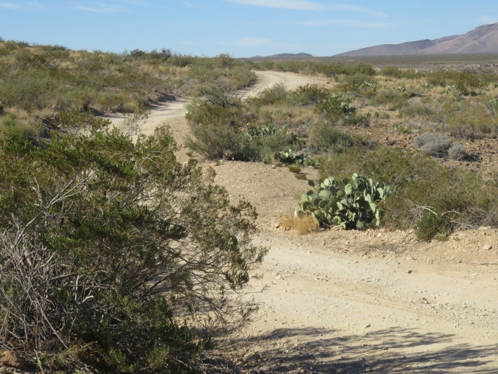
Cal usually obliges my curiosity about things, but heading to this trail necessitated a 7-mile drive down a dirt road in the desert which became more “washboardy” the farther down it we went. After a lot of bouncing around I was relieved when we finally arrived, since his good humor was just starting to dissipate.
“THAT ROAD”
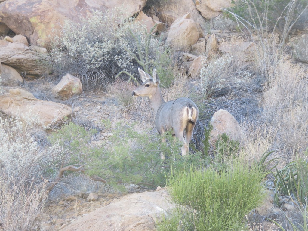
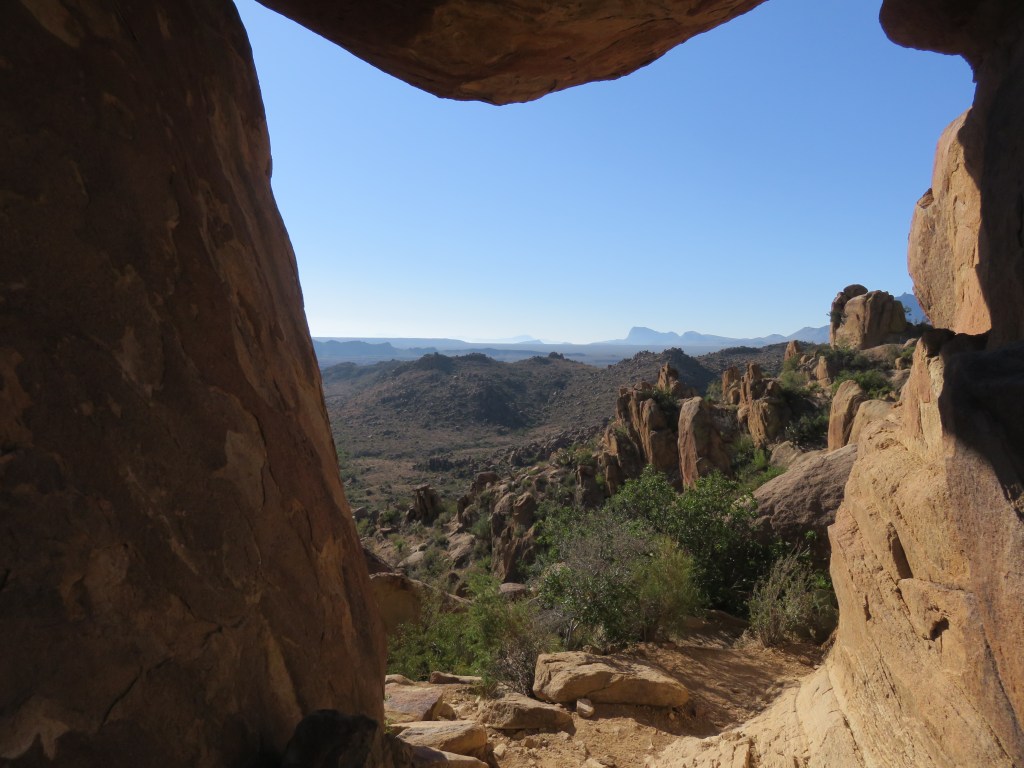
The trail was 2.2 miles and very easy except the last 1/4 mile, which was straight up. We enjoyed the scenery along the way.
Breakfast time-this deer only momentarily stopped its munching
I think this is a claret cup cactus, sitting way up high on the rocks
The last 1/4 mile involved clambering up rocks with hands and knees in places. It was an accomplishment to arrive at the top!
We had to climb up this trail, and then back down
What a grand adventure. I will continue our exploration of the park in my next post, because there is still so much to see!
Next time: Chisos Mountains and Santa Elena Canyon in Big Bend National Park