USTravel

Rocks, Wine and Pecans in the Southwest

Having spent the last month in Phoenix, Arizona, the Twosna Travelers are now officially snowbirds. Snowbirds are people who spend the warmer months in the upper regions of the United States and “flock” to the Southern states when it becomes cooler. We’ve spent 95% of our lives living in places with cold winters. I realized I didn’t like cold weather around the time I was in high school, while Cal has only recently arrived at this realization.

But if one is going to winter in Arizona, one has to get there first.

A lot of folks will zip from El Paso, Texas on interstate 10 to Tucson or Phoenix without giving anything a second look. We did stop in El Paso, but it was only to leave Sam (our 5th wheel trailer) plugged in and snoozing peacefully there for a week while we drove to Denver for Thanksgiving with our family. We’ll have to give El Paso more of a look another time.

On the way back from our Thanksgiving trip, we stopped off for dinner in a little no-name restaurant in a little no-name town just north of El Paso. This cute little house was right next to where we parked.

Deming, New Mexico

What drew me to Deming was the idea of going to Rockhound State Park, located just southeast of the town. At this park, one can just pick up rocks and keep them, unlike any other state or national park I have been to. Geodes, jasper, onyx, agates, and perlite are some of the rocks that can be found. Upon doing further research, however, I realized that the best rocks are to be found only on the remote trails, and they have already been dug pretty deeply. A person would need to have a pickax slung over their shoulder as they hiked, and some pretty good equipment back at home to split them open. Despite my interest, I have total ignorance on the subject, and would have rocks in my head to think that I should add more heavy rocks (and weight) to Sam’s load. Cal politely pointed none of this out, but let me figure it all out all on my own. So I contented myself with the nature trail in the park, and picked up a few small little rocks that fit in my pocket to add to my growing collection.

Still wanting to learn at least a little more on the subject, we stopped at a rock shop outside of the park. The ancient proprietor of the establishment was more than happy to have someone to talk about rocks with. My rocks are garden variety rhiolytes, formed as the result of (surprise, surprise) volcanic activity. He used to pull out a lot of geodes with his partner, now passed, at his claim somewhere in New Mexico called Baker Egg Mine. He had some beautifully split and polished geodes, but all I wanted was a small one that had only been split – much easier on the budget. I’m not sure that I learned much, but I still like picking up pretty little rocks. I guess I don’t need to know what they are. The small oval one fits nicely in the palm of my hand, and is surprisingly smooth.

Spring Canyon – Rockhound State Park

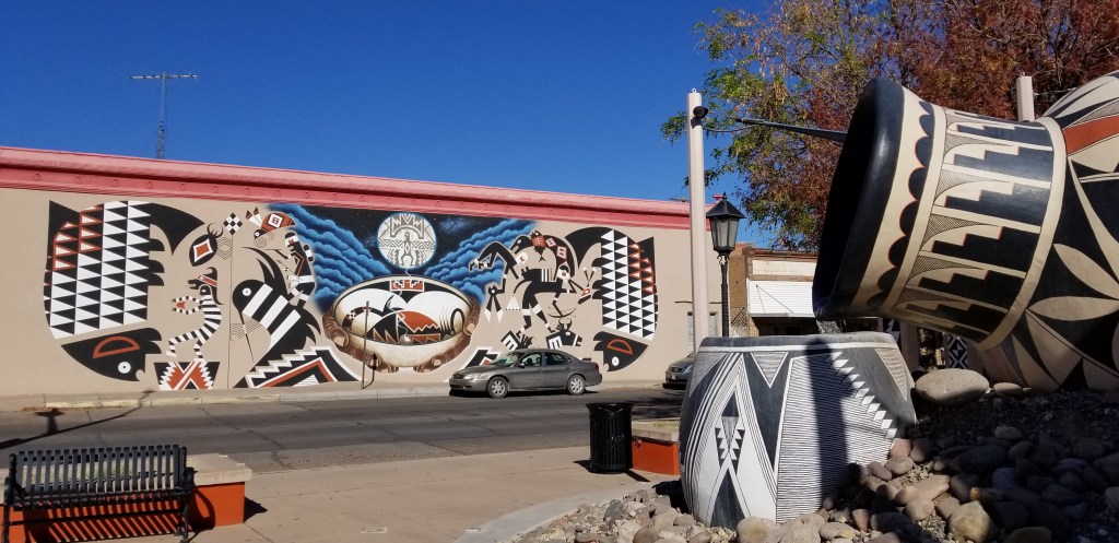
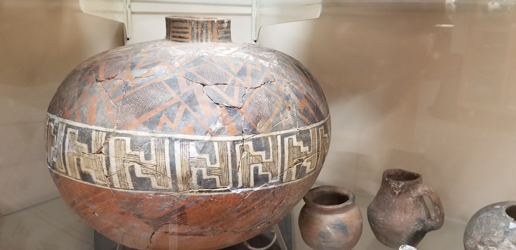
The funny thing about all this is, while I thought Rockhound would be the highlight of our time in Deming, the highlight for me was actually the Deming Luna Mimbres Museum, billed as “New Mexico’s largest free museum”. It is located in their old Armory, built just two months after the famous Pancho Villa Raid in 1916. It became a USO during war time, and then the museum with its repository of many collections. And yes, a large collection of…rocks.

Thundereggs straight from our rock shop proprietor’s mine

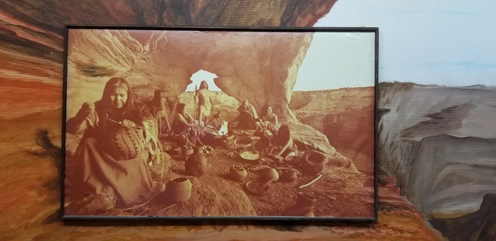
The Mimbres people lived in this area as far back as 1000 AD. Their pottery is something Deming is very proud of, as can be seen in this mural and fountain in downtown Deming:

There were pieces just like these in the museum

Whenever I’m under an outcropping of rock just like this, I always like to imagine how the people lived who took shelter there. This painting did a fine job of showing that.

The museum went on and on. There was a huge doll collection, rooms with antique furniture, storefronts showing actual Deming turn-of-the-century establishments and what would have been there, and many other varied collections from area residents over the years.

We passed some time in a couple of local wineries, and restocked our wine cellar. Lescombes Winery was a large establishment and their parking lot was so large that we could have stayed the night there (for the price of a bottle of wine or a tasting, of course). The wine was good, but we preferred the wine at Luna Rossa. They weren’t such a large commercial operation and their wines were cheaper and complementary to our (un)sophisticated wine palate.

Willcox, Arizona

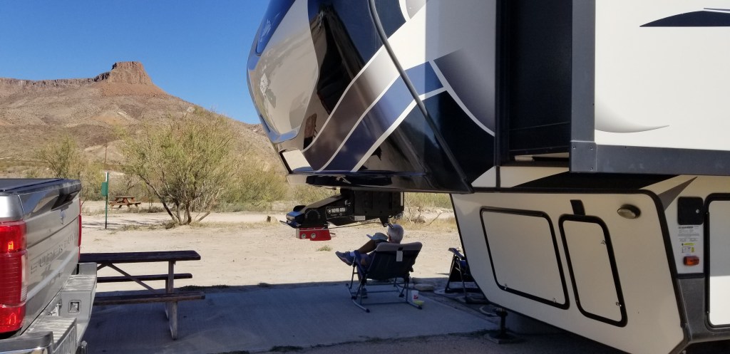
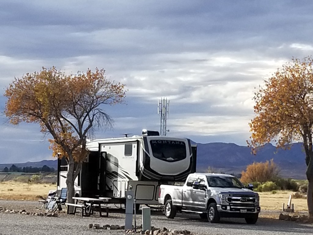
Full-time RVing, fun as it may seem, is still full of the ups and downs of ordinary life. One of the downers for us is the on-going trouble we’ve had with our left front jack erroring out during leveling, and the amount of battery power needed just to get Sam up and down off of Frodo’s (the truck’s) hitch. It got worse with every stop we made. Our stop at the Willcox KOA was supposed to be one overnight, but we canceled some plans and made the decision to stay for five, so that our arrival in Phoenix would be our last until some repairs were made.

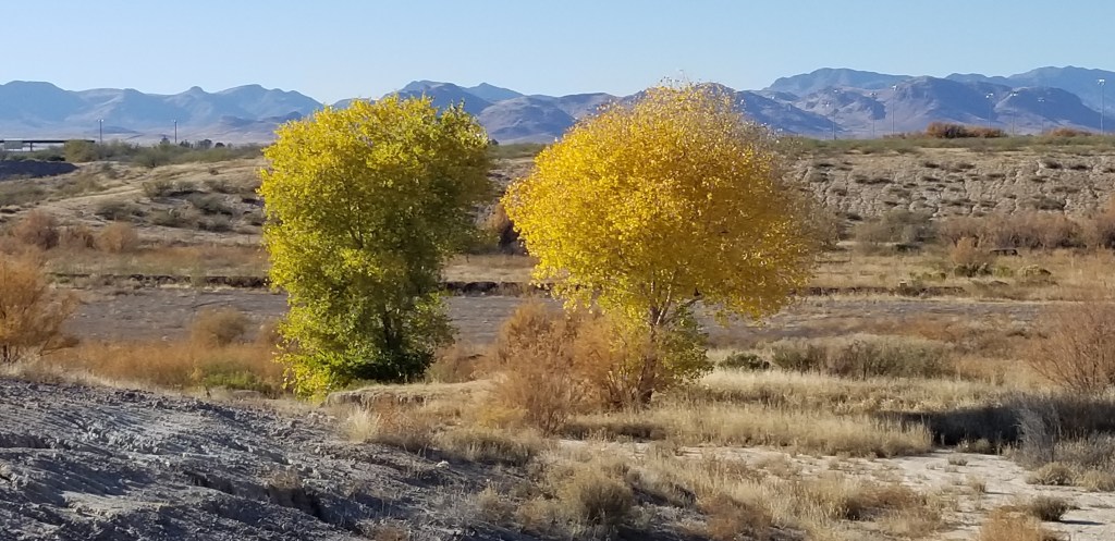
KOA parks can be good or bad, depending on who is running them. This is true especially of KOAs located just off the highways of America, usually used for only an overnight stop. The Willcox KOA is indeed off the highway, but when learning of our situation, the kind folks put us in a spot furthest away from it, with a much-coveted tree on the site. It’s pictured at the top of this post. We watched people painting and upkeeping the grounds every day. There is a restaurant (with excellent gyros) and a heated pool on-site. Just this past week, I read a newsletter from the KOA national organization which named this park a “rising star” in the franchise for 2021, and I would definitely agree.

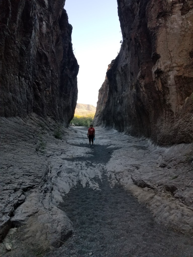
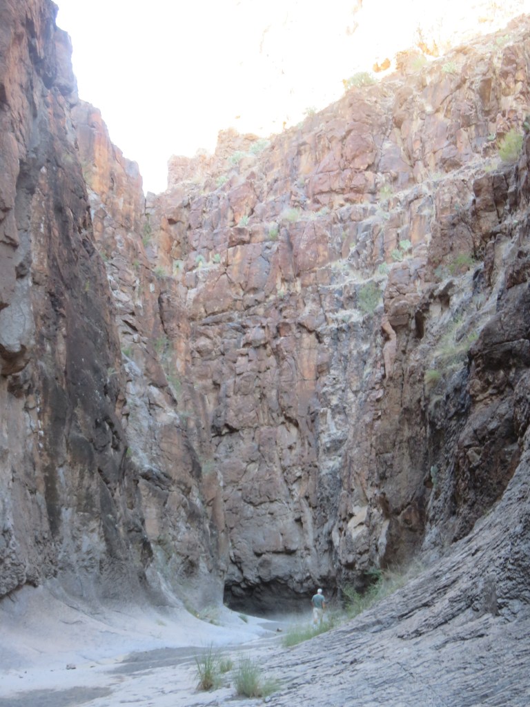
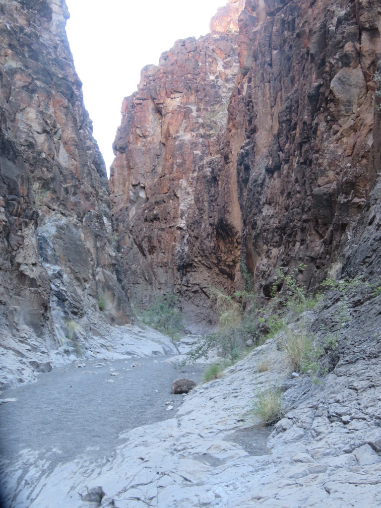
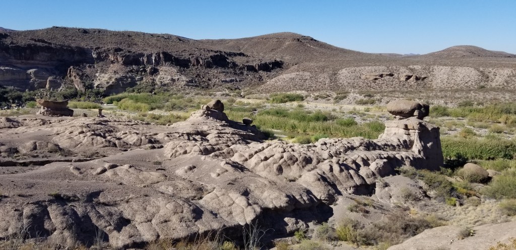
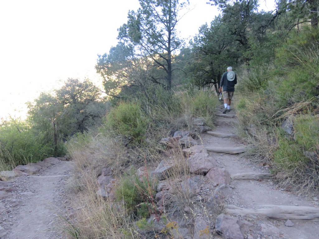
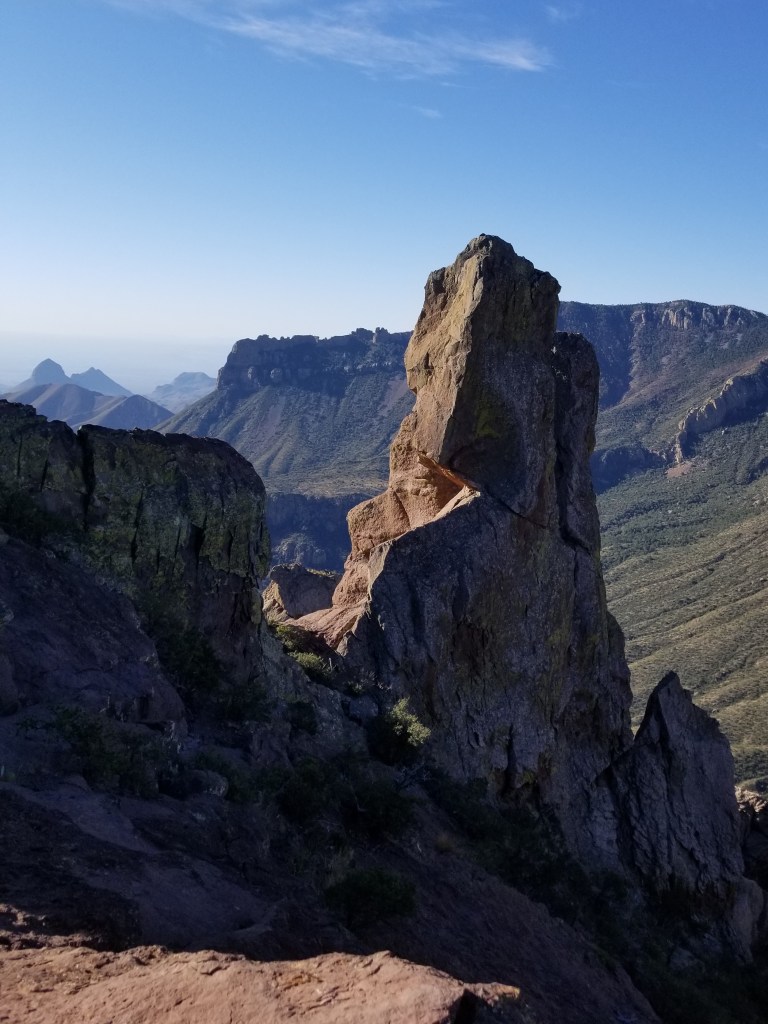
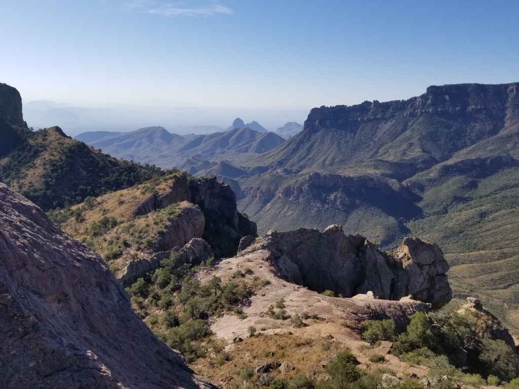
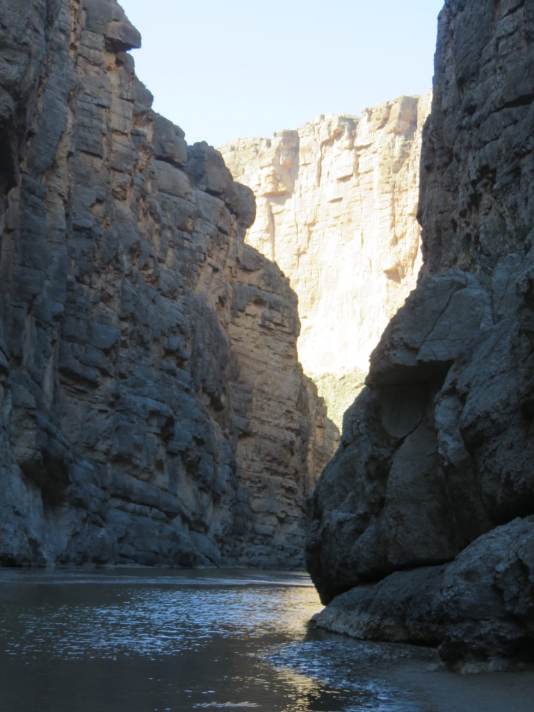
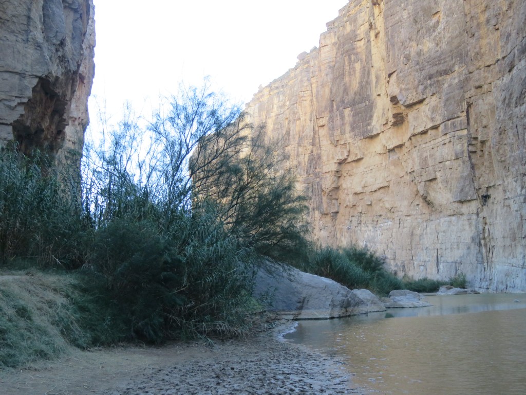
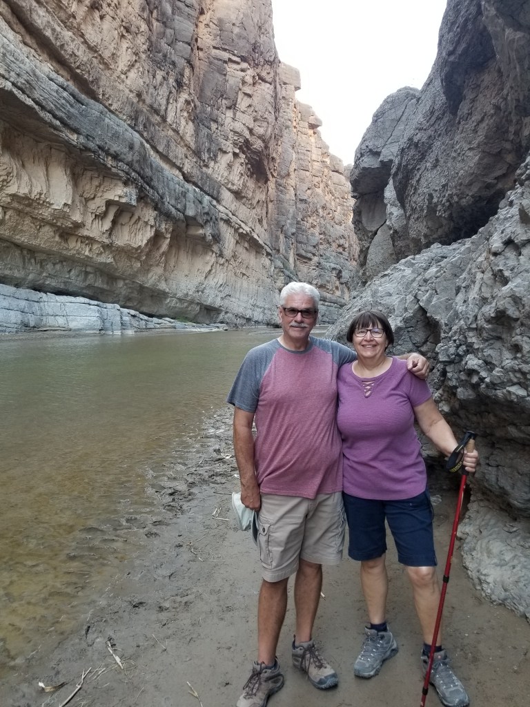
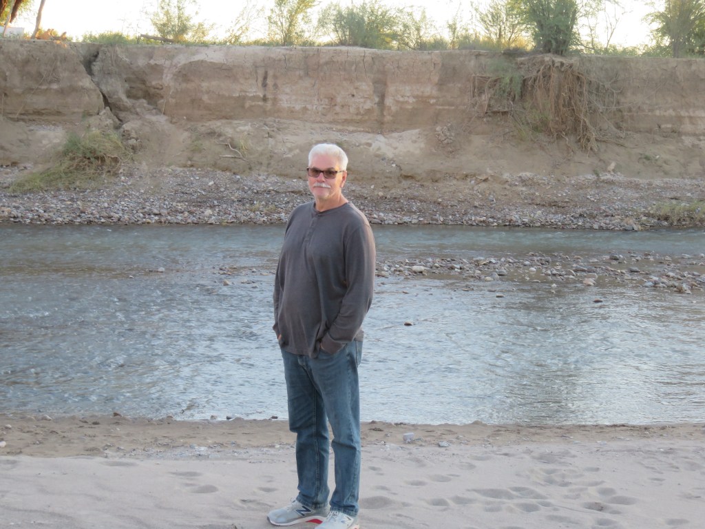
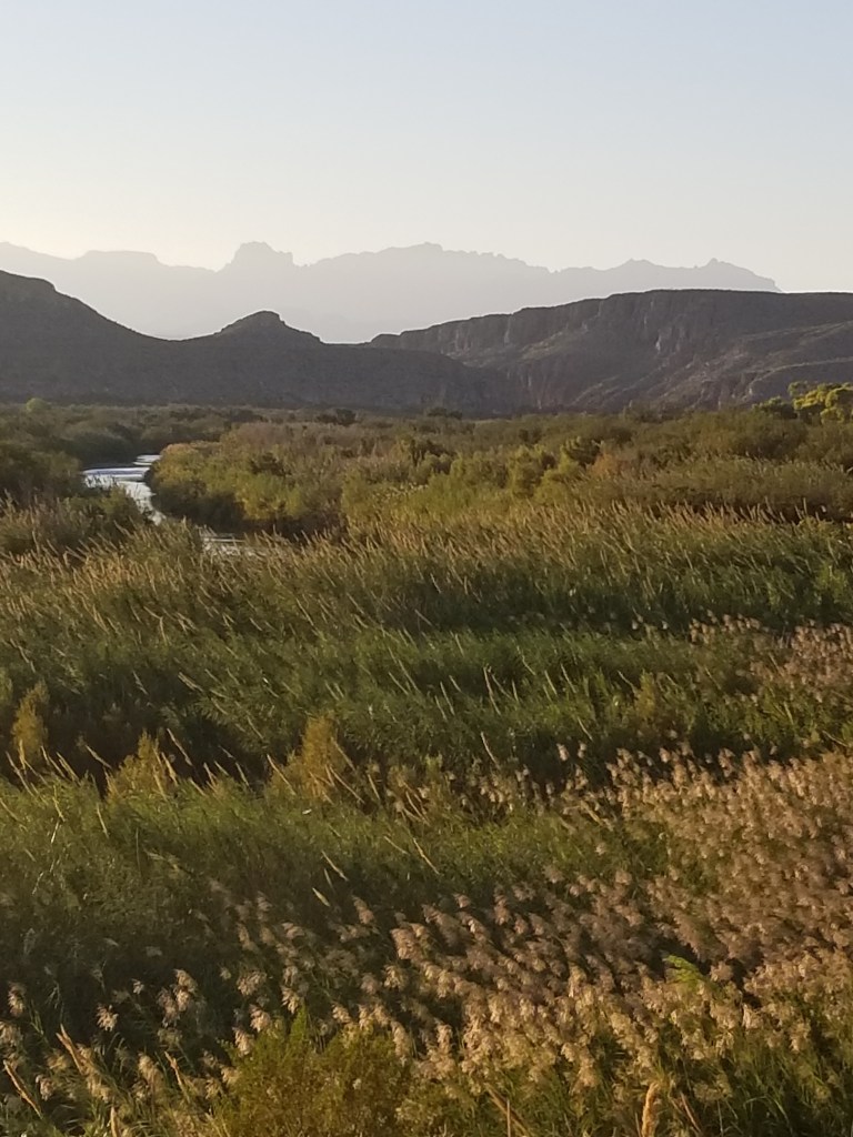
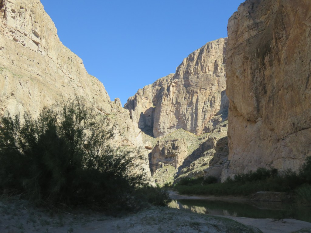
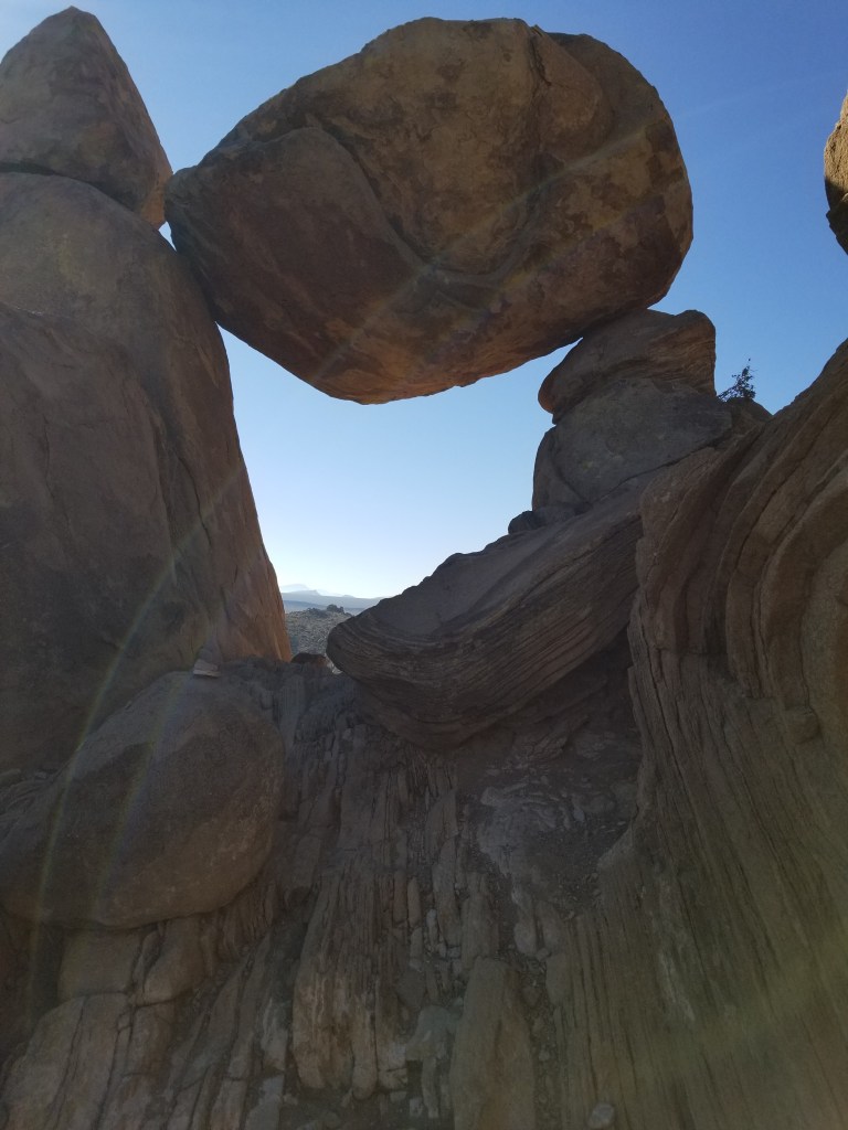
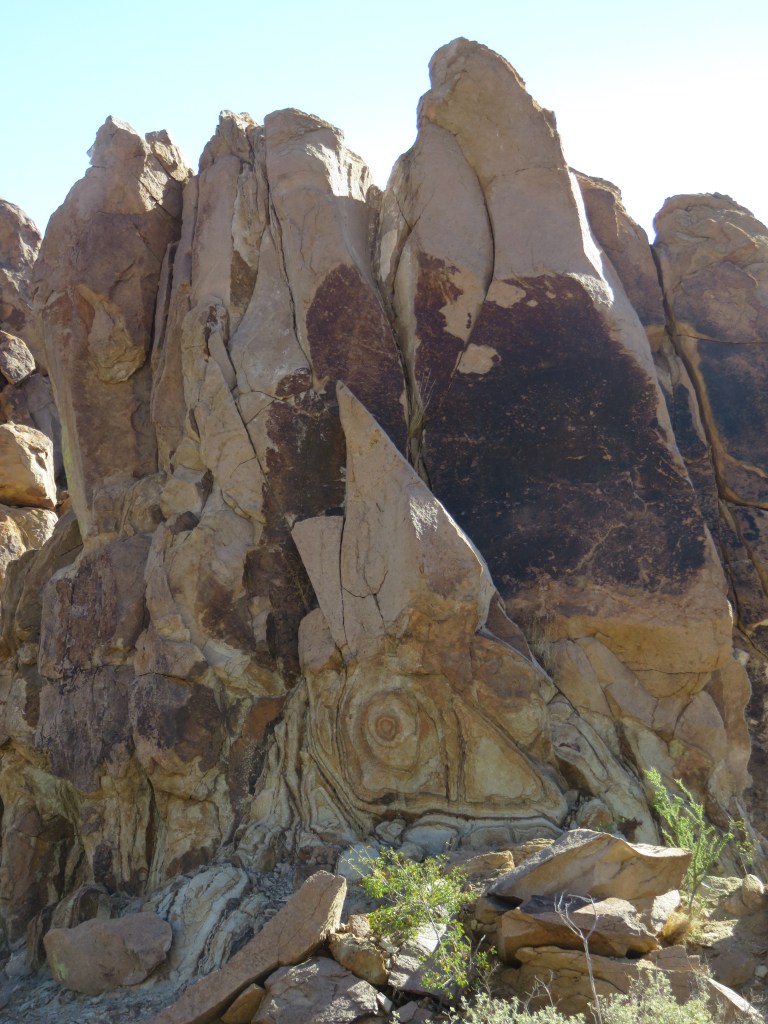
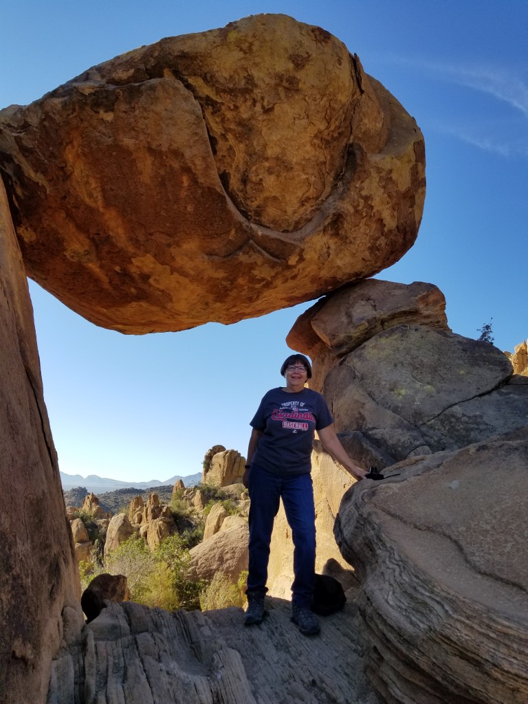
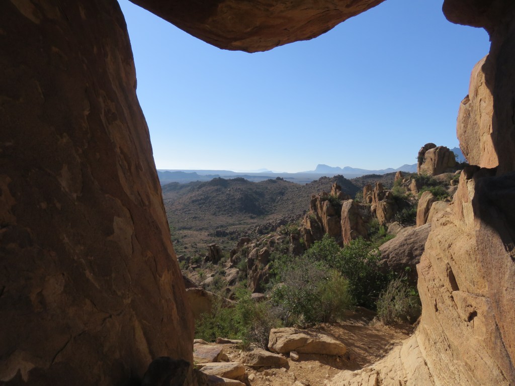
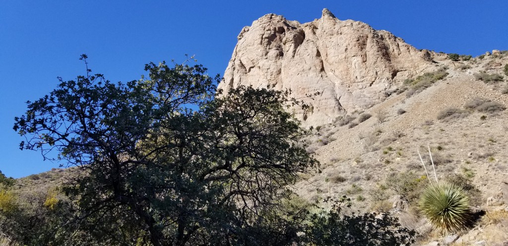
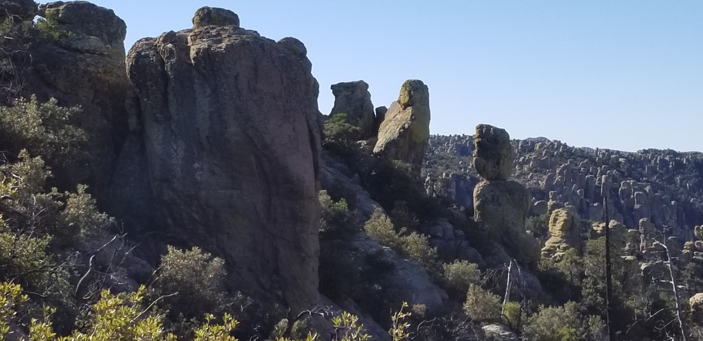
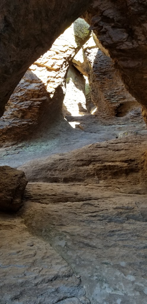
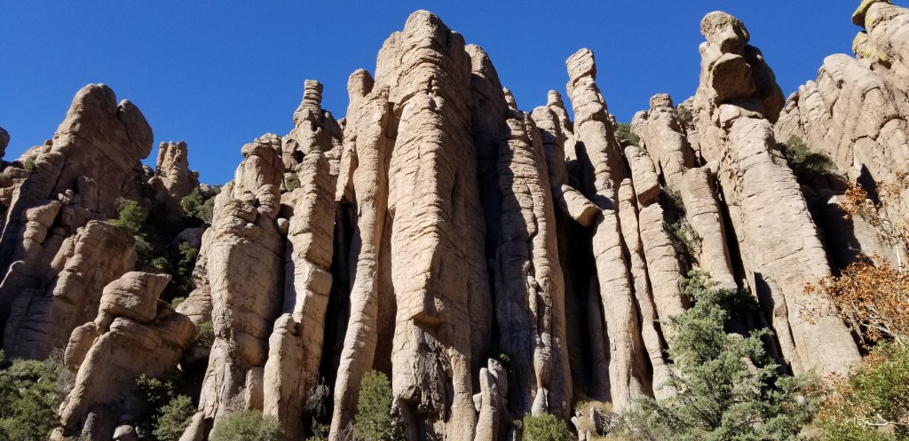
What softened the blow for having to stay in Willcox was being able to visit Chiracahua National Monument, 40 miles away. We lived in Arizona for a couple of years back in the 80’s, and one of our favorite tent-camping stories is from a weekend we spent there. One evening, a pair of skunks wandered through our site while we were sitting in our lawn chairs. We froze in place, not daring to move, as they sniffed around and actually passed right underneath us. We were lucky we didn’t get sprayed! It was fun to drive through the campground again, a wooded oasis right under the tall rock cliffs, but we wouldn’t be able to stay there in our 5th wheel. Chiracahua is an other-worldly, magical place:

The rocks at Chiracahua are in columns, pinnacles, and balanced rock
“Claret Cup” rock, which shows how impossibly a lot of the rocks are balanced.
“Organ Pipes”

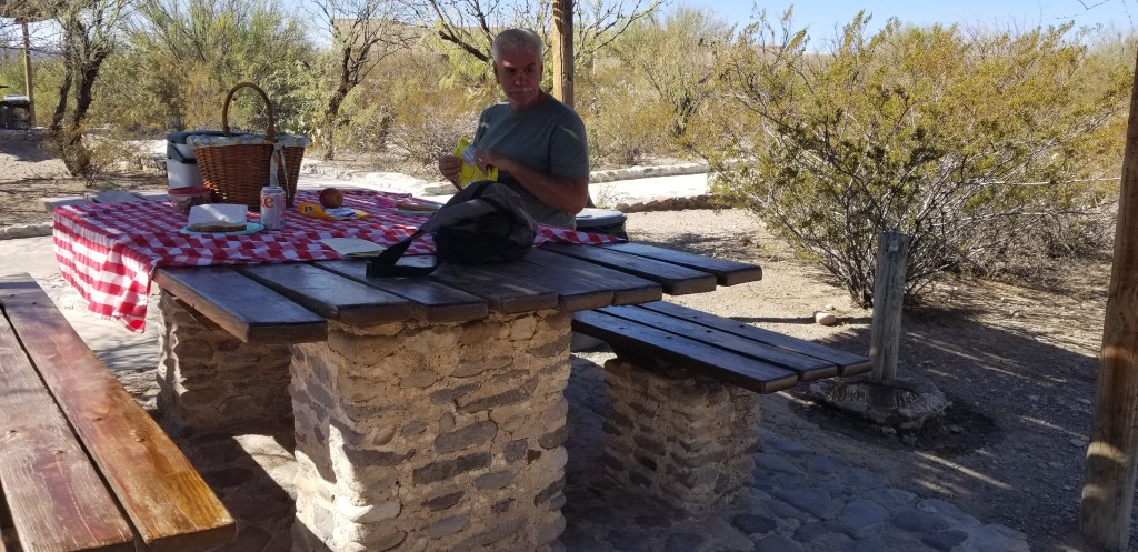
We had an audience for our picnic lunch at Chiracahua:

A spotted towhee and a Mexican jay eying our lunch
Three birds, plus one in the bush. At one time we had seven birds all watching us, hoping for a handout. We had some fresh crusty bread so I hope they were happy with the crumbs we left.

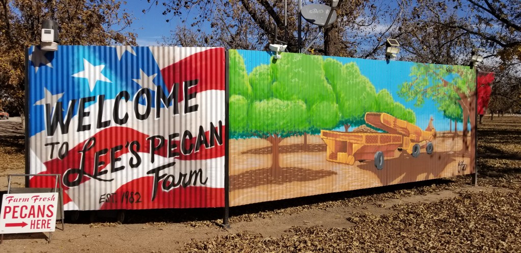
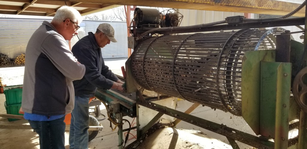
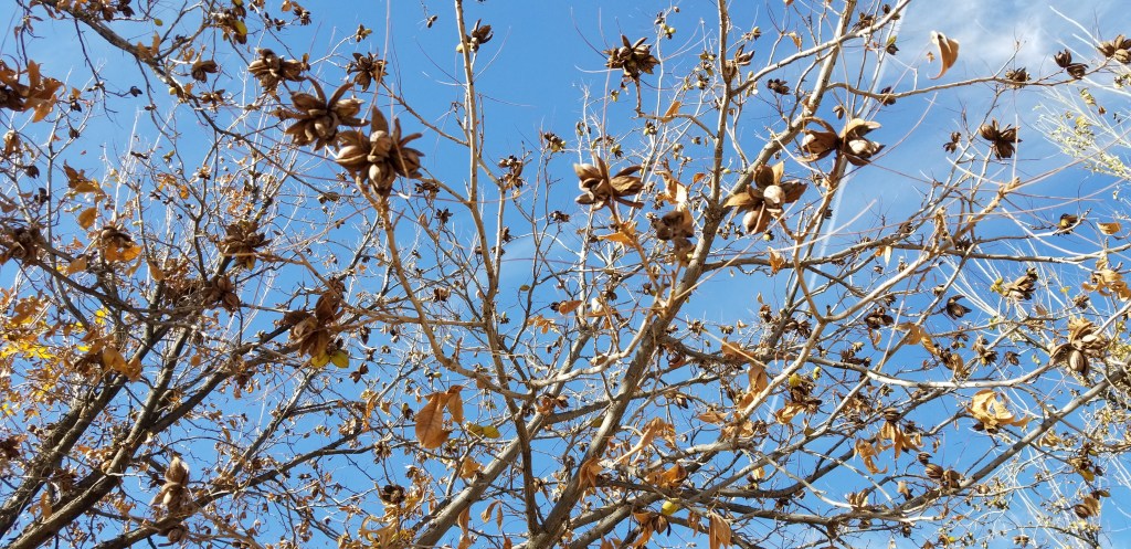
Starting in Roswell, New Mexico, but also in southwest Texas, southern New Mexico, and now Arizona, we saw a lot of pecan farms. In Roswell in early November, the leaves were still green on the trees. By the time we got to Texas, the leaves that we saw on the trees were changing color. There was a farm near our KOA, so we had a nice chat with Paul and Jackie Lee. They were happy to take us around. I’m munching on their pecans as I write. In mid-December, they were only three weeks away from harvest. This is a very small operation, so they send the picked nuts out to New Mexico and Texas for processing, then the shelled nuts are returned to them. They are then placed in one of several chest freezers for sale all year round, until the next harvest.

The nuts can’t be harvested until all the trees lose their leaves. Some nuts fall in the process, so when the leaves are raked, Paul puts everything (minus the leaves) into this separator to get the rocks and other debris out. He welded this contraption together himself, like so much of his equipment.
Final result..and the real harvest hasn’t even started
The orchard is the Lee’s retirement project and they planted all the trees themselves in the early 80’s. The trees are now in their prime.
Almost ready for harvest; the outside pods have to be open, like most of these are, and the nuts inside have to be dry. They were expecting a bumper crop.

Like Deming, Willcox also has a healthy amount of wineries, but as we were already extended on our wine budget, we limited our purchases to pecans. By the way, if I have made you hungry for pecans, the Lee’s pecans can be purchased on-line. Who knew this was such a good climate for growing grapes and pecans?

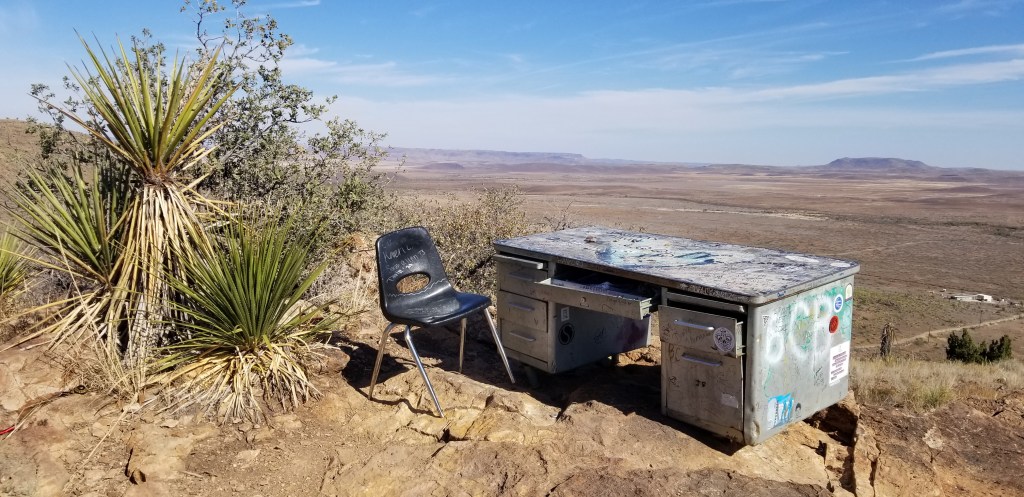
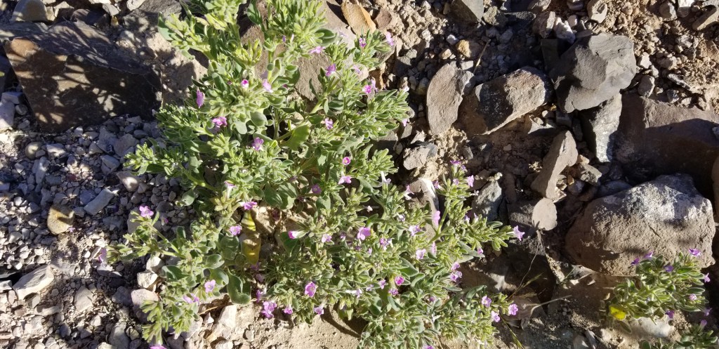
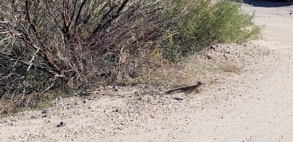
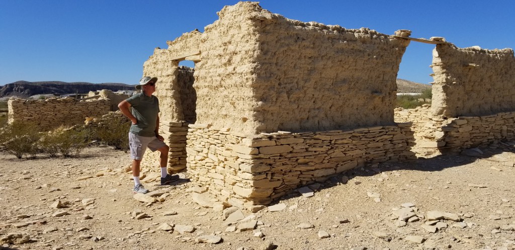
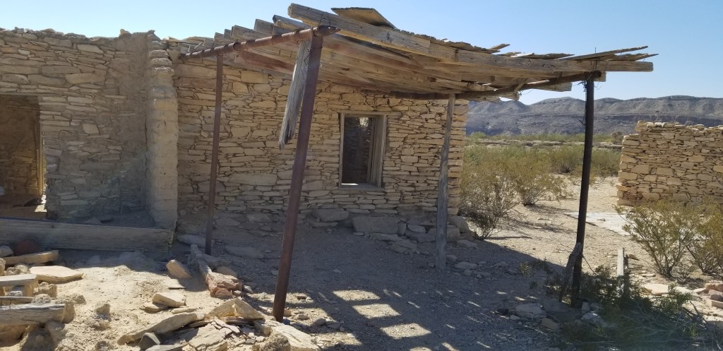
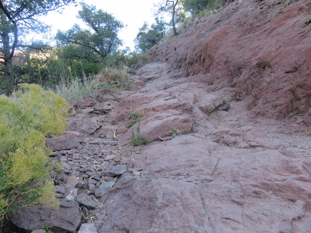
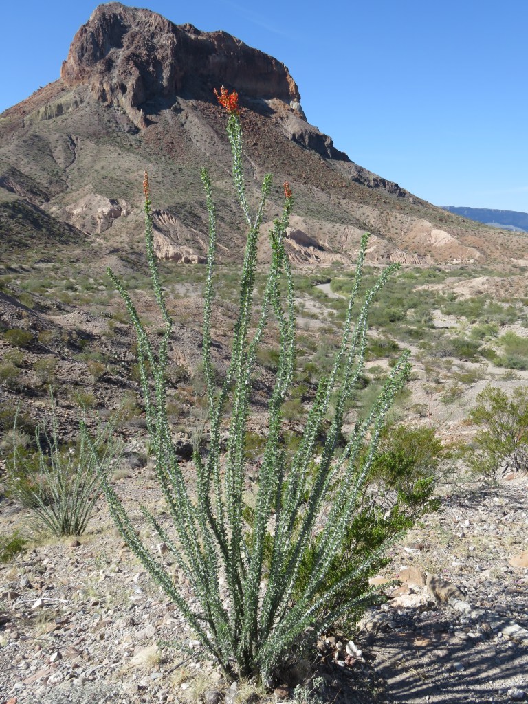
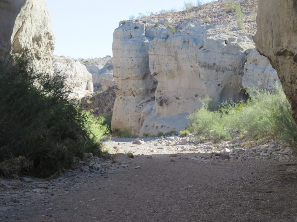
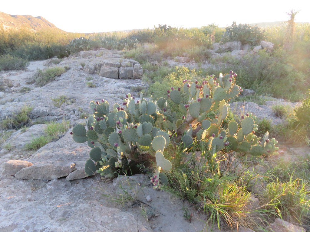
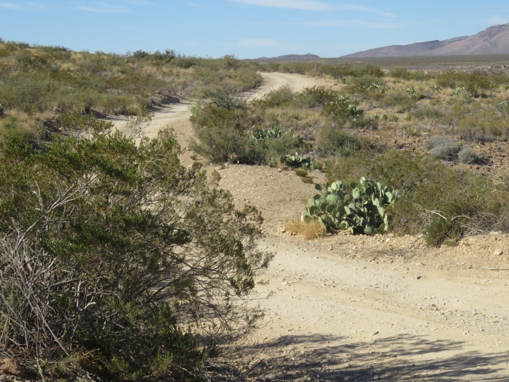
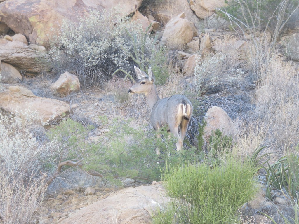
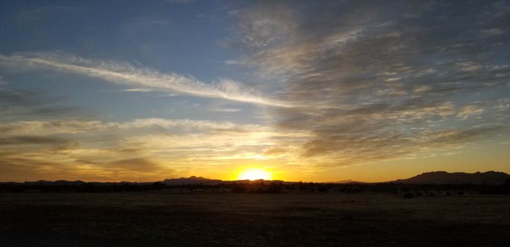
Cal was nursing a cold during our Willcox stay so this was pretty much the extent of our activities. I entertained myself with many enjoyable walks into the desert around our KOA. I’ll leave you for now with some of the pictures from those walks.

What a big, fluffy bush! The un-fluffy part looked like bittersweet, the tiny white “filler flowers” in a bouquet of flowers from the florist.
A very late autumn burst of color

Next time – Phoenix!

USTravel

Alpine, Texas

The Desk and The View

Back in the Eighties, three students decided they needed a quieter place to study than their dorm rooms at Sul Ross University. They hauled a desk and a chair all the way up the hill behind their dorm. They greatly enjoyed their spot and spent a lot of time up there. One of them accidently left his notebook in the desk, and when he returned for it, he was surprised to see a hiker had signed it. The notebook, the desk, and the chair became the stuff of legends. By now the desk has been replaced two or three times and there are several filled notebooks in a museum. I kept running into suggestions to “Hike to The Desk” in my research for this area of Texas, so we did.

It isn’t the easiest hike. The trail is only 1.3 miles to the desk, but there is a 219 foot ascent on a rocky and uneven trail. Once up at the top there are several trails crisscrossing each other and we had to ask some other hikers where to go. It is on the opposite side of the hill from the university. I couldn’t believe they hauled a metal desk all the way up there! These bicycles in a tree let us know we were finally almost there:

Cal signing us in The Notebook
On the side of The Desk
Sul Ross University and Alpine view before our final descent

Once down, we visited Museum of the Big Bend, since it was located on the university campus. Being a fan of petroglyphs, I thought this 17 foot replica of a remote petroglyph was interesting. The original was done in six colors of pigment and belongs to a hunting gathering culture dating back to 700 AD. The meaning is unknown, although archaeologists think it relates to their belief system. It looks like a lot of scribbles to me, but what do I know?

There were some very old maps, and I also liked this recreation of a general store, back in the 1800’s:

An 1836 map of Texas, the first to show the Rio Grande to the 42nd parallel

There was an art festival going on in the town, which was a huge deal before COVID hit and canceled it last year. Someone in an information booth gave us a walking tour map to see Alpine’s murals. It was fun looking at these. These were some of my favorites:

A pretty little courtyard

If I could pick Alpine up and move it closer to my family in Denver, I would love living there. It is a small, walkable little university town with a lot of flavor. And the milkshakes and Mexican Wedding Cakes at Scoops Creamery weren’t bad either!

Next time – On the road through the Southwest

USTravel

Southwest Texas

Enjoying the view of Lajitas Mesa from our RV site

Merry Christmas to all of my readers! Life is running a little slower this holiday weekend, so it seems like an opportune time to catch up on where the Twosna Travelers have been. I thought of doing a blog post from Texas to Arizona in one fell swoop, but that was entirely overwhelming.

The truth is, our time in the extreme south of Texas was absolutely golden. We loved the area, particularly the capriciousness of the landscape – flat desert with mostly all one type of cactus here, a mesa suddenly poking up there, a set of hills made out of ancient volcanic ash, canyons and hoodoos. When driving, we would find ourselves all of a sudden in the middle of the most jaw-dropping scenery. The nights were cool and the days warmed up, it never rained, and there was a new direction to head off in every time we were ready to go. If we didn’t, then Lajitas Mesa gave us a wonderful view every time we looked out our window. Here is another view with a look left of the mesa:

The piles of hardened volcanic ash look man-made to me, as if looking at a quarry or gravel and concrete business. The fact that they have been there millions of years makes it all the more fascinating. This view is partly in a state park. The RV park, and the resort in Lajitas that it is part of, sticks up like a thumb into Big Bend Ranch State Park, and somewhere in there is the border between the two.

It was like a moonscape, and we enjoyed some short hikes right from our RV into it:

Mexican Heather growing in the wild – something I planted every year in my flower garden
A prickly pear with the biggest spines I’d ever seen. Don’t dare come close!

It was a thrill one day to see a road runner cross the path near our RV:

One of the highlights of our time here was the day we drove through Big Bend Ranch State Park. Its border is the Rio Grande River. The scenic road, at the very bottom of the United States, winds up and around hills and canyons, always with the river on the left (going west) so that one is always looking at Mexico on that side, and more of the state park on the right. Here are two views of the river at Madura Canyon:

Closed Canyon was a “don’t miss” stop. It was our first slot canyon, and I’m looking forward to seeing more of these as we travel further west. It was marked as an easy-moderate trail but as the canyon walls closed in, the trail became very rocky with steep declines from one layer to the next. The rocks were slick and smooth with lots of crumbly gravel thrown in. We finally called it quits when one dropoff was so deep we couldn’t figure out how we’d get back up!

Entering the canyon – easy enough
The trail was not too bad at first
Cal looks so small compared to those canyon walls!
One of those steep dropoffs!
A place of awesome beauty which made us feel significantly small in the universe

Once back on the road, we stopped to check out a scorpion scurrying across:

From here, we entered the land of the hoodoos. Hoodoos, by definition, are tall, thin spires of rock that stick up from the desert floor. Mostly they are relatively soft rock topped by harder, less easily eroded stone that protects each column from the elements, and are formed within sedimentary rock and volcanic rock formations.

Along the road, this was our first glimpse of hoodoos, and this one looked like a shaggy dog to me:

Several hoodoos at a scenic stop

Our last stop, Ft. Leaton, was a total surprise to us. We thought it might be another western military outpost, but no…it was a trading post used from 1848 to 1884, but the last family lived here until 1925. The original owner had a Mexican wife, and after his death, she remarried and stayed on at the post. Lots of murder and mayhem went on here, and the post had a major fire in later years. Archeologists have found artifacts, and the Texas Parks and Wildlife completed a faithful restoration job. The walls are adobe and the inside rooms were cool and comfortable. A lonely state park ranger was pretty excited to show us a video and then we walked through. This was a very fascinating stop.

Ft. Leaton
A corner of the inner courtyard
The parlor, one of many rooms in the restored family area
Carretas such as these may have been the first wheeled vehicles to enter the United States when the Spanish first brought them in 1590. The wheels on this carreta are 6 feet tall!

Fully loaded carretas were so heavy that it took 10 to 12 oxen to pull them. The carretas here transported goods, most commonly Mexican silver bullion, on the Chihuahua Trail to San Antonio, Texas.

In the picture below is a fence made out of ocotillo, a common desert cactus.

The view from the bakery window
Of course, after this, a picnic was in order!

Before turning around, we decided to drive on in to Presidio, TX and discovered a grocery store! We had been deprived of a real grocery store for weeks, so this was very exciting. There was also a plethora of various dollar stores owing, we think, to the fact that Presidio is a Mexican border entry town.

The town of Terlingua was a short drive from our RV park in the other direction. It is a ghost town, but has a small artist colony which makes for some interesting shopping, and a handful of restaurants. The biggest thing that draws people to Terlingua, though, is the cemetery. It dates back to the early 1900s and is still being used. Many of the graves are of Hispanic heritage but then there is a hippie vibe to it, too.

In the early 1900’s, Terlingua was a mercury mining town and helped supply the WW1 war effort. The town was booming but there were mine accidents, gunfights, and the 1918 influenza epidemic. The town declined through the mid-1900’s and demand for Terlingua’s mercury was not repeated during WW2.

I had fun exploring the ruins of some of the houses. They were so small, and the doorways so short!

This church reminded me of one that has been in the news lately..the movie set shooting.
A 1930’s movie theatre, which is now a great place to eat, have a drink, and listen to live music. All is not dead in Terlingua.

Our RV park, Maverick Ranch, was part of the Lajitas Golf Resort and Spa. Like a poor cousin, the park is set back across and down the road from the resort. While there was nothing at all luxurious about Maverick Ranch, you could be entertained for days at the Lajitas Golf Resort, especially if you play golf. Whatever Lajitas was before the resort was built, the tiny town is now all about the resort. There is an airport built specially to ferry in the vacationers. If you need more entertainment, there is horseback riding, ziplining, jeep tours, and a concierge to arrange whatever it is you might need. There’s also a “boardwalk” (made out of cobblestone) for shopping, although I couldn’t begin to afford anything in the shops. A couple of restaurants/bars round out the offerings.

Down the long driveway from Maverick Ranch, there is a cemetery smaller than the one in Terlingua:

We made a personal call on the Mayor of Lajitas, which is… a goat:

Our last evening in Lajitas, we took a stroll under the starry skies, and a full moon, over to one of the bars at the resort. It was a great way to say farewell to an area that we had enjoyed very much. We are on the lookout for long-term places to winter in the future. If we could boost our phone and internet service, Maverick Resort would be a sure contender. Cheers!

Looking at Big Bend National Park from Terlingua Starlight Theatre, Mule’s Ears on the right

Next time: Alpine, Texas

USTravel

Big Bend National Park – Chisos Mountains and Santa Elena Canyon

Chisos Mountains, Big Bend National Park

We were in Big Bend a full week, and it was barely enough to cover the highlights. Several people we talked to opted for a couple of hikes a day. Owing to the direct afternoon sunshine, and the fact that a lot of hikes necessitated a drive down bumpy rocky roads or hiking in open desert, one hike per day was enough for us. We visited the Chisos Mountains area after our Balanced Rock hike.

The Chisos Mountains go around in a circular fashion and in the middle is a slightly hilly area called “The Basin”. Big Bend operates another campground, a lodge and restaurant, and a park visitor center in the Basin, and many trailheads begin here. We didn’t even look around the Basin when we first arrived, because after the Balanced Rock hike we were looking for lunch. Several tourists were admiring this tarantula outside the restaurant.

I was opting to be cool, pretend I’d seen a lot of tarantulas in the wild in my life, and eat my lunch, but Cal had to go have a look.

There is a break in the Chisos Mountains circle called “The Window”. There is a 5.6 mile round trip trail that can be taken to it, but that would have been our second hike of the day. We opted for the quarter mile paved “Window View” trail. The view through the Window and out to the western part of the park was spectacular.

View of “The Window” from The Window View Trail, Big Bend

On another day, when we were fresh, we returned to the Chisos Mountains to hike the Lost Mine Trail. This trail is 4.8 miles round trip with an 1,100 foot elevation gain. It was one of those straight-up trails, but despite that, it is one of the most popular trails in the park.

There were several switchbacks, and at one point the trail was nothing but pure rock.

The trail left, and the trail right

Once we gained elevation, we were rewarded with gorgeous views of the Chisos Mountains.

I saw this same view on a postcard, and said it was a view of “Elephant Tusk”. That might be the formation in the top center of the card. It doesn’t look like an elephant tusk to me, though.
Being at this altitude and looking down on the mountain peaks was pretty exhilarating!
At the top
The only wildlife we saw was this lizard, perfectly matching the rocks it lives on.

At the top, I inched my way around the corner of the rock we were on, and dangled my feet while I looked at the view below. There was nothing but air straight down. It was a bit dizzying, so I didn’t stay for long!

In the western side of the park is another “can’t miss” hike, the Santa Elena Canyon. It is at the end of Ross Maxwell Scenic Drive, which in itself was a treat. There were many places to stop on the way, a nice way to see the park if one wasn’t inclined to do a lot of hiking. We visited the ruins of Sam Nail Ranch, an oasis of green sunk into the hills. It was supposed to be great for birding, but we didn’t see birds.

The Nail family once called this their home

Another stop-off, this time to see “Mule’s Ears”, below

We admired the purple cactus on the way. I had never seen purple prickly pear cactus before, and there were areas where there were more purple than green.

And, a blooming ocotillo. These usually bloom in the spring, so this was a surprise. A whole area of blooming ocotillo in the desert is really a sight to see.

The rock behind the ocotillo is called “Cerro Castellan”, and was a landmark for those traveling along the way. We had stopped for a look at Tuff Canyon, which we ended up hiking in for a bit. The area we were driving through had seen major volcanic activity millions of years ago. There were over 20, and some minor ones, which created the landscape we were seeing. “Tuff” is hardened volcanic ash. This canyon was an unexpected surprise and I would have loved to explore it further.

Santa Elena Canyon lies at the end of this scenic drive. At the beginning of the canyon, we had to figure out how to get around the creek that feeds into the river. The other hikers showed us the way.

We had arrived at Santa Elena Canyon. The walls on the left are Mexico, on the right is the US, and the Rio Grande River is in the middle. I had a mistaken impression we could wade over to Mexico, but it was too deep at this point.

The trail to get up and inside the canyon
Sadly, the end of the trail. We could go no further.
With Cal down the trail a bit, you can get a little perspective on how large the canyon is.
With my back to Mexico and the Rio Grande. I touched the bushes with my walking stick so…I was there

A woman we crossed paths with several times on this day seemed a little disappointed with the size of the river. “Rio Grande”, she said, “The word means big! Where is it big?” She had tried several paths on the river, and none panned out for her. Indeed, at times in the park, it seemed like no more than a trickle. It seems to me that at times when I’ve crossed over into Mexico further east than Big Bend that it was wider and deeper. Or maybe “Grande” refers to the length. Or maybe it used to be bigger? Who knows, but it was grand enough to me.

The Twosna Travelers at the very bottom of the USA

Big Bend is one of our least visited US National Parks. It’s a distance to go, even for Texans. There aren’t a lot of paved roads except for the main connectors through the park. With its combination of river, desert, and mountains, it was an amazing place to visit and I’m glad we were able to spend a week there.

Next time – Big Bend Ranch State Park

USTravel

Big Bend National Park, Texas

Blessed are the curious, for they shall have adventures.

-Lovell Drachman

Sierra del Carmen mountains in Mexico, Big Bend

From Denver, down we went to escape the coming of winter just as fast as we could: Raton Pass and Roswell, New Mexico; Guadalupe National Park, Texas. The weather stayed in the 40’s, fog and low hanging clouds. I was excited to return to the Guadalupes and thought we’d have a picnic lunch and maybe a little hike there. It was windy and cold so we ate a quick lunch in the truck.

Guadalupe Mountains: there’s a mountain out there somewhere!

Then Van Horn, Marfa and Alpine, Texas. The towns kept getting smaller and the scenery by the road more beautiful. Marathon, Texas; then 39 miles to the gate of Big Bend; 26 miles from there to Panther Junction in the park; and then, finally, 20 miles more to our RV site in Rio Grande village. It took us 4 days driving an average of 200 miles to arrive. That sign looked pretty good.

I was hoping this tunnel would be fine for our RV and luckily, it was.

You can see the Sierra del Carmen mountains peeking over the top of tunnel on the right. A picture of them is also at the top of this post, and brown/grey is their normal color. They are at the far east of the park, and at their feet is the Rio Grande River. That means that these mountains are actually in Mexico. We were closer to the mountains in our site, and the beautiful thing about them is that the sun turns them a beautiful pink as it sets. We enjoyed this show every evening while we were there.

We took the “nature hike” at an adjoining campground for our first look at the Rio Grande.

That’s Mexico over there behind Cal and the Rio Grande
A peek at the Rio with the Chisos Mountains behind
I discovered I really, really like to take pictures of all the various cactii

When we returned to our RV area, there was a coyote yapping in the parking lot. I don’t know what its problem was, but then we saw a few javelinas grazing just beyond our RV. Then, walking just beyond the RV’s over to an adjoining meadow, horses grazing! We were very excited to see all the wildlife and were hopeful this would continue every evening, but that was the best show. We learned from a ranger later that the horses weren’t wild, but belong to Mexicans just over the border. They just let them wander and graze until they want them. Unfortunately, the only good picture I got was of the javelinas.

These two javelinas posed nicely for me, although they wouldn’t stand right next to each other!

Boquillas Canyon, in the Sierra del Carmens, was also close to us so we took a hike there.

Along the hike to Boquillas, the Mexicans across the border had items left for sale in many places. Most everything was $10, and you would leave your money in a container. Near Boquillas, you could cross the Rio Grande over to a little village called Boquillas del Carmen in a rowboat for $5. Once there you could shop for a handmade item, or have a lunch in a couple of restaurants. Sadly, this operation was shutdown for COVID when we were there, and this cut off a good source of income for these people. But they are very enterprising, so this was their way of keeping a little money coming in. This fellow let me know his wife’s tamales were very delicious, so we purchased a couple of bags. He was right, they were excellent. And I’m happy to report that the Boquillas del Carmen crossing has been reopened since we left the Big Bend area.

I watched these guys, over in Mexico, setting up a volleyball net. I think they were surreptitiously keeping an eye on their merchandise.

Also close to us was Hot Springs. Cal got his first experience on the Big Bend side roads in getting there.

It was a one way loop with steep dropoffs.

Hot Springs was actually a little resort from the 20’s to the 40’s.

The old “motor court
Petroglyphs on the way to the hot springs
An immense yucca tree; you can see how large it is by looking for Cal on the left.
Here I am, taking a soak in the hot springs. It was very hot! The resort had built a spring house around it which is gone now, but the foundation of it is good for sitting on.
The hot springs, and the Rio Grande next to it, was a popular swimming hole and an enterprising woman over on the Mexican side was taking advantage. This was a large group of partying Americans who were suddenly hungry for tacos and tamales.

Many people who love the national parks bemoan the fact that sites which were once little-known are being publicized by influencers on social media. They are becoming more crowded and, in some places, becoming literally trampled over by excessive usage. I see this as a double-edge sword. It’s not great that we couldn’t find a parking spot just to take a hike in Rocky Mountain National Park. But necessity has led the Park Service to create a park shuttle service. The overusage in the parks is leading to some pretty creative and innovative ideas. Social media, namely a National Parks Facebook group that I am in, led me to this next spot in Big Bend. Park literature didn’t show a picture of it, only to name the trail. It is this spot: Balanced Rock, on the Grapevine Hills Trail. Once I saw a picture of it, I wanted to find it.

Cal usually obliges my curiosity about things, but heading to this trail necessitated a 7-mile drive down a dirt road in the desert which became more “washboardy” the farther down it we went. After a lot of bouncing around I was relieved when we finally arrived, since his good humor was just starting to dissipate.

“THAT ROAD”

The trail was 2.2 miles and very easy except the last 1/4 mile, which was straight up. We enjoyed the scenery along the way.

Breakfast time-this deer only momentarily stopped its munching
I think this is a claret cup cactus, sitting way up high on the rocks

The last 1/4 mile involved clambering up rocks with hands and knees in places. It was an accomplishment to arrive at the top!

We had to climb up this trail, and then back down

What a grand adventure. I will continue our exploration of the park in my next post, because there is still so much to see!

Next time: Chisos Mountains and Santa Elena Canyon in Big Bend National Park