USTravel

Twenty-four Hours in Isle Royale National Park, Michigan

This national park is included on a list of the top six least-visited national parks. It’s not for lack of beauty, but simply because they are all hard to get to. Isle Royale sits in the middle of Lake Superior, 55 miles as the crow flies from Copper Harbor in Michigan. I’ve always had my eye on Isle Royale, though, and finally we had our opportunity to go. It was part of the reason we were staying in the Keweenaw Peninsula of Michigan’s Upper Peninsula.

We were told to be at the harbor at 7AM for an 8AM departure on the Isle Royal Queen. We would be staying overnight at Rock Harbor Lodge, so we had duffel bags. The ships crew hoisted them onto the boat and we never saw them again until we were in our room at the lodge. Besides us were more people with luggage, large excited groups of backpackers with their stuffed packs, which also got loaded, and a handful of daytrippers.

It was exciting to be on the boat and finally on our way.

Leaving Copper Harbor

The ride is over three hours, plus a wait to get off boarded and a talk by the park rangers before being turned loose. I’m not sure if its worth it to just come for the day. The boat leaves Isle Royale at 3PM, and of course you need to be there early again, so for your well-over six hour boat ride, you barely get a couple of hours to explore. That’s good, I guess, if you just want to see it and say you’ve been there.

There’s not a lot to see from the boat. We could see the Keweenaw Peninsula for a long time off in the distance. For an interval of time there was just water. Lake Superior is the largest of all the Great Lakes and the largest freshwater lake in the world by surface area at 31,700 square miles. It also holds 3 quadrillion gallons of water, enough to cover North and South America with a foot of water. There have been over 350 shipwrecks on the lake, and its cold water has preserved them for divers. The number of shipwrecks is why there are so many lighthouses.

Finally, Isle Royale in view!

The two buildings on the left are the lodges; the one on the right is a guest house and the only place to pick up the Internet.

We arrived in Rock Harbor, which is on the northeast side of the island. The only other settlement is Windigo, which is on the southwest side and serves the boats coming from Minnesota. It takes five hours to ride a boat from one end to the other; the distance is 45 miles. It takes a backpacker 4 or 5 days to reach Windigo.

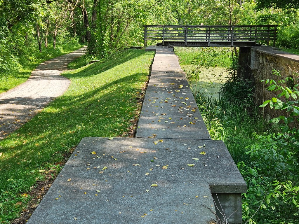
Rock Harbor would be our center of life for the next day; if we wanted to leave the area, there were only hiking trails that led into the interior.

At first, we needed a map to get around. Signboards were very helpful. There’s no internet here! By the time we left we knew pretty well what was where.

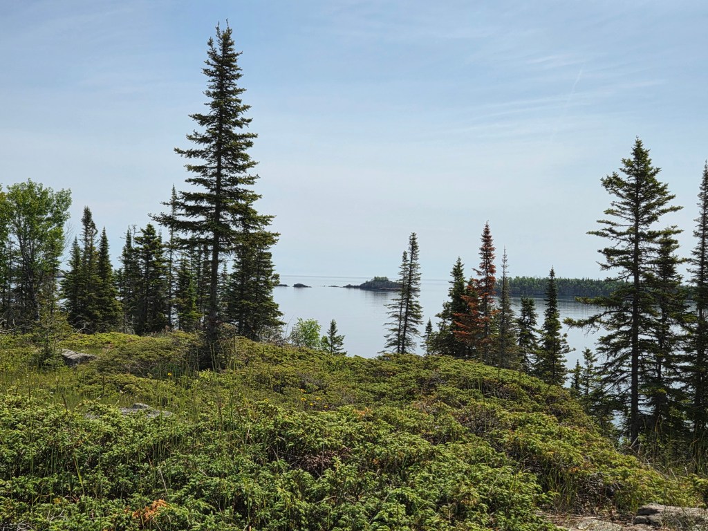
The dining building is a restaurant on one side and a fast-food place called the Grill on the other. After lunch at the Grill, we went out for a hike as our room was not yet ready. We chose the Stoll Memorial Trail, seen on the bottom right of the map. After a half hour, Cal declared that he was done and wanted to turn around. The day was warm, the sun was bright, and his hat was in his luggage. I had no thought of turning around and kept going.

What a beautiful, untrammeled place, all quiet save for birdsong.

At some point in my hike, I passed a sign that stated I was now in wilderness, and past the Park Service’s maintenance. Wilderness? When in my life have I ever been in true wilderness? Perhaps somewhere in the Rockies? I pondered that as I walked.

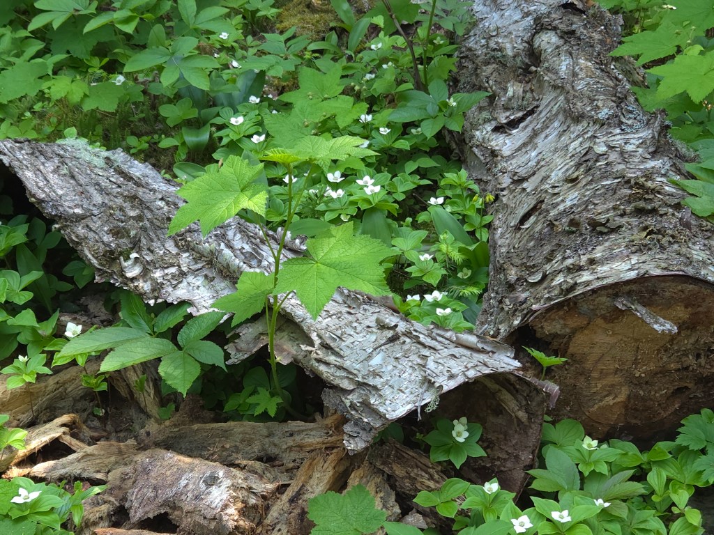
There were many wildflowers to enjoy along the way.

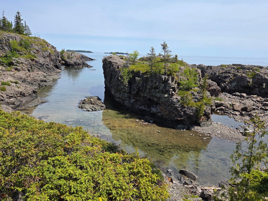
I thought it might be nice to get to the tip of the island at Scoville Point, but it isn’t the tip. Blake Point is. But Scoville was good enough, and it felt wonderful to sit and enjoy the day when I reached it.

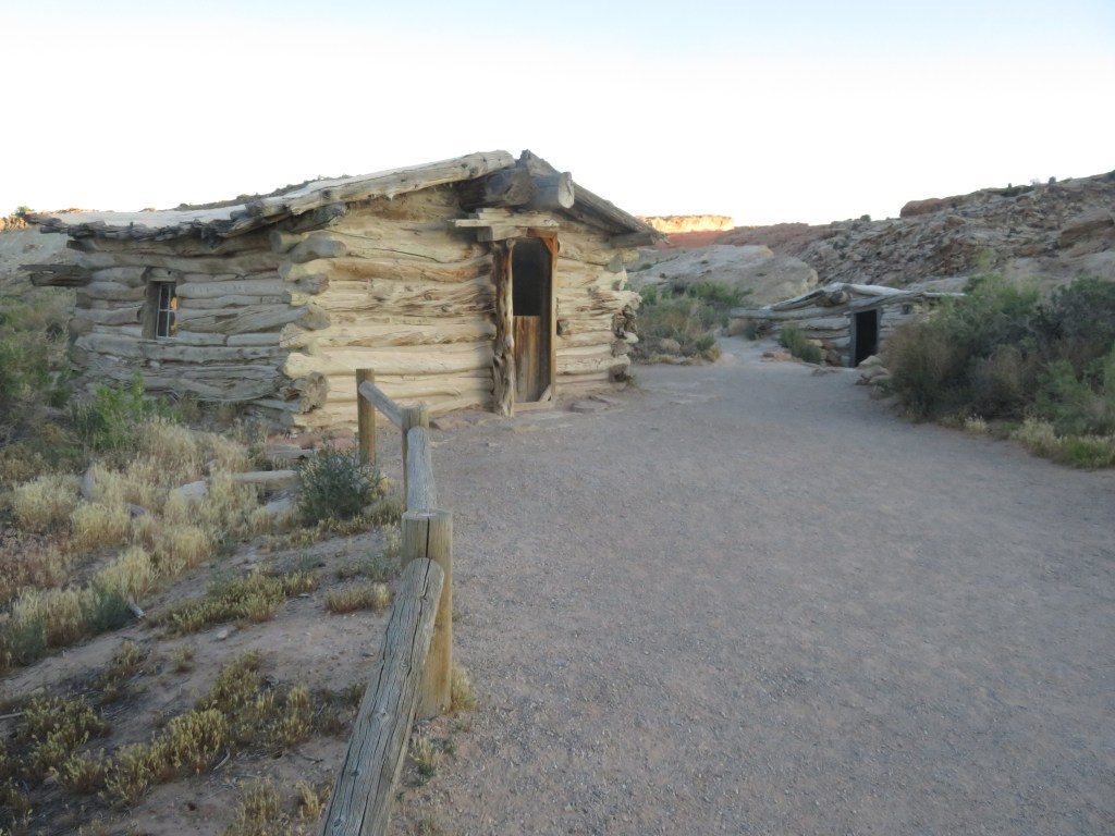
On the way back I chose a different trail, and this took me to Smithwick Mine. It was just a hole in the ground, but a man named Smithwick tried mining copper for a couple of years. It wasn’t profitable.

Large mammals live on the island (but no bears). It is assumed that they crossed over to the island during winters when the lake was frozen. But how did the Isle Royale red squirrel get here? It’s not known, but they’ve been here so long, they are considered to be their own subspecies. They are smaller and make different sounds than the ones we are familiar with. I wasn’t lucky enough to see a moose, but I was excited to see a squirrel at the Smithwick Mine ruins.

After my hike our room was ready. It was very basic, but did have a large picture window where we could look out at the lake.

We dined on fish in the restaurant and took a post-dinner stroll to Tobin Lake. It is where people land if they arrive by airboat. It was still bright day as the sun sets late here.

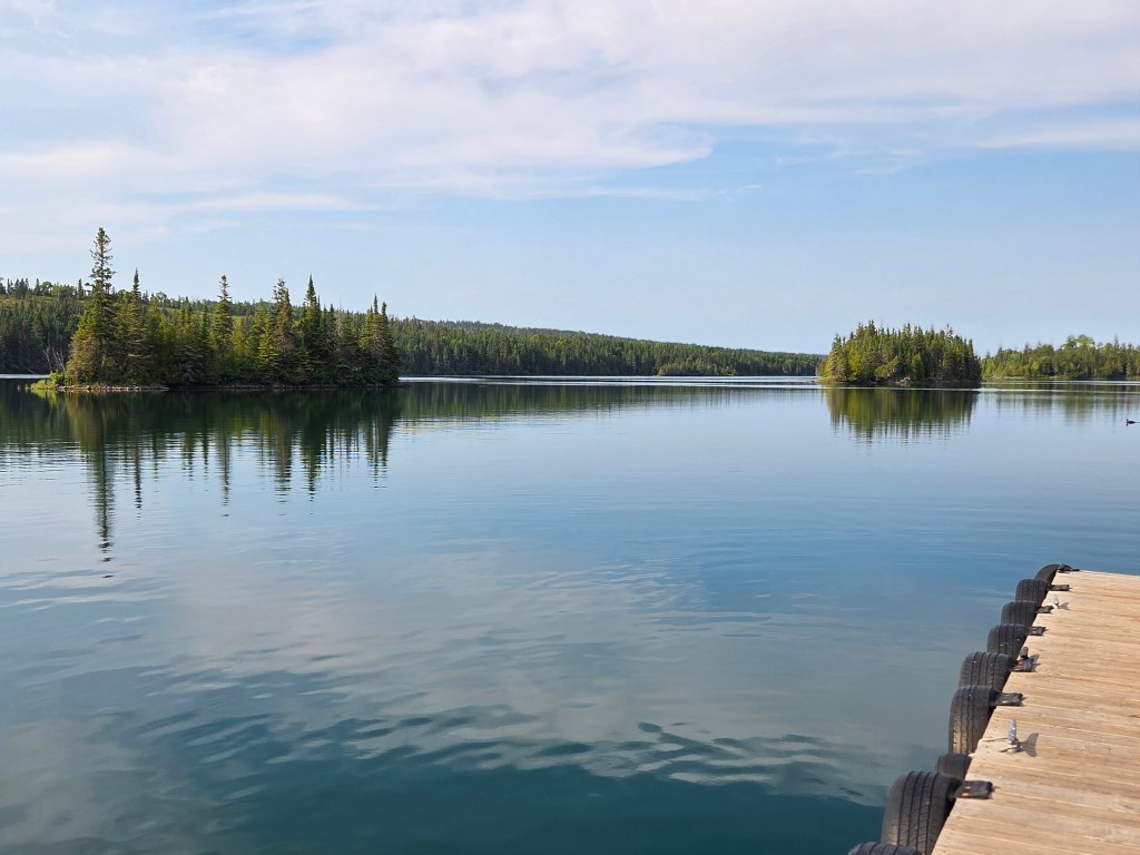
We fell asleep while enjoying the view in our room with the windows open. It was still light out at 10 PM, which is when I took the picture below. I woke up later and could see stars as well as the Milky Way. Windows still open, I was lulled back to sleep by the sound of the waves.

In the morning, we hiked in the other direction after breakfast and admired a duck with no less than 23 fuzzy ducklings. We stopped to look at Suzy’s Cave. It was a shallow cave, probably hollowed out by the lake at one time.

We hung out on the beach for a little bit:

Lake Superior showed us the capriciousness of her weather. While the previous day had been sunny and warm, this day was overcast and cool. Cal reminded me of the weather forecast: it was due to rain, so we came back to the harbor at a pretty good clip.

In a place as remote as Isle Royale, everybody becomes your friend and we talked to many people. There was the couple on the boat going over who were going backpacking for 5 days. We swapped hiking and traveling stories, which made the trip pass quickly. Our server at dinner in the restaurant was an Ecuadorian law student who was eager to chat; he’d worked at Isle Royale several summers.

But the couple who stood out for me were the folks we shared a table with in the lunch area for two hours while it poured rain outside. They’ve been on a mission to see every single one of the main 63 National Parks in the system. Isle Royale was number 61. That includes Samoa, the US Virgin Islands, and all of the parks in Alaska except for the two they have left to go. The husband started showing their pictures: the fat bears catching salmon in Alaska, the peaks of Denali. Then he moved on to their other adventures: animals on safari in Africa (Tanzania and Kenya are better than South Africa, if you ever want to go), penguins in Antartica, Machu Pichu, Easter Island, the list went on. I have never in my life met such a well-traveled yet totally unassuming couple, and they were fascinating.

On the way back, we sat with a woman who had solo backpacked on the island for five days. The weather had been beautiful. She showed us pictures of the animals she’d seen: a family of otters, a moose with baby, and a fox. She bested my mama duck with the 23 ducklings by showing me a picture of a loon mama with 32 chicks, including one on her back. I thought that I would have liked to have seen all of that, but I decided that at this point in my life I wouldn’t want to spend five days in the wilderness to do it.

These peoples’ stories, plus our own, have all been wrapped up in the memory of our time here. It was special and unique and not something I will quickly forget.

Next time: a visit to Bayfield, Wisconsin

USTravel

A Quick Stop In Northwest Indiana

Our travel journey took us to Elkhart, Indiana. I’ve traveled in, around, and through this state, and even lived in it for a short time or two. There are a couple of places I’ve missed seeing, but I don’t have the fondness for Indiana that I do for Ohio. With that in mind, our stop in Elkhart was only two nights. I had a plan for our one day here, which involved a small museum and a place to have lunch.

I’m generally our trip planner, but Cal surprised me in the morning of our stay by asking me if I wanted to go to Indiana Dunes National Park, some 65 miles away. I wasn’t going to turn that offer down.

The Visitor’s Center was open when we arrived. I stamped my National Park book, watched a video about the park, and purchased a couple postcards. As I was checking out, the cashier – who was also helpful park staff – asked if I needed assistance in planning our time in the park. I told him we were looking for a trail to hike after our long drive, maybe a combination of woods and dunes? What he suggested was absolutely perfect.

I had learned in the video that the park is working hard to restore the woodlands after decades of abuse. It lies in an industrial area, and indeed, we passed the road to a steel mill on our way to the trail. The woodlands are the final result of sand dunes that have been blown out by the wind, forming ponds and marshes first, and then a savanna after the marsh dries.

So, the view in the picture above was an ancient pond which is now a marsh. Lake Michigan would have lapped at my feet eons ago. This process doesn’t happen quickly.

We found West Beach and the Dune Succession Trail easily enough. First, there were boardwalk steps to climb —

–after which we were rewarded by our first view of Lake Michigan and the dunes.

Down into the woods we went–

— and finally, out to the dunes and the lake.

Dipping my feet into the lake was mighty fine.

This had been about a three-mile hike.

Our morning over, we headed back past Elkhart to Middlebury and Das Essenhaus, a restaurant that had been recommended to me by my sister-in-law Heidi. Indeed, I’m not even sure I hadn’t been there before. It’s in Amish country and not too far from Shipshewana, a shopping mecca that I enjoyed with her on a couple of occasions long ago.

This was a late lunch and our appetites were up. When our delectable broasted chicken arrived, we had already inhaled the dinner rolls. We even had pie for dessert because it was too tempting to resist.

Das Essenhaus is huge. A sign up in their hallway stated that they can serve 1,100 guests at once. They have their own bakery store, plus other shops outside of the restaurant. Afterward we purchased more dinner rolls (they are great for lunchtime sandwiches) and other baked goods for the freezer.

They have their own car show every Thursday. It doesn’t start till 4:30, but that didn’t stop folks from setting up several hours early. We had seen plenty of old cars in the drive by in Ohio, but stopped for a quick look.

The Elkhart area is the RV capital of the United States, since most of the big brands are built here. As we drove around, we saw some names we recognized and names of makers of the parts that go inside of them. Early in our planning process, I had hoped to tour the factory that made our Keystone Montana, but we weren’t here on their Tour Day.

Instead, we visited the RV Hall of Fame and Museum. I don’t know who or what is in the Hall of Fame, I just wanted to see the old RV’s. It was a fun stop to end our day.

This is the oldest one, a 1913 Earl, which could go behind a Ford Model T.

A trailer from 1916 made me want to go camping. Out in the woods or mountains somewhere.

It is one of the first manufactured trailers. Most to this point had been homemade.

An RV built for a famous movie star is here, too. It was built in 1931 for Mae West. Paramount built it for her to entice her to make movies for them. It has a small hot plate and an icebox, plus a porch out back to sit and enjoy a fine day. What more could any movie star want?

Moving forward in time, this “Scotty” trailer was manufactured in the late 1950’s. It just looks so cozy.

Mobile homes are here, too. Cal lived in one for many years as a child, so I asked him if this looked familiar. He was very young then, so didn’t remember.

There wermotorhomes and many varieties of trailers and campers, as well as park models – the ones that go into RV parks and don’t move. It wasn’t until we left that I realized – why were there no 5th wheels, like our RV? I didn’t think to ask until after we left. This RV may look a little bit like one, but it is really a trailer.

The RV I like best, however, is our own, and that’s the one we go home to after all our adventures on the road.

Next time – north to Michigan

USTravel

Back to Ohio – Cleveland and Cuyahoga

It’s only a 58 mile drive from Lake Pymatuning, PA to Streetsboro, OH. That was one of our shorter moves. While moving day was full of sunshine and warmth, the next day was full of rain. We were here for many reasons, one of them being Cuyahoga National Park. A visitor center is always a good place to start, so we headed out in the pouring rain to Boston Mill Visitor Center.

This national park is distinct in that it sits in an urban area between the cities of Cleveland and Akron. It’s long and narrow, running north to south. I was surprised to hear that the park turned 50 recently. Gerald Ford signed it into existence in 1974 as a National Recreation Area. It only became a national park in 2000.

I did not think the person behind the desk was all that helpful. I had heard that you can put your bikes on a train that runs through the park, but I discovered that the train is a separate concession. She pushed a train schedule at me, and a map of the route, but I couldn’t take either one with me. I took pictures of them and we figured out a plan on our own.

Two days later, when the rain was finally finished, we were at the Brecksville Station. On the park map, it is shown as “Station Road Bridge”, and nearby is the Brecksville Nature Center. We waited hopefully with our bikes…and waited…no train. I finally did what I should’ve done in the beginning, and looked it up online. That’s what everyone really wants you to do in 2025. The train doesn’t run on Tuesdays, the very day we were there.

No worries, we rode on the Ohio-Erie Canal towpath nearby and although we were a shade disappointed that the bikes didn’t get to ride a train, we had a great bike ride. First, we had to cross the 100-mile Cuyahoga River, the centerpiece of the park.

After we crossed the bridge, we swung southward, and the old canal was on our left. The bike trail goes along the old tow path. Signboards told us what we were seeing, which necessitated a lot of stops. The theme of the board on this particular stop is that nature is slowly reclaiming the canal. Sometimes it is totally grown over, and sometimes there is still water in it.

The canal was constructed during the 1820’s and 30’s, and saw heavy usage right away. It carried freight traffic until 1861, when railroads were built. Until 1913, it was a source of water for nearby towns and industries. It began a slow decline in the late 1800’s, and then the flood of 1913 happened. The canal was mostly wiped out. This must have been a huge flood. I first learned about it when we had been in Dayton. There, a whole museum building in Carillon Park was dedicated to the flood and its aftermath in that city.

The signboards told of industry activity on the canal, families growing up nearby and using the canal for skating in the winter, portions where there was danger from thieves and bandits. Settlements such as Boston and Peninsula became flourishing towns.

A part of the National Park area in Boston, Ohio

Riding the towpath is an enjoyable way to experience the park.

We returned the next day to ride the train. This is not just a cute little excursion train. It is a full size antique passenger train cobbled together from old train cars from across the United States. This is an old resurrected California Zephyr observation car that ran between 1949 and 1970. It had been put behind a passenger train of unknown-to-me origin.

Our seats were in one of the “coach” cars that you see on the right of the picture above. We explored the train–ok, I admit, we were looking for the concession car– and walked through first-class cars that had been lovingly restored to the glamour of the 50’s and 60’s. We rode the train to its northern terminus at Rockside, and then back down to where our truck was sitting in Peninsula. If we’d had our bikes, the porters would have put them in the baggage car and taken them down again for us.

Before riding the train, we explored a couple of Cuyahoga Valley’s waterfalls. Driving through the park and trying to find things isn’t the easiest thing to do. The park’s boundries go in and out of suburbia and also Cleveland Metroparks, and signage isn’t always the best. We couldn’t find Great Falls of Tinker’s Creek, and spoke with another tourist at Bridal Veil Falls who couldn’t find it either. But Bridal Veil was beautiful.

At Tinkers Creek Gorge overlook, the full beauty of the national park is in view.

Brandywine Falls is the showpiece of the park.

I mentioned at the beginning that we’d had two full-on days of rain. On the first rainy afternoon, we had visitors.

Kevin and Diana arrived with Lithuanian kugelis, which is a potato and egg “pudding” – like an egg dish – and roses from their garden.

Diana and I were classmates when I lived in the Cleveland suburb of Euclid. We went to school together from grades one through four, and were pen pals for many years after I moved away. Now, though, we communicate by texting. She and Kevin drove from their home in Fairport Harbor just to see us. The rainy afternoon flew by and we ended up having the kugelis for supper.

Aren’t the roses beautiful? They really brightened up our RV for a few days. Even the two tiny buds bloomed.

I’ve seen Diana off and on through the years we’ve been friends, but mostly in our younger days. Whenever we do get together, though, it always feels like yesterday since I’ve seen her. There is always so much to catch up on.

We were a bit torn on what to do during the next rainy day, but in the end we drove up to Cleveland to visit the Rock and Roll Hall of Fame. This was a fun stop!

Exhibits took us through the genre’s history, from before we were born and when we were children. Music blared and most of it was songs we’d remembered and liked. Original music, costumes, and other memorabilia were highlighted for many artists.

There was sheet music and boots from Carole King and Bob Dylan’s harmonica. Guitars from Earth, Wind and Fire and the Doobie Brothers. A couple of Cher’s and Rod Stewart’s costumes, and the list goes on.

There is a whole room dedicated to the Beatles.

It’s a little bit funny to think Elton wore these things.

Pink Floyd’s “The Wall” was a favorite of Cal’s back in the day. The Wall actually exists and it is here.

In the early era of rock and roll, those in authority were sure that the music was leading teenagers down the path of destruction. I liked what John Lennon had to say about it.

The heart of rock and roll is still beating…in Cleveland.

As we stepped out of the museum, the rain was letting up, and we decided to walk into downtown Cleveland for lunch. The Winking Lizard had the best salad I have had in a long time. They called it the Blueberry Salad, but there was more fruit in it than just blueberries, plus feta cheese, and sliced steak that came out sizzling hot. So delicious! On the way to the restaurant, an orchestra was playing:

For several years of my early elementary-school childhood, I lived on Lake Erie, and its beaches were my playground. Because of that, I feel a particular affinity to this lake. We walked up to it after lunch, but by then, we were back to full rainshowers.

The William Mather is Cleveland’s Great Lakes museum ship

Goodbye, Cleveland. Perhaps we’ll return on a sunnier day.

Next time – a bi-state visit

USTravel

A Drive and A Hike to the Top at Yosemite

After our bike ride at Yosemite, it was getting toward late afternoon but we weren’t quite ready to call it quits in the park yet. We decided to finish the day by driving the just-recently-opened road to Glacier Point. This added 15 slow miles of twisting and winding road to the already long drive, but Cal said he was up for it. We began to see snow in the forest after we had gone several miles up the mountain.

Once parked, it is an easy walk on sidewalks to the different viewpoints.

Glacier Point’s elevation is 7,214 feet above sea level, so the view from the top is very spectacular.

Straight ahead in the picture above is Tenaya Canyon, and Basket Dome is on the upper left. Half Dome, on the right, figures prominently in almost every view from this point, and Clouds Rest is to the left of Half Dome. I learned a new word: Clouds Rest is an arete. That is a thin ridge of rock that is left when melting glaciers eroded away solid rock. The melting glacier formed Tenaya Canyon. Looking down from the Clouds Rest you can see its path.

Putting Half Dome to the left of the picture, you can see Nevada Falls and Vernal Falls, with a view of the falls again below. Nevada Falls is the upper falls.

Another view of this beautiful place:

Our park visit had lasted ten hours, and this was the perfect way to end the day.

We wanted to see Yosemite again, but we needed to put a rest day in between. It was a very long drive to the park. Our next visit was on the Thursday before Memorial Day. Now or never!

This time, we were here just a little earlier than the previous visit. This was serious Hike Day for us, and I didn’t want to do it in a crowd of people. We chose to hike Vernal Falls. According to the Park newspaper, it’s 2.4 miles one way. No sweat, right? It wouldn’t be, except for those 600 granite steps up to the top.

The most sedate part of this hike was the one mile walk (not included in the 2.4 mile calculation) to the trailhead from where we parked. Immediately at the Mist Trail trailhead, we started going uphill. A stop at the footbridge to admire the rushing river after a mile and a half gave us a chance to catch our breath.

The steps started after the footbridge, and the falls soon came into view.

The falls created its own wind, drenching us as we worked our way up the uneven steps of varying heights.

And then, the final ascent, along a cliffside to the top:

Finally, Vernal Falls – we made it! We sat in the sun in an effort to dry out and to eat our snacks. We chatted with a couple who had come up with their eight-year-old daughter. She was deservedly very proud of herself.

Looking down on the trail from whence we’d come:

From here, many people continue on to Nevada Falls, or even Half Dome. This was enough for us; it had seriously tested our limits. It had given us a tremendous feeling of accomplishment. But we had led a steadily increasing stream of folks coming up, and with the narrow trail and steep steps, we did not want to go back down the same way. We opted instead for the Lewis and Clark Trail. Although there were a few hills to climb, there weren’t near as many steps, and eventually we were mostly going downhill.

We could look down on the top of the falls where we had just been—

and enjoy our last glimpse of the beautiful mountain wilderness.

With the hike from the parking lot and back included, our total day’s trek was 20,636 steps – 8.46 miles. It had taken us five hours. Pizza on the deck at Curry Village in Yosemite Village was much enjoyed.

Yes, there are crowds at Yosemite, especially near a three day weekend. The park is so large, though, that with a bit of planning anyone can carve out a peaceful slice of this paradise for themselves. It truly is one of our park system’s greatest gems.

Next time – three stops on the road

USTravel

A First Day In Yosemite National Park

We did not have far to go to switch from one RV spot to another while heading to Yosemite. By now we were into the week before Memorial Day, a time of year that I really didn’t want to be in to visit the park. That’s the way calendar planning goes sometimes, so we had to make it work. The very next day after our new setup, Tuesday, we went into the park.

I was afraid of a miles-long wait to get into Yosemite. Massive crowds. Happily, we did not experience that, even for a weekday before a holiday. We did get up at 5 AM to drive the hour and a half trip to get there. The guard shack at the entrance was not even open yet, and we drove right in. Coming through Tunnel View, this is the sight that greeted us:

The morning sunlight streamed in between the peaks, filling the valley with exquisite light and playing a peek-a-boo shadow game with the surrounding cliffs.

From Tunnel View, we proceeded to the Yosemite Valley Floor, and got a spot in the empty parking lot at Yosemite Valley Lodge. It was a short walk across the road, where the climbers in their tiny dome tents at Camp 4 were already packing and ready to take on El Capitan. Down an easy paved trail, and up to Upper and Lower Yosemite Falls, there were only a handful of other folks out.

At Lower Yosemite Falls, I was delighted to see that the sparkling water and morning sun produced a beautiful rainbow.

We had signed up for a Valley Floor Tour, and had some time to kill, so back at the lodge we sampled some pastries. A young man from one of the cities on the California coast shared our table and we had an interesting chat. He was hoping to do some climbing that morning, but wanted to meet someone to buddy up with to do his climb. We were for sure not the right folks for that!

The Valley Floor Tour may have been too sedate an activity for him, but it was a perfect introduction to the park for us as we rode on an open air tram. This is the Three Brothers Peaks:

Our ranger guide told us some interesting stories. The middle peak of the Three Brothers had a rockfall in the 90’s that covered the busy Valley Floor park road. A park ranger heard the rumbling and stopped traffic, despite orders from his supervisor. His actions saved many lives as the large rocks tumbled onto the road.

She also pointed out the climbers on the face of El Capitan, so tiny you could hardly make them out. You certainly can’t see them in my picture, but they are there.

Both our guide and our climber friend from breakfast talked about Alex Honnold, the first person to free solo El Capitan. Free solo means NO ropes or safety gear! There has been a documentary made about him – “Free Solo” which I’d like to watch see sometime.

We got out of the tram to look at the gushing Merced River, with beautiful Bridal Veil Falls as a backdrop. All of the creeks, rivers, and waterfalls were swollen with water due to the late spring snow melt from the higher elevations.

Later in the tour we were able to see Bridal Veil Falls from a bit closer as it tumbled down the cliffside:

Bridal Veil Falls is grand, but the prize for the shortest waterfall – 18 inches high – goes to pretty Fern Spring Waterfall. Our guide told us this little fact, but it may have been tongue-in-cheek.

The tour went up to Tunnel View, where we had stopped on our way in earlier in the day and was where I took the first picture in this post. The rising sun had cast the mighty cliffs in shadows and made it difficult to take pictures. Now we could see everything more clearly, all the way back to Half Dome and Cloud’s Rest.

On the way back to Yosemite Valley Lodge, we learned many more facts about Yosemite as we rode, and received a closer view of Bridal Veil Falls. We felt that this tour was a good “Yosemite 101” introduction to the park and all of its wonders, excellent for a first morning. Not knowing anything about Yosemite to begin with, I had felt a little overwhelmed about what to do when I was planning our visit here. It’s important to book the tour far in advance, though.

One of the best pieces of advice I’d heard is to park once and visit everything on foot, bike, or by shuttle. The parking lot was already packed by the time we returned from the tour. So, we grabbed our e-bikes, put our lunch in my basket, and returned to a picnic area we had seen at Yosemite Falls. We were very glad we had visited the falls early, because now the path was crowded with other tourists.

After lunch, we hadn’t ridden our bikes far when we came to Yosemite Village, where there are some museums. At the Yosemite Museum, I admired the expert weaving of Lucy Telles and her younger sister Alice Wilson. They were both natives who lived in Yosemite most of their lives.

This basket is made of sedge root, bracken fern root, redbud and willow, and took four years to complete.

Behind Yosemite Village is a native village. The Miwok Indians lived in this valley beginning in the 14th century. In the early 1900’s they were considered an asset to the tourist trade, and both Lucy and Alice demonstrated their skills. The Indians are no longer here but their little village is on display.

Here I am in front of, as the sign says, “a ceremonial round house…the center of religious activity.” It is still in use.

The inside of it looks like this:

Back in the museum, I looked at the equipment climbers use, including a cot that can hang off the side of the mountain for the night! No thank you! And here, I learned more about Alex Honnold.

Nearby stands this statue and display board of John Muir:

There is an exhaustive list of things John Muir did in his lifetime, but among them he was a naturalist, environmentalist, and champion for the preservation of wilderness: namely, Yosemite Valley, Sequoia National Park, and the Sierra Nevada Mountains in which they exist.

Another luminary of Yosemite is Ansel Adams, a photographer and, like Muir, an environmentalist. He’s perhaps the best known for his black and white landscape photos of the West and Yosemite. I popped into the Ansel Adams Gallery at Yosemite and admired some of the photos but it seemed to be more of a shop to purchase them and other items.

We were ready for some real bike riding by this time, and the crowds around Yosemite Village were thick. There is a nice trail but there is also a bike rental place which adds to the number of people on it. Finally, it cleared out because most people didn’t ride far. The valley opened up and we had a beautiful ride.

Looking at Half Dome on the Yosemite Valley bike trail

We packed even more into this very special day, but that’s for next time.

Next time – Yosemite – the best view, and a challenging hike upward

USTravel

More Visits to Death Valley National Park

After our first visit to Death Valley I could not wait to come back. We returned to Death Valley for an early morning hike on the Golden Canyon and Red Cathedral trails with abundant sunshine. The canyon lives up to its name; in morning light it holds a golden glow.

The golden rocks on our canyon trail and the red rocks in the “cathedral” above

It was a bit of a scramble up to the pinnacles of Red Cathedral. At one point I looked up, saw Cal, and could not figure out how he got up to where he was. He was scaling the rocks like a mountain goat.

How did you get up there??”

Meanwhile, he took a picture of me from his perch.

The heights at the top were a bit dizzying, especially since the rock pinnacles are so tall here.

The view at the end of the trail is nothing short of spectacular.

We sat here by ourselves for a good long time just resting and enjoying the view. Another couple from Massachusetts came up from a different trail and we chatted for awhile. We discovered many things in common, particularly once we started discussing international travel. It’s funny who you meet in the wilderness and how easily conversations can start.

For a different angle on this magnificent park, we visited the Harmony Borax Works. I remember my mother always having a box of 20 Mule Team Borax on hand, but I never gave a thought as to where the product came from. Turns out that in the late 1800’s, borax was mined right here in Death Valley. You can see the white borax on the ground in this view, along with ruins of the housing for the Chinese workers in the distance.

Borates, or salt minerals, were deposited in ancient lakebeds long ago and eroded into the Furnace Creek Badlands of Death Valley. Water mixed with the borates and carried the borax ore here. Borax has many uses around the home. My mother used it in the laundry as a whitener and stain remover before “Shout” was available, but borax can also kill weeds, unclog drains, and remove rust. In the late 1800’s miners, blacksmiths, and morticians also used borax. It is a multi-purpose product, and even more so in the days before many chemical alternatives were invented.

It was cheaper in those times to refine the borax ore right on the spot, and it is the ruins of the processing center that you can still see at Death Valley today.

Here, the borax was separated from mud and salts. I won’t get in the weeds about how it was done, but if you are interested, I’ve included a picture of the signboard here that details the process.

It took ten days for a team of twenty mules to pull the wagons of borax 165 miles out of the desert to Mojave, where there was a railroad. The round tank that you see here held the water supply needed to make the trip out of the desert. This is one set of only two remaining original wagons. I could only imagine the mule team hitched up and on their way!

An actual photo of the mule team; the picture hangs at Death Valley Inn

The mine wasn’t profitable, and only had a six year run. Borax was discovered elsewhere in California where the processing costs weren’t so high. In 1889 the Harmony Borax Works closed for good. But the logo of the twenty-mule team still graces boxes of Borax sold today.

Mesquite Sand Dunes was our furthest-north stop on this day. By now it was afternoon, and was getting hot. Death Valley is the hottest place on earth. In 2020 and in 2021, the temperature reached 130 degrees, the 5th and 6th hottest days ever recorded anywhere. Of course, that would have been summer time, but even on this late winter day it still felt very warm and the temperature was hovering around the 90’s.

Although it doesn’t look like it from this picture, there were a lot of people here. The dunes seemed to swallow them all up.

We made one more stop on this day, to the Inn at Death Valley where I took a picture of the mule team. My driver was sorely in need of a rest. I had seen these ruins and wanted to explore while Cal took a break in the hotel lobby before the drive back home.

I couldn’t find much out about this building. I do know that the original adobe inn was constructed in 1927 with natural materials onsite. This building is across the street from the inn. As I walked inside, I noticed several partitions that looked like horse stalls. A stable for the inn, maybe? Well, who knows. It’s shabby on the outside. Perhaps it has purposefully been left that way.

Once you go inside, though, it is a different and beautiful story. Past the horse stall ruins that may not be horse stalls, there is an inner courtyard. And perhaps the “horse stalls” were actually small inn rooms back in the day which led into this main area. In current day, it looks like it is being used as a venue for special events.

Of course, this is Death Valley, so right next door to this is are some interesting rock formations.

From here, I walked down to the spot that is considered to be the entrance to the valley. A small marker memorialized a group of one hundred emigrants who in 1849 tried to cross Death Valley as a shortcut and instead met thirst and starvation. We forget about how difficult this terrain is for those who weren’t Shoshone natives and didn’t have speedy vehicles equipped with air conditioning, heat, or comfortable seating. Nor did they have plastic water bottles.

We had time for one more morning hike, and chose the closest one from home. This was the Badlands Loop at Zabriske Point. It was more open and even more desolate than anything we’d encountered earlier.

I marveled that anything at all could grow here.

I will leave you with a public service announcement. Days after our Death Valley visit, we were watching the evening news when there was a segment about a couple of people lifting the largest boulders that they could and tossing them off of a cliff while visiting a national monument. It was caught on camera, thankfully, and the perpetrators were arrested. The news station then posted the contact numbers and web addresses for the organizations that you can notify if you ever see some one desecrating our national parks and monuments like this.

Next time – Almorgosa Valley living

USTravel

Death Valley Days

For the present, our brief Arizona foray was finished. In mid-March we traveled northward.

From Lake Havasu City in Arizona, we crossed into Nevada and spent a night in Boulder City. I navigated Cal through south Las Vegas to avoid the worst of morning rush hour traffic. It was not spring yet in the Spring Mountains; we encountered snow and salt trucks going through the pass there, topping our elevation out at 5,490 feet. Dropping down, we were in the Mojave Desert again. And then, we arrived in beautiful Amargosa Valley, our headquarters for a few days.

I tried to obtain reservations for the campground that has full hookups in Death Valley National Park, but others were quicker than I. We drove from Nevada to California every day that we traveled to the park. Our RV was situated about 33 miles from the first main viewpoint of Death Valley, Zabriskie Point. There was a lot of driving to do every day we were here. Our first day was cloudy, rainy, and cool.

At Zabriskie Point the ancient rocks show the results of underground upheaval, wind, sun and rain. The black in the rocks are evidence of volcanic activity.

From this place, we received our first look at Manly Lake and the Salt Flats at Badwater. On a day such as this, the water is the same color as the sky.

We took some time out to see Furnace Creek Visitors Center; they had a movie that I enjoyed seeing. It focused on the people who have always lived here, the Timbisha Shoshones. “Why do they call this Death Valley?” one elder mused. “It is our home. It gives us life. Not death.” These people were once put on display for the tourists. On the road to the Visitors Center, there is a turnoff to the Timbisha Shoshone village. The tribe numbers around 1,770 members today but only around 50 live in the village.

One of the first things I wanted to see in the park were the salt flats and the lake. This area has been in the news this winter. Normally Death Valley receives about two inches of rain per year, but two things happened: Hurricane Hillary in August 2023, and then an atmospheric river in February of this year dumped more rain. A lake formed here for the first time since 2005. In February we heard that people were actually bringing kayaks to go boating on the lake. At its peak, it measured about three feet deep.

By the time we arrived, the lake level had subsided. We were able to walk far out onto the flats. The salt deposits gave us places to put our feet.

Salt crystals in Badwater Basin

Knowing we were coming here, I was following events at Lake Manly this winter. There were some strong winds at the end of February, and since the lake is so shallow, the wind actually moved the lake two miles! And then moved it (mostly) back where it was!

Badwater Basin lies 282 feet below sea level. It’s hard to fathom when you are standing in a place that is that low.

The lake, the salt and desert dirt, and the clouds formed ribbons of color.

More colors were to be seen at Artist’s Palette, a scenic drive containing viewpoints and a trail.

According to the park signboard, volcanic eruptions created this tapestry made of iron, magnesium, aluminum, titanium, and other elements.

Cal drove us from the lowest part of the park at Badwater Basin up to one of the highest points at Dante’s View. The elevation here is 5,575 feet. He was happy to just enjoy the view. But I saw a trail, so I took off.

Looking at the next peak, I said “Why not?” and climbed it. And then the next. Looking down from such a height on an overcast day, one almost loses perspective. Which are the clouds, the water, the salt flats, or merely a reflection?

I was feeling very accomplished after this little jaunt, which had been a bit precarious.

What else is there to see in Death Valley? So much that I could not fit everything we experienced here into one post. Stay tuned!

Next time – Salt Minerals, Sand and a Cathedral in Death Valley

USTravel

Wandering New Mexico

Sunset on the mountains behind our RV, Alamogordo, NM

Happy first blog of 2023! I haven’t gotten back to blogging as quickly as I would have liked after the holidays. Blame it on the flu, and traveling, and also having some nonexistent Internet. We are now in a good spot with great Wi-Fi for awhile, so it’s time to flip the calendar back a couple of months…

Entering our RV again after 3 months away in Europe was truly like coming home. It even still had a little of that “new RV” smell. No mice had settled in and nothing catastrophic happened to any of its mechanics. The lithium batteries hadn’t even lost much of their juice. We looked forward to getting back to our nomadic life, even as we still missed some of the aspects of life that we’d had in Europe. First, though, was two weeks in Denver and a happy reunion with our family there. We would be returning at Christmas. So, for the weeks in between, we headed south to New Mexico.

Our time in this state was a comical musical chairs-style switch up in plans and RV reservations. A five-night stay in a state park was canceled by the park for maintenance issues. A clueless RV park owner who takes reservations only by phone lost our reservation and had a full park during the dates we were to be there. And, unexpected: it often got cold at night, sometimes with below-freezing temperatures. We ended up canceling three other stays because the temperatures were dipping too much. RV life sometimes calls for some flexibility!

One of our “substitute stays” took us to a KOA park in Las Vegas. No, not THAT Las Vegas…remember, we are in New Mexico. While there, we took a drive 35 miles down the highway to visit Pecos National Historical Park. The Pecos Indians had a pueblo there, four to five stories high, home to about 2,000 people for several hundred years until the Spanish came along. What the Spanish didn’t destroy, the Americans did: later, it was a stage stop on the Santa Fe Trail. Situated in a fertile valley between two mountain ranges, it was a major gathering and trading place. The warriors were known to be fierce and undefeatable.

Pecos National Historical Park, New Mexico

The pueblo is in ruins. This is all that remains of a once-great people. Once upon a time, there were 20 kivas here, which were places for ritual ceremonies. I climbed down inside of one of them.

The park service is slowly reconstructing some of the park based on archeological finds. The Spanish mission was in a partially ruined state and they have rebuilt some of it and the surrounding pueblo.

The remains of the Spanish Mission church and layout of surrounding buildings that were here

We drove around Las Vegas a couple of times. It was once a stop on the Santa Fe trail during its Mexican past. Later, the railroad arrived. I read that there are 900 historic buildings in this town, dating back hundreds of years. There are things to see another time when it’s warmer. We had dinner in the Buffalo Hall and Cowboy Cafe, another old building. Their barbeque was delicious.

For me, KOA parks are usually just an overnight stop off the highway. Some are practically on the highway, and come with traffic noise and small sites. We stayed here for two nights, and I must say it wasn’t bad. They gave us site #1, which meant a full sprawling yard and no RV’s in view from our front porch. Susan, in the office, fried us up some delicious pancakes with vanilla and cinnamon for breakfast. However, this park sits near the Hogback Mountains, and Las Vegas itself is at 6,424 feet elevation. I didn’t think it would be so chilly this early in November, but we had snow on the morning of our departure. We needed to get further south!

The view from our porch in Las Vegas, New Mexico; time to flee!

Northern New Mexico is mountainous and is very beautiful. Santa Fe, Taos, and Angel Fire are all nearby. But we’ll have to save our exploration of it for a time when it’s a little warmer.

Our next stay, in Fort Sumner, was also a last-minute replacement find. It was a small mobile home and RV park, usually the kind of place that would be at the very bottom of our desired place to stay. But the permanent residents were to the back, us transients to the front, and all places were neat and tidy. Our site was very wide, and we were right in town. Well, such as town was. What this place lacked in amenities, it made up for in character.

The owners of Valley View RV also own the “Billy the Kid” museum up the street. Ed & Jewel Sweet opened the museum in 1953 as a repository for all the stuff they had collected in their life, and naming it after New Mexico’s famous outlaw is what drew people in. Their son, Donald (who is no spring chicken himself, but gets around well) is running the family business and together with his son, Tim, they run a tight ship.

Billy the Kid’s Rifle

I wasn’t much drawn into the Billy the Kid stuff. Stuff of lore though he may have been, he was still a criminal. Allegedly, he killed 21 men before he himself was killed at the age of 21 in 1881. But this is BTK territory: where ever we went around these parts, a sign would proclaim “Billy slept here!” or “Billy shot someone here!” and I couldn’t see one redeeming thing that he ever did. I guess it helps with tourism dollars, but I would say the heyday on these events has come and gone.

I loved looking at all the stuff the Sweets collected and had on for display in the museum, though. Besides these farm implements, there were collections of various household items, lots of old buggies and some covered wagons, and of course more BTK ephemera.

Whenever there is a fort to be seen, and we’re looking for something to do, we usually go see it. They’re all different, and some have been amazing for the surprises they hold. Nothing could have prepared me for Fort Sumner, though. Rather than normal western fort-looking buildings, this beautiful museum greeted us:

Recently completed, the Bosque Redondo Memorial tells the story of how 8,500 Navajo and Apache Indians were rounded up in January of 1864 and made to march almost 300 miles to this place. Called “The Long Walk”, under the leadership of Kit Carson, 200 of them died of cold and starvation on the way. The site was to be a reservation to “civilize” them by going to school, practicing Christianity, and becoming corn farmers. Once they got here, they were made to construct their own dwelling places. Unfortunately, the nearby Pecos river was brackish and caused intestinal problems and disease, armyworm destroyed the corn crops, and the wood supply was soon depleted. Most of the Apache escaped the next year, but it would be three more years before the Navajo simply walked home. The whole venture was a miserable failure.

The memorial was built at the request of some Navajo teenagers who, when visiting Ft. Sumner, wanted to know why their story here wasn’t told. Until just two years ago, you would visit the fort and simply not know what happened at this place. The events were certainly not included in any of my history books.

I didn’t have much of an appetite for visiting the fort after that, but we followed the trail out. There isn’t much left of it anyway. Walking about the grounds, I pondered the atrocities that occurred here under the direction of our government. It is a silent, windswept place.

A partially reconstructed layout of some of the buildings

I’m continually astounded at man’s inhumanity to man. I came away with a feeling that I, we all, need to travel and see these places and to learn their stories. Otherwise, how can we learn not to repeat them?

As a side note, after the fort was abandoned in 1869, a rancher purchased one of the old barracks buildings and turned it into a grand house. It was there that a local sheriff ended the life of Billy the Kid. He is buried in the military cemetery nearby, but we did not visit it.

Ready to get back to nature, our next stay was at Valley of Fires Recreation Area, maintained by the Bureau of Land Management. It looks over part of a 44-mile lava flow that happened 5,000 years ago. It was not the result of a volcano. Instead, the Carrizozo Malpais Lava Flow was the result of volcanic vent openings in the valley floor. Our site also looked out over the lava field and provided us with several grand sunsets. From our perch, the only man-made thing that we could see was the nature trail and, occasionally, cars on the road far off in the distance to our right. Ahhhhh…excellent.

It is a quiet and peaceful place and was our favorite stay during this time.

When we hiked the nature trail, we discovered that the lava field is very much a living place. There are cactus, trees, and bushes common to the Chihuahuan Desert that we were in, as well as some late-blooming flowers. Animals live here too but we didn’t see any. Seeing lava rock again almost made us feel like we were back on the Big Island of Hawaii.

As a fill-in for our lost RV reservation, we stayed for several days in Alamogordo, right across the road from the world’s biggest pistachio.

It’s best not to try to eat this pistachio! It’s 30 feet tall.

McGinn’s PistachioLand and its neighbor, Heart of the Desert, were both great places to sample pistachios, pecans, and wine. It was very handy, after having all that wine, to just be able to walk across the road (carefully!) and go home. At McGinn’s we also took a little tram ride through the orchards and vineyards for an interesting tour. We liked McGinn’s best, but that was probably because Heart of the Desert was a smaller operation and were very busy with a wedding when we visited.

Also behind our RV park in Alamogordo was a little country road which I enjoyed walking on a couple of times. There was a large pecan orchard to look at, mountains ahead of me, and friendly horses to pet.

A pecan orchard

The highlight of our stay in Alamogordo, though, was a visit to White Sands National Park. Although it was designated a national monument in 1933, it became a national park in 2019. We took a guided walk by a park ranger, where we learned that recently they have found a set of ancient footprints here. The footprints date to 24,000 years ago, placing humans in North America sooner than was thought, but this date seems to still be in dispute. Although the gypsum sands seem dry, there is water only a couple of feet below the surface.

We also hiked a short nature trail – and it was easy to lose the trail!
The sand pack on the road looked exactly like a snow storm had occurred here.

The sun going down made for great effect, casting its long shadows over the sandy hills. We were here in the late afternoon so as to catch the ranger’s tour, but it was a great time of day to visit.

Our last stay during this time was in Las Cruces. From our park, we were able to walk to Old Mesilla, a village that was settled over one hundred years ago. Red chile peppers adorn the plaza and the thick adobe-walled buildings contain art galleries, shops and restaurants.

A mural on our walk to Old Mesilla
Chile peppers and Christmas lights on the plaza

I cannot help but point out that there was once a courthouse here where Billy the Kid was tried for his crimes and sentenced to hang. He escaped before that could happen.

A historic home in Old Mesilla

We had excellent fajitas in a restaurant called La Posta in Old Mesilla. It had been a Butterfield stage stop and inn, and in 1935 it became a restaurant. Parrots and a piranha fish greeted us when we entered. La Posta had rooms upon rooms, and we ate in what was once was the blacksmith and harness room, with a fireplace that kept us warm. While we enjoyed our delicious dinner, we could look at an immense Christmas tree in an adjoining room.

The state of New Mexico overall has much to offer, but we will have to return at a time when it is warmer. The entire state is at elevation, which means it isn’t a great place to be in late fall and winter. Las Cruces itself, while in the far south of New Mexico, sits at 3,900 feet elevation. It was 27 degrees on our last morning in Las Cruces and it wasn’t the first time we’d had a freeze. Daytime temperatures usually warmed up into at least the 50’s, but nighttime freezing temperatures means that the RV mechanic (that’s Cal) has to disconnect hoses and turn on tank heaters. It’s always a worry that a connection might freeze and crack.

We were continuously keeping an eye on the Weather Channel, trying to figure out where would be the warmest place to sit for awhile. What did we find? That is the subject of my next post!

Next time – looking for sunshine in the southwest

USTravel

Canyons, Arches and Goblins – Eastern Utah

Delicate Arch, Arches National Park

Feeling like someone whose family vacation slides have gone on too long, I’m wrapping up our travels through Utah mostly in one blog. Suffice to say that we loved seeing all five of the Utah national parks, three state parks, national forests and one national monument that we visited. The rock formations were amazing, and all different. We tried not to pick favorites, because every park had a flavor all its own. The highlights:

GOBLIN VALLEY STATE PARK

Goblins, mushrooms, hobbit houses? In a place you can explore and not have to stay on a trail? Sign me up, please! Nature is at her playful best here.

This little area did look like a hobbit village to me

As the name implies, these magical rock formations sit in a valley and the area where anyone is free to explore (after paying the $20.00 park pass) covers about 3 square miles. There are other trails in this park but we found that by the time we were done wandering about, it was time for our picnic lunch in a shelter overlooking the valley. There is something about Goblins that makes you feel like you are twelve years old again.

A face-off in silhouette

The area that is now Goblin Valley was once a muddy tidal flat on an inland sea, back in the Jurassic period. Waves deposited sand and silt. Erosion, wind and rain over millennia hardened the shapes into Entrada sandstone, as we have seen in other parks, and the goblins. They are ever-changing.

Further back in the valley, the cliffs were full of small caves and little nooks and crannies.

Impossibly, wildflowers grow here, too:

A formation called the The Three Sisters. Was there ever a fourth, that fell off her pedestal?

Canyonlands National Park

Our last stay was in Moab, where we visited these final parks. Canyonlands didn’t take much time. Our usual drive-through, stopping at places of interest and doing minimal walking to them, took only a couple of hours. It looked like a miniature Grand Canyon. In the heart of the Colorado Plateau, the Green and Colorado rivers carved the canyons.

There are four districts to Canyonlands, and although they all have desert landscape, they are all different from each other. The rivers divide the districts and there are no roads that connect them. We visited the Island in the Sky District, which is closest to Moab.

A precarious picnic spot with a million dollar view

It seemed like every park we had been to had their trophy arch or natural bridge, and Canyonlands was no exception:

Mesa Arch

The picture below is of Upheaval Dome, which is a scientific mystery. It is a circular depression about two miles wide. Was it a violent meteor impact that cracked the rock and formed the crater, or was it the effect of time, cracking and splitting the rock that was originally a salt dome? I love a good mystery, and I hope they can find something conclusive. Right now they are leaning toward the meteor theory. When I peered down into the crater, I decided that there a lot of interesting things going on here, geologically.

Dead Horse State Park

Dead Horse completes time spent at Canyonlands. They are right next door to each other, and complement each other well. At Dead Horse, you pay the $20 park fee for a view, but it’s a pretty awesome view:

The Colorado has done its work here, and given us a view much like Horseshoe Bend in Arizona. Here, there is a grand view of the canyon to go with it.

The East Rim Trail was a pleasant stroll for looking down into the canyon.

When scrolling through my phone, I found a list of the “Top Things to See in Moab”. Included in this list were the Solar Evaporation Ponds at Intrepid Potash mine. The ponds can be viewed in or out of Deadhorse. Salts are part of the rock formations, and water is pumped into the mine to dissolve the salt. The salt water is then pumped sent into the ponds for evaporation, and a blue dye is added to speed the process. At certain times of the year, the blue shows up more brilliantly. From Dead Horse you can just barely see the ponds, and I zoomed in as far as I could to catch this picture.

As I was gazing out, trying to decide what I thought about the ponds, a woman standing next to me commented: “Spoils the view, doesn’t it?” I guess it all depends on what you have come to see. I would tend to agree with her though. What is the salt in the end of the process used for? Fertilizer.

Arches National Park

Arches didn’t make the top 10 of most visited parks for 2021, but the numbers are growing. It was the only Utah park for which we had to make reservations to get in. I chose the 6 to 7 AM timeframe.  The park is actually open 24 hours a day, and before 6 AM you don’t need a reservation.  We were glad that we came as early as we did.

There are some interesting rock formations here.  This one was in the Courthouse Towers area, and looked to me like a small group of people on the lookout:

There is Balanced Rock, made more famous by Edward Abbey in his book “Desert Solitaire”:

But the star of the show, to me, was the Arches.  We spent a lot of time at the Windows section where we could see Double Arch, North and South Window Arches, and Turret Arch.  Cal enjoyed the trails going up to these arches, and I enjoyed doing my best to climb right up under them. Our time in the Windows was actually timeless.  We were out of the truck and walking, had no thought to what we were going to do next, and were awed by the Arches, the sun coming up, and the beauty of the day.  Best of all, and especially at first, we were just a teeny bit ahead of the crowd.

South Window
Both South and North Window in the morning light

Everyone politely waits for their turn at getting a photo snapped of themselves under the Arch.  There are always willing folks to take our picture, because of course we will then take theirs. We stayed at South Window for a bit, absorbing the view, and we were actually photographed several times.

All you had to do from the Windows Arches was to turn around, and there was Turret Arch.

Turret Arch, with its “bonus” little window on the left

We had criss-crossed paths a couple of times with three Hispanic folks from Florida, originally Colombia. I practiced my Spanish, even though two of them spoke pretty good English. One of them was having too much fun with her camera, and took several pictures of us as well.  This one was her idea:

We coincidentally ran into these folks again at another trail in Arches, and then again the next day at Dead Horse, although the woman didn’t offer to snap any more pictures of us. Maybe her excitement had worn off by then.

My favorite here was Double Arch, which is what we were looking at at the time.  I tried to get underneath it, but the rock in the final ascent was just too tricky. Double Arch is massive and absolutely breathtaking, and the view changes with every step closer that you take.

You can just barely see me in blue, almost to the top of this climb, but the final stretch was too steep.

The bonus to getting up early to visit Arches in May, if you like flowers, is being able to see the evening primrose still in bloom. When the sun starts to burn brightly, the flowers close and the blooms are pink.

We also visited Sand Dunes Arch. It was a short walk, and half the fun was trying to get anywhere in the soft sand:

Sand Dunes Arch

The last arch for the day: Landscape Arch, which looks like an elephant with its trunk stretched out.

A bit of trivia: so far, over 2,000 arches have been counted in Arches National Park.

On our very last day in the Moab area, we used our second early-morning Arches reservation to visit Delicate Arch, the iconic Utah arch that you see in the top photo. The trail is about 1.5 miles one-way to the arch, and ascends almost from the beginning. It was probably about 6:15 AM when we arrived, and we passed plenty of people who were already returning from their ascent.

We passed Wolfe Ranch, a remote settlement that was farmed for about a decade during the turn of the century:

Just past the Wolfe Ranch was Ute rock art, dating from between 1650-1850. John Wolfe may have enjoyed showing this to any visitors that came by:

Part of our hike was on slickrock. Cal is shown here descending the rock, after we had visited the arch:

Finally, a very narrow path to the top with no fence to keep you from tumbling off the cliff! Again, this view is actually taken from the descent perspective.

A turn in our narrow pathway, and the stunning Delicate Arch came into view:

Perfection! An absolutely grand finish to our journey through Utah!

Finally, I have to give a shout out to these fine books, which I purchased from Barnes and Noble just before we hit the road:

They don’t include information that changes often, like hours of operation, shuttle times or advance reservation requirements, so the books should be relevant for a long time. The National Parks book was invaluable for guiding us through the parks and telling us which stops were worthwhile and which not, some hikes that were good, and other things to do. We used it exclusively to guide us on our drive through a couple of the Utah parks. It has information in it that the parks brochures do not. The State Parks book only has a few of the best parks in each state. Dead Horse and Goblin, as well as Kodachrome which I blogged earlier, are in here. I have not used the Secrets book much. It seems like some of that information requires drives on rugged roads or hikes that are a bit longer than we usually take.

Next time – we visit a “Tourist Attraction”

USTravel

The village of Fruita – Capitol Reef NP

The first time I heard of Fruita was when I was looking for sites for our RV. Capitol Reef’s little historic village has a campground, and you can see a little corner of it next to the horse pasture. There are orchards with 2,000 apple, peach, pear, apricot, cherrry and plum trees all over Fruita, and in the summer, anyone is free to pick the fruit. Now that sounds like fun!

Of course, it wasn’t summer yet and the trees didn’t even begin to have fruit on them. The campground doesn’t have any hookups. We drove through it. The sites were wide but right next to each other, and seemed a little more crowded even than ours at Wonderland. I liked that the campground was in the trees, with one of the orchards right next door. It would be fun to stay for a couple of days in the summer and just go over and pick the fruit.

The Mormons settled Fruita in the 1880’s. The fields were already there, abandoned by the Fremont Indians 700 years ago. The Mormons built irrigation systems to bring water from the Fremont River and Sulphur Creek, and they’re still used today to water the pastures and orchards. In its heyday, in the early 1900’s, there were as many as 10 families here. The town still had residents as recently as the 1960’s, but by then most of the Mormons had moved on.

The Gifford house, which you can see behind the horse above, is the last one remaining in Fruita. The Gifford farm lies in the heart of the Fruita valley, a desert oasis described by Wallace Stegner (a Western novelist) as “…a sudden, intensely green little valley among the cliffs of the Waterpocket Fold, opulent with cherries, peaches, and apples in season, inhabited by a few families who were about equally good Mormons and good frontiersmen and good farmers.” The home was originally built in 1908 by Calvin Pendleton, a polygamist with two wives. The Gifford family purchased the home in 1928 and lived and farmed there as recently as 1969.

Family treasures in the Gifford House

Today the Gifford House has a bakery and small gift shop with locally produced items, and only one small room has a tiny museum about the family who lived there. These are the things I like to look at from families long gone: the mundane stuff of daily life, and the family photos.

In the shop, there are cinnamon rolls every morning, which were gone by the time we were there, close to noon. They also sell fresh pies, which are conveniently sized for 2 or 3 people to feast on. We were able to purchase a couple of those, one of which we devoured with our picnic lunch. We also loaded up on specialty food items, which are great for gifts and to have in our pantry: jars of cherry salsa, jam, soup, and pancake syrup.

Capitol Reef’s visitor center lies at the entrance to Fruita. There is also a blacksmith shop that can be seen. We made a stop at the village schoolhouse, which sits on Route 24. A typical class would have been around 8 to 26 students, and the classes grew smaller as the years went on. The children were needed for the farm, so school was in session only from November to April.

A peek into the schoolhouse through one of the windows
Fruita Schoolhouse

A small orchard sits next to the schoolhouse.

Not in Fruita, but on the far eastern side of Capitol Reef as you enter the park, lies the Behunin Cabin. In my previous post, I noted how Elijah Behunin had led a team of men to clear the boulders in Capitol Gorge. Same busy guy. He tried to start a farm next to the Fremont River, and built this cabin for his family in the early 1800’s…with no less than 11 of his 13 children. It was only big enough for he, his wife, Tabitha Jane, and the two youngest to sleep in. The boys slept in an alcove in the rocks above the cabin, and the girls slept in the wagon bed. What did they do when it got really cold? I’d like to know what Tabitha thought about this cabin.

Unfortunately, the close proximity to the river caused the crops to flood. After only a year, the family moved to Fruita and became one of the first settlers to live there. I hope he built Tabitha a bigger house.

There is certainly more to Capitol Reef than I had originally thought, and what Fruita had to offer made for an interesting – and delicious! – diversion from the gorgeous scenery all around.

Next time – Goblin Valley State Park