USTravel

Scenic Route 12 and Wonderland in Utah

The road reaches every place; the shortcut, only one.

James Richardson

“Should we do it or not?”

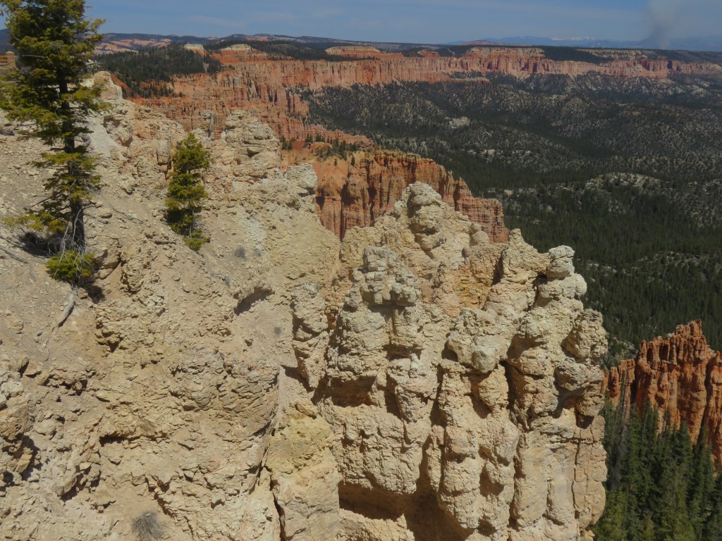
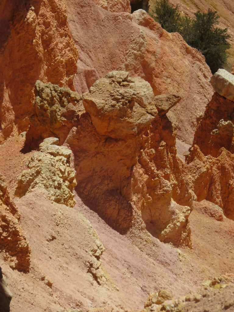
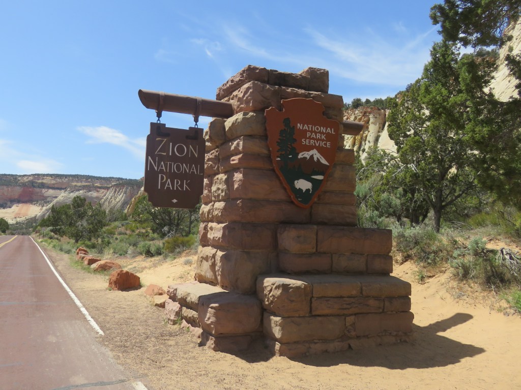
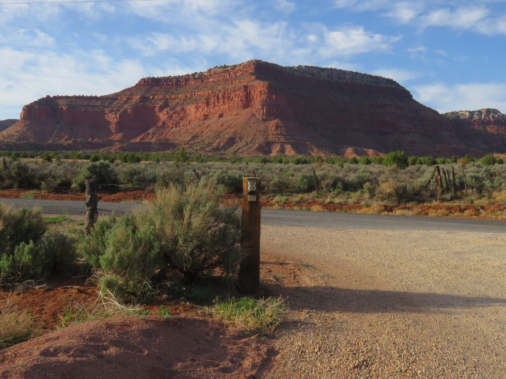
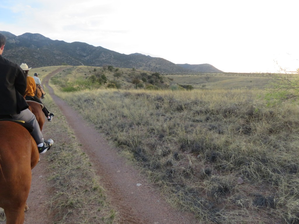
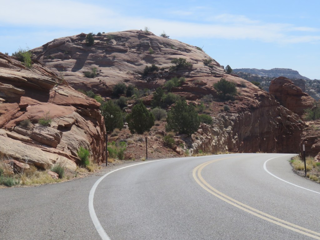
That was the question of the week while we were staying in the Bryce area. Route 12 was the most direct way to our next location in Torrey, Utah. It is has been designated as an “All American Road” as one of the most beautiful scenic drives in the United States. It is 124 miles long. It is also a narrow two lane road with many curves, hairpin turns, and steep grades – a challenge when pulling a 5th wheel. I combed our RVin’g Facebook groups for other travelers’ input. One RVer’s advice: “just stay between the lines and you’ll be fine.” Well…okay! But in reality, I left this decision up to Cal, since he’s the driver, and he decided he could give it a go.

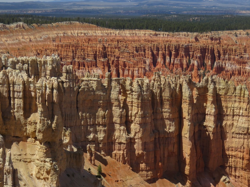
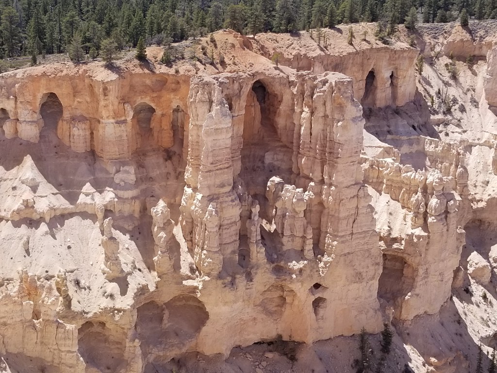
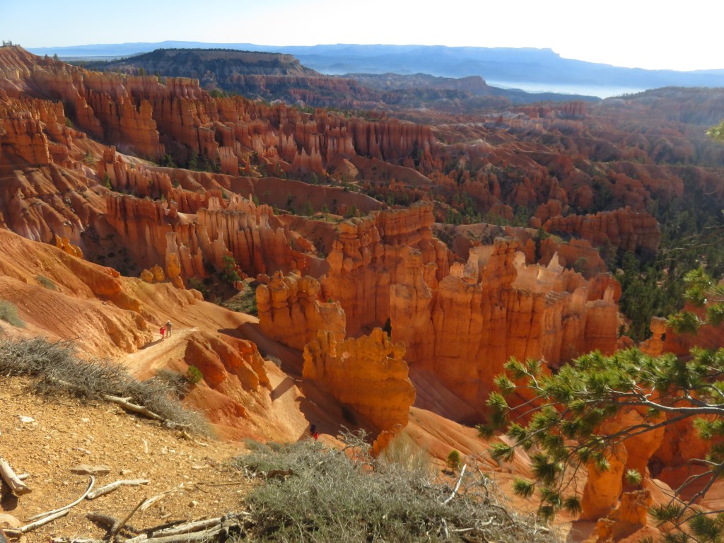
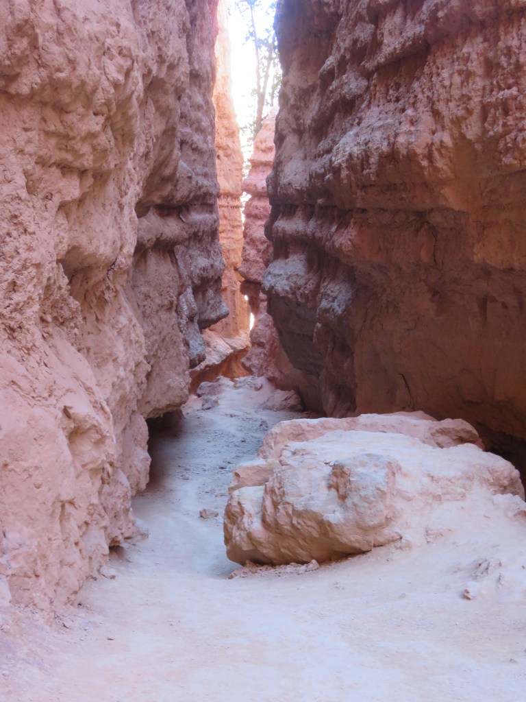
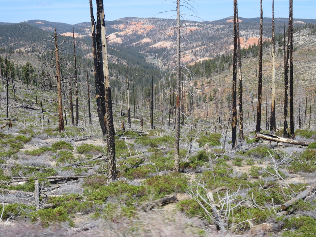
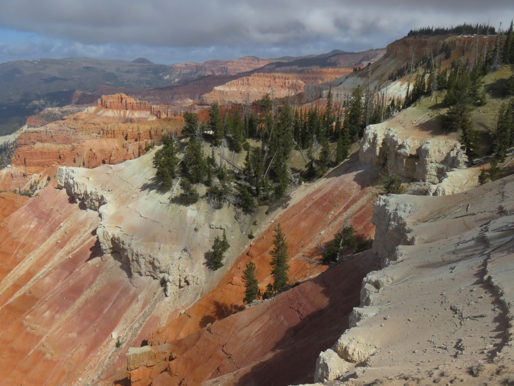
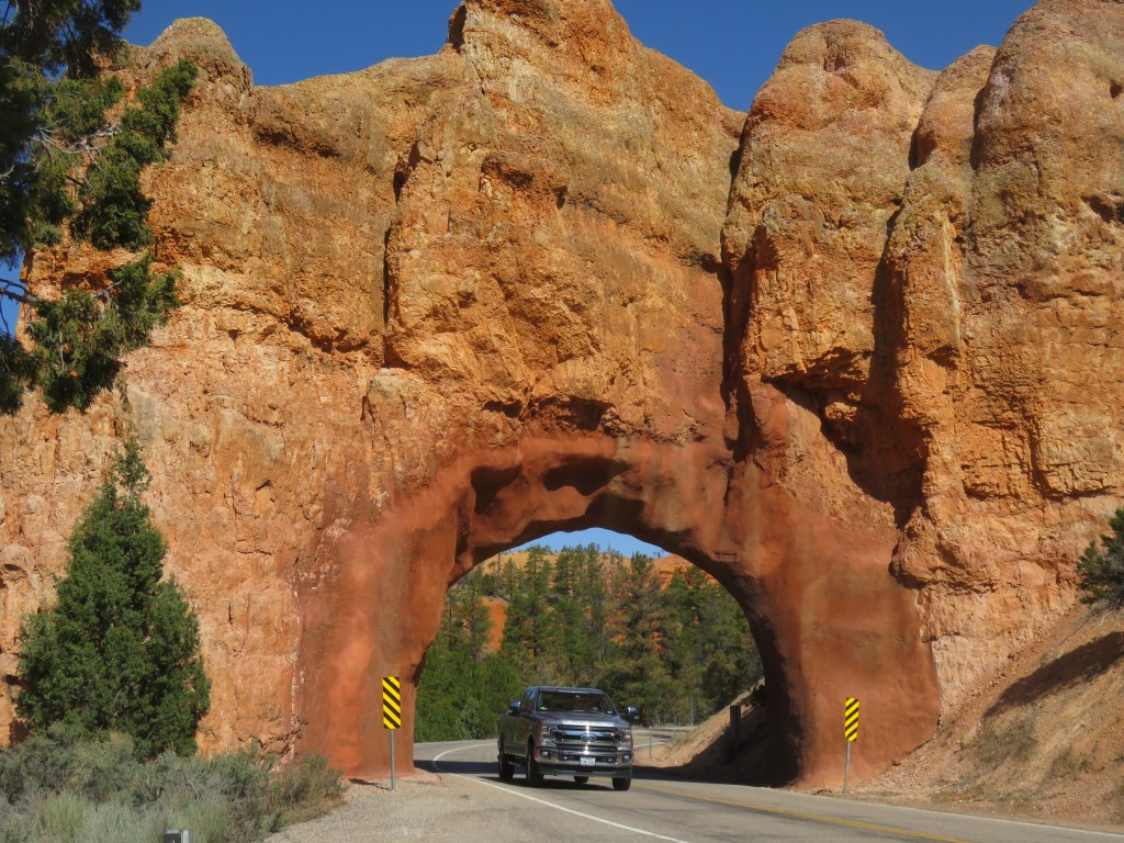
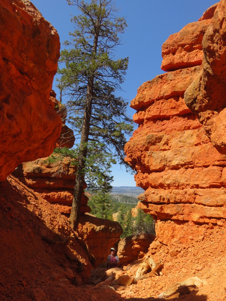
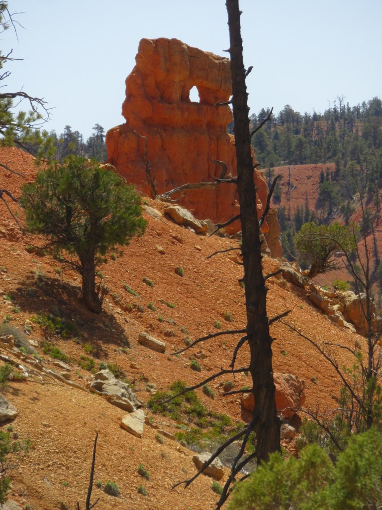
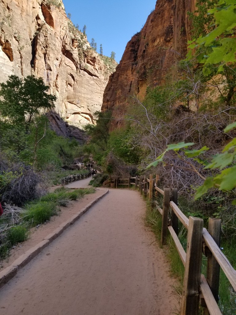
The western side of Route 12 starts at Panguitch and proceeds through the tunnels at Red Canyon that I blogged about earlier. It passes the turnoff to Bryce NP, and then the road to Kodachrome SP. All of that just in the first 25 miles! Heading east past Kodachrome, we were on new territory.

With Sam in tow behind Frodo, we don’t usually make stops on travel day. We were told, however, that Kiva Coffeehouse is a great stop for blackberry muffins. They have a large circular lot for RV’s, so we gave it a try. The rumors were true. The muffins were great, and so was the view.

This was a busy little spot. The Escalante River flows through here, so there are river activities, as well as a trailhead.

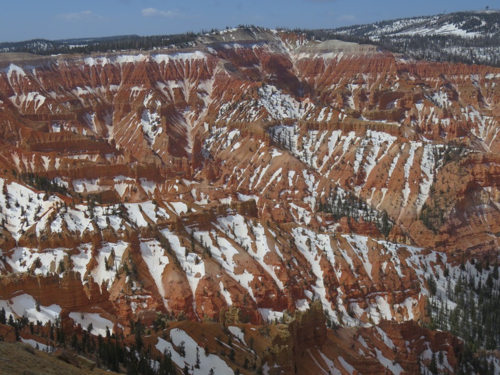
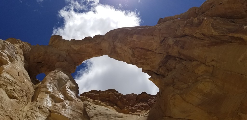
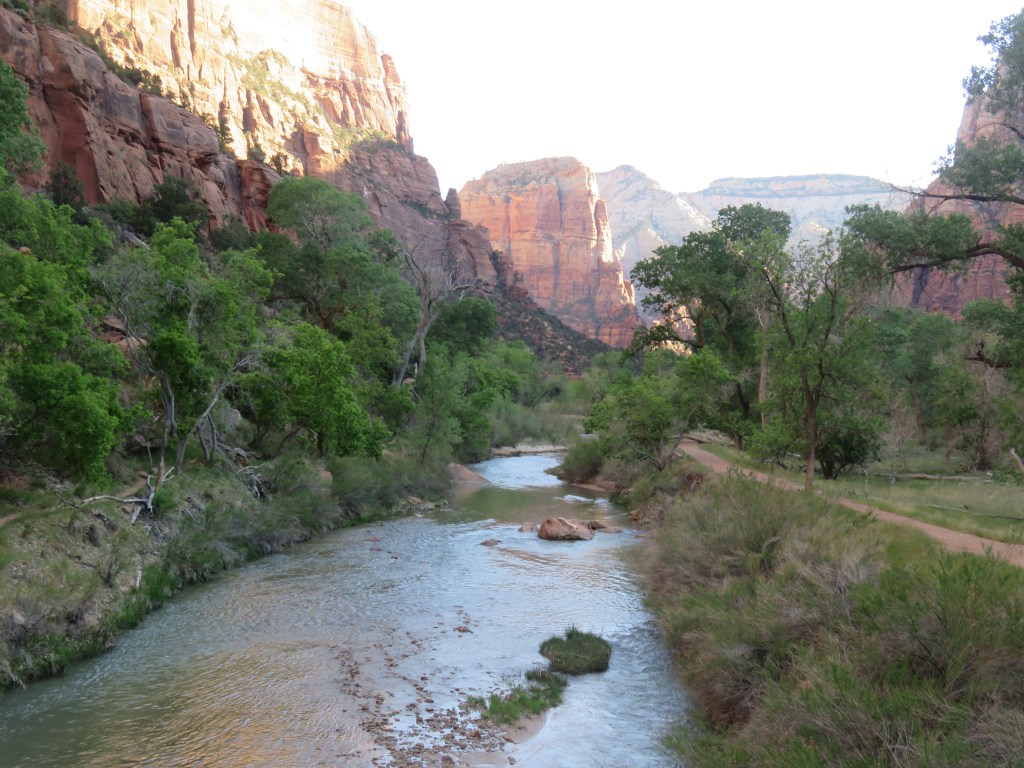
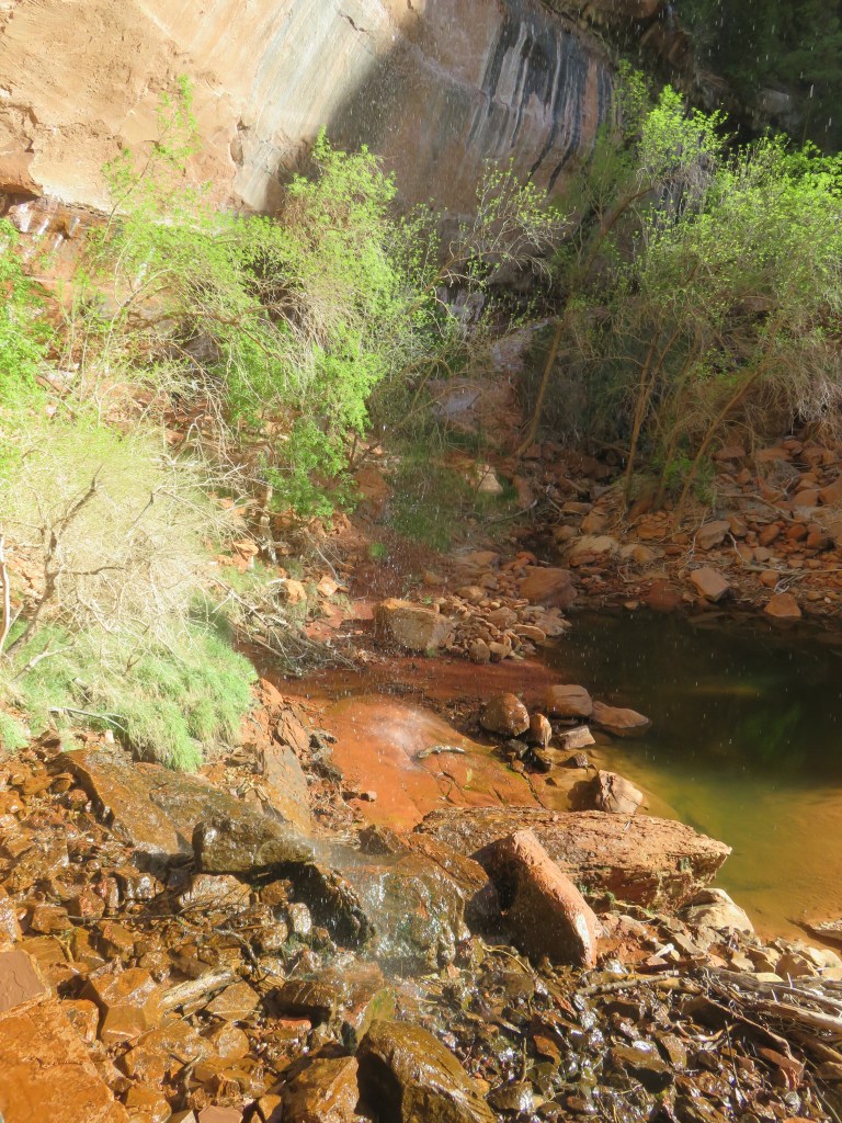
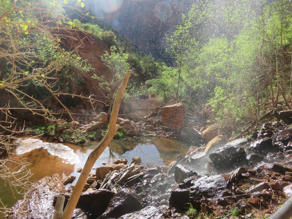
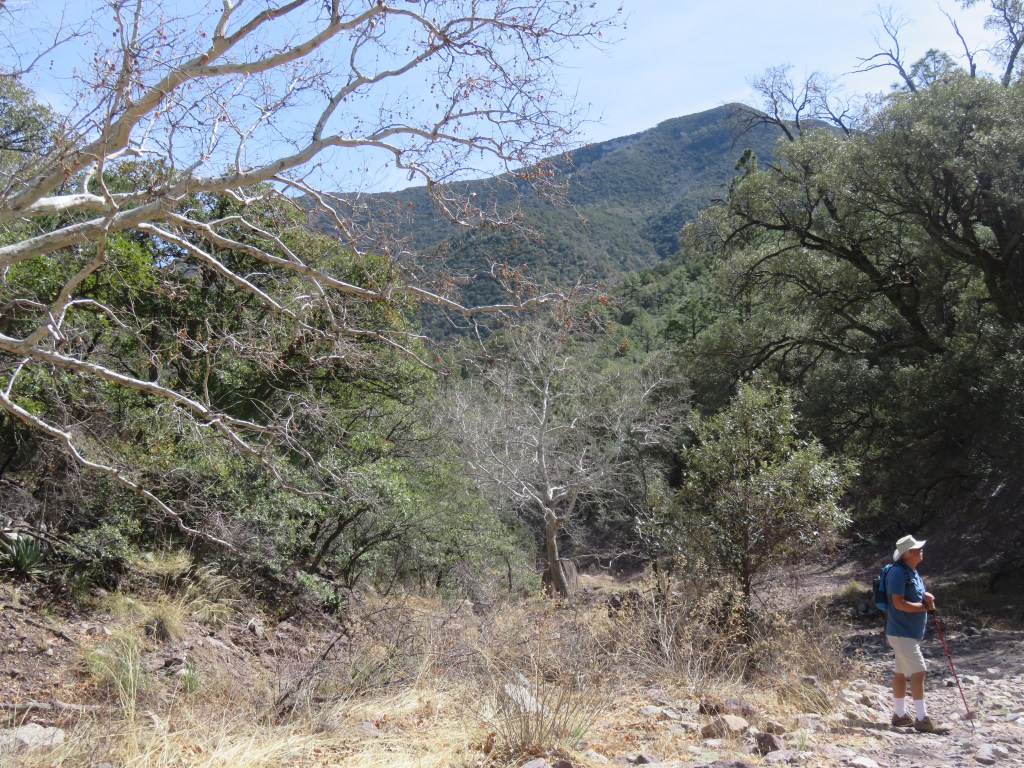
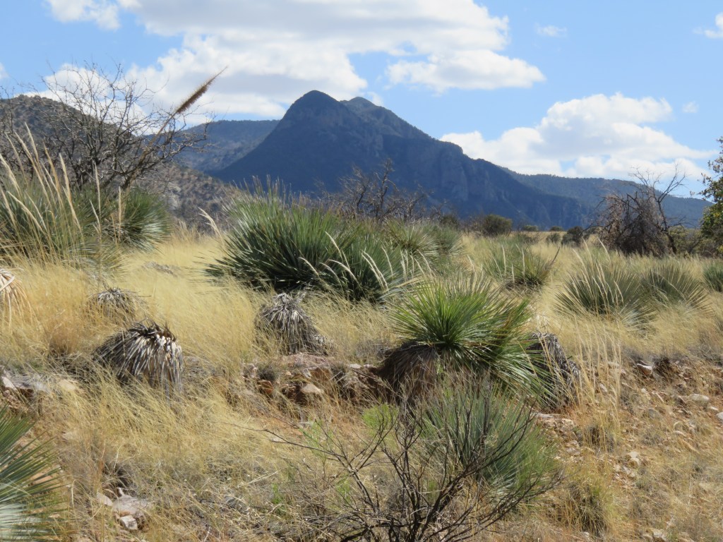
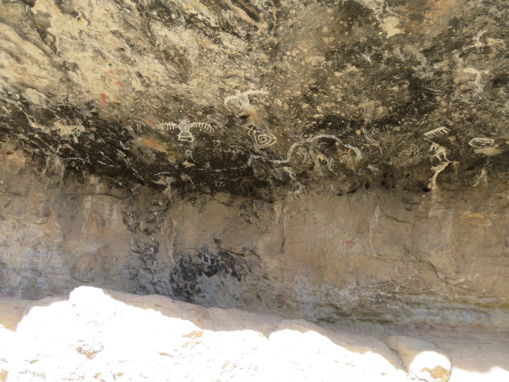
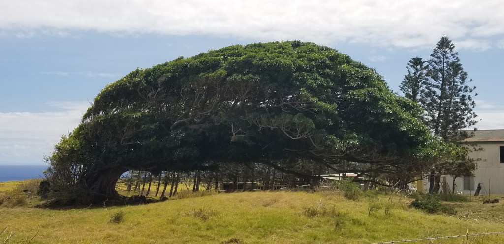
At Yonder Escalante, you could stay in a little cabin, in one of ten Airstream trailers, or park your own RV, all in the middle of a gorgeous landscape. We passed this cute resort on the grounds of an old drive-in theatre and thought it might be a fun place for an overnight or two, while taking in some of the sights that we missed on Route 12. There was Escalante Petrified State Park, Escalante Canyons, and the highly rated Anasazi Park Museum, not to mention some beautiful overlooks. In the Dixie National Forest, there is an overlook at the road’s summit of 9,000 feet, with contrasting stands of fir and aspen.

One of many ranches on the road

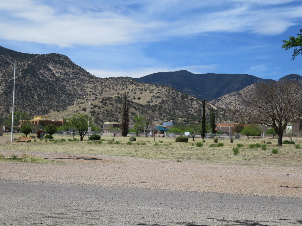
Route 12 ends in Torrey and right there at the end, where it intersects with Route 24, was our RV park for the next few days.

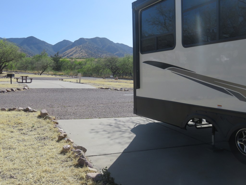
I booked Wonderland RV reluctantly. It was the best park with hookups in this area that we could find, and was recommended to us. The national park and a state park not too far away only had basic sites, no hookups. There is a lot of free national land (BLM) that one could park on. I wish we could do this, but for a stay of more than 2 or 3 nights it just doesn’t work. So Cal and I conferred, and found a site that was not right on the busy road or already occupied. But when we arrived, at first, I was so disappointed. It was a very narrow site! I always wish the people who build RV parks could just give us a little more space.

Wonderland is a fairly new park. It’s situated on the back end of a family ranch and is owned by the same family. The small park was thoughtfully designed, albeit with the narrow sites, and it filled up every night. We saw them spending time on maintenance and making sure the grass was watered in between our sites and around the park, which was something we appreciated in this land of rock and dirt. We thought this was probably a gold mine for them; what a way to use the “back forty” of the ranch land!

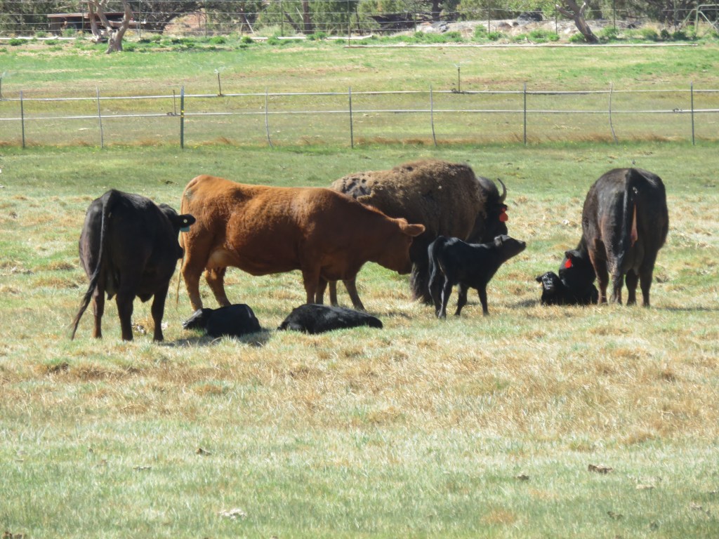
The view out our bedroom window is what saved the stay. There were horses, cattle, and a bison in the field. If we had parked just three or four sites down, we would have had a scenic view of the shower house. We mostly had full sightseeing days while we were here so we weren’t at home too much.

Appropriately, on Mother’s Day one of the cows gave birth through the night. Two other cows had already had their calves. They, the bison, and the mother huddled around the new baby anxiously, but it hadn’t yet stood up. Both the bison and the mother licked the calf continuously until the mother got fed up and shooed the bison away. We, and many other park residents, watched and chatted at the fence, but I eventually went on to do other things. We were at home on this day, and Cal reported that the calf finally stood up around noon. He spoke with the owner later, and found out that all of the cows plus the bison had been impregnated by the same bull. The bison still had a couple of weeks to go before her birth.

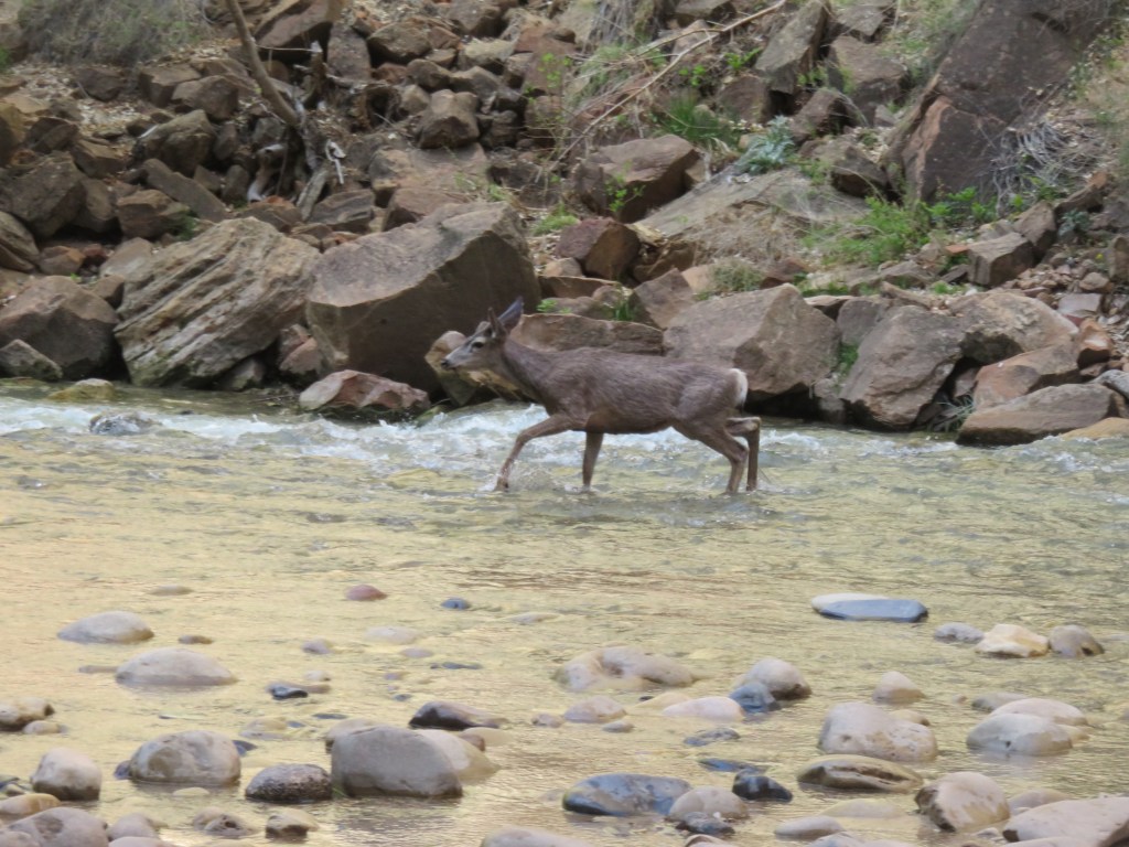
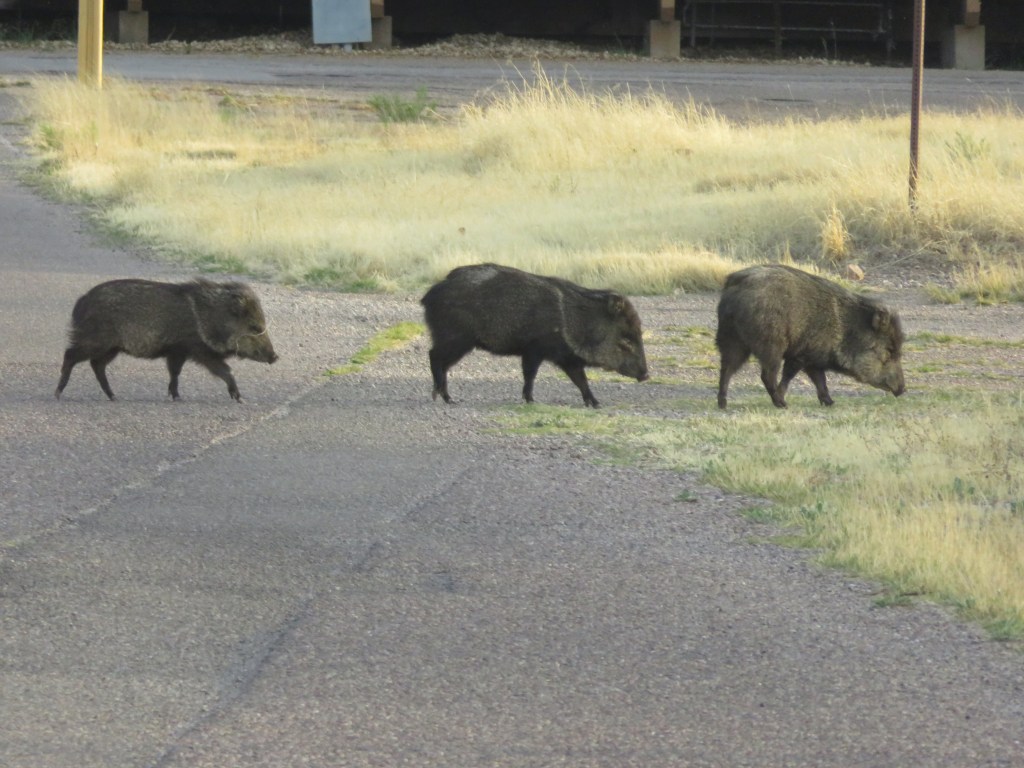
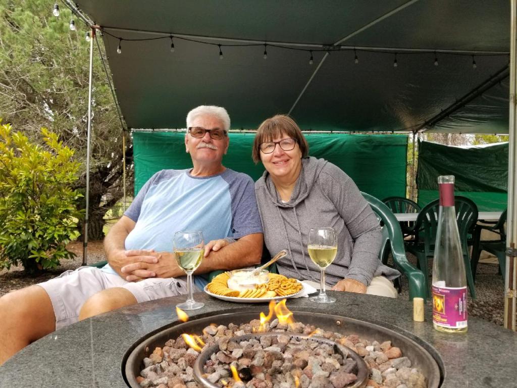
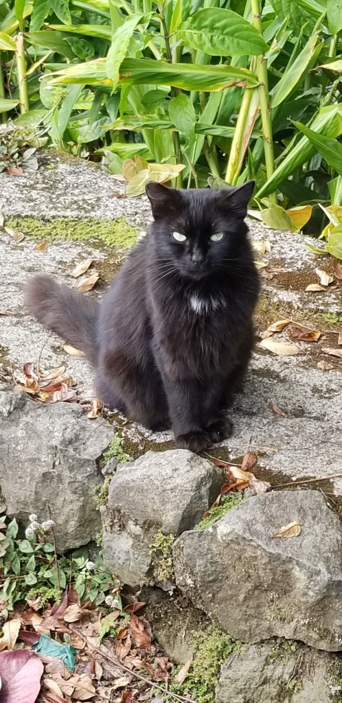
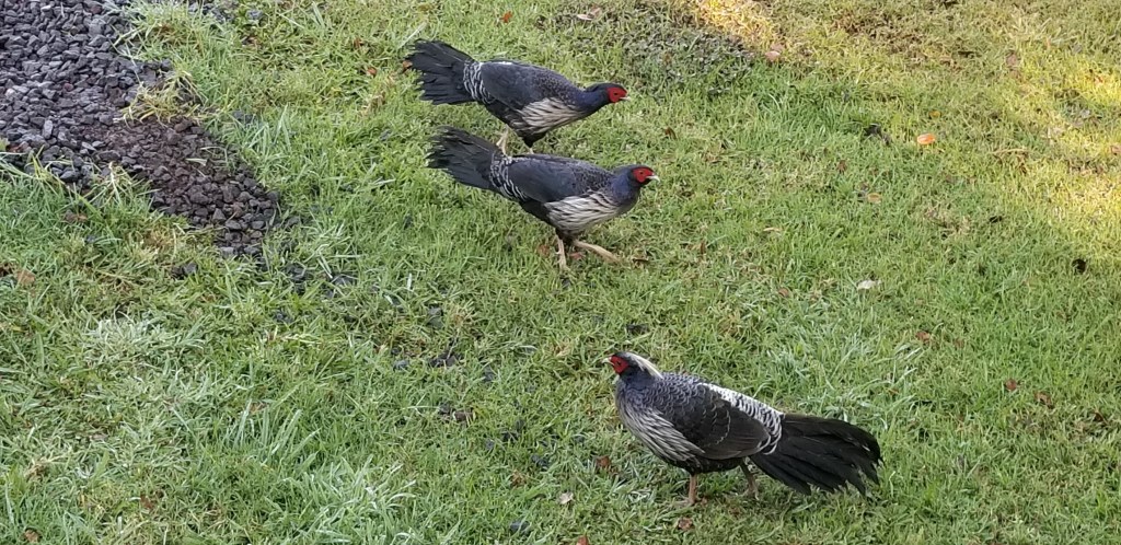
We also had evening visitors at our site.

Wonderland had some creative places to stay. How would you like to spend the night in this little wagon?

Next time – Capitol Reef National Park

USTravel

Bryce Canyon National Park

Bryce! There are not enough adjectives to describe this park. It’s truly amazing. If by chance you are planning a trip to Utah and don’t know which national parks to visit, Bryce should not be the one that gets cut from the list, in my humble opinion.

Our visit to Cedar Breaks was shorter than we had anticipated because of the cold. The weather had warmed up when we arrived home and a beautiful afternoon was before us, so we hopped on the park shuttle for our first visit to Bryce. Stopping at the visitor center, a park ranger told us that for some great views, Bryce Point was the place to start. We followed her instructions and got off the shuttle there, walking the rim trail down to Inspiration Point before getting back on the shuttle. The first glimpses were astounding.

This formation of hoodoos looked just like a castle fortress.

Where our home was sitting for these few days, we joined in a happy hour with our neighbors, and they outlined the perfect Bryce hike that they had been on. Start at Sunset Point, go down the Wall Street portion of the Navajo Loop, into the Queen’s garden trail, back at Sunrise Point, and hike on the rim back to Sunset.

Temperatures were in the 30’s on the morning of our planned Bryce hike day. I procrastinated, wishing desperately that it were warmer. Cal was running circles around me getting ready for our day. If we set a depart time, he doesn’t waver from it. I layered up, we hit the trail, and I was glad we stuck to the plan. This was the sight that greeted us when we set out:

Our neighbors thought it would be better to hike down to Wall Street rather than going up at the end, as they had. It is switch-back after switch-back from the canyon rim all the way down to the bottom:

This is just the lower half of the downward trail. If Cal is bundled up like this, you know it’s cold!
Heading into Wall Street

The next two pictures are inside Wall Street:

At the end of Wall Street, hoodoo heaven

Looking for information about one national park or another, I came across a blogger (I don’t know who, so if it was you, please let me know and I’ll give credit!) who stated:

“In the Grand Canyon you are looking down at the rocks,

In Zion you are looking up at the rocks,

In Bryce you are in the rocks.”

So true, but in Bryce, only if you take a hike!

Many ancient trees on the trail were twisted and gnarled, as this one was

After awhile I finally warmed up and we found a log off the path to sit and strip layers down. Cal was zipping off the bottom portion of his pants when a couple came along and asked, “Would you like us to take your picture?” I looked around, not thinking it was a particularly photogenic spot, but said “Sure!” And we liked the one they took. They even graciously took it from Cal’s knees up, so you can’t see that he still has one pant leg only partially off.

The couple was from Arkansas and later we met another from Switzerland. We crossed paths frequently with both couples and found many things in common as we hiked. Finding people to walk with always makes a hike more fun.

Queen’s Garden has a lot of hoodoos, but this one has been famous for decades because it resembles a statue of Queen Victoria in London. The sun was in the wrong place for a photo, but it is below, and I think it looks like she is sitting backwards on a resting camel.

The hoodoos on the rest of the hike were simply stunning. All one has to do is turn a bit, or take another step, and there is a totally different view.

A thin wall of rock, such as this, is called a “fin”. At some point in the future, it will be eroded by wind and rain, perhaps forming a new hoodoo.
The smile on my face says it all…this was the best hike ever!
Turning off the trail, I looked back to see this sign. I really didn’t think the trail was THAT bad! Good thing I had my boots on!

As the morning went on, the crowds picked up. Climbing back up to the rim, we decided our neighbors’ advice was very, very good.

The National Park Service calls this park “poetry in stone”. Some excerpts from the brochure: “Stand at the rim in early morning and experience the chilly dawn, crystalline blue sky, and rocks ablaze with the ruddy light of sunrise.. the sun arcing across the sky casts a kaleidocope of slowly altered hues and shifting shadows over the land… At Bryce Canyon the forces of weathering and erosion never rest, not even for a day.”

Bryce is a collection of giant natural amphitheaters. It contains the largest number of hoodoos in the world. Because of its remote location, it doesn’t receive as many visitors as Zion or Grand Canyon. It didn’t seem remote to me, but then, it was pretty much on our route going east.

The shuttle at Bryce goes as far as Bryce Point. Like Zion, it doesn’t require reservations. Unlike Zion, the road continues past the last stop for another 17 miles. We drove out to the end, which is at Rainbow Point. On the way, we passed miles of devastation from a recent fire. I’ve seen this before in the West, and it always leaves me feeling sad. It takes decades for a forest to recover from a fire.

On the way to Rainbow Point, the cars thinned out and so did the air. The elevation here is 9,100 feet. It wasn’t as high as Cedar Breaks, so we weren’t in as much snow, but high enough to feel as if we were on top of the world. The air was quiet and all we could hear was the cries of a hawk circling above us. It was so good to just stand there, look out, and contemplate the view, which was well worth the drive.

Looking out over the Paunsaugunt Plateau

On the way back, a sign pointed to a view point for Natural Bridge, and we were glad we made this stop:

Underneath the bridge, could it be…Yoda?

“Did you see Bryce?” If the answer is “Yes!”, everyone just smiles. The park and all its wonders was unforgettable, and I continue to love the surprises, and the natural beauty, of our national parks.

Next time: Scenic Route 12

USTravel

Southwest Utah Travels

Cedar Breaks National Monument

Cedar Breaks is a natural amphitheater which looks a bit like the Grand Canyon with some hoodoos thrown in. It sits at 10,000 feet above sea level, a fact we may not have thought enough about when planning to visit. It was early May and the road to Cedar Breaks had only recently been open for the summer. It is covered in snow and impassable through the winter. We chose the coldest day of our Bryce area stay for a visit to this park, reasoning that if it was too cold we’d just enjoy the drive in the truck. It was 55 miles from where we were staying.

As we climbed, the temperature dipped down into the upper 20’s. We stopped at the first viewpoint, and the cold hit us with a frigid blast as we stepped out of the truck. Brrrr! There was ice on the walkway to the overlook.

Aside from a family with a snowsuit-clad toddler, there was no one out here but us. Unless, of course, you count this little marmot, who looked as cold as we were.

It seemed we were visiting in a period between ski season and hiking season.

We looked for the visitor center and finally decided it was a boarded-up log building. The signs hadn’t even been put up for the summer! The views from the overlooks were outstanding, though, and that made the drive up here worthwhile.

Outside the park, I saw piles of volcanic rock as we drove by, which reminded me of Big Island of Hawaii. It looked like the volcano had just happened.

We had packed a picnic lunch but it was too cold outside for a picnic. We lunched in the truck with a fine view of Lake Panguitch.

Kodachrome Basin State Park

I had Paul Simon songs running through my head while we were in this area. It started with the hoodoos. “Now who do… Whoooooo do you think you’re fooling?” (She loves me like a rock!) When Cal and I would start talking about Kodachrome Basin State Park, I would be singing “Kodachrome, they give us those nice bright colors” in my head for days.

I tried to secure a spot for our RV in this park, so we were talking about it early on. There aren’t very many sites here that have the full hookups that we need, though, and of course they were already gone when I tried to reserve a spot the very first day that I could. This park wasn’t far from where we ended up staying. We took a hike on the Angel’s Palace Trail, and on the Nature Trail across the road from that.

The sandstone chimneys in this park change in color with the day’s light and shadow. Together with the blues in the sky and the green of the trees, the color and contrast led the National Geographic Society to name this park Kodachrome in 1949. Of course, they secured permission from Kodak Film first. I would venture to say that as time goes on, no one will know what Kodachrome is unless they Google it first.

Cal is posing in this photo to show you how tall this “sedimentary pipe” is. The geology of the Utah rock layers is pretty fascinating stuff to me. There was an inland sea here 180 million years ago which deposited solid layers of white gypsum. Layered on top of it is the Entrada Formation, fine grained sandstone laid down during the Jurassic Period of time. The formation Cal is standing next to, as with so many that we saw throughout Utah and this park, is Entrada Formation Rock. This era in time is also responsible for the formation of “slickrock”, seen in the lower right corner of the middle picture above.

I chose the trail because it was not too long (1.5 miles one way), and had little side trails for observation and exploration. A small downside was that, because of the side trails, we kept losing the main trail. The signage was not great. Add to that the wind, and I mean knock-your-socks-off, sudden-gusty kind of wind. Cal led the way on this precarious overlook. You can see the trail jutting out from the right. He had just started venturing out when the wind almost knocked off his hat and he grabbed it just in time. I’m an adventurous sort, but I really didn’t want to get blown off that trail when there was no where to go but down. A long way down.

Exploring little caves and nooks farther down in the canyon is more my style.

As we traveled through Utah, we came across expansive green valleys with pretty rivers flowing in and and out. This is the country the Mormons settled long ago. It was easy to picture them coming through in their wagon trains, settling the fertile valleys with cattle ranches, farms and orchards. Descendants of those first families still live here. Sometimes I would find traces of those pioneers, as in the description of this plant:

It is called “Mormon Tea”. The leaves and stems were used by native Americans and Mormons as a medicinal brew for all sorts of ailments, and also a substitute for coffee and tea.

We often saw old cabins here and there, and I would always wonder about the people who had built them and the families that may have lived there. This one was on the road just outside of Kodachrome.

Due to the wind, we ate yet another picnic lunch in the truck, but we had this gorgeous view to go with our tuna salad and crackers:

Grosvenor Arch

Getting to Grosvenor Arch involves driving 10 miles down red-dirt Cotton Canyon Road. We debated doing this as we were munching our lunch, because the road begins directly to the right of the Kodachrome sign up above. Cal decided to go for it. The road turned out to be not nearly as bad as some other dirt (rock) roads we have been on, and was very scenic. Then up a hill, and around a bend, and the arch was a very welcome sight to see.

Grosvenor is actually a double arch. You can see the smaller one to the left of the larger one. Both sit 150 feet up off the ground.

It’s hard to figure how many days to stay in one area. We allowed five nights for this corner of Utah, and were glad that we did.

Those who contemplate the beauty of the earth find reserves of strength that will endure as long as life lasts.

Rachel Carson, conservationist and marine biologist

Next time: Bryce Canyon National Park

USTravel

Red Canyon, Utah

We drove our RV through these two tunnels! Our Garmin is set to reroute us if there are bridges on our route lower than 13 feet 8 inches, but when it reroutes us, it doesn’t tell us why. We saw no low bridges on our trucker’s atlas, so we ignored Garmin’s route since it was about 75 miles longer. The second tunnel is 13 feet 6 inches, which we can make with no problem. Still, it really made me nervous, especially with Garmin screaming at us to turn around. Cal, unfazed, straddled the lane divider and easily cruised right on through the center.

Our stay in the Bryce area was our coldest. Early morning temperatures dipped down into the upper 20’s and took its time warming back up for the day. High winds added to the chill. We looked at the forecast for the week and decided to save Bryce National Park for later on when it would be warmer and explore all the other natural places around us first.

The tunnel that struck such fear in me was in Red Canyon. There were mixed emotions going on here: besides the tunnel, we were suddenly in the middle of the most amazing landscape: hoodoos and rock spires of brilliant red sandstone set against the green pines. It wasn’t too far from where we were staying, so a visit (without the RV) was the first thing Cal wanted to do the next day.

The nice folks at the visitors center were so helpful in mapping out a trail for us. It was 2.2 miles long and covered the Pink Ledges, the Hoodoo, and the Birdseye Trails.

Hoodoos: columns, pinnacles or pillars of rock that have variable thickness and a totem pole shaped appearance.

Forest Service, Red Canyon

We first saw hoodoos way back in Big Bend NP, Texas, but nothing like we saw here or would see in Bryce NP. Besides the formations, there was that awesome red rock:

The bright red rock throughout the canyon comes from tiny iron particles embedded in limestone.

Hoodoos on a hill
A wooden park sign helpfully pointed out that this is a camel.

Red Canyon made me feel like I was ten years old again. There were plenty of nooks and crannies to explore. I climbed up to this point only to discover there was more to discover behind the rocks!

This park was a great initiation for all the things there were to see and do here, and it was a favorite. I’m not sure I’d want to go back through that tunnel with the RV, though!

Next time – more to explore near Bryce

USTravel

Zion National Park

We set out for Zion, forty miles from our home, early in the morning when it was still dark. We’d heard about how busy the parks are, and it was a Saturday. This picture of the park and its sign were taken on the way out of the park, when we were going back home.

Dawn was just breaking over the rocks when we entered the park. Seeing the huge boulders looming above us as the sun climbed higher, we knew it was going to be a special day. Not far inside the East Gate we stopped for our first adventure at the Canyon Overlook trail. This is one of the oldest trails in the park. The trail was only a mile in, but the surface was rocky and we had to climb a bit. It was probably a good thing that we missed the sunrise because we might have tumbled down a cliff if we hadn’t been able to see! This was the only time in the day that we were looking down. For most of the visit to Zion, we were looking up while passing through the bottom of Zion Canyon.

View from under an overhang; is that a cave over there?
Walking the plank around a cliff

We were hiking above the narrows of Pine Creek, which forms a “T” with Zion Canyon at the end. There is a view of Zion at the top right of the above picture, and the road we would be taking into it. Looking back on this hike later, we were so glad we did it. It felt the most like our normal hiking in nature, had the fewest people, and was the only one that we went on all day that wasn’t either nicely paved or soft dirt. The morning was quiet, and the beauty was all around us.

Back on the road, we soon disappeared into this tunnel. Like the trail we had just hiked, it was completed in 1930 and is 1.1 miles long. There are a few great windows cut into the mountain, but otherwise there are no lights and no ventilation.

The road through Zion Canyon itself is closed, and the only way to experience it is to ride a shuttle from the visitors center. This we did, getting off at stops that we were interested in, which made for a relaxing day of exploration. The shuttle comes and goes every few minutes, is included with the cost of getting into the park (actually, our Lifetime Pass), and doesn’t need advance reservations. We were still early so there was no wait.

We got off to look at the Court of Patriarchs. From left to right, they are Abraham, Isaac, and Jacob, named by a Methodist minister.

We were always craning our necks to view the immense sandstone rocks overhead, beautiful in their various colors of tan, ochre, and white. The Virgin River carved this park millions of years ago.

The next shuttle stop was for Emerald Pools; we took the hike to Lower Emerald Pool.

Picture taken from a bridge on our way to Emerald Pools

The water dripping from the high cliffs glistened in the morning light. Emerald Pools is named for the color of the algae that grows here. At the top of the cliff are streaks in various colors; those are caused by water passing through the natural chemicals in the rocks. You can also see this effect in the photo at top of the blog.

Looking up at a wet, mossy cliffside

Back on the shuttle again, we rode to the end of the road and took the Riverside Walk. The crowds were growing. This is a very popular trail.

The two most popular trails at Zion are Angel’s Landing and the Narrows. Although strenuous because it is a high altitude climb up the rocks, Angel’s Landing now requires a permit because the trail has often been so crowded. Riverside Trail leads right into the Narrows, where the cliff walls rise high above the river on both sides. The hike is totally in the Virgin River, and it’s possible to follow it for several miles. That would have required us to rent equipment, something we did not want to do on this Zion exploration day.

This couple is unwittingly modeling the equipment that can be rented for the Narrows: waterproof coveralls and backpack, shoes, and thick wooden walking poles. The rocks are large in the Narrows and I’ve heard the walk can be compared to walking on slippery bowling balls. In April, the water is waist deep farther up the canyon. It looks like great adventure. That’s for next time – if we don’t wait too many years to return, that is!

The view above the river gives a hint of how beautiful it must be up in the Narrows

There was a steady stream of folks heading into the Narrows, and it picked up as we watched. Later, as we hiked back, Riverside Trail was even more packed with people on their way in than it was when we came. I would not like to be here in the middle of summer. Looking at the view up the river, though, it must be an incredible hike.

There was all kinds of merchandise for sale in the Visitors Center with the logo “I hiked the Narrows!” So Cal took my picture here in the river, so I can also say “I hiked the Narrows!”

Unbelievable for all the people around, but a couple of deer appeared for their morning walk. One of them wore a tracking collar. They looked like they were used to this scene, and were careful about where they were fording the river.

Back on the shuttle bus, Zion Lodge was a great place to stop for snacks and to supplement the lunch we had packed. As the day wore on, the shuttles became full, but never so bad that we had to wait in a long line for them. We agreed that the last day of April was a very good day for a visit.

The Watchman
The Great Arch – a blind arch, since it is recessed into the cliff

Zion is a very easy way to experience a National Park, if one doesn’t have a lot of hiking experience. With the shuttle and the paved paths, it’s possible to have a relaxing day at the park. With all the trails added up, we walked about 6.5 miles in the day. It was very easy walking except for Canyon Overlook trail. As with all National Parks, arriving early or later in the day is key. We recently spoke to someone who said Zion is his favorite park. The only thing he did in Zion was to hike Angel’s Landing, awesome in itself. His day was very different than ours!

Next time – exploring near Bryce National Park, Utah

USTravel

On the Road, Arizona To Utah

Saguaro in bloom, Phoenix

If you ever find yourself on the road between Flagstaff, Arizona and Kenab, Utah, please do not hesitate to take US State Route 89. The route has some of the most beautiful scenery we have enjoyed on a travel day. We might not have even been on the southern part of this drive, were it not for a last-minute change of plans.

Palo Verde trees in blossom, somewhere near Tucson

To back up just a bit, on the day we were to leave Ft. Huachuca, we received news of a Covid crisis with our family in Denver. The next day I was on a plane heading from Phoenix to Denver to provide some needed day care for our grandchildren. Cal stayed at Luke Air Force Base for a week, having a time watching the F-16 and F-35 training pilots continually take off on the runway. Life turns on a dime, doesn’t it?

A couple of planned stays were completely eliminated, and that is how we ended up taking 89 all the way from Flagstaff to Kenab. The scenery changes here from high mountain ponderosa pine to desert shrub, rolling hills, buttes and mesas, and odd piles of rocks. There are turnoffs for both the South and North Rims of the Grand Canyon. We drove through Navajo Nation, where there were wooden stands for selling Navajo crafts. Most were empty, some falling apart, but a few were occupied selling mostly jewelry from what I could see. I’m speculating that they will disappear one day in the future, when artisans have so many other ways to take their creations to market.

There was a scenic turnoff for a beautiful overlook and off in the distance were the Vermillion Cliffs. The whole vista was a feast for the eyes. Cal could not stop because we had Sam behind us and there was no room to park.

Near Page, we stopped at Horseshoe Bend. The park is run by the city of Page which charges for its huge parking lot; happily, there was room for us. We generally do not make stops on travel days, so I was surprised when Cal turned in. It was just over a half mile walk to the most amazing view:

Horseshoe Bend, on the Colorado River

In the view above, you can just barely see the Vermillion Cliffs rising in the background. Route 89-A is another scenic route for seeing them, and this road would go also to the North Rim.

Rocks are so interesting. I saw these on our hike to Horseshoe Bend. They look just like…well, I will leave it to your imagination. I was looking around for Paul Bunyan’s ox.

In the parking lot was this ensemble. We had crossed paths with them earlier in the day:

Someone has been doing a lot of boondocking in the desert

It looks like they have everything they need right there.

On the other side of Page, we came to Glen Canyon Dam:

We’ve been reading a lot in the news about Glen Canyon, and Lake Powell that the dam creates. The water levels are dangerously low due to a 25-year drought. If you look above the dam, the white cliffs will show you how much the water has dropped. On one side of Lake Powell, the water is completely gone. We drove for many miles past the dam and were pretty sure that we should have been seeing beautiful views of the lake. What will happen when the dam can no longer produce power or water for life downstream? These are difficult problems that are being encountered across the Southwest.

Looking downstream from the dam

We crossed over into Utah, which was our first new state in many months, except for Hawaii. We’d been in Arizona since December and were a little sad to leave the state. We will be back.

Our stay while in the Kenab area was at Dark Sky RV Park, our destination for the day. It is fairly new, family owned, and every site is designed for maximum enjoyment of the night sky. We visited a bit with Rick, “Dad” in the enterprise. He had a brief experience with towing a 5th wheel and decided that none of his sites were going to be back-ins. There is a “cocktail table” with two log seats, a regular size table with a cover, and even a propane fire pit. Lights must be off after dark. With our pull-through site, we were able to enjoy nothing but the desert.

View from our RV

We also had this view across the road! It was a fine stay in which to begin our Utah adventures.

Next time – Zion National Park

USTravel

Riding the Rails to Grand Canyon National Park

It didn’t seem right to leave Arizona without seeing the Grand Canyon. Cal and I have been there a few times in our lives, separately and together, so I looked around for a different way to see it. Riding a train seemed like a perfect idea.

The depot is in Williams and they have quite a set up: besides the train, there is a hotel with all the amenities plus the RV park where we stayed for just two nights. It was a packed park. We were right in front of some railroad tracks, separated only by a ditch and a fence. You either love the sound of the trains, or you hate them. I don’t mind if they are off in the distance, but the train horn blowing woke me up once each night.

Small price to pay for the convenience, though. We were able to walk to the depot in the morning of our excursion. Before we boarded the train, there was a shootout outside the depot. The sheriff was having a little trouble with the Cataract Creek Gang. This was a huge event; why did I not see it in the morning news?

Silliness aside, we enjoyed the two hour ride up to Grand Canyon. Our host in our car told us about the trains and the scenery we were passing, there was a little snack buffet, and a singer came by with guitar in hand to entertain us with a few songs. Before we knew it, we were at the Grand Canyon Depot.

The 64-mile Grand Canyon Railway was originally completed in 1901 and was instrumental in the development of Grand Canyon Village. It was built by the Atchison, Topeka and Santa Fe Railway. With the decline of the railway, the last passengers rode the train in 1968. Developers purchased the line and restored operations again in 1989. Today the train runs 364 days a year. Our car was full and it looked like the others were too on the day we rode.

Of course, the Grand Canyon is the main attraction. We climbed up a lot of steps from the depot, and there it was. I had forgotten. Forgotten how it takes my breath away and almost brings me to tears every time I see it. I’m struck, every time, by its beauty. It truly is grand.

A National Park Service informational sign says much of what I was feeling:

Gazing upon this view, one is struck by the canyon’s vastness. The mind struggles to comprehend it. Try to describe the canyon’s size in words. Try to measure in your mind the canyon’s depth, width, and length. Measurements like 1 mile deep, 18 miles wide, and 277 river miles long leave us scratching our heads. Perhaps the best we can do is just feel the canyon’s enormity. Measure yourself up against it. We are miniscule in comparison…”

We rode the park shuttle to Hopi Point and hiked back along the Rim Trail. That was a good way to get some quiet trail time. We appreciated our host’s suggestion for this; our walk from Hopi Point was all down hill.

From Hopi Point, we could see the Colorado River far below.

The view of the canyon was dizzying in some spots, as there was no barrier rail in many places of this part of the trail:

Maricopa Point looked like a good viewing spot, although we did not hike over to it.

If one wants to hike down inside the canyon, Bright Angel Trail is the trail to take, and it will be four to six hours to the bottom. It is a long and strenuous hike, and hiking back up takes twice as long as venturing down. If one is overnighting, Phantom Ranch has basic accommodations at the bottom. I think it would be fun to hike down and stay at Phantom Ranch, if someone could come by and pick me up in the morning! Before we hopped on the shuttle, we passed the Bright Angel trailhead.

As we got closer to Grand Canyon Village on our hike, we could see the trail far below.

Looking down on Bright Angel Trail closer to the beginning of the trail head:

This little squirrel posed nicely for me. Or it was looking for a handout, I can’t be sure.

You wouldn’t think you’d see much wildlife so close to all the humanity around, but this bighorn sheep was oblivious.

I visited Grand Canyon with my parents when I was twelve, and again in my late teens with a friend on our way back to Texas from Las Vegas. Each time, I loved to see the Hopi House on the edge of the canyon. I wondered if this was a real Hopi house. Did Hopi Indians once live here? At the time, I received no answers, or I don’t remember that I did.

Fast forward to the Internet age. Our host on the train told us that the Hopi House was designed by Mary Coulter for the Fred Harvey Company which was instrumental in promoting tourism in the canyon. In the early 1900’s, she was revolutionary in the field of architecture. Her designs blended the natural landscape with whatever building materials were local. The Hopi House was finished in 1905.

The Hopi were a native canyon tribe and at the time were considered more civilized because they lived in permanent pueblos and created beautiful arts and crafts. The Hopi House was built as a place where Hopis could work and live, and visitors could observe and purchase their goods. It’s built like a true Hopi home, where several families could live, enjoy the rooftop terraces and vistas in the evening, and enjoy the company of fellow artisans. The exception to this is that there is a door in the front on ground level; the Hopi would not have had one. At one point, three generations of one family lived here. A dance platform was built in the 30’s but the evening Hopi dances ended in the early 1970’s with resentment by many Hopi for having their culture on display for tourists. Today, we know that several tribes once lived in the Canyon, not just the Hopi, and we celebrate their cultures as well.

I found much of this information on gracahistory.org and for further reading you can visit their site with a search on “Hopi House”.

The Hopi House has been refurbished. True to its original conception, it is a shop and art gallery that sells mostly native crafts. The items for sale are beautiful, and I also tried to look past them to see the original house as it was.

My parents were also here on their honeymoon in 1938, which was probably the heyday of the Hopi house. I faintly remember my mother saying that the Indians would be sitting along side of the road selling their wares as they traveled. I would love to see the Hopi house as she saw it then.

All too soon, it was time to board the train back to Williams. We had a different singer this time, who billed himself as “The Rock-n-Roll Cowboy.” And then we were held up by the Cataract Creek Gang! We saw them on their horses as we passed and soon the train stopped. The robbers actually got away with some of our cash, which was in reality tip money.

The sheriff just before the robbers boarded our car, certain that the passengers ahead of us knew of their whereabouts

The train was great fun and we liked not having a car at the Canyon, but I would not recommend it if it would be someone’s first visit there. I was surprised that, even as a repeat visitor, our time at the Canyon felt a little short. Or maybe I just got lost in the Hopi House. Some passengers had luggage and were staying at the Canyon with a return trip the next day. I wish I had thought of that earlier! The train ride would also be a whole bunch of fun for school-age kids.

The town of Williams is on the original Route 66 and was one of the last towns to be bypassed by the highway. We were able to walk over the tracks for a little visit.

Our time in Williams was brief but with much to look forward to on the road ahead, we were ready to go. I’ll leave you with one last view of the Grand Canyon.

Next time: on the road to Utah

USTravel

Ft. Huachuca, Arizona

Morning snow cover on the Huachuca Mountains

We arrived at Ft. Huachuca early in February. After a week, we were off to Hawaii. Frodo and Sam (our truck and 5th wheel) went into storage for a month in a lot on post close to Apache Flats, our RV park. We were there another month after our trip to Hawaii. I was working on the Hawaii blogs the whole time, so none of the fun excursions we did were posted. Perhaps I will catch them up at a later date.

Ft. Huachuca is an old Army post that dates back to the 1800’s, when new trails were being explored across the West and the Indian wars were happening. Today, it is the home of Military Intelligence (MI). There is a training school for mostly new recruits fresh out of basic training and a handful of MI battalions, among other units. It’s tucked up into the foothills of the Huachuca mountains, and sprawls all the way down to the Sonoran desert. The whole post is quiet and relaxed, although maybe not for the students at the MI school.

Looking at the Huachucas from the historic side of post

The RV park on Ft. Huachuca is in the foothills on the edge of civilization before the road goes off into the brush. There was nothing but nature all around us, and we started to think of the mountain as “ours”, in all its moods.

We called Ft. Huachuca home for a couple of years back in the 80’s, and loved it here. It was the only military assignment Cal had, after we married, in which we lived in government family quarters. It was a quiet, laid-back place to live. We were at the end of a 6-plex row of homes, and became friends with several of the neighbors around us. There were game nights, dinners together, and plenty of chats on the driveways. I went to school on my GI Bill and was one semester short of an Associate’s Degree when Cal received a “can’t miss” chance for reassignment in Washington, D.C. I always thought we’d at least come back for a visit, but this was our first time here in all the years since.

The rows of 6-plexes are gone now, replaced by beautiful new housing, schools, and a daycare facility. There is a larger emphasis on taking care of soldiers’ families in the military today, and I’m happy to see that. Our quarters were old even when we lived in them. Two rows of the 6-plexes were saved from the bulldozer for use as maintenance offices.

Looking down the row of the 6-plex. The front yards would have been grassy with the occasional prickly pear cactus.

The “A” unit was ours, on the end. I checked the address on the side of the building and it was not the one we lived in. That would have been a huge coincidence. Since all units were identical, I stood on the front entryway of the “A” unit and felt just a touch nostalgic for what had been.

This was our view when we lived here, minus the new buildings. Our unit was on the edge of the desert.

Ft. Huachuca is home to a lot of wildlife. Deer are numerous, and we often saw javelinas. We had a sighting of a coyote one evening, and I stumbled on the huge flock of turkeys on one of my walks one day. I counted at least a couple dozen.

This deer and I had a stare-down contest. I lost the game.
Sort of reminds me of the Beatles walking across Abbey Road. But wait, there’s one missing!
Ah, there’s the little straggler.
They’re easy to miss because they blend in, but there is a whole row of turkeys behind the one in the front

The birds! There were so many of them. The mountains of southern Arizona are “sky islands” in the Sonoran desert. The birds migrate up from Mexico along the chain of mountains. Sierra Vista, the town outside of Ft. Huachuca, is known as the hummingbird capital of the U.S. for all the types of hummingbirds that come. For a while, a couple in an RV with three hummingbird feeders were parked across from us. They would be gone all day, and we could enjoy the hummingbirds from our lawn chairs when we were home. They told us they had seen 8 varieties while sitting at dinner one night. Even without the feeders there were plenty of them zipping around the park at any time. And this little red bird came to visit us often.

We took many hikes into both Huachuca and Garden canyons, right on the military post. I don’t remember this from when we lived here. We visited many beautiful places while we lived in Arizona; how did we not know this was in our own back yard? I guess it was a combination of the pre-computer era, and also the busyness of daily life, plus only having weekends for exploration. If we didn’t know anyone who hiked the canyons, we just wouldn’t have known about it.

Garden Canyon even had some petroglyphs.

Before getting deep into the canyons, we would pass multiple picnic areas which are no longer being maintained. I couldn’t understand why not, at first. I finally decided that they hearken back to an earlier era when government family quarters didn’t have air conditioning. Parents might’ve been happy to get up into the cooler canyons to let the kids play and have a picnic on a Sunday afternoon. I never saw anyone using the facilities.

We also attended a rodeo at the only rodeo arena in the world that is inside a military installation.

There was a competition in which four teams of military guys had to put panties on a bull. It was hilarious to watch their efforts!

Ft. Huachuca also has horse stables. Back in the day, you could go up to a window at the stables, show your ID card, give them a few bucks, and “check out” a horse. Cal and I did that several times, just riding the horses up into the hills by ourselves. We would always put a carrot or two in our pockets for them. Sadly, you can’t do that anymore. You have to go on a trail ride. We went on a sunset ride, and although it wasn’t the same, it was still enjoyable. We’ve heard that there used to be around 90 horses, and now there are only 16. They stopped individual check outs because too many people were getting bucked.

Back in the Midwest, spring was my favorite season. I loved the arrival of spring flowers and the budding and blooming of the trees. Here at Ft. Huachuca we have enjoyed a spring season also, but it’s just a little different. It started back in February when I saw a barrel cactus in bloom in Tucson:

The cholla cactus was in bloom throughout our entire stay at Ft. Huachuca. At Apache Flats, we enjoyed watching a bird building a nest in one of them on our evening walks.

This huge agave was sprouting inch by inch. I would’ve liked to have seen it when it reached full growth.

When March turned to April, the ocotillo went into bloom. Their flowers are only at the top. On a desert hillside full of ocotillo, they look like orange waving flags. Usually the rest of the ocotillo stems are black, but in spring they turn green.

Interestingly, I read on Wikipedia that ocotillo is more closely related to tea and blueberries, even though it is semi-succulent and a desert plant.

The trees by our site went into leaf a little more slowly than I would have liked. I think we need to stay an extra couple of weeks into spring the next time we are here, so we can finish watching everything come into full bloom. Yes, there will be a next time, but as always, we don’t know how many years down the road it will be. We’re on the road again!

Next time: Grand Canyon

Hawaii

Hangin’ on the South Side of the Big Island

While we were staying at Volcano, we celebrated our one-year anniversary of being “location independent”. That’s a new term I’ve learned this past week, and I like it for what we are doing. I cannot say that this past year has not had its ups and downs, or a few doubts that we’re doing the right thing, although that was mostly earlier in the year. We jumped into this in the middle of Covid with hardly a look back or saying many goodbyes, because of the said pandemic. For our current situation in life, this fits. We’re enjoying it and feel blessed that we can travel as much as we can. Cheers to that!

We celebrated at Volcano’s only winery, Volcano Winery, with a guava grape wine. It is the southernmost winery in the United States. They grow their own grapes and also have tea trees, so they make their own tea. After our celebration, I had a little tea tasting, complete with a tea leaf.

Being at the winery made me wonder: is this really the southernmost part of the United States? We’ve been to Key West, Florida, and thought we were at the southernmost place there. A Google search answered the question: Key West is the southernmost point of the contiguous United States. Lava rock at the ocean on the Big Island is the southernmost point of the whole United States. Let’s go!

Well, we didn’t just jump up from our chairs and dive in the car, but we did go on another day. All we did was google “southernmost point” and let GPS take it from there. We passed a huge coffee farm. The couple of towns we went through got smaller. Then, windswept cattle and horse ranches. The trees were blown sideways, especially this monkeypod tree, with its trunk totally on the left side of it:

There is no sign saying “You are here!”. We questioned our GPS, but when I looked up pictures of the “Southernmost Point”, this view is what frequently comes up. The exact place is somewhere on the lava rocks. We wondered about all the cautionary signs. This spot is on a pretty substantial cliff; who would ever want to jump into the water here?

There was no fence around this hole in the ground. It was pretty fascinating to watch the water ebb and flow with the waves, and too deep to be a blowhole.

As Cal and I were peering down this hole, I started chatting with a girl nearby. I was still wondering if we were in the right place for the southernmost point. She didn’t really care about that, but she said she’d heard that there was cliff jumping here. She thought there would be more people jumping (there were none at that point). She and her friends were trying to decide whether or not to do it.

“Shall I jump?” This, despite the warnings and the memorial on the red sign!

He did jump!! I didn’t catch it on camera, but I did get a picture of the girl I had been talking to:

For many reasons, just “Wow”!

In case you are wondering, there are no rocks straight down in the ocean here, which I suppose explains its popularity for cliff jumping. These two were joined by a third young man, and his mother was right there cheering them all on. They were all wearing outer gear that made me think they were a swim team and she was their instructor but I can’t be sure of that. The group seemed to enjoy their swim in the water but the rope ladder for the climb back up looked very precarious.

Off to the other side: this is not the area anyone would want to jump down into!
A sea turtle we noticed while watching the swimmers

It was time for lunch at the southernmost bakery in the U.S. We had meat inside soft, fresh Hawaiian rolls with malasadas for dessert. I’ll get back to the malasadas in a bit. This place is very popular and we had quite a wait just to be able to place our lunch order.

On the way back to Volcano, we stopped at Punalu’u Beach, known for its black lava sand. It was our very last beach, and a great way to end the vacation.

Back to the malasadas. We were riding with our friends Kathy and John on a highway in Honolulu when I saw a sign with a food truck way up off the road advertising them. I asked Kathy what they were, and she didn’t know, so she googled it. Definition: a fried type of doughnut. In the melting pot that is Hawaii, malasadas were brought to the Islands by the Portuguese. In Lana’i, my niece Rachel told me that there were excellent malasadas in Lahaina, Maui, and told me where to go. But we had so much good food to eat in Lahaina in a short time that we never got there.

We were coming back to Volcano one day after an outing when I saw a sign for malasadas and shouted out for Cal to stop. He’s never one to question a food stop, so he pulled a great U-turn. And there they were, two guys under a canopy, deep frying malasadas, with…pigs and chickens running free nearby. They (the guys, that is) were very nice and even gave us free samples since we’d never had them before. This is why I’ve noted in an earlier post that sometimes it felt like we were in a foreign country in this part of Hawaii!

We purchased a paper bag of traditional malasadas, easily compared to donut holes. They were excellent, pigs and chickens notwithstanding. Our malasadas were especially good washed down with pog juice, which had also become a Hawaiian favorite. So far, we can’t find pog in the continental States.

Back to Punalu’u Bakery. They had traditional malasadas, but also the filled variety. My strawberry-filled malasada was good but the filling tasted a little to me like canned pie filling, not my favorite. I kept looking longingly at Cal’s chocolate-filled malasada but he didn’t offer a sample. He thought he liked the traditional ones best. I liked them both, very different from each other.

I enjoy figuring out the origins of words, and I study Spanish. Portuguese is very similar to Spanish. “Mal” in Spanish means “bad” and “asada” means “grilled”, or “roasted”. So I’m conjecturing that the very first malasada was a complete accident.

With a toast to malasadas and pog, I’m concluding this edition of The Hawaii Chronicles. I hope you enjoyed reading about our little romp through some of the Hawaiian islands. What would we like to see if we came back? We didn’t get to Kauai, and Molokai might be interesting. I would like a return to Maui to see Haleakala National Park. People we talked to on the Big Island were surprised that we didn’t see Kona, although we were pretty happy on the southeast side, so I suppose that might be a possibility. Cal really liked Lana’i and would like to return. But then, there are so many other places in the world to go, and the US to explore, especially with our RV.

Until next time, Aloha – and Mahalo – (thank you) for reading!

Next time – back to Frodo, Sam, and Arizona!

Hawaii

A Hilo Kind of Day on the Big Island, and the Bird House

Our Bird House

When we first flew into Hilo, it was already dark, and raining. We had not seen rain since Christmas so that was surprising. We needed to rent a car. Easily done, because Hilo Airport is so small that all we had to do was step out of the airport door. There were groceries to purchase. Then, thirty miles to Volcano. As we rode, I started noticing elevation signs. By the time we arrived at our AirBnb, The Bird House, we were at 4,000 feet and solidly in the rainforest. The temperature was cooler.

In the morning, when we could see, we walked outside and got a good look at where we were. Pleasant surprise, looking at the Bird House from outside! After a few days, we noticed a pattern: mornings were generally sunny, although not the warmest, but by afternoon it would start clouding up. Usually it would be raining by late afternoon, or at least misting. It was OK. We’d had two weeks of fun in the sun in Hawaii, and we figured this week was just going to be different.

After a few days of this, and a lot of volcano activity on our part, we were ready to hop down out of our perch, warm up a bit, and see something of the island.

Preparing coconuts for sale at the Hilo Market

Our first stop was the Hilo Farmers Market. There was produce for sale which we were not used to seeing in a market.

Bright anthuriums for sale

Behind the fruits and vegetables tent was a crafter’s market. Everything was made in Hawaii. That was a good spot to finish up all of my gift shopping.

There was a tourist street near the water which looked similar to Front Street in Lahaina, Maui. We were done with all of that after Lahaina, so we skipped it and drove north of Hilo to the Hawaii Tropical Bioreserve and Garden. Compared to our elevation at the Bird House, here we were at 120 feet above sea level to start the garden visit.

Dan and Pauline Lutkenhouse purchased a little valley containing 17 acres on Onomea Bay. It was full of junk and overgrown jungle. They spent six years hacking and clearing and giving space for native plants to grow back. Dan designed a boardwalk down into the Garden over uneven terrain and large boulders, like a bridge. Dan and Pauline are gone, leaving a treasure in this non-profit preserve.

Our walk through this garden was one pleasant surprise after another. Orchids were growing on many trees, and there were other flowers such as I’ve not often seen:

Purple anthurium – I had only ever seen red before
Heliconia

We looked at Onomea Waterfalls, which goes into Onomea Stream, and right out to the bay:

A cute little gecko popped in to say hello:

I liked the effect of the sun on the picture I took of this monkeypod tree.

Finally, as always in Hawaii, ocean in view! Now we were at sea level.

Twin Rocks on Onomea Bay

Have you ever seen a cannonball tree? This was truly amazing.

We really appreciated the love and care that has gone into this garden. What a gift they have left us.

After most of the morning spent at the gardens, we headed even further north, past the village of Honumu. Japanese immigrants once harvested sugar cane here. Past Honumu, we visited Akaka Falls.

On our little hike to Akaka, there was the smaller Kahuna Falls.

Akaka Falls has a drop of 442 feet and was the most impressive of all the falls we’d seen so far on Hawaii.

We had had a huge delicious breakfast at Ken’s Pancake House in Hilo, so in the early afternoon we were still only hungry for a small snack. There were some tables for a picnic at Akaka Falls. We enjoyed our manju (soft cookies with red bean paste filling) and banana bread that we’d purchased at the Hilo market, and sweet easy-to-peel Hawaiian grown oranges. I didn’t say too much to Cal about what was inside his manju, and he thought it was pretty tasty.

This cute and furry cat came by as soon as we started eating. It didn’t want food or much attention, and promptly curled up near us for a nap. When we finished our lunch it woke up, stretched, and off it went. Pretty fine day for a cat, if you ask me.

Returning to Hilo, we drove to Rainbow Falls. The sun shines on the falls in such a way as to produce a rainbow effect. But there was no rainbow. Later I found out that the best time to see the effect is in the morning. Oh well, it was still pretty.

Back in Volcano, we loved our stay at the Bird House. It was a welcoming place. When the owners first saw it, they thought it looked like a bird house, and so all of the decor inside is bird related. There is even old-time newspaper design tile in the entry way, like you might put newspaper in the bottom of a bird cage. I thought that they must have had fun scouring the earth for every bird-design item possible, because the birds were in every nook and cranny.

This was advertised as a “tiny house”. In my mind before our arrival it kept shrinking; I had no idea how tiny it was going to feel. In actuality, I think it was slightly bigger than a typical tiny house. We had plenty of space on the first floor. The loft where we slept was spacious and we could fully stand up in it.

There were birds in a cage above us–

–and this parrot seemed to look askance at me for whatever I happened to be doing in the bathroom.

We were back at the Bird House one day for lunch, and it was warm enough to have a little picnic on the porch. There was a bird wind catcher above me and a big red bird in the yard.

But the piéce de résistance was this diorama, set into the landing on the stairs. YFlipping a switch to turned it on. It lit up, and one of the birds and the butterfly started flapping their wings. I couldn’t even dream of setting something like this inside a house, and there was so much artistry involved.

The bird theme continued outside with thanks to Mother Nature: a flock of Kalij pheasants visited our front lawn every morning and sometimes returned late afternoon.

We took some walks around our neighborhood. All the houses were different from each other, some expensive-looking, some weren’t much better than a shack. Some were right on the road, and you could hardly see some others. Most had some nice landscaping with local plants in the yard. But none were too close together, and in between, the rain forest was allowed to grow unchecked in a riot of many different trees and plants. We rated the Bird House as our favorite stay.

I would like to credit my niece Rachel for her travel suggestions. She had recently traveled to the Big Island, and most of the places that we visited and enjoyed in our Hilo day was thanks to her advice.

Next time: the south side of the Big Island