
For the present, our brief Arizona foray was finished. In mid-March we traveled northward.
From Lake Havasu City in Arizona, we crossed into Nevada and spent a night in Boulder City. I navigated Cal through south Las Vegas to avoid the worst of morning rush hour traffic. It was not spring yet in the Spring Mountains; we encountered snow and salt trucks going through the pass there, topping our elevation out at 5,490 feet. Dropping down, we were in the Mojave Desert again. And then, we arrived in beautiful Amargosa Valley, our headquarters for a few days.
I tried to obtain reservations for the campground that has full hookups in Death Valley National Park, but others were quicker than I. We drove from Nevada to California every day that we traveled to the park. Our RV was situated about 33 miles from the first main viewpoint of Death Valley, Zabriskie Point. There was a lot of driving to do every day we were here. Our first day was cloudy, rainy, and cool.
At Zabriskie Point the ancient rocks show the results of underground upheaval, wind, sun and rain. The black in the rocks are evidence of volcanic activity.

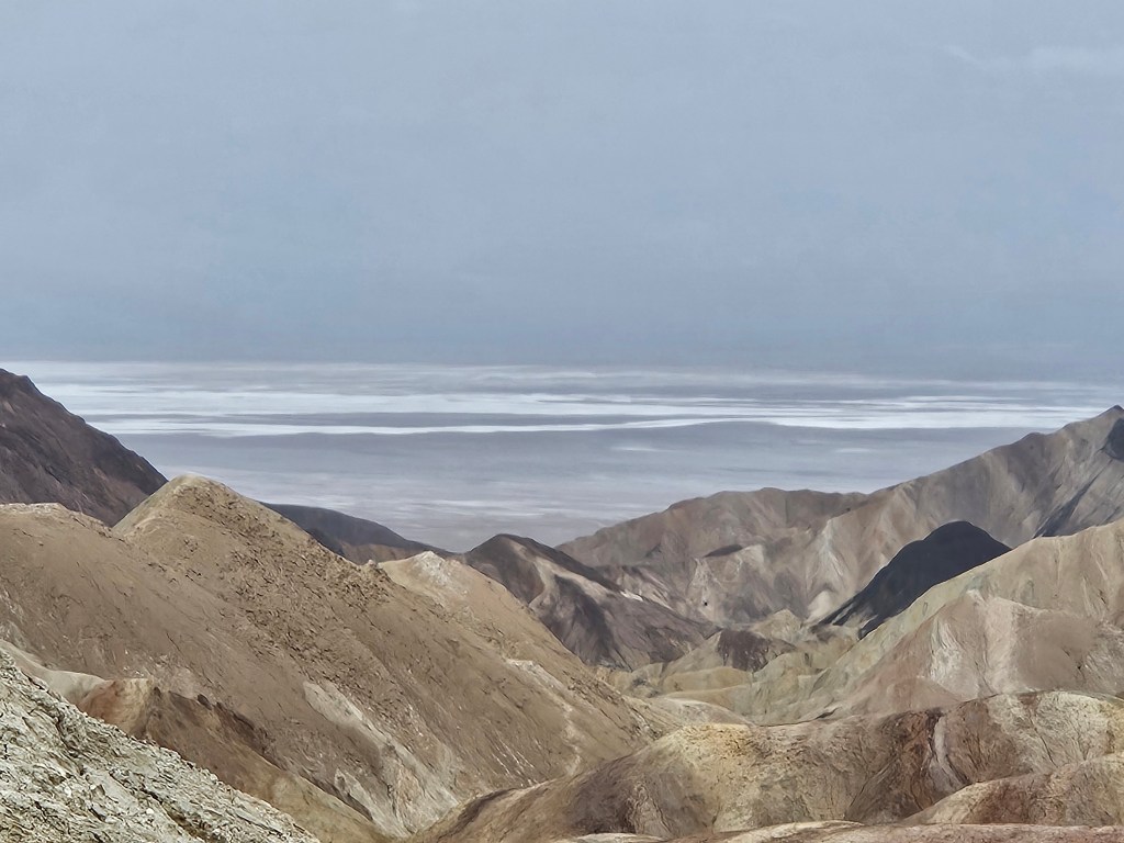
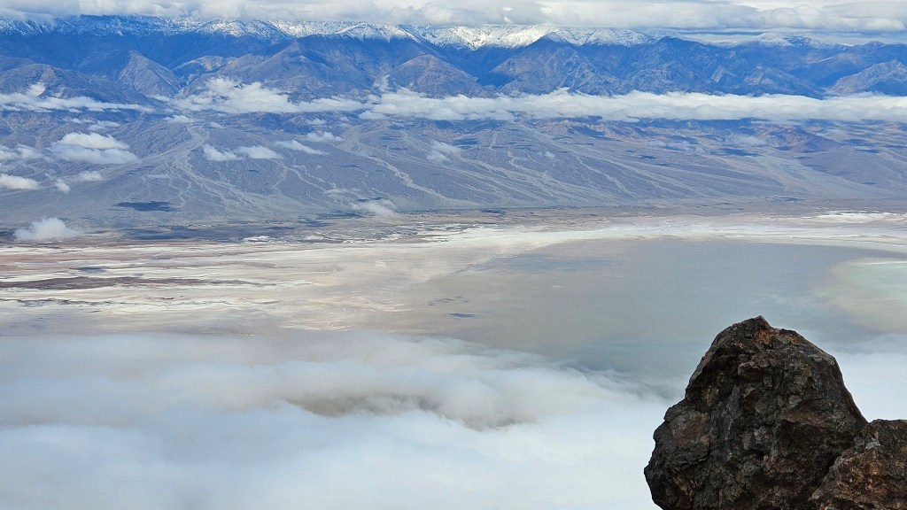
From this place, we received our first look at Manly Lake and the Salt Flats at Badwater. On a day such as this, the water is the same color as the sky.
We took some time out to see Furnace Creek Visitors Center; they had a movie that I enjoyed seeing. It focused on the people who have always lived here, the Timbisha Shoshones. “Why do they call this Death Valley?” one elder mused. “It is our home. It gives us life. Not death.” These people were once put on display for the tourists. On the road to the Visitors Center, there is a turnoff to the Timbisha Shoshone village. The tribe numbers around 1,770 members today but only around 50 live in the village.
One of the first things I wanted to see in the park were the salt flats and the lake. This area has been in the news this winter. Normally Death Valley receives about two inches of rain per year, but two things happened: Hurricane Hillary in August 2023, and then an atmospheric river in February of this year dumped more rain. A lake formed here for the first time since 2005. In February we heard that people were actually bringing kayaks to go boating on the lake. At its peak, it measured about three feet deep.
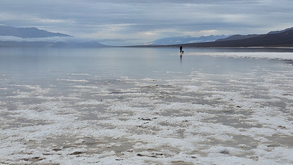
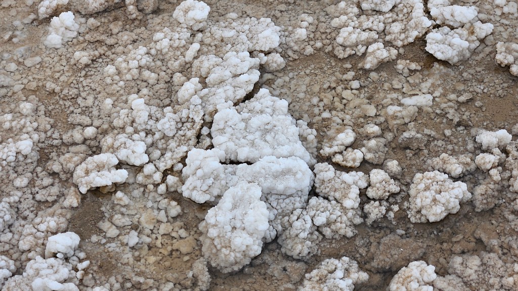
By the time we arrived, the lake level had subsided. We were able to walk far out onto the flats. The salt deposits gave us places to put our feet.
Knowing we were coming here, I was following events at Lake Manly this winter. There were some strong winds at the end of February, and since the lake is so shallow, the wind actually moved the lake two miles! And then moved it (mostly) back where it was!
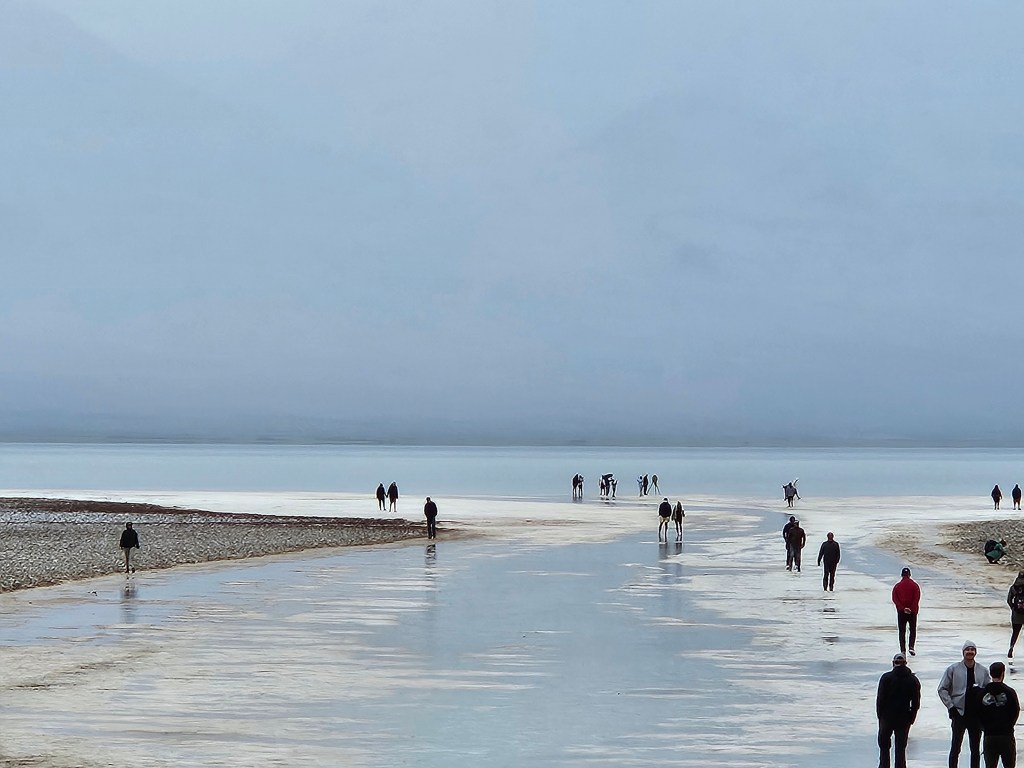
Badwater Basin lies 282 feet below sea level. It’s hard to fathom when you are standing in a place that is that low.

The lake, the salt and desert dirt, and the clouds formed ribbons of color.

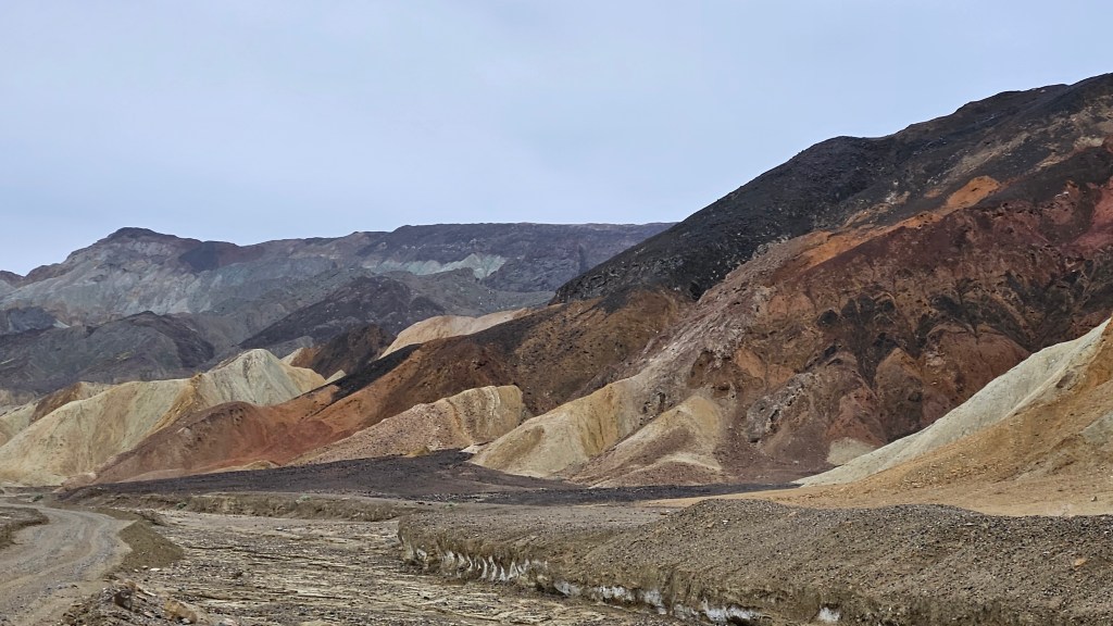
More colors were to be seen at Artist’s Palette, a scenic drive containing viewpoints and a trail.
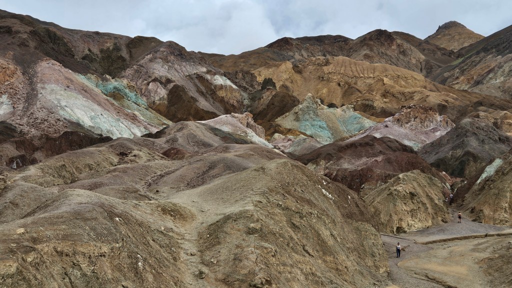
According to the park signboard, volcanic eruptions created this tapestry made of iron, magnesium, aluminum, titanium, and other elements.
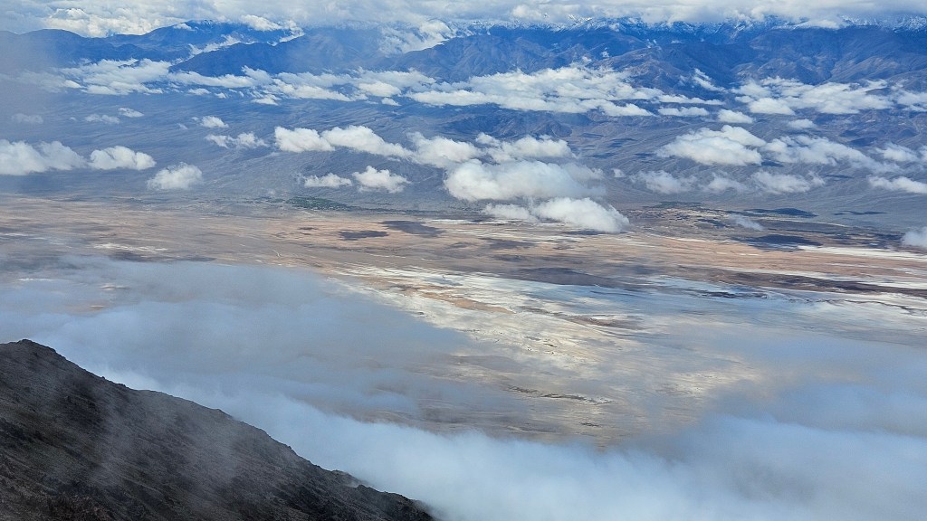
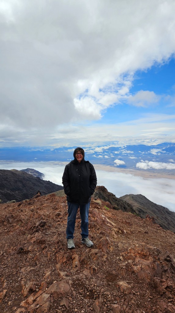
Cal drove us from the lowest part of the park at Badwater Basin up to one of the highest points at Dante’s View. The elevation here is 5,575 feet. He was happy to just enjoy the view. But I saw a trail, so I took off.
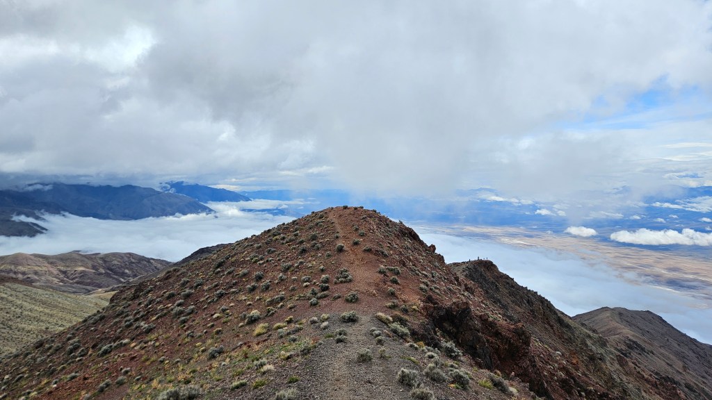
Looking at the next peak, I said “Why not?” and climbed it. And then the next. Looking down from such a height on an overcast day, one almost loses perspective. Which are the clouds, the water, the salt flats, or merely a reflection?
I was feeling very accomplished after this little jaunt, which had been a bit precarious.
What else is there to see in Death Valley? So much that I could not fit everything we experienced here into one post. Stay tuned!
Next time – Salt Minerals, Sand and a Cathedral in Death Valley

This place has its own unique beauty. I don’t know much about it. So I very much enjoyed this post and am looking forward to the next. All of your pictures are beautiful, but I especially liked the one at Badwater Basin. It is hard to imagine a place 282 feet below sea level. In my ebook, I listed a one mile bike path from the Death Valley NP campground. I included it because I read there are trails bikes can go on. Also, bikes can ride the park roads. I’m interested in what you observed regarding biking there. Perhaps I can add more info in the ebook. Also, I noticed this post is from where you were back in March. You must be busy traveling and exploring!
LikeLiked by 1 person
Yes, I am a bit behind on blogging. I’m an early morning blogger. I’ve also been working on another project on some mornings, and other days we’ve been out early seeing a lot of wonderful things. I don’t think biking is so great in Death Valley. Here in the west, what they mean when they say you can bike on trails, is mountain biking. We didn’t hike any trails for any sort of bike to ride on. The roads can indeed be biked on but there is usually no shoulder and it can get very busy. I wouldn’t do it, although we did see bikers, mostly the “hard core” variety. People have to be careful passing them. We did see the bike trail, it goes from the rv park and visitor center to the borax works. Very short. Thanks for your comments and for reading my very long reply!
LikeLiked by 1 person
Thanks for the info. I can add more info to my description. I’m curious about your other project…
LikeLike
Scrapbooking a first year book for my grandchildren! I might do a blog about that sometime. 🤔I got a lot done on it this winter when I alternated it with blogging time.
LikeLiked by 1 person
That will be a great keepsake!
LikeLiked by 1 person