USTravel

Puttering Around in Paducah, and Other Kentucky Treasures

Leaving southern Missouri and heading east, our route took us over two rivers – the Mississippi and the Ohio, one right after the other. When we weren’t on bridges, we were on an elevated roadway. This was a surprise as we’ve crossed both rivers many times, but never in such quick succession.

Both bridges were old, and very narrow. Cal had to pull in the truck mirrors. I suppose the road crews want to save their upgrades for the major bridges over interstates.

White knuckle time whenever a truck blew by!

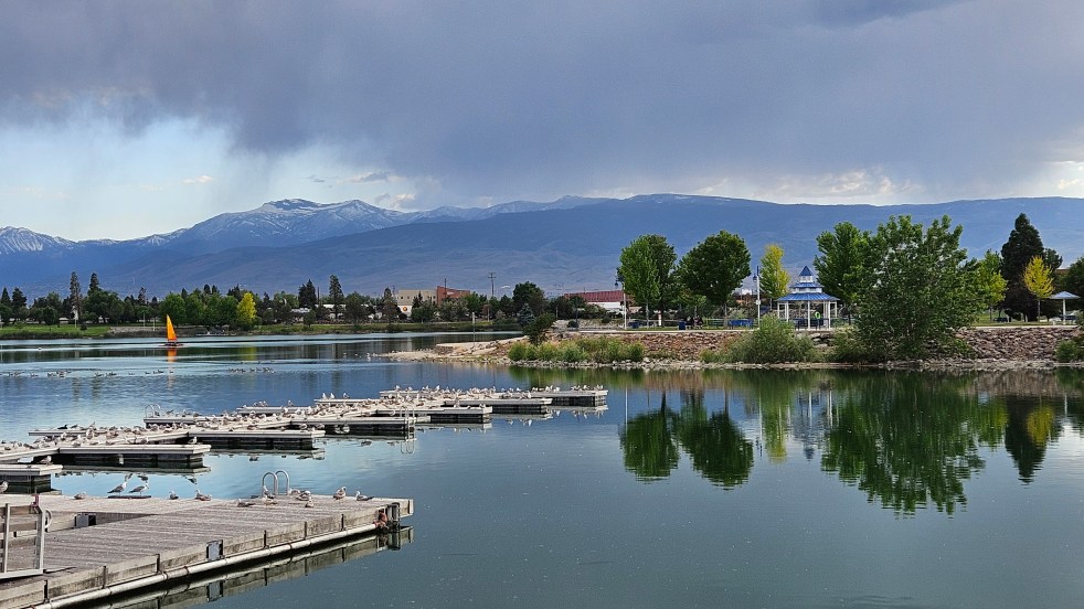
When we used to travel from St. Louis, the rest area at Paducah was a break from the interstate on our way south. The Whitehaven Kentucky Welcome Center is actually a distinctive post civil war era mansion. On one trip, my youngest daughter and I had checked out the upper floors. This was my first time to see the town, though, and I don’t know how it is I hadn’t been here sooner. Especially with someone who enjoys shopping!

We were pleasantly surprised when we arrived in the old downtown area. Old buildings have been lovingly restored. There are shops, art galleries, restaurants, museums, and twenty blocks of this area are on the National Resister of Historic Places.

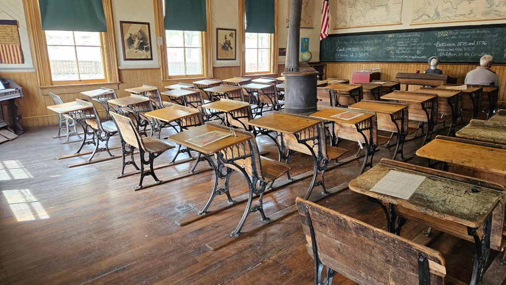
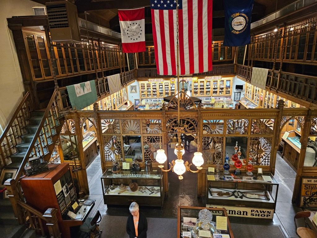
Even the old market hall has been transformed and divided into new purposes. One of those is the Market House Theatre and another space has the William Clark Market House Museum.

William Clark? Yes, that William Clark, from the Lewis and Clark Expedition. In 1827, some years after that little trip, he purchased 37,000 acres here for $5.00. He laid out the town as it would be, named it Paducah after Western Indians he had met on his trip, and set this spot as the town’s public market.

We’d found a great place for lunch as soon as we arrived. It was Kirchhoff’s Bakery, and we’d had delicious gyros on their bakery-made pita bread. In the museum, we learned that it had been there since 1873, passed down in the family from one generation to another.

After visiting the museum, Cal had to step back over to the bakery to buy an assortment of their cookies.

An old pharmacy that was closing its doors donated their shelves and intricate woodwork to the museum. That provided the backdrop to this little space crammed with memories of the town’s history.

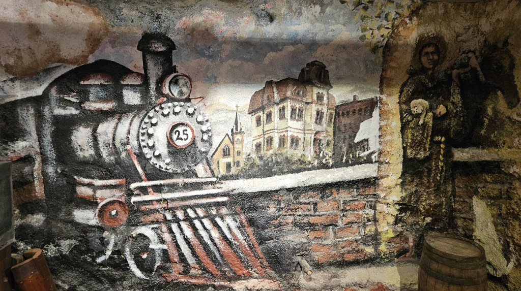
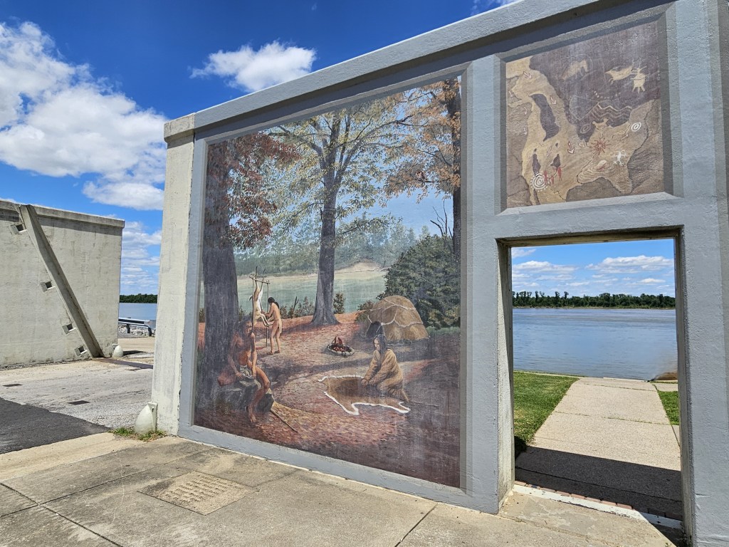
Sitting at the confluence of the Tennessee and Ohio rivers, Paducah’s history of is that of being a busy port. Then the rail industry came into existence. Factories, foundries, and dry dock facilities were built.

We walked along the riverfront and watched this boat push several barges along the Ohio.

But to me, none of that was quite as interesting as what I learned almost as soon as we started walking around the town. In 2013, Paducah was designated as a UNESCO Creative City for “the City’s important role in the connectivity of cultures through creativity”.

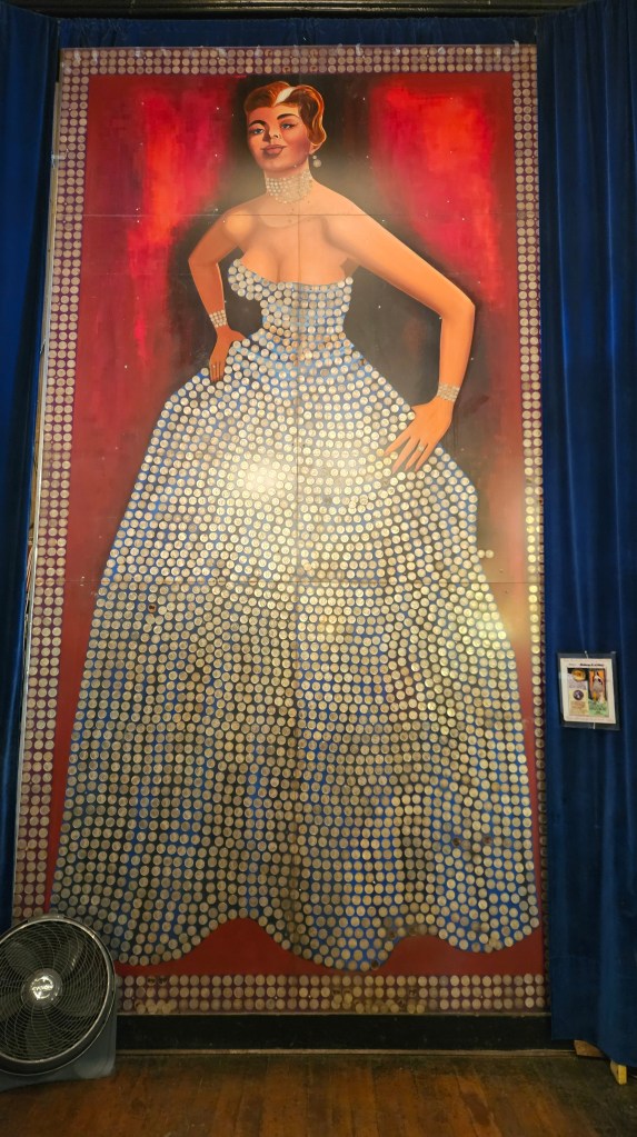
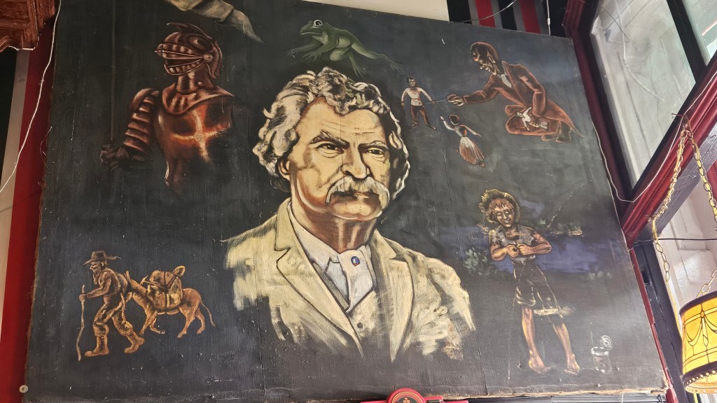
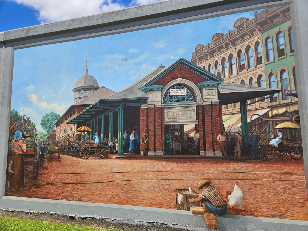
Evidence of this is right there on the waterfront, as the flood wall is covered in murals.

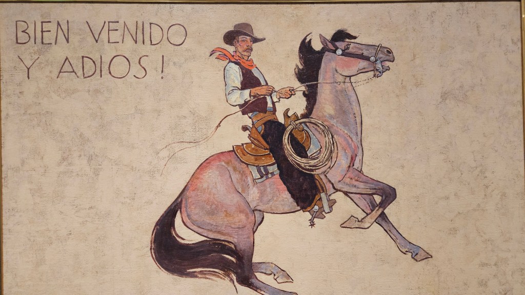
Time moved forward as I strolled along the murals. Here is another of the market building. I like how the little boy is just on the edge of the picture.

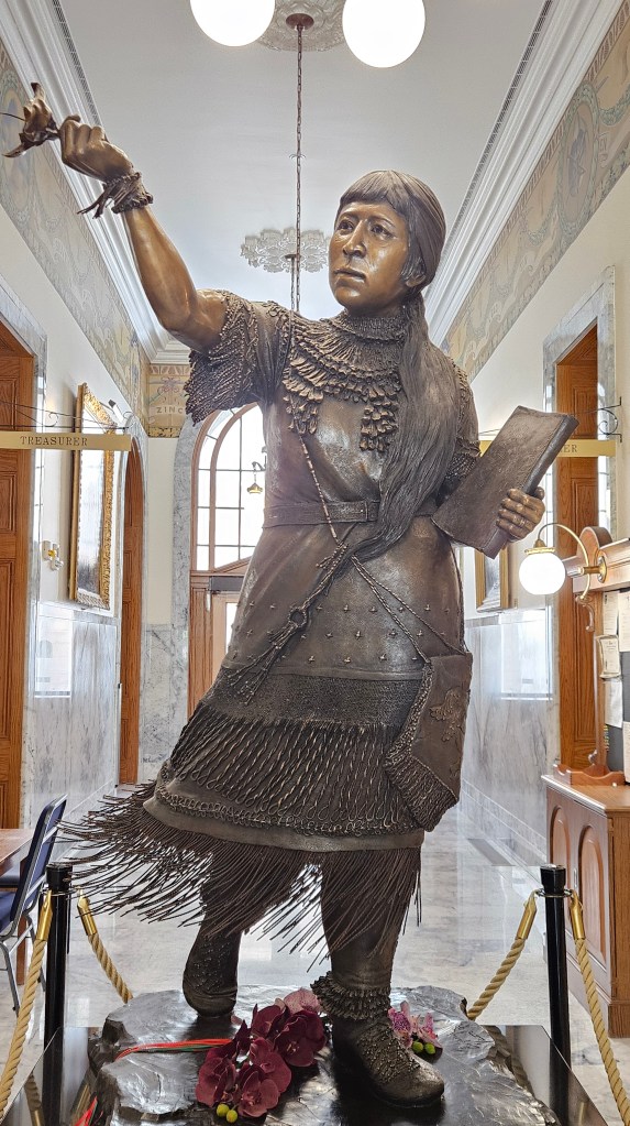
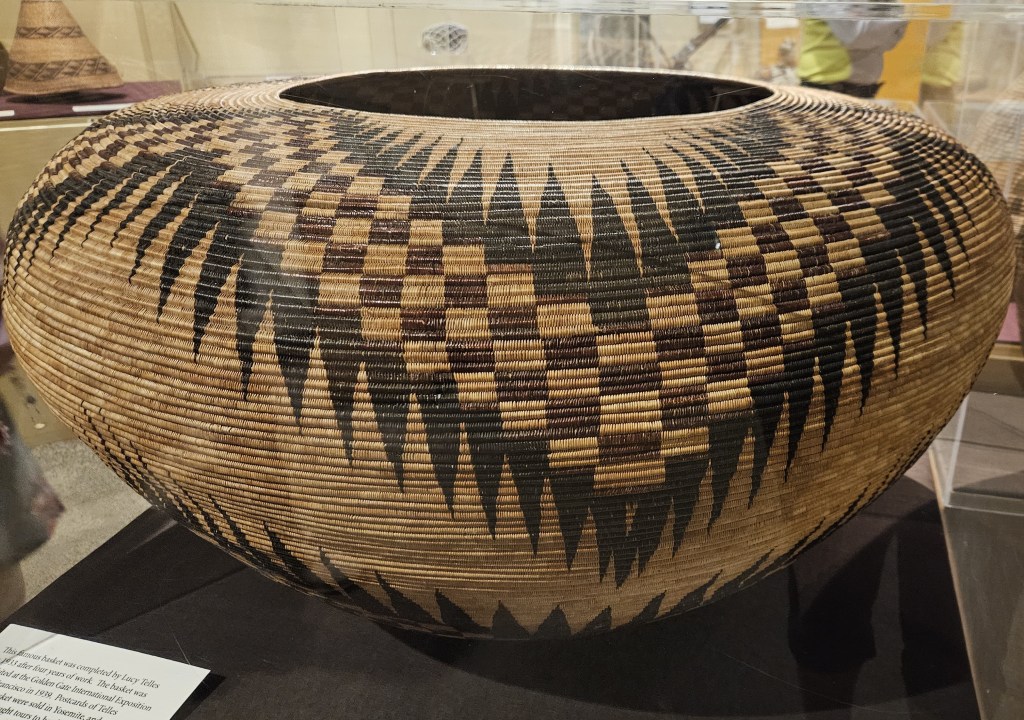
But I had another reason for visiting Paducah. The National Quilt Museum is here. On my way to visit, I stopped to admire this statue. With a bit of artistic license, it portrays Clark and his dog Seaman, and those who helped him and Lewis on their journey. Interestingly, the sign near the statue notes that Clark paid $20.00 for Seaman, but only $5.00 for Paducah.

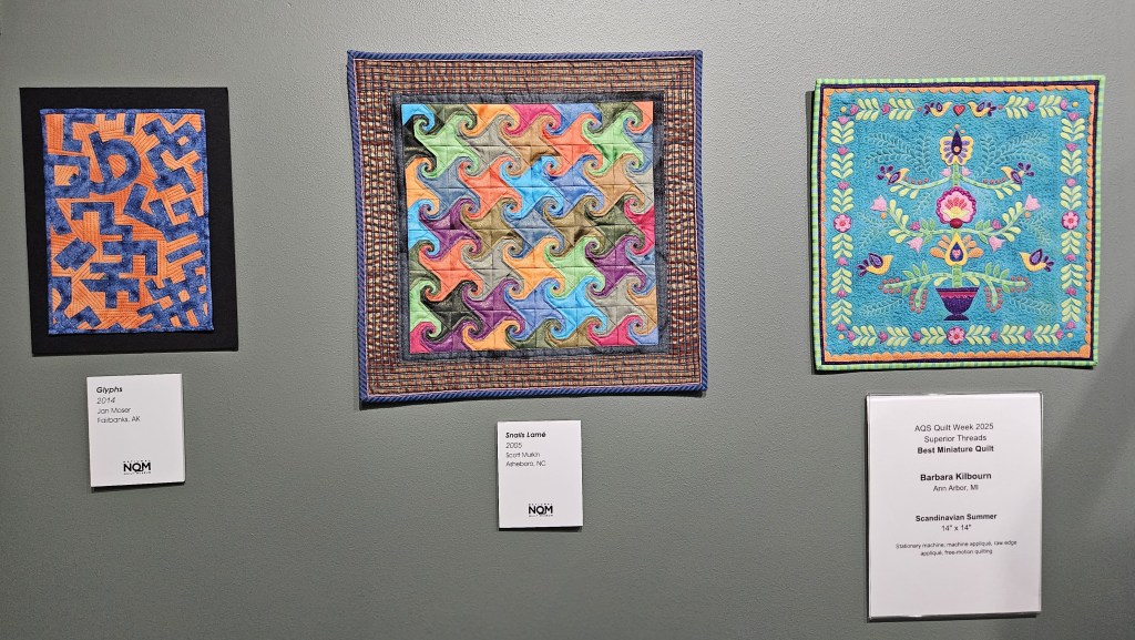
I truly admired the artistry of the quilts in the museum. Some of the most intricate ones were hand sewn. I can’t imagine doing all that work by hand. Others, just as beautiful, were machine sewn and some were a combination of the two.

This quilt looked like a painting when I stepped away from it, and the windows seemed to glow with light:

There were many miniatures. Which is your favorite?

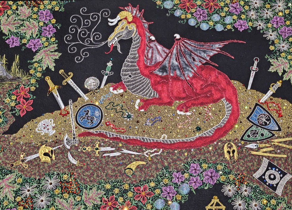
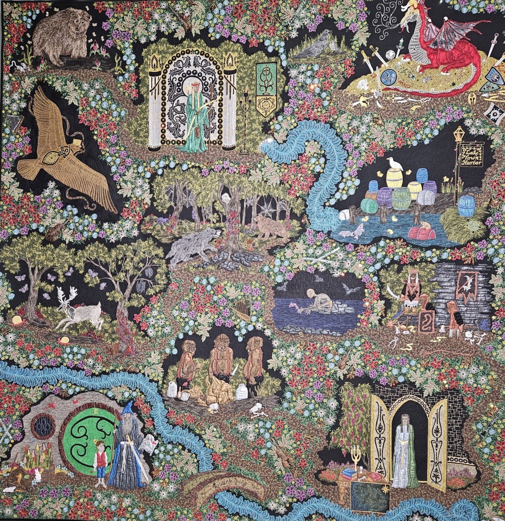
The picture below does not adequately show how this quilt shimmered with beads. It depicts scenes from the Hobbit. The featured picture for this blog post is a close-up of Smaug sitting on his hoard of gold.

Of course, there were plenty of more traditional quilts too.

I was inspired by the quilt museum. Down the road, I have found and purchased a learn-to-quilt kit. I have no machine so it will be handsewn, but it makes a potholder, a coaster, and small mat. I think it’s geared for children, so maybe it will be easy. Well, that’s what it assures me on the package. But oh no—another project to save for another time!

On our way out of the great state of Kentucky, we needed an overnight stop. This being the start of Memorial weekend, it was not an easy find. The Ft. Knox military family camp had a spot for us. It sits outside the gate and feels like a state park. We had to make sure we drove by the United States Bullion Depository. According to Wikipedia, it holds 147.3 million ounces of gold bullion. That’s over half of the gold that the government holds.

The government is not shy about saying what this building is. It sits right off the main road on “Bullion Boulevard”. You can bet there’s some heavy security, though.

Sunset glow at Ft. Knox Family Camp’s fishing lake

Next time – friends, family and sights in Dayton

USTravel

A National Monument, a State Park, and Dinosaurs in Western Colorado

As we crossed over the border into Colorado from Utah, we were ready for a little break. James M. Robb State Park seemed like the place to put down the RV jacks for a few days. It sits just off of I-70 in the small town of Fruita.

Actually, it was a little too close to I-70 for a state park – I could see vehicles on the freeway in the distance in one direction, although I couldn’t hear them. And if I peered hard through the trees I could see – what?? It was the distinctive red of a Dairy Queen sign. That was too tempting. On our first evening, we walked through the campground and right out the front gate to have a little ice cream after supper.

Still, our site was pretty and there were pleasant walking paths in the park. It was a welcome improvement over some of the RV parks we’d overnighted in on our journey east. The park borders the Colorado River, which was full of gushing snow melt.

Behind us, we could see the towering cliffs of Colorado National Monument. We drove to the park for a visit. It’s only a couple of miles from the state park, but a world away. The road to the entrance wound up and up, with some rock formations, a couple of tunnels, and then…wow! We arrived on top of a huge canyon with rocks in formations and colors, pinon and juniper trees, and many viewpoints from which to see them. Rim Rock Road, which goes through the park and was built by the CCC, travels on top of mesas with plenty of switchbacks.

The scene was so different from what we were now seeing that it felt like a hidden surprise.

Desert varnish painted some of the cliffs in multi-colored stripes.

There was a different view around every turn–

–and ancient junipers stretched out their long and gnarled limbs.

We had come into the park just before the visitors center opened, so that was our last stop. They had a great movie about the formation of the canyon and its rocks eons ago.

Dairy Queen wasn’t the only establishment in walking distance from the state park. As we’d driven back and forth, I’d seen a building called Dinosaur Journey Museum. It is part of the Museum of Western Colorado, just down the road in Grand Junction. I walked down to it from our campsite to check it out.

It turns out that this area has been rich in fossil finds. It’s called “the Jurassic Badlands” with hard sandstone ledges called “the Morrison Formation”.

There’s even a dinosaur named after the area. This is a life-size model of Fruitadens, one of the smallest dinosaurs in the world.

There are larger dinosaurs here, too. This is Dryosaurus Altus, which lived during the late Jurassic period. It’s still considered to be a small dinosaur!

I learned many things here, among them the fact that the state of Colorado has the largest track site of late Jurassic dinosaurs anywhere in North America. It is 350 miles away on the eastern side of the state, in La Junta. I appreciated the fact that this was not a kid attraction and that everything was presented factually. There was even an interesting movie to watch.

There are working labs here which could be seen through windows, with a multitude of shelves containing fossils. One of those windows can be seen here, behind this picture of an upside-down Apatosaurus pelvis.

There was one more thing to do while we were at James M. Robb, and that was to ride our bikes. This town is working hard on having a network of bike trails. Actually, the full name of this park is James M. Robb Colorado River State Park, and it boasts that there are five ecological areas in separated parks: Fruita on the west end, where we were; Connected Lakes, Colorado River Wildlife Area, Corn Lake, and Island Acres on the east end. We did not have time to explore the other areas and opted instead to head back west on our ride.

The trail started out prettily enough, along the river, but then it swung alongside the highway with little shade. I think it’s great to build bike trails, but I wish planners would consider proximity to busy roads. I suppose it comes down to land availability. My lone picture from this very hot ride was from something called “Wakezone Park.” People could waterski on a lake without a boat through a system of cables and pulleys. It looked like fun.

I caught this person on top of an incline. It looks like she is stopped on the incline, but she was actually going full speed.

The day was sunny and very hot. I thought Cal was in a hurry to get back to our site, but as we came back into town he suddenly veered onto a left turnoff instead of going directly back. I was perplexed until I discovered the reason for the detour: he’d seen a sign for Ace Hardware, one of his favorite stores, and needed to make a purchase. I was impressed that he was able to spot it, but I suppose it would have been the same for me if it had been a craft store or antique mall sign!

Back on the road, we had one more stop before arriving in Denver: another state park, Rifle Gap. Unlike James M. Robb, this park is set a few miles away from the highway.

We explored Rifle Gap and the surrounding area couple of years ago. Now it provides a restful mountain overnight on our eastward journeys back to Denver.

Next time: our Denver life

Note: although I am writing this during the winter of 2025, the trip actually occurred in June 2024.

USTravel

The Loneliest Road and I-70 Through Nevada and Utah

Sitting on the border of Nevada and Utah, Great Basin is one of the least-visited national parks because of its remoteness. It sits right off of State Route 50 (the Loneliest Road) near Baker, Nevada. We parked for two nights so that we could visit it.

Looking through the museum in the visitor center, I learned something that was fascinating. An area that covers almost the entire state of Nevada and west to the Wasatch Mountains in Utah is a huge basin. Water comes in the form of rainwater and snowmelt and flows through the streams and rivers, but never leaves the basin. Sort of like the milk at the bottom of your cereal bowl. The National Park is but a tiny microcosm of it.

Some of the Basin’s moisture has dripped into Lehman Cave, a feature of the park that we were able to get a tour for.

Every cave that we’ve visited has one or two things that differentiate it from any other. Lehman has 1,107 “cave turnips”. Only a dozen caves have them world wide, and they date back to the Ice Age. A cave turnip is a stalactite with a bulge in it. There are two of them in the picture below; can you spot them?

Out of the cave, we drove up the scenic drive, stopping at a couple of view points. Here was a flip side of the view that we had been seeing for the last couple of days.

At Mather Overlook, we could see another basin, this one carved out by a glacier.

We topped out at 9,886 elevation on Wheeler Peak, although it was not the tippy-top of the mountain. The road ended here, and we stopped for a little hike.

Melting snow created a wonderland of waterfalls and rushing streams. The sound of flowing water and the chirping of the birds made a nice backdrop for a lawn chair lunch.

Although this is a smaller national park, it is nice not to have all the crowds of the more dramatic parks we have been to.

Back at our RV, we admired the clashing fronts happening in the sky – dark clouds rolling in but still blue to the west, from which we had come. There was intermittent wind and splashes of rain. It was a relief from the heat.

Also looking west–the official Lonely Road sign.

I wandered around in the desert a bit.

In the morning, we drove about a second before we were in Utah and Mountain Time.

And still, the road went on.

The western side of Utah was prettier than I thought it would be. We climbed up a pass and went down into a rocky gorge. Then, there was something that looked to be a huge dry lake covered with sand, or maybe it was a salt bed, and it went on for miles.

I looked at my paper Utah map, and it was noted there as Sevier Lake (Dry).

We climbed out of the Wasatch mountains, and we were out of the Great Basin. Our stay for the night was an RV park in Salina, Utah. The only thing memorable about this park was that the owner kept a huge flock of chickens, and she gave us a complimentary dozen eggs in several colors. Today, I’m not sure if she wouldn’t have charged us for them, because they are pure gold!

Highway 50 ended here, and we were now on Interstate 70. Route 66 may be called “The Mother Road”, but to me, I-70 is the Mother Road. I’ve either lived a large portion of my life not far from this highway, or I’ve driven on it through many states countless times to vacation or visit family. I think, though, that this was only the second time we’d been on it at its western origination.

Interstate 70, looking like ribbons through cut rock, is on the upper left of this picture

We were now entering a spectacular area with towering rock monuments, rock pillars and canyon vistas. It was almost as good as going through the Utah national parks. Actually, Arches National Park is somewhere to the south of this view. There was even a turnoff, Salt Wash Scenic area, to take in the view and enjoy a picnic lunch.

The parking lot was packed and I felt really happy that this stop off was here. It gives people a small taste of the state’s wonders, even if all they can do is zip through it.

Next time – a few days in Western Colorado

Note: although I am writing this during the winter of 2025, the trip actually occurred in June 2024.

USTravel

Traveling the Loneliest Road

In 1986 a Life magazine article dubbed Highway 50 in Nevada “The Loneliest Road in America”. It’s a pretty desolate stretch of two-lane highway, with miles between services. The pictures I’ve seen of the scenery along the roadway looked intriguing and I always thought it would be fun to ride it to see what it’s all about. “Desolate” is a word that in my language means “enticing”.

Cal is the driver of our journey and after looking at the map, he thought the drive would be OK. It’s a truck route, after all. So we headed east on 50 from Nevada’s western side at Washoe Lake State Park. There was nothing lonely about it for the first 60 miles or so. Construction and lane closures caused line-ups and slowed traffic, especially in some small towns we passed. Finally, we left everyone behind. The view was of salt and sand, pretty mountain scenery as we went up and down passes, a large flooded lake. We saw horses and a pronghorn antelope.

Along this stretch of road people had used rocks to leave their mark on the salt flats
Color contrasts on the desert floor and hills of sand

I had read ahead of time to look for a sign that said “BAR” in big red letters. Like a desert mirage, it soon appeared.

This was to be our lunch stop since this place has a reputation for delicious juicy hamburgers.

Middlegate was so named back in the 1860’s for Overland stagecoach trail that was cut through the mountains. Huge rocks on either side of the blasted trail formed the “gates”. This was a stagecoach and freight station until the early 1900’s, and for a brief time it was also a Pony Express stop. The hamburgers here lived up to their reputation.

After lunch, the road went on.

Our stop for the night was in Austin, Nevada. Summer weather had finally caught up to us, and it was hot. I had thought that after parking we might explore this tiny town, but we were perched on a cliffside and nothing looked inviting enough to cause us to want to sweat. The RV park was advertised as being next to a city park, which it would have been if not for the hill. We did walk down the road a bit to peer in the windows of this old general merchandise store, opened in 1863, which happily has been turned into a library.

Here was our first sighting of the invasion of the Mormon crickets. There weren’t a lot of them as they marched off to the side of our RV. At first I was fascinated, but in the morning I was happy to put Austin behind us. As we drove, we saw hordes of them crossing the roadway in places, staining the entire roadway red where they had been smashed.

**Fun fact – Mormon crickets are actually shield-backed katydids. They received their nickname after they destroyed the early crops of the Mormon settlers.

Not too long after leaving Austin, Cal discovered that the rubber seal around our RV door was flapping. He stopped and made a five-minute fix. That was enough time for me to hop out and take some pictures, and I noticed that the desert floor was alive with the movement of the crickets in a steady stream, north to south. Where were they going? They aren’t visible in this picture but trust me, they were there. I’m happy to report that this was the last sighting.

In Ely, Nevada, we stopped for a picnic lunch in the city park, and the sight and smell of the green grass was intoxicating. In the other direction from this view, some folks were engaged in a dog obedience class that provided us some entertainment. The far end of the park had a small duck pond.

A glimpse of a mural can just be seen in the back of the photo above. There was another mural across the street, depicting explorers and visitors to Lehmann Cave in Great Basin National Park. Altogether, there are more than twenty murals in this town.

I would have loved a closer look at Ely’s downtown and to hunt for more murals, but it was hot and we were still on the move.

Our drive today involved ascending more mountain passes, descending through junipers and pinion pines, and back down to fragrant sage deserts. More jaw-dropping scenery.

From a great distance, we saw a road snaking impossibly up a mountain side. Were we really going to have to go up there? Relief: as we got closer, our road revealed itself: no, we were happily going to veer off to the side. This turned out to be the backside of Great Basin National Park.

At the end of the day, we stopped for the night just inside the Nevada-Utah border. We had been generally trouble-free for a long time. But after arriving we discovered that a road-striping truck had splashed yellow paint on the lower front of the RV. To add to that mess, it was covered with red sticky Mormon cricket goo. Inside the RV our fire extinguisher had come off the wall, rolled under a strip of molding, and in the process of opening the slide, had pulled the strip off the wall.

Trouble comes in threes. Some tubing under the bathroom faucet had leaked and flooded the basement. Cal kept his good humor and everything was cleaned and repaired. It’s a good thing this doesn’t happen often!

Storm clouds at sunset in Baker, Nevada

In 2024 (or 2025), would State Route 50 in Nevada still be considered the loneliest road in America? It’s probably debatable, but I do know that it provided us with a lot of grand vistas and new sights on our journey through it.

Next time – we visit Great Basin National Park

Note: although I am writing this during the winter of 2025, the trip actually occurred in June 2024.

USTravel

So Much To Do In Virginia City, Nevada

Silver! The Comstock Lode was discovered in Virginia City in 1859, and the boom was on. It was the first major silver deposit found in the United States. Mines opened and the town grew to a population of around 25,000 ten years later. The growth in this town is what led the state of Nevada to statehood.

It had been a while since we’d ridden a train, so upon our arrival here we decided to take a ride on the diesel-powered Virginia and Truckee Railroad to start our day.

The train was originally built to haul the ore out of the Comstock Lode Mines, as well as other building materials and supplies, and went all the way to Carson City. Now it hauls tourists on a round-trip venture down to Gold Hill, a tiny town where the first of the silver lode was mined.

Our conductor and guide shared names of the mines and some of their stories as we rode.

You can see the train tracks just above this long-gone silver mine
The town of Gold Hill was so named because gold is what was found here first.

After riding the train, we wandered along the boardwalk through town.

If for some crazy reason you didn’t find anything of interest to see in Virginia City, you could at least wander into the candy shops and have a treat. Your favorite must be in here somewhere!

Mark Twain had a job as a newspaper reporter in the 1860’s. He wrote about his Nevada years in the book “Roughin’ It”. There is a museum dedicated to his time here, but it is being reconstructed.

Of course, in a town such as Virginia City, there are several mine tours that one could take in while visiting. We wandered into the Ponderosa Saloon, and a tour of Best and Belcher mine is available (for a fee, of course) once you walk straight back past the bar. Who could resist?

A hapless miner displays various drilling tools in the Best and Belcher Mine.

This mine was dug for gold, but it was not profitable. Not, that is, until the present-day owners of the Ponderosa realized that this shaft entrance was steps from their saloon. We enjoyed this informative 25 minute tour.

Not that we are saloon hoppers by any means, but down the street at the Silver Queen saloon, we could see a 16 foot Queen made out of 3,261 silver dollars. This lady weighs 210 pounds and the coins are all Virginia City silver. There is a wedding chapel in the Silver Queen too, in case you want to get married after you see her.

I also liked this tribute to Mark Twain inside the saloon. Samuel Clemens used the pen name of Mark Twain for the first time when he lived and worked here.

We visited two other places in Virginia City. The first was St. Mary in the Mountains, Nevada’s oldest Catholic church. The number of Irish immigrants working the mines necessitated its original construction. It outgrew that one and a new building burned down during a huge fire that decimated the town. The church was rebuilt with bricks in 1864.

Looking from the nave to the entrance of St. Mary’s in the Mountains

Our train conductor had touted the museum in its basement, and also the fact that they sell wine down there. We couldn’t figure out what happened to the wine, but the paintings in the wine cellar were splendid. The museum held many ecclesiastical treasures.

Our last stop of the day was at the old schoolhouse, renovated and turned into the Historic Fourth Ward School Museum. It’s painted into the center of the picture above, and shown below as well.

The children of immigrant miners, wealthy mineowners, town professionals, the shopkeepers, and other residents of the town crowded into this school. There were 3,000 children living here in 1875! Here’s all the facts:

This four-story, Victorian-era school building is the last of its type still in existence. Children from young elementary all the way up through high school attended here. One room was set up exactly the way it was back in the day. Yes, that’s Cal in the front row.

Here is the first grade class in the 1890’s. Note that there is only one teacher for all of these kids!

Other school rooms contain displays of Virginia City history. Here is a piece of Comstock ore:

Unexpectedly for us, we spent an entire day visiting this mining town. It is hard to compare mining towns from one to another because they all have their own history, but Virginia City had a lot of stories to tell.

Next time – we head out on a road dubbed “America’s Loneliest”

USTravel

An Unexpected Day in Reno, and Horsing Around at Washoe Lake State Park Nevada

I didn’t have a clue what Reno would be like, but I imagined something like we’d seen in Las Vegas. Remembering our time there, we knew we didn’t want to drive our truck into the city. We took an Uber instead, and our driver was very chatty. He said that beginning twenty years ago, less people began to come to Reno. Older hotels and casinos closed, and some have been torn down, leaving empty lots. We saw some empty storefronts and boarded up casinos. He pointed out the two or three that were still good places to go. New casino resorts are here, they just aren’t being built much on the old Strip.

Downloading a walking tour of Las Vegas had been a good idea, so I did the same for Reno. I had our driver drop us off at the Reno sign. Following the walking tour, this meant that we did not walk past any casinos at all, which was fine. The Strip didn’t look enticing enough to check out. And so, this whole day was totally different than I had envisioned.

We walked through City Plaza, with the Truckee River flowing by below it.

We actually found a piece of the Irish Blarney Stone. You don’t have to go to Ireland to see it!

Tourists in Ireland go through great lengths to kiss the Blarney Stone. I guess here in Reno they thought that just rubbing it might be a better idea.

We looked at the copper-colored geodesic dome of the Performing Arts Center and took a peek inside the old Post Office. Next up was the Riverwalk area which was quiet on a Saturday morning.

We went off-tour through the beautiful city park, where people were floating down the river.

We were off the tour route and passing by the park on our way to Washoe Public House for a delicious lunch.

Back to the tour, we visited the West Street Market. I had looked forward to this, but disappointingly, it was no longer a market. Was this tour written pre-covid? I hadn’t checked the date.

Our last stop was at the beautiful Thomas Aquinas Cathedral. It has a beautiful wrap around mural in the front from the 1950’s, thought to be one of the finest works of art in America.

We had come to the end of the walking tour. Cal was tired of walking on city streets and hot concrete. He was ready to call it done, but I didn’t feel done with Reno. He took an Uber back to the RV park, and I walked back past where we’d had lunch to the Nevada Museum of Art.

At first, I was a little disappointed. It was smaller than I thought it would be, with no permanent exhibits due to construction. But an eager docent took me through an exhibit by Cannupa Hanska Luger, an artist who is of mixed Native and European ancestry, entitled “Speechless”. She made the art come alive with her interpretations of his various pieces.

It was the second exhibit that stole my heart. It displayed the art of Maynard Dixon, who lived from 1875-1946. He painted the West, including Nevada. I love the paintings that I saw, some capturing the red rocks at sunset, and immersed myself in his life and work. He really got the feel of the Nevada landscape. Dixon also illustrated in magazines and books of the day and wrote poetry.

Mountains in Sunset Light” – Maynard Dixon
A self-portrait mural, “Welcome and Goodbye!”

The other thing that I learned about him was that he was married for a time to Dorothea Lange, a well-regarded photographer in her own right whose works I have admired. She was the mother to their two sons.

I’m sure the Reno strip would have appeared differently at night. The Riverwalk is regarded as a great place to visit and perhaps have dinner after taking in the casinos. But we did not return.

It had been a short stay at the park in Sparks, outside of Reno, and one of our nights had been out of the RV in South Lake Tahoe at a lodge. But I was happy to move on, especially since the next three nights were a grand total of 32 miles down to Washoe Lake State Park.

We had a beautiful spot here–

–with beautiful views of the Sierra Nevadas. The lake that gives the park its name was between our RV and the mountains. Scrubby hills lined with cedar trees were behind us.

All of this would be very fine, in and of itself. But the thing that makes this park extra special is the wild horse herd that lives here.

We’d seen them as we’d driven in and out of the park. One morning we drove the truck out to a trailhead to hike in order to see them closer. From the path, we watched a group of horses.

In the distance, we saw a larger group having breakfast lakeside. The two colts on the front left were frolicking and running together so they were fun to watch.

I was busy photographing them when Cal came up and said in a low voice, “You might want to turn around.” The first group was coming up right behind us on the path! They did not seem to have any fear of us, but were definitely minding their own business as they clip-clopped by.

Seeing so many horses in this gorgeous natural environment was a real treat. Afterwards, Cal drove the truck back to our spot but I opted to take a long hike back. Horses were still in view. There was a group hanging around the restrooms at the picnic area. It must be true what they say…the grass is always greener over the septic tank?

For a time, I was walking along the Washoe Lake shore, where a lone horse was doing the same.

In all, we had sighted over 60 horses on this morning.

We never know what lies around the bend on our travels. Some sights are not quite what we think they will be, but others go over and beyond our expectations. That is the surprise and the gift of the journey.

Next time – we visit Virginia City

USTravel

A Lake Tahoe Visit

Lake Tahoe is a place I’ve long wanted to visit, although my husband says that everywhere is somewhere I’ve always wanted to visit. That may be true, but it was still a very exciting moment when I stood on the shoreline and gazed at the clear blue water.

It had been a long drive back into California from where we left our RV on the east side of Reno. I hadn’t been able to find available RV parks any closer, although I had looked months earlier. In a rare occurrence, I was at the wheel, and enjoyed driving on the winding roads along mountain sides and pine forests until we arrived at the lake.

The picture above was taken at one of the first small turnoffs we came to.

Our first actual stop was at Eagle Falls on Emerald Bay. We were on top of it in the picture below, and the falls are on the right of this picture. The little island in the water (above the tree limb) is Fannette Island.

Lake Tahoe didn’t receive the early protection from development that Yosemite did. In the early 1900’s, wealthy folks purchased swaths of land and built homes along the lake. One of these was Vikingsholm, considered to be “Tahoe’s Hidden Castle”. If you enjoy Scandanavian architecture, it is considered to be one of the finest examples in the United States. We decided to take a tour of the home.

First though, we had to walk one mile downhill in the gorgeous pine forest on the old road, now a path, to the house. Views of the lake abounded. We were acutely aware that we were going to have to walk this same mile up when we were done!

The home was built for Lora Josephine Knight, a widow in her 60’s. A house had already been here since the late 1860’s, and a later owner built cabins. The land was cleared to build the home but Lora did not want one single tree cut down in the construction. She had traveled to the Scandinavia many times and Emerald Bay reminded her of the fjords there. Her niece’s husband was a Swedish architect who designed the home for her in that style. It was completed in 1929, and became her summer home.

Of course, the Scandinavian design continued inside the home, as our guide pointed out many features. Lora loved to entertain and have guests, so the dining room is large enough to stretch out the table when needed. And of course, having many guests requires having a large kitchen!

Arriving guests would drive under the structure in the picture below to the courtyard in the back. This structure housed the caretaker, who lived here year round, and also guests. This roof was made of logs; the low buildings on either side of it had roofs made of sod in true Scandinavian fashion.

From the front of the house we could walk right out to the lake shore, and happened to catch a passing excursion boat. On the right is Fannette Island again, which also belonged to Lora, and she built a tea house there.

Lora enjoyed 15 summers here and she had no descendants. The home eventually was acquired by the state of California, and is part of Emerald Bay State Park. Besides the home, she is also known for generous contributions to youth organizations, and for providing educational opportunities for those who could not afford them. In addition, she was a prime financial backer of Charles Lindbergh’s flight across the Atlantic.

Our next stop was the marina restaurant at Camp Richardson. It is an old resort community, and its setting under the tall pines gives it a national park feel. There are cabins, and – across the road – a great-looking RV park. I didn’t remember if I had seen this in my RV park search, but most likely it was already full. At the restaurant, we had delicious bread bowls of clam chowder with bacon sprinkled on the top. We were in full view of the lake.

We walked out onto a very long dock after lunch and I took pictures of the restaurant, the beach, and the lake with that beautiful clear water.

The rest of the afternoon was spent in scenic driving down to South Lake Tahoe. I had booked a room in a ski lodge at a post-ski-season rate. Calling it a ski lodge makes it sound fancy, but it was really just a remodeled old motel. Our room was cozy, had a gas fireplace, and was decorated with a fishing theme. Turning left onto the road from the lodge would have taken us directly up to the ski slopes.

Walking a few blocks to dinner, we enjoyed the neighborhood under its canopy of tall pines. Some of the homes were very interesting.

And later, we found another couple of docks.

So, just the same as our last night in Arizona at Grand Canyon West, our last night in California was spent outside of RV.

I highly recommend breakfast at Heidi’s Restaurant in South Lake Tahoe. I had a waffle with warm strawberry sauce and whipped cream. This turned out to be a very tasty trip!

South Lake Tahoe is right on the border with Nevada, so as soon as we crossed it we were passing by several casinos. Rounding a bend in the lake, we were now proceeding north. We received magnificent views of the snow-capped Sierra Nevadas from here.

We were going to take a hike at Cave Rock, but it didn’t pan out. First we found ourselves in a marina parking lot, where I did get a view of the rock. This is a sacred place for the Washoe native peoples.

It seemed like we were supposed to drive through a residential area to the trailhead, but the signs were confusing. We dropped that idea and drove on to see Carson City, which is the capitol of Nevada. With a little bit of extra time before heading home, we decided to stop at the capitol building. It serves the governor of the state and has some offices besides the museum. The other workings of the state happens in buildings around this one.

I learned a some interesting things here. The first is that the Nevada became a state on October 31, 1864, just eight days before President Lincoln’s reelection. He needed the votes, and Nevada was not a slave state. Politicians in Nevada wrote up a constitution and telegraphed it to Washington – the longest telegraph ever sent to that date. As soon as he received it, he admitted Nevada to the Union by an act of Congress. And the rest is history.

The other thing I learned is that Carson City is one of only eight cities to be an official US mint. It was short-lived, however. The first minting was in 1870 after discovery of the Comstock Lode. It closed permanently in 1893 after silver mining declined. If you ever find a coin with the “CC” designation on it, it might be worth a little something.

I also learned about Sarah Winnemucca, who lived from 1844 to 1891. I’ll let this signboard tell you what you might like to know about her, and there is a statue of her in the capital:

Every state capitol we’ve been to has something interesting and different to see and learn.

This had been a great little trip, and our adventures still continue!

Next time – we check out Reno and move to Washoe Lake State Park

USTravel

Adventures on the Road – Coarsegold to Sparks

The Coarsegold River at SKP Park of the Sierras, California

Our stay for the Yosemite visits was in Coarsegold, California. In those blogs I alluded to the fact that it was a long distance from the park. If we ever find our way back here, I might look for a closer spot, but at least we didn’t have to worry about the road being open for the year.

This stop was at an Escapees (SKP) Co-op Park. We’ve been members of Escapees because they handle our mail, and have stayed at their flagship park in Livingston, Texas. This was the first Co-op park we’d stayed in. Members buy into the park and own their site. They are responsible for maintaining it and contributing to the greater good of the park. There is no outside technical maintenance. When members are away, they can release their site into a pool so the park can rent it out. That is how we were able to stay.

We opted for a tour of the park in a golf cart, and Brian was our guide as part of his contribution to it. The first owners, he told us, were called Pioneers, and they built the park on the bare bones of the newly-purchased land. Aside from initial Escapees assistance, the park was built completely on the talents of the new owners.

Notice anything funny about that stagecoach?

This large stained-glass piece hangs over the clubhouse. It was conceptualized by an expert original owner who enlisted a team of women, who initially had no experience in stained-glasscrafting, to assist him.

A stagecoach is the park’s logo because a stagecoach road ran through here. In a brilliant move, more land was purchased than was needed for sites because of fear of nearby development down the road. The park is very private and there are not even any signs outside of it to tell you that you are here. An entire portion of the park has been left to nature. Brian showed us the original stagecoach road. It is now a walking path that leads to the Coarsegold River, shown at the top of this post.

The stagecoach road leads to to the river, and there are more walking paths beyond it. Once Brian showed this to us, I was easily able to get my daily steps in on walks through this beautiful natural area.

We considered and discussed, not seriously, over the long Memorial weekend if we would want to buy into this park. In the end, we decided that we didn’t like the idea of maintaining a site. We’re retired and live in an RV, why would we possibly want to mow grass?? For volunteer work for the park, neither of us are talented in technical or grounds maintenance, although Brian’s tour gig in the golf cart didn’t look too bad to me – or working in the office. The killer, though, is that the entire park is on a steep Sierra Nevada hill. The clubhouse is at the bottom, our site was at the back, and that made for some steep walking anytime we went back and forth. The tree-covered hill made for a lot of beautiful views and very private sites, but long term? No thank you. There’s a waiting list to buy in, anyway.

So we moved on, north and a little west. The roadway treated us for miles to gorgeous blooming oleander in the median, huge bushes sometimes seven or eight feet tall, spilling into each other in a riot of pink, red and occasional white.

We used our Harvest Host membership for a one-night stay at Jessie’s Grove Winery in Lodi, California. Here, we shared a table, a glass of wine and a late-afternoon charcuterie plate with a tuxedo cat.

She was so cute that we couldn’t help giving her a couple nibbles of cheese, whereupon she curled up for a nap on the far corner of the table.

This was a ranch, begun in 1868 by one Joseph Spenker who planted the first vines, and the winery is still owned by his descendants. Some of their Zinfandel grapes are among the oldest in the state. There are old olive trees in the front and flowers everywhere. The winery comes with more than one tuxedo cat, and two horses out in the pasture.

This was a very photogenic farm and I took way too many pictures for an overnight stay. There were no other RV’ers here for the night, and once they shut down at 6 PM for the day we had the place to ourselves. We took an evening walk through grapevine-lined paths.

All was quiet in the morning as well. I took another walk through a path in the oak tree woods with nut shells under my feet before we headed out.

Cal had a tough driving day, owing to road construction and heavy traffic and a turn in error (Garmin’s fault) in Sacramento. There was more traffic and reduced lanes going over the Donner Pass, at 7200 feet. Over through Truckee, and we were now in Nevada. I gazed longingly northward as we drove east, because I would really like to explore northern California. We’ll have to do that another time.

The road led us to Sparks, Nevada and Sparks Marina RV on the east side of Reno. Funny thing, there is no marina here. We could walk down the road to a small lake, but there’s no marina there either.

From behind where I took this picture, there is a developed community with walking paths which open up into an interesting retail area. The lake, which used to be a quarry, has a walking path all the way around it. I’m impressed with the city planning that went into this little corner of town.

The far side of the lake has a park which was very busy on a Sunday morning. They did a great job putting in a new memorial for those who have lost their lives in the service of our country.

Although our RV park had its shortcomings, there was one thing interesting about it: all of the sites are covered with bright green Astroturf.

It wasn’t what I had envisioned for a stay in this part of the country. That didn’t matter much, though. As it turned out, we didn’t spend a lot of time here, as you’ll see in the next post.

Next time: Lake Tahoe

USTravel

A Drive and A Hike to the Top at Yosemite

After our bike ride at Yosemite, it was getting toward late afternoon but we weren’t quite ready to call it quits in the park yet. We decided to finish the day by driving the just-recently-opened road to Glacier Point. This added 15 slow miles of twisting and winding road to the already long drive, but Cal said he was up for it. We began to see snow in the forest after we had gone several miles up the mountain.

Once parked, it is an easy walk on sidewalks to the different viewpoints.

Glacier Point’s elevation is 7,214 feet above sea level, so the view from the top is very spectacular.

Straight ahead in the picture above is Tenaya Canyon, and Basket Dome is on the upper left. Half Dome, on the right, figures prominently in almost every view from this point, and Clouds Rest is to the left of Half Dome. I learned a new word: Clouds Rest is an arete. That is a thin ridge of rock that is left when melting glaciers eroded away solid rock. The melting glacier formed Tenaya Canyon. Looking down from the Clouds Rest you can see its path.

Putting Half Dome to the left of the picture, you can see Nevada Falls and Vernal Falls, with a view of the falls again below. Nevada Falls is the upper falls.

Another view of this beautiful place:

Our park visit had lasted ten hours, and this was the perfect way to end the day.

We wanted to see Yosemite again, but we needed to put a rest day in between. It was a very long drive to the park. Our next visit was on the Thursday before Memorial Day. Now or never!

This time, we were here just a little earlier than the previous visit. This was serious Hike Day for us, and I didn’t want to do it in a crowd of people. We chose to hike Vernal Falls. According to the Park newspaper, it’s 2.4 miles one way. No sweat, right? It wouldn’t be, except for those 600 granite steps up to the top.

The most sedate part of this hike was the one mile walk (not included in the 2.4 mile calculation) to the trailhead from where we parked. Immediately at the Mist Trail trailhead, we started going uphill. A stop at the footbridge to admire the rushing river after a mile and a half gave us a chance to catch our breath.

The steps started after the footbridge, and the falls soon came into view.

The falls created its own wind, drenching us as we worked our way up the uneven steps of varying heights.

And then, the final ascent, along a cliffside to the top:

Finally, Vernal Falls – we made it! We sat in the sun in an effort to dry out and to eat our snacks. We chatted with a couple who had come up with their eight-year-old daughter. She was deservedly very proud of herself.

Looking down on the trail from whence we’d come:

From here, many people continue on to Nevada Falls, or even Half Dome. This was enough for us; it had seriously tested our limits. It had given us a tremendous feeling of accomplishment. But we had led a steadily increasing stream of folks coming up, and with the narrow trail and steep steps, we did not want to go back down the same way. We opted instead for the Lewis and Clark Trail. Although there were a few hills to climb, there weren’t near as many steps, and eventually we were mostly going downhill.

We could look down on the top of the falls where we had just been—

and enjoy our last glimpse of the beautiful mountain wilderness.

With the hike from the parking lot and back included, our total day’s trek was 20,636 steps – 8.46 miles. It had taken us five hours. Pizza on the deck at Curry Village in Yosemite Village was much enjoyed.

Yes, there are crowds at Yosemite, especially near a three day weekend. The park is so large, though, that with a bit of planning anyone can carve out a peaceful slice of this paradise for themselves. It truly is one of our park system’s greatest gems.

Next time – three stops on the road

USTravel

A First Day In Yosemite National Park

We did not have far to go to switch from one RV spot to another while heading to Yosemite. By now we were into the week before Memorial Day, a time of year that I really didn’t want to be in to visit the park. That’s the way calendar planning goes sometimes, so we had to make it work. The very next day after our new setup, Tuesday, we went into the park.

I was afraid of a miles-long wait to get into Yosemite. Massive crowds. Happily, we did not experience that, even for a weekday before a holiday. We did get up at 5 AM to drive the hour and a half trip to get there. The guard shack at the entrance was not even open yet, and we drove right in. Coming through Tunnel View, this is the sight that greeted us:

The morning sunlight streamed in between the peaks, filling the valley with exquisite light and playing a peek-a-boo shadow game with the surrounding cliffs.

From Tunnel View, we proceeded to the Yosemite Valley Floor, and got a spot in the empty parking lot at Yosemite Valley Lodge. It was a short walk across the road, where the climbers in their tiny dome tents at Camp 4 were already packing and ready to take on El Capitan. Down an easy paved trail, and up to Upper and Lower Yosemite Falls, there were only a handful of other folks out.

At Lower Yosemite Falls, I was delighted to see that the sparkling water and morning sun produced a beautiful rainbow.

We had signed up for a Valley Floor Tour, and had some time to kill, so back at the lodge we sampled some pastries. A young man from one of the cities on the California coast shared our table and we had an interesting chat. He was hoping to do some climbing that morning, but wanted to meet someone to buddy up with to do his climb. We were for sure not the right folks for that!

The Valley Floor Tour may have been too sedate an activity for him, but it was a perfect introduction to the park for us as we rode on an open air tram. This is the Three Brothers Peaks:

Our ranger guide told us some interesting stories. The middle peak of the Three Brothers had a rockfall in the 90’s that covered the busy Valley Floor park road. A park ranger heard the rumbling and stopped traffic, despite orders from his supervisor. His actions saved many lives as the large rocks tumbled onto the road.

She also pointed out the climbers on the face of El Capitan, so tiny you could hardly make them out. You certainly can’t see them in my picture, but they are there.

Both our guide and our climber friend from breakfast talked about Alex Honnold, the first person to free solo El Capitan. Free solo means NO ropes or safety gear! There has been a documentary made about him – “Free Solo” which I’d like to watch see sometime.

We got out of the tram to look at the gushing Merced River, with beautiful Bridal Veil Falls as a backdrop. All of the creeks, rivers, and waterfalls were swollen with water due to the late spring snow melt from the higher elevations.

Later in the tour we were able to see Bridal Veil Falls from a bit closer as it tumbled down the cliffside:

Bridal Veil Falls is grand, but the prize for the shortest waterfall – 18 inches high – goes to pretty Fern Spring Waterfall. Our guide told us this little fact, but it may have been tongue-in-cheek.

The tour went up to Tunnel View, where we had stopped on our way in earlier in the day and was where I took the first picture in this post. The rising sun had cast the mighty cliffs in shadows and made it difficult to take pictures. Now we could see everything more clearly, all the way back to Half Dome and Cloud’s Rest.

On the way back to Yosemite Valley Lodge, we learned many more facts about Yosemite as we rode, and received a closer view of Bridal Veil Falls. We felt that this tour was a good “Yosemite 101” introduction to the park and all of its wonders, excellent for a first morning. Not knowing anything about Yosemite to begin with, I had felt a little overwhelmed about what to do when I was planning our visit here. It’s important to book the tour far in advance, though.

One of the best pieces of advice I’d heard is to park once and visit everything on foot, bike, or by shuttle. The parking lot was already packed by the time we returned from the tour. So, we grabbed our e-bikes, put our lunch in my basket, and returned to a picnic area we had seen at Yosemite Falls. We were very glad we had visited the falls early, because now the path was crowded with other tourists.

After lunch, we hadn’t ridden our bikes far when we came to Yosemite Village, where there are some museums. At the Yosemite Museum, I admired the expert weaving of Lucy Telles and her younger sister Alice Wilson. They were both natives who lived in Yosemite most of their lives.

This basket is made of sedge root, bracken fern root, redbud and willow, and took four years to complete.

Behind Yosemite Village is a native village. The Miwok Indians lived in this valley beginning in the 14th century. In the early 1900’s they were considered an asset to the tourist trade, and both Lucy and Alice demonstrated their skills. The Indians are no longer here but their little village is on display.

Here I am in front of, as the sign says, “a ceremonial round house…the center of religious activity.” It is still in use.

The inside of it looks like this:

Back in the museum, I looked at the equipment climbers use, including a cot that can hang off the side of the mountain for the night! No thank you! And here, I learned more about Alex Honnold.

Nearby stands this statue and display board of John Muir:

There is an exhaustive list of things John Muir did in his lifetime, but among them he was a naturalist, environmentalist, and champion for the preservation of wilderness: namely, Yosemite Valley, Sequoia National Park, and the Sierra Nevada Mountains in which they exist.

Another luminary of Yosemite is Ansel Adams, a photographer and, like Muir, an environmentalist. He’s perhaps the best known for his black and white landscape photos of the West and Yosemite. I popped into the Ansel Adams Gallery at Yosemite and admired some of the photos but it seemed to be more of a shop to purchase them and other items.

We were ready for some real bike riding by this time, and the crowds around Yosemite Village were thick. There is a nice trail but there is also a bike rental place which adds to the number of people on it. Finally, it cleared out because most people didn’t ride far. The valley opened up and we had a beautiful ride.

Looking at Half Dome on the Yosemite Valley bike trail

We packed even more into this very special day, but that’s for next time.

Next time – Yosemite – the best view, and a challenging hike upward