USTravel

A Quick Stop In Northwest Indiana

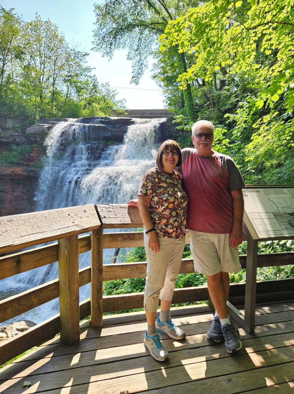
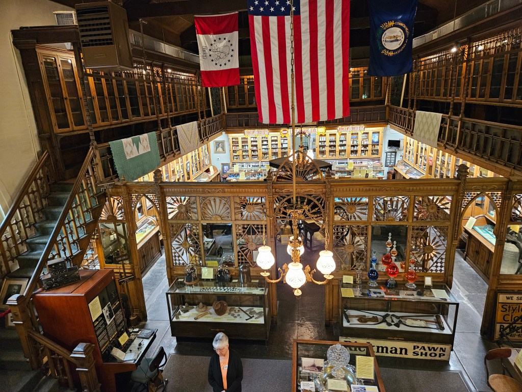
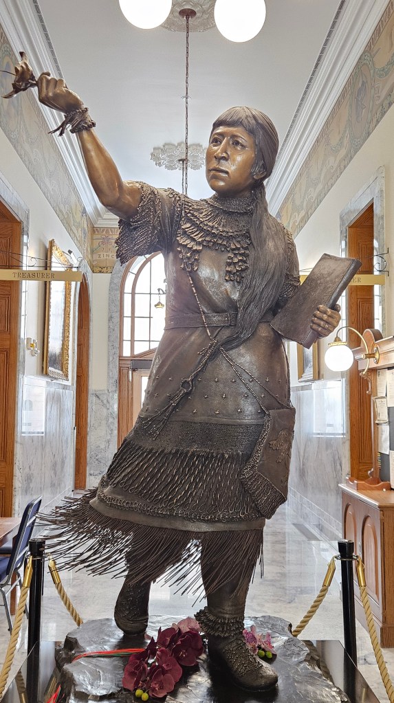
Our travel journey took us to Elkhart, Indiana. I’ve traveled in, around, and through this state, and even lived in it for a short time or two. There are a couple of places I’ve missed seeing, but I don’t have the fondness for Indiana that I do for Ohio. With that in mind, our stop in Elkhart was only two nights. I had a plan for our one day here, which involved a small museum and a place to have lunch.

I’m generally our trip planner, but Cal surprised me in the morning of our stay by asking me if I wanted to go to Indiana Dunes National Park, some 65 miles away. I wasn’t going to turn that offer down.

The Visitor’s Center was open when we arrived. I stamped my National Park book, watched a video about the park, and purchased a couple postcards. As I was checking out, the cashier – who was also helpful park staff – asked if I needed assistance in planning our time in the park. I told him we were looking for a trail to hike after our long drive, maybe a combination of woods and dunes? What he suggested was absolutely perfect.

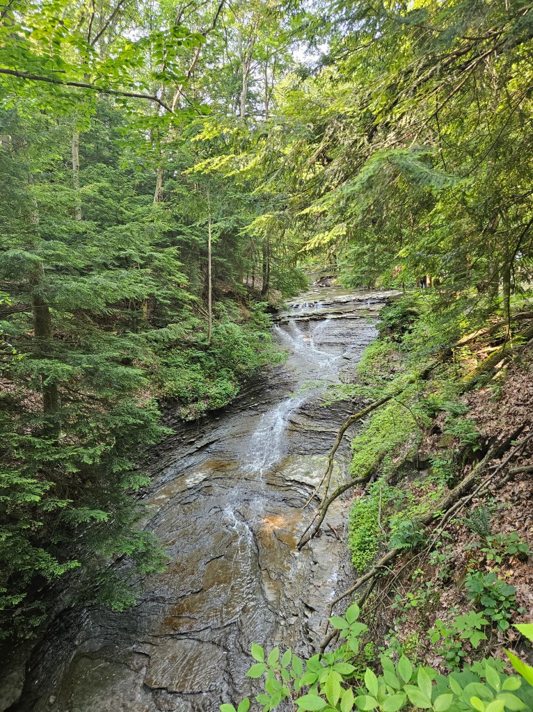
I had learned in the video that the park is working hard to restore the woodlands after decades of abuse. It lies in an industrial area, and indeed, we passed the road to a steel mill on our way to the trail. The woodlands are the final result of sand dunes that have been blown out by the wind, forming ponds and marshes first, and then a savanna after the marsh dries.

So, the view in the picture above was an ancient pond which is now a marsh. Lake Michigan would have lapped at my feet eons ago. This process doesn’t happen quickly.

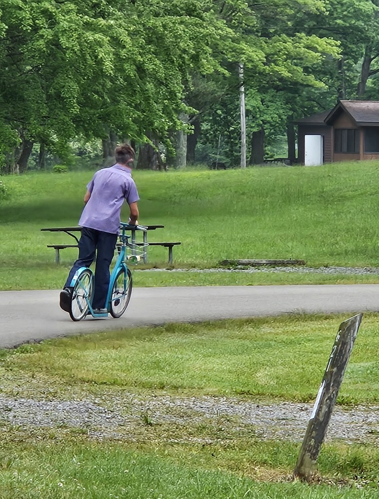
We found West Beach and the Dune Succession Trail easily enough. First, there were boardwalk steps to climb —

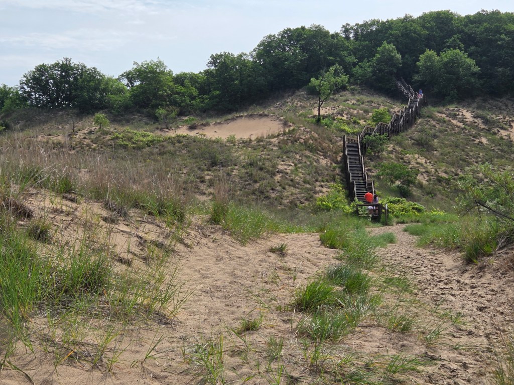
–after which we were rewarded by our first view of Lake Michigan and the dunes.

Down into the woods we went–

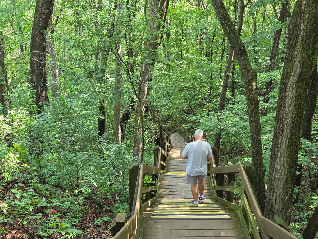
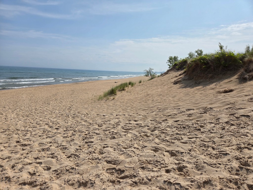
— and finally, out to the dunes and the lake.

Dipping my feet into the lake was mighty fine.

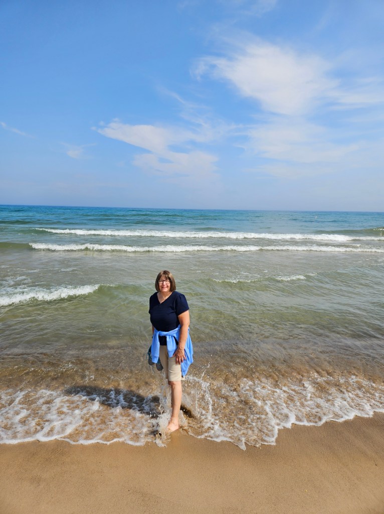
This had been about a three-mile hike.

Our morning over, we headed back past Elkhart to Middlebury and Das Essenhaus, a restaurant that had been recommended to me by my sister-in-law Heidi. Indeed, I’m not even sure I hadn’t been there before. It’s in Amish country and not too far from Shipshewana, a shopping mecca that I enjoyed with her on a couple of occasions long ago.

This was a late lunch and our appetites were up. When our delectable broasted chicken arrived, we had already inhaled the dinner rolls. We even had pie for dessert because it was too tempting to resist.

Das Essenhaus is huge. A sign up in their hallway stated that they can serve 1,100 guests at once. They have their own bakery store, plus other shops outside of the restaurant. Afterward we purchased more dinner rolls (they are great for lunchtime sandwiches) and other baked goods for the freezer.

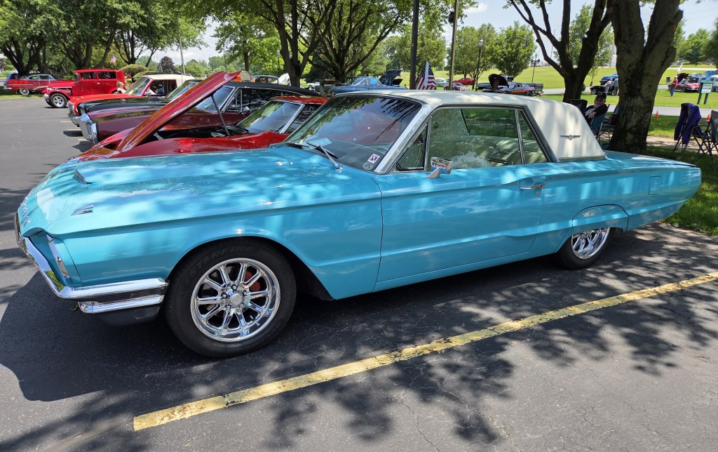
They have their own car show every Thursday. It doesn’t start till 4:30, but that didn’t stop folks from setting up several hours early. We had seen plenty of old cars in the drive by in Ohio, but stopped for a quick look.

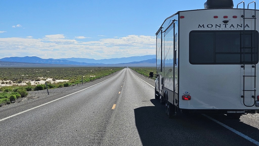
The Elkhart area is the RV capital of the United States, since most of the big brands are built here. As we drove around, we saw some names we recognized and names of makers of the parts that go inside of them. Early in our planning process, I had hoped to tour the factory that made our Keystone Montana, but we weren’t here on their Tour Day.

Instead, we visited the RV Hall of Fame and Museum. I don’t know who or what is in the Hall of Fame, I just wanted to see the old RV’s. It was a fun stop to end our day.

This is the oldest one, a 1913 Earl, which could go behind a Ford Model T.

A trailer from 1916 made me want to go camping. Out in the woods or mountains somewhere.

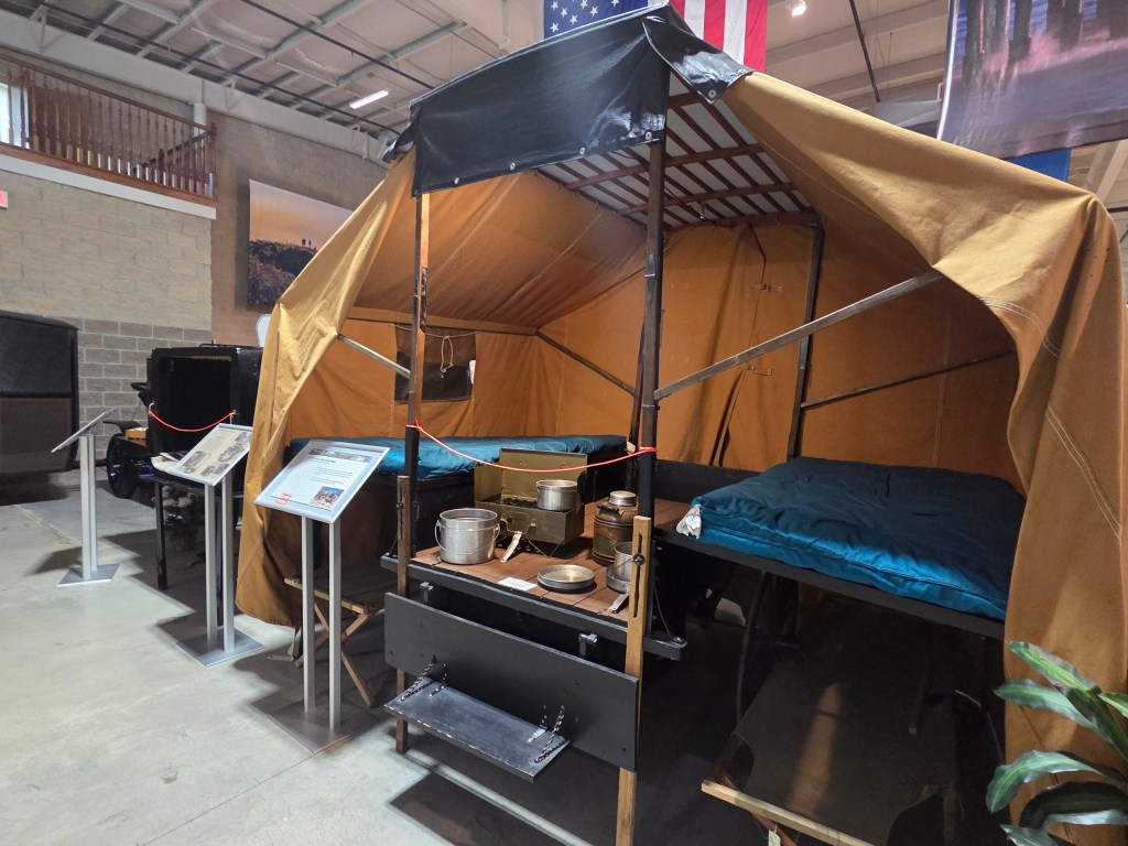
It is one of the first manufactured trailers. Most to this point had been homemade.

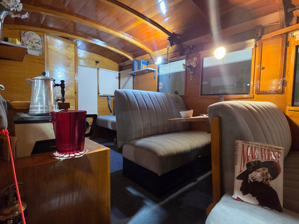
An RV built for a famous movie star is here, too. It was built in 1931 for Mae West. Paramount built it for her to entice her to make movies for them. It has a small hot plate and an icebox, plus a porch out back to sit and enjoy a fine day. What more could any movie star want?

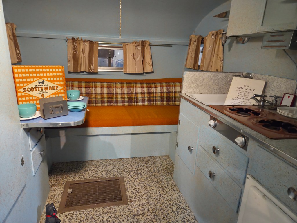
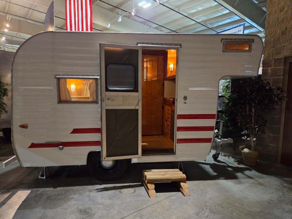
Moving forward in time, this “Scotty” trailer was manufactured in the late 1950’s. It just looks so cozy.

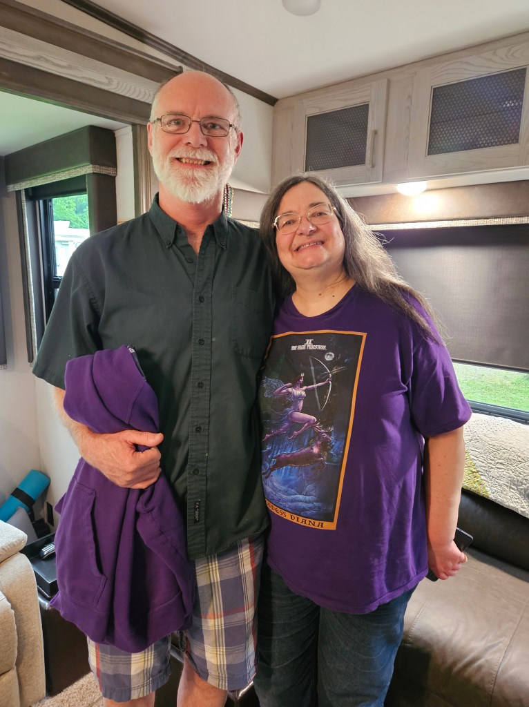
Mobile homes are here, too. Cal lived in one for many years as a child, so I asked him if this looked familiar. He was very young then, so didn’t remember.

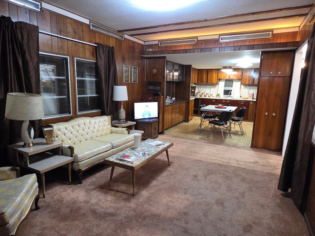
There wermotorhomes and many varieties of trailers and campers, as well as park models – the ones that go into RV parks and don’t move. It wasn’t until we left that I realized – why were there no 5th wheels, like our RV? I didn’t think to ask until after we left. This RV may look a little bit like one, but it is really a trailer.

The RV I like best, however, is our own, and that’s the one we go home to after all our adventures on the road.

Next time – north to Michigan

USTravel

Back to Ohio – Cleveland and Cuyahoga

It’s only a 58 mile drive from Lake Pymatuning, PA to Streetsboro, OH. That was one of our shorter moves. While moving day was full of sunshine and warmth, the next day was full of rain. We were here for many reasons, one of them being Cuyahoga National Park. A visitor center is always a good place to start, so we headed out in the pouring rain to Boston Mill Visitor Center.

This national park is distinct in that it sits in an urban area between the cities of Cleveland and Akron. It’s long and narrow, running north to south. I was surprised to hear that the park turned 50 recently. Gerald Ford signed it into existence in 1974 as a National Recreation Area. It only became a national park in 2000.

I did not think the person behind the desk was all that helpful. I had heard that you can put your bikes on a train that runs through the park, but I discovered that the train is a separate concession. She pushed a train schedule at me, and a map of the route, but I couldn’t take either one with me. I took pictures of them and we figured out a plan on our own.

Two days later, when the rain was finally finished, we were at the Brecksville Station. On the park map, it is shown as “Station Road Bridge”, and nearby is the Brecksville Nature Center. We waited hopefully with our bikes…and waited…no train. I finally did what I should’ve done in the beginning, and looked it up online. That’s what everyone really wants you to do in 2025. The train doesn’t run on Tuesdays, the very day we were there.

No worries, we rode on the Ohio-Erie Canal towpath nearby and although we were a shade disappointed that the bikes didn’t get to ride a train, we had a great bike ride. First, we had to cross the 100-mile Cuyahoga River, the centerpiece of the park.

After we crossed the bridge, we swung southward, and the old canal was on our left. The bike trail goes along the old tow path. Signboards told us what we were seeing, which necessitated a lot of stops. The theme of the board on this particular stop is that nature is slowly reclaiming the canal. Sometimes it is totally grown over, and sometimes there is still water in it.

The canal was constructed during the 1820’s and 30’s, and saw heavy usage right away. It carried freight traffic until 1861, when railroads were built. Until 1913, it was a source of water for nearby towns and industries. It began a slow decline in the late 1800’s, and then the flood of 1913 happened. The canal was mostly wiped out. This must have been a huge flood. I first learned about it when we had been in Dayton. There, a whole museum building in Carillon Park was dedicated to the flood and its aftermath in that city.

The signboards told of industry activity on the canal, families growing up nearby and using the canal for skating in the winter, portions where there was danger from thieves and bandits. Settlements such as Boston and Peninsula became flourishing towns.

A part of the National Park area in Boston, Ohio

Riding the towpath is an enjoyable way to experience the park.

We returned the next day to ride the train. This is not just a cute little excursion train. It is a full size antique passenger train cobbled together from old train cars from across the United States. This is an old resurrected California Zephyr observation car that ran between 1949 and 1970. It had been put behind a passenger train of unknown-to-me origin.

Our seats were in one of the “coach” cars that you see on the right of the picture above. We explored the train–ok, I admit, we were looking for the concession car– and walked through first-class cars that had been lovingly restored to the glamour of the 50’s and 60’s. We rode the train to its northern terminus at Rockside, and then back down to where our truck was sitting in Peninsula. If we’d had our bikes, the porters would have put them in the baggage car and taken them down again for us.

Before riding the train, we explored a couple of Cuyahoga Valley’s waterfalls. Driving through the park and trying to find things isn’t the easiest thing to do. The park’s boundries go in and out of suburbia and also Cleveland Metroparks, and signage isn’t always the best. We couldn’t find Great Falls of Tinker’s Creek, and spoke with another tourist at Bridal Veil Falls who couldn’t find it either. But Bridal Veil was beautiful.

At Tinkers Creek Gorge overlook, the full beauty of the national park is in view.

Brandywine Falls is the showpiece of the park.

I mentioned at the beginning that we’d had two full-on days of rain. On the first rainy afternoon, we had visitors.

Kevin and Diana arrived with Lithuanian kugelis, which is a potato and egg “pudding” – like an egg dish – and roses from their garden.

Diana and I were classmates when I lived in the Cleveland suburb of Euclid. We went to school together from grades one through four, and were pen pals for many years after I moved away. Now, though, we communicate by texting. She and Kevin drove from their home in Fairport Harbor just to see us. The rainy afternoon flew by and we ended up having the kugelis for supper.

Aren’t the roses beautiful? They really brightened up our RV for a few days. Even the two tiny buds bloomed.

I’ve seen Diana off and on through the years we’ve been friends, but mostly in our younger days. Whenever we do get together, though, it always feels like yesterday since I’ve seen her. There is always so much to catch up on.

We were a bit torn on what to do during the next rainy day, but in the end we drove up to Cleveland to visit the Rock and Roll Hall of Fame. This was a fun stop!

Exhibits took us through the genre’s history, from before we were born and when we were children. Music blared and most of it was songs we’d remembered and liked. Original music, costumes, and other memorabilia were highlighted for many artists.

There was sheet music and boots from Carole King and Bob Dylan’s harmonica. Guitars from Earth, Wind and Fire and the Doobie Brothers. A couple of Cher’s and Rod Stewart’s costumes, and the list goes on.

There is a whole room dedicated to the Beatles.

It’s a little bit funny to think Elton wore these things.

Pink Floyd’s “The Wall” was a favorite of Cal’s back in the day. The Wall actually exists and it is here.

In the early era of rock and roll, those in authority were sure that the music was leading teenagers down the path of destruction. I liked what John Lennon had to say about it.

The heart of rock and roll is still beating…in Cleveland.

As we stepped out of the museum, the rain was letting up, and we decided to walk into downtown Cleveland for lunch. The Winking Lizard had the best salad I have had in a long time. They called it the Blueberry Salad, but there was more fruit in it than just blueberries, plus feta cheese, and sliced steak that came out sizzling hot. So delicious! On the way to the restaurant, an orchestra was playing:

For several years of my early elementary-school childhood, I lived on Lake Erie, and its beaches were my playground. Because of that, I feel a particular affinity to this lake. We walked up to it after lunch, but by then, we were back to full rainshowers.

The William Mather is Cleveland’s Great Lakes museum ship

Goodbye, Cleveland. Perhaps we’ll return on a sunnier day.

Next time – a bi-state visit

Uncategorized

Stories of Western Pennsylvania Travels

A dogwood in full bloom – Ohiopyle, Pennsylvania

If you think about a battlefield in Pennsylvania, I’m sure Gettysburg comes to mind. But no, we were still near Ohiopyle, a hundred and fifty miles away to the west.

Cal wanted to get the oil changed in the truck, so on his way in to Farmington he dropped me off at Ft. Necessity National Battlefield. I wanted to get my National Park book stamped, but I also wanted to see what it was about.

I spent some time in the Visitors Center, boning up on my American history. There is a short video to watch, too. Here’s the information I gleaned: this site was the catalyst of the French-Indian-British wars that would last for about 7 years. Before the American Revolution ever started, there were trade disputes with the French to the north, British to the south, and Indians stuck in between.

In May of 1754 a group of British soldiers, led by none other than a young inexperienced George Washington, surprised some French soldiers in nearby Jumon Glen. No one knows who fired the first shot (the excellent video told both sides of the story).To add insult to injury, an Indian on the British side killed their leader. Of course, that led to more fighting on both sides that spread to a conflict that would rattle the European world for years to come, and ultimately lead to victory for the British.

After their victory at Jumon Glen, Washington saw trouble coming, and built Ft. Necessity. It has been reconstructed according to archeological finds. Coming down the trail and first seeing it, I was surprised by how tiny it was!

I was able to get a little more perspective on it by going inside. This cabin, probably Washington’s headquarters and lodging, takes up the almost whole fort.

It didn’t take long to visit. But something else had intrigued me in the Visitors Center: the story of the National Road.

George Washington’s men had had to hack through trees and brush in order to get to this natural meadow. Once the Revolution passed, people were starting to push west. There were not only settlers but also tradespeople. With the first section completed in 1811, the National Road had been established. It was the first federally financed highway.

By 1850, the National Road looked like this.

In modern times, this road has been replaced by US State Route 40. Nothing was said about Interstate 70, but it follows the same route.

Mount Washington Tavern is also part of the Ft. Necessity park. It was built in the 1830’s when traffic on the National Road was hopping. People needed sustenance, a place to stay, and a change of horses. It became a stop on the Good Intent stagecoach line.

My only picture of the outside is above, on the side, as I hiked up to it. It’s a 3-story brick structure. I sure could have used a nice cold lemonade about then, owing to the heat and the small hill I’d had to climb, but I was about 200 years too late.

The tavern was the surprise of the day. I knew nothing about it, and tried the door: open. Creeeak! Absolutely no one around. It is self-guided.

A traveler would have come into the main hall. There is a lovely parlor on the left.

Looking to the right, I could see why the parlor had been so nice: it was for women and families. The men would have congregated in the bar.

When a bell was rung, everyone came to dinner in the dining room, family-style, around one big table.

Upstairs, men and women slept in separate bedrooms. It would not have been unusual to share a bed with a stranger. If the sheets had been washed in the past few days, you were lucky.

Your hotel room for the night, 1850’s style. Oh, you wanted a bed to yourself? Sorry, we’re full…

And, I was feeling lucky that I had been born in the latter half of the 20th century. I really enjoyed this peek into the past.

Our time in Ohiopyle was sadly over. It had been a full and enjoyable couple of days, and I was sorry to move on.

More fun was ahead, though, as we moved northward on the National Road and other roads to Lake Pymatuning State Park. This lake straddles the two states of Pennsylvania and Ohio not far south of Lake Erie. We stayed on the Pennsylvania side.

Lake Pymatuning is a lake that is probably much like countless others that dot the Midwest. For me, though, it has some faded memories. When my family lived in a Cleveland suburb, we came here for camping trips in our family tent. I remember swimming with a (real) inner tube and eating tons of my mother’s pancakes, although I may not have the right park in my mind.

Early morning fishing on Lake Pymatuning

We arrived in a downpour. We could not remember the last time we had to set up in the rain. That showed us that our site had excellent drainage. By the next morning, all was clear.

My Dad would pile my brothers into a rented row boat for some fishing. Always a rowboat. I don’t know if motor boats were as much of a thing back then, or if he just didn’t want to pay what I’m sure would have been a higher cost. If I was really lucky, I was invited along. They would give me a little bamboo pole but I don’t remember catching anything.

My family was strictly in the camp of eating whatever we caught. No “catch and release” for us, unless it was “just” a little sunfish. My Dad and brothers would clean the fish and my mother would fry them up for supper. What would she do if there were not enough? I don’t know, she always made plenty to eat.

There was an Amish encampment here with a lot of kids. Perhaps there was more than one family. As I walked by, they had a huge pile of bikes behind their tent. Instead of seats, though, they had skateboard platforms. I’d never seen these before. A young man unwittingly demonstrated how they work as he flew all over the campground.

My first thought was, “They’re not even allowed to sit on a bike?” Cal pointed out that it is just better exercise to stand rather than sit, since he had seen these before.

Our stay here was relaxing and idyllic. We were in a smaller, quieter loop than the main one with its beach, playground, dock and fish cleaning station. It looked like folks were mainly local, and a lot of people just had tents.

We did get out a bit. The thing to do is to drive up to the spillway and feed the fish. I did not know what the big deal is about that, but apparently it has gone on for years. The catchphrase is “Where the ducks walk on the fish!”

The fish are carp and there were a lot more geese than ducks, but that is something that changes with the seasons. There were SO many geese, and SO many big fat carp all vying for a bit of bread…or Cheerios.

I do not remember my parents bringing us here. My sister Gloria says that our Mom would have used every scrap of her homemade bread in her cooking, and my ever-practical Dad would never have bought us bread just to feed fish and ducks. I would tend to agree. But this was evidently a thing as far back as the 30’s, according to the signboard. You can buy an entire loaf of bread for $1 to feed them. It is a feeding frenzy.

The board also noted that, while it is now known that bread is not the best thing to feed waterfowl and fish, the culture and tradition are being honored. It’s prohibited to do this anywhere else.

We left the fish, and their gaping mouths, and drove along the causeway into Ohio to the little town of Andover for lunch. The main part of the town is on a square. It seems like there should be a courthouse on that square, but there is a nice park instead. The city street goes around the square in one direction. On the edge of the square is a gas station, and behind it and off to the side is the town grocery store. This has the effect of keeping the old town busy, and is brilliant city planning.

We ate lunch at West Side Deli, which is in yellow lettering at the far left of the above picture. We ordered the shrimp basket special, and while we were waiting for lunch a steady stream of customers flowed in. They were giving free hot dogs to the kids. I had gotten into conversation with another customer, and she said for sure it is a once-a-week event, if not more often. It’s really wonderful to see a business supporting the community in this way.

There is also a campground on the Ohio side of Lake Pymatuning, and we drove through it. It is smaller than the Pennsylvania park we were in, but it looks a little more familiar. I’m not sure if this isn’t where my family camped, because it was all too long ago.

At Ohiopyle and Pymatuning, we were at the farthest south and east that we would be on this trip. From here eastward, the only place to go is back to Ohio. And that is a story for next time.

Next time: we visit the Cleveland area, and old friends too

USTravel

Puttering Around in Paducah, and Other Kentucky Treasures

Leaving southern Missouri and heading east, our route took us over two rivers – the Mississippi and the Ohio, one right after the other. When we weren’t on bridges, we were on an elevated roadway. This was a surprise as we’ve crossed both rivers many times, but never in such quick succession.

Both bridges were old, and very narrow. Cal had to pull in the truck mirrors. I suppose the road crews want to save their upgrades for the major bridges over interstates.

White knuckle time whenever a truck blew by!

When we used to travel from St. Louis, the rest area at Paducah was a break from the interstate on our way south. The Whitehaven Kentucky Welcome Center is actually a distinctive post civil war era mansion. On one trip, my youngest daughter and I had checked out the upper floors. This was my first time to see the town, though, and I don’t know how it is I hadn’t been here sooner. Especially with someone who enjoys shopping!

We were pleasantly surprised when we arrived in the old downtown area. Old buildings have been lovingly restored. There are shops, art galleries, restaurants, museums, and twenty blocks of this area are on the National Resister of Historic Places.

Even the old market hall has been transformed and divided into new purposes. One of those is the Market House Theatre and another space has the William Clark Market House Museum.

William Clark? Yes, that William Clark, from the Lewis and Clark Expedition. In 1827, some years after that little trip, he purchased 37,000 acres here for $5.00. He laid out the town as it would be, named it Paducah after Western Indians he had met on his trip, and set this spot as the town’s public market.

We’d found a great place for lunch as soon as we arrived. It was Kirchhoff’s Bakery, and we’d had delicious gyros on their bakery-made pita bread. In the museum, we learned that it had been there since 1873, passed down in the family from one generation to another.

After visiting the museum, Cal had to step back over to the bakery to buy an assortment of their cookies.

An old pharmacy that was closing its doors donated their shelves and intricate woodwork to the museum. That provided the backdrop to this little space crammed with memories of the town’s history.

Sitting at the confluence of the Tennessee and Ohio rivers, Paducah’s history of is that of being a busy port. Then the rail industry came into existence. Factories, foundries, and dry dock facilities were built.

We walked along the riverfront and watched this boat push several barges along the Ohio.

But to me, none of that was quite as interesting as what I learned almost as soon as we started walking around the town. In 2013, Paducah was designated as a UNESCO Creative City for “the City’s important role in the connectivity of cultures through creativity”.

Evidence of this is right there on the waterfront, as the flood wall is covered in murals.

Time moved forward as I strolled along the murals. Here is another of the market building. I like how the little boy is just on the edge of the picture.

But I had another reason for visiting Paducah. The National Quilt Museum is here. On my way to visit, I stopped to admire this statue. With a bit of artistic license, it portrays Clark and his dog Seaman, and those who helped him and Lewis on their journey. Interestingly, the sign near the statue notes that Clark paid $20.00 for Seaman, but only $5.00 for Paducah.

I truly admired the artistry of the quilts in the museum. Some of the most intricate ones were hand sewn. I can’t imagine doing all that work by hand. Others, just as beautiful, were machine sewn and some were a combination of the two.

This quilt looked like a painting when I stepped away from it, and the windows seemed to glow with light:

There were many miniatures. Which is your favorite?

The picture below does not adequately show how this quilt shimmered with beads. It depicts scenes from the Hobbit. The featured picture for this blog post is a close-up of Smaug sitting on his hoard of gold.

Of course, there were plenty of more traditional quilts too.

I was inspired by the quilt museum. Down the road, I have found and purchased a learn-to-quilt kit. I have no machine so it will be handsewn, but it makes a potholder, a coaster, and small mat. I think it’s geared for children, so maybe it will be easy. Well, that’s what it assures me on the package. But oh no—another project to save for another time!

On our way out of the great state of Kentucky, we needed an overnight stop. This being the start of Memorial weekend, it was not an easy find. The Ft. Knox military family camp had a spot for us. It sits outside the gate and feels like a state park. We had to make sure we drove by the United States Bullion Depository. According to Wikipedia, it holds 147.3 million ounces of gold bullion. That’s over half of the gold that the government holds.

The government is not shy about saying what this building is. It sits right off the main road on “Bullion Boulevard”. You can bet there’s some heavy security, though.

Sunset glow at Ft. Knox Family Camp’s fishing lake

Next time – friends, family and sights in Dayton

USTravel

Traveling the Loneliest Road

In 1986 a Life magazine article dubbed Highway 50 in Nevada “The Loneliest Road in America”. It’s a pretty desolate stretch of two-lane highway, with miles between services. The pictures I’ve seen of the scenery along the roadway looked intriguing and I always thought it would be fun to ride it to see what it’s all about. “Desolate” is a word that in my language means “enticing”.

Cal is the driver of our journey and after looking at the map, he thought the drive would be OK. It’s a truck route, after all. So we headed east on 50 from Nevada’s western side at Washoe Lake State Park. There was nothing lonely about it for the first 60 miles or so. Construction and lane closures caused line-ups and slowed traffic, especially in some small towns we passed. Finally, we left everyone behind. The view was of salt and sand, pretty mountain scenery as we went up and down passes, a large flooded lake. We saw horses and a pronghorn antelope.

Along this stretch of road people had used rocks to leave their mark on the salt flats
Color contrasts on the desert floor and hills of sand

I had read ahead of time to look for a sign that said “BAR” in big red letters. Like a desert mirage, it soon appeared.

This was to be our lunch stop since this place has a reputation for delicious juicy hamburgers.

Middlegate was so named back in the 1860’s for Overland stagecoach trail that was cut through the mountains. Huge rocks on either side of the blasted trail formed the “gates”. This was a stagecoach and freight station until the early 1900’s, and for a brief time it was also a Pony Express stop. The hamburgers here lived up to their reputation.

After lunch, the road went on.

Our stop for the night was in Austin, Nevada. Summer weather had finally caught up to us, and it was hot. I had thought that after parking we might explore this tiny town, but we were perched on a cliffside and nothing looked inviting enough to cause us to want to sweat. The RV park was advertised as being next to a city park, which it would have been if not for the hill. We did walk down the road a bit to peer in the windows of this old general merchandise store, opened in 1863, which happily has been turned into a library.

Here was our first sighting of the invasion of the Mormon crickets. There weren’t a lot of them as they marched off to the side of our RV. At first I was fascinated, but in the morning I was happy to put Austin behind us. As we drove, we saw hordes of them crossing the roadway in places, staining the entire roadway red where they had been smashed.

**Fun fact – Mormon crickets are actually shield-backed katydids. They received their nickname after they destroyed the early crops of the Mormon settlers.

Not too long after leaving Austin, Cal discovered that the rubber seal around our RV door was flapping. He stopped and made a five-minute fix. That was enough time for me to hop out and take some pictures, and I noticed that the desert floor was alive with the movement of the crickets in a steady stream, north to south. Where were they going? They aren’t visible in this picture but trust me, they were there. I’m happy to report that this was the last sighting.

In Ely, Nevada, we stopped for a picnic lunch in the city park, and the sight and smell of the green grass was intoxicating. In the other direction from this view, some folks were engaged in a dog obedience class that provided us some entertainment. The far end of the park had a small duck pond.

A glimpse of a mural can just be seen in the back of the photo above. There was another mural across the street, depicting explorers and visitors to Lehmann Cave in Great Basin National Park. Altogether, there are more than twenty murals in this town.

I would have loved a closer look at Ely’s downtown and to hunt for more murals, but it was hot and we were still on the move.

Our drive today involved ascending more mountain passes, descending through junipers and pinion pines, and back down to fragrant sage deserts. More jaw-dropping scenery.

From a great distance, we saw a road snaking impossibly up a mountain side. Were we really going to have to go up there? Relief: as we got closer, our road revealed itself: no, we were happily going to veer off to the side. This turned out to be the backside of Great Basin National Park.

At the end of the day, we stopped for the night just inside the Nevada-Utah border. We had been generally trouble-free for a long time. But after arriving we discovered that a road-striping truck had splashed yellow paint on the lower front of the RV. To add to that mess, it was covered with red sticky Mormon cricket goo. Inside the RV our fire extinguisher had come off the wall, rolled under a strip of molding, and in the process of opening the slide, had pulled the strip off the wall.

Trouble comes in threes. Some tubing under the bathroom faucet had leaked and flooded the basement. Cal kept his good humor and everything was cleaned and repaired. It’s a good thing this doesn’t happen often!

Storm clouds at sunset in Baker, Nevada

In 2024 (or 2025), would State Route 50 in Nevada still be considered the loneliest road in America? It’s probably debatable, but I do know that it provided us with a lot of grand vistas and new sights on our journey through it.

Next time – we visit Great Basin National Park

Note: although I am writing this during the winter of 2025, the trip actually occurred in June 2024.

USTravel

A Lake Tahoe Visit

Lake Tahoe is a place I’ve long wanted to visit, although my husband says that everywhere is somewhere I’ve always wanted to visit. That may be true, but it was still a very exciting moment when I stood on the shoreline and gazed at the clear blue water.

It had been a long drive back into California from where we left our RV on the east side of Reno. I hadn’t been able to find available RV parks any closer, although I had looked months earlier. In a rare occurrence, I was at the wheel, and enjoyed driving on the winding roads along mountain sides and pine forests until we arrived at the lake.

The picture above was taken at one of the first small turnoffs we came to.

Our first actual stop was at Eagle Falls on Emerald Bay. We were on top of it in the picture below, and the falls are on the right of this picture. The little island in the water (above the tree limb) is Fannette Island.

Lake Tahoe didn’t receive the early protection from development that Yosemite did. In the early 1900’s, wealthy folks purchased swaths of land and built homes along the lake. One of these was Vikingsholm, considered to be “Tahoe’s Hidden Castle”. If you enjoy Scandanavian architecture, it is considered to be one of the finest examples in the United States. We decided to take a tour of the home.

First though, we had to walk one mile downhill in the gorgeous pine forest on the old road, now a path, to the house. Views of the lake abounded. We were acutely aware that we were going to have to walk this same mile up when we were done!

The home was built for Lora Josephine Knight, a widow in her 60’s. A house had already been here since the late 1860’s, and a later owner built cabins. The land was cleared to build the home but Lora did not want one single tree cut down in the construction. She had traveled to the Scandinavia many times and Emerald Bay reminded her of the fjords there. Her niece’s husband was a Swedish architect who designed the home for her in that style. It was completed in 1929, and became her summer home.

Of course, the Scandinavian design continued inside the home, as our guide pointed out many features. Lora loved to entertain and have guests, so the dining room is large enough to stretch out the table when needed. And of course, having many guests requires having a large kitchen!

Arriving guests would drive under the structure in the picture below to the courtyard in the back. This structure housed the caretaker, who lived here year round, and also guests. This roof was made of logs; the low buildings on either side of it had roofs made of sod in true Scandinavian fashion.

From the front of the house we could walk right out to the lake shore, and happened to catch a passing excursion boat. On the right is Fannette Island again, which also belonged to Lora, and she built a tea house there.

Lora enjoyed 15 summers here and she had no descendants. The home eventually was acquired by the state of California, and is part of Emerald Bay State Park. Besides the home, she is also known for generous contributions to youth organizations, and for providing educational opportunities for those who could not afford them. In addition, she was a prime financial backer of Charles Lindbergh’s flight across the Atlantic.

Our next stop was the marina restaurant at Camp Richardson. It is an old resort community, and its setting under the tall pines gives it a national park feel. There are cabins, and – across the road – a great-looking RV park. I didn’t remember if I had seen this in my RV park search, but most likely it was already full. At the restaurant, we had delicious bread bowls of clam chowder with bacon sprinkled on the top. We were in full view of the lake.

We walked out onto a very long dock after lunch and I took pictures of the restaurant, the beach, and the lake with that beautiful clear water.

The rest of the afternoon was spent in scenic driving down to South Lake Tahoe. I had booked a room in a ski lodge at a post-ski-season rate. Calling it a ski lodge makes it sound fancy, but it was really just a remodeled old motel. Our room was cozy, had a gas fireplace, and was decorated with a fishing theme. Turning left onto the road from the lodge would have taken us directly up to the ski slopes.

Walking a few blocks to dinner, we enjoyed the neighborhood under its canopy of tall pines. Some of the homes were very interesting.

And later, we found another couple of docks.

So, just the same as our last night in Arizona at Grand Canyon West, our last night in California was spent outside of RV.

I highly recommend breakfast at Heidi’s Restaurant in South Lake Tahoe. I had a waffle with warm strawberry sauce and whipped cream. This turned out to be a very tasty trip!

South Lake Tahoe is right on the border with Nevada, so as soon as we crossed it we were passing by several casinos. Rounding a bend in the lake, we were now proceeding north. We received magnificent views of the snow-capped Sierra Nevadas from here.

We were going to take a hike at Cave Rock, but it didn’t pan out. First we found ourselves in a marina parking lot, where I did get a view of the rock. This is a sacred place for the Washoe native peoples.

It seemed like we were supposed to drive through a residential area to the trailhead, but the signs were confusing. We dropped that idea and drove on to see Carson City, which is the capitol of Nevada. With a little bit of extra time before heading home, we decided to stop at the capitol building. It serves the governor of the state and has some offices besides the museum. The other workings of the state happens in buildings around this one.

I learned a some interesting things here. The first is that the Nevada became a state on October 31, 1864, just eight days before President Lincoln’s reelection. He needed the votes, and Nevada was not a slave state. Politicians in Nevada wrote up a constitution and telegraphed it to Washington – the longest telegraph ever sent to that date. As soon as he received it, he admitted Nevada to the Union by an act of Congress. And the rest is history.

The other thing I learned is that Carson City is one of only eight cities to be an official US mint. It was short-lived, however. The first minting was in 1870 after discovery of the Comstock Lode. It closed permanently in 1893 after silver mining declined. If you ever find a coin with the “CC” designation on it, it might be worth a little something.

I also learned about Sarah Winnemucca, who lived from 1844 to 1891. I’ll let this signboard tell you what you might like to know about her, and there is a statue of her in the capital:

Every state capitol we’ve been to has something interesting and different to see and learn.

This had been a great little trip, and our adventures still continue!

Next time – we check out Reno and move to Washoe Lake State Park

USTravel

Adventures on the Road – Coarsegold to Sparks

The Coarsegold River at SKP Park of the Sierras, California

Our stay for the Yosemite visits was in Coarsegold, California. In those blogs I alluded to the fact that it was a long distance from the park. If we ever find our way back here, I might look for a closer spot, but at least we didn’t have to worry about the road being open for the year.

This stop was at an Escapees (SKP) Co-op Park. We’ve been members of Escapees because they handle our mail, and have stayed at their flagship park in Livingston, Texas. This was the first Co-op park we’d stayed in. Members buy into the park and own their site. They are responsible for maintaining it and contributing to the greater good of the park. There is no outside technical maintenance. When members are away, they can release their site into a pool so the park can rent it out. That is how we were able to stay.

We opted for a tour of the park in a golf cart, and Brian was our guide as part of his contribution to it. The first owners, he told us, were called Pioneers, and they built the park on the bare bones of the newly-purchased land. Aside from initial Escapees assistance, the park was built completely on the talents of the new owners.

Notice anything funny about that stagecoach?

This large stained-glass piece hangs over the clubhouse. It was conceptualized by an expert original owner who enlisted a team of women, who initially had no experience in stained-glasscrafting, to assist him.

A stagecoach is the park’s logo because a stagecoach road ran through here. In a brilliant move, more land was purchased than was needed for sites because of fear of nearby development down the road. The park is very private and there are not even any signs outside of it to tell you that you are here. An entire portion of the park has been left to nature. Brian showed us the original stagecoach road. It is now a walking path that leads to the Coarsegold River, shown at the top of this post.

The stagecoach road leads to to the river, and there are more walking paths beyond it. Once Brian showed this to us, I was easily able to get my daily steps in on walks through this beautiful natural area.

We considered and discussed, not seriously, over the long Memorial weekend if we would want to buy into this park. In the end, we decided that we didn’t like the idea of maintaining a site. We’re retired and live in an RV, why would we possibly want to mow grass?? For volunteer work for the park, neither of us are talented in technical or grounds maintenance, although Brian’s tour gig in the golf cart didn’t look too bad to me – or working in the office. The killer, though, is that the entire park is on a steep Sierra Nevada hill. The clubhouse is at the bottom, our site was at the back, and that made for some steep walking anytime we went back and forth. The tree-covered hill made for a lot of beautiful views and very private sites, but long term? No thank you. There’s a waiting list to buy in, anyway.

So we moved on, north and a little west. The roadway treated us for miles to gorgeous blooming oleander in the median, huge bushes sometimes seven or eight feet tall, spilling into each other in a riot of pink, red and occasional white.

We used our Harvest Host membership for a one-night stay at Jessie’s Grove Winery in Lodi, California. Here, we shared a table, a glass of wine and a late-afternoon charcuterie plate with a tuxedo cat.

She was so cute that we couldn’t help giving her a couple nibbles of cheese, whereupon she curled up for a nap on the far corner of the table.

This was a ranch, begun in 1868 by one Joseph Spenker who planted the first vines, and the winery is still owned by his descendants. Some of their Zinfandel grapes are among the oldest in the state. There are old olive trees in the front and flowers everywhere. The winery comes with more than one tuxedo cat, and two horses out in the pasture.

This was a very photogenic farm and I took way too many pictures for an overnight stay. There were no other RV’ers here for the night, and once they shut down at 6 PM for the day we had the place to ourselves. We took an evening walk through grapevine-lined paths.

All was quiet in the morning as well. I took another walk through a path in the oak tree woods with nut shells under my feet before we headed out.

Cal had a tough driving day, owing to road construction and heavy traffic and a turn in error (Garmin’s fault) in Sacramento. There was more traffic and reduced lanes going over the Donner Pass, at 7200 feet. Over through Truckee, and we were now in Nevada. I gazed longingly northward as we drove east, because I would really like to explore northern California. We’ll have to do that another time.

The road led us to Sparks, Nevada and Sparks Marina RV on the east side of Reno. Funny thing, there is no marina here. We could walk down the road to a small lake, but there’s no marina there either.

From behind where I took this picture, there is a developed community with walking paths which open up into an interesting retail area. The lake, which used to be a quarry, has a walking path all the way around it. I’m impressed with the city planning that went into this little corner of town.

The far side of the lake has a park which was very busy on a Sunday morning. They did a great job putting in a new memorial for those who have lost their lives in the service of our country.

Although our RV park had its shortcomings, there was one thing interesting about it: all of the sites are covered with bright green Astroturf.

It wasn’t what I had envisioned for a stay in this part of the country. That didn’t matter much, though. As it turned out, we didn’t spend a lot of time here, as you’ll see in the next post.

Next time: Lake Tahoe