USTravel

The Pacific Coast near San Luis Obispo, CA

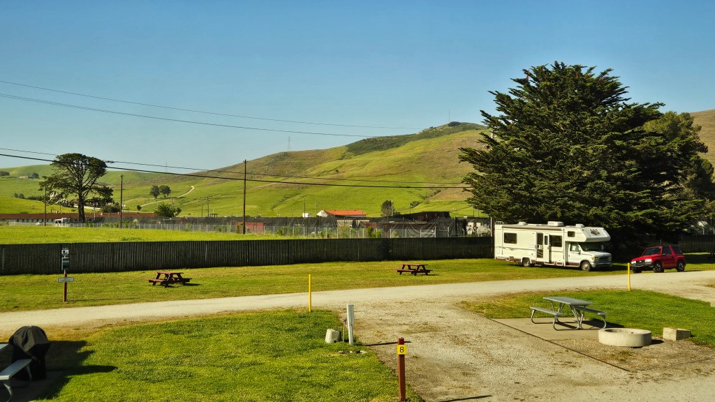
Before I came to the San Luis Obispo area, I knew nothing about what there is to see or do. Somewhere in the back of my mind, though, I’d heard of Morro Rock, which sits in the ocean about ten miles away from where we were staying at Camp San Luis Obispo. That was where we headed for another look at the Pacific Coast.

At Morro Bay State Park we received our first view of the bay. At the visitors center there is also the small Museum of Natural History. We admired the views, and this statue, while we waited for it to open up.

“Seasons Come and Seasons Go”

Interestingly, the state park was once a country club, opened just a few months before the stock market crash of 1929. The state of California purchased it not too long afterward, and the Civilian Conservation Corps of the 1930’s transformed it into the park that it is today.

Enjoying a short hike on one of the CCC’s rock-lined trails

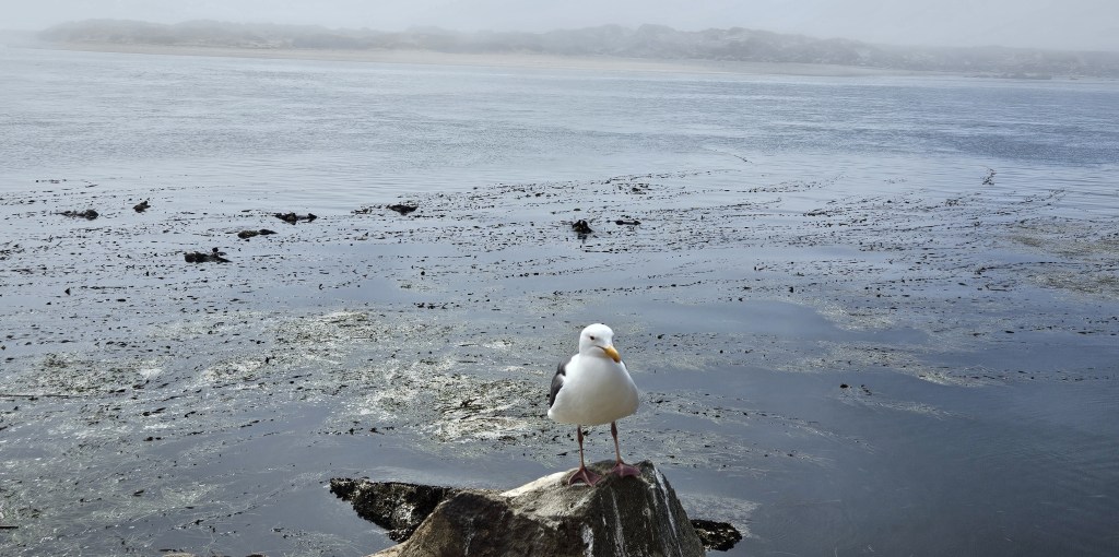
Down below this point, there is a marina and the Moro Estuary National Preserve. We took another little hike on its boardwalk, but there weren’t too many bird sightings for us on this day.

Looking over the bay from the estuary, you can just see the CCC trail.

Back in the truck again, we drove through the town of Morro Bay–

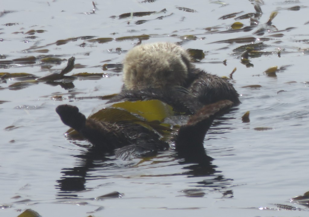
–and out to Morro Rock Beach. Here was a surprise – sea otters! I had never seen so many in their natural habitat.

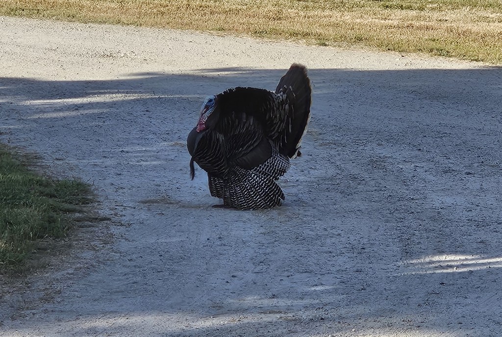
Meanwhile, the ground squirrels were everywhere, trying to wrest food from the tourists and entertaining us with their Chip-and-Dale-style antics.

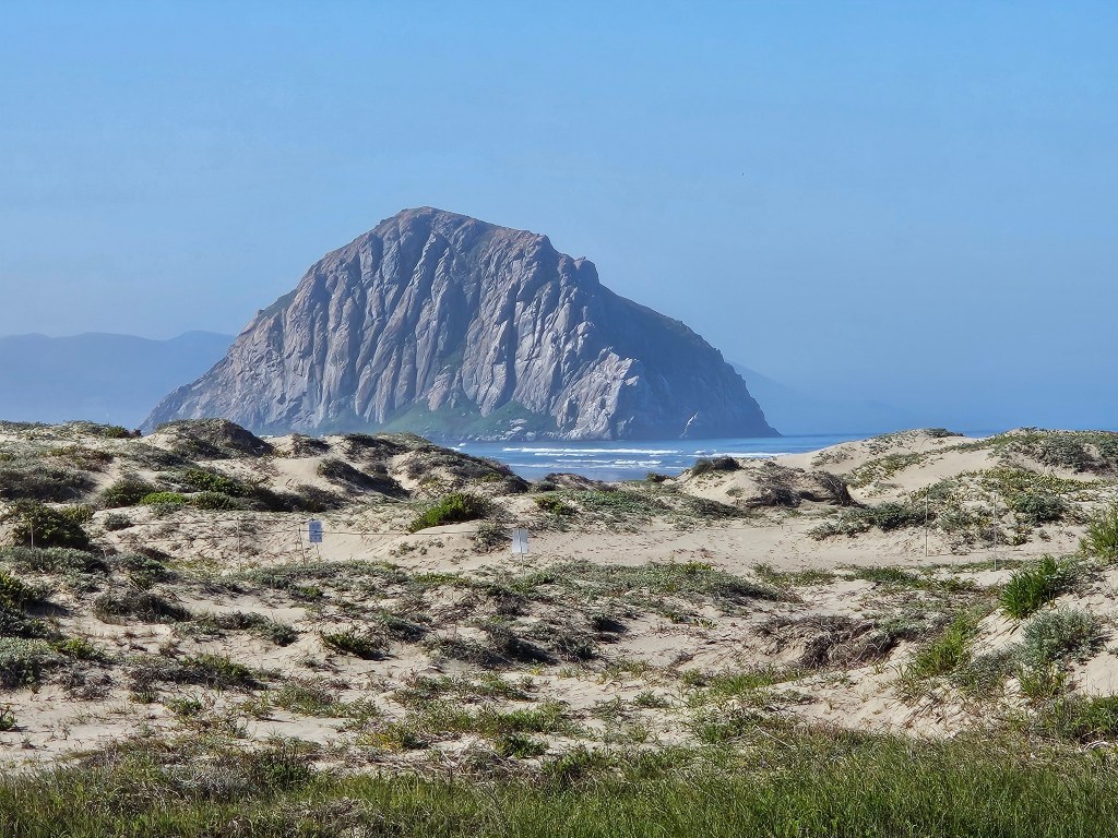
The dunes beyond the water were lost in a marine layer that had settled over everything.

And still we wondered…”where’s the rock?”

We hiked out to the end of the beach, where it turns into impassable huge boulders. We studied a park map. And then we realized…it was right next to us! It had been shrouded in the dense fog all morning.

Cal walking on the beach trail right next to Morro Rock

Morro Rock is a volcanic plug, which means that it was created from magma inside a vent on an active volcano 23 million years ago. The rock was quarried from the late 1800’s until as late as 1969, when it was declared a California Historical Landmark. Today, even just climbing on it is not allowed.

We received a better look at the whole rock the next day as we were driving up the coast. On this day there was no marine layer.

Morro Rock – we had been on the other side of it the day before.

We had lunch at a restaurant on the dock from where I’d taken the picture of the town of Morro Bay. Our server said that on days when the marine layer is heavy, the main question that he gets is “Where’s the rock?”

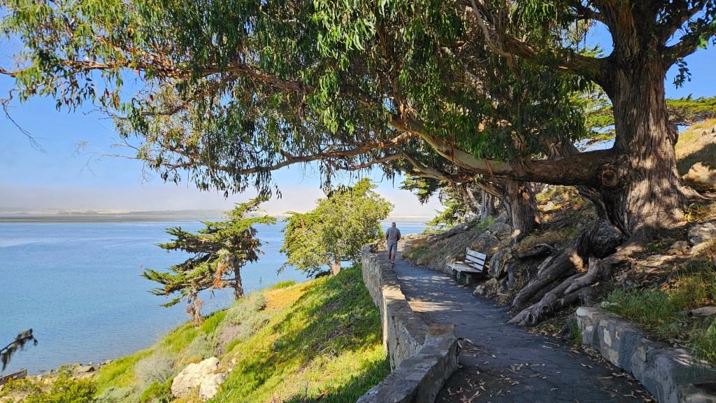
Morro Bay lies to the west of San Luis Obispo. Just south of the town is Montana de Oro State Park, and there the coastline takes a turn eastward. The other two beaches we visited here lay to the south of us.

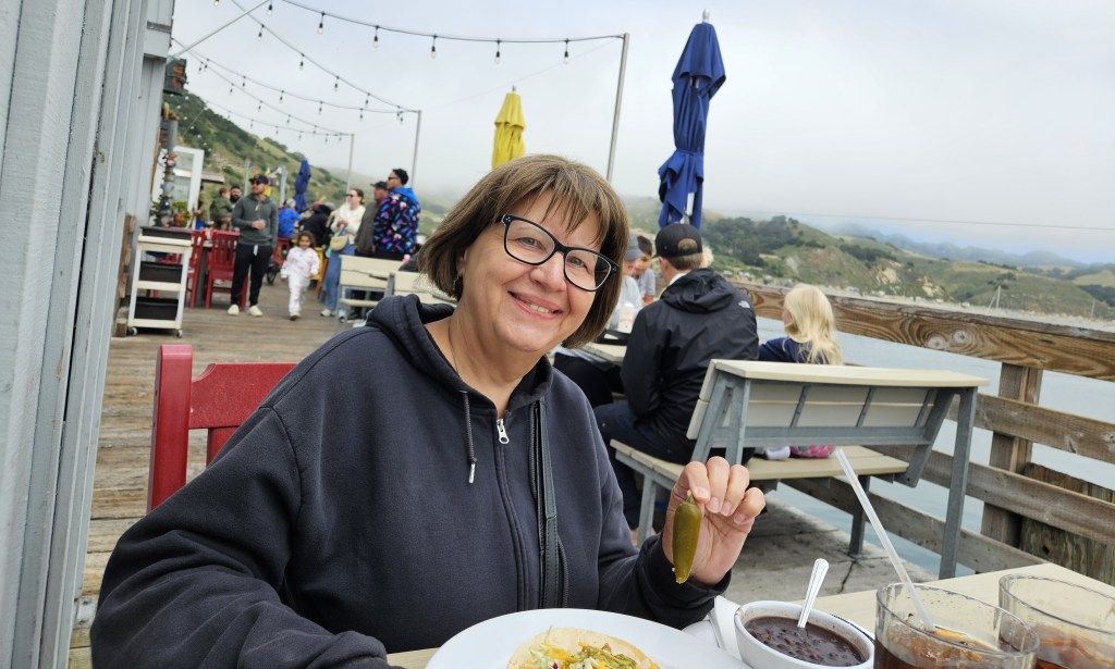
Our stay happened to coincide with Mother’s Day. When we are not far from the ocean, this Mother wants to eat seafood. Even though I’d had excellent clam chowder and grilled fish at Morro Bay, another chance for seafood was not an opportunity to pass up.

Mersea Restaurant sits at the end of a long pier on Avila Beach. As we walked down the pier, I was delighted to see seals in the water.

The seals at Avila Beach

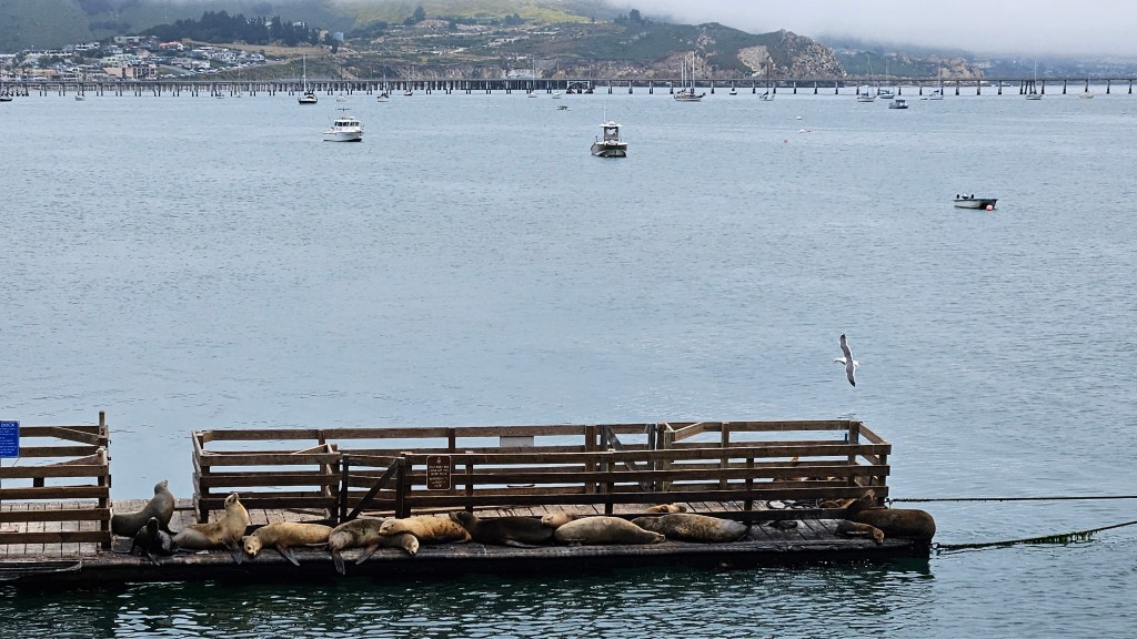
The seals were swimming below us as I had my excellent lunch of fish tacos. This picture didn’t quite capture my whole lunch, but you can see I that I would have shared my jalapeno with anyone who wanted it. This made a perfect, although a little chilly, setting for a Mother’s Day meal.

I looked nice for Mother’s Day, really. We had been to church earlier. My pretty clothes were all under that toasty warm sweat jacket!

From the pier, we could see Avila Beach has a small sandy beach. We also admired an RV park going up the hill, and another one alongside the water. But otherwise, it seemed more like a place for the locals. Certainly fine by us.

Tools of the trade on the Avila Beach pier
The beautiful green Pacific coastline

Pismo Beach is just down the road from Avila Beach and seems to be the greater attraction for families and tourists. On this Mother’s Day, parents huddled on lawn chairs and under blankets and canopies while the children chased the waves. It was a happening place.

As we walked on the sandy beach, there were many small blue jellyfish that had washed up, as well as several purple sand dollars. I have learned that the purple ones are still alive, so when I can I throw them back into the water.

There’s a boardwalk at Pismo Beach, as well as hotels, restaurants and shops.

You wouldn’t know it, but away from the beach it was a clear sunny day. You can see the blue sky behind the hills in the picture above. On this day, the marine layer later crept in almost all the way in to where we were staying.

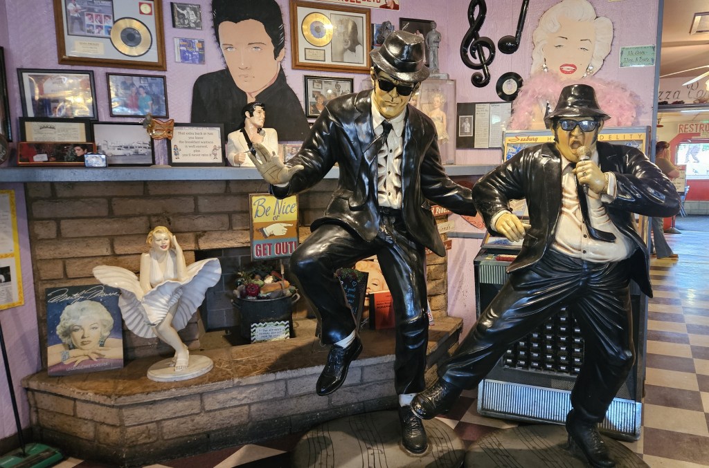
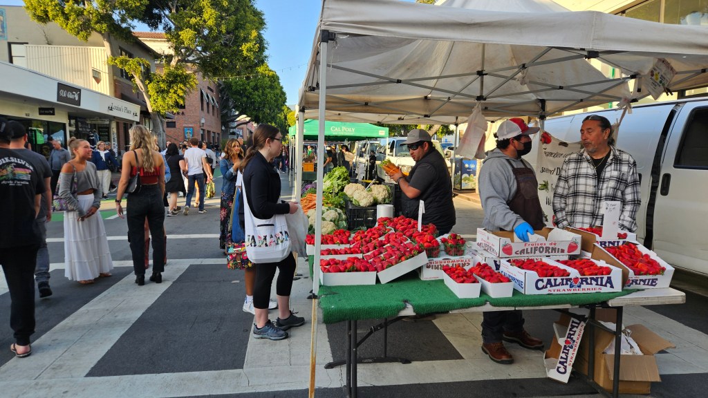
San Luis Obispo is a college town. Cal Poly (officially: California Polytechnic State University) is here, and so is Cuesta College. As we drove to the pretty tree-lined downtown area, students were everywhere walking or riding bikes with backpacks and iced coffees in hand. The streets close every Thursday night for the Downtown SLO Farmers Market. The students queued up for all the places that were serving food, met and chatted in groups, and shopped at the crafter’s tents.

At the market, we realized that in the nearby Central Valley, strawberries were in season. There were tables heaped with them. We bought some at the market and they were a sweet, delectable opposite of the strawberries that you buy in the grocery store.

Our time here was short, and I would have loved to explore more of the town and what there may have been to see away from the beaches. Certainly, with more time, I would have gone to Paso Robles and done some wine tasting. But we had one more place to see, which in actuality was the whole reason why we were here at all.

Next time–we visit a castle

Uncategorized · USTravel

Wagons West to California

A lunch stop at the first rest area inside California

I have one note to add before I jump into this post: we are now actually in Denver for the summer. We’re in our RV at the local state parks, and getting ready for a blessed event! Yes, we are expecting our third grandchild within another month, and helping out the busy parents to (literally!) get their house in order by doing a lot of babysitting for the older two. The most traveling that we are doing these days is to shuffle between the two state parks every two weeks.

There are still plenty of memories to record for this trip. Once we were into the month of May in Las Vegas, the weather started getting very warm. Long rows of RV sites at our park stood empty. Did we stay in Vegas too far into the spring? As we traveled through California and beyond, there were times when I thought so. There were other times, though, when I was glad we waited.

Counting Desert Eagle at Nellis Air Force Base in Las Vegas, we had three military RV park stays back to back, with just a one-night stop at a KOA thrown in between for good measure. That’s rare for us. We traveled southwest from Vegas back into California on Interstate 15. We were farther north than we had been earlier in the season, but still traveling through the Mojave Desert. Our second military park was the tiny Marine Logistics Base just east of Barstow.

The black shield in the middle of this marker reads “Barstow 66″ for the legendary road

Cal was very excited about this stop as it was our first Marine Corps base. The only military branch we haven’t stayed with at this point is the Coast Guard. This base once sat on the old Route 66. The RV park wasn’t much, just a solitary road with a dozen or RV sites on either side, but it was OK for a night.

The real reason for being here is that I wanted to go to Peggy Sue’s Diner. I had found it on Harvest Host and it looked like a fun place to eat and then stay for the night. Harvest Host stops already have one strike against them in Cal’s mind, since they don’t have RV hookups. Add in a huge potholed concrete lot on the side of the highway where truckers also like to stop, and that’s two strikes. So, after unhooking truck from RV, we headed out for dinner.

You can’t miss Peggy Sue’s. With billboards back as far as Las Vegas, it is an I-15 institution. The place was opened in 1954, and this is the original diner:

These tables were full, but no worries: there are several more dining rooms. After we found a table and ordered, I was entertained by getting up to look around at all the rock-n-roll memorabilia while I waited for my dinner.

There’s even an outdoor garden:

We indulged our appetite for fried chicken, and the portions were huge enough to take home for another meal and then some. By not eating all of the dinner, we saved room to share a slice of delicious strawberry-rhubarb pie with ice cream.

There’s one more thing to note about this stay: in the morning, we walked over to the commissary for a few groceries. I saw this, for the very first time in my life:

Perhaps you’ve seen these before, especially if you live in California. It is a solar-powered electric charging station. Having one environmentally friendly power source charged by another is brilliant. Perhaps I’m being a bit of an idiot and they are everywhere. Later, in California, we found ones that were much bigger. It’s the wave of the future, recorded here! Is this the first time you’ve seen this?

We’d seen huge solar farms farther south and in Nevada as we’d traveled. The places I’ve lived in the past don’t have enough sun for a solar farm, so for me they are novel.

Moving on further west, there was the usual desert driving, more Joshua trees, and finally we climbed a mountain. At Tehachapi we entered a valley and that was the end of the Mojave Desert. When we parked at the Bakersfield KOA, we had grass on our site. That was a marvel! The grass was so soft. We thought hard about it and decided it was the first grassy site our RV had been parked in since we’d left Colorado the previous November.

We didn’t disconnect truck from RV in Bakersfield, so for some entertainment we walked down to the Camping World store about a quarter of a mile away. Across the road from the KOA were car dealerships lined up, one next to another. Each one had one of these cute little Bakersfield-themed pieces of art in front of them:

After Bakersfield, we entered the Central Valley of California. In the distance we could see barren hills. But in the valley were miles and miles of orchards. I don’t know what kind of trees for sure, but we saw signs for almond and pistachio. There were ranches with cattle and a couple of beautiful flower fields. Closer to Paso Robles, we began to see vineyards and many wineries. Now we turned south and the hills started to close in and become green with a smattering of trees. And then, all the hills became tree covered. Everything was kalaidoscopic green. Having been in the desert for seven months, I felt like we’d reached the Emerald City!

We stayed at a National Guard post outside of San Luis Obispo for several days. Everything looked like it had been built in the 1940’s and not much improved since then. Here, though, we found a place that we absolutely loved. There is only space for 12 RV’s, plus more room for dry camping around the edges, at Camp San Luis Obispo. The sites are wide and grassy. The whole time we were here there were probably less than five other RV’s sharing the park with us, plus the camp host.

Here’s a view to the green hills of San Luis Obispo:

An afternoon bike ride here felt like a ride through the countryside. And back at our site, there was plenty of wildlife to entertain us: a whole scurry of ground squirrels that resided in the field behind us, one or two deer strolling through, and a pair of turkeys that regularly visited.

On the last couple of days of our stay, a marine layer (fog) crept in over the hills, for the ocean was just on the other side.

We are learning that all of the military branches have diverse places to stay across the US. But near San Luis Obispo there are other places for RVer’s to stay. Why would anyone want to come here? I’ll explain in my next two blogs.

Next time – the Pacific seaside near San Luis Obispo