USTravel

Home in Denver, Colorado

When spring comes around, all roads lead to Denver. That is because a big part of our family is here – our daughter, their wife and children. I see that I haven’t written a lot about these times since the first summer we were here, and now we have spent four summers.

I really wish sometimes that we could settle into one RV park and stay there, but Denver isn’t blessed with good commercial RV parks. In the state parks one can only stay two weeks. So we stay at the two state parks nearby and rotate through the summer. I’ve come to look forward to these times because each one has its merits.

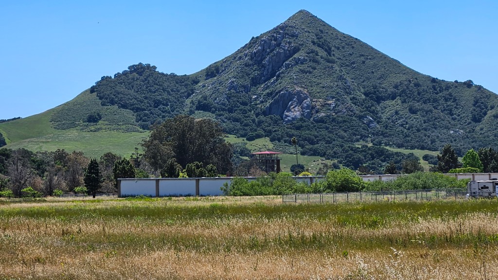
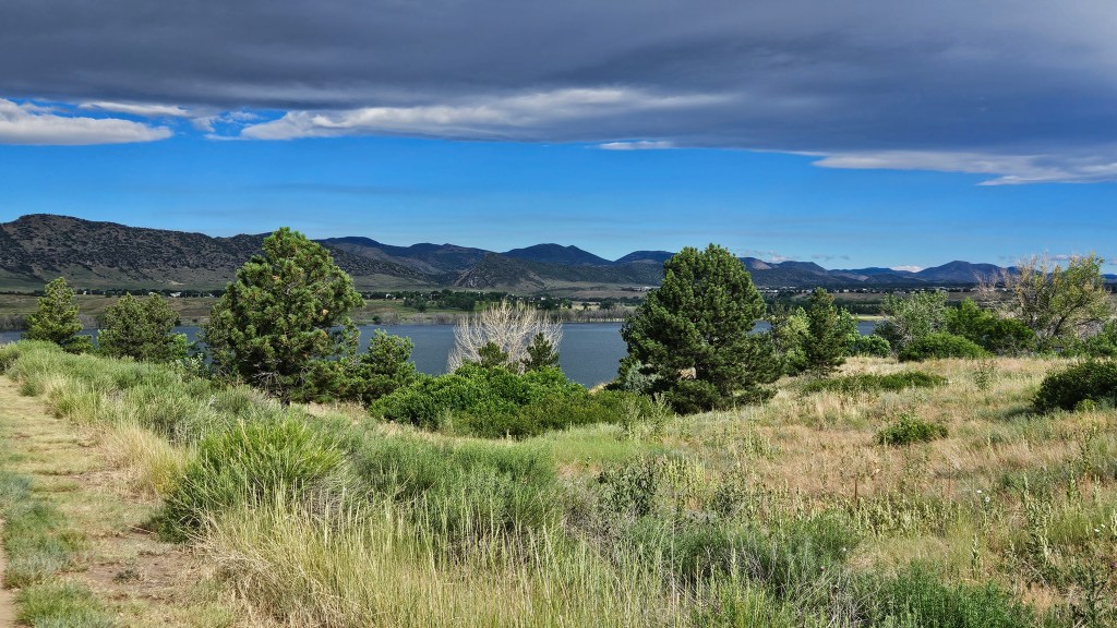
It’s funny to say that a state park feels like home, but Cherry Creek is that for me. It’s nestled smack dab in suburban Denver, an oasis in the city. Yet, deer welcome us back almost every time we come in for the first time.

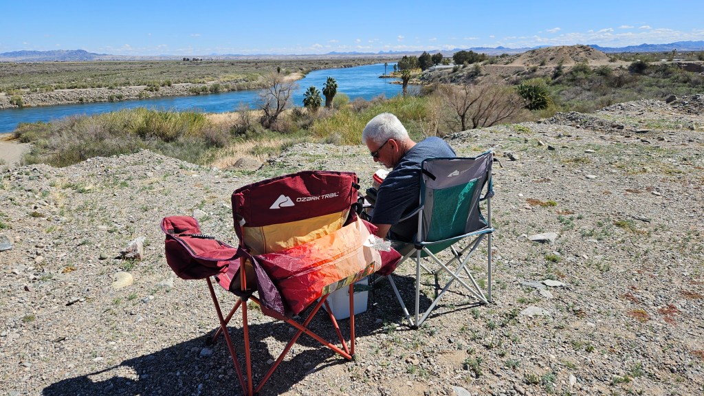
We are close to our family at Cherry Creek, and are often called to babysit or otherwise help out. We might have the kids over for some outdoor play time, or the whole family for dinner. I can visit with my friends on Monday mornings if we’re not busy. We try to cram in dentist or doctor visits while here. In between the busyness, I get my daily steps in with two favored walks.

One of them is a walk through the campground to a trail that goes down along the beach. Over the winter they had erected a brand new bath house, along with this sign:

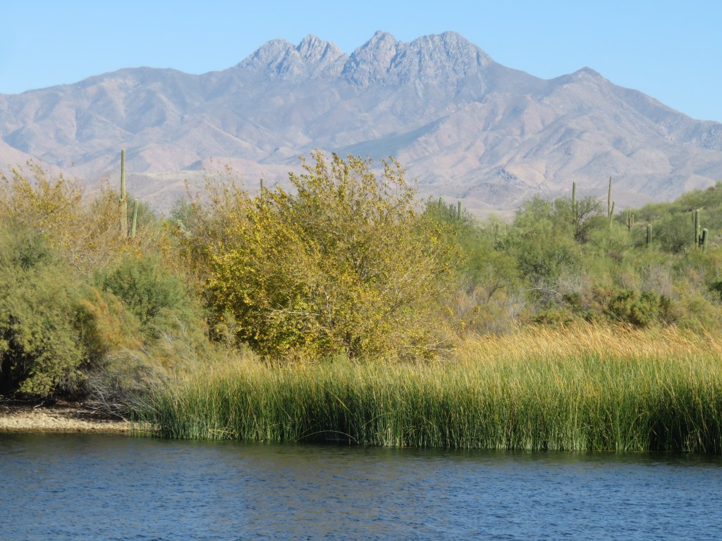
It’s fun to imagine what the view ahead would have been like without the lake!

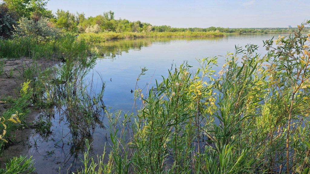
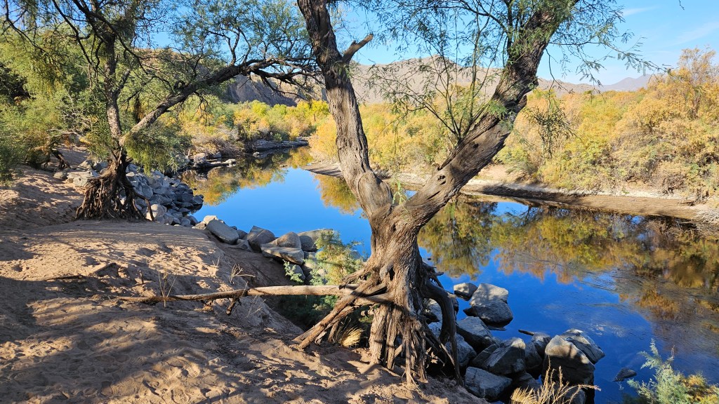
This view is on the far side of my beach walk. You can see that the waterfront is covered with weed growth. Until last year, I could walk along here all summer to see a lot of shore birds at the far end. A flood in 2023 raised the lake level and now I have to wait until fall, when the water recedes and opens enough sand to walk on.

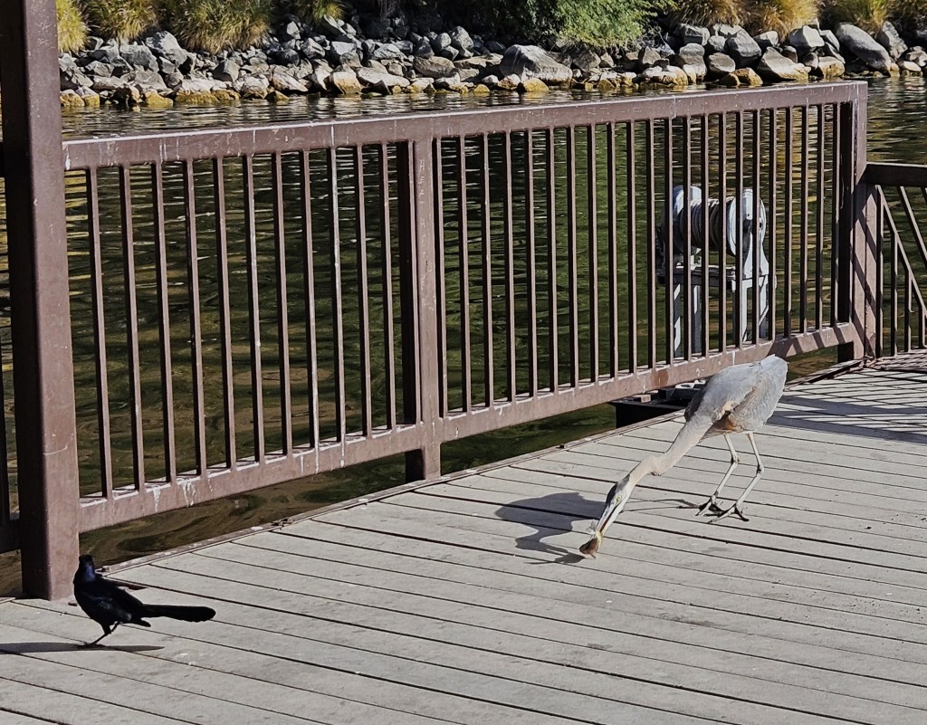
When that finally happened last fall, I was so excited to finally walk all the way back to visit my bird friends.

The other walk is along the dam to the marina, although if the day is hot I don’t make it that far. It’s a four mile round trip, and I’ve started to push myself farther. One day, I think, I will walk all the way around the lake. Or maybe not.

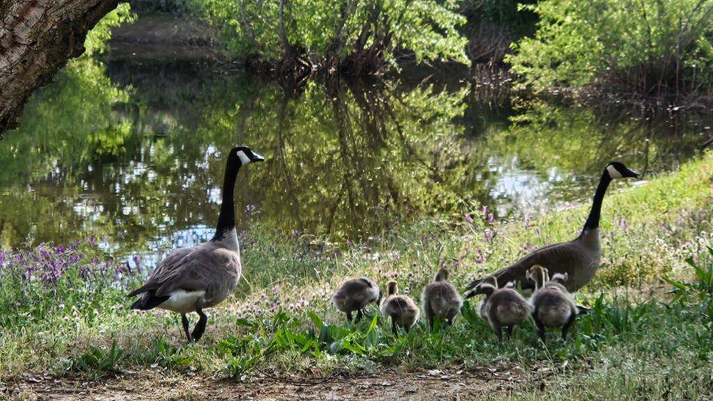
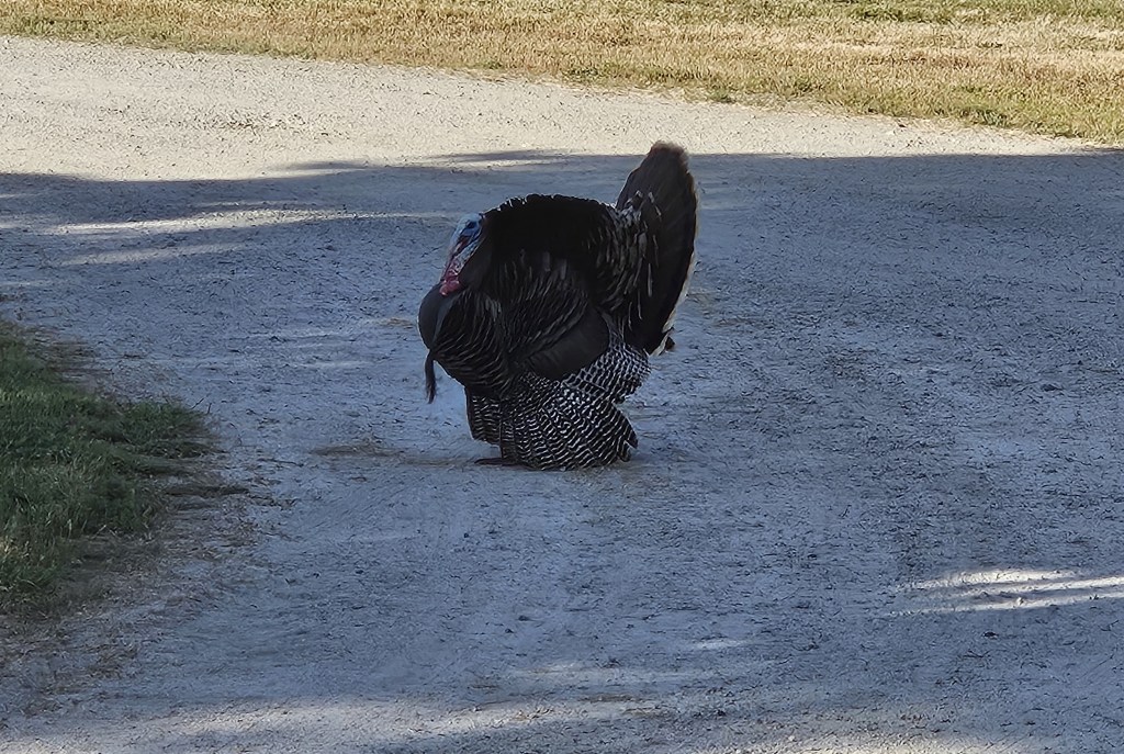
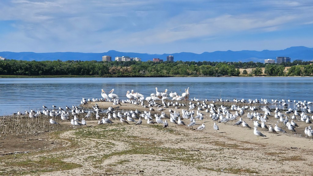
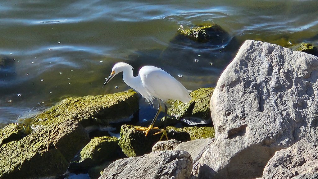
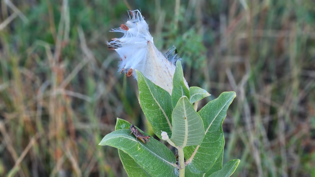
Along the dam trail, I enjoy watching the egrets, ducks, and pelicans along the shoreline. In August, flowers begin to bloom.

When our two weeks at Cherry Creek are up, we move over to Chatfield. Here we are about a half-hour’s drive from our family, and it’s possible for busyness to still reign over a stay here. We try not to have to make too many trips into town, though, because we relish time to just enjoy a bit of the back-to-nature feel of this park.

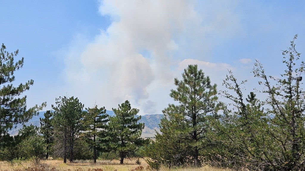
In July, we had some excitement during our stay. We could see the smoke from a forest fire over one of the distant peaks from our site. Helicopters flew overhead constantly, getting water from the lake and dumping it on the peak to wet it down. Luckily, it never advanced to our side of the mountain.

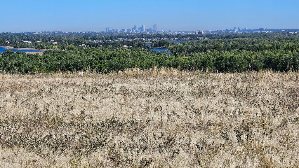
At Chatfield, we can ride bikes around the park’s trail. In late September it had cooled down enough to head out on the north side, up on top of the dam for a spectacular view of the city of Denver–

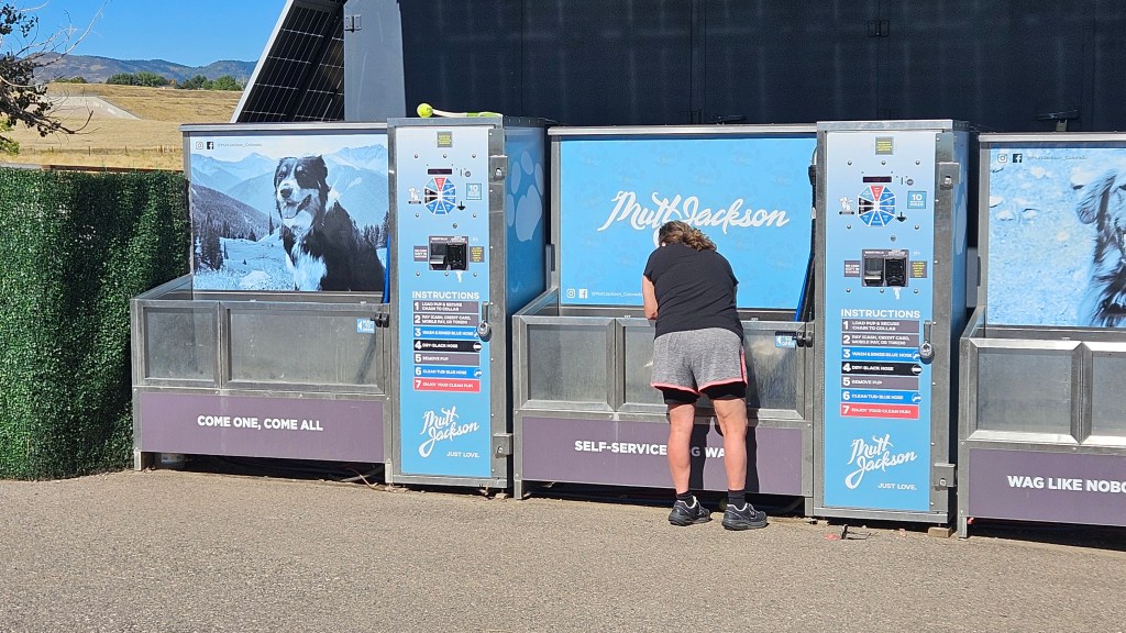
and discover a whole new area on the other side of the dam. There’s a huge dog park, with a place to wash your pups after they’re done romping around the small lake there.

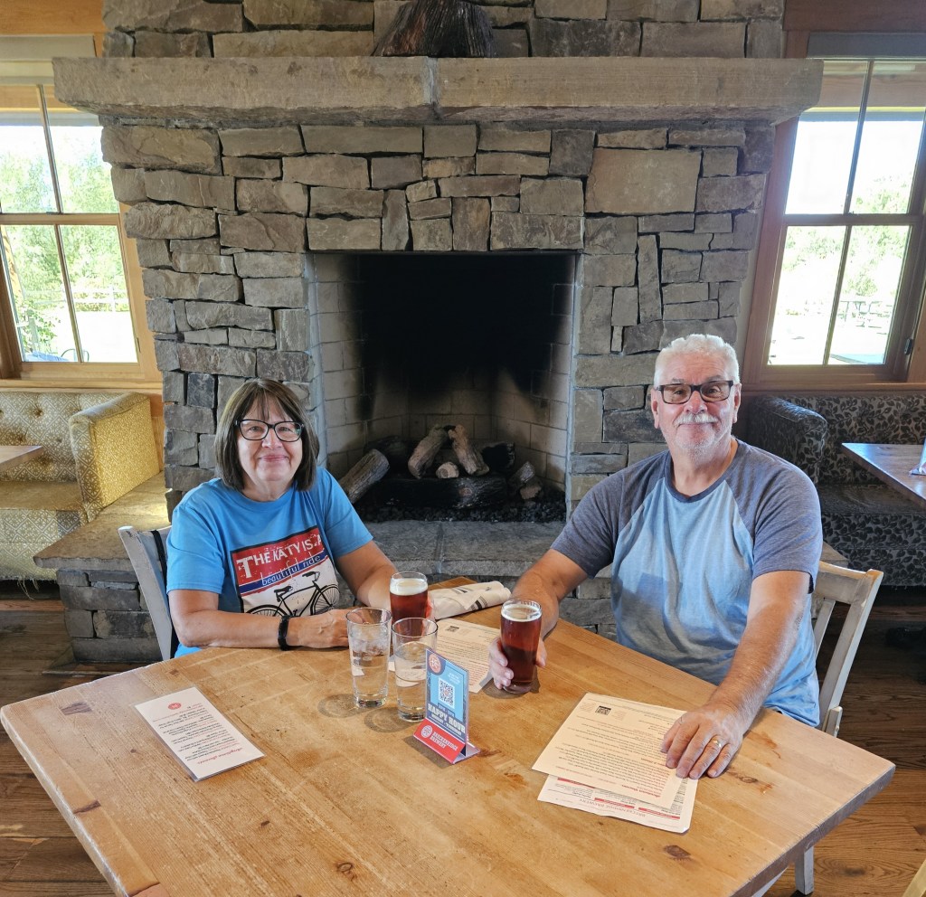
The bike trail went out of the park and onto shaded trails in the cottonwoods alongside the Platte River, and finally to Breckenridge Brewery for a fine, refreshing lunch. Yes, food did follow the beer.

Every year, when the nights get chilly and the calendar rolls over to November, we are on the road going south. But not this past year. At the beginning of October, we put the RV in storage and moved into an AirBnb apartment for a seven month stay. I wanted to care for our newest grandbaby two days a week so she wouldn’t be in day care for all five days, and that was very fine with her parents.

Our apartment is in an old, refurbished building in an suburb of Denver which bumps right up to the city and is only ten minutes from our family. It has a small-town feel which includes a downtown where the old buildings have been converted to restaurants and small shops. The old post office is still in use and on the National Register of Historic Buildings. We can walk there and, best of all, there are more restaurants just steps away from our apartment.

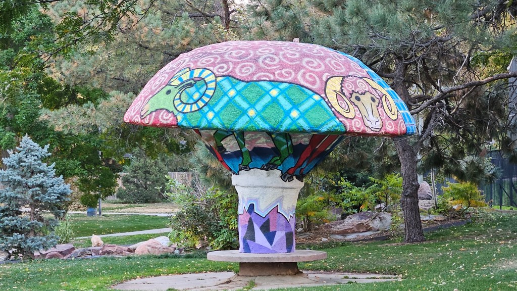
Not far away is a small park that has sprouted several of these beautiful mushrooms.

We can have a number of different walks when the weather is fine. We can take our life in our hands to cross a busy road where there are natural areas with paths and multi-million-dollar homes set back from narrow, winding lanes with views of the mountains. In the other direction, homes from every era of the 1900’s line the streets of neighborhoods that go on forever. Cozy 1930’s bungalows sit alongside ranch styles from the 1950’s and 1960’s. Many have been remodeled and given a fresh look. In between, someone may have built a new contemporary home. There is a whole neighborhood of mid-century modern homes, many of which look like Frank Lloyd Wright himself had overseen their construction.

Early in the fall, the other reason we are here revealed itself: our daughter-in-law has breast cancer, and her treatment regimen stretches for a year. We are so happy to be here for them. Yes, there are some very long days, especially when I babysit my grandbaby and am needed to stay for dinner and bedtime, but there have been a lot of rewarding times with the children. We are here for sick days, but we are also here for fun trips around town on weekends and school holidays.

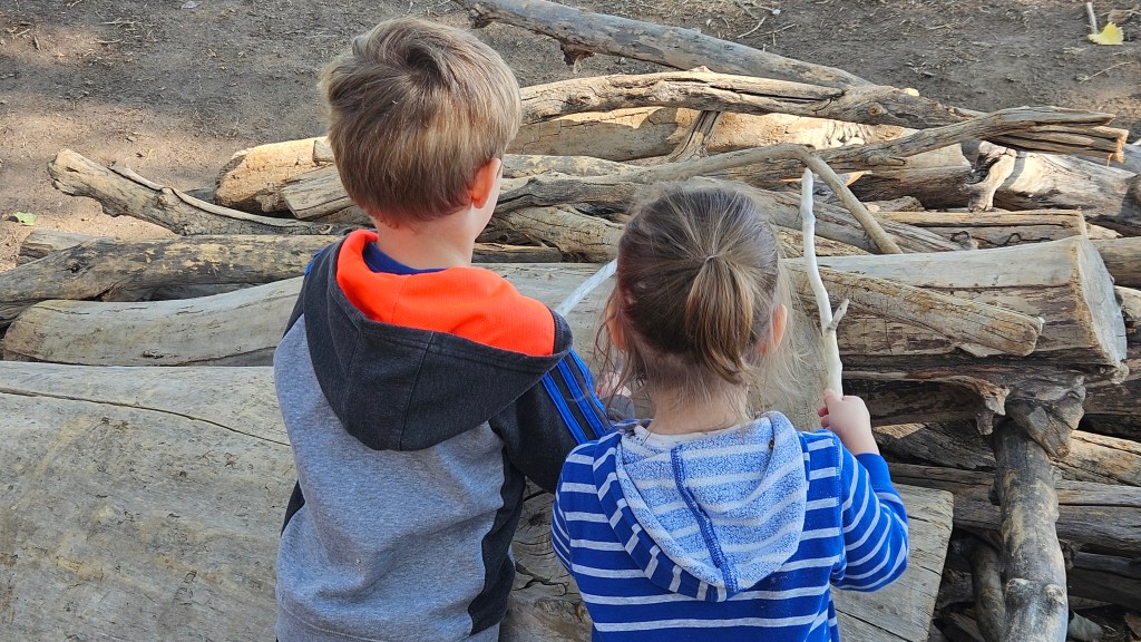
Here are our two oldest at a park, pretending to roast marshmallows over a fire. Yum!

We are not used to winter anymore, so having cold and snow has been different. On most snow days, we can’t luxuriate in just looking out the window: there are things to do and we have to go out. It’s better that way, anyway.

Blogging time has been sorely diminished, but I’m still not hurting for blog material. I can pull out of my pocket any number of adventures we’ve had for that. And, there are only two more months left in our AirBnb stay. Although our hearts are here, with our family, we are also looking forward to moving back into our RV. These months have taught us that our happy place is on the road. Trips out are already planned, but the road always circles back to Denver.

Next time…visiting the mountains southwest of Colorado Springs

USTravel

The Loneliest Road and I-70 Through Nevada and Utah

Sitting on the border of Nevada and Utah, Great Basin is one of the least-visited national parks because of its remoteness. It sits right off of State Route 50 (the Loneliest Road) near Baker, Nevada. We parked for two nights so that we could visit it.

Looking through the museum in the visitor center, I learned something that was fascinating. An area that covers almost the entire state of Nevada and west to the Wasatch Mountains in Utah is a huge basin. Water comes in the form of rainwater and snowmelt and flows through the streams and rivers, but never leaves the basin. Sort of like the milk at the bottom of your cereal bowl. The National Park is but a tiny microcosm of it.

Some of the Basin’s moisture has dripped into Lehman Cave, a feature of the park that we were able to get a tour for.

Every cave that we’ve visited has one or two things that differentiate it from any other. Lehman has 1,107 “cave turnips”. Only a dozen caves have them world wide, and they date back to the Ice Age. A cave turnip is a stalactite with a bulge in it. There are two of them in the picture below; can you spot them?

Out of the cave, we drove up the scenic drive, stopping at a couple of view points. Here was a flip side of the view that we had been seeing for the last couple of days.

At Mather Overlook, we could see another basin, this one carved out by a glacier.

We topped out at 9,886 elevation on Wheeler Peak, although it was not the tippy-top of the mountain. The road ended here, and we stopped for a little hike.

Melting snow created a wonderland of waterfalls and rushing streams. The sound of flowing water and the chirping of the birds made a nice backdrop for a lawn chair lunch.

Although this is a smaller national park, it is nice not to have all the crowds of the more dramatic parks we have been to.

Back at our RV, we admired the clashing fronts happening in the sky – dark clouds rolling in but still blue to the west, from which we had come. There was intermittent wind and splashes of rain. It was a relief from the heat.

Also looking west–the official Lonely Road sign.

I wandered around in the desert a bit.

In the morning, we drove about a second before we were in Utah and Mountain Time.

And still, the road went on.

The western side of Utah was prettier than I thought it would be. We climbed up a pass and went down into a rocky gorge. Then, there was something that looked to be a huge dry lake covered with sand, or maybe it was a salt bed, and it went on for miles.

I looked at my paper Utah map, and it was noted there as Sevier Lake (Dry).

We climbed out of the Wasatch mountains, and we were out of the Great Basin. Our stay for the night was an RV park in Salina, Utah. The only thing memorable about this park was that the owner kept a huge flock of chickens, and she gave us a complimentary dozen eggs in several colors. Today, I’m not sure if she wouldn’t have charged us for them, because they are pure gold!

Highway 50 ended here, and we were now on Interstate 70. Route 66 may be called “The Mother Road”, but to me, I-70 is the Mother Road. I’ve either lived a large portion of my life not far from this highway, or I’ve driven on it through many states countless times to vacation or visit family. I think, though, that this was only the second time we’d been on it at its western origination.

Interstate 70, looking like ribbons through cut rock, is on the upper left of this picture

We were now entering a spectacular area with towering rock monuments, rock pillars and canyon vistas. It was almost as good as going through the Utah national parks. Actually, Arches National Park is somewhere to the south of this view. There was even a turnoff, Salt Wash Scenic area, to take in the view and enjoy a picnic lunch.

The parking lot was packed and I felt really happy that this stop off was here. It gives people a small taste of the state’s wonders, even if all they can do is zip through it.

Next time – a few days in Western Colorado

Note: although I am writing this during the winter of 2025, the trip actually occurred in June 2024.

USTravel

An Unexpected Day in Reno, and Horsing Around at Washoe Lake State Park Nevada

I didn’t have a clue what Reno would be like, but I imagined something like we’d seen in Las Vegas. Remembering our time there, we knew we didn’t want to drive our truck into the city. We took an Uber instead, and our driver was very chatty. He said that beginning twenty years ago, less people began to come to Reno. Older hotels and casinos closed, and some have been torn down, leaving empty lots. We saw some empty storefronts and boarded up casinos. He pointed out the two or three that were still good places to go. New casino resorts are here, they just aren’t being built much on the old Strip.

Downloading a walking tour of Las Vegas had been a good idea, so I did the same for Reno. I had our driver drop us off at the Reno sign. Following the walking tour, this meant that we did not walk past any casinos at all, which was fine. The Strip didn’t look enticing enough to check out. And so, this whole day was totally different than I had envisioned.

We walked through City Plaza, with the Truckee River flowing by below it.

We actually found a piece of the Irish Blarney Stone. You don’t have to go to Ireland to see it!

Tourists in Ireland go through great lengths to kiss the Blarney Stone. I guess here in Reno they thought that just rubbing it might be a better idea.

We looked at the copper-colored geodesic dome of the Performing Arts Center and took a peek inside the old Post Office. Next up was the Riverwalk area which was quiet on a Saturday morning.

We went off-tour through the beautiful city park, where people were floating down the river.

We were off the tour route and passing by the park on our way to Washoe Public House for a delicious lunch.

Back to the tour, we visited the West Street Market. I had looked forward to this, but disappointingly, it was no longer a market. Was this tour written pre-covid? I hadn’t checked the date.

Our last stop was at the beautiful Thomas Aquinas Cathedral. It has a beautiful wrap around mural in the front from the 1950’s, thought to be one of the finest works of art in America.

We had come to the end of the walking tour. Cal was tired of walking on city streets and hot concrete. He was ready to call it done, but I didn’t feel done with Reno. He took an Uber back to the RV park, and I walked back past where we’d had lunch to the Nevada Museum of Art.

At first, I was a little disappointed. It was smaller than I thought it would be, with no permanent exhibits due to construction. But an eager docent took me through an exhibit by Cannupa Hanska Luger, an artist who is of mixed Native and European ancestry, entitled “Speechless”. She made the art come alive with her interpretations of his various pieces.

It was the second exhibit that stole my heart. It displayed the art of Maynard Dixon, who lived from 1875-1946. He painted the West, including Nevada. I love the paintings that I saw, some capturing the red rocks at sunset, and immersed myself in his life and work. He really got the feel of the Nevada landscape. Dixon also illustrated in magazines and books of the day and wrote poetry.

Mountains in Sunset Light” – Maynard Dixon
A self-portrait mural, “Welcome and Goodbye!”

The other thing that I learned about him was that he was married for a time to Dorothea Lange, a well-regarded photographer in her own right whose works I have admired. She was the mother to their two sons.

I’m sure the Reno strip would have appeared differently at night. The Riverwalk is regarded as a great place to visit and perhaps have dinner after taking in the casinos. But we did not return.

It had been a short stay at the park in Sparks, outside of Reno, and one of our nights had been out of the RV in South Lake Tahoe at a lodge. But I was happy to move on, especially since the next three nights were a grand total of 32 miles down to Washoe Lake State Park.

We had a beautiful spot here–

–with beautiful views of the Sierra Nevadas. The lake that gives the park its name was between our RV and the mountains. Scrubby hills lined with cedar trees were behind us.

All of this would be very fine, in and of itself. But the thing that makes this park extra special is the wild horse herd that lives here.

We’d seen them as we’d driven in and out of the park. One morning we drove the truck out to a trailhead to hike in order to see them closer. From the path, we watched a group of horses.

In the distance, we saw a larger group having breakfast lakeside. The two colts on the front left were frolicking and running together so they were fun to watch.

I was busy photographing them when Cal came up and said in a low voice, “You might want to turn around.” The first group was coming up right behind us on the path! They did not seem to have any fear of us, but were definitely minding their own business as they clip-clopped by.

Seeing so many horses in this gorgeous natural environment was a real treat. Afterwards, Cal drove the truck back to our spot but I opted to take a long hike back. Horses were still in view. There was a group hanging around the restrooms at the picnic area. It must be true what they say…the grass is always greener over the septic tank?

For a time, I was walking along the Washoe Lake shore, where a lone horse was doing the same.

In all, we had sighted over 60 horses on this morning.

We never know what lies around the bend on our travels. Some sights are not quite what we think they will be, but others go over and beyond our expectations. That is the surprise and the gift of the journey.

Next time – we visit Virginia City

USTravel

Big Cats at Cat Haven, and RV Life

View of the Sierras from the pond in our RV park

When the National Parks have been seen, and we still have days to stay in our spot, then what?

Driving back and forth to Kings Canyon and Sequoia National Parks, I noticed a sign for something called Project Survival Cat Haven. Looking online, I saw their mission statement: “…an innovative park dedicated to the preservation of wild cats.” They are not a sanctuary, although some cats have been orphaned in the wild or have needed to be re-homed. Their focus is to “educate people about the plight of endangered cat species, and to raise funds for the conservation project in the wild.” The reviews of the place were good.

The only way to visit Cat Haven is to book a tour, so we did. Below is a picture of our guide and what some of the pathways looked like with the cats’ cages. There are two cats in the cage on the right.

It was morning, and the cats had already had their breakfast and playtime. Most were stretched out for naps in the front of their cages. Although I don’t like seeing them behind bars, the cages for the largest cats stretched back into the hillside.

There are about 25 big cats here. We learned each one’s story as we passed their cages.

The park is the culmination of a dream for Dale Anderson, who became focused on the cats at a young age. Before he could ever start his park, he received hands on experience by working with cats while purchasing the land for his park. The first cats, a pair of Amur Leopards, arrived in 1997. If you are interested in his conservation and education projects, you can look the park up on the Internet.

We saw a lion, a tiger, a lynx, a jaguar, and a Bengal tiger, among others. There was also a mountain lion, a Canada lynx, and this black leopard:

There were also very small cats, such as caracals and a pallas cat.

I learned many things. Leopards have been called black panthers, and they don’t exist. The word “panther” means big cat, and this is an error that goes all the way back to “Jungle Book”. Also, a jaguar has teeth that are very strong. The jaguar in this park chewed through his metal bucket as a play toy!

And , this: small cats purr but big cats don’t. So that jaguar with the strong teeth won’t purr, but a mountain lion does, making it a small cat.

The caracals were sleeping in their little nest, so we couldn’t see them. I purchased this photo postcard in the store, which is a nicer picture than I could have ever gotten of them:

Photo credit: Project Survival Cat Haven

The park covers 93 scenic acres on a hillside covered with live oak and buckeye trees. At this time of year, the blooming manzanitas were spectacular here and also outside of the park.

On another day, we drove back down out of the foothills and towards Fresno to stop at some orchard fruit stands. At the first tiny stand, there were only oranges. I wasn’t really interested, as we’d had plenty of fresh oranges in Arizona. But the old gentleman inside began cutting a large warty looking tangerine just as we were going to leave. He spoke no English, just handed over the freshly cut fruit. Delectable! It was so juicy and sweet and easy to peel, we bought a bag. Just not as big a bag as he would have liked us to purchase.

At another stand, we purchased freshly picked peaches, cherries, and vegetables.

The interesting thing about Sequoia RV park is that sites are not assigned, even though an RV’er or camper has a reservation. There’s no office. Upon arriving, one simply drives through the park and chooses a site. This is an old park, so many sites aren’t level and in some, the utilities are problematic. We arrived early on our first day, tried a couple spots, and finally found one we liked.

The camp host and his wife were wonderful folks, who actually live in the trailer park that fits like a cap over the RV park. He took on the hosting job to clean up the neighborhood in both parks. We enjoyed this view with no RV’s in sight (they were all to one side or behind us) for a few days because he was having issues with the guy who was mowing the grounds. When the sites were finally mowed, they filled in.

Around 5 PM, the show started. Folks would start arriving from either the National Parks or from were they had driven that day, looking for the best site. When the park started filling up, we would see the same RVs circling more than once just to find a place to settle. Many of these were small RV’s rented from Cruise America or El Monte, and most of the people renting them that we talked to were European. I decided this grab-your-own-site deal wasn’t such a fine idea.

At our site, I would sometimes look down on our driveway or on a corner of our mat, and it seemed like the ground was moving. There were tiny little frogs hopping en masse! It wasn’t a constant thing, so it was startling and fascinating when I saw them. What I found on Google is that these frogs lay eggs on land, rather than water, and look like fully grown frogs when they hatch. They prefer to live under leaf and other ground litter, and move quickly when they think they are being detected.

A mini frog, no bigger than a quarter

One evening, what should come down our lane but a big fat pig on a harness?

This is Cleopatra and despite her huge size, she is picky about what she eats. Our neighbor had come out with a bag of lettuce and she totally rejected it. Not good enough for her. I’m supposing Cleopatra lives in the mobile home part of the park because I can’t imagine traveling with a pig in an RV.

We also had a goose family that waddled near our site now and again. Their favorite spot was the pond, of course. I took my lawnchair and my cross-stitching under a tree near the pond on a Sunday afternoon and they provided fine entertainment. They swam around the pond, rested on their little island, and got into some squabbles with a pair of ducks.

One of the best things here, though, was a dramatic sky that was ever-changing.

Although we are blessed to travel and see many things, it is the every day experiences in our home that provides the fabric of our current life. Whatever will happen at the next place is a constant gift that is just waiting to be opened.

Next time – Yosemite National Park

Uncategorized · USTravel

Wagons West to California

A lunch stop at the first rest area inside California

I have one note to add before I jump into this post: we are now actually in Denver for the summer. We’re in our RV at the local state parks, and getting ready for a blessed event! Yes, we are expecting our third grandchild within another month, and helping out the busy parents to (literally!) get their house in order by doing a lot of babysitting for the older two. The most traveling that we are doing these days is to shuffle between the two state parks every two weeks.

There are still plenty of memories to record for this trip. Once we were into the month of May in Las Vegas, the weather started getting very warm. Long rows of RV sites at our park stood empty. Did we stay in Vegas too far into the spring? As we traveled through California and beyond, there were times when I thought so. There were other times, though, when I was glad we waited.

Counting Desert Eagle at Nellis Air Force Base in Las Vegas, we had three military RV park stays back to back, with just a one-night stop at a KOA thrown in between for good measure. That’s rare for us. We traveled southwest from Vegas back into California on Interstate 15. We were farther north than we had been earlier in the season, but still traveling through the Mojave Desert. Our second military park was the tiny Marine Logistics Base just east of Barstow.

The black shield in the middle of this marker reads “Barstow 66″ for the legendary road

Cal was very excited about this stop as it was our first Marine Corps base. The only military branch we haven’t stayed with at this point is the Coast Guard. This base once sat on the old Route 66. The RV park wasn’t much, just a solitary road with a dozen or RV sites on either side, but it was OK for a night.

The real reason for being here is that I wanted to go to Peggy Sue’s Diner. I had found it on Harvest Host and it looked like a fun place to eat and then stay for the night. Harvest Host stops already have one strike against them in Cal’s mind, since they don’t have RV hookups. Add in a huge potholed concrete lot on the side of the highway where truckers also like to stop, and that’s two strikes. So, after unhooking truck from RV, we headed out for dinner.

You can’t miss Peggy Sue’s. With billboards back as far as Las Vegas, it is an I-15 institution. The place was opened in 1954, and this is the original diner:

These tables were full, but no worries: there are several more dining rooms. After we found a table and ordered, I was entertained by getting up to look around at all the rock-n-roll memorabilia while I waited for my dinner.

There’s even an outdoor garden:

We indulged our appetite for fried chicken, and the portions were huge enough to take home for another meal and then some. By not eating all of the dinner, we saved room to share a slice of delicious strawberry-rhubarb pie with ice cream.

There’s one more thing to note about this stay: in the morning, we walked over to the commissary for a few groceries. I saw this, for the very first time in my life:

Perhaps you’ve seen these before, especially if you live in California. It is a solar-powered electric charging station. Having one environmentally friendly power source charged by another is brilliant. Perhaps I’m being a bit of an idiot and they are everywhere. Later, in California, we found ones that were much bigger. It’s the wave of the future, recorded here! Is this the first time you’ve seen this?

We’d seen huge solar farms farther south and in Nevada as we’d traveled. The places I’ve lived in the past don’t have enough sun for a solar farm, so for me they are novel.

Moving on further west, there was the usual desert driving, more Joshua trees, and finally we climbed a mountain. At Tehachapi we entered a valley and that was the end of the Mojave Desert. When we parked at the Bakersfield KOA, we had grass on our site. That was a marvel! The grass was so soft. We thought hard about it and decided it was the first grassy site our RV had been parked in since we’d left Colorado the previous November.

We didn’t disconnect truck from RV in Bakersfield, so for some entertainment we walked down to the Camping World store about a quarter of a mile away. Across the road from the KOA were car dealerships lined up, one next to another. Each one had one of these cute little Bakersfield-themed pieces of art in front of them:

After Bakersfield, we entered the Central Valley of California. In the distance we could see barren hills. But in the valley were miles and miles of orchards. I don’t know what kind of trees for sure, but we saw signs for almond and pistachio. There were ranches with cattle and a couple of beautiful flower fields. Closer to Paso Robles, we began to see vineyards and many wineries. Now we turned south and the hills started to close in and become green with a smattering of trees. And then, all the hills became tree covered. Everything was kalaidoscopic green. Having been in the desert for seven months, I felt like we’d reached the Emerald City!

We stayed at a National Guard post outside of San Luis Obispo for several days. Everything looked like it had been built in the 1940’s and not much improved since then. Here, though, we found a place that we absolutely loved. There is only space for 12 RV’s, plus more room for dry camping around the edges, at Camp San Luis Obispo. The sites are wide and grassy. The whole time we were here there were probably less than five other RV’s sharing the park with us, plus the camp host.

Here’s a view to the green hills of San Luis Obispo:

An afternoon bike ride here felt like a ride through the countryside. And back at our site, there was plenty of wildlife to entertain us: a whole scurry of ground squirrels that resided in the field behind us, one or two deer strolling through, and a pair of turkeys that regularly visited.

On the last couple of days of our stay, a marine layer (fog) crept in over the hills, for the ocean was just on the other side.

We are learning that all of the military branches have diverse places to stay across the US. But near San Luis Obispo there are other places for RVer’s to stay. Why would anyone want to come here? I’ll explain in my next two blogs.

Next time – the Pacific seaside near San Luis Obispo

USTravel

More Visits to Death Valley National Park

After our first visit to Death Valley I could not wait to come back. We returned to Death Valley for an early morning hike on the Golden Canyon and Red Cathedral trails with abundant sunshine. The canyon lives up to its name; in morning light it holds a golden glow.

The golden rocks on our canyon trail and the red rocks in the “cathedral” above

It was a bit of a scramble up to the pinnacles of Red Cathedral. At one point I looked up, saw Cal, and could not figure out how he got up to where he was. He was scaling the rocks like a mountain goat.

How did you get up there??”

Meanwhile, he took a picture of me from his perch.

The heights at the top were a bit dizzying, especially since the rock pinnacles are so tall here.

The view at the end of the trail is nothing short of spectacular.

We sat here by ourselves for a good long time just resting and enjoying the view. Another couple from Massachusetts came up from a different trail and we chatted for awhile. We discovered many things in common, particularly once we started discussing international travel. It’s funny who you meet in the wilderness and how easily conversations can start.

For a different angle on this magnificent park, we visited the Harmony Borax Works. I remember my mother always having a box of 20 Mule Team Borax on hand, but I never gave a thought as to where the product came from. Turns out that in the late 1800’s, borax was mined right here in Death Valley. You can see the white borax on the ground in this view, along with ruins of the housing for the Chinese workers in the distance.

Borates, or salt minerals, were deposited in ancient lakebeds long ago and eroded into the Furnace Creek Badlands of Death Valley. Water mixed with the borates and carried the borax ore here. Borax has many uses around the home. My mother used it in the laundry as a whitener and stain remover before “Shout” was available, but borax can also kill weeds, unclog drains, and remove rust. In the late 1800’s miners, blacksmiths, and morticians also used borax. It is a multi-purpose product, and even more so in the days before many chemical alternatives were invented.

It was cheaper in those times to refine the borax ore right on the spot, and it is the ruins of the processing center that you can still see at Death Valley today.

Here, the borax was separated from mud and salts. I won’t get in the weeds about how it was done, but if you are interested, I’ve included a picture of the signboard here that details the process.

It took ten days for a team of twenty mules to pull the wagons of borax 165 miles out of the desert to Mojave, where there was a railroad. The round tank that you see here held the water supply needed to make the trip out of the desert. This is one set of only two remaining original wagons. I could only imagine the mule team hitched up and on their way!

An actual photo of the mule team; the picture hangs at Death Valley Inn

The mine wasn’t profitable, and only had a six year run. Borax was discovered elsewhere in California where the processing costs weren’t so high. In 1889 the Harmony Borax Works closed for good. But the logo of the twenty-mule team still graces boxes of Borax sold today.

Mesquite Sand Dunes was our furthest-north stop on this day. By now it was afternoon, and was getting hot. Death Valley is the hottest place on earth. In 2020 and in 2021, the temperature reached 130 degrees, the 5th and 6th hottest days ever recorded anywhere. Of course, that would have been summer time, but even on this late winter day it still felt very warm and the temperature was hovering around the 90’s.

Although it doesn’t look like it from this picture, there were a lot of people here. The dunes seemed to swallow them all up.

We made one more stop on this day, to the Inn at Death Valley where I took a picture of the mule team. My driver was sorely in need of a rest. I had seen these ruins and wanted to explore while Cal took a break in the hotel lobby before the drive back home.

I couldn’t find much out about this building. I do know that the original adobe inn was constructed in 1927 with natural materials onsite. This building is across the street from the inn. As I walked inside, I noticed several partitions that looked like horse stalls. A stable for the inn, maybe? Well, who knows. It’s shabby on the outside. Perhaps it has purposefully been left that way.

Once you go inside, though, it is a different and beautiful story. Past the horse stall ruins that may not be horse stalls, there is an inner courtyard. And perhaps the “horse stalls” were actually small inn rooms back in the day which led into this main area. In current day, it looks like it is being used as a venue for special events.

Of course, this is Death Valley, so right next door to this is are some interesting rock formations.

From here, I walked down to the spot that is considered to be the entrance to the valley. A small marker memorialized a group of one hundred emigrants who in 1849 tried to cross Death Valley as a shortcut and instead met thirst and starvation. We forget about how difficult this terrain is for those who weren’t Shoshone natives and didn’t have speedy vehicles equipped with air conditioning, heat, or comfortable seating. Nor did they have plastic water bottles.

We had time for one more morning hike, and chose the closest one from home. This was the Badlands Loop at Zabriske Point. It was more open and even more desolate than anything we’d encountered earlier.

I marveled that anything at all could grow here.

I will leave you with a public service announcement. Days after our Death Valley visit, we were watching the evening news when there was a segment about a couple of people lifting the largest boulders that they could and tossing them off of a cliff while visiting a national monument. It was caught on camera, thankfully, and the perpetrators were arrested. The news station then posted the contact numbers and web addresses for the organizations that you can notify if you ever see some one desecrating our national parks and monuments like this.

Next time – Almorgosa Valley living

USTravel

London Bridge is Not Falling Down – Lake Havasu City, Arizona

Here’s a fun bit of trivia for you. When you think of the London Bridge, what do you think of?

Is it this?

No, that’s Tower Bridge, in London, England.

Is it the bridge that you see to the left of this picture?

Wrong again! No, that’s Westminster Bridge, also in London.

London Bridge is in Lake Havasu City, Arizona. Like the two bridges above, it once spanned the River Thames in London, England.

In its original home, London Bridge was in bad shape. The city determined to sell it, and in 1968 an entrepreneur and developer named Robert P. McCulloch from Missouri placed the winning bid of $2.4 million dollars for reconstruction in Arizona. He had already built the planned community of Lake Havasu City in 1964, but this would really put it on the map.

He didn’t purchase the insides of the bridge, though. This bridge is reinforced concrete. He only purchased the exterior granite blocks of the original structure. It was completed in 1971.

The city of London, England rebuilt their London Bridge in the 1970’s, but it is built for function and not decoration. Hundreds of thousands of cars drive over that bridge over the Thames daily.

Robert Mccullough also built “English Village” next to the bridge, with British-themed shops and facades made to look like old London. Those are mostly gone now, replaced with shopping, dining, and entertainment venues. But we still got a little taste of the English Village as we walked in for a look. The bridge is behind it.

This London Bridge was not London’s first. The Visitor Center has a nice video which discusses the older London Bridges which go back in time to the 1200’s. In those days, London Bridge had multi-level houses, shops and pubs on it. The current bridge was built in 1729.

When tearing down the bridge in London, 10,276 pieces were numbered for shipment to Arizona. The latter part of the video details the preparation of the site for the bridge, and the reconstruction in putting those numbered pieces back together in Lake Havasu City.

Who besides Robert McCullough would think about putting a bridge in the desert? This bridge did go over nothing but desert land, so he built Bridgewater Channel to divert water from Lake Havasu.

Looking down at the Channel from London Bridge

There are paths along both sides of the channel which lead to Lake Havasu. On an early morning it was an enjoyable place for a walk.

The actual walking path is to the left of this picture

A fun thing about Lake Havasu is that there are 28 lighthouses all around the lake. They are working small replicas of lighthouses around the United States. A group of concerned citizens formed the Lake Havasu Lighthouse Club to improve night-time navigation for boaters on the lake. Besides being decorative, they serve an important function with their lights.

At the end of the canal path, we found our first one.

This is Currituck Beach Lighthouse. The original is on the Outer Banks in Corolla, North Carolina. This lighthouse is one eighth the size of that one, which stands at 168 feet.

The lighthouses on the east, or Arizona side, are replicas of East Coast lighthouses. The ones on the west side of the lake in California are replicas of West Coast lighthouses.

When the canal was built under the London Bridge, an island was created on what was formerly a peninsula. We had heard there is a bike trail around the island, so we rode it on one of our days here.

I was excited to see this lighthouse on the far west side of the island. The lighthouses on the island are Great Lakes lighthouses and this one is Split Rock. The beautiful original overlooks Lake Superior in Two Harbors, Minnesota, and it is one we have visited often.

From this viewpoint, we could see over to California.

There are RV parks on the island and I would have liked to have stayed at one of them, but they come with long waiting lists. We would have had to put our names on a list now in order to hope for someone to call us for a stay next year, or maybe the following year. We circled around one of the parks and down along to the beach to one of its corners to find this gem.

It is so close to the mainland here that I guess they figured they’d put an East Coast lighthouse in this spot. This is West Quoddy Lighthouse in Maine. I liked this one because it came with the little lightkeeper’s cabin. It’s the first lighthouse the club built.

You could make an expedition to find all the lighthouses. There are boat excursions on the lake designed to see most, or all of them. I thought it was fun just to find them at random.

Lake Havasu has beautiful sunsets.

Here’s something fun. These signs were all over this part of Arizona. We thought they were pretty humorous, although probably they weren’t meant to be. Whenever Cal had a momentary confusion about which way to go, I’d say “Just DRIVE!” and we would have a good chuckle all over again.

If you think this might be a nice place to visit, just know that it is very busy. We did both the channel stroll and the bike ride in the morning, and the large parking lot was almost empty. By the time we returned, it was full and traffic was clogged. This is headquarters for every outdoor and water activity you could think of. We wish there would have been easier access to the bridge to get up and around the traffic for bikes. While I’m assembling my dream list, a bike trail along the road to our RV park would also have been nice, because it goes right past a nature preserve on one side and dunes on the other. But maybe they just need to finish the bike trail on the island first, with paved bike access to the lighthouses.

Next time – burros!

USTravel

California’s Highways to Arizona’s Lake Havasu City

Along state route 95

The highways that we have traveled on in southern California have been endlessly interesting to me. I’ve ridden on a lot of America’s roads in my life, but the state was mostly a mystery before this winter. I often toss my stitching or a book in the truck on travel day, but not here. I’m normally not able to get pictures since we are usually zipping down the highway.

To me, just seeing America’s roadways is a big part of the RV life.

I was so eager to dive into the San Diego blogs that I didn’t mention the incredible landscape that we had had on I-8 going from Yuma to San Diego. We started out traveling at sea level through windy sand dunes, with sand visibly swirling in the air. Later, we went through mountains of rocks.

Toward the end, there was a larger mountain to cross over, which we summitted at 4,100 feet in a snow squall. Cal said he felt as if he’d driven through four seasons all in one day.

I wrote in my last blog about our entrance to the Coachella Valley, which was short but no less dramatic. From Desert Hot Springs, we continued on I-10 through the valley floor to its eastern end near Desert Center. And I really don’t know if Desert Center is a town, because I never saw it.

We had an adjustment to make with our RV reservation in Lake Havasu City and, as a consequence, I’d needed to find us a park for one night before our arrival there. I found one on Lake Tamarisk, two miles north of the highway. It lay in the middle of the desert.

This place contained a mix of mostly permanent trailers but also some RV’s. There are 150 sites at this resort, and if you buy into it, you therefore own 1/150th of the entire park. It’s governed by a park committee, all owners. They maintain a handful of sites for us folks passing through.

A new and pretty cactus garden built by the women of the park

There was a trail around the lake, which was smaller than I thought it would be, but beautiful nonetheless with ducks and a crane, and an occasional fish jumping.

Blue waters out in the desert. Is this a mirage?

A trail also wound in and around the park. It was not fancy, but had very homey feeling not unlike Andy Griffith’s Mayberry. On our walk, we passed by one of the trailers, and the owners were out having a late afternoon beer and popcorn on their patio. We’d seen them earlier in the day, so they invited us over. Gene and Dawn are from Oregon and, visiting from next door, Ken and his adult daughter are from Vancouver, Canada. We had a lovely visit and they told us the park is mostly owned by 50% golfers and 50% ATV owners. The whole desert is right out there to be hiked or ridden in. But, the nearest grocery store is fifty miles away. Most folks return to homes up North during the summer.

The whole experience was so far “out there” that we wondered if we’d stumbled into some sort of desert mirage. Was this Shangri-La? Being neither golfers nor ATV drivers, would we enjoy staying here for a week or two? For the entire winter? Would we get bored? We weren’t sure, but these were all things to ponder as we drove away the next morning.

From I-10, we had two choices in our route north to Lake Havasu City: state route 95 in California, or the same-numbered road in Arizona. We opted for the California route, because I could see on the map that the Colorado River went right alongside it after some miles. The scenery was stunning. Cal found a turnoff where we could have one of our lawn chair picnics.

Across the river and once again heading north, but this time on Arizona Route 95, there were more rocky hills to see. This is where I took the picture at the top of the blog. We landed at Lake Havasu City to find our next RV park.

It was a very small park for very large RV’s, mostly those big Class A “diesel pushers”. Our 34-foot 5th wheel was at the lowest limit for size. The park road was one small oval inside a cinder block wall, and one thing I had neglected to note while reserving: absolutely no amenities, which meant no laundry. We 5th wheels were allotted just a handful of sites together, humbly grateful just to be allowed to the party. There was not a shred of anything green, but we had a huge paved site with plenty of room, along with an extra spot for our ATV, if we’d had one. The on-line pictures had made it look a lot greener. Open RV sites are hard to come by in this town.

There was some fine entertainment to be had at this park, though. The weather was so nice that we were eating dinner out at our picnic table. Every evening around 5:30 or 6:00 PM, we’d start to see many birds flying in our direction from far in the distance. More would arrive, and, after much circling, they would fly over our heads to the top of a tree on the other side of the fence. We would marvel at their wing spans as they soared over us. They were turkey buzzards! By the end of the evening, there was much jockeying for the best perches, and invariably one or two would get knocked off, but finally they would all settle down. And in the morning, they opened their wings to stretch for awhile, and they’d all be off again.

It may not look like it, but this tree is full of turkey buzzards doing their morning wing stretches. We could figure no reason why they were attracted to this particular tree.

Later, we rode our bikes over to another RV park to visit a couple that we’d met in Desert Hot Springs. Their sites were so close that there was no room side to side. We had to visit in front of their RV, in the park road. And the RV park was sitting on the busy state route. Suddenly our spot looked great, with all of our space and those turkey buzzards to provide our evening entertainment.

So, we dipped our toes back into Arizona for a six night stay. This is a boating, ATVing, and weekend partying area. That’s why it’s very hard to get a spot in any RV park here, even during the week. What is there to see in Lake Havasu City? That will be the subject of my next post, but here’s a little bit of a sneak preview:

Lake Havasu City as seen from Lake Havasu
Sunset on Lake Havasu, looking over to California

Next time – what’s to see in Lake Havasu City?

USTravel

A Visit to the Capitol of Arizona

Just over a week before Christmas, we moved to Goodyear, on the west side of Phoenix. Two days later, we were on a plane to spend the holidays with our family in Denver. We were back in our RV for the New Year, ready to go and find out just what’s on this side of the city.

Except…we came back to Goodyear with long lingering colds, and Arizona was having its winter. It was chilly, and we spent a lot of time in the RV. One day, I was ready to get out, but we needed to go somewhere indoors. We hadn’t yet visited Arizona’s capitol building, so we headed back east to downtown Phoenix.

This may seem like an odd choice, but we have visited many capitol buildings, and they are usually pretty interesting. There is something different about each one. 


Right away, I spotted the difference in Arizona’s capitol building. It’s a museum. The state grew out of its building pretty quickly, and in 1960 constructed both a house and a senate building. 

This image has an empty alt attribute; its file name is 20240105_095334.jpg

From where I was standing to take the Capitol building picture, the House of Representatives and the Senate buildings were on my right and left.

A Capitol docent was on hand as we stepped into the building. He made sure we knew that there is no fancy architecture here or impressive sculptures as in other state capitols. During the time of its construction in 1900, money was tight and the entire cost of the construction was a mere $135,000.00. Arizona was only a territory until statehood came in 1912. Even the copper dome on top was just painted on for its first 75 years, until the Arizona Mining Association donated the material for the real deal. This was a low budget build.

We walked through the original senate room, where the statue of a man presided over an empty room. Empty, that is, except for Cal over there on the right. Together, they look like they’re studying something up on the balcony.

This image has an empty alt attribute; its file name is 20240105_103925.jpg

I thought this was a little strange, but a small plaque on his desk told me who he was: none other than George W.P. Hunt, first governor of Arizona. He also served in both houses of the Arizona Territorial Legislature. Interesting piece of trivia – his burial spot is in a gleaming pyramid on a hill in Papago Park overlooking the Phoenix Airport. Jets are flying right over him in perpetuity.

Other than the legislature, the rooms on all four floors are for exhibits now. The first one we came to was a room dedicated to the USS Arizona, a battleship that was sunk during the attack at Pearl Harbor. Although it is now at the bottom of the sea and part of the memorial there, a piece of it is right here in the capitol building.

Across the hall is an exhibit dedicated to Buffalo Soldiers. They were the first African American soldiers to serve at Fort Huachuca back in the late 1800’s. Having spent time at that military post both when Cal was in the Army and at the RV park there two years ago, it was like greeting old friends. 

We looked at the exhibit, and then went into a room where they detailed the lives of some of the soldiers. I was interested in one in particular: Private Cathay Williams. It turns out that Cathay was a woman, although her picture is a fictionalized version of what she was thought to look like.

Born into slavery, Cathay experienced great discrimination and oppression in her life. Only being able to cook and clean after emancipation, she joined the military to be able to make her own way. Being 5’9″ tall, she was able to conceal her identity for a full two years, until a smallpox outbreak put her in the hospital. She was then discharged. The military denied her a pension even though she suffered ill health for the rest of her life as a result of her service. If she didn’t receive the honor she deserved in life, I’m glad her story is here in the Capitol for all to learn about.

A model railroad is set up in another room. The train runs the length of the state of Arizona in the exhibit. One of the engineers was on hand to point out the points of interest in various “towns” and natural features – including the Grand Canyon – that the train passes.

The life of Sandra Day O’Connor is also highlighted in the capitol building. She was the first female Supreme Court justice, and she grew up on a family cattle ranch near Duncan, Arizona.

When we visited, there was also an art exhibit of paintings solely by Arizona women artists. I liked this painting, called “Laughter in Creases”, by Christina Carmel.

The results of the 1912 election are written on the wall on the first floor. It was the first election after statehood, and in this election, women were given the right to vote. Nationally, this did not happen until 1920.

When we reached the top floor, we could look all the way down to the first floor and the mosaic of the state seal.

There were many other items of interest here which I haven’t covered. We found this to be a great way to pass a dreary and cool winter morning.

Next time – wrapping up our Phoenix-area stay

USTravel

Saguaro Lake and the Wild Horses of the Salt River, Arizona

The distance from our abode at Lost Dutchman State Park to our next stay at Gold Canyon RV Park was a grand total of eight miles away. For all that, our forty-day stay there might have been a world away in comparison. We enjoyed happy-hour music on the bistro patio while watching the Superstition mountains turn red, a golf-cart Christmas parade and a choir concert, and watching folks playing (or trying to play) glow-in-the-dark golf one evening as we took in our evening walk. It is a fun and welcoming place, which is why we returned. We’d stayed here two years ago.

We are already gone from there, though. Joe Friday from Dragnet comes to mind with the quote: “Just the facts, ma’am, just the facts.” In this case, “just the highlights”. When I think of the highlights from our Gold Canyon stay, it is the the wild horses of the Salt River that I think of first.

During our last stay at Gold Canyon, I’d heard about the horses and wanted to see them, but didn’t know where to find them. This time, I received information on two possibilities. 

We headed east a little bit before driving north of Mesa into the Tonto National Forest, leaving the Superstitions behind us and going into the Four Peaks mountain area. This was new territory to us and we enjoyed the drive. 

Our first stop this day was Coon Bluff Rec Area. It is a pretty spot with mesquite trees lining the high banks of the Salt River. Many bird watchers were out on this sunny day. I don’t know if they were successful in their bird sightings, but we didn’t have luck seeing the horses here. Still, it was pretty enough for a picture, horses or no.

Our second lead for possible horse sightings was Blue Point Rec area. We continued down the road, and just as we were on the bridge before the turnoff I saw them: several beautiful horses in the river! We turned into the Pebble Beach area across the road from Blue Point.

Except for one thirsty horse, they came up from the river soon after our arrival. We discovered there was a group of about eight, although they didn’t stay together.

They seemed aware of us but not afraid, moving not too far away as they munched their way up into the desert.

The horses are descendants of those brought here by the Spanish missionaries in the 1600’s when they were establishing their new churches. They are wild, but of course not indigenous. As such, they have had a long and fraught history. Their numbers multiplied more than local ranchers and the government would have liked, so they have been hunted and their numbers culled. Because of the dense vegetation along the river where horses could hide, however, many survived.

Several of them came up from the riverbank and I sat down on a rock to watch the show. They were unafraid of us but I did not want to come too close.

Today, the horses of the Salt River are protected and managed. It is thought that there are around three hundred of them, maybe more. There is an effort, through birth control, to reduce the herd down to one hundred. The horses do have predators: I was briefly a member of their Facebook group, and one of the new colts had just fallen prey to a mountain lion.

As we walked back to the car, the horses seemed to follow us.

We weren’t ready to head home yet after all that excitement, so we moved up the road a short way to Saguaro Lake. We turned into the marina and drove around to a fishing dock where a blue heron was perched.

I usually can never, ever get a shot of a heron from this distance. They are aware of me long before I can focus my phone. I soon discovered the reason why this one was sticking around. A fisherman was throwing his small unwanted catch over to the heron.

We watched as he did this. A hopeful crow fluttered down next to the fish, but waited for the heron first. Snap! That fish was gone quick as a flash!

We returned to Saguaro Lake a few weeks later to ride its tour boat, the Desert Belle. For an hour and a half, we were treated to pretty mountain and desert views as we circled the lake.

A forest of saguaros grows on a hillside on one corner of the lake, where the sun and moisture are most favorable.

As the boat rounded the back of the lake, we found one of those most elusive of saguaros: the crested saguaro. For every 200,000 saguaros that there are, there is only one that is crested. We saw two or three during our last winter in Arizona, so now we can add this one to our list.

At the beginning of this blog, I noted that we were in the Four Peaks region of the Tonto National Forest. From the lake, we could see those peaks off in the distance.

The captain told us that there is an amethyst mine nestled below the peaks.

Bighorn sheep live here, but there were none to be seen today. We did, however, see eagles, and I switched my phone out for my camera to get this shot of one high on the rocks.

He also told us that there are actually four lakes created by damming the Salt River. From where we were, at Saguaro Lake, they go off to the east. If you think of the dams as a “scar” on the land, you can remember the names of the lakes that way: Saguaro, Canyon (in the Superstition Mountains), Apache, and Roosevelt.

One last shot of the lake for you – if you can see it, there is a rock formation that looks like an elephant. Appropriately, it is called Elephant Rock.

There were other adventures during our Gold Canyon stay, but I’ll save them for another time, perhaps. We’re on the move!

Next time – visiting Arizona’s Capitol Museum