
In an era of our lives, the Upper Peninsula of Michigan (the “UP”) is a place that used to be pretty familiar for us. My Mom lived in Saginaw, Michigan. Cal’s Mom lived in Duluth, Minnesota. Traveling Route 2 was our highway in between and was always an occasion for stopping to see Michigan’s delights.
What could we visit that we hadn’t already seen?
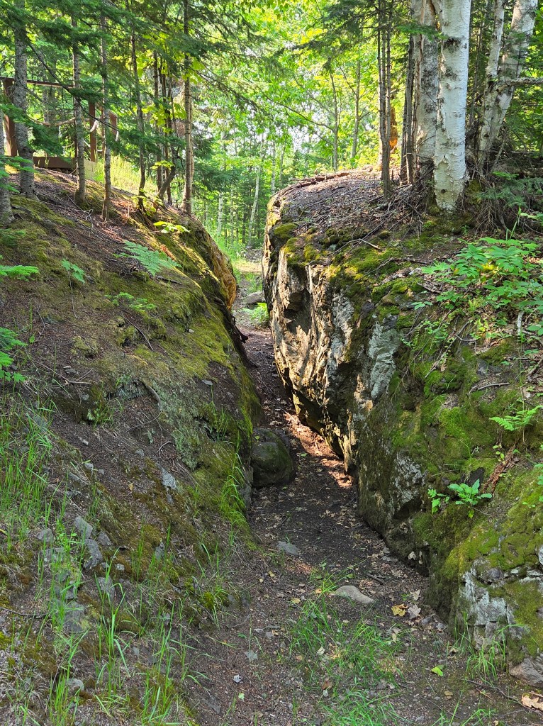
The only thing we had previously done in Munising was the Pictured Rocks Boat Tour. Ages ago, it had been a day trip for us from elsewhere in the UP, so it was decided to spend time here. Since we had seen Pictured Rocks from a boat, I wanted to see it from the shore.
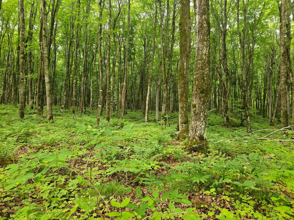
Our biggest hike here was to Mosquito Falls. True to its name, the bugs were out, and we had to resort to using insect repellent. All was fine after that. We were rewarded with gorgeous forest with green glowing ferns, pink lady slipper flowers, and huge fungi as big as plates.
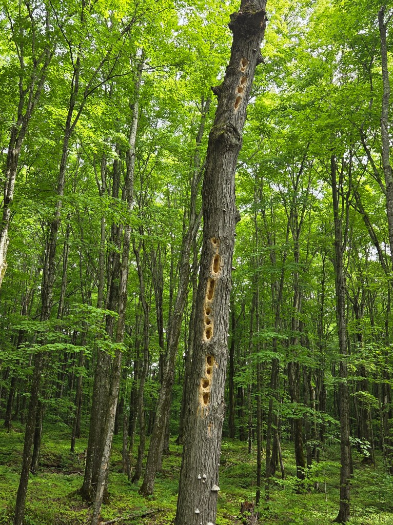
And, pretty interesting, an old dead tree full of woodpecker holes.
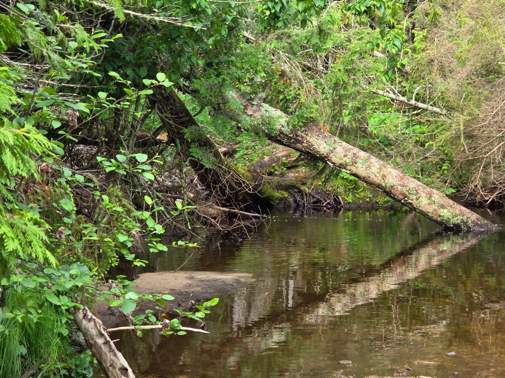
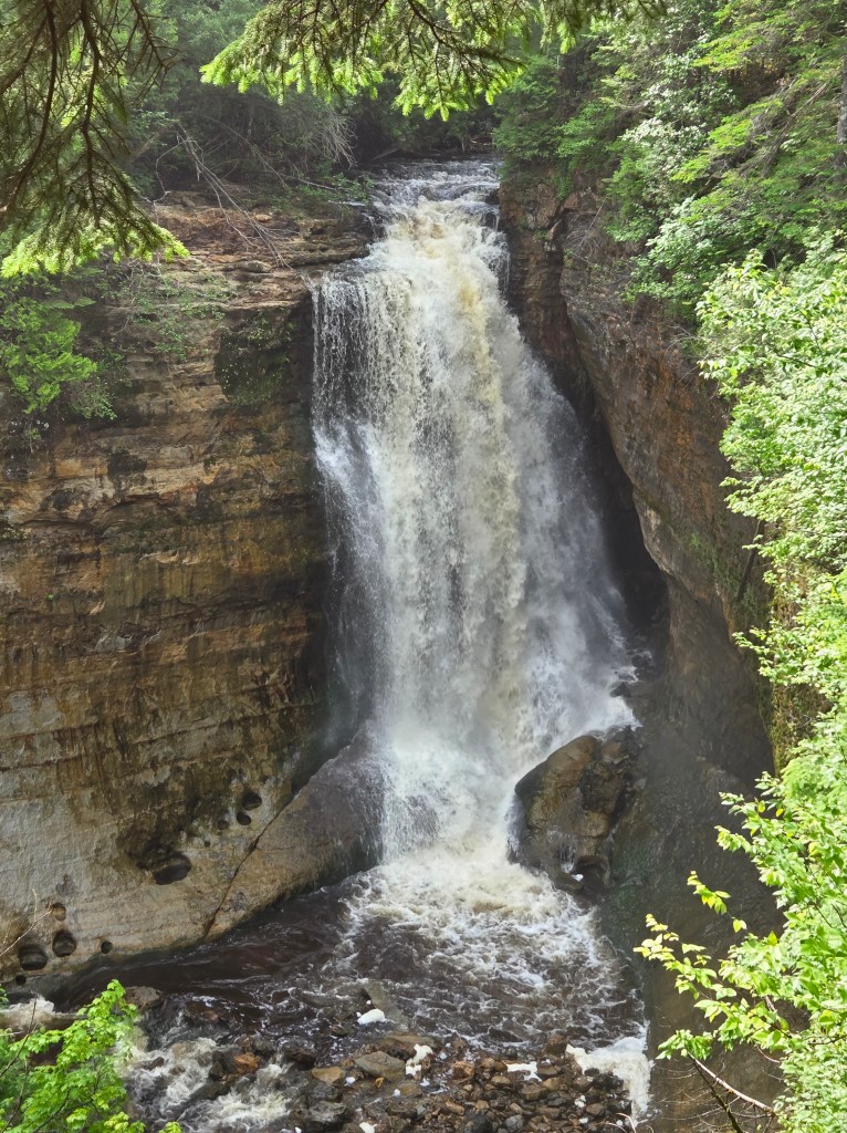
The Mosquito River, as we’d seen elsewhere, had a Coca-Cola color from tree tannin. This is Mosquito Falls…

…and this is Mosquito Falls, too.

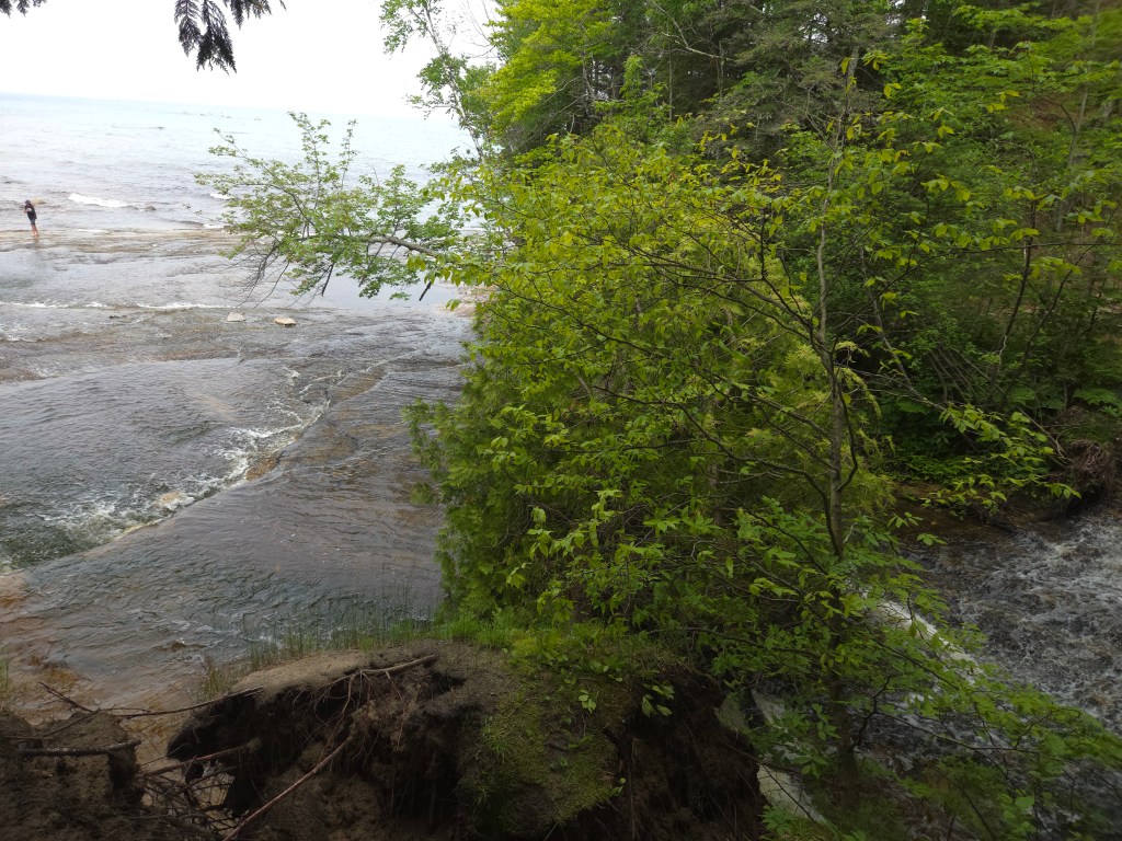
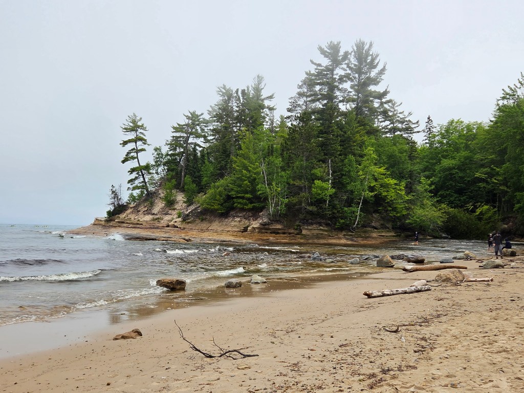
There was a dramatic difference where the river met the sea – Lake Superior, that is.
We sat on Superior’s shore, watched a loon play in the water, and munched on granola bars while fog settled in over the rocky shoreline. And life was pretty fine.
The full name of Pictured Rocks is Pictured Rocks National Lakeshore. That meant that I could stamp my National Parks book. The park is long and narrow and hugs the shoreline, so a visitor drives in and out of it while seeing the sights.
Our first day’s hike was about 4.7 miles, and we nowhere near matched that afterwards. On another day we visited Miner’s Castle which is nicely set up for tourists. It is the only place where one can drive to a cliff overlook. The trail was mostly paved, and we went to three different viewing platforms for great views of the lake.
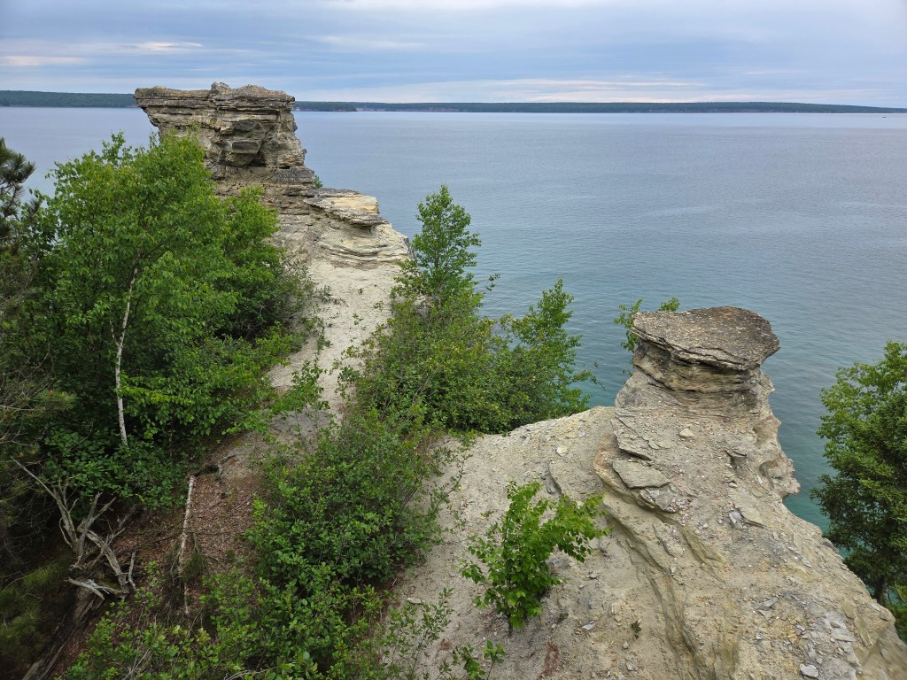
If you look closely at the picture above, there seems to be a little platform to the right of the rock formation on the top left. For millennia, there was another formation there, but it collapsed in 2006.
More dramatic sandstone cliff views are to be seen on the opposite shore.

Miners Castle has a Miners Falls to match. It’s about 50 feet tall.
Continuing the Miners theme, Miners Pasties is the place to eat if you want to try pasties. Beginning in Mackinac City, we had seen signs for pasties everywhere. We’ve had them before in the pre-Internet era. This time, if I was going to eat a pastie, I wanted to be sure it would be a good one. Miners Pasties lived up to its reputation. The “yooper” – actually a name for people who live in the UP – is the traditional beef and vegetable. Their carrot cake is also recommended, so we purchased one piece to share and take home.
How good was it all? So good, we went back the next day and tried another pastie – chicken, this time, to go – and also this time I took a picture. For some reason I couldn’t finish it, and had to save half for the next day’s lunch. And then I really was done with pasties.

The whole UP area was once full of mines – iron and copper, mainly. Many of the miners immigrated from the Cornwall area of England, where they had also mined for a living. The food was popular for these folks, as it could easily be tucked into a lunch box.
If you are hungry for steak and are feeling a little spendy, dinner at Foggy’s is also good. We got this recommendation from someone way back in Mackinac City. They have a huge grill that you walk by as you find your table, and you can even grill your own steak if you think you can do it better. Anyway, we opted to split a steak, and there was even enough to take home.
I had a morning where I walked about in Munising, and I needed to go to the Post Office. It is one of those old classic styles with artwork over the Postmaster’s door. I’ve seen one of these before, and now I look for them. In Munising, it is this:
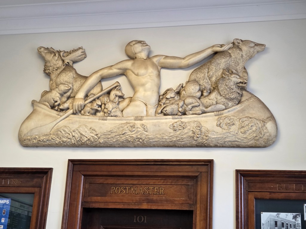
It is a plaster sculpture titled “Chippewa Legend” done by Hugo Robus and, like the others, is from the New Deal era. I love all the detailed animals in it.
After a few days in Munising we moved on to the Keweenaw Peninsula, which is a 60-mile finger of land that sticks up into Lake Superior. I didn’t know this when we visited, but it is actually an island. The Portage Canal divides the peninsula, and a bridge across the cities of Houghton and Hancock took us further north. Our park was in the town of Lac La Belle, which really wasn’t a town at all.
Driving up to the Keweenaw, we had the most awesome spot for a picnic overlooking a small lake. The road often hugged the shoreline, winding through picturesque resort towns.

Native Americans who once lived here mined for copper. When modern prospectors arrived in the 1840’s, they used the ancient mining pits to establish copper mines, and the area was settled. The Delaware Copper Mine operated from 1847 to 1887 and it wasn’t far from where we were parked, so we went for a visit.
We could see what was once an above-ground native copper pit. I loved looking down and imagining them at work.
The copper mine was self-guiding. We could actually walk down into it all by ourselves after listening to a safety briefing and receiving helmets. The lights weren’t even on yet. I thought they were motion-detecting lights, but no. When we were all the way down at the bottom, I was very glad that there was another couple at the top that we could yell up to to get them turned on.
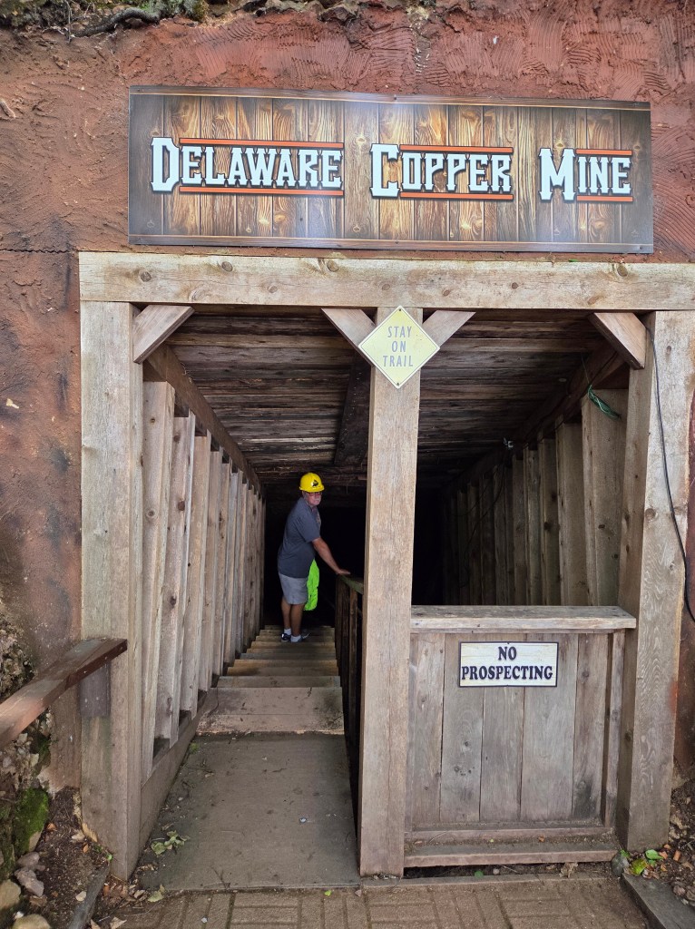
Helpful signs along the way told us what we were seeing.

Michigan native copper is reputed to be some of the purest on the planet. From the mid-1800’s into the 1900’s, two-thirds of the world’s copper came from here. The Delaware Mine was never profitable, but others were.
Outside, nature is reclaiming the decaying mine buildings.

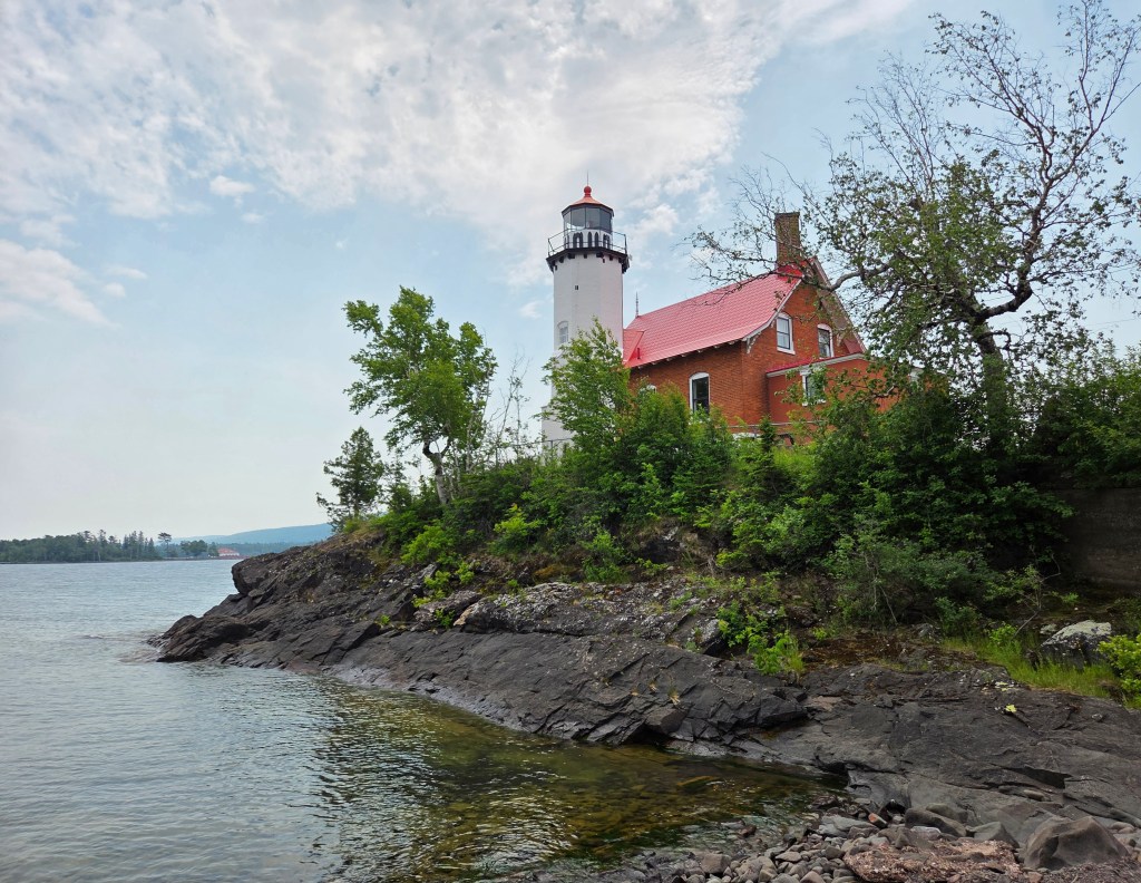
There are other mines, historic buildings, and a ghost town to be seen in the Peninsula, but our next stop was at the Eagle Harbor Lighthouse. You may be able to tell by now that I like lighthouses.
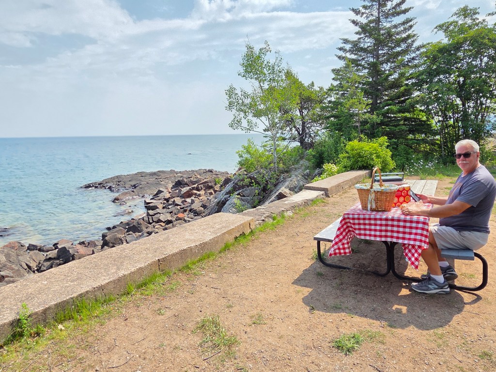
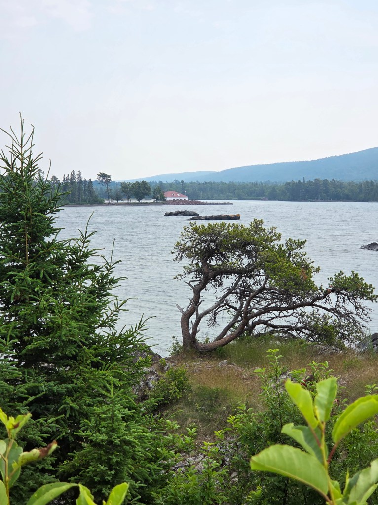
Today’s picnic was on the shore of Lake Superior within view of the lighthouse.
When the copper miners first arrived, transportation and business were done almost completely by boat. Lake Superior was a hub for settlers and supplies as well as all the copper and timber being produced. The lake’s weather is unpredictable, so ships needed the lighthouses for navigational assistance. A lighthouse was built here in 1851, destroyed by harsh weather, and Eagle Harbor lighthouse replaced it in 1871.
The cheerful kitchen in the lighthouse looked like a welcoming place.

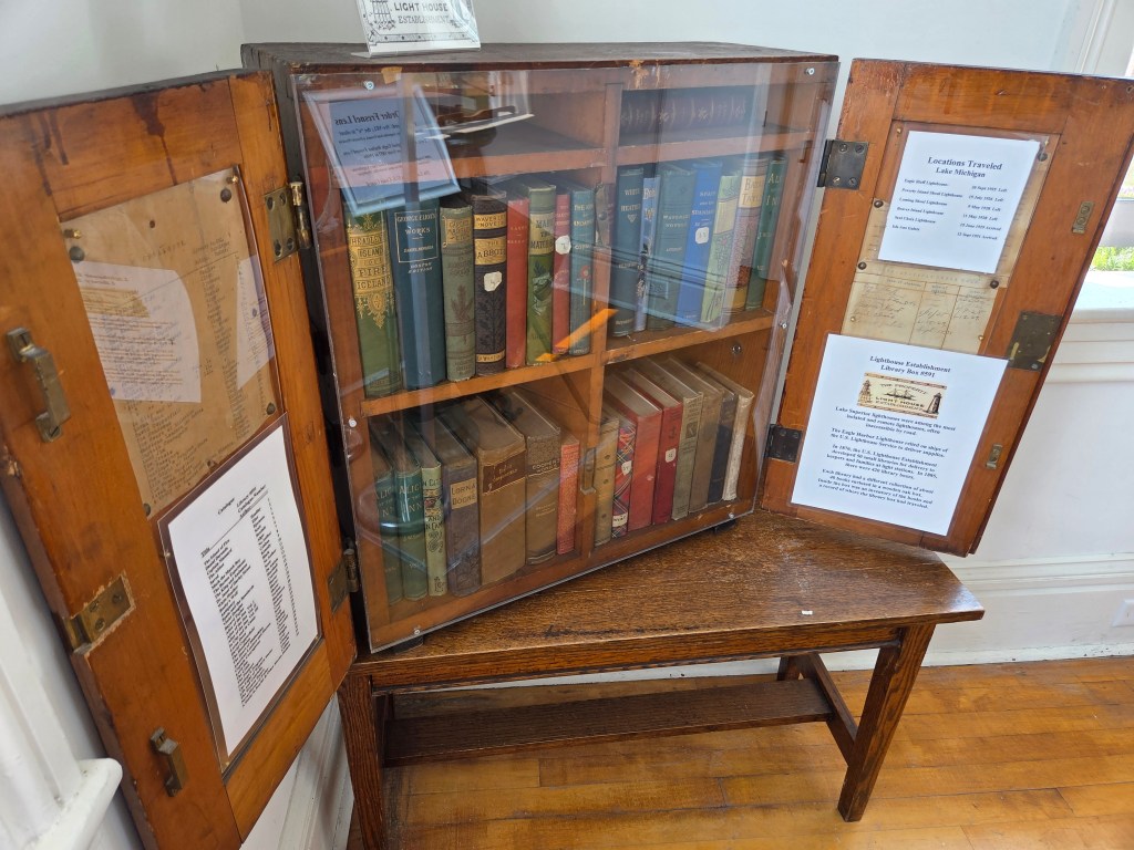
I found something interesting here: a traveling library. Lighthouse keepers eagerly awaited the boats bearing their supplies. There were many boxes containing libraries that were swapped back and forth between all the lighthouses. The boxes were numbered, contents catalogued, and a log was kept of where each box had been. Life here was very isolated, so I’m sure each box was eagerly awaited to get through a cold Superior winter. The picture isn’t good with a bad glare, but you can get an idea of what a box looked like.
The view of the harbor here is so beautiful and if you look closely, you may be able to see an eagle in a tree.

The lighthouse had many outbuildings, each of which is now a little museum with various aspects of Eagle Harbor’s history.
On to one of the most important stops of the day: the Jampot. The monks of Poorrock Abbey make preserves from many kinds of fruit, plus muffins, cookies, fruitcakes, and all sorts of other delectable delights. We almost didn’t go in because of the line out the door, but that is because not many people can fit into the little shop at once.
And of course, this being the UP, there is a waterfall next door.

We made two trips in to the little town of Copper Harbor. One of them was for a very big reason, which you shall see in the next post.
Next time: visiting one of the least-visited National Parks
