
Subscribe to continue reading
Subscribe to get access to the rest of this post and other subscriber-only content.
RV travel, US and international travel, retirement life

Subscribe to get access to the rest of this post and other subscriber-only content.
This national park is included on a list of the top six least-visited national parks. It’s not for lack of beauty, but simply because they are all hard to get to. Isle Royale sits in the middle of Lake Superior, 55 miles as the crow flies from Copper Harbor in Michigan. I’ve always had my eye on Isle Royale, though, and finally we had our opportunity to go. It was part of the reason we were staying in the Keweenaw Peninsula of Michigan’s Upper Peninsula.
We were told to be at the harbor at 7AM for an 8AM departure on the Isle Royal Queen. We would be staying overnight at Rock Harbor Lodge, so we had duffel bags. The ships crew hoisted them onto the boat and we never saw them again until we were in our room at the lodge. Besides us were more people with luggage, large excited groups of backpackers with their stuffed packs, which also got loaded, and a handful of daytrippers.
It was exciting to be on the boat and finally on our way.

The ride is over three hours, plus a wait to get off boarded and a talk by the park rangers before being turned loose. I’m not sure if its worth it to just come for the day. The boat leaves Isle Royale at 3PM, and of course you need to be there early again, so for your well-over six hour boat ride, you barely get a couple of hours to explore. That’s good, I guess, if you just want to see it and say you’ve been there.
There’s not a lot to see from the boat. We could see the Keweenaw Peninsula for a long time off in the distance. For an interval of time there was just water. Lake Superior is the largest of all the Great Lakes and the largest freshwater lake in the world by surface area at 31,700 square miles. It also holds 3 quadrillion gallons of water, enough to cover North and South America with a foot of water. There have been over 350 shipwrecks on the lake, and its cold water has preserved them for divers. The number of shipwrecks is why there are so many lighthouses.
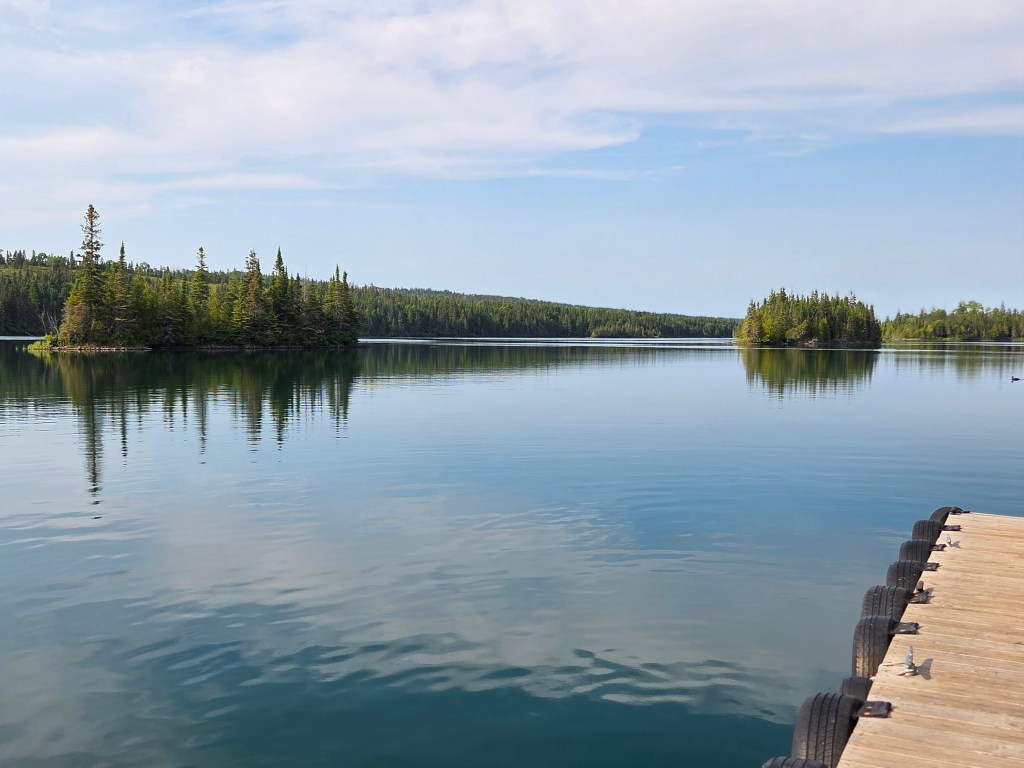
Finally, Isle Royale in view!

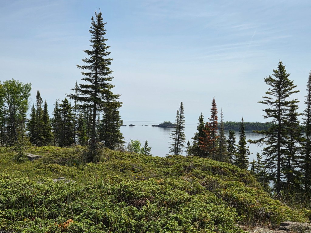
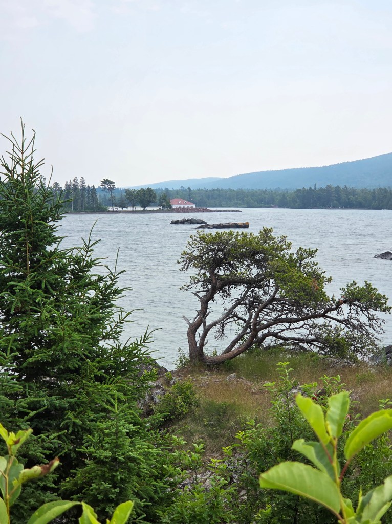
We arrived in Rock Harbor, which is on the northeast side of the island. The only other settlement is Windigo, which is on the southwest side and serves the boats coming from Minnesota. It takes five hours to ride a boat from one end to the other; the distance is 45 miles. It takes a backpacker 4 or 5 days to reach Windigo.
Rock Harbor would be our center of life for the next day; if we wanted to leave the area, there were only hiking trails that led into the interior.

At first, we needed a map to get around. Signboards were very helpful. There’s no internet here! By the time we left we knew pretty well what was where.

The dining building is a restaurant on one side and a fast-food place called the Grill on the other. After lunch at the Grill, we went out for a hike as our room was not yet ready. We chose the Stoll Memorial Trail, seen on the bottom right of the map. After a half hour, Cal declared that he was done and wanted to turn around. The day was warm, the sun was bright, and his hat was in his luggage. I had no thought of turning around and kept going.
What a beautiful, untrammeled place, all quiet save for birdsong.
At some point in my hike, I passed a sign that stated I was now in wilderness, and past the Park Service’s maintenance. Wilderness? When in my life have I ever been in true wilderness? Perhaps somewhere in the Rockies? I pondered that as I walked.
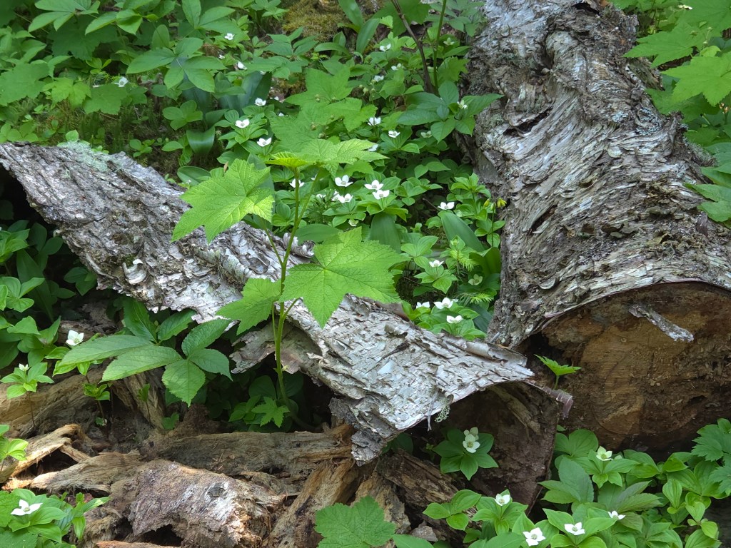
There were many wildflowers to enjoy along the way.

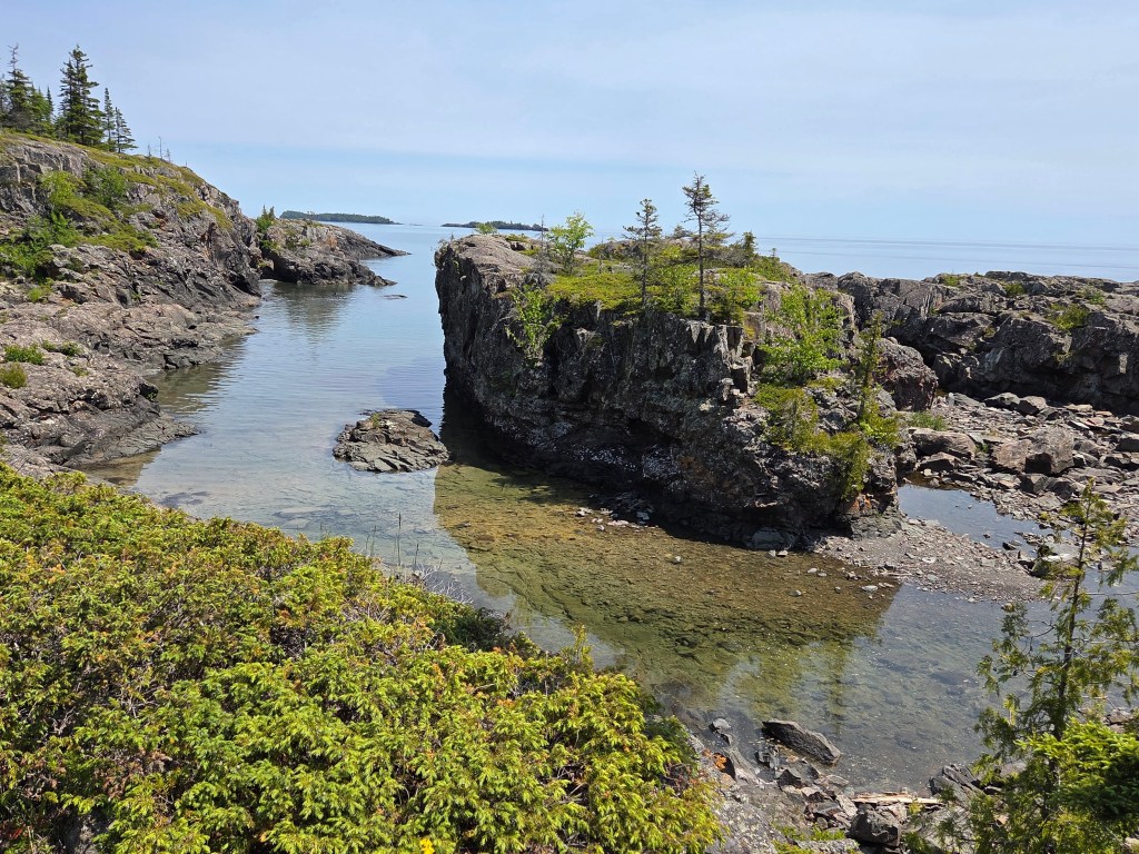
I thought it might be nice to get to the tip of the island at Scoville Point, but it isn’t the tip. Blake Point is. But Scoville was good enough, and it felt wonderful to sit and enjoy the day when I reached it.

On the way back I chose a different trail, and this took me to Smithwick Mine. It was just a hole in the ground, but a man named Smithwick tried mining copper for a couple of years. It wasn’t profitable.
Large mammals live on the island (but no bears). It is assumed that they crossed over to the island during winters when the lake was frozen. But how did the Isle Royale red squirrel get here? It’s not known, but they’ve been here so long, they are considered to be their own subspecies. They are smaller and make different sounds than the ones we are familiar with. I wasn’t lucky enough to see a moose, but I was excited to see a squirrel at the Smithwick Mine ruins.

After my hike our room was ready. It was very basic, but did have a large picture window where we could look out at the lake.

We dined on fish in the restaurant and took a post-dinner stroll to Tobin Lake. It is where people land if they arrive by airboat. It was still bright day as the sun sets late here.
We fell asleep while enjoying the view in our room with the windows open. It was still light out at 10 PM, which is when I took the picture below. I woke up later and could see stars as well as the Milky Way. Windows still open, I was lulled back to sleep by the sound of the waves.

In the morning, we hiked in the other direction after breakfast and admired a duck with no less than 23 fuzzy ducklings. We stopped to look at Suzy’s Cave. It was a shallow cave, probably hollowed out by the lake at one time.

We hung out on the beach for a little bit:

Lake Superior showed us the capriciousness of her weather. While the previous day had been sunny and warm, this day was overcast and cool. Cal reminded me of the weather forecast: it was due to rain, so we came back to the harbor at a pretty good clip.
In a place as remote as Isle Royale, everybody becomes your friend and we talked to many people. There was the couple on the boat going over who were going backpacking for 5 days. We swapped hiking and traveling stories, which made the trip pass quickly. Our server at dinner in the restaurant was an Ecuadorian law student who was eager to chat; he’d worked at Isle Royale several summers.
But the couple who stood out for me were the folks we shared a table with in the lunch area for two hours while it poured rain outside. They’ve been on a mission to see every single one of the main 63 National Parks in the system. Isle Royale was number 61. That includes Samoa, the US Virgin Islands, and all of the parks in Alaska except for the two they have left to go. The husband started showing their pictures: the fat bears catching salmon in Alaska, the peaks of Denali. Then he moved on to their other adventures: animals on safari in Africa (Tanzania and Kenya are better than South Africa, if you ever want to go), penguins in Antartica, Machu Pichu, Easter Island, the list went on. I have never in my life met such a well-traveled yet totally unassuming couple, and they were fascinating.
On the way back, we sat with a woman who had solo backpacked on the island for five days. The weather had been beautiful. She showed us pictures of the animals she’d seen: a family of otters, a moose with baby, and a fox. She bested my mama duck with the 23 ducklings by showing me a picture of a loon mama with 32 chicks, including one on her back. I thought that I would have liked to have seen all of that, but I decided that at this point in my life I wouldn’t want to spend five days in the wilderness to do it.
These peoples’ stories, plus our own, have all been wrapped up in the memory of our time here. It was special and unique and not something I will quickly forget.
Next time: a visit to Bayfield, Wisconsin
In an era of our lives, the Upper Peninsula of Michigan (the “UP”) is a place that used to be pretty familiar for us. My Mom lived in Saginaw, Michigan. Cal’s Mom lived in Duluth, Minnesota. Traveling Route 2 was our highway in between and was always an occasion for stopping to see Michigan’s delights.
What could we visit that we hadn’t already seen?
The only thing we had previously done in Munising was the Pictured Rocks Boat Tour. Ages ago, it had been a day trip for us from elsewhere in the UP, so it was decided to spend time here. Since we had seen Pictured Rocks from a boat, I wanted to see it from the shore.
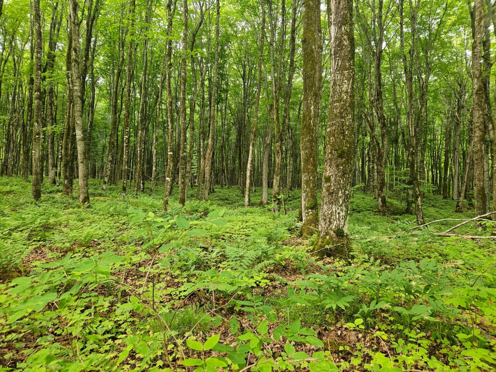
Our biggest hike here was to Mosquito Falls. True to its name, the bugs were out, and we had to resort to using insect repellent. All was fine after that. We were rewarded with gorgeous forest with green glowing ferns, pink lady slipper flowers, and huge fungi as big as plates.
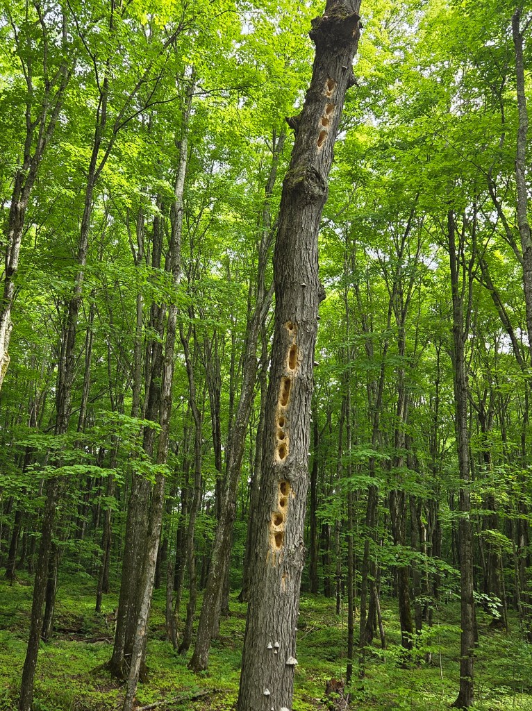
And, pretty interesting, an old dead tree full of woodpecker holes.
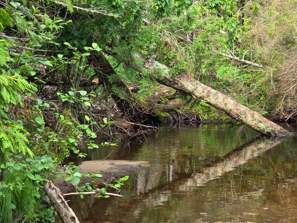
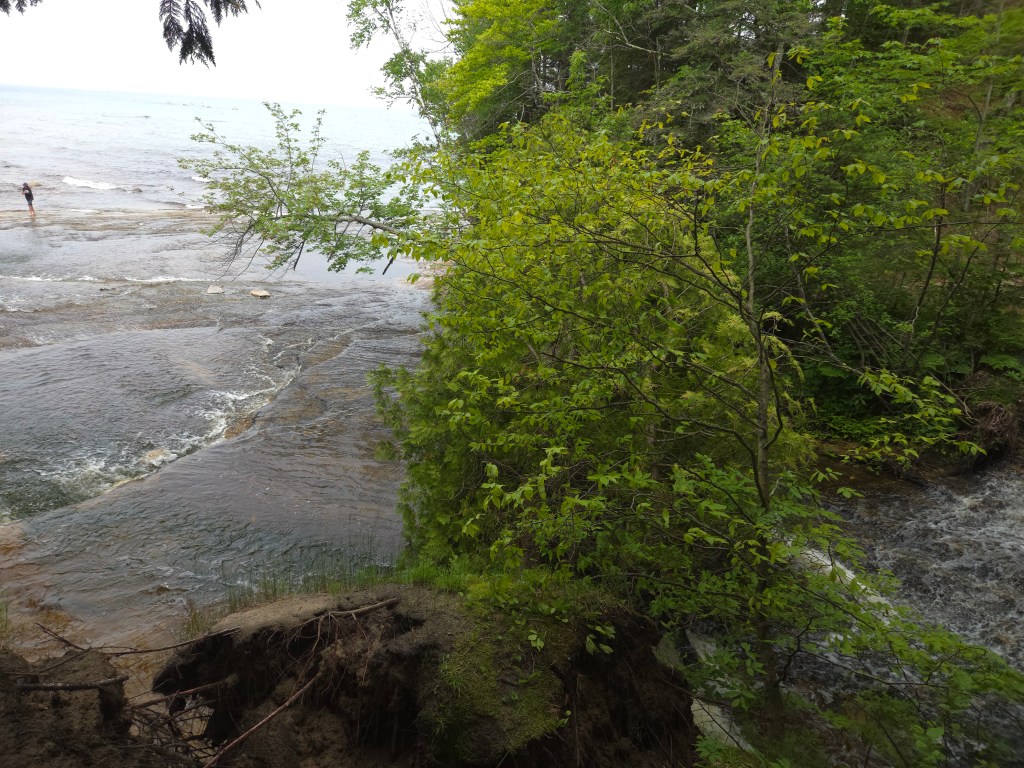
The Mosquito River, as we’d seen elsewhere, had a Coca-Cola color from tree tannin. This is Mosquito Falls…

…and this is Mosquito Falls, too.

There was a dramatic difference where the river met the sea – Lake Superior, that is.
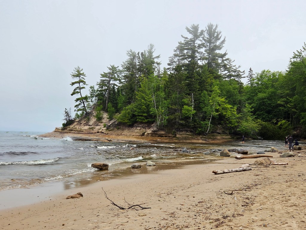
We sat on Superior’s shore, watched a loon play in the water, and munched on granola bars while fog settled in over the rocky shoreline. And life was pretty fine.
The full name of Pictured Rocks is Pictured Rocks National Lakeshore. That meant that I could stamp my National Parks book. The park is long and narrow and hugs the shoreline, so a visitor drives in and out of it while seeing the sights.
Our first day’s hike was about 4.7 miles, and we nowhere near matched that afterwards. On another day we visited Miner’s Castle which is nicely set up for tourists. It is the only place where one can drive to a cliff overlook. The trail was mostly paved, and we went to three different viewing platforms for great views of the lake.
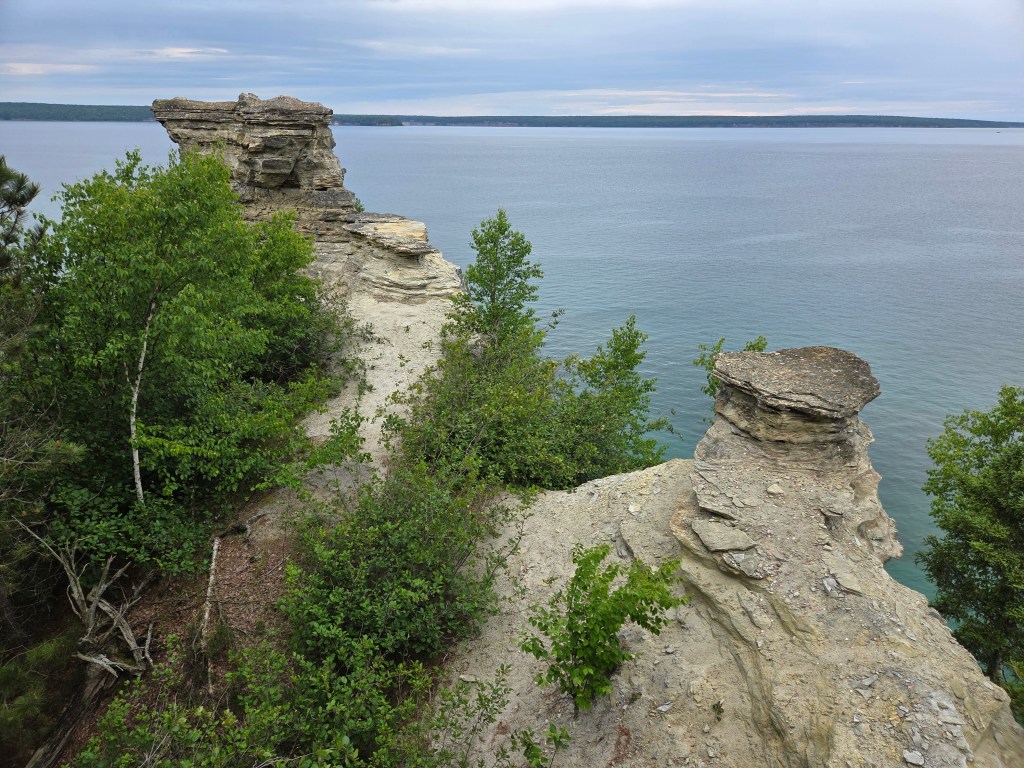
If you look closely at the picture above, there seems to be a little platform to the right of the rock formation on the top left. For millennia, there was another formation there, but it collapsed in 2006.
More dramatic sandstone cliff views are to be seen on the opposite shore.

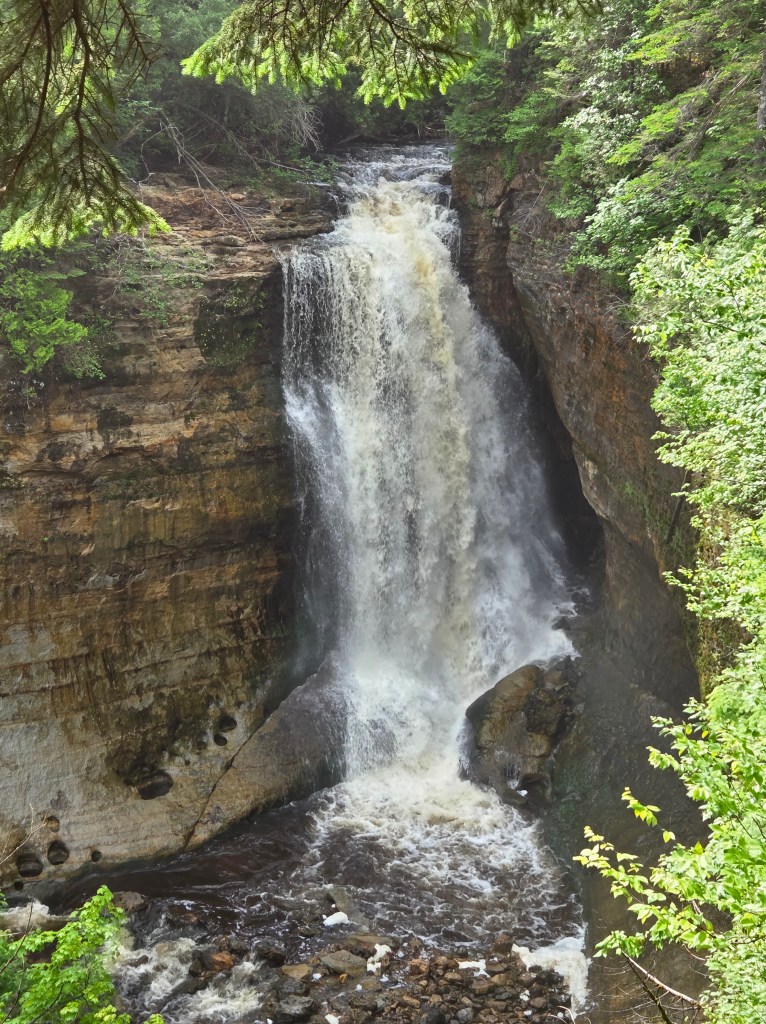
Miners Castle has a Miners Falls to match. It’s about 50 feet tall.
Continuing the Miners theme, Miners Pasties is the place to eat if you want to try pasties. Beginning in Mackinac City, we had seen signs for pasties everywhere. We’ve had them before in the pre-Internet era. This time, if I was going to eat a pastie, I wanted to be sure it would be a good one. Miners Pasties lived up to its reputation. The “yooper” – actually a name for people who live in the UP – is the traditional beef and vegetable. Their carrot cake is also recommended, so we purchased one piece to share and take home.
How good was it all? So good, we went back the next day and tried another pastie – chicken, this time, to go – and also this time I took a picture. For some reason I couldn’t finish it, and had to save half for the next day’s lunch. And then I really was done with pasties.

The whole UP area was once full of mines – iron and copper, mainly. Many of the miners immigrated from the Cornwall area of England, where they had also mined for a living. The food was popular for these folks, as it could easily be tucked into a lunch box.
If you are hungry for steak and are feeling a little spendy, dinner at Foggy’s is also good. We got this recommendation from someone way back in Mackinac City. They have a huge grill that you walk by as you find your table, and you can even grill your own steak if you think you can do it better. Anyway, we opted to split a steak, and there was even enough to take home.
I had a morning where I walked about in Munising, and I needed to go to the Post Office. It is one of those old classic styles with artwork over the Postmaster’s door. I’ve seen one of these before, and now I look for them. In Munising, it is this:
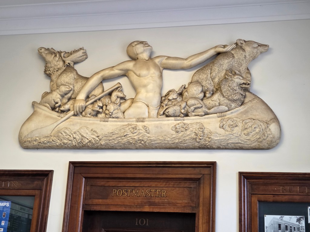
It is a plaster sculpture titled “Chippewa Legend” done by Hugo Robus and, like the others, is from the New Deal era. I love all the detailed animals in it.
After a few days in Munising we moved on to the Keweenaw Peninsula, which is a 60-mile finger of land that sticks up into Lake Superior. I didn’t know this when we visited, but it is actually an island. The Portage Canal divides the peninsula, and a bridge across the cities of Houghton and Hancock took us further north. Our park was in the town of Lac La Belle, which really wasn’t a town at all.
Driving up to the Keweenaw, we had the most awesome spot for a picnic overlooking a small lake. The road often hugged the shoreline, winding through picturesque resort towns.

Native Americans who once lived here mined for copper. When modern prospectors arrived in the 1840’s, they used the ancient mining pits to establish copper mines, and the area was settled. The Delaware Copper Mine operated from 1847 to 1887 and it wasn’t far from where we were parked, so we went for a visit.
We could see what was once an above-ground native copper pit. I loved looking down and imagining them at work.
The copper mine was self-guiding. We could actually walk down into it all by ourselves after listening to a safety briefing and receiving helmets. The lights weren’t even on yet. I thought they were motion-detecting lights, but no. When we were all the way down at the bottom, I was very glad that there was another couple at the top that we could yell up to to get them turned on.
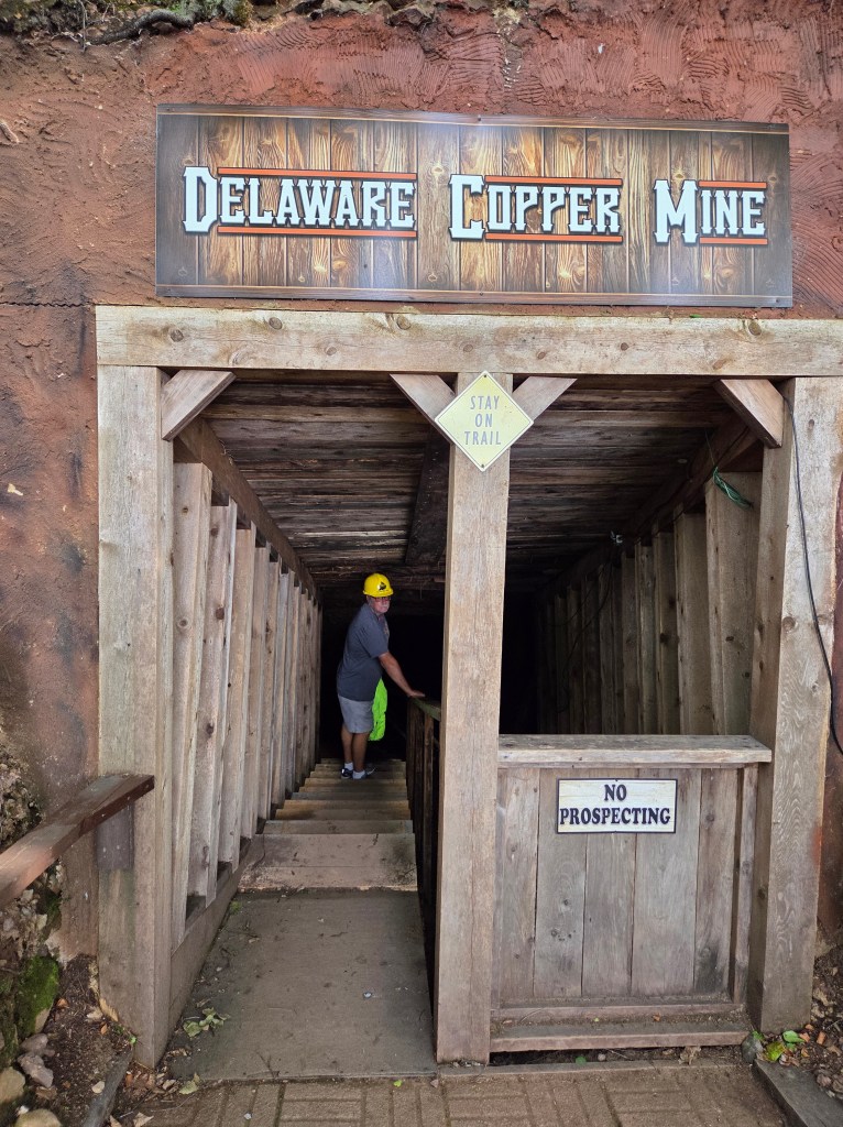
Helpful signs along the way told us what we were seeing.

Michigan native copper is reputed to be some of the purest on the planet. From the mid-1800’s into the 1900’s, two-thirds of the world’s copper came from here. The Delaware Mine was never profitable, but others were.
Outside, nature is reclaiming the decaying mine buildings.

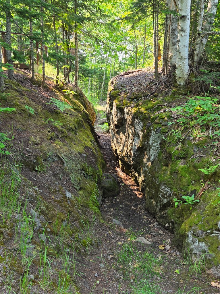
There are other mines, historic buildings, and a ghost town to be seen in the Peninsula, but our next stop was at the Eagle Harbor Lighthouse. You may be able to tell by now that I like lighthouses.
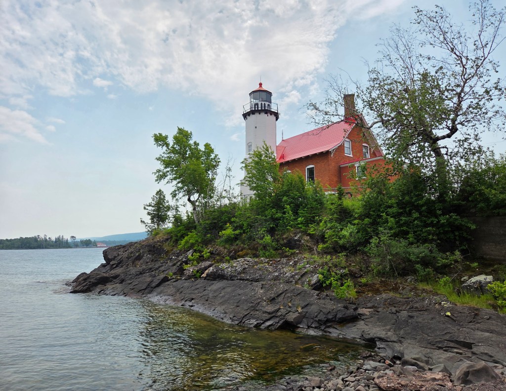
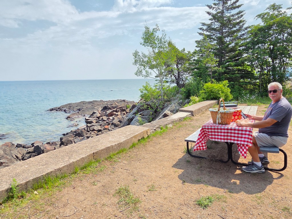
Today’s picnic was on the shore of Lake Superior within view of the lighthouse.
When the copper miners first arrived, transportation and business were done almost completely by boat. Lake Superior was a hub for settlers and supplies as well as all the copper and timber being produced. The lake’s weather is unpredictable, so ships needed the lighthouses for navigational assistance. A lighthouse was built here in 1851, destroyed by harsh weather, and Eagle Harbor lighthouse replaced it in 1871.
The cheerful kitchen in the lighthouse looked like a welcoming place.

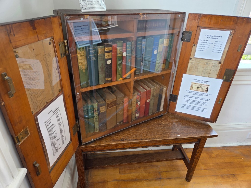
I found something interesting here: a traveling library. Lighthouse keepers eagerly awaited the boats bearing their supplies. There were many boxes containing libraries that were swapped back and forth between all the lighthouses. The boxes were numbered, contents catalogued, and a log was kept of where each box had been. Life here was very isolated, so I’m sure each box was eagerly awaited to get through a cold Superior winter. The picture isn’t good with a bad glare, but you can get an idea of what a box looked like.
The view of the harbor here is so beautiful and if you look closely, you may be able to see an eagle in a tree.

The lighthouse had many outbuildings, each of which is now a little museum with various aspects of Eagle Harbor’s history.
On to one of the most important stops of the day: the Jampot. The monks of Poorrock Abbey make preserves from many kinds of fruit, plus muffins, cookies, fruitcakes, and all sorts of other delectable delights. We almost didn’t go in because of the line out the door, but that is because not many people can fit into the little shop at once.
And of course, this being the UP, there is a waterfall next door.

We made two trips in to the little town of Copper Harbor. One of them was for a very big reason, which you shall see in the next post.
Next time: visiting one of the least-visited National Parks