USTravel

So Much To Do In Virginia City, Nevada

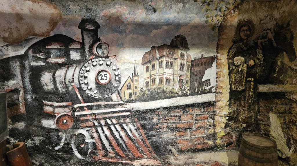
Silver! The Comstock Lode was discovered in Virginia City in 1859, and the boom was on. It was the first major silver deposit found in the United States. Mines opened and the town grew to a population of around 25,000 ten years later. The growth in this town is what led the state of Nevada to statehood.

It had been a while since we’d ridden a train, so upon our arrival here we decided to take a ride on the diesel-powered Virginia and Truckee Railroad to start our day.

The train was originally built to haul the ore out of the Comstock Lode Mines, as well as other building materials and supplies, and went all the way to Carson City. Now it hauls tourists on a round-trip venture down to Gold Hill, a tiny town where the first of the silver lode was mined.

Our conductor and guide shared names of the mines and some of their stories as we rode.

You can see the train tracks just above this long-gone silver mine
The town of Gold Hill was so named because gold is what was found here first.

After riding the train, we wandered along the boardwalk through town.

If for some crazy reason you didn’t find anything of interest to see in Virginia City, you could at least wander into the candy shops and have a treat. Your favorite must be in here somewhere!

Mark Twain had a job as a newspaper reporter in the 1860’s. He wrote about his Nevada years in the book “Roughin’ It”. There is a museum dedicated to his time here, but it is being reconstructed.

Of course, in a town such as Virginia City, there are several mine tours that one could take in while visiting. We wandered into the Ponderosa Saloon, and a tour of Best and Belcher mine is available (for a fee, of course) once you walk straight back past the bar. Who could resist?

A hapless miner displays various drilling tools in the Best and Belcher Mine.

This mine was dug for gold, but it was not profitable. Not, that is, until the present-day owners of the Ponderosa realized that this shaft entrance was steps from their saloon. We enjoyed this informative 25 minute tour.

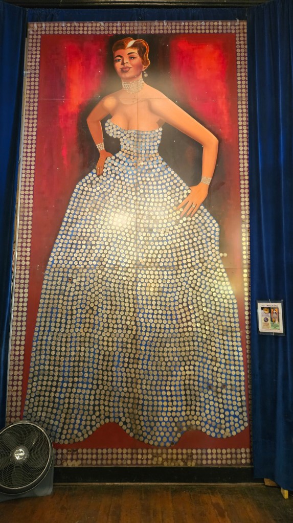
Not that we are saloon hoppers by any means, but down the street at the Silver Queen saloon, we could see a 16 foot Queen made out of 3,261 silver dollars. This lady weighs 210 pounds and the coins are all Virginia City silver. There is a wedding chapel in the Silver Queen too, in case you want to get married after you see her.

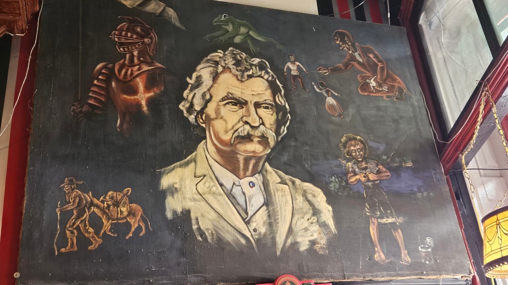
I also liked this tribute to Mark Twain inside the saloon. Samuel Clemens used the pen name of Mark Twain for the first time when he lived and worked here.

We visited two other places in Virginia City. The first was St. Mary in the Mountains, Nevada’s oldest Catholic church. The number of Irish immigrants working the mines necessitated its original construction. It outgrew that one and a new building burned down during a huge fire that decimated the town. The church was rebuilt with bricks in 1864.

Looking from the nave to the entrance of St. Mary’s in the Mountains

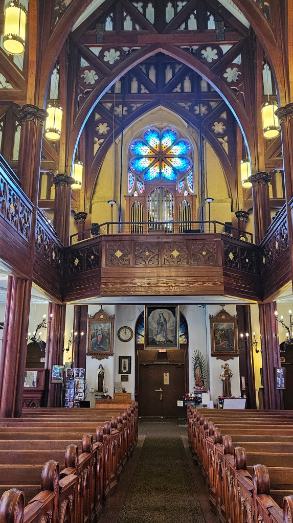
Our train conductor had touted the museum in its basement, and also the fact that they sell wine down there. We couldn’t figure out what happened to the wine, but the paintings in the wine cellar were splendid. The museum held many ecclesiastical treasures.

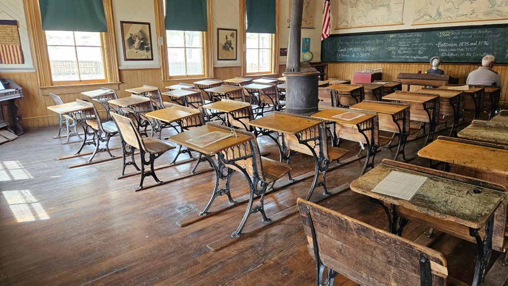
Our last stop of the day was at the old schoolhouse, renovated and turned into the Historic Fourth Ward School Museum. It’s painted into the center of the picture above, and shown below as well.

The children of immigrant miners, wealthy mineowners, town professionals, the shopkeepers, and other residents of the town crowded into this school. There were 3,000 children living here in 1875! Here’s all the facts:

This four-story, Victorian-era school building is the last of its type still in existence. Children from young elementary all the way up through high school attended here. One room was set up exactly the way it was back in the day. Yes, that’s Cal in the front row.

Here is the first grade class in the 1890’s. Note that there is only one teacher for all of these kids!

Other school rooms contain displays of Virginia City history. Here is a piece of Comstock ore:

Unexpectedly for us, we spent an entire day visiting this mining town. It is hard to compare mining towns from one to another because they all have their own history, but Virginia City had a lot of stories to tell.

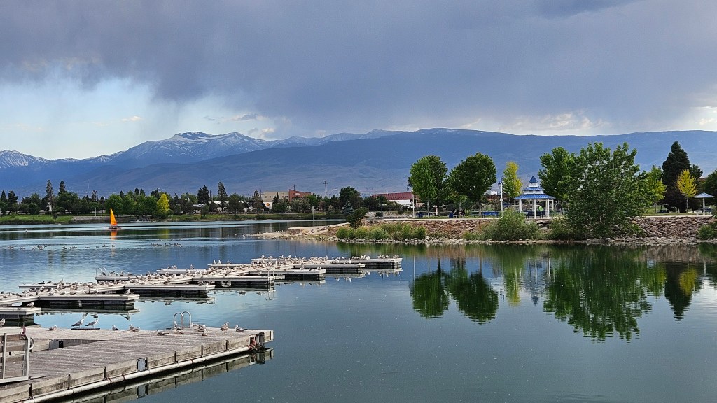
Next time – we head out on a road dubbed “America’s Loneliest”

USTravel

An Unexpected Day in Reno, and Horsing Around at Washoe Lake State Park Nevada

I didn’t have a clue what Reno would be like, but I imagined something like we’d seen in Las Vegas. Remembering our time there, we knew we didn’t want to drive our truck into the city. We took an Uber instead, and our driver was very chatty. He said that beginning twenty years ago, less people began to come to Reno. Older hotels and casinos closed, and some have been torn down, leaving empty lots. We saw some empty storefronts and boarded up casinos. He pointed out the two or three that were still good places to go. New casino resorts are here, they just aren’t being built much on the old Strip.

Downloading a walking tour of Las Vegas had been a good idea, so I did the same for Reno. I had our driver drop us off at the Reno sign. Following the walking tour, this meant that we did not walk past any casinos at all, which was fine. The Strip didn’t look enticing enough to check out. And so, this whole day was totally different than I had envisioned.

We walked through City Plaza, with the Truckee River flowing by below it.

We actually found a piece of the Irish Blarney Stone. You don’t have to go to Ireland to see it!

Tourists in Ireland go through great lengths to kiss the Blarney Stone. I guess here in Reno they thought that just rubbing it might be a better idea.

We looked at the copper-colored geodesic dome of the Performing Arts Center and took a peek inside the old Post Office. Next up was the Riverwalk area which was quiet on a Saturday morning.

We went off-tour through the beautiful city park, where people were floating down the river.

We were off the tour route and passing by the park on our way to Washoe Public House for a delicious lunch.

Back to the tour, we visited the West Street Market. I had looked forward to this, but disappointingly, it was no longer a market. Was this tour written pre-covid? I hadn’t checked the date.

Our last stop was at the beautiful Thomas Aquinas Cathedral. It has a beautiful wrap around mural in the front from the 1950’s, thought to be one of the finest works of art in America.

We had come to the end of the walking tour. Cal was tired of walking on city streets and hot concrete. He was ready to call it done, but I didn’t feel done with Reno. He took an Uber back to the RV park, and I walked back past where we’d had lunch to the Nevada Museum of Art.

At first, I was a little disappointed. It was smaller than I thought it would be, with no permanent exhibits due to construction. But an eager docent took me through an exhibit by Cannupa Hanska Luger, an artist who is of mixed Native and European ancestry, entitled “Speechless”. She made the art come alive with her interpretations of his various pieces.

It was the second exhibit that stole my heart. It displayed the art of Maynard Dixon, who lived from 1875-1946. He painted the West, including Nevada. I love the paintings that I saw, some capturing the red rocks at sunset, and immersed myself in his life and work. He really got the feel of the Nevada landscape. Dixon also illustrated in magazines and books of the day and wrote poetry.

Mountains in Sunset Light” – Maynard Dixon
A self-portrait mural, “Welcome and Goodbye!”

The other thing that I learned about him was that he was married for a time to Dorothea Lange, a well-regarded photographer in her own right whose works I have admired. She was the mother to their two sons.

I’m sure the Reno strip would have appeared differently at night. The Riverwalk is regarded as a great place to visit and perhaps have dinner after taking in the casinos. But we did not return.

It had been a short stay at the park in Sparks, outside of Reno, and one of our nights had been out of the RV in South Lake Tahoe at a lodge. But I was happy to move on, especially since the next three nights were a grand total of 32 miles down to Washoe Lake State Park.

We had a beautiful spot here–

–with beautiful views of the Sierra Nevadas. The lake that gives the park its name was between our RV and the mountains. Scrubby hills lined with cedar trees were behind us.

All of this would be very fine, in and of itself. But the thing that makes this park extra special is the wild horse herd that lives here.

We’d seen them as we’d driven in and out of the park. One morning we drove the truck out to a trailhead to hike in order to see them closer. From the path, we watched a group of horses.

In the distance, we saw a larger group having breakfast lakeside. The two colts on the front left were frolicking and running together so they were fun to watch.

I was busy photographing them when Cal came up and said in a low voice, “You might want to turn around.” The first group was coming up right behind us on the path! They did not seem to have any fear of us, but were definitely minding their own business as they clip-clopped by.

Seeing so many horses in this gorgeous natural environment was a real treat. Afterwards, Cal drove the truck back to our spot but I opted to take a long hike back. Horses were still in view. There was a group hanging around the restrooms at the picnic area. It must be true what they say…the grass is always greener over the septic tank?

For a time, I was walking along the Washoe Lake shore, where a lone horse was doing the same.

In all, we had sighted over 60 horses on this morning.

We never know what lies around the bend on our travels. Some sights are not quite what we think they will be, but others go over and beyond our expectations. That is the surprise and the gift of the journey.

Next time – we visit Virginia City

USTravel

A Lake Tahoe Visit

Lake Tahoe is a place I’ve long wanted to visit, although my husband says that everywhere is somewhere I’ve always wanted to visit. That may be true, but it was still a very exciting moment when I stood on the shoreline and gazed at the clear blue water.

It had been a long drive back into California from where we left our RV on the east side of Reno. I hadn’t been able to find available RV parks any closer, although I had looked months earlier. In a rare occurrence, I was at the wheel, and enjoyed driving on the winding roads along mountain sides and pine forests until we arrived at the lake.

The picture above was taken at one of the first small turnoffs we came to.

Our first actual stop was at Eagle Falls on Emerald Bay. We were on top of it in the picture below, and the falls are on the right of this picture. The little island in the water (above the tree limb) is Fannette Island.

Lake Tahoe didn’t receive the early protection from development that Yosemite did. In the early 1900’s, wealthy folks purchased swaths of land and built homes along the lake. One of these was Vikingsholm, considered to be “Tahoe’s Hidden Castle”. If you enjoy Scandanavian architecture, it is considered to be one of the finest examples in the United States. We decided to take a tour of the home.

First though, we had to walk one mile downhill in the gorgeous pine forest on the old road, now a path, to the house. Views of the lake abounded. We were acutely aware that we were going to have to walk this same mile up when we were done!

The home was built for Lora Josephine Knight, a widow in her 60’s. A house had already been here since the late 1860’s, and a later owner built cabins. The land was cleared to build the home but Lora did not want one single tree cut down in the construction. She had traveled to the Scandinavia many times and Emerald Bay reminded her of the fjords there. Her niece’s husband was a Swedish architect who designed the home for her in that style. It was completed in 1929, and became her summer home.

Of course, the Scandinavian design continued inside the home, as our guide pointed out many features. Lora loved to entertain and have guests, so the dining room is large enough to stretch out the table when needed. And of course, having many guests requires having a large kitchen!

Arriving guests would drive under the structure in the picture below to the courtyard in the back. This structure housed the caretaker, who lived here year round, and also guests. This roof was made of logs; the low buildings on either side of it had roofs made of sod in true Scandinavian fashion.

From the front of the house we could walk right out to the lake shore, and happened to catch a passing excursion boat. On the right is Fannette Island again, which also belonged to Lora, and she built a tea house there.

Lora enjoyed 15 summers here and she had no descendants. The home eventually was acquired by the state of California, and is part of Emerald Bay State Park. Besides the home, she is also known for generous contributions to youth organizations, and for providing educational opportunities for those who could not afford them. In addition, she was a prime financial backer of Charles Lindbergh’s flight across the Atlantic.

Our next stop was the marina restaurant at Camp Richardson. It is an old resort community, and its setting under the tall pines gives it a national park feel. There are cabins, and – across the road – a great-looking RV park. I didn’t remember if I had seen this in my RV park search, but most likely it was already full. At the restaurant, we had delicious bread bowls of clam chowder with bacon sprinkled on the top. We were in full view of the lake.

We walked out onto a very long dock after lunch and I took pictures of the restaurant, the beach, and the lake with that beautiful clear water.

The rest of the afternoon was spent in scenic driving down to South Lake Tahoe. I had booked a room in a ski lodge at a post-ski-season rate. Calling it a ski lodge makes it sound fancy, but it was really just a remodeled old motel. Our room was cozy, had a gas fireplace, and was decorated with a fishing theme. Turning left onto the road from the lodge would have taken us directly up to the ski slopes.

Walking a few blocks to dinner, we enjoyed the neighborhood under its canopy of tall pines. Some of the homes were very interesting.

And later, we found another couple of docks.

So, just the same as our last night in Arizona at Grand Canyon West, our last night in California was spent outside of RV.

I highly recommend breakfast at Heidi’s Restaurant in South Lake Tahoe. I had a waffle with warm strawberry sauce and whipped cream. This turned out to be a very tasty trip!

South Lake Tahoe is right on the border with Nevada, so as soon as we crossed it we were passing by several casinos. Rounding a bend in the lake, we were now proceeding north. We received magnificent views of the snow-capped Sierra Nevadas from here.

We were going to take a hike at Cave Rock, but it didn’t pan out. First we found ourselves in a marina parking lot, where I did get a view of the rock. This is a sacred place for the Washoe native peoples.

It seemed like we were supposed to drive through a residential area to the trailhead, but the signs were confusing. We dropped that idea and drove on to see Carson City, which is the capitol of Nevada. With a little bit of extra time before heading home, we decided to stop at the capitol building. It serves the governor of the state and has some offices besides the museum. The other workings of the state happens in buildings around this one.

I learned a some interesting things here. The first is that the Nevada became a state on October 31, 1864, just eight days before President Lincoln’s reelection. He needed the votes, and Nevada was not a slave state. Politicians in Nevada wrote up a constitution and telegraphed it to Washington – the longest telegraph ever sent to that date. As soon as he received it, he admitted Nevada to the Union by an act of Congress. And the rest is history.

The other thing I learned is that Carson City is one of only eight cities to be an official US mint. It was short-lived, however. The first minting was in 1870 after discovery of the Comstock Lode. It closed permanently in 1893 after silver mining declined. If you ever find a coin with the “CC” designation on it, it might be worth a little something.

I also learned about Sarah Winnemucca, who lived from 1844 to 1891. I’ll let this signboard tell you what you might like to know about her, and there is a statue of her in the capital:

Every state capitol we’ve been to has something interesting and different to see and learn.

This had been a great little trip, and our adventures still continue!

Next time – we check out Reno and move to Washoe Lake State Park

USTravel

Adventures on the Road – Coarsegold to Sparks

The Coarsegold River at SKP Park of the Sierras, California

Our stay for the Yosemite visits was in Coarsegold, California. In those blogs I alluded to the fact that it was a long distance from the park. If we ever find our way back here, I might look for a closer spot, but at least we didn’t have to worry about the road being open for the year.

This stop was at an Escapees (SKP) Co-op Park. We’ve been members of Escapees because they handle our mail, and have stayed at their flagship park in Livingston, Texas. This was the first Co-op park we’d stayed in. Members buy into the park and own their site. They are responsible for maintaining it and contributing to the greater good of the park. There is no outside technical maintenance. When members are away, they can release their site into a pool so the park can rent it out. That is how we were able to stay.

We opted for a tour of the park in a golf cart, and Brian was our guide as part of his contribution to it. The first owners, he told us, were called Pioneers, and they built the park on the bare bones of the newly-purchased land. Aside from initial Escapees assistance, the park was built completely on the talents of the new owners.

Notice anything funny about that stagecoach?

This large stained-glass piece hangs over the clubhouse. It was conceptualized by an expert original owner who enlisted a team of women, who initially had no experience in stained-glasscrafting, to assist him.

A stagecoach is the park’s logo because a stagecoach road ran through here. In a brilliant move, more land was purchased than was needed for sites because of fear of nearby development down the road. The park is very private and there are not even any signs outside of it to tell you that you are here. An entire portion of the park has been left to nature. Brian showed us the original stagecoach road. It is now a walking path that leads to the Coarsegold River, shown at the top of this post.

The stagecoach road leads to to the river, and there are more walking paths beyond it. Once Brian showed this to us, I was easily able to get my daily steps in on walks through this beautiful natural area.

We considered and discussed, not seriously, over the long Memorial weekend if we would want to buy into this park. In the end, we decided that we didn’t like the idea of maintaining a site. We’re retired and live in an RV, why would we possibly want to mow grass?? For volunteer work for the park, neither of us are talented in technical or grounds maintenance, although Brian’s tour gig in the golf cart didn’t look too bad to me – or working in the office. The killer, though, is that the entire park is on a steep Sierra Nevada hill. The clubhouse is at the bottom, our site was at the back, and that made for some steep walking anytime we went back and forth. The tree-covered hill made for a lot of beautiful views and very private sites, but long term? No thank you. There’s a waiting list to buy in, anyway.

So we moved on, north and a little west. The roadway treated us for miles to gorgeous blooming oleander in the median, huge bushes sometimes seven or eight feet tall, spilling into each other in a riot of pink, red and occasional white.

We used our Harvest Host membership for a one-night stay at Jessie’s Grove Winery in Lodi, California. Here, we shared a table, a glass of wine and a late-afternoon charcuterie plate with a tuxedo cat.

She was so cute that we couldn’t help giving her a couple nibbles of cheese, whereupon she curled up for a nap on the far corner of the table.

This was a ranch, begun in 1868 by one Joseph Spenker who planted the first vines, and the winery is still owned by his descendants. Some of their Zinfandel grapes are among the oldest in the state. There are old olive trees in the front and flowers everywhere. The winery comes with more than one tuxedo cat, and two horses out in the pasture.

This was a very photogenic farm and I took way too many pictures for an overnight stay. There were no other RV’ers here for the night, and once they shut down at 6 PM for the day we had the place to ourselves. We took an evening walk through grapevine-lined paths.

All was quiet in the morning as well. I took another walk through a path in the oak tree woods with nut shells under my feet before we headed out.

Cal had a tough driving day, owing to road construction and heavy traffic and a turn in error (Garmin’s fault) in Sacramento. There was more traffic and reduced lanes going over the Donner Pass, at 7200 feet. Over through Truckee, and we were now in Nevada. I gazed longingly northward as we drove east, because I would really like to explore northern California. We’ll have to do that another time.

The road led us to Sparks, Nevada and Sparks Marina RV on the east side of Reno. Funny thing, there is no marina here. We could walk down the road to a small lake, but there’s no marina there either.

From behind where I took this picture, there is a developed community with walking paths which open up into an interesting retail area. The lake, which used to be a quarry, has a walking path all the way around it. I’m impressed with the city planning that went into this little corner of town.

The far side of the lake has a park which was very busy on a Sunday morning. They did a great job putting in a new memorial for those who have lost their lives in the service of our country.

Although our RV park had its shortcomings, there was one thing interesting about it: all of the sites are covered with bright green Astroturf.

It wasn’t what I had envisioned for a stay in this part of the country. That didn’t matter much, though. As it turned out, we didn’t spend a lot of time here, as you’ll see in the next post.

Next time: Lake Tahoe

USTravel

A Drive and A Hike to the Top at Yosemite

After our bike ride at Yosemite, it was getting toward late afternoon but we weren’t quite ready to call it quits in the park yet. We decided to finish the day by driving the just-recently-opened road to Glacier Point. This added 15 slow miles of twisting and winding road to the already long drive, but Cal said he was up for it. We began to see snow in the forest after we had gone several miles up the mountain.

Once parked, it is an easy walk on sidewalks to the different viewpoints.

Glacier Point’s elevation is 7,214 feet above sea level, so the view from the top is very spectacular.

Straight ahead in the picture above is Tenaya Canyon, and Basket Dome is on the upper left. Half Dome, on the right, figures prominently in almost every view from this point, and Clouds Rest is to the left of Half Dome. I learned a new word: Clouds Rest is an arete. That is a thin ridge of rock that is left when melting glaciers eroded away solid rock. The melting glacier formed Tenaya Canyon. Looking down from the Clouds Rest you can see its path.

Putting Half Dome to the left of the picture, you can see Nevada Falls and Vernal Falls, with a view of the falls again below. Nevada Falls is the upper falls.

Another view of this beautiful place:

Our park visit had lasted ten hours, and this was the perfect way to end the day.

We wanted to see Yosemite again, but we needed to put a rest day in between. It was a very long drive to the park. Our next visit was on the Thursday before Memorial Day. Now or never!

This time, we were here just a little earlier than the previous visit. This was serious Hike Day for us, and I didn’t want to do it in a crowd of people. We chose to hike Vernal Falls. According to the Park newspaper, it’s 2.4 miles one way. No sweat, right? It wouldn’t be, except for those 600 granite steps up to the top.

The most sedate part of this hike was the one mile walk (not included in the 2.4 mile calculation) to the trailhead from where we parked. Immediately at the Mist Trail trailhead, we started going uphill. A stop at the footbridge to admire the rushing river after a mile and a half gave us a chance to catch our breath.

The steps started after the footbridge, and the falls soon came into view.

The falls created its own wind, drenching us as we worked our way up the uneven steps of varying heights.

And then, the final ascent, along a cliffside to the top:

Finally, Vernal Falls – we made it! We sat in the sun in an effort to dry out and to eat our snacks. We chatted with a couple who had come up with their eight-year-old daughter. She was deservedly very proud of herself.

Looking down on the trail from whence we’d come:

From here, many people continue on to Nevada Falls, or even Half Dome. This was enough for us; it had seriously tested our limits. It had given us a tremendous feeling of accomplishment. But we had led a steadily increasing stream of folks coming up, and with the narrow trail and steep steps, we did not want to go back down the same way. We opted instead for the Lewis and Clark Trail. Although there were a few hills to climb, there weren’t near as many steps, and eventually we were mostly going downhill.

We could look down on the top of the falls where we had just been—

and enjoy our last glimpse of the beautiful mountain wilderness.

With the hike from the parking lot and back included, our total day’s trek was 20,636 steps – 8.46 miles. It had taken us five hours. Pizza on the deck at Curry Village in Yosemite Village was much enjoyed.

Yes, there are crowds at Yosemite, especially near a three day weekend. The park is so large, though, that with a bit of planning anyone can carve out a peaceful slice of this paradise for themselves. It truly is one of our park system’s greatest gems.

Next time – three stops on the road

USTravel

A First Day In Yosemite National Park

We did not have far to go to switch from one RV spot to another while heading to Yosemite. By now we were into the week before Memorial Day, a time of year that I really didn’t want to be in to visit the park. That’s the way calendar planning goes sometimes, so we had to make it work. The very next day after our new setup, Tuesday, we went into the park.

I was afraid of a miles-long wait to get into Yosemite. Massive crowds. Happily, we did not experience that, even for a weekday before a holiday. We did get up at 5 AM to drive the hour and a half trip to get there. The guard shack at the entrance was not even open yet, and we drove right in. Coming through Tunnel View, this is the sight that greeted us:

The morning sunlight streamed in between the peaks, filling the valley with exquisite light and playing a peek-a-boo shadow game with the surrounding cliffs.

From Tunnel View, we proceeded to the Yosemite Valley Floor, and got a spot in the empty parking lot at Yosemite Valley Lodge. It was a short walk across the road, where the climbers in their tiny dome tents at Camp 4 were already packing and ready to take on El Capitan. Down an easy paved trail, and up to Upper and Lower Yosemite Falls, there were only a handful of other folks out.

At Lower Yosemite Falls, I was delighted to see that the sparkling water and morning sun produced a beautiful rainbow.

We had signed up for a Valley Floor Tour, and had some time to kill, so back at the lodge we sampled some pastries. A young man from one of the cities on the California coast shared our table and we had an interesting chat. He was hoping to do some climbing that morning, but wanted to meet someone to buddy up with to do his climb. We were for sure not the right folks for that!

The Valley Floor Tour may have been too sedate an activity for him, but it was a perfect introduction to the park for us as we rode on an open air tram. This is the Three Brothers Peaks:

Our ranger guide told us some interesting stories. The middle peak of the Three Brothers had a rockfall in the 90’s that covered the busy Valley Floor park road. A park ranger heard the rumbling and stopped traffic, despite orders from his supervisor. His actions saved many lives as the large rocks tumbled onto the road.

She also pointed out the climbers on the face of El Capitan, so tiny you could hardly make them out. You certainly can’t see them in my picture, but they are there.

Both our guide and our climber friend from breakfast talked about Alex Honnold, the first person to free solo El Capitan. Free solo means NO ropes or safety gear! There has been a documentary made about him – “Free Solo” which I’d like to watch see sometime.

We got out of the tram to look at the gushing Merced River, with beautiful Bridal Veil Falls as a backdrop. All of the creeks, rivers, and waterfalls were swollen with water due to the late spring snow melt from the higher elevations.

Later in the tour we were able to see Bridal Veil Falls from a bit closer as it tumbled down the cliffside:

Bridal Veil Falls is grand, but the prize for the shortest waterfall – 18 inches high – goes to pretty Fern Spring Waterfall. Our guide told us this little fact, but it may have been tongue-in-cheek.

The tour went up to Tunnel View, where we had stopped on our way in earlier in the day and was where I took the first picture in this post. The rising sun had cast the mighty cliffs in shadows and made it difficult to take pictures. Now we could see everything more clearly, all the way back to Half Dome and Cloud’s Rest.

On the way back to Yosemite Valley Lodge, we learned many more facts about Yosemite as we rode, and received a closer view of Bridal Veil Falls. We felt that this tour was a good “Yosemite 101” introduction to the park and all of its wonders, excellent for a first morning. Not knowing anything about Yosemite to begin with, I had felt a little overwhelmed about what to do when I was planning our visit here. It’s important to book the tour far in advance, though.

One of the best pieces of advice I’d heard is to park once and visit everything on foot, bike, or by shuttle. The parking lot was already packed by the time we returned from the tour. So, we grabbed our e-bikes, put our lunch in my basket, and returned to a picnic area we had seen at Yosemite Falls. We were very glad we had visited the falls early, because now the path was crowded with other tourists.

After lunch, we hadn’t ridden our bikes far when we came to Yosemite Village, where there are some museums. At the Yosemite Museum, I admired the expert weaving of Lucy Telles and her younger sister Alice Wilson. They were both natives who lived in Yosemite most of their lives.

This basket is made of sedge root, bracken fern root, redbud and willow, and took four years to complete.

Behind Yosemite Village is a native village. The Miwok Indians lived in this valley beginning in the 14th century. In the early 1900’s they were considered an asset to the tourist trade, and both Lucy and Alice demonstrated their skills. The Indians are no longer here but their little village is on display.

Here I am in front of, as the sign says, “a ceremonial round house…the center of religious activity.” It is still in use.

The inside of it looks like this:

Back in the museum, I looked at the equipment climbers use, including a cot that can hang off the side of the mountain for the night! No thank you! And here, I learned more about Alex Honnold.

Nearby stands this statue and display board of John Muir:

There is an exhaustive list of things John Muir did in his lifetime, but among them he was a naturalist, environmentalist, and champion for the preservation of wilderness: namely, Yosemite Valley, Sequoia National Park, and the Sierra Nevada Mountains in which they exist.

Another luminary of Yosemite is Ansel Adams, a photographer and, like Muir, an environmentalist. He’s perhaps the best known for his black and white landscape photos of the West and Yosemite. I popped into the Ansel Adams Gallery at Yosemite and admired some of the photos but it seemed to be more of a shop to purchase them and other items.

We were ready for some real bike riding by this time, and the crowds around Yosemite Village were thick. There is a nice trail but there is also a bike rental place which adds to the number of people on it. Finally, it cleared out because most people didn’t ride far. The valley opened up and we had a beautiful ride.

Looking at Half Dome on the Yosemite Valley bike trail

We packed even more into this very special day, but that’s for next time.

Next time – Yosemite – the best view, and a challenging hike upward

USTravel

Big Cats at Cat Haven, and RV Life

View of the Sierras from the pond in our RV park

When the National Parks have been seen, and we still have days to stay in our spot, then what?

Driving back and forth to Kings Canyon and Sequoia National Parks, I noticed a sign for something called Project Survival Cat Haven. Looking online, I saw their mission statement: “…an innovative park dedicated to the preservation of wild cats.” They are not a sanctuary, although some cats have been orphaned in the wild or have needed to be re-homed. Their focus is to “educate people about the plight of endangered cat species, and to raise funds for the conservation project in the wild.” The reviews of the place were good.

The only way to visit Cat Haven is to book a tour, so we did. Below is a picture of our guide and what some of the pathways looked like with the cats’ cages. There are two cats in the cage on the right.

It was morning, and the cats had already had their breakfast and playtime. Most were stretched out for naps in the front of their cages. Although I don’t like seeing them behind bars, the cages for the largest cats stretched back into the hillside.

There are about 25 big cats here. We learned each one’s story as we passed their cages.

The park is the culmination of a dream for Dale Anderson, who became focused on the cats at a young age. Before he could ever start his park, he received hands on experience by working with cats while purchasing the land for his park. The first cats, a pair of Amur Leopards, arrived in 1997. If you are interested in his conservation and education projects, you can look the park up on the Internet.

We saw a lion, a tiger, a lynx, a jaguar, and a Bengal tiger, among others. There was also a mountain lion, a Canada lynx, and this black leopard:

There were also very small cats, such as caracals and a pallas cat.

I learned many things. Leopards have been called black panthers, and they don’t exist. The word “panther” means big cat, and this is an error that goes all the way back to “Jungle Book”. Also, a jaguar has teeth that are very strong. The jaguar in this park chewed through his metal bucket as a play toy!

And , this: small cats purr but big cats don’t. So that jaguar with the strong teeth won’t purr, but a mountain lion does, making it a small cat.

The caracals were sleeping in their little nest, so we couldn’t see them. I purchased this photo postcard in the store, which is a nicer picture than I could have ever gotten of them:

Photo credit: Project Survival Cat Haven

The park covers 93 scenic acres on a hillside covered with live oak and buckeye trees. At this time of year, the blooming manzanitas were spectacular here and also outside of the park.

On another day, we drove back down out of the foothills and towards Fresno to stop at some orchard fruit stands. At the first tiny stand, there were only oranges. I wasn’t really interested, as we’d had plenty of fresh oranges in Arizona. But the old gentleman inside began cutting a large warty looking tangerine just as we were going to leave. He spoke no English, just handed over the freshly cut fruit. Delectable! It was so juicy and sweet and easy to peel, we bought a bag. Just not as big a bag as he would have liked us to purchase.

At another stand, we purchased freshly picked peaches, cherries, and vegetables.

The interesting thing about Sequoia RV park is that sites are not assigned, even though an RV’er or camper has a reservation. There’s no office. Upon arriving, one simply drives through the park and chooses a site. This is an old park, so many sites aren’t level and in some, the utilities are problematic. We arrived early on our first day, tried a couple spots, and finally found one we liked.

The camp host and his wife were wonderful folks, who actually live in the trailer park that fits like a cap over the RV park. He took on the hosting job to clean up the neighborhood in both parks. We enjoyed this view with no RV’s in sight (they were all to one side or behind us) for a few days because he was having issues with the guy who was mowing the grounds. When the sites were finally mowed, they filled in.

Around 5 PM, the show started. Folks would start arriving from either the National Parks or from were they had driven that day, looking for the best site. When the park started filling up, we would see the same RVs circling more than once just to find a place to settle. Many of these were small RV’s rented from Cruise America or El Monte, and most of the people renting them that we talked to were European. I decided this grab-your-own-site deal wasn’t such a fine idea.

At our site, I would sometimes look down on our driveway or on a corner of our mat, and it seemed like the ground was moving. There were tiny little frogs hopping en masse! It wasn’t a constant thing, so it was startling and fascinating when I saw them. What I found on Google is that these frogs lay eggs on land, rather than water, and look like fully grown frogs when they hatch. They prefer to live under leaf and other ground litter, and move quickly when they think they are being detected.

A mini frog, no bigger than a quarter

One evening, what should come down our lane but a big fat pig on a harness?

This is Cleopatra and despite her huge size, she is picky about what she eats. Our neighbor had come out with a bag of lettuce and she totally rejected it. Not good enough for her. I’m supposing Cleopatra lives in the mobile home part of the park because I can’t imagine traveling with a pig in an RV.

We also had a goose family that waddled near our site now and again. Their favorite spot was the pond, of course. I took my lawnchair and my cross-stitching under a tree near the pond on a Sunday afternoon and they provided fine entertainment. They swam around the pond, rested on their little island, and got into some squabbles with a pair of ducks.

One of the best things here, though, was a dramatic sky that was ever-changing.

Although we are blessed to travel and see many things, it is the every day experiences in our home that provides the fabric of our current life. Whatever will happen at the next place is a constant gift that is just waiting to be opened.

Next time – Yosemite National Park

USTravel

Sequoia National Park – It’s All About the Trees

No other tree in the world, as far as I know, has looked down on so many centuries as the sequoia or opens so many impressive and suggestive views into history. — John Muir

Although where we stayed was billed as the closest RV park to the National parks, the road was twisting and full of precipitous drops on the passenger side. It was still a fair distance to the gate. Past the entrance, we turned right, to go into Sequoia, instead of left, to go into Kings Canyon as we had done previously.

From Grant Grove Village, where we came into the parks, it is a 30 mile, 60 minute drive on the Generals Highway down to parking for the Sherman Tree trail. This is a beautiful and heavily forested drive. As we rode through the conifer forest, the music of Josefine and Trine Opsahl – Sterna Paradisae – provided a perfect accompaniment.

This is one of the world’s largest remaining groves of the world’s largest trees. Here, in an area measuring roughly five miles, are over 2,100 trees that measure over 10 miles in diameter. Many have been burned in forest fires but yet, fire is the way that giant sequoias regenerate.

Once parked, it is a half mile hike to the General Sherman Tree. Even taking the sequoias out of the equation, the pines are tall and stately. The forest is hushed, the animals long gone into their hiding places for the day, and the sun plays peek-a-boo with the trees.

Until, that is, we get down to the General Sherman tree, where the other tourists are. Early on a weekday, though, the crowd level is not too bad.

Here it is – the largest tree in the world.

Not the tallest, the oldest, or even the largest around. It is the volume of its trunk. It just keeps growing, to the point where it has more wood than any other tree – 52,500 cubic feet, to be exact. It is 109 feet around its base. Maybe its easier to understand that it would take up three lanes of traffic if you set it down on a highway.

The General Sherman tree was named back in 1879 by a cattleman who had served in the Civil War under General Sherman and greatly admired him. The tree naming continues on the 2.7 mile Congress Trail, where we took a longer hike through the stately sequoia grove.

Many trees here have been burned in the 2021 fire. General Sherman itself had been under threat, but received protective wrap around the base to help it survive.

The stumps of burned trees hold their own special beauty.

Despite the fire, the sequoias still stand tall – one may be damaged, but the next is not.

The whole trail is beautiful, and some parts of it even more so when a pretty waterfall is thrown in across the path.

Tree roots form impossible loops and holes.

What do you do when a sequoia falls on the trail? You simply tunnel under it.

Congress Trail is named for trees that have themselves been given names of the various branches of the US Government. There is the Senate grouping, and there is the President McKinley tree. The rear of the House trees look battle-scarred. Down, maybe, but for sure not out. I thought this was an amusing metaphor for our current House.

Fire generates new growth in the forest, and this is good to see. What will our planet be like when these trees grow tall?

All too soon, it was time to leave the forest. We could have gone further to the Giant Forest Museum, but our truck was over on the other side of General Sherman and up a hill. We hiked back to it and continued down the Generals Highway to the museum. There, I learned a lot more about the trees and how the park has changed its approach to having visitors in it. The focus now is on forest conservation and remediation from years of damage.

We also learned that our next stop to the Moro Rock area of the park would not be possible since the road had not yet been cleared for the summer.

Nothing else to do but have a lovely late lawn chair lunch.

Next time – Cat Haven and RV life

USTravel

Kings Canyon National Park

Everybody needs beauty as well as bread, places to play in and pray in, where Nature may heal and cheer and give strength to body and soul alike. –John Muir

Heading out from San Luis Obispo, our destination was to the Sierra Nevada mountain range. We retraced some of our drive through the California Central Valley. This time, though, we turned northeastward, driving through miles and miles of orchards and fields growing strawberries, blueberries and other produce around Fresno. We learned later that we were driving on part of the “Fresno County Fruit Trail”.

We soon ascended into the Sierra foothills and arrived at an aged RV park, the closest one to the entrance of the twin Kings Canyon and Sequoia National Parks. On our first day, we decided to explore just Kings Canyon.

Maybe if you think about Sequoia trees, you think about Sequoia National Park. I know I did, and did not know what to expect with Kings Canyon. This park has its share also, though. Upon arrival at the park we soon turned off onto a parking lot for a half-mile loop that would bring us face-to-face with these majestic sentinels of the forest.

In the morning, when the day was fresh and new and we were one of the first on the trail, the feeling of walking among the tall trees was indescribable. It isn’t just the giant sequoia: there is the ponderosa pine, the sugar pine, and the white fir, among others.

The headliner in this area is the Grant Tree. Its stats are impressive. It is the third largest in the world by volume, 268 feet tall and 1700 years old. I tried to wrap my head around what was going on in the world when this tree was but a seedling.

It’s not age that makes a sequoia grow so tall, though. Just the right amount of nutrients, water and sun is the secret sauce that makes one tree thrive so extraordinarily.

Also on this trail is the trunk of a long-felled sequoia which we could walk through. There is a photograph on a signboard which shows that this trunk sheltered a construction crew around the turn of the century, and likely other travelers needing a spot to camp for the night down through the ages.

Sequoias decay very slowly when they fall, continuing to exist for hundreds of years.

As wonderful as all of this was, it was only part of what was to come during our day in the park. Upon entering the gate, we were delighted to discover that the Kings Canyon Scenic Byway had just been opened for the summer. Every time I’d looked it up online, the byway had still not been cleared from the winter snows.

I’m so glad we did not miss seeing it!

Here we were, with a ringside seat to the Sierra Nevada mountain range. Mount Whitney is the highest peak in this range, and it’s possible we were looking right at it, but I can’t be sure which peak it was.

As we descended into Kings Canyon, the South Fork of the Kings River came into view.

Gushing waterfalls streamed from the high walls of the canyons to join the roiling river waters.

Boyden Cave sounded interesting so we stopped, but the trail to whatever cave that may have been there was closed. It was a nice break, though, and we enjoyed the scenery all around.

The grand finale to this drive was Grizzly Falls.

We stayed a little while to take in this extraordinary sight before regretfully turning the truck around. The road continued to Cedar Grove Visitor Center and Zumwalt Meadow, but it had not yet been cleared and opened for the summer.

Retracing our drive, we turned off at Hume Lake.

A man by the name of John Eastwood had this dam built in 1908 for his lumbering operation. The lake served as a holding tank for cut sequoia and pines, and water supply for a 54-mile flume that carried the water through Kings Canyon to a town on the other end for finishing. At one time, an entire community lived here.

Thankfully, the era of sequoia harvesting ended in 1929. The sawmill had burned down. By 1936 the federal government came under ownership of the lake as part of the Sequoia National Forest. And, decades later, we could enjoy a picnic lawn chair lunch on its shores.

Next time – Sequoia National Park

USTravel

A Visit to Hearst Castle

The reason why we were in this part of California at all is because I wanted to see Hearst Castle. Looking around for a place to stay, Camp San Luis Obispo was the best recommended for the best price. And by staying there, we discovered the whole area of San Luis Obispo. Travel is like that. You find one thing while looking for another, and soon a new world has been opened up to you, one you’d like to revisit again and again.

The bonus to staying near San Luis Obispo is that we had to drive up the Pacific coastal highway 1 to get to Hearst Castle. I had purchased timed tickets for our visit and we allowed plenty of time for stops along the way. This is when I snapped the beautifully clear photo of Morro Rock that I posted earlier. The turnoff to the castle is just south of San Simeon.

Magnificent coastal views awaited us at every turn

Hearst Castle was built by William Randolph Hearst, on land he inherited from his father. George Hearst purchased 40,000 acres of ranch land in 1865. George made a fortune, lost it, made two new fortunes. It was a major stake in the gold that came out of the South Dakota Black Hills, though, that clinched his wealth. William inherited the land upon the death of his mother in 1919 and eventually expanded the spread to 250,000 acres.

When we were standing here, at this spot in the gardens, we could see for about thirty-seven miles. That used to be about the extent of his property. Now, much of it has been sold off and only 83,000 acres are still owned.

William R. Hearst expanded on his father’s wealth in newspaper publishing beginning in the late 1800’s. By the turn of the century, one in four newspapers printed was a Hearst newspaper.

His family loved to come up to the ranch. In 1919 he found an architect, Julia Morgan, and famously asked her if she could build something a little more comfortable to stay in than tents up on the hill. For over thirty years she worked closely with him. The castle is still unfinished, although I didn’t see any evidence of that.

This is only partially the result, the grand entrance of the house:

The entrance gate once belonged to a convent and the gold is real.

We actually started our tour by getting on a bus at the visitor center, and rode up through verdant countryside and around the hill before arriving at the mansion. As we rode, we were given taped introduction to the castle narrated by none other than the lately departed Alex Trebek from Jeopardy. When we first arrived, we walked through gorgeous gardens, our tour guide giving us a lot of information as we went.

In the right corner of the above picture is one of the guest houses. There are three at Hearst castle, and another is shown below. There is a tour just to visit the guest houses at Hearst, which would all be worth seeing in their own right.

Soon, views of the main house began to peek out at us. At the time, I didn’t really know if it was the house or something like a private chapel!

We saw a video about Hearst’s life in the visitors center after our tour. In 1873, his mother wanted to educate him on the finer things of life and took him on the grand tour of Europe when he was only 10. I loved seeing this as they showed many of the places that I have also seen. This trip affected him as much as it did me over one hundred years later. I don’t have a fortune to purchase all of the pieces of castles, monasteries, and other antiquities that he did, though.

Those pieces are what Julia Morgan incorporated into the design of Hearst Castle. The top of the structure by the pool is from ancient Rome, and was Julia’s inspiration for creating the Neptune Pool. An artist by the name of Charles Cassou created the statuary.

The first room we entered upon going through the golden gates is the assembly room, which would be a living room to you and me. Guests would gather here for conversation and cocktails before dinner. One of the things you see here, just to give an idea of the treasures Hearst amassed, is an 18th century monastery chant book on the table that is so large that it has wheels:

Tapestries hanging in this room are the remaining four of a set of ten that are 500 years old and depict the defeat of Hannibal.

The dining room is done in Gothic style. It reminded me of the dining room at Hogwarts Castle, if you are a Harry Potter fan.

It was here that our guide mentioned that Hearst wanted to give the visitor a taste of the art and architecture of Europe without traveling there. He and Julia nailed it. Every piece was exquisite, had history to tell, and was wonderfully incorporated with the work of artists and designers of the day. At the same time, though, I wondered if some of this stuff shouldn’t have stayed back in a museum in Europe, where it originally came from. Times were different back in the early 20th century.

A passageway like any you’d find in a European castle
Tapestry and tiles in the billiard room

If it was too cold or rainy to swim in the pool outside, you could always swim in the indoor Roman pool. It’s styled like an ancient Roman bath, with heated water. There are eight statues of Roman gods and goddesses, created by an Italian sculptor in the 1930’s.

We sat in the theatre, where Hearst would show movies to his guests. One of those was Clark Gable, who watched the movie Gone With the Wind which he himself starred in. Hearst would also film his guests having fun at the castle, and we watched some clips of those.

Among Hearst’s guests were politicians such as Winston Churchill and Calvin Coolidge, and folks from the entertainment industry: Charlie Chaplin, Gary Cooper, Greta Garbo, Carole Lombard, and Harpo Max, to name a few. Other guests were Howard Hughes and George Bernard Shaw. Some I recognized in the black and white film clips but most I did not.

There were also tennis courts and horses for riding. There was once even the world’s largest private zoo. We could see the bear pits as we rode up to the castle. All of this opulence comes at a cost, however. Hearst spent prodigiously not only on this property but also on other ones that he owned, eventually bankrupting himself. The animals were sold off to pay debts, but zebras can still be seen mingling with cattle herds on the hills around the castle. I had hoped to see them, but we did not on this day.

Both our tour guide and a couple of folks in the visitor center told us not to miss seeing the elephant seals at Elephant Seal Beach, just a short drive further up the Pacific Coast Highway. So after leaving the castle we had a late tailgate lunch overlooking the beach, and then walked over to see the seal rookery.

This is the Piedras Blancas colony of elephant seals, which number about 25,000. They are never all here at the same time, and they only come up on shore for only four or five weeks. The ones that we saw were adult females as well as juveniles that had been out at sea all winter. They were shedding old skin and hair while growing a new one.

This was truly an unforgettable sight, and a superb finish to this day.

Next time – back east to the national parks