USTravel

Rallying in Gering, Nebraska

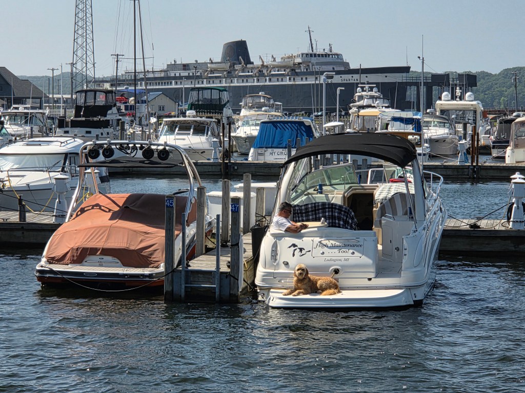
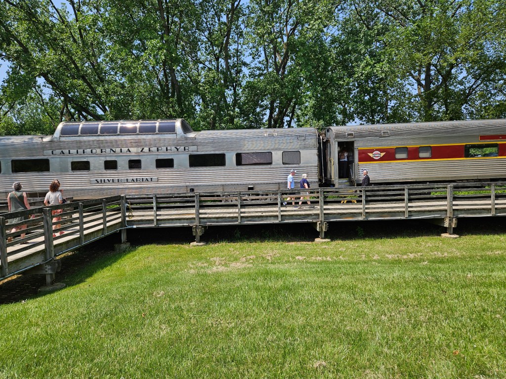
One of the benefits of membership in Escapees, which is an RV club that we are members of, is being able to be part of smaller, regional chapters and to attend rallies. Basically these are just gatherings, large and small, of RV’ers, with various events planned during the rally. We are never in the right place for them, usually.

While we were wintering in Denver last year, though, we discovered that the Rocky Mountain Chapter 2 of Escapees meets once a month at the Golden Corral just down the road from the AirBnb where we were staying. I thought that besides meeting some new folks, we might be able to find some new-to-us Colorado RV’ing spots that we might like to check out whenever we want a break from Denver. We went to a couple of meetings and discovered that their first rally we could go to was in…Gering, Nebraska.

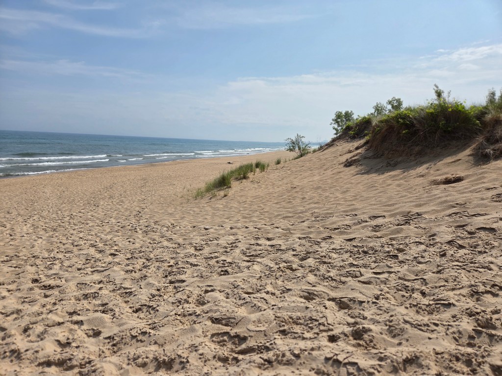
Surprisingly, Gering is only 200 miles from Denver. And it sits in the shadow of beautiful Scotts Bluff, which in the 1800’s was a main stopping point for travelers heading West. Our RV park was in view of the bluffs. We could catch the changing mood of the rocks, whether at sunset or sunrise or sitting under storm clouds.

Scotts Bluff National Monument was the first excursion our group took together. We listened to a ranger talk, watched a movie, and then were turned loose to go explore. The covered wagons lined up in the picture below are all sitting on the former Oregon Trail.

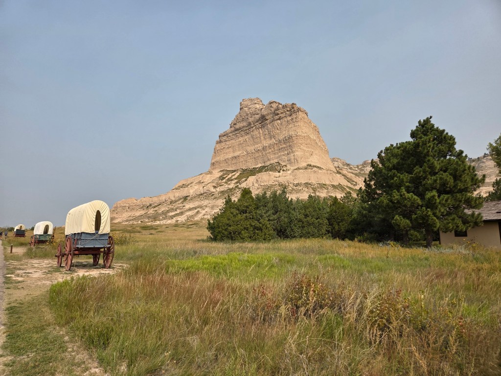
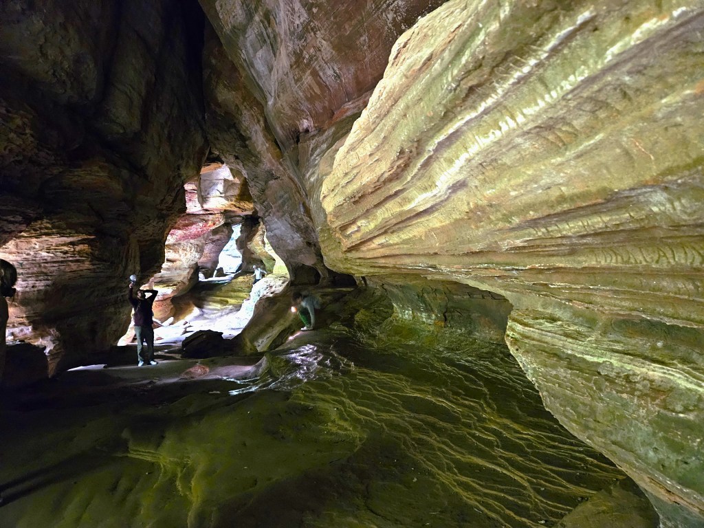
The bluff is a series of striking rock formations. The pioneers in their day would not have seen the view from the top. We were able to do it simply by driving up to the top on the road that now exists for us.

Scotts Bluff was important for them because it was a measure of progress after weeks of seeing nothing but prairie grass. On the Oregon Trail, a third of the journey now lay behind them. They had been hard-won miles of disease, unpredictable weather, flood, and bison stampedes. It was called “a Nebraska Gibraltar”.

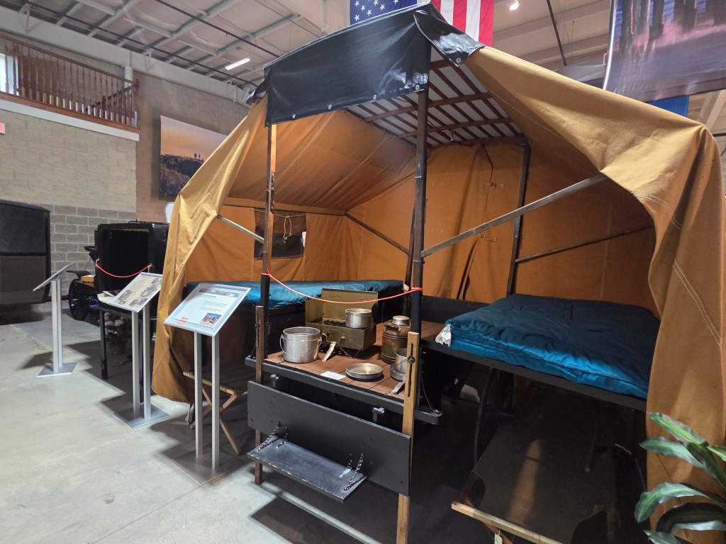
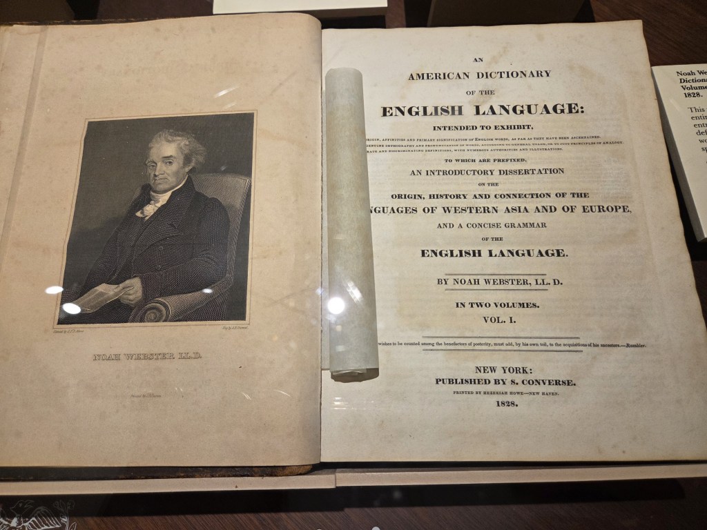
The Legacy of the Plains Museum is close to Scottsbluff and later we took a quick visit before closing time.

Looking at a fully loaded wagon is a sobering reminder of just how small they are.

Of course, John Deere tractors were not seen on the plains until many years later. In an alternate life, Cal envisions himself driving one.

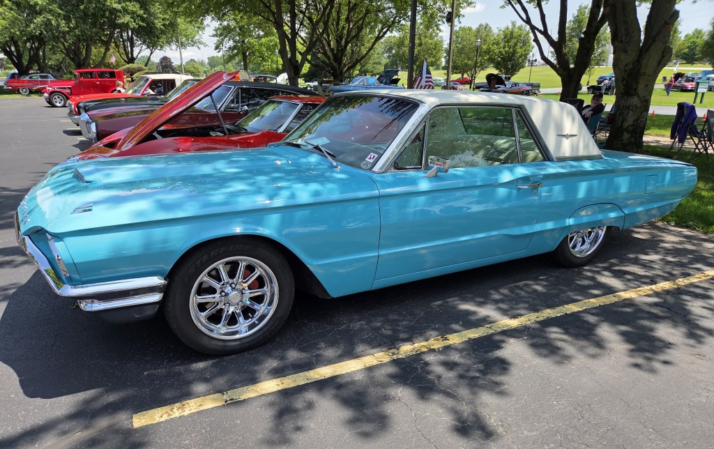
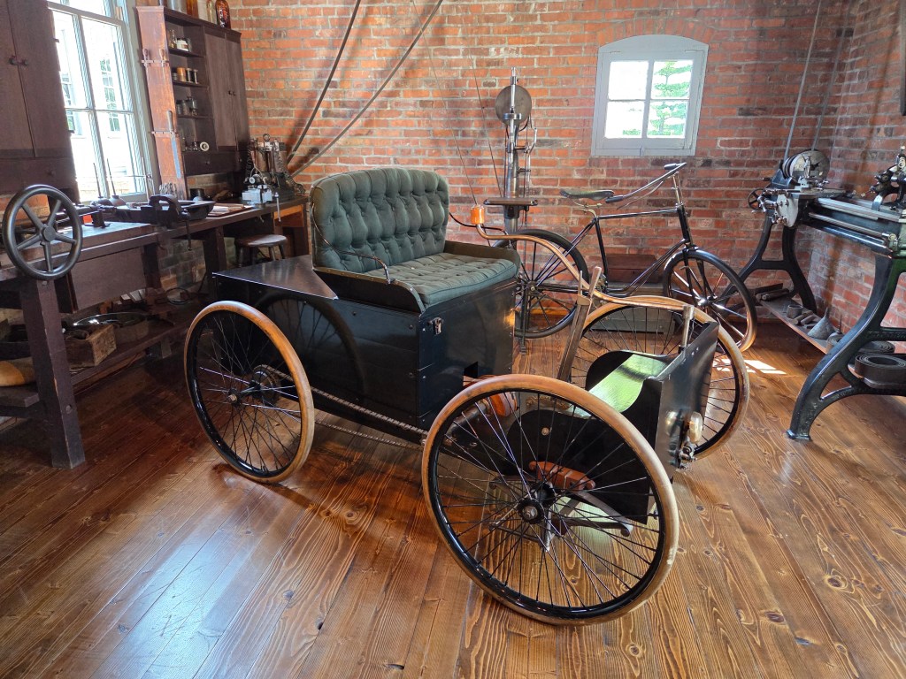
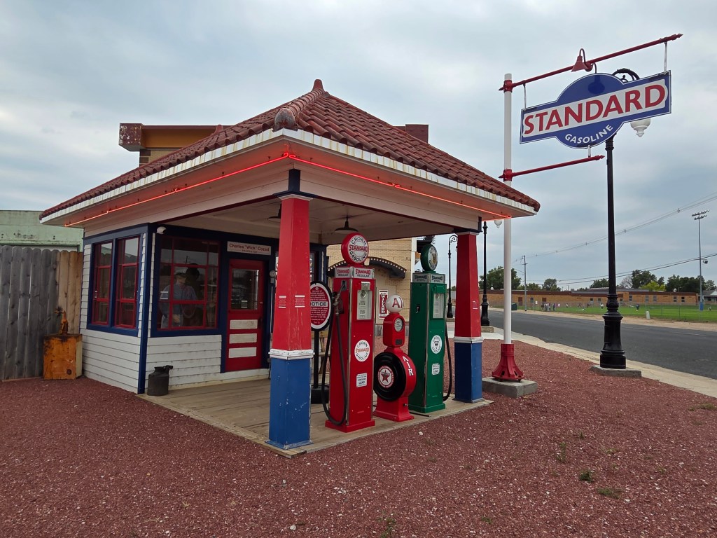
A very different experience was next on the rally agenda. We visited Cozad’s Antique Ford Garage. All of this is the work of one man, Tom Cozad, who has a special passion for both Fords and Coca Cola. So much so, that he bought up the whole block.

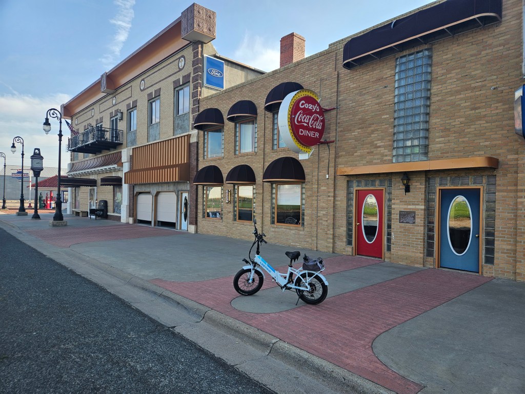
Oh, and there’s a gas station too.

Around the corner is Tom’s sign shop, the business that he owns. The rest is all a hobby.

Only one of several restored antique Fords

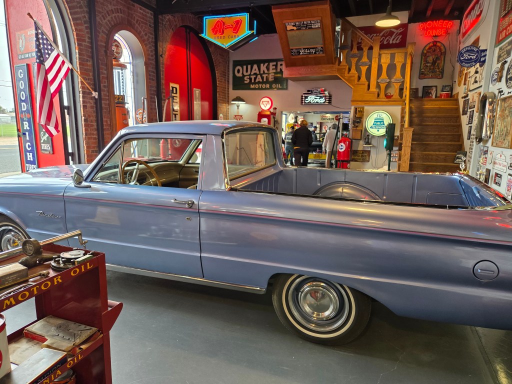
Besides the cars and Ford displays, there are several rooms of Coca Cola memorabilia, a small theatre with old theatre seats and a big screen TV, a tiny antique barbershop, fully equipped, and all on two levels.

When I first saw this on the rally agenda, I was not sure that I would find it interesting. But it was, very much so, since there was so much to look at. I just couldn’t believe he collected all this stuff singlehandedly!

Unfortunately, Mr. Cozad does not keep regular hours, is not open to the general public, and only does this by word of mouth. He accepts no entrance fees, only cash contributions which he then donates to charity.

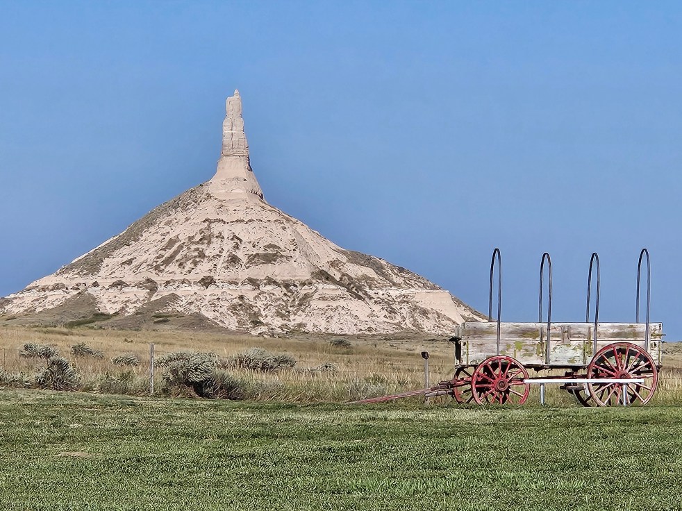
What I liked about the rally is that we could join in on as much or as little as we liked, with plenty of time to do things on our own. On another morning we rose early to visit Chimney Rock.

This rock, along with Courthouse and Jailhouse Rocks, were actually what the pioneers saw first when coming from the east. It let them know they were not far from Scotts Bluff. Chimney Rock is a state park and in the visitors center there are more exhibits about the pioneer story.

I was really more interested in reading about the rock, but I did get this information about the trails west: the graves of 20,000 people line those trails. This is no surprise. But then there is this: a half million people traveled on them. So, more than 90% of travelers made it to their destination.

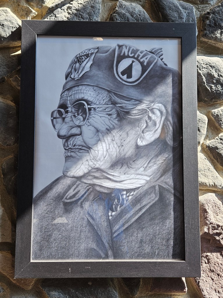
We hiked the mile-long trail behind the visitor center toward Chimney Rock. There was a small graveyard in the bluff close to the rock. The graves were mostly post-1900, but there was this memorial stone:

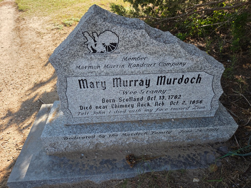
Mary’s son John converted to the Mormon faith in the United States, returned to Scotland, and converted the rest of his family. Mary, whose husband had already died in a mining accident, made the trip from Scotland at age 67 to join her son and his family in Utah. She died in her sleep, though, and is buried somewhere out on the trail. She was part of a group of Mormon immigrants who were pushing carts on the trail for lack of wagons.

Chimney Rock itself is not as the pioneers saw it. The rock has a sandstone cap, which protects it, but it is still eroding. Early travelers were sure it would have fallen over by now. Who knows how much longer it will stand?

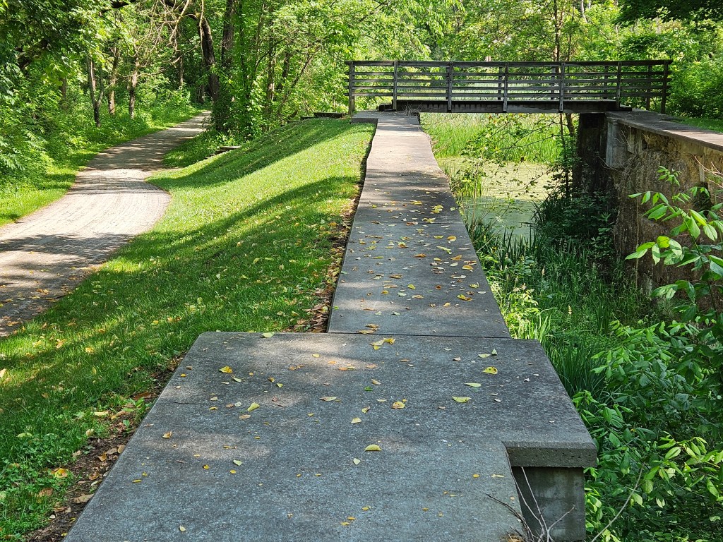
Robidoux RV Park, where our rally gathered, has nice wide sites and belongs to the city of Gering. We could ride our bikes into the small town or out into the countryside along a pretty little canal. After breakfast at a local restaurant, we were able to walk across the historic downtown area over to Tom Cozad’s museum. We enjoyed the small-town environment here.

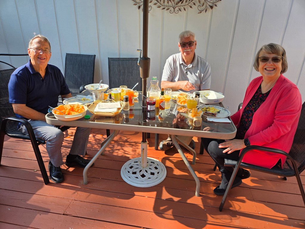
In between the sightseeing, we joined other rally members for dinner every night. All 26 of us overloaded the kitchen at the golf course one evening. Other meals were potluck or covered by the rally planners. A couple of mornings I joined some other women in the clubhouse to work on our crafts and chat for an hour or so. Those interested could do a scavenger hunt, watch the Sunday afternoon Broncos game together, or play golf.

The rally was fun and if time allows we’ll be back for another in a different location next year. And who knows, maybe we’ll visit Gering again? We liked the RV park and here are still things to see that we didn’t do.

Back here in Denver, we are getting excited for a month-long international trip, leaving in just a few days. It will be at least that amount of time before I post again.

USTravel

Boating and Biking in Bayfield, WI

Subscribe to continue reading

Subscribe to get access to the rest of this post and other subscriber-only content.

USTravel

Twenty-four Hours in Isle Royale National Park, Michigan

This national park is included on a list of the top six least-visited national parks. It’s not for lack of beauty, but simply because they are all hard to get to. Isle Royale sits in the middle of Lake Superior, 55 miles as the crow flies from Copper Harbor in Michigan. I’ve always had my eye on Isle Royale, though, and finally we had our opportunity to go. It was part of the reason we were staying in the Keweenaw Peninsula of Michigan’s Upper Peninsula.

We were told to be at the harbor at 7AM for an 8AM departure on the Isle Royal Queen. We would be staying overnight at Rock Harbor Lodge, so we had duffel bags. The ships crew hoisted them onto the boat and we never saw them again until we were in our room at the lodge. Besides us were more people with luggage, large excited groups of backpackers with their stuffed packs, which also got loaded, and a handful of daytrippers.

It was exciting to be on the boat and finally on our way.

Leaving Copper Harbor

The ride is over three hours, plus a wait to get off boarded and a talk by the park rangers before being turned loose. I’m not sure if its worth it to just come for the day. The boat leaves Isle Royale at 3PM, and of course you need to be there early again, so for your well-over six hour boat ride, you barely get a couple of hours to explore. That’s good, I guess, if you just want to see it and say you’ve been there.

There’s not a lot to see from the boat. We could see the Keweenaw Peninsula for a long time off in the distance. For an interval of time there was just water. Lake Superior is the largest of all the Great Lakes and the largest freshwater lake in the world by surface area at 31,700 square miles. It also holds 3 quadrillion gallons of water, enough to cover North and South America with a foot of water. There have been over 350 shipwrecks on the lake, and its cold water has preserved them for divers. The number of shipwrecks is why there are so many lighthouses.

Finally, Isle Royale in view!

The two buildings on the left are the lodges; the one on the right is a guest house and the only place to pick up the Internet.

We arrived in Rock Harbor, which is on the northeast side of the island. The only other settlement is Windigo, which is on the southwest side and serves the boats coming from Minnesota. It takes five hours to ride a boat from one end to the other; the distance is 45 miles. It takes a backpacker 4 or 5 days to reach Windigo.

Rock Harbor would be our center of life for the next day; if we wanted to leave the area, there were only hiking trails that led into the interior.

At first, we needed a map to get around. Signboards were very helpful. There’s no internet here! By the time we left we knew pretty well what was where.

The dining building is a restaurant on one side and a fast-food place called the Grill on the other. After lunch at the Grill, we went out for a hike as our room was not yet ready. We chose the Stoll Memorial Trail, seen on the bottom right of the map. After a half hour, Cal declared that he was done and wanted to turn around. The day was warm, the sun was bright, and his hat was in his luggage. I had no thought of turning around and kept going.

What a beautiful, untrammeled place, all quiet save for birdsong.

At some point in my hike, I passed a sign that stated I was now in wilderness, and past the Park Service’s maintenance. Wilderness? When in my life have I ever been in true wilderness? Perhaps somewhere in the Rockies? I pondered that as I walked.

There were many wildflowers to enjoy along the way.

I thought it might be nice to get to the tip of the island at Scoville Point, but it isn’t the tip. Blake Point is. But Scoville was good enough, and it felt wonderful to sit and enjoy the day when I reached it.

On the way back I chose a different trail, and this took me to Smithwick Mine. It was just a hole in the ground, but a man named Smithwick tried mining copper for a couple of years. It wasn’t profitable.

Large mammals live on the island (but no bears). It is assumed that they crossed over to the island during winters when the lake was frozen. But how did the Isle Royale red squirrel get here? It’s not known, but they’ve been here so long, they are considered to be their own subspecies. They are smaller and make different sounds than the ones we are familiar with. I wasn’t lucky enough to see a moose, but I was excited to see a squirrel at the Smithwick Mine ruins.

After my hike our room was ready. It was very basic, but did have a large picture window where we could look out at the lake.

We dined on fish in the restaurant and took a post-dinner stroll to Tobin Lake. It is where people land if they arrive by airboat. It was still bright day as the sun sets late here.

We fell asleep while enjoying the view in our room with the windows open. It was still light out at 10 PM, which is when I took the picture below. I woke up later and could see stars as well as the Milky Way. Windows still open, I was lulled back to sleep by the sound of the waves.

In the morning, we hiked in the other direction after breakfast and admired a duck with no less than 23 fuzzy ducklings. We stopped to look at Suzy’s Cave. It was a shallow cave, probably hollowed out by the lake at one time.

We hung out on the beach for a little bit:

Lake Superior showed us the capriciousness of her weather. While the previous day had been sunny and warm, this day was overcast and cool. Cal reminded me of the weather forecast: it was due to rain, so we came back to the harbor at a pretty good clip.

In a place as remote as Isle Royale, everybody becomes your friend and we talked to many people. There was the couple on the boat going over who were going backpacking for 5 days. We swapped hiking and traveling stories, which made the trip pass quickly. Our server at dinner in the restaurant was an Ecuadorian law student who was eager to chat; he’d worked at Isle Royale several summers.

But the couple who stood out for me were the folks we shared a table with in the lunch area for two hours while it poured rain outside. They’ve been on a mission to see every single one of the main 63 National Parks in the system. Isle Royale was number 61. That includes Samoa, the US Virgin Islands, and all of the parks in Alaska except for the two they have left to go. The husband started showing their pictures: the fat bears catching salmon in Alaska, the peaks of Denali. Then he moved on to their other adventures: animals on safari in Africa (Tanzania and Kenya are better than South Africa, if you ever want to go), penguins in Antartica, Machu Pichu, Easter Island, the list went on. I have never in my life met such a well-traveled yet totally unassuming couple, and they were fascinating.

On the way back, we sat with a woman who had solo backpacked on the island for five days. The weather had been beautiful. She showed us pictures of the animals she’d seen: a family of otters, a moose with baby, and a fox. She bested my mama duck with the 23 ducklings by showing me a picture of a loon mama with 32 chicks, including one on her back. I thought that I would have liked to have seen all of that, but I decided that at this point in my life I wouldn’t want to spend five days in the wilderness to do it.

These peoples’ stories, plus our own, have all been wrapped up in the memory of our time here. It was special and unique and not something I will quickly forget.

Next time: a visit to Bayfield, Wisconsin

USTravel

Up North in Michigan’s Upper Peninsula

In an era of our lives, the Upper Peninsula of Michigan (the “UP”) is a place that used to be pretty familiar for us. My Mom lived in Saginaw, Michigan. Cal’s Mom lived in Duluth, Minnesota. Traveling Route 2 was our highway in between and was always an occasion for stopping to see Michigan’s delights.

What could we visit that we hadn’t already seen?

The only thing we had previously done in Munising was the Pictured Rocks Boat Tour. Ages ago, it had been a day trip for us from elsewhere in the UP, so it was decided to spend time here. Since we had seen Pictured Rocks from a boat, I wanted to see it from the shore.

Our biggest hike here was to Mosquito Falls. True to its name, the bugs were out, and we had to resort to using insect repellent. All was fine after that. We were rewarded with gorgeous forest with green glowing ferns, pink lady slipper flowers, and huge fungi as big as plates.

A day-glo-green fern forest

And, pretty interesting, an old dead tree full of woodpecker holes.

The Mosquito River, as we’d seen elsewhere, had a Coca-Cola color from tree tannin. This is Mosquito Falls…

…and this is Mosquito Falls, too.

There was a dramatic difference where the river met the sea – Lake Superior, that is.

We sat on Superior’s shore, watched a loon play in the water, and munched on granola bars while fog settled in over the rocky shoreline. And life was pretty fine.

The full name of Pictured Rocks is Pictured Rocks National Lakeshore. That meant that I could stamp my National Parks book. The park is long and narrow and hugs the shoreline, so a visitor drives in and out of it while seeing the sights.

Our first day’s hike was about 4.7 miles, and we nowhere near matched that afterwards. On another day we visited Miner’s Castle which is nicely set up for tourists. It is the only place where one can drive to a cliff overlook. The trail was mostly paved, and we went to three different viewing platforms for great views of the lake.

Miners Castle

If you look closely at the picture above, there seems to be a little platform to the right of the rock formation on the top left. For millennia, there was another formation there, but it collapsed in 2006.

More dramatic sandstone cliff views are to be seen on the opposite shore.

Miners Castle has a Miners Falls to match. It’s about 50 feet tall.

Continuing the Miners theme, Miners Pasties is the place to eat if you want to try pasties. Beginning in Mackinac City, we had seen signs for pasties everywhere. We’ve had them before in the pre-Internet era. This time, if I was going to eat a pastie, I wanted to be sure it would be a good one. Miners Pasties lived up to its reputation. The “yooper” – actually a name for people who live in the UP – is the traditional beef and vegetable. Their carrot cake is also recommended, so we purchased one piece to share and take home.

How good was it all? So good, we went back the next day and tried another pastie – chicken, this time, to go – and also this time I took a picture. For some reason I couldn’t finish it, and had to save half for the next day’s lunch. And then I really was done with pasties.

A Miners Pasties chicken pastie

The whole UP area was once full of mines – iron and copper, mainly. Many of the miners immigrated from the Cornwall area of England, where they had also mined for a living. The food was popular for these folks, as it could easily be tucked into a lunch box.

If you are hungry for steak and are feeling a little spendy, dinner at Foggy’s is also good. We got this recommendation from someone way back in Mackinac City. They have a huge grill that you walk by as you find your table, and you can even grill your own steak if you think you can do it better. Anyway, we opted to split a steak, and there was even enough to take home.

I had a morning where I walked about in Munising, and I needed to go to the Post Office. It is one of those old classic styles with artwork over the Postmaster’s door. I’ve seen one of these before, and now I look for them. In Munising, it is this:

It is a plaster sculpture titled “Chippewa Legend” done by Hugo Robus and, like the others, is from the New Deal era. I love all the detailed animals in it.

After a few days in Munising we moved on to the Keweenaw Peninsula, which is a 60-mile finger of land that sticks up into Lake Superior. I didn’t know this when we visited, but it is actually an island. The Portage Canal divides the peninsula, and a bridge across the cities of Houghton and Hancock took us further north. Our park was in the town of Lac La Belle, which really wasn’t a town at all.

Driving up to the Keweenaw, we had the most awesome spot for a picnic overlooking a small lake. The road often hugged the shoreline, winding through picturesque resort towns.

Native Americans who once lived here mined for copper. When modern prospectors arrived in the 1840’s, they used the ancient mining pits to establish copper mines, and the area was settled. The Delaware Copper Mine operated from 1847 to 1887 and it wasn’t far from where we were parked, so we went for a visit.

We could see what was once an above-ground native copper pit. I loved looking down and imagining them at work.

The copper mine was self-guiding. We could actually walk down into it all by ourselves after listening to a safety briefing and receiving helmets. The lights weren’t even on yet. I thought they were motion-detecting lights, but no. When we were all the way down at the bottom, I was very glad that there was another couple at the top that we could yell up to to get them turned on.

Helpful signs along the way told us what we were seeing.

According to the sign, this is a “stope” where a vein of copper was mined

Michigan native copper is reputed to be some of the purest on the planet. From the mid-1800’s into the 1900’s, two-thirds of the world’s copper came from here. The Delaware Mine was never profitable, but others were.

Outside, nature is reclaiming the decaying mine buildings.

There are other mines, historic buildings, and a ghost town to be seen in the Peninsula, but our next stop was at the Eagle Harbor Lighthouse. You may be able to tell by now that I like lighthouses.

Today’s picnic was on the shore of Lake Superior within view of the lighthouse.

When the copper miners first arrived, transportation and business were done almost completely by boat. Lake Superior was a hub for settlers and supplies as well as all the copper and timber being produced. The lake’s weather is unpredictable, so ships needed the lighthouses for navigational assistance. A lighthouse was built here in 1851, destroyed by harsh weather, and Eagle Harbor lighthouse replaced it in 1871.

The cheerful kitchen in the lighthouse looked like a welcoming place.

I found something interesting here: a traveling library. Lighthouse keepers eagerly awaited the boats bearing their supplies. There were many boxes containing libraries that were swapped back and forth between all the lighthouses. The boxes were numbered, contents catalogued, and a log was kept of where each box had been. Life here was very isolated, so I’m sure each box was eagerly awaited to get through a cold Superior winter. The picture isn’t good with a bad glare, but you can get an idea of what a box looked like.

The view of the harbor here is so beautiful and if you look closely, you may be able to see an eagle in a tree.

The lighthouse had many outbuildings, each of which is now a little museum with various aspects of Eagle Harbor’s history.

On to one of the most important stops of the day: the Jampot. The monks of Poorrock Abbey make preserves from many kinds of fruit, plus muffins, cookies, fruitcakes, and all sorts of other delectable delights. We almost didn’t go in because of the line out the door, but that is because not many people can fit into the little shop at once.

And of course, this being the UP, there is a waterfall next door.

We made two trips in to the little town of Copper Harbor. One of them was for a very big reason, which you shall see in the next post.

Next time: visiting one of the least-visited National Parks

USTravel

Summering on the Great Lakes

What is so quintessentially summer as being on a beach? We spent a few days exploring the small resort towns of Pentwater, Ludington and Mackinac City on Lakes Michigan and Huron.

I would never have heard of Pentwater, or thought to spend time there, if I hadn’t heard of it from my blogger friend Betty of chambersontheroad.com. She and her family have camped at Mears State Park for years, and now enjoy Hill and Hollow RV park with their trailer. Every summer I can look forward to at least a couple of blogs about Pentwater.

Downtown Pentwater is small, and the whole town is easily walkable. We spent our Saturday morning browsing the farmers market. It was still too early in the season to find either cherries or vegetables, though, so it was more of a craft market. I was in “birthday shopping” mode, and had some success with that there and with all the shops in town. The main street opens up onto a harbor, which is Lake Pentwater.

A channel was built from Lake Michigan in the 1800’s that connects the lake to Lake Michigan. A walkway on the channel goes out to the larger lake, and this made for a lovely stroll.

A beautiful statue graces the beginning of the channel walk, and from here one can look back on the town. If you were standing here before 1856, you would be looking at a swampy patch, the end of a stream of water that came from Lake Michigan. Charles Mears, a lumber baron, drained the swamp. He created the channel and released the “pent-up” water from the larger lake, and Lake Pentwater was born.

The existence of the channel enabled Pentwater to become a busy port town well into the early 1900’s. When the lumber industry declined, the channel became perfect for pleasure boating.

The beach that butts up to the the pier is Mears State Park. One can just walk in for free or drive in for the cost of a day pass.

If a picnicker doesn’t want to negotiate the sand – or can’t – this table is thoughtfully picnic-ready!

The sun sets beautifully on Lake Michigan, so one evening we came in to just watch the show. We were then approaching the summer solstice, so it didn’t set until 9:30. People were still swimming in the water. Ah….summertime.

Another Lake Michigan town, Ludington, lies fifteen miles up the road from Pentwater. Here is where we made a shopping run for groceries and Wal-Mart, plus an excellent pizza lunch at Mancino’s. But what we enjoyed most was a stroll at Waterfront Park, where many sculptures graced the path.

“The Seafarer”, which is a depiction of a real-life gentleman by name of Charles Conrad, pays homage to all those who have made a life on the sea.

I told Cal this is a good depiction of he and our grandson Teddy, if and when he ever takes him fishing.

At first, when I saw the Great Lakes boat “The Spartan” behind all the smaller boats in the marina, I thought it was the ferry boat that our oldest and their family rode across Lake Michigan from Wisconsin last year.

But no, this is not the Lake Express High-Speed ferry that leaves from Milwaukee and goes to Muskegon, MI. It is a twin of the Badger, a historic, coal-fired steamer which is a slower ride and goes from Manitowoc, Mi to Ludington. They were launched between 1952 and 1953, and built to haul railroad cars across the lake. When rail traffic declined, the Badger was converted to a car ferry. The Spartan is only used now for the Badger’s spare parts.

It was while we were staying near Pentwater that we were contacted by an old friend of ours, Mike. He’d seen Cal’s posts of our travels on Facebook and wondered if we would be anywhere near Hesperia, MI on that Saturday. He was having an open house at the family cabin. We looked it up, discovered it was only 30 miles away, and made a spontaneous decision to go. Everything inside the cabin has been brought up to the 2020’s and he spared no expense renovating it beautifully. Next, he wants to finish the exterior of the cabin.

Mike and Cal worked in the same office in our Germany years, and his sons were our daughters’ ages so they played together. Mike’s Mom, Marcia, nannied for the family, and she and I became friends. Back in the states, I visited her here once. I’m not sure if the cabin even had electricity or plumbing, but she loved to cook and bake. This visit brought back a lot of memories, and it was nice to meet Mike’s wife Katja and other members of his family too.

We were a little sad when it was time to leave the Pentwater area. Our site at Hill and Hollow backed up to the woods and we’d had a very relaxing time. A hill rose up directly behind the site and on our last morning a young buck peeked in our back window to say good-bye.

On the way north, we stopped in at Boyne Winery. As you can see, a sign advised us to relax, so we did with a glass of sangria wine.

This was an overnight stop with Harvest Hosts, and will be our last. We do not use the membership enough.

Our last adventure in the “mitten” of Michigan was at the top of the state with a stay in Mackinac City. There was a drive I wanted to take, where we headed back south as far as Petosky State Park. Here, it is said that you can find Petosky stones. I wandered on the beach for quite awhile, because this is where one can find them, but I had no luck.

Pretty much expecting this turn of events, I had purchased a polished Petosky stone in Pentwater. The description tells you what it is.

I also purchased two unpolished ones for next-to-nothing later, but my RV has eaten them. I cannot find them anywhere.

A while ago I read a novel, “Famous in a Small Town” by Viola Shipman. A place in Michigan was featured in this book enticingly enough so that I wanted to visit it. It is the Tunnel of Trees, and it is found on M-119. I had thought it was one small spot, but actually it is a 20-mile scenic drive on a road so small that there aren’t any lane dividers.

I wanted to stop somewhere for a few pictures. There was a small turnout, and as luck would have it, a red bench for us to have our picnic lunch and take in the Lake Michigan view.

Also featured in the book was the Good Hart General Store. The owners were repainting the facade and scaffolding was everywhere so I didn’t take a picture. In the book there was all manner of cherry items for sale, and although we found a couple things for purchase, we were once again too early in the season for cherries. Their frozen pot pies are also reputed to be delicious but we did not buy any.

Our last stop on this day was Wilderness State Park, at the top of Michigan’s northwest shore, where we found a secluded woodsy spot overlooking the beach to just pop out the lawn chairs.

The view of Lake Michigan from our shaded woodsy resting spot

Our final day in Mackinac City was rainy. We set out to explore the two lighthouses nearby, one on each side of the famous Mackinac Bridge. This bridge connects the upper and lower parts of Michigan and crosses the Straits of Mackinac. On one side of the Straits is Lake Michigan. The other is Lake Huron.

McGulpin Point Lighthouse

John McGulpin received this plot of land after retiring from service in the British army. Patrick McGulpin, his son, inherited the land after the Revolutionary war was won, as part of a new treaty. The lighthouse was established in 1869 and was named after the family, as was the Point. The lighthouse was in service for almost forty years. We were able to go inside and see the living space of the lightkeepers who were here.

A path from the lighthouse to the lake took us through the woods and down to the lake. Signboards took us back in time with stories of the lives of all the people who lived here through the ages. A big rock out in the water on Lake Michigan’s shores has history, too. Named McGulpin Rock, it has been used as both a navigational tool since Natives lived here. It also helps measure the cyclical changes in Great Lakes water depth.

We moved on to the Lake Huron side of the bridge too and took a look at Old Mackinac Point Lighthouse. Things are busier and more touristy over here, since it is near Mackinac City. We did not go inside.

We could also view Lake Huron from our immense RV park. An evening stroll took us there. This area included some swings to sit and look out over the lake.

Despite the size and overload of amenities at Mackinaw Mill Campground, we liked our spot here. Once again it was covered on three sides by shrubbery and trees, and there was a huge green space behind the RV. We liked it, that is, until the heavy rains flooded the road (but thank goodness, not our site) on the day we were to leave! Time to go!

Into the mist we drove, on the Mackinac Bridge northward to the Upper Peninsula of Michigan.

Next time – Heading further north to Michigan’s Upper Peninsula

USTravel

A Quick Stop In Northwest Indiana

Our travel journey took us to Elkhart, Indiana. I’ve traveled in, around, and through this state, and even lived in it for a short time or two. There are a couple of places I’ve missed seeing, but I don’t have the fondness for Indiana that I do for Ohio. With that in mind, our stop in Elkhart was only two nights. I had a plan for our one day here, which involved a small museum and a place to have lunch.

I’m generally our trip planner, but Cal surprised me in the morning of our stay by asking me if I wanted to go to Indiana Dunes National Park, some 65 miles away. I wasn’t going to turn that offer down.

The Visitor’s Center was open when we arrived. I stamped my National Park book, watched a video about the park, and purchased a couple postcards. As I was checking out, the cashier – who was also helpful park staff – asked if I needed assistance in planning our time in the park. I told him we were looking for a trail to hike after our long drive, maybe a combination of woods and dunes? What he suggested was absolutely perfect.

I had learned in the video that the park is working hard to restore the woodlands after decades of abuse. It lies in an industrial area, and indeed, we passed the road to a steel mill on our way to the trail. The woodlands are the final result of sand dunes that have been blown out by the wind, forming ponds and marshes first, and then a savanna after the marsh dries.

So, the view in the picture above was an ancient pond which is now a marsh. Lake Michigan would have lapped at my feet eons ago. This process doesn’t happen quickly.

We found West Beach and the Dune Succession Trail easily enough. First, there were boardwalk steps to climb —

–after which we were rewarded by our first view of Lake Michigan and the dunes.

Down into the woods we went–

— and finally, out to the dunes and the lake.

Dipping my feet into the lake was mighty fine.

This had been about a three-mile hike.

Our morning over, we headed back past Elkhart to Middlebury and Das Essenhaus, a restaurant that had been recommended to me by my sister-in-law Heidi. Indeed, I’m not even sure I hadn’t been there before. It’s in Amish country and not too far from Shipshewana, a shopping mecca that I enjoyed with her on a couple of occasions long ago.

This was a late lunch and our appetites were up. When our delectable broasted chicken arrived, we had already inhaled the dinner rolls. We even had pie for dessert because it was too tempting to resist.

Das Essenhaus is huge. A sign up in their hallway stated that they can serve 1,100 guests at once. They have their own bakery store, plus other shops outside of the restaurant. Afterward we purchased more dinner rolls (they are great for lunchtime sandwiches) and other baked goods for the freezer.

They have their own car show every Thursday. It doesn’t start till 4:30, but that didn’t stop folks from setting up several hours early. We had seen plenty of old cars in the drive by in Ohio, but stopped for a quick look.

The Elkhart area is the RV capital of the United States, since most of the big brands are built here. As we drove around, we saw some names we recognized and names of makers of the parts that go inside of them. Early in our planning process, I had hoped to tour the factory that made our Keystone Montana, but we weren’t here on their Tour Day.

Instead, we visited the RV Hall of Fame and Museum. I don’t know who or what is in the Hall of Fame, I just wanted to see the old RV’s. It was a fun stop to end our day.

This is the oldest one, a 1913 Earl, which could go behind a Ford Model T.

A trailer from 1916 made me want to go camping. Out in the woods or mountains somewhere.

It is one of the first manufactured trailers. Most to this point had been homemade.

An RV built for a famous movie star is here, too. It was built in 1931 for Mae West. Paramount built it for her to entice her to make movies for them. It has a small hot plate and an icebox, plus a porch out back to sit and enjoy a fine day. What more could any movie star want?

Moving forward in time, this “Scotty” trailer was manufactured in the late 1950’s. It just looks so cozy.

Mobile homes are here, too. Cal lived in one for many years as a child, so I asked him if this looked familiar. He was very young then, so didn’t remember.

There wermotorhomes and many varieties of trailers and campers, as well as park models – the ones that go into RV parks and don’t move. It wasn’t until we left that I realized – why were there no 5th wheels, like our RV? I didn’t think to ask until after we left. This RV may look a little bit like one, but it is really a trailer.

The RV I like best, however, is our own, and that’s the one we go home to after all our adventures on the road.

Next time – north to Michigan

USTravel

Around and Near (but not in) Toledo and Detroit

Maumee Bay State Park is a grand place to stay for a few days. Here’s a picture of Cal enjoying the site.

It’s the only picture I took, and it doesn’t show how our site was buffered on the left and right by trees and shrubs for complete privacy. It was always especially fine to come home to this spot after being out.

Maumee Bay is on Lake Erie just east of Toledo. As nice as this spot was, we left it for two nights to visit my brother Marcus and his wife Heidi. They live on the west side of Toledo, in Sylvania on the Ohio-Michigan border.

They have a lovely patio full of beautiful flowers and plants. It’s a great spot to look out and enjoy watching all of the varied birds that stop by their multiple feeders. Can you spot the two tiny yellow finches?

On our first morning at their house, we enjoyed a delicious breakfast on their patio.

Father’s Day was particularly special with the arrival of their daughter Rebecca, son-in-law Cyril, and their two sons.

They went out of their way to make sure all of the Dads were properly feted with a grilled hamburger cookout, cards and gifts.

All the partying and fun over, we set out to the Detroit suburb of Dearborn, Michigan for a day at Greenfield Village. Henry Ford himself assembled this open-air museum full of the homes, shops and workplaces of famous (and not so famous) Americans.

Here I am standing on the porch of the house that Ford grew up in. A road construction project threatened to destroy his birth home in 1919. Rather than see it destroyed, he moved and restored it to the way it looked about the time that his mother passed.

Ford’s inventive beginnings go back to his work on the new idea he had – a “quadricycle” constructed in a shed behind the duplex he and his wife were renting. It was completed in 1896. This shed is reconstructed, with some bricks from the original shed included.

There were two failed attempts at starting a business but finally, in 1903, Ford founded the Ford Motor Company.

When Ford made his money, he began collecting. This idea had its roots in his relocation of his birth house. He liked those things that represented American ingenuity and inventiveness. And so, Orville and Wilbur Wright’s house is here, too, along with their bicycle shop. In the back, they were building their first airplane to be flown at Kitty Hawk.

Ford didn’t stop with the Wright Brothers. A visitor can see a replica of Thomas Edison’s Menlo Park laboratory. The homes of Robert Frost and Luther Burbank and the George W. Carver cabin, slave cabins, and other homes of people I knew and didn’t know have been moved to Greenfield Village. A few are reconstructions. And not just homes and workplaces, but craftsman shops and working farms, too. It takes all day to see the village, and it feels like a step back in time.

Folks can go for a ride in a Ford Model T, and seeing these around town added to the feeling of being in another era, if only for a day.

One of my personal favorites was the Noah Webster home. Webster completed the American Dictionary of the English Language in 1828 while living here.

The book is on display:

What I did not know before this is that it was Webster himself, by publishing his dictionary, who differentiated American English from British. He is why we have words like “color” instead of “colour”, “theater” instead of “theatre”, “magic” instead of “magick”. He added very American words such as “tomahawk”. There are 70,000 words in it, 12,000 more words in his dictionary than had been in any dictionary to this time. And here’s one for your next trivia night: it was the last dictionary written by one person.

We lunched at Eagle Tavern, the same building that was run by Calvin Wood in the 1850’s. The selections on the menu are from recipes and food that was available in that day. I had dumplings with cooked vegetables and a “cherry effervescent” to drink, which was listed as a “temperance beverage”. We had a lit candle on our table; it was a little dark inside even at lunchtime.

One last favorite of mine to show you is a home and outbuildings from the Cotswold area of England that Ford had dismantled and reconstructed here. It was originally built in the early 1600’s and lived in until the mid 1850’s. The only thing missing for me is the thatched roof and honestly, not all of them had them. I suppose a thatched roof would have required a lot of maintenance.

The stone walls are hiding the beautiful flower garden that is also here.

Just outside of Greenfield Village is the Henry Ford Museum, which is a fascinating place in itself. We’ve been there, so we skipped it. We would have had to pass on some of the Village in order to visit all of that in a day.

So, back to our life back in Maumee Bay…

On our first morning, we had errands to run. As we drove up to the Verizon store, we noticed vintage cars coming towards us. Business complete (I got a new phone!), we stepped out and noticed they were still coming. Cal needed a haircut, and I had brought things to do to sit in the truck while I waited. I did not need to do those things, because the parade of cars and pickup trucks kept going the entire time he was in there.

Later, I found out that there were over 200 of them making their way to a car show. The hotels in town had all been full the night before.

We took a bike ride on our last day to explore the park. Just outside of it, we saw an Ohio city sign. I remember these sitting just inside every town when I was growing up, but there aren’t many of them around any more.

Thanks to Google, I found a little history on the two men noted on the sign. Peter was a noted French settler here and built a cabin in 1807. He He and his brothers saw active duty in the war of 1812, although he was not on the enlistment rolls. He traded with the local Indians and could speak their dialect. Autokee was known for his honesty, friendliness, and for being the last Ottawa chief in the Maumee Valley.

Our bike trail ended at the water where we could see Maumee Bay opening up onto Lake Erie.

We rode past a pretty lighthouse, but it was privately owned so we couldn’t get closer.

And we also rode past two little skunk babies sitting on the edge of the trail. I really wanted to stop and take a picture because they were so cute. I was fairly certain Mama was in the grass nearby, though, so I didn’t stop.

We went back to my brother’s house on our last night in town. His two granddaughters, Eliza and Emilynn, had just flown in from Hawaii, accompanied by their other grandmother Joy. The next day Rebecca and her family were set to leave for France to visit Cyril’s parents. Dinner was a celebration of comings and goings.

Tuna salad for dinner!

Growing up, tuna macaroni salad was something my mother made in the summer time. It may be a midwest throw-back to the 1960’s, but I still enjoy it and make it for Cal and I on our travel days. It’s nice to have something just to pull out of the refrigerator and eat. I was delighted that Marcus and Heidi enjoy this dish too, as well as their whole family, and they made it for supper. Heidi even made a smaller dish without onions, just for me!

Next time – a day in northwest Indiana

USTravel

Back to Ohio – Cleveland and Cuyahoga

It’s only a 58 mile drive from Lake Pymatuning, PA to Streetsboro, OH. That was one of our shorter moves. While moving day was full of sunshine and warmth, the next day was full of rain. We were here for many reasons, one of them being Cuyahoga National Park. A visitor center is always a good place to start, so we headed out in the pouring rain to Boston Mill Visitor Center.

This national park is distinct in that it sits in an urban area between the cities of Cleveland and Akron. It’s long and narrow, running north to south. I was surprised to hear that the park turned 50 recently. Gerald Ford signed it into existence in 1974 as a National Recreation Area. It only became a national park in 2000.

I did not think the person behind the desk was all that helpful. I had heard that you can put your bikes on a train that runs through the park, but I discovered that the train is a separate concession. She pushed a train schedule at me, and a map of the route, but I couldn’t take either one with me. I took pictures of them and we figured out a plan on our own.

Two days later, when the rain was finally finished, we were at the Brecksville Station. On the park map, it is shown as “Station Road Bridge”, and nearby is the Brecksville Nature Center. We waited hopefully with our bikes…and waited…no train. I finally did what I should’ve done in the beginning, and looked it up online. That’s what everyone really wants you to do in 2025. The train doesn’t run on Tuesdays, the very day we were there.

No worries, we rode on the Ohio-Erie Canal towpath nearby and although we were a shade disappointed that the bikes didn’t get to ride a train, we had a great bike ride. First, we had to cross the 100-mile Cuyahoga River, the centerpiece of the park.

After we crossed the bridge, we swung southward, and the old canal was on our left. The bike trail goes along the old tow path. Signboards told us what we were seeing, which necessitated a lot of stops. The theme of the board on this particular stop is that nature is slowly reclaiming the canal. Sometimes it is totally grown over, and sometimes there is still water in it.

The canal was constructed during the 1820’s and 30’s, and saw heavy usage right away. It carried freight traffic until 1861, when railroads were built. Until 1913, it was a source of water for nearby towns and industries. It began a slow decline in the late 1800’s, and then the flood of 1913 happened. The canal was mostly wiped out. This must have been a huge flood. I first learned about it when we had been in Dayton. There, a whole museum building in Carillon Park was dedicated to the flood and its aftermath in that city.

The signboards told of industry activity on the canal, families growing up nearby and using the canal for skating in the winter, portions where there was danger from thieves and bandits. Settlements such as Boston and Peninsula became flourishing towns.

A part of the National Park area in Boston, Ohio

Riding the towpath is an enjoyable way to experience the park.

We returned the next day to ride the train. This is not just a cute little excursion train. It is a full size antique passenger train cobbled together from old train cars from across the United States. This is an old resurrected California Zephyr observation car that ran between 1949 and 1970. It had been put behind a passenger train of unknown-to-me origin.

Our seats were in one of the “coach” cars that you see on the right of the picture above. We explored the train–ok, I admit, we were looking for the concession car– and walked through first-class cars that had been lovingly restored to the glamour of the 50’s and 60’s. We rode the train to its northern terminus at Rockside, and then back down to where our truck was sitting in Peninsula. If we’d had our bikes, the porters would have put them in the baggage car and taken them down again for us.

Before riding the train, we explored a couple of Cuyahoga Valley’s waterfalls. Driving through the park and trying to find things isn’t the easiest thing to do. The park’s boundries go in and out of suburbia and also Cleveland Metroparks, and signage isn’t always the best. We couldn’t find Great Falls of Tinker’s Creek, and spoke with another tourist at Bridal Veil Falls who couldn’t find it either. But Bridal Veil was beautiful.

At Tinkers Creek Gorge overlook, the full beauty of the national park is in view.

Brandywine Falls is the showpiece of the park.

I mentioned at the beginning that we’d had two full-on days of rain. On the first rainy afternoon, we had visitors.

Kevin and Diana arrived with Lithuanian kugelis, which is a potato and egg “pudding” – like an egg dish – and roses from their garden.

Diana and I were classmates when I lived in the Cleveland suburb of Euclid. We went to school together from grades one through four, and were pen pals for many years after I moved away. Now, though, we communicate by texting. She and Kevin drove from their home in Fairport Harbor just to see us. The rainy afternoon flew by and we ended up having the kugelis for supper.

Aren’t the roses beautiful? They really brightened up our RV for a few days. Even the two tiny buds bloomed.

I’ve seen Diana off and on through the years we’ve been friends, but mostly in our younger days. Whenever we do get together, though, it always feels like yesterday since I’ve seen her. There is always so much to catch up on.

We were a bit torn on what to do during the next rainy day, but in the end we drove up to Cleveland to visit the Rock and Roll Hall of Fame. This was a fun stop!

Exhibits took us through the genre’s history, from before we were born and when we were children. Music blared and most of it was songs we’d remembered and liked. Original music, costumes, and other memorabilia were highlighted for many artists.

There was sheet music and boots from Carole King and Bob Dylan’s harmonica. Guitars from Earth, Wind and Fire and the Doobie Brothers. A couple of Cher’s and Rod Stewart’s costumes, and the list goes on.

There is a whole room dedicated to the Beatles.

It’s a little bit funny to think Elton wore these things.

Pink Floyd’s “The Wall” was a favorite of Cal’s back in the day. The Wall actually exists and it is here.

In the early era of rock and roll, those in authority were sure that the music was leading teenagers down the path of destruction. I liked what John Lennon had to say about it.

The heart of rock and roll is still beating…in Cleveland.

As we stepped out of the museum, the rain was letting up, and we decided to walk into downtown Cleveland for lunch. The Winking Lizard had the best salad I have had in a long time. They called it the Blueberry Salad, but there was more fruit in it than just blueberries, plus feta cheese, and sliced steak that came out sizzling hot. So delicious! On the way to the restaurant, an orchestra was playing:

For several years of my early elementary-school childhood, I lived on Lake Erie, and its beaches were my playground. Because of that, I feel a particular affinity to this lake. We walked up to it after lunch, but by then, we were back to full rainshowers.

The William Mather is Cleveland’s Great Lakes museum ship

Goodbye, Cleveland. Perhaps we’ll return on a sunnier day.

Next time – a bi-state visit

USTravel

Fallingwater and Ohiopyle,Pennsylvania

We drove 200 miles to see a house.

Not just any house, though. Fallingwater is one of the finest from Frank Lloyd Wright, the famous architect. It lies in the Laurel Highlands of southwestern Pennsylvania and about 70 miles south of Pittsburgh.

A picture like this first drew me to the house. The steps go right down into the stream from the living room! I can imagine sitting on those steps in the morning with a hot cup of tea, or dipping my toes in the stream on a hot day. That is also a spring-fed pool on the right.

Edward Kaufmann was the owner of Pittsburgh’s finest and largest department store. He had a wife and one son, and they enjoyed coming to these hills for vacations. The site originally was a summer camp and he would bring employees out by train. Edward and his wife contracted with Mr. Wright in 1935 to build the home and its guesthouse at a cost of $35,000. The final cost ballooned to $148,000 with $11,300 in architect’s fees.

The forest around Fallingwater is full of rhododendrons, but they weren’t in bloom yet. Our guide showed us that the light ocher color under the rhododendron leaves match the color of the house. The only other color used is red, a favorite of his.

Wright always wanted his houses to be in complete harmony with their surroundings. He thought the house should be horizontally orientated and in layers, like the rocks that you see behind the water in the picture below, and made from the same rock.

This idea is repeated in many features of the house, such in the dining room.

The house is built to bring in light and the beauty of the surrounding forest. The steps to the stream go down from behind and to the left of this picture.

Artwork from the masters such as Picasso and Diego Rivera are on the walls and decorating the house, as well as treasures from art galleries and antique shops from here and abroad.

There is a viewpoint which we could walk to to see the house as Frank Lloyd Wright intended. The Kaufmanns thought the house might be nice alongside the stream. Wright thought it should be on the stream, and right over a waterfall, so that’s where he put it.

When the Kaufmanns’ son, Edward Jr., grew up and his parents died, he started a foundation and donated the whole house, including the contents, to it. Money was added to maintain it in perpetuity, for everyone to enjoy. Today, the house is a UNESCO site.

The Youhiogheny River flows by Ohiopyle with the Ohiopyle Falls in view from walkways that front the town. A state park by the same name also is right here. This picture is from the visitor center viewing platforms.

In planning for this part of the trip, the house was the focus. What I did not realize at first was that it lies in another beautiful area, much like Hocking Hills in Ohio. And there is another Wright house to visit, Kentuck Knob. We did not visit that one because there were other things to see in and around the nearby town of Ohiopyle.

You can hear the sound of flowing water everywhere you walk in Ohiopyle.

Speaking of the state park visitors center, I really liked the small sculptures that went along with the signboards on the walkway to the building. George Washington declared the Youhiogeny River unnavigable, after trying to get down it on a raft. The sculpture really puts it in perspective.

Maybe he just needed to relax and go with the flow, as today’s rafters do.

We chose not to get on the water, but rode our bikes on the rails-to-trails that went over the river not far from the falls.

Hikers can walk over the bridge and onto one of the many paths, including old growth forest and a natural area full of ferns.

When the rail line was originally built, it brought passengers from Pittsburgh for a dollar. Resorts and all manner of entertainment lined the river. Eventually, as automobiles replaced the train, the resorts were torn down and the forest has been allowed to regrow and become Ohiopyle State Park. The rail line is now a 150-mile hiking and biking trail, renamed the Great Allegheny Passage Trail.

We rode five miles out and back in one direction, then repeated the same in the other, for a total of twenty miles. Gorgeous views abound, especially from the two rail bridges—

–and in the woods.

The trail followed the river from on high and alongside, and there were more waterfalls. Signboards directed us to look at things we may have otherwise missed. This is coal country, and after reading one sign we looked up to see a coal seam in the rock ledge. Another sign told about the first settlers, and without that board we may have missed a rock wall that is still here directly behind it.

There are open meadows – perhaps they were once settlers’ homesteads – that are now designated pollinator sanctuaries. We stopped at a shelter near one of them. Gigantic bumblebees, butterflies, and all manner of bugs were flying about. There are a lot of birds, too, judging by the birdsong. It must be a feast for them, but we did not want to be that feast, so we didn’t stop for long.

After riding bikes, hiking, floating the river, or seeing Fallingwater, there are a lot of great places for lunch in Ohiopyle. We had delicious gyros with a view of the trail and falls at Falls Market Restaurant.

The RV park we were staying in bumped right up behind the state park, and we enjoyed its peacefulness. Our door looked out onto this little pond.

This pond was closely guarded by a pair of watch ducks. As you can see below left in the above picture, they are snoozing on the job. Every time I walked by, they would fuss and cluck to let me know they didn’t approve of me getting close, even if I wasn’t close. I saw them one morning pecking on the glass office door. A few minutes later, someone came out with a bucket of feed and dumped it by their tree. It was a feast for the squirrels when they were finished!

Next time – a battlefield, a tavern and a lake

USTravel

A Stay in Beautiful Hocking Hills, Ohio

Have you read the book Grandma Gatewood’s Walk by Ben Montgomery? It tells the story of Emma Gatewood, who at 67 years of age walked the entire Appalachian trail solo. And then did it two more times, as well as other long-distance walking trips!

A Gallipolis, Ohio native, she also loved to walk in Hocking Hills, a wooded and hilly area in southern Ohio. There is a six-mile particularly deep stretch of gorge that she called “more interesting than anything I saw on the Appalachian Trail”. It’s loaded with many beautiful natural features. Once a year, until her death, she would lead a hike through this gorge, and it is now called “The Grandma Gatewood Trail”. I have wanted to hike this trail ever since reading the book.

This map doesn’t even cover the whole trail, or show that parts of the trail are one-way for crowd control

Not wanting to wait for the weekend crowd, we planned to hike on the day following our arrival, which was a Friday morning. This trail is extremely popular. Rain was predicted, though. I really debated if I wanted to get up out of my cozy bed early, but I also did not want to share this trail with a lot of people. We arrived at 7AM and saw less than five people the entire time we were hiking.

I was pleased to see this memorial stone when we started hiking.

We crossed a bridge and were immediately met with this waterfall:

And not far after that, Devil’s Bathtub:

The walk is rated “difficult”, but the rough edges of this popular part of the trail have been worn down a bit. Grandma Gatewood Trail is blazed in light blue, as you can see on the tree.

The forest was moist and drippy, with the sounds of water flowing almost everywhere. A multitude of birds sang to us.

Many bridges crossed the meandering stream. I especially loved the way the bridge below was built to harmonize with its surroundings.

And then there was this tree, seeded at the bottom of the gorge, growing mightily out of a boulder to reach over the tall sandstone cliffs and find the sun.

There were immense boulders and cliffs to walk under–

gorgeous waterfalls everywhere–

and then, a final insult to our tired legs, the hike up to Old Man’s Cave–

and up and out.

Old Man’s Cave is named for a recluse, Richard Rowe, who lived here in the 1800’s and made this cave his home.

Our walk here was about 3.5 miles. The rain started in a drizzle, and we turned back at a point where we could join the return part of the one-way trail. It was coming down harder as we returned to the truck so we were glad that we did not try to venture further.

While reading the book, I had envisioned the surrounding area to be fairly pristine and quiet, the state park an oasis of tranquility. This couldn’t be further from the truth. It is a huge tourist area. The country roads down to the park were lined with signs for cabins, and the state park visitors center contains an immense parking area. There is good hiking everywhere and not just in the state park. In the towns of Hocking Hills and Logan, there is everything a tourist could want to empty their wallets on: ziplining, rappelling, tubing down the river, going to a zoo, shopping in a huge plaza with antique malls and other delights, going to a glass factory, and the list goes on. So what did we find to do on a rainy day?

How about a Pencil Sharpener Museum? This is a tiny little building located next to the Hocking Hills Regional Welcome Center. It is two men’s collections: Paul Johnson and Frank Parades. Paul’s collection of 3,450 sharpeners is reputed to be the world’s largest, and Frank traveled the world while collecting his.

There was even a book about how to sharpen a pencil. I’m sure I didn’t know that I needed this.

As if pencil sharpeners were not exciting enough, we drove into Logan to visit the Columbus Washboard Co. It is the only factory in the US that still makes washboards. In case you need one, this is the place to go.

We missed their factory tour and I didn’t need a new washboard that day, so we wandered over to M&M Family Diner next door for lunch. Shelves and walls around the restaurant were full of M&M memorabilia that dedicated customers have gifted them over the years. The M&M actually comes from the name of the owners, Michelle and Marvin. We enjoyed simple but warming bowls of soup and sandwich.

We ran a couple of errands and got groceries but it was still raining. We passed the rest of the afternoon at Hocking Hills Winery. Here, the thing to do to sit at a table and order a sample flight. We were out on their patio in front of a heater, just watching it rain in the woods. What a great way to pass a Friday afternoon!

Our last day in Hocking Hills was sunnier, and we enjoyed another very different activity: park golf. If you never heard of this, it is because our RV park has one of only two park golf courses in the United States. The idea originated in Japan and is popular there. The game is a cross between regular golf and croquet. A park golf course fits into a more compact space than a normal golf course.

The golf clubs are heavier, with a chunky wood base. The balls are brightly colored plastic resin, larger than a golf ball.

The cups seemed deeper…or is it our age? We had to to get on our knees to retrieve the ball.

The grass was mowed into three different heights. I could feel the effort of hitting the ball in my arms, especially where the grass was higher. It’s harder than it looks to whack that ball down the fairway, and we were way over par on every hole.

If this was something I could do regularly, I think it would be great exercise. Maybe some pickle ball courts could be replaced with a park golf course? This may be a new wave of the future, and you saw it first right here.

Anyone could play this course, even if they were not staying at the park. The office also had an ice cream counter, so a dish of ice cream afterward was definitely in order.

We hiked at Hocking Hills State Park every morning during our stay. There was a staircase climb down to Cedar Falls with its tall cliffs and two waterfalls, one large and one small. Everything was dripping because of the prior day’s rain.

We also drove to the trailhead for Ash Cave, which is partly a handicap trail and paved. It is a large rock overhang, and again owing to the rain, we had a beautiful waterfall.

Our last hike was on the Rock House Trail. Rock House is the only cave in Hocking Hills that is a true cave. It is shaped like a house, hence it’s name. You enter in through the front, and there is a big room to the right and left with “windows”.

Ash Cave and Cedar Falls are also on the Grandma Gatewood trail, but Rock House is not.

We went to the state visitors center on the morning after the big rain. It was Saturday around 10AM, and that immense parking lot was jam packed. The area around the building and the trails was a hive of activity. We were so glad we had done the bigger hike the day before. In display area of the visitors center, I looked for Emma Gatewood and found her, along with a short biography.

I felt a little wimpy that we hadn’t walked the entire trail in one piece. Climbing around down in the gorge and up through the cliffs is difficult, though, and the distance out-and-back is twelve miles. It’s not a simple walk in the park. I justified our shorter distances with thinking that Emma had had a harder life than I. She gave birth to 11 children, lived with an abusive husband, and had to manage what was not much more than basic subsistence living on a farm for many years. She was a tough lady, and I’ve had a much easier life than she. That’s the story I’m sticking to, anyway.

For all the rest of Grandma Gatewood, you’ll just have to read the book.

On the morning we left Hocking Hills, we walked over to a coffee shop in a converted Airstream trailer just outside our park for coffee and tea. We were finishing up when the owner arrived with more boxes of doughnuts. Seeing us, he came over and gave us a free chocolate long john to share that was crammed with cream, even though we had just shared a muffin. Feeling good about his largesse, sitting and enjoying the start of the morning in the fresh air, I was more than a little sorry to leave the area. I could have stayed longer.

Next time – more magic found in Pennsylvania