For the present, our brief Arizona foray was finished. In mid-March we traveled northward.
From Lake Havasu City in Arizona, we crossed into Nevada and spent a night in Boulder City. I navigated Cal through south Las Vegas to avoid the worst of morning rush hour traffic. It was not spring yet in the Spring Mountains; we encountered snow and salt trucks going through the pass there, topping our elevation out at 5,490 feet. Dropping down, we were in the Mojave Desert again. And then, we arrived in beautiful Amargosa Valley, our headquarters for a few days.
I tried to obtain reservations for the campground that has full hookups in Death Valley National Park, but others were quicker than I. We drove from Nevada to California every day that we traveled to the park. Our RV was situated about 33 miles from the first main viewpoint of Death Valley, Zabriskie Point. There was a lot of driving to do every day we were here. Our first day was cloudy, rainy, and cool.
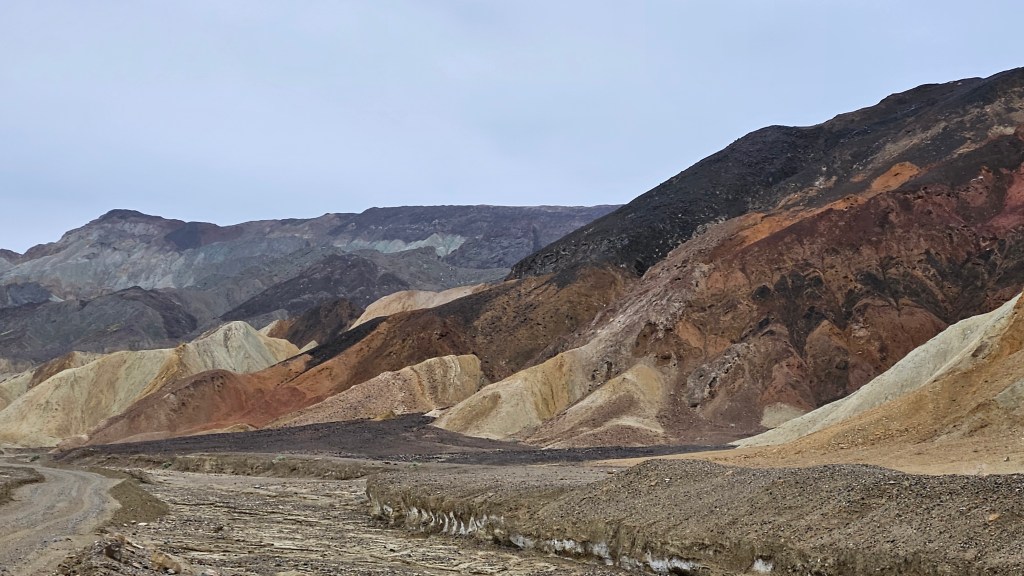
At Zabriskie Point the ancient rocks show the results of underground upheaval, wind, sun and rain. The black in the rocks are evidence of volcanic activity.
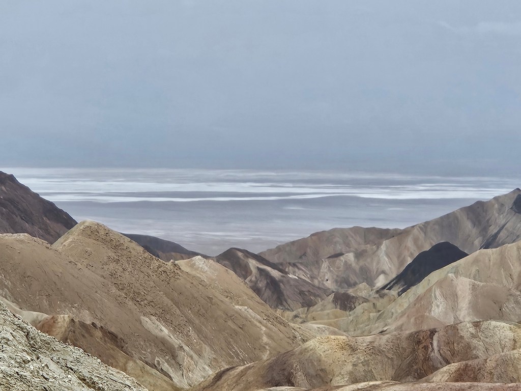
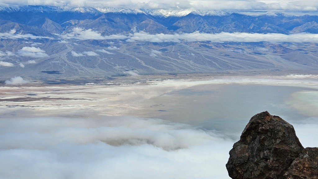
From this place, we received our first look at Manly Lake and the Salt Flats at Badwater. On a day such as this, the water is the same color as the sky.
We took some time out to see Furnace Creek Visitors Center; they had a movie that I enjoyed seeing. It focused on the people who have always lived here, the Timbisha Shoshones. “Why do they call this Death Valley?” one elder mused. “It is our home. It gives us life. Not death.” These people were once put on display for the tourists. On the road to the Visitors Center, there is a turnoff to the Timbisha Shoshone village. The tribe numbers around 1,770 members today but only around 50 live in the village.
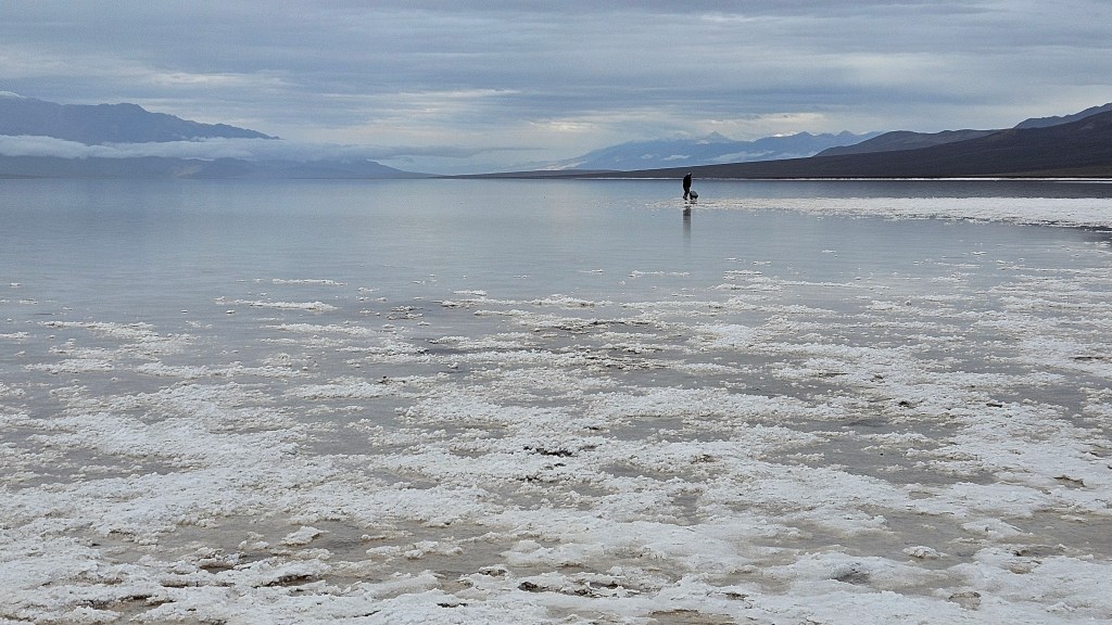
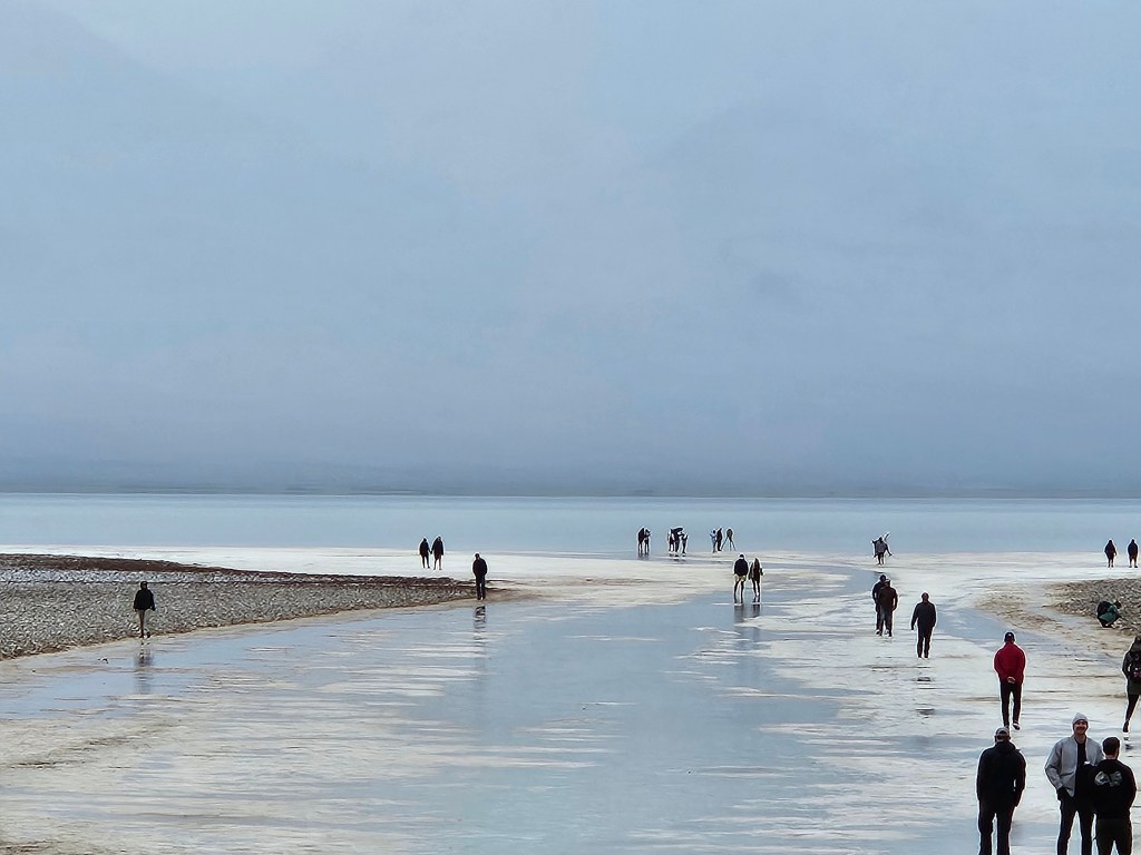
One of the first things I wanted to see in the park were the salt flats and the lake. This area has been in the news this winter. Normally Death Valley receives about two inches of rain per year, but two things happened: Hurricane Hillary in August 2023, and then an atmospheric river in February of this year dumped more rain. A lake formed here for the first time since 2005. In February we heard that people were actually bringing kayaks to go boating on the lake. At its peak, it measured about three feet deep.
By the time we arrived, the lake level had subsided. We were able to walk far out onto the flats. The salt deposits gave us places to put our feet.
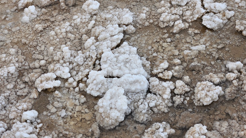
Salt crystals in Badwater Basin
Knowing we were coming here, I was following events at Lake Manly this winter. There were some strong winds at the end of February, and since the lake is so shallow, the wind actually moved the lake two miles! And then moved it (mostly) back where it was!
Badwater Basin lies 282 feet below sea level. It’s hard to fathom when you are standing in a place that is that low.
The lake, the salt and desert dirt, and the clouds formed ribbons of color.
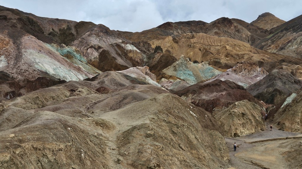
More colors were to be seen at Artist’s Palette, a scenic drive containing viewpoints and a trail.
According to the park signboard, volcanic eruptions created this tapestry made of iron, magnesium, aluminum, titanium, and other elements.
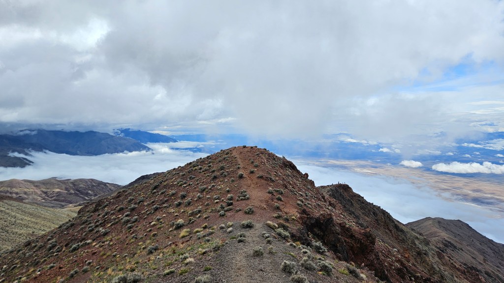
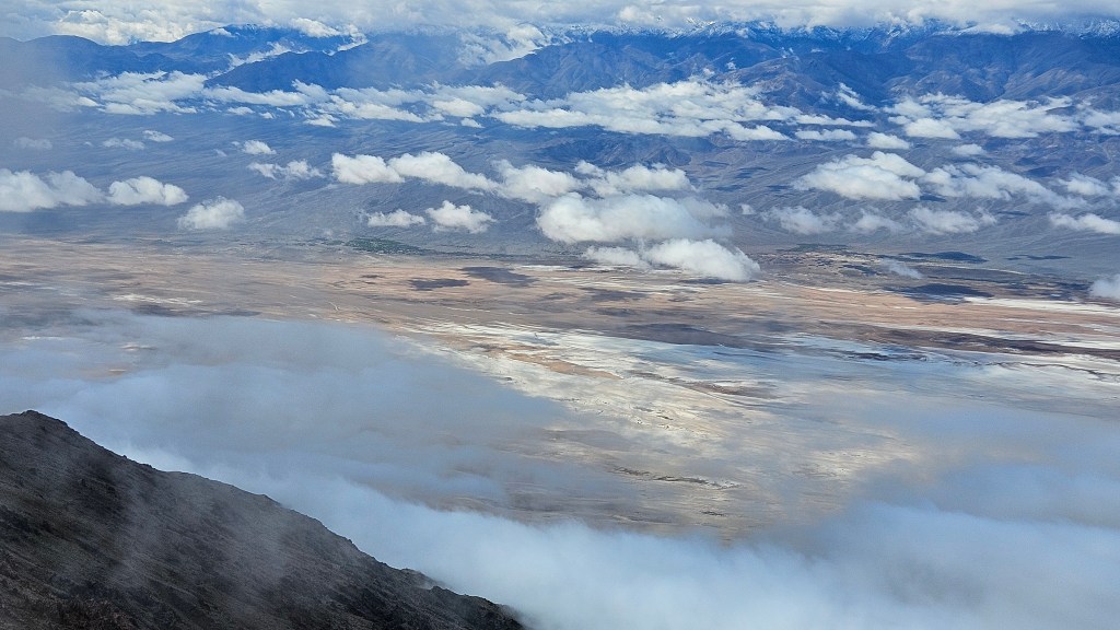
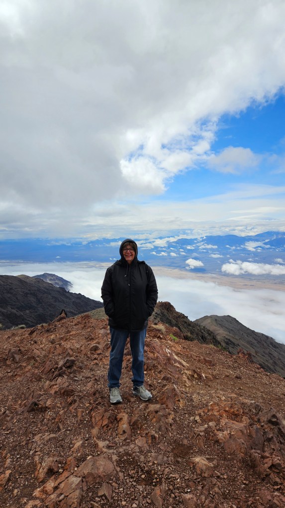
Cal drove us from the lowest part of the park at Badwater Basin up to one of the highest points at Dante’s View. The elevation here is 5,575 feet. He was happy to just enjoy the view. But I saw a trail, so I took off.
Looking at the next peak, I said “Why not?” and climbed it. And then the next. Looking down from such a height on an overcast day, one almost loses perspective. Which are the clouds, the water, the salt flats, or merely a reflection?
I was feeling very accomplished after this little jaunt, which had been a bit precarious.
What else is there to see in Death Valley? So much that I could not fit everything we experienced here into one post. Stay tuned!
Next time – Salt Minerals, Sand and a Cathedral in Death Valley
The old mining town of Oatman lies in the northwest corner of Arizona and is around fifty miles from Lake Havasu City. With that distance, it’s a little far for a day trip, but after a few days around Lake Havasu we were ready for something different to do.
An unexpected bonus to the trip to Oatman is that it is on old Route 66, and the desert vistas are gorgeous.
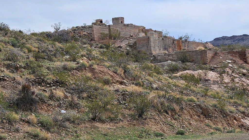
Oatman began, as many Southwest towns did, by the discovery of gold in 1915. It is named after a little Illinois girl named Olive Oatman who was captured by Indians. It was a big story that everyone knew about at the time.
Millions of dollars in gold were mined here, and the remains of those mines dot the hillsides.
A sign on a board in Oatman stated that the town furnished gold for World War I, and copper for World War II.
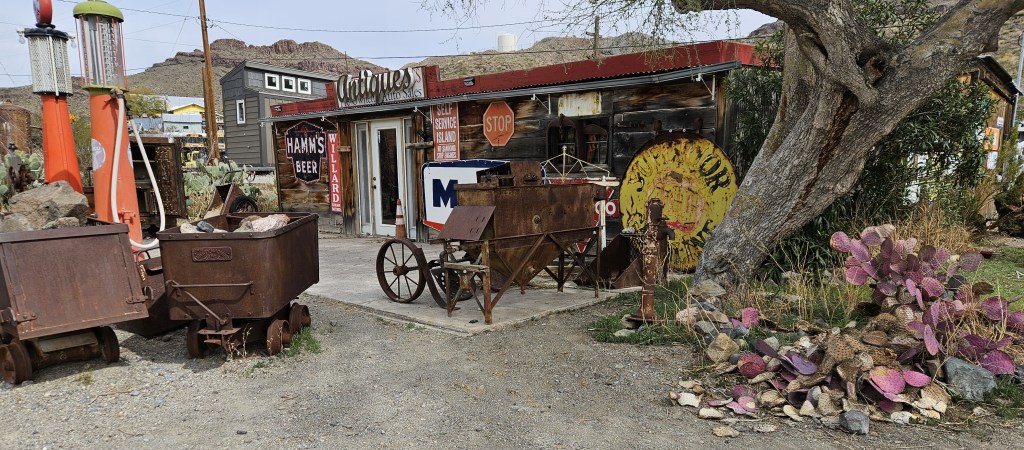
There was a bit of a renaissance as a destination with a Western theme for tourists when the Mother Road, Route 66, was built.
Abandoned homes tell the story of Oatman’s booms and busts.
Route 66 was bypassed after Interstate 40 was constructed. The town may have died but for the thing that keeps it on the map: the burros that wander around town. When the mines closed, the workers turned their hardworking burros into the hills. The burros became feral, and burros did what burros do – they multiplied. They were used to being fed, so they wandered through town looking for handouts. Now, of course, everyone wants to feed them, and the shops sell mule food.
We came into Oatman in the morning, and nary a burro was to be seen. It was a cool morning, and I was told that they like to laze about when it’s cool and come into town when it warms up. So we walked through the craft and trinket shops, and looked at all the varied items that an antique store had sitting outside.
The town had a huge fire in 1921 which burned down many of the buildings in existence at the time. This wall is the site of one of the hotels, and the doorway is the entrance to a mine that was constructed later.
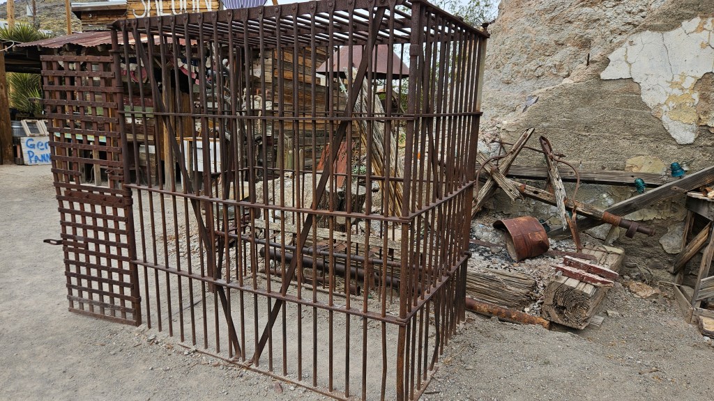
Nearby, there is a jail cell that was used for temporary incarceration of prisoners.
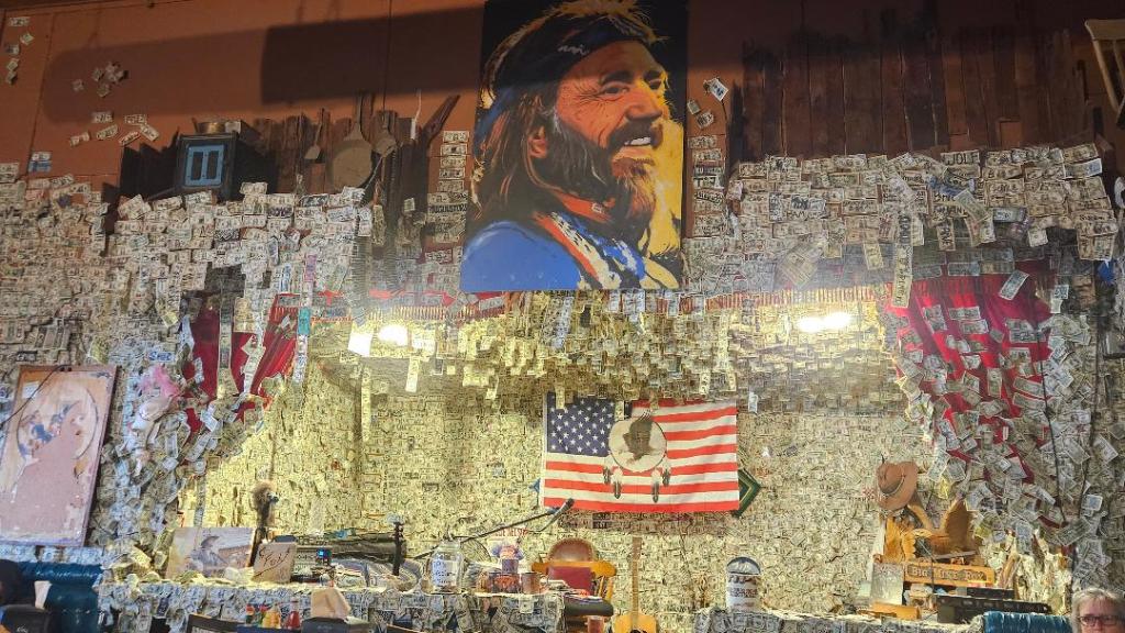
The Oatman Hotel survived the fire of 1912. Built in 1902, it is the county’s oldest two-story adobe structure. We went in for lunch. The walls were plastered with dollar bills and, as I waited for my food, I gazed at a large picture of Willie (in his younger days) on the stage.
I enjoyed a most delicious lunch here. It was the special of the day and called “Greek Shepherd’s Pie”. I can’t pass up anything with “Greek” in the name. After taking a few bites, I realized it was moussaka, but I’d never had moussaka like this before. Maybe it was the melted cheese in it, warm and tasty. I’m still thinking about that lunch. Cal had his usual burger and fries.
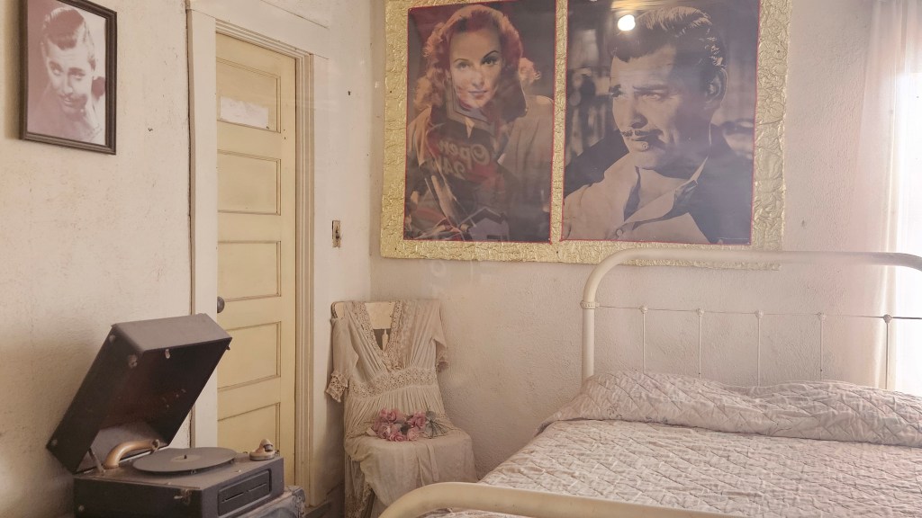
After that extremely satisfying meal, we went into what I think was formerly the lobby but now has a soda counter selling ice cream. Despite all that moussaka, there was room for ice cream. A precocious little girl sat on one of the stools, swinging her legs as she chatted us up. She told us that it’s not possible to stay overnight in the hotel any longer. But we could go upstairs and look in the room where Clark Gable and Carole Lombard spent their honeymoon night after being married in Kingman. Of course we had to take a look after receiving her excellent tourist information.
It’s not a great picture, and there is a bit of a glare with the plexiglass barring the entrance to the room. I thought I’d post the picture anyway because, interestingly, this story is rooted more in myth than in reality. I read later that they returned to Hollywood directly after the wedding. Their supposed room wasn’t the only one to see, though. Other rooms were open and set up to show us the things that early travelers might have brought with them when they stayed in the hotel.
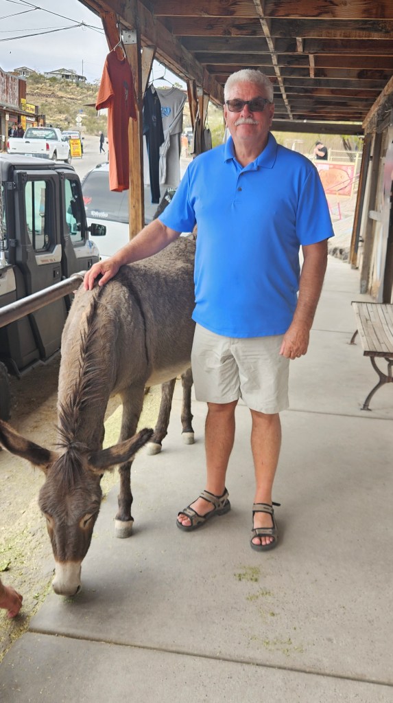
When we emerged from upstairs, the little girl was gone, and there was a shootout on the street. A large crowd gathered. As if on cue, the burros arrived and were soon swamped with tourists. I didn’t buy any feed for them, but that didn’t stop them from checking to make sure.
Cal’s new pet burro
It was hard to get a picture of them without other tourists in the picture. We soon began work on an idea we’d gotten from the little post office here. We purchased cute burro postcards for our grandchildren and mailed them from Oatman. They were cancelled with a special stamp.
Our time in Oatman was over. On the way back to the truck, I wished I had enough energy to hike over to get a closer look at this gorgeous work of sandstone art by Mother Nature.
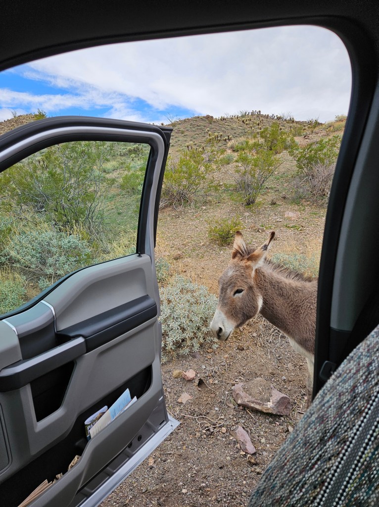
We had one last treat in store. As we began to drive out, a burro was standing all by itself in the road. No tourists were anywhere in sight so I had this burro all to myself.
You know everything there is to know about photographing wildlife. We’ve all seen the pictures of crazy tourists approaching buffalo in Yellowstone. These burros are wild but they are used to people. There are cautions, though, that they can bite and this one was not in town. I kept my distance and stepped out of the truck to take a picture from across the road. The burro, probably hoping for a handout, came over to me. I retreated and slowly walked back to the truck. It followed and clearly wanted a cuddle.
I made an exception for my wildlife rule. This burro was probably used to being in Oatman anyway.
The burro followed me over to the truck as I started to get in. I’m sure it was looking for a handout.
It finally gave up on me, and checked to see if maybe Cal had some treats in the truck.
If you visit Oatman, you may want to not miss the jail museum. The jail has been preserved from Oatman’s heyday and most of it is original. I didn’t even know about it until we came home and came across it when looking up information about Carol Lombard and Clark Gable’s wedding. If we are ever back in the area, that will be a good excuse to visit the burros again. Maybe the Oatman hotel will have “Greek Shepherd’s Pie” on the menu!
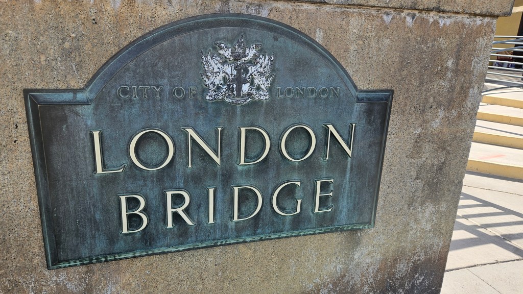
Here’s a fun bit of trivia for you. When you think of the London Bridge, what do you think of?
Is it this?
No, that’s Tower Bridge, in London, England.
Is it the bridge that you see to the left of this picture?
Wrong again! No, that’s Westminster Bridge, also in London.
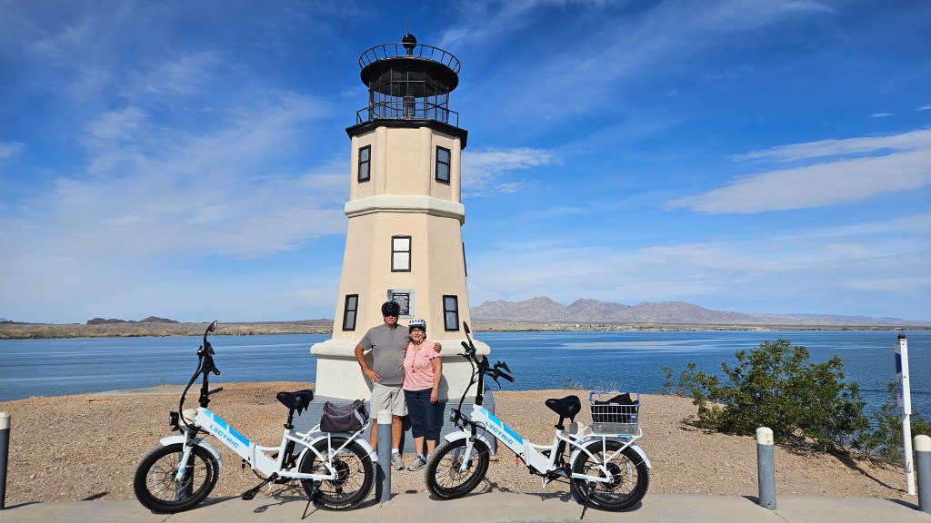
London Bridge is in Lake Havasu City, Arizona. Like the two bridges above, it once spanned the River Thames in London, England.
In its original home, London Bridge was in bad shape. The city determined to sell it, and in 1968 an entrepreneur and developer named Robert P. McCulloch from Missouri placed the winning bid of $2.4 million dollars for reconstruction in Arizona. He had already built the planned community of Lake Havasu City in 1964, but this would really put it on the map.
He didn’t purchase the insides of the bridge, though. This bridge is reinforced concrete. He only purchased the exterior granite blocks of the original structure. It was completed in 1971.
The city of London, England rebuilt their London Bridge in the 1970’s, but it is built for function and not decoration. Hundreds of thousands of cars drive over that bridge over the Thames daily.
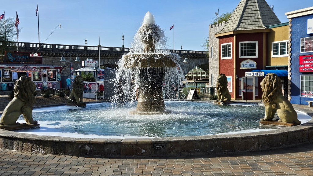
Robert Mccullough also built “English Village” next to the bridge, with British-themed shops and facades made to look like old London. Those are mostly gone now, replaced with shopping, dining, and entertainment venues. But we still got a little taste of the English Village as we walked in for a look. The bridge is behind it.
This London Bridge was not London’s first. The Visitor Center has a nice video which discusses the older London Bridges which go back in time to the 1200’s. In those days, London Bridge had multi-level houses, shops and pubs on it. The current bridge was built in 1729.
When tearing down the bridge in London, 10,276 pieces were numbered for shipment to Arizona. The latter part of the video details the preparation of the site for the bridge, and the reconstruction in putting those numbered pieces back together in Lake Havasu City.
Who besides Robert McCullough would think about putting a bridge in the desert? This bridge did go over nothing but desert land, so he built Bridgewater Channel to divert water from Lake Havasu.
Looking down at the Channel from London Bridge
There are paths along both sides of the channel which lead to Lake Havasu. On an early morning it was an enjoyable place for a walk.
The actual walking path is to the left of this picture
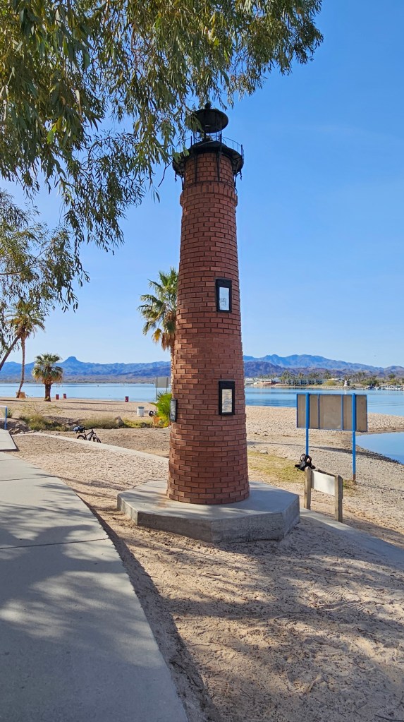
A fun thing about Lake Havasu is that there are 28 lighthouses all around the lake. They are working small replicas of lighthouses around the United States. A group of concerned citizens formed the Lake Havasu Lighthouse Club to improve night-time navigation for boaters on the lake. Besides being decorative, they serve an important function with their lights.
At the end of the canal path, we found our first one.
This is Currituck Beach Lighthouse. The original is on the Outer Banks in Corolla, North Carolina. This lighthouse is one eighth the size of that one, which stands at 168 feet.
The lighthouses on the east, or Arizona side, are replicas of East Coast lighthouses. The ones on the west side of the lake in California are replicas of West Coast lighthouses.
When the canal was built under the London Bridge, an island was created on what was formerly a peninsula. We had heard there is a bike trail around the island, so we rode it on one of our days here.
I was excited to see this lighthouse on the far west side of the island. The lighthouses on the island are Great Lakes lighthouses and this one is Split Rock. The beautiful original overlooks Lake Superior in Two Harbors, Minnesota, and it is one we have visited often.
From this viewpoint, we could see over to California.
There are RV parks on the island and I would have liked to have stayed at one of them, but they come with long waiting lists. We would have had to put our names on a list now in order to hope for someone to call us for a stay next year, or maybe the following year. We circled around one of the parks and down along to the beach to one of its corners to find this gem.
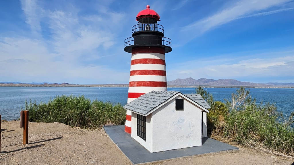
It is so close to the mainland here that I guess they figured they’d put an East Coast lighthouse in this spot. This is West Quoddy Lighthouse in Maine. I liked this one because it came with the little lightkeeper’s cabin. It’s the first lighthouse the club built.
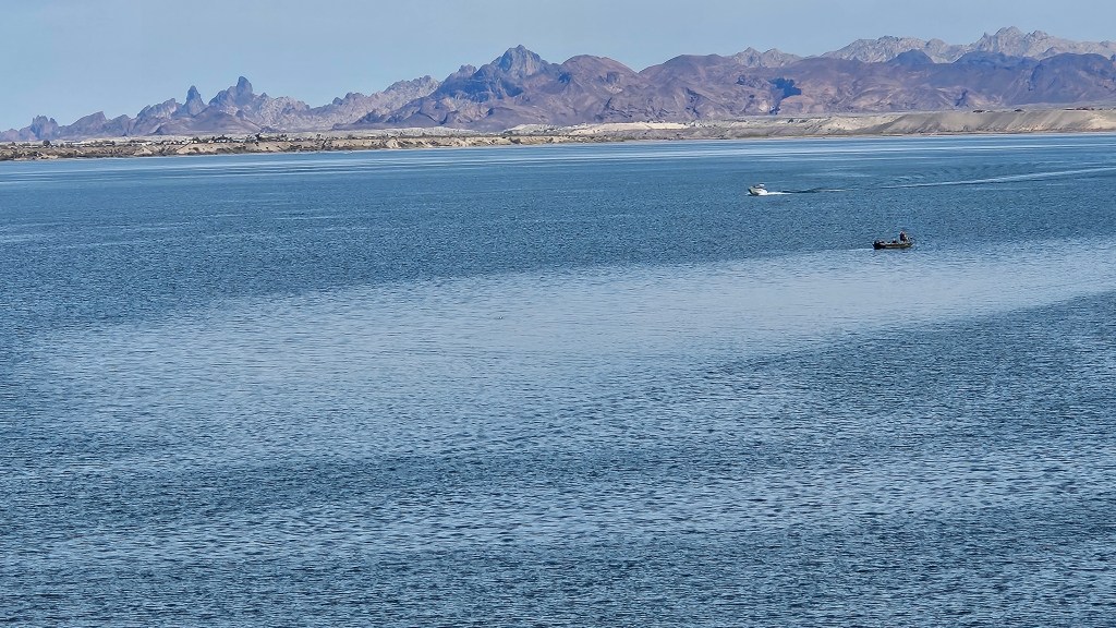
You could make an expedition to find all the lighthouses. There are boat excursions on the lake designed to see most, or all of them. I thought it was fun just to find them at random.
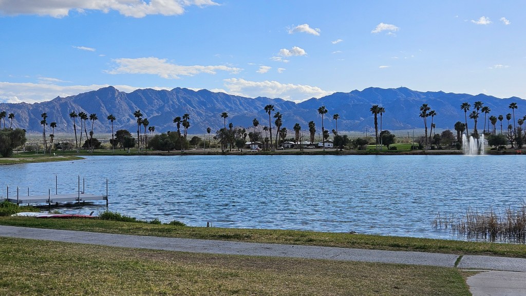
Lake Havasu has beautiful sunsets.
Here’s something fun. These signs were all over this part of Arizona. We thought they were pretty humorous, although probably they weren’t meant to be. Whenever Cal had a momentary confusion about which way to go, I’d say “Just DRIVE!” and we would have a good chuckle all over again.
If you think this might be a nice place to visit, just know that it is very busy. We did both the channel stroll and the bike ride in the morning, and the large parking lot was almost empty. By the time we returned, it was full and traffic was clogged. This is headquarters for every outdoor and water activity you could think of. We wish there would have been easier access to the bridge to get up and around the traffic for bikes. While I’m assembling my dream list, a bike trail along the road to our RV park would also have been nice, because it goes right past a nature preserve on one side and dunes on the other. But maybe they just need to finish the bike trail on the island first, with paved bike access to the lighthouses.
The highways that we have traveled on in southern California have been endlessly interesting to me. I’ve ridden on a lot of America’s roads in my life, but the state was mostly a mystery before this winter. I often toss my stitching or a book in the truck on travel day, but not here. I’m normally not able to get pictures since we are usually zipping down the highway.
To me, just seeing America’s roadways is a big part of the RV life.
I was so eager to dive into the San Diego blogs that I didn’t mention the incredible landscape that we had had on I-8 going from Yuma to San Diego. We started out traveling at sea level through windy sand dunes, with sand visibly swirling in the air. Later, we went through mountains of rocks.
Toward the end, there was a larger mountain to cross over, which we summitted at 4,100 feet in a snow squall. Cal said he felt as if he’d driven through four seasons all in one day.
I wrote in my last blog about our entrance to the Coachella Valley, which was short but no less dramatic. From Desert Hot Springs, we continued on I-10 through the valley floor to its eastern end near Desert Center. And I really don’t know if Desert Center is a town, because I never saw it.
We had an adjustment to make with our RV reservation in Lake Havasu City and, as a consequence, I’d needed to find us a park for one night before our arrival there. I found one on Lake Tamarisk, two miles north of the highway. It lay in the middle of the desert.
This place contained a mix of mostly permanent trailers but also some RV’s. There are 150 sites at this resort, and if you buy into it, you therefore own 1/150th of the entire park. It’s governed by a park committee, all owners. They maintain a handful of sites for us folks passing through.
A new and pretty cactus garden built by the women of the park
There was a trail around the lake, which was smaller than I thought it would be, but beautiful nonetheless with ducks and a crane, and an occasional fish jumping.
Blue waters out in the desert. Is this a mirage?
A trail also wound in and around the park. It was not fancy, but had very homey feeling not unlike Andy Griffith’s Mayberry. On our walk, we passed by one of the trailers, and the owners were out having a late afternoon beer and popcorn on their patio. We’d seen them earlier in the day, so they invited us over. Gene and Dawn are from Oregon and, visiting from next door, Ken and his adult daughter are from Vancouver, Canada. We had a lovely visit and they told us the park is mostly owned by 50% golfers and 50% ATV owners. The whole desert is right out there to be hiked or ridden in. But, the nearest grocery store is fifty miles away. Most folks return to homes up North during the summer.
The whole experience was so far “out there” that we wondered if we’d stumbled into some sort of desert mirage. Was this Shangri-La? Being neither golfers nor ATV drivers, would we enjoy staying here for a week or two? For the entire winter? Would we get bored? We weren’t sure, but these were all things to ponder as we drove away the next morning.
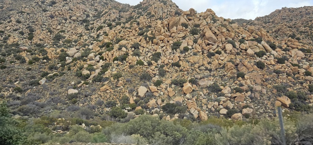
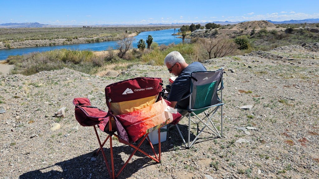
From I-10, we had two choices in our route north to Lake Havasu City: state route 95 in California, or the same-numbered road in Arizona. We opted for the California route, because I could see on the map that the Colorado River went right alongside it after some miles. The scenery was stunning. Cal found a turnoff where we could have one of our lawn chair picnics.
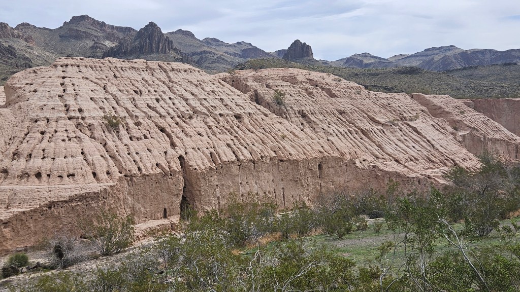
Across the river and once again heading north, but this time on Arizona Route 95, there were more rocky hills to see. This is where I took the picture at the top of the blog. We landed at Lake Havasu City to find our next RV park.
It was a very small park for very large RV’s, mostly those big Class A “diesel pushers”. Our 34-foot 5th wheel was at the lowest limit for size. The park road was one small oval inside a cinder block wall, and one thing I had neglected to note while reserving: absolutely no amenities, which meant no laundry. We 5th wheels were allotted just a handful of sites together, humbly grateful just to be allowed to the party. There was not a shred of anything green, but we had a huge paved site with plenty of room, along with an extra spot for our ATV, if we’d had one. The on-line pictures had made it look a lot greener. Open RV sites are hard to come by in this town.
There was some fine entertainment to be had at this park, though. The weather was so nice that we were eating dinner out at our picnic table. Every evening around 5:30 or 6:00 PM, we’d start to see many birds flying in our direction from far in the distance. More would arrive, and, after much circling, they would fly over our heads to the top of a tree on the other side of the fence. We would marvel at their wing spans as they soared over us. They were turkey buzzards! By the end of the evening, there was much jockeying for the best perches, and invariably one or two would get knocked off, but finally they would all settle down. And in the morning, they opened their wings to stretch for awhile, and they’d all be off again.
It may not look like it, but this tree is full of turkey buzzards doing their morning wing stretches. We could figure no reason why they were attracted to this particular tree.
Later, we rode our bikes over to another RV park to visit a couple that we’d met in Desert Hot Springs. Their sites were so close that there was no room side to side. We had to visit in front of their RV, in the park road. And the RV park was sitting on the busy state route. Suddenly our spot looked great, with all of our space and those turkey buzzards to provide our evening entertainment.
So, we dipped our toes back into Arizona for a six night stay. This is a boating, ATVing, and weekend partying area. That’s why it’s very hard to get a spot in any RV park here, even during the week. What is there to see in Lake Havasu City? That will be the subject of my next post, but here’s a little bit of a sneak preview:
The wind was blowing fiercely as we drove into the Coachella Valley from the west. A brown haze hung over the air because of all the sand being blown about. We gaped at tall, steep San Jacinto mountain looming over us with its cap of snow and cloud. And then there are the windmills – 2,700 of them, to be exact. What an entrance!
Entering the Coachella Valley, windmills just coming into view on the leftside of this picture
The constant wind keepsthe windmills working and the east side of the valley in a perpetual haze, seen here from the visitor center in Palm Springs
The sand in the desert is fine and often given to pure dunes. Entering the north side of Palm Springs, the wind gives its final blast, sometimes covering the road with so much sand that the roads have to be blocked off until they are cleared.
North of the highway, in Desert Hot Springs, the wind didn’t abate much while we were there. This is where our RV park was, and it was often windy. Maybe for this reason, Desert Hot Springs is a poorer cousin to the lushness of Palm Springs to the south. It is certainly more affordable.
Once we passed the final blast of air, left the sand behind us, and drove deeper into Palm Springs, the wind calmed and we found ourselves in a lush oasis. The native Cahuilla Indians thought that the mountain was sacred. Streams and springs here provided them with water and pools for bathing and cooling. Later, Europeans found that the springs and the climate were restorative. They came here to recuperate from a variety of illnesses such as asthma, influenza, and tuberculosis. Sanatoriums and hotels opened. And later, Hollywood arrived.
The 26-foot-tall statue of Marilyn Monroe: “Forever Marilyn”, at the Palm Springs Art Museum
The studios of Hollywood had a two-hour rule: contracted actors had to be able to show up at the studio in less than two hours for last-minute film shoots. In the 1920’s, long before Los Angeles traffic got so crazy, that put Palm Springs on the map for many of them. Frank Sinatra, Dean Martin, Sammy Davis Jr., and – yes – Marilyn Monroe schmoozed in the hotels and bars, played tennis and golf, and even bought homes. They enjoyed the privacy that this place gave them. Others such as Elvis Presley, Elizabeth Taylor, and Sonny Bono, and Leonardo DiCaprio had or still do have homes here.
I looked up the addresses of some of the stars and we set off for a bike ride to find them. I quickly discovered that it was an impossible task. Unconcerned about movie stars, Cal just wanted a bike ride, and so we zipped past (maybe) Liberace and Clark Gable’s homes. George Hamilton’s was up on a cliffside. Determined, I looked for Dean Martin’s home, but had an issue with the house numbers. The home which I think was his is boarded up and being renovated. It was a good thing I gave up, because I enjoyed the ride more once we did.
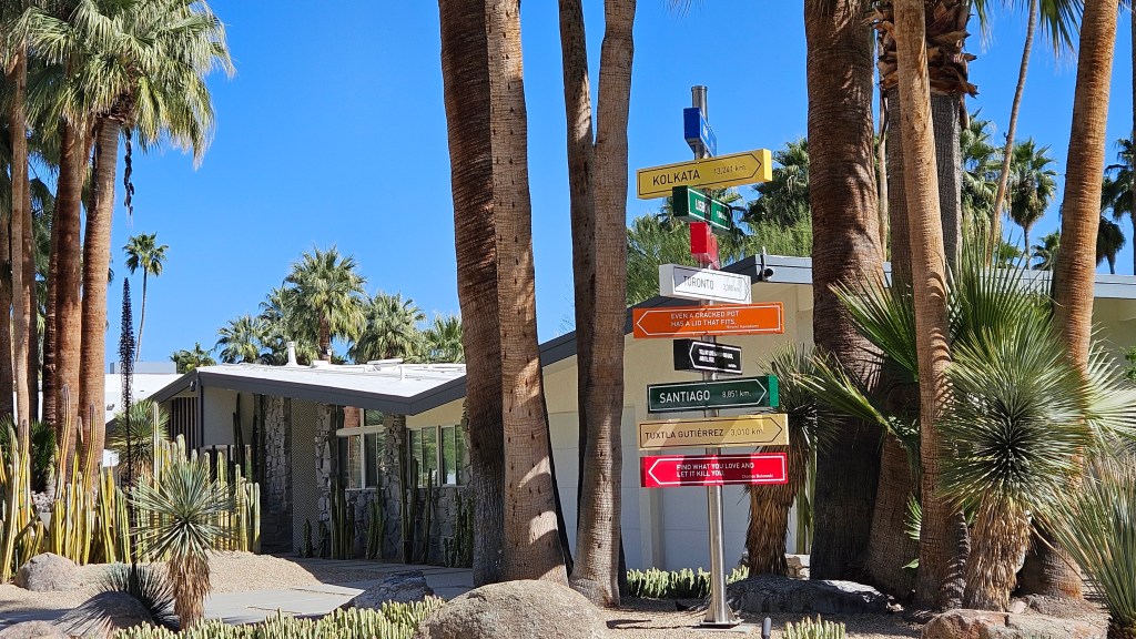
The homes in the neighborhoods of the stars all have a contemporary design and gorgeous landscaping. I liked this one, with all of its fun signs and sayings.
“Even a cracked pot has a lid that still fits”
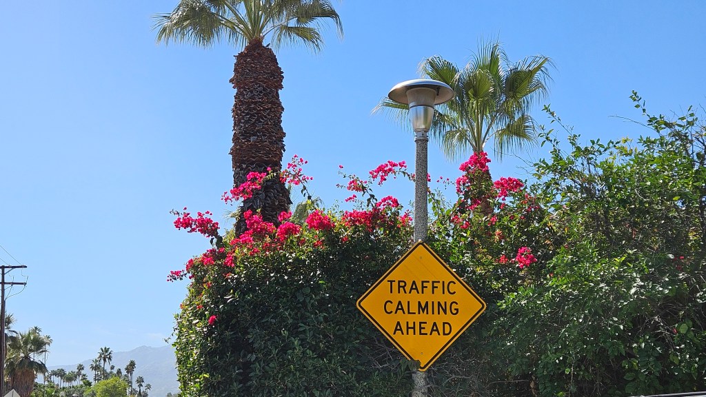
Palm Springs has several bike trails laid out. Sometimes we were on actual bike paths, sometimes on roads, but we mostly had our own lane. I really felt that we had seen the city when we were finished, and wished that more small cities would have interesting trails that are so well-marked.
This is actually a polite warning about speed bumps. But we did feel very calm riding through here.
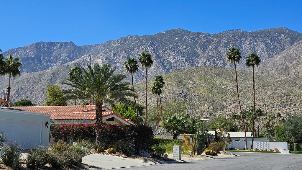
In a neighborhood at the south end of Palm Springs — wouldn’t you love to have this view in your back yard?
Built in the 1920’s and converted to a doctor’s office in the 1930’s, the former home below is in downtown Palm Springs.
While we were there, we had a fine lunch on the sidewalk in front of a cafe. Afterward, we walked Palm Canyon Drive to window shop and look at the “Walk of the Stars”.
One attraction that Palm Springs has is the Palm Springs Aerial Tramway, and we rode it up to the top.
We’ve been on a lot of cable car rides, but this was the first one we’ve ridden on that rotates all the way around. The car was full of people, but it didn’t matter – we had a great view all the way up.
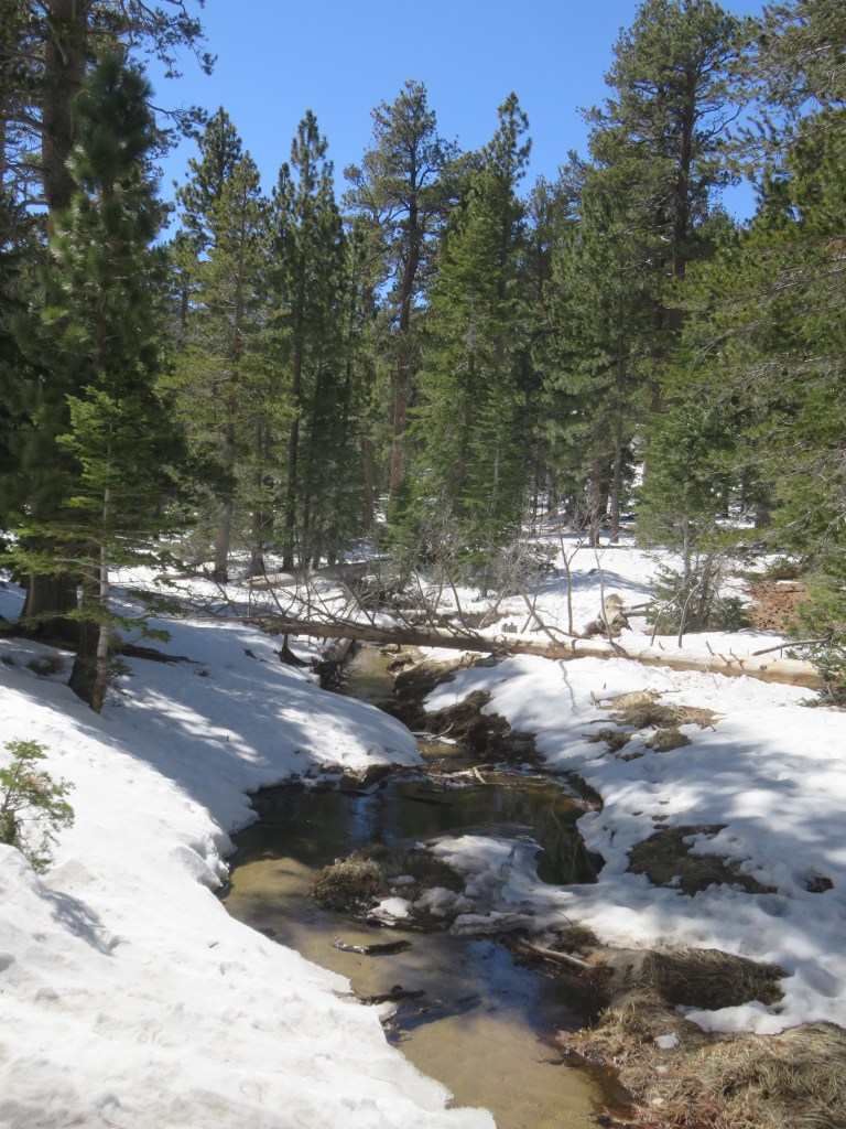
At the top, it’s a whole different world! The aerial tram is the entryway to Mount San Jacinto State Park. All of a sudden we were in a pine tree forest with snow under our feet.
We started walking on a trail that led directly out of the visitors center. It soon became icy and treacherous. A short way into the forest, we decided that we would choose the shortest trail option that would take us back to the tram. Did I mention that it was also very cold?
We had chosen a beautiful clear day for the trip up – clear, except for that perpetual haze over the windy sand dunes. Across that haze, closer to the opposite mountain range, lay Desert Hot Springs and our RV park.
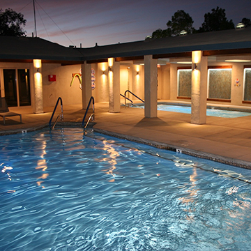
I had chosen this park because it sits on a mineral hot springs. Owing to that, there is a large hot tub as well as two swimming pools that are fed by the water from the springs.
Photo Credit: Catalina Spa and RV Resort
We have been in an RV pool maybe only once in our years of RVing, but we did get into this one. The mineral water coming up out of the ground is so hot that it has to be cooled. We both got in, and preferred the warmer water in the hot tub over the water in the pool. It felt wonderful.
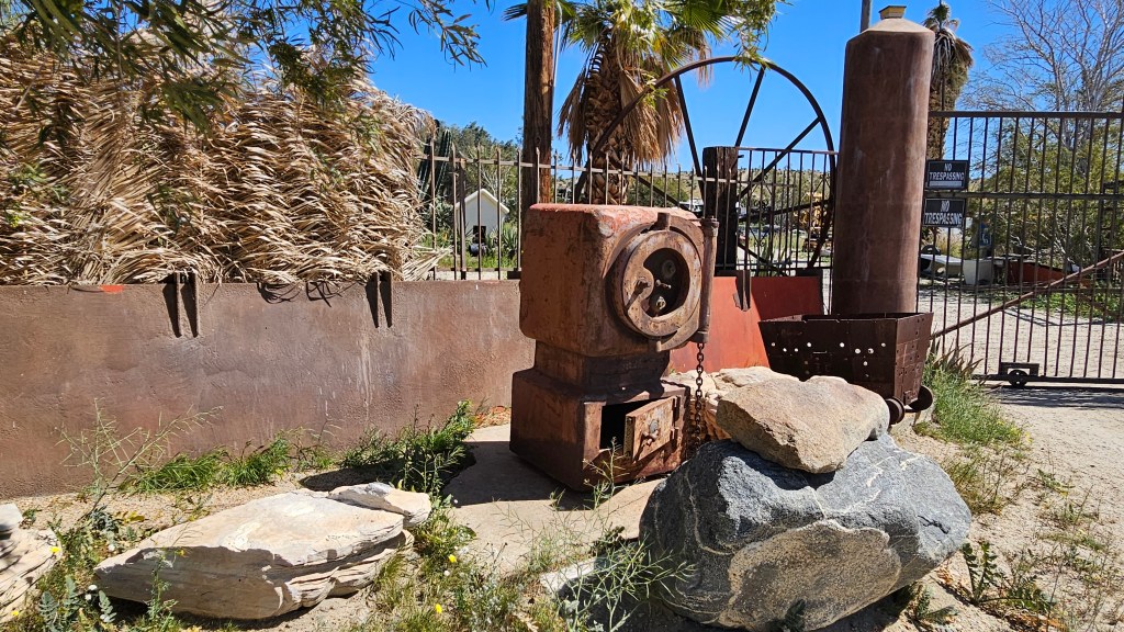
I had seen signs for a hiking trail outside of our park. I thought a hike might be nice on the day before we left, and Cal went with me. Kim Nichol trail is new and is supposed to be a five mile loop. It was really a treat to not have to get in the truck; all we had to do was walk down a dirt road.
That road had some interesting things to see along the way.
Any guesses as to what this is?
And there was this:
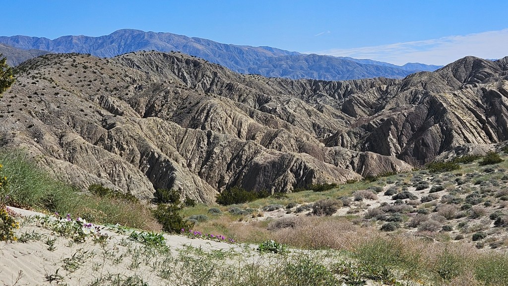
The trail was excellent hiking, although we had to do a fair amount of climbing. There was often deep sand on the hills, which really made for a strenuous thigh workout.
The good news is that much of the sand on the trail was not so deep and provided soft padding for our feet. At the top of every hill we were always rewarded by breathtaking views. Patches of yellow, purple and white flowers added to the pretty landscape.
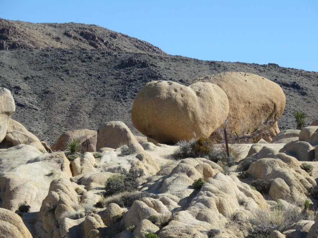
Summiting one of the hills, we came upon this unexpected sight. This rocky ridge was a surprise until we were right up on it.
Other trails criss crossed the desert. We finally got tired of climbing what were starting to seem like mountains. Was the the trail ever going to loop us back in the direction in which we had come? We ditched the Kim Nichol trail and hopped on one of these other trails to make our way back. Sorry, Kim! When we arrived home, my Fitbit read that we had hiked five miles, including the dirt road we’d had to walk on at either end. I say that’s good enough!
There is another snow capped range to the north of Mt. San Jacinto. I’ll leave you with an excellent view of Mt. San Gorgonio, along with some of the yellow desert poppies that we had seen. We were graced with this sight as we wended our way homeward from our hike.
Next time – California highways lead us back to Arizona
Up the road from San Diego and east of the Los Angeles sprawl lies the 50-mile-wide Coachella Valley. It’s roughly bounded by the cities of Palm Springs on the west side and Indio to the east. Palm Springs lies to the south of I-10, and Desert Hot Springs, where we stayed for a few days, is to the north. Joshua Tree was one of big stops here, where there are large swaths of the Seuss-like plants.
It was hard for me to get back into “national park mode”: getting up at 5:30 in the dark and cold morning so we could leave at 6:30. From our RV park, an hour’s drive of beautiful early-morning scenery greeted us as we drove up and around to the other side of the Little San Bernadino mountains. Our first Joshua trees were to be seen in the aptly named town of Joshua Tree.
Further down the road, we had a bit of a mix-up getting into the park. A visitors center lies right in the town of 29 Palms which, unlike every other national park I’ve been to, is a couple of miles outside the entrance gate. The center is new enough that an old park map I was following didn’t show it. I thought I knew better than GPS, so I didn’t listen to what it was telling me. We went into the gate and then backtracked into town. Once in town, Cal was distracted by a jelly doughnut place and purchased two to eat later.
Oasis of Mara
One of the stops I wanted to make was also outside the gate, adding to my initial confusion. The Oasis of Mara was once a bubbling spring surrounded by grasslands. The Marra’yam people’s legend goes that the women were failing to produce baby boys, so a medicine man told them to go into the desert and stop at the first place they found water for a new place to live. This venture was so successful that the men of the tribe planted a fan palm tree for each boy born, twenty-nine in all. Not all trees have survived but to these people, the trees are their ancestors.
As you can see below, I was dwarfed by these palms. What did it look like when all of the palms were still standing?
Oh, and that bubbling spring no longer exists. Over time, it trickled down. It finally completely disappeared in the 1940’s, when new development lowered the water table.
Past the gate and further down the road, some Joshua trees came into view. The short cactus that you see on the right of this picture is called Mojave Cactus.
Joshua trees aren’t really trees at all – they are in the agave family of succulents. When the Mormon settlers saw them, the upraised arms of the trees reminded them of the Biblical Joshua, with his arms raised up in supplication to God. They are slow-growing and can live to be 150 years old, although older ones have been found.
On my park map, I thought Arch Rock might be interesting, so we made a stop. The hike to it was longer than I thought it would be, but the rocks that we encountered here were totally unexpected.
We took a little detour to Heart Rock. But if you don’t see the heart on the left of the two boulder-sized rocks, you might think they look like a couple of potatoes.
We finally found the arch. It was a little hard to photograph, with many tall rocks all around. In comparison to the others, the huge one in the foreground had an interesting texture. The surface was bumpy but it looked like it should have been smooth. Tiny gravel pieces were firmly embedded all around it.
The biodiversity of Joshua Tree is what was surprising to me, and interesting to learn about. I thought our day would be full of Joshua trees, but not so. We began our exploration in the Mojave Desert, but as we drove further south on the park road, the road went up and then skirted the Hexie mountains through Wilson Canyon. This marked the transition from the Mohave Desert to the Colorado Desert. The Colorado borders the Sonora Desert, where we had been for a good part of the winter in Arizona. From here, I could look down into the Pinto Basin, which was once a huge inland sea.
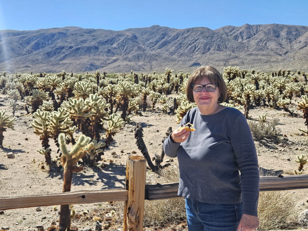
In the Colorado desert, Joshua trees and Mohave cactus disappeared. We stopped to look at Cholla Cactus Garden. The cholla seemed to go on forever. While we gazed, we munched on our delicious blueberry jelly doughnuts. This was a too-long-delayed event, in Cal’s opinion.
Further down the road, we came to the Ocotillo Patch. I love ocotillo for the way they metamorphose from dead-looking brown branches to green leaves, and then red flower blooms looking like a flag on top. I was hoping to see a large number in bloom. No such luck, but I did see one or two. The rest had their green leaves on, probably since the desert has received a lot of rain this past winter.
An interesting fact that I learned here, thanks to a National Park signboard, is that ocotillo are not season dependent, but rain dependent. They can grow or drop leaves as much as five times a year.
I’m always fascinated by how certain cactii varieties grow together, to the exclusion of other ones. We’ve noticed that slight changes in altitude can affect what grows where.
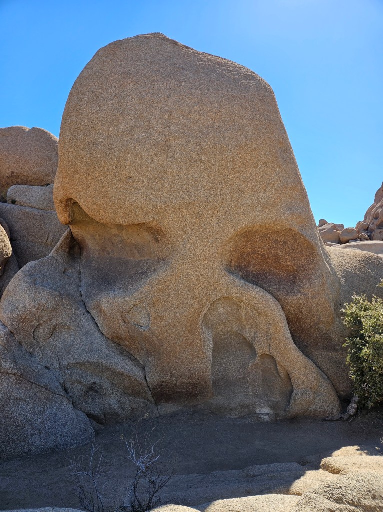
We turned around here and drove many miles back to Park Boulevard, where we took a left and stopped to see Skull Rock. I had read in more than one place that this would be a “don’t miss” stop. It must be everywhere on social media, judging from all the cars spilling out from a small parking lot and onto the roadway. At Ocotillo Patch, we’d had the parking lot almost to ourselves. Neither of us were much impressed by Skull Rock, but maybe that’s because we had to climb over so many people.
From here there were some tempting trails, though, and fun rock climbing if I were just a bit less cautious.
Further down the road, we took a twenty-minute detour upward to Keys View. This is an overlook that, at 5,185 feet above sea level, provides a gorgeous, if somewhat hazy, view of the Coachella Valley and the surrounding mountains.
It was lunchtime, but the picnic shelters we saw were full. Cal never has a problem with that. We parked at a small trailhead, pulled out our lawnchairs, and had a picnic lunch in full view of the great Mojave desert.
It was getting on to mid-afternoon, but there was one more stop to make. Hidden Valley trail is reputed to be the best hike in the park. Unfortunately everyone else knew that too, so the trail was very crowded. This is why we get up early to go to National Parks. We had seen the crowd level rise through the day, but up to Skull Rock and this stop it had been manageable.
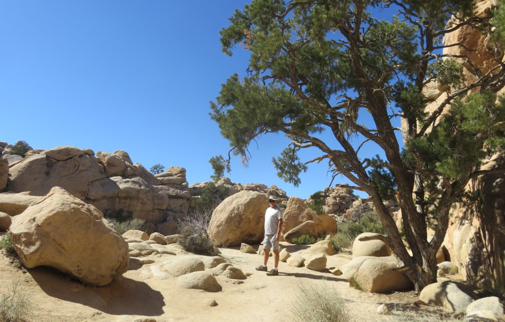
I could see why the trail is so popular, because it is beautiful and not too long. One enters a portal of rocks, and then it opens up into a tiny valley surrounded by rock. Bandits used to hide stolen horses in here, but in later times the portals were blasted open by a rancher and it was no longer a secret.
This is considered to be a “transition zone” between the Joshua tree forest and pinyon-juniper tree woodlands.
I thought the rock in the picture below looked like the south end of a gnome going north. But then again, maybe I was just getting hot and tired.
Opposite the trail area, a Joshua tree “forest” can be seen.
We were glad to have seen the park and that we didn’t die on any of the trails.
Memory is a funny thing. Years ago, we took my Mom on a trip to Los Angeles from where we were living at the time in southeastern Arizona. I’m pretty sure we traveled on I-10 going west and I remember seeing the Joshua trees out my window. I was so impressed that I have always since then wanted to come here for a visit. The southern reaches of the national park do go down to I-10. But we traveled the entirety of I-10 through the Coachella Valley, and there are no Joshua trees to be seen! Now I’ve learned that that part of the park is the Colorado Desert, not the Mojave, so of course they wouldn’t grow there. Where did I see those trees? I couldn’t have imagined them. It’s a mystery which may or may not be solved some day.
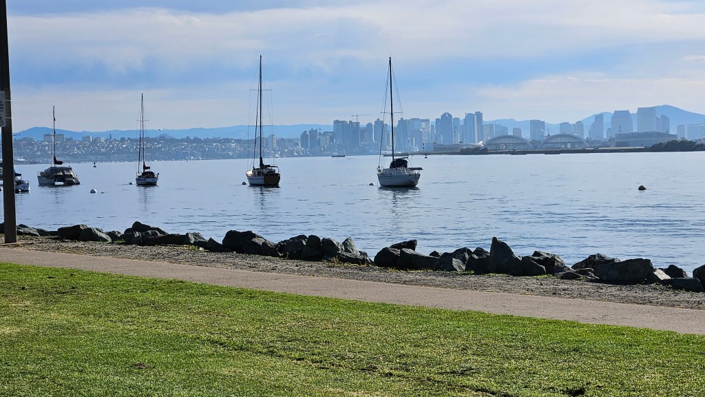
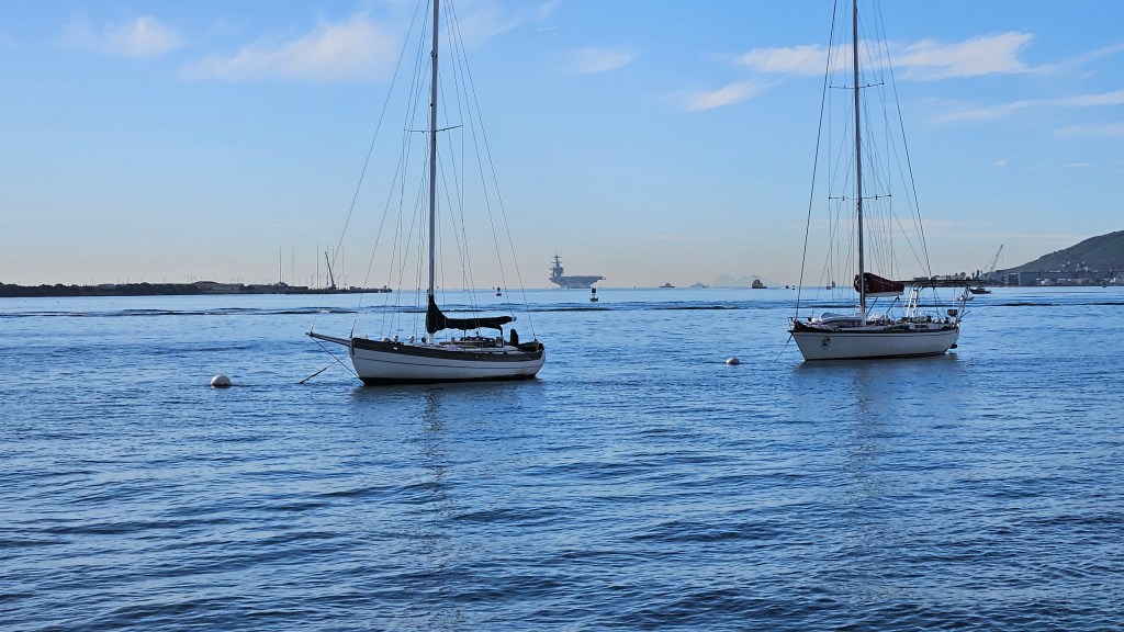
The city of San Diego as seen from Shelter Island Park
We have a nephew Mike, who is a pilot for the Navy. He had to do some operations time on a ship, so he was deployed on the aircraft carrier Carl Vinson for several months on a jaunt around the Pacific. Toward the end of our San Diego stay we watched the ship come back into port with his wife, Emily.
To get a good view, we met her at Shelter Island and enjoyed some time at the park while we waited. The ship was still a long ways off before we arrived and appears only as a dot on the center horizon in the picture below.
As the ship came closer to view, we could see all the sailors lined up on deck. It was an exciting and moving sight.
Unfortunately, I had to shoot all the pictures into the sun.
Mike was not on top, but stood by the rails on the open lower part of the ship which is the hangar deck. We could just barely see him with the binoculars.
The large ship was assisted into port by two tug boats.
The Carl Vinson aircraft carrier was part of the Carl Vinson strike force. Many various ships had been out to sea as part of this group, and they were all coming back to port during the days that we were here. It was interesting to see what was in the harbor on any given day.
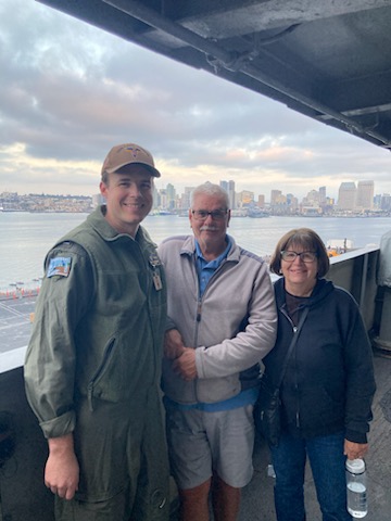
We did not see Mike on this day, but two days later we had lunch with him and Emily.
Mike had some plans for us. We were able to return to the Carl Vinson for a visit when he had 24-hour duty a few days later. We picked up some take out with Emily and had dinner with him in the Officer’s Mess. He then gave us a tour all over the ship. We saw his room on ship, his office and also the bridge. We walked on the flight deck and saw the immense hangar below. There were so many flights of steps, passageways, and turns. It would be very easy to get lost! It was reminiscent for me of touring the Midway, although that ship is thirty years older than the Carl Vinson.
The Navy doesn’t take kindly to people taking photographs on board their ships, so we only have this one of us together with Mike.
The ship looked very festive as we left, brightly lit for the evening.
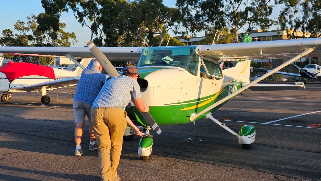
Mike has over a thousand hours of flight time, but needs a few more for post-Navy employment plans. He belongs to a flight club at a small nearby airport where he can “check out” a plane when he wants to fly. So, one afternoon we went up in the air with him.
I was in the back seat of the little Cessna. Looking at my pictures now, I don’t always know exactly where we were when I took them. This one is somewhere north of San Diego, looking out to the Pacific.
We flew over Mission Bay…
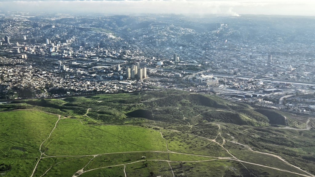
to just safely north of the Mexican border. We flew over our RV and Mike’s apartment. This is looking over the border to Tijuana.
Besides flight hours, a pilot also needs to log time taking off and landing a plane. Mike found several nearby airports where he put the wheels on the runway briefly and then we were up again. I was happy when I learned we were done going up and down in that little plane.
All too soon, we were permanently back on the ground. Cal helped Mike push the plane back into its parking spot.
What a fun flight!
I have another nephew in San Diego, a cousin to Mike. Marcus is married to Bekki and both are Lutheran pastors at different churches. We alternated between the two churches on Sunday mornings while we were in town. Bekki’s church is right across the street from Sunset Cliffs on the Pacific side of northern Point Loma.
As it happened, we were in town for a very special event – baby Isaak’s 1st birthday. His big brother Elijah was very excited about the party too.
We never know who we’re going to find on our travels. Cal has an Army buddy, Ed, who served with him in Greece. He wasn’t able to make it to the reunion in Thessaloniki a couple years ago, but he was in town at the same time as we were. Ed was the person who introduced us to Liberty Station, as we tried to have lunch at Cocina 35. There was a two hour wait! It was President’s Day and everyone was out in the beautiful sunny weather.
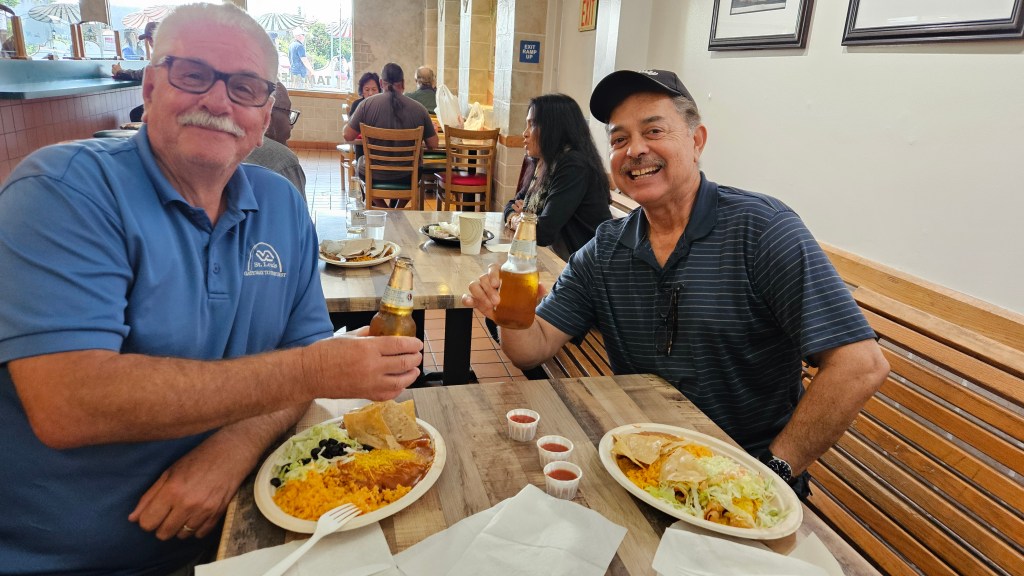
We passed on that, but went instead to a restaurant called El Indio, an order-at-the-counter place for Mexican that has been there for 40 years. The food was delicious. It was the first time I’d met Ed. He and Cal enjoyed catching up.
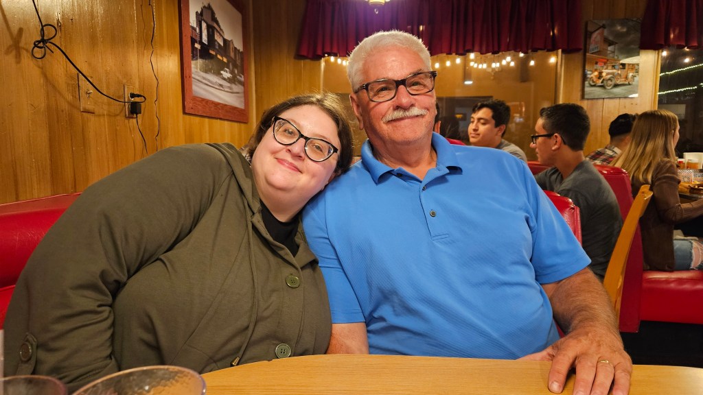
As if any of this could possibly get any better, we also were able to see our daughter Katie. We had actually already left San Diego when she came into town for a business trip. We drove 75 miles south to Temecula, California just to meet her for dinner. She had a slightly shorter drive up from San Diego. It had only been a couple of months since we’d seen her at Christmas time, but it was still great to have a short visit.
Figuring that we were missing the Texas barbeque that we had enjoyed so much a year earlier, she picked out the Swing Inn, another restaurant that has been in place forever. She has a talent for picking out good places to eat, as the barbeque was delicious.
I was sad to leave San Diego, but the high cost of living – even in our RV lifestyle – precluded a stay of any longer than three weeks for us. So we said farewell to this city and the folks that had shown us such a good time. Perhaps another year the road will lead us back.
Buckle up your seat belts, because you’re in for a ride all around San Diego!
We explored the city over a period of three weeks. We went many places, walked many miles, and I took hundreds of pictures. Any one of these destinations could be placed into one blog by themselves. But I’m going to do my best to condense, because time has passed since we were in San Diego. I have many more fantastic places to tell you about.
In my last post, I mentioned a harbor tour that we had taken while here. On that tour, we passed the USS Midway Museum, an aircraft carrier that missed World War II by one week. It is the longest-serving aircraft carrier, only having been decommissioned in 1992. I highly recommend touring this ship if you ever visit San Diego; we did it on our one previous visit a few years ago. Here, you can also see the back of the statue depicting the famous picture of a sailor kissing a nurse in New York Times Square on V-J day.
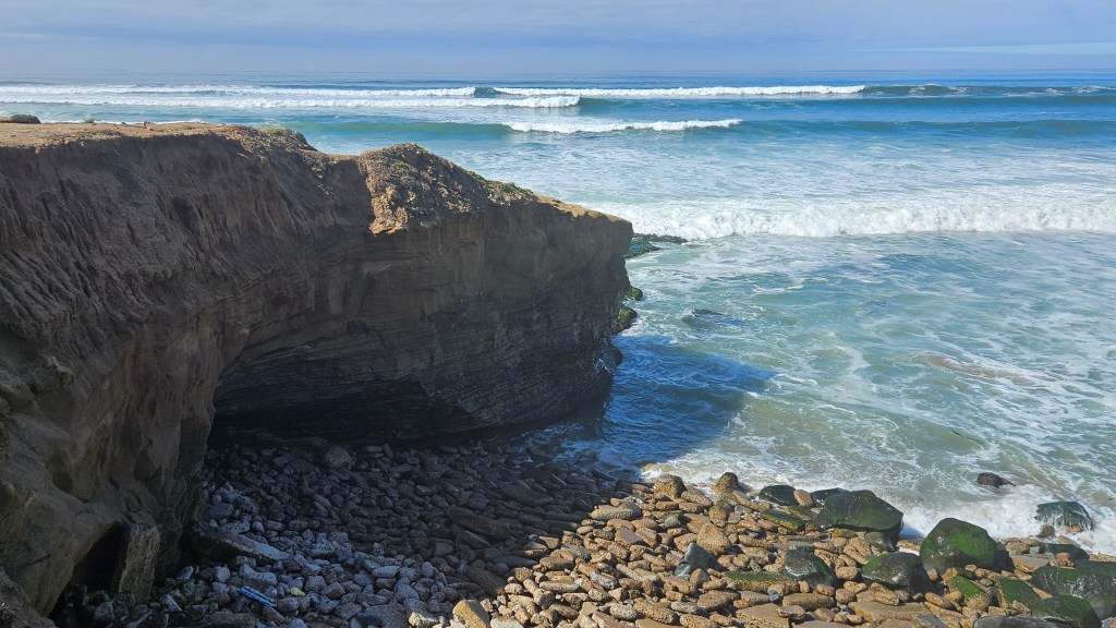
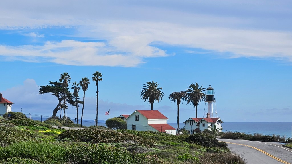
Point Loma is a place we frequently found ourselves in, near, or viewing from a distance. You can see the eastern side of it in the picture at the top of this post. Like Coronado, it is a long peninsula. Unlike Coronado, it hangs down from San Diego from the north instead of pointing up from the south. No one calls it an island: there is no part of it that is low enough to be at sea level for miles. It is high and rocky.
At the very top of Point Loma, where it merges with the city, is Liberty Station. This place was formerly a Navy trainee center. It has closed and the buildings have all been recycled and repurposed. This has been done in a way that respects its history but provides a multitude of various uses. The former barracks have artist studios and venues. There are both exclusive and casual restaurants as well as a food hall, and mixed with these is a high school, church, a Trader Joe’s and other commercial stores, an improv theatre, open air space for festivals, and I’m sure a whole lot more that I’m not mentioning. It’s all in a beautiful setting. The painting decorating this breezeway stood out among the more austere buildings.
We met my nephew’s wife, Emily, here for lunch while he was on deployment with the Navy. We could each have our own idea of a good lunch in the food hall, and all of it was delicious. The food hall looks a bit like it could formerly have been a mess hall. She and I lost ourselves at Sea Hive Station, a large vintage and maker’s store. We decided that the building had maybe been a gym in its earlier life.
I’m sending my readers a postcard from Liberty Station:
Farther down the coast, we had a view of Point Loma from the water on our harbor tour, and enjoyed seeing many sea lions alongside the coast.
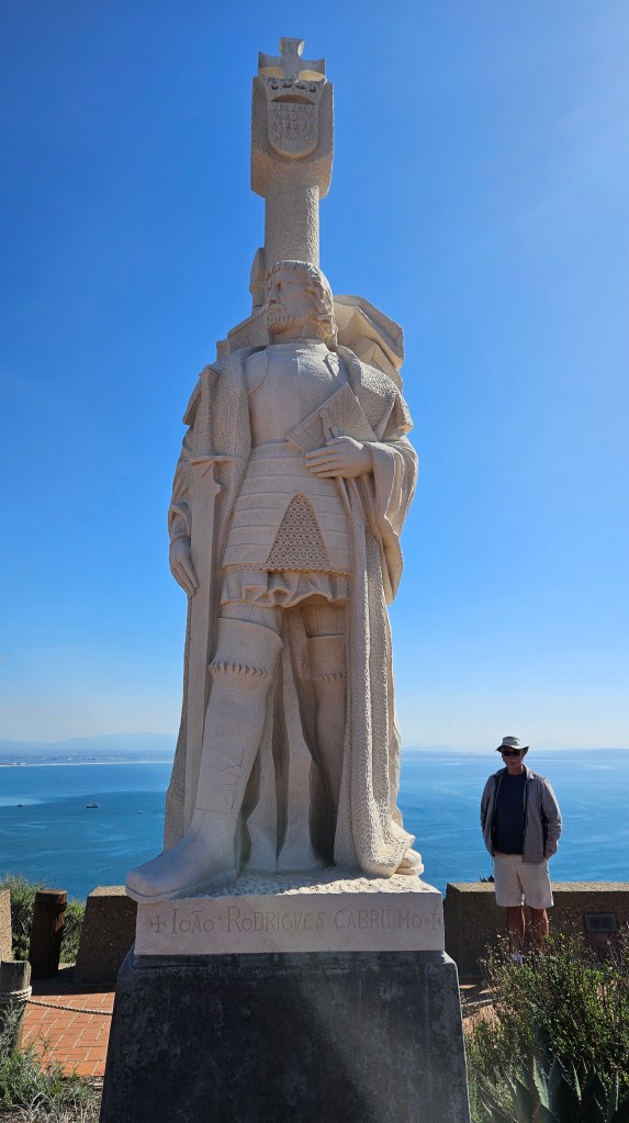
In our truck, we drove down to the tip of Point Loma to visit Cabrillo National Monument.
This statue commemorates Juan Rodriguez Cabrillo, who was the first European to set foot in present-day California. He explored the coast in 1542 from what is now Mexico, on behalf of the Spanish Empire.
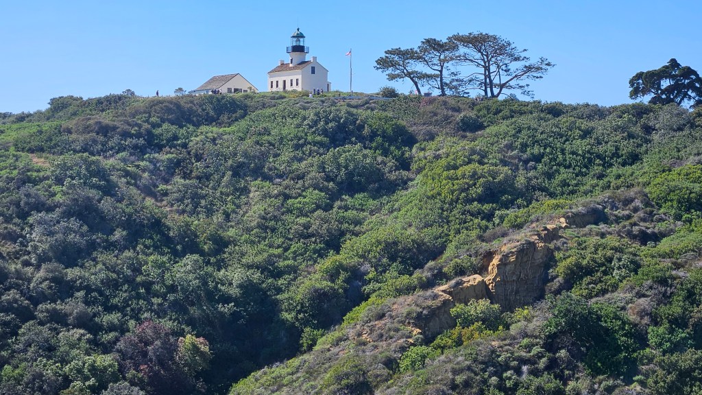
Besides the visitor’s center, there is also the Old Point Loma Lighthouse to visit.
This lighthouse served from from 1855 to 1891, when a new lighthouse was built. We were not able to climb the tower.
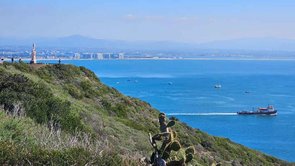
From both the lighthouse and the statue, sweeping views were to be seen. We could look back at Coronado Island and San Diego harbor.
From this area, we drove down closer to the water, and could look at the new lighthouse. It’s still in operation, so it belongs to the Coast Guard and can’t be visited.
There are tide pools here which I wanted to see. To investigate them, one needs to visit the ocean at low tide. The first time we were here, we hit it squarely at high tide. We went down again after our visit to Liberty Station, right at low tide, and the area was closed for a sewage leak! Oh no!! Instead, we took the coastal path and enjoyed a walk along the mighty cliffs.
The National Park Service calls the dramatic cliff rocks here a “seven-layer sediment cake”. There are of course more than seven layers, which were formed millions of years ago when they were 3,500 feet under the sea.
Moving on from Point Loma, we go now up to the city of San Diego. On two different days, we visited Old Town San Diego and Balboa Park. We followed advice given to us and used public transportation. For Old Town, we took an Uber to the ferry at Coronado, and rode it over to the harbor area. We had the ferry mostly to ourselves on an early weekday morning.
When we got off the ferry, a short walk took us to light rail which, in San Diego, is called “The Trolley”. It took us right to Old Town San Diego State Historic Park.
Old Town dates back to San Diego’s earliest days. It is the first European settlement in what is now California. Some of the buildings here are museums, and this part of it is the state park. Some of the buildings have been turned into shops or Mexican open-air craft markets. There are countless restaurants, and all of them that I saw are Mexican. Whatever your idea of a fun day is, you can have it here. Many of the old buildings line a pleasant park in the middle. And admission is free, including the museums.
One of our first stops was to the La Casa de Machado y Stewart Museum, where the table was set for dinner. There were lots of beans, which looked pretty good to me.
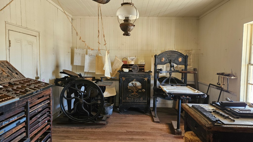
We also visited the first newspaper and printing office.
The other building to the left of the printing office is a rock and gem shop, which, I might mention, is also a great place to wander though.
Here is the inside of the printing office:
The building housing the printing office was actually constructed in Maine, and shipped around the Horn in 1851. The first edition of the San Diego Union newspaper came out in 1868.
We also saw the earliest courthouses, an 1860’s restaurant, and other historic structures. We made the mistake of visiting on a Monday, and many of the museum buildings are closed on that day. There was still plenty to see, though, and the shops were mostly open.
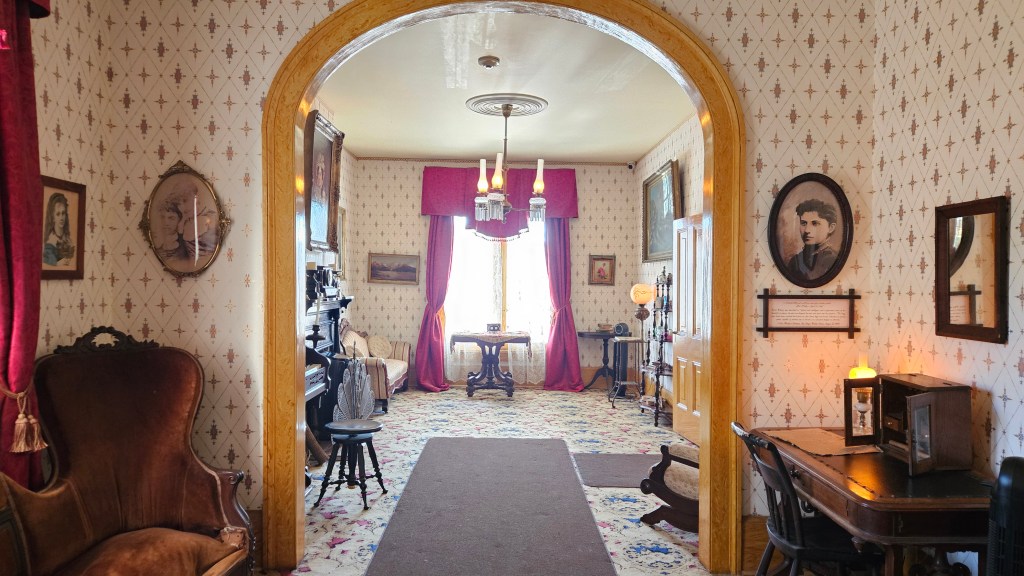
After our excellent Mexican lunch (which did include beans), and having visited the buildings that we could, we wandered over to the Whaley House. It is considered to be the most haunted house in America because of family deaths in the house. Not only that, before its construction it had been the site of public town executions…right under the arch in the parlor.
Hauntings aside, it was a fascinating look at early San Diego and the Whaley family. Thomas Whaley was an extremely enterprising man and built the house big enough so that he could rent out parts of it at various times for a courtroom, a general store, and a theatre.
We visited Balboa Park just a few days later. We were getting better with public transportation at this point and caught a bus not far from our park. It took us over the Coronado Bridge and into downtown San Diego. We only had to transfer to another bus and ride two stops to get there.
Balboa became a park way back in the 1800’s, but then it hosted two world’s fairs – in 1915 and in 1935. Its layout and many of its buildings are the direct result of those fairs. There are eighteen museums to suit anyone’s interest – from Comic-Con to art, cars, railroads, air and space, and the Museum of Us, to name just a few. There are many various gardens, attractions, plus the usual things that you’d expect in a park: a golf course, a pool, baseball and soccer fields and the like. The world-renowned San Diego Zoo is here. The whole thing covers 1,200 acres, bigger than New York’s Central Park and Chicago’s Millennium Park combined.
We thought for this visit we would mainly wander and explore. Right away, I liked the feel of being in Europe as we entered the park.
Plaza de Panama was built for the 1915 Panama California fair, which celebrated the completion of the Panama Canal.
At lunch-time, I tried my first-ever Vietnamese banh mi sandwich at one of the park’s cafes near this plaza, and it was delicious.
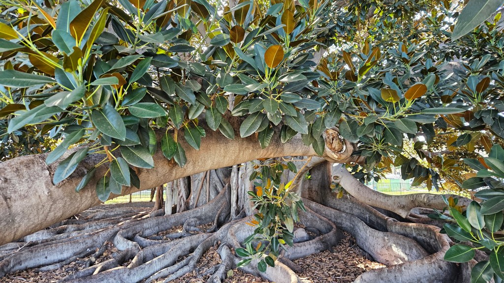
Continuing on, this fig tree was planted for the same World’s Fair, and we wandered around under its canopy.
It’s a Moreton Bay strangler fig with a trunk that is 16 feet around. Although it still stands, its surroundings have completely changed in the over one hundred years since its planting.
We walked through a desert garden, and the Japanese garden which we had to pay to get into. Most gardens are free, but that one was not.
The Japanese garden had an impressive display of bonsai trees. This one is a 45-year-old “juniper forest”.
Like the gardens, some museums are free and some not. We went into two of the free museums, one being the San Diego History Center. They had a collage of the murals in that are in Chicano Park, exciting to see since we had ridden through it on the bus.
We spent the better part of a day in Balboa Park and only scratched the surface. I wanted to come back to concentrate on a museum or two or perhaps visit some sections that we missed. That was not to be, but just maybe we will be back another time.
San Diego provided us with a wealth of things to do, and after being here I still feel like I’ve only just begun to explore.
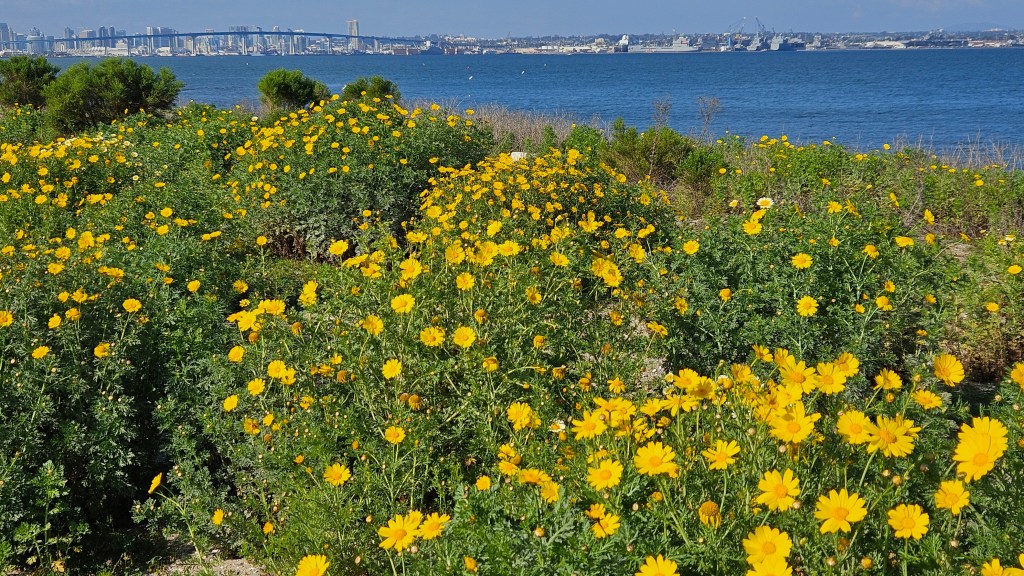
After going as far south as we could go in Yuma, Arizona, we then traveled as far west as we could go. It is 150 miles from there to this place, where we bumped into the San Diego Bay.
We stayed in a Navy-run RV park, Fiddler’s Cove, on the Silver Strand of Coronado Island. It is a lovely place, one of the best of the military family camps, and we greatly enjoyed the three-week stay.
Coronado Island runs north and south. The northern tip of it is a Navy base. Directly south of that is the beautiful resort town of Coronado. The Silver Strand is a narrow stretch of land which leads south from Coronado, with the San Diego Bay on one side and the Pacific Ocean on the other. The town was so close to us that we could ride bikes there on trails that led directly from our park and looped around the city.
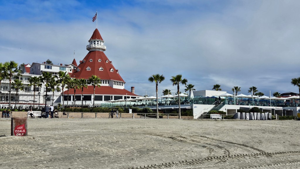
Hotel del Coronado, or “Hotel Del” as it’s called in local lingo, was built in 1888. It had electricity when it was built, a novelty at the time, and supplied power to the little city around it. Presidents and celebrities have stayed here. Frank Baum wrote three books in his Wizard of Oz series while in residency at the hotel. Marilyn Monroe filmed “Some Like it Hot” here in 1958.
We took a stroll through the lobby, and then wandered around to the beach out back. From here, the hotel’s lighthouse-style cupola stands out like a beacon.
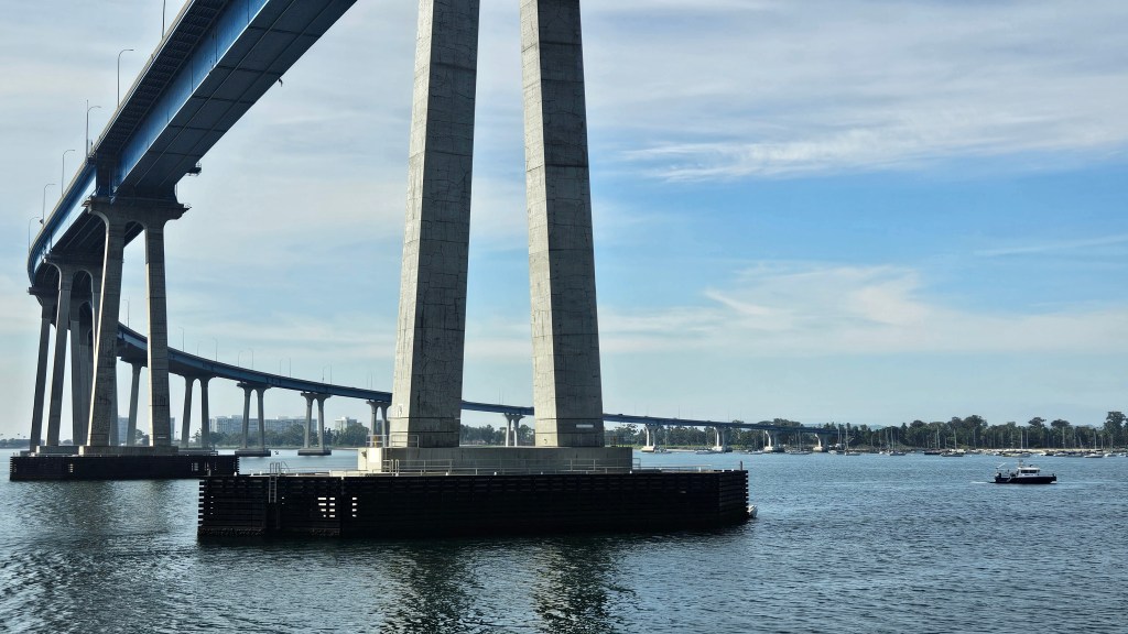
We took a harbor tour of the San Diego Bay, so some of my pictures will be from that boat ride. This picture of the bridge from Coronado Island to San Diego was taken on the boat.
I always received a beautiful birds-eye view of San Diego while riding in our truck on the bridge.
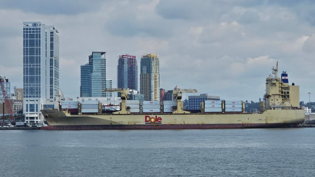
Do you see the yellow ship in back of this picture? It’s a banana boat!
On our harbor cruise, our captain told us that the Dole ships supply bananas to Western-$state grocery stores weekly from Central and South America. That’s 2 billion bananas annually for San Diego alone!
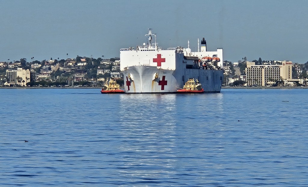
Another day, a Naval hospital ship was being assisted into port by a couple of tug boats.
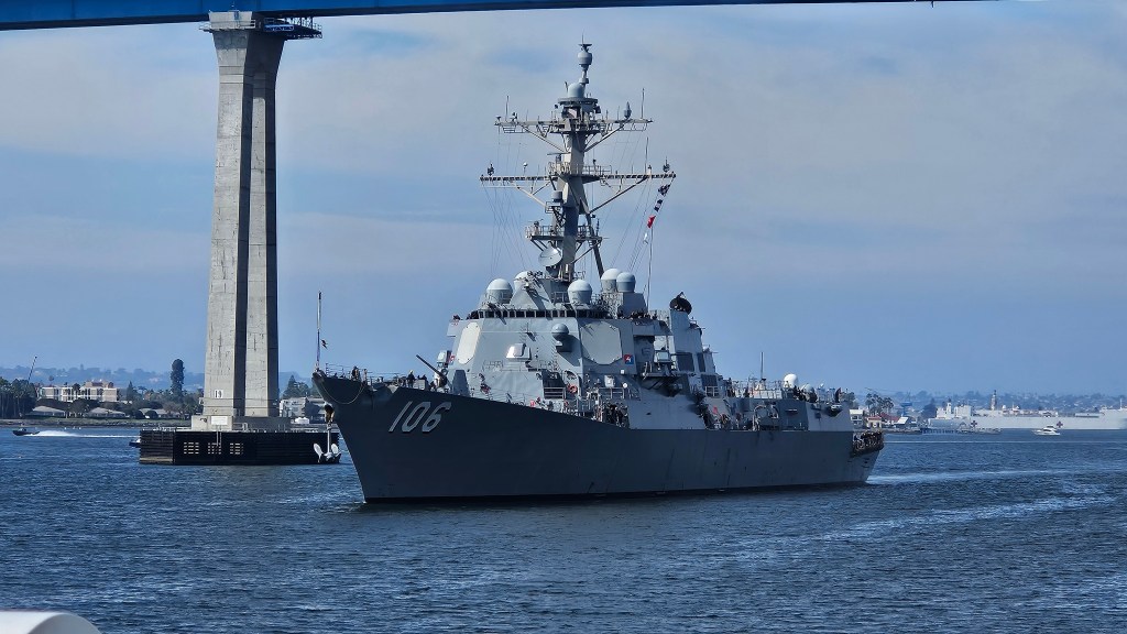
On the harbor tour we caught the destroyer USS Stockdale coming in to dock, and waved to the sailors on deck.
Our time here wasn’t all about ships. Back at the park, we enjoyed views of the mountains across the bay and would check to see if there was snow on top.
We were on the very edge of our park, and could see a tall pole with an osprey nest on top from out our window. A pair of them resided in the nest and we delighted in watching them fly about or cuddle in their nest. I’m not a wildlife photographer, but I did get a hyper zoom on them one day.
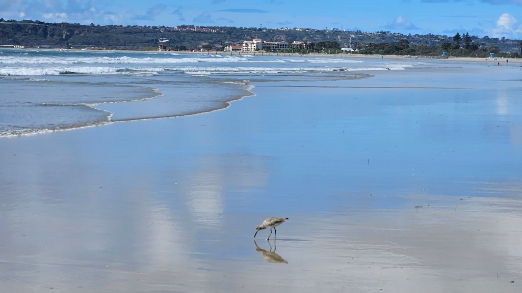
To me, a great RV park has ample space for long walks. I could go right out our door to walk either along the beach on the bay or on the path directly behind it. You can see it in the picture on top of this post. If I had time for a longer walk, the path would lead to Silver Strand State Park where there were always birds hanging about.
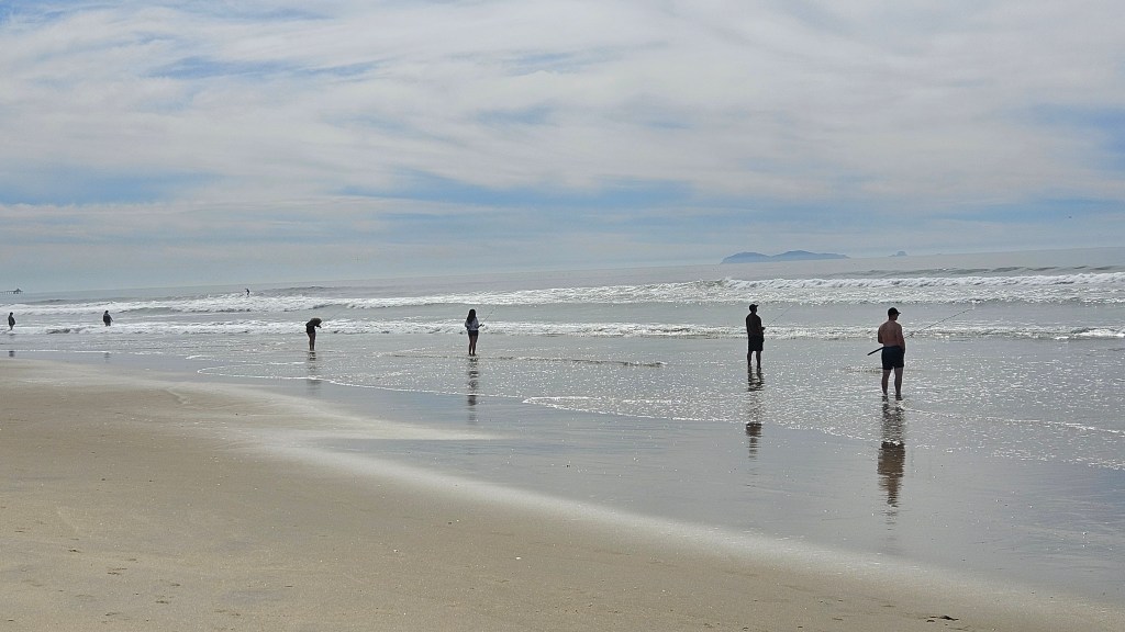
The path had a tunnel under the road and then I could be right on the Pacific side of the state park, where people would be fishing, surfing, or just enjoying the beach.
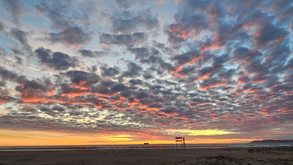
We also walked over across the road one night to watch the sun go down over the Pacific.
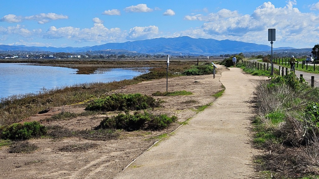
The funny thing is, Coronado Island is not really an island. It’s a peninsula. The town of Imperial Beach sits at the southern end. Our bike path went that direction, too, and led into a nature preserve at the south end of the bay.
Imperial Beach enjoys the distinction of being most southwesterly point in the United States, as the restaurant at the end of its pier proudly points out.
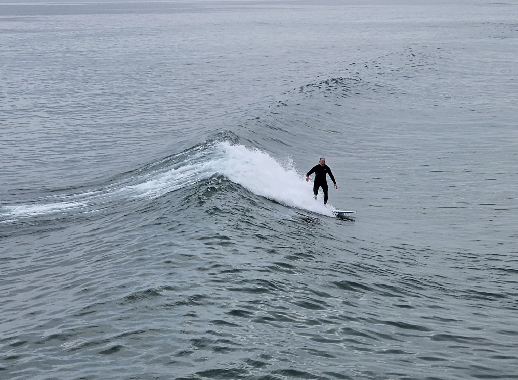
The next city south of Imperial Beach is Tijuana, Mexico. At night, we could see the lights of the city on the hills in the distance. On a cool overcast day, we could just spot it from the pier. We also enjoyed watching a few surfers who are probably out in any kind of weather. I caught this guy right at the beginning of the crest of his wave.
Just before we were to leave our park, the wildflowers went into bloom along the path. Could there be any better sendoff than that?
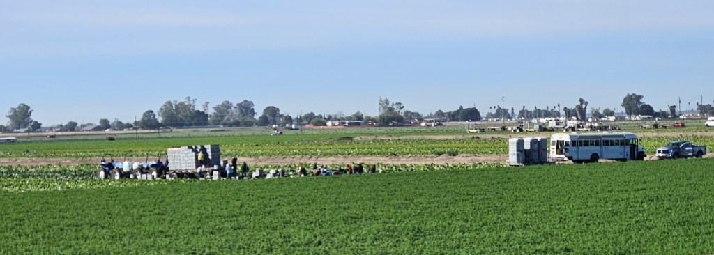
When we arrived in Yuma, trucks were suddenly everywhere. Several were lined up at an intersection, we were following one or two more, and we thought perhaps our next RV stay was going to be in an industrial park. Happily, not so. But what was up with these trucks?
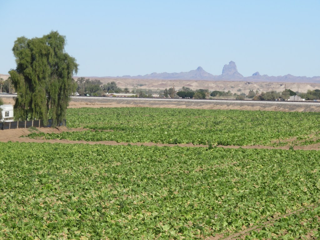
It wasn’t long before we figured it out: lettuce! Most of the lettuce you’ve been eating this winter comes from Yuma. We’d follow trucks filled with boxes of romaine and iceberg lettuce. We saw fields of broccoli and cauliflower too. The fields are fertile, the weather warm, and there is an ample supply of pickers just over the border in Mexico. Dole and Sunkist are major employers.
During our first days in the town, we visited the Yuma Territorial Prison State Historic Park. It is the main tourist attraction in this town and a very interesting place. It dates back to the days before Arizona was a state.
The guard house at Yuma Territorial Prison
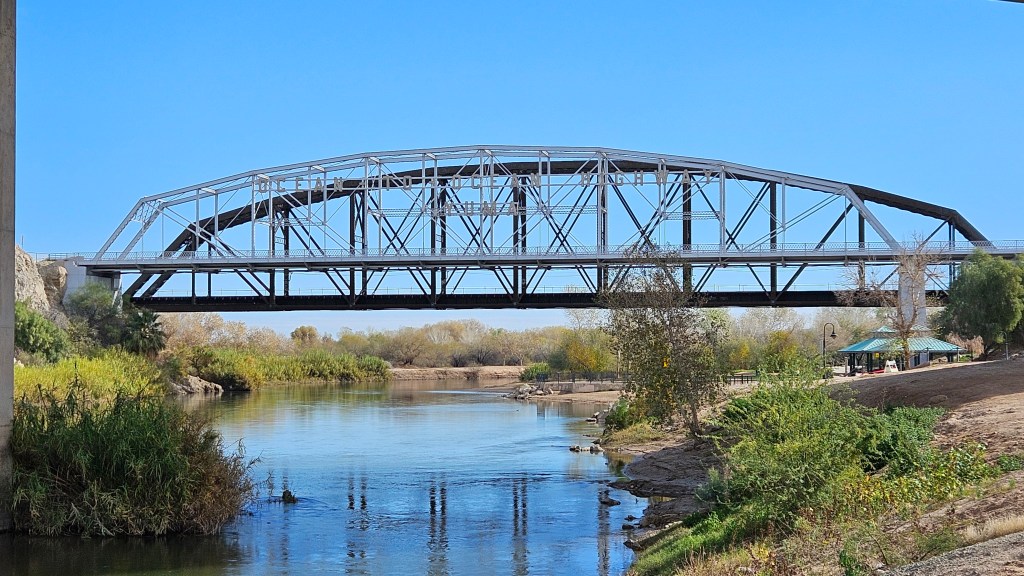
A few days later, we saw the prison again from the bike trail, which runs for three and a half miles along the Colorado River. On the bike trail, we were able to see the Ocean to Ocean Highway Bridge. It was built in 1915 and was the last link in the “new” interstate highway system. Previously, a ferry shuttled travelers across the river. Now it is only used for local traffic and a massive highway bridge serves for drivers on I-8.
The Colorado River had been dammed up in the early days of the city’s growth. The fertile valley and wetlands that the natives had enjoyed into prehistory was destroyed. I’m glad to see the wetlands brought back with native trees and grasses.
The bike trail wasn’t long, and eventually it went on to a country road. We rode it for some miles and eventually ended up in an iceberg lettuce field.
Across the road, another field was being harvested.
The bus with the porta-potties behind, which carries the pickers, is also a common sight around town.
It’s not just lettuce, though. Our RV park was miles down a country road. Getting to town, we would pass many orange and lemon groves. It seemed like they had mostly been picked earlier in the month. I took a longer-than-usual walk one afternoon and wandered through rows of lemon trees. There was a soft whisper of lemon scent in the air.
Inexplicably, there was one loaded orange tree in this orchard. Is anyone going to come and pick them?
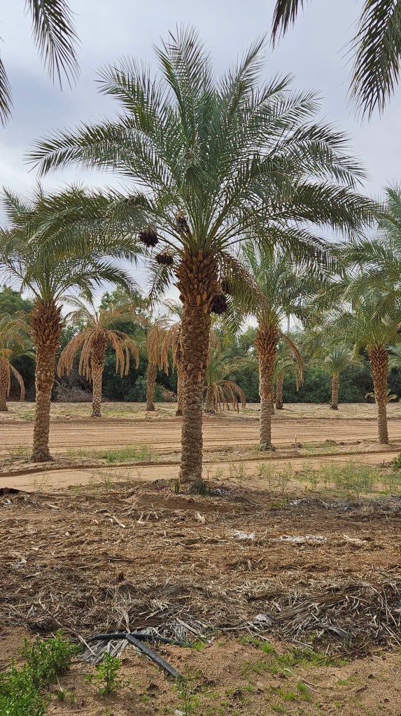
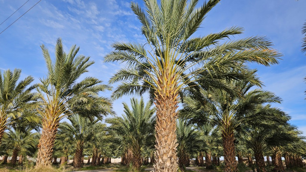
Dates are also grown in Yuma. It’s not the season for harvesting dates so I’m not sure how it is that this palm tree has some hanging down. But I wouldn’t know; we tried unsuccessfully twice to tour Martha’s Gardens Date Farm. If you ever show up there, know that they do not do tours on Monday, even though they are open.
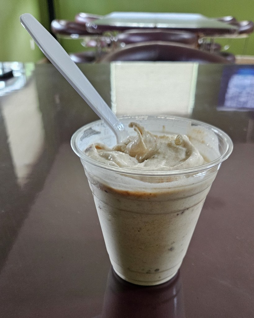
We settled for a date shake in their little cafe while watching a video about the farm. It was delicious!
If we had toured the farm, I was hoping to find out why there are groves of palm trees planted in many areas around Yuma. It’s still a mystery to me.
A crop of something we couldn’t identify was being newly grown in the fields behind our RV, with green shoots just peeking out of the ground. The irrigator made for some great sunset pictures.
Yuma has a huge winter snowbird population. I wanted to see what it was all about, and the produce production was pretty interesting aspect of our stay. I’m not sure that I would want to stay much longer than the two weeks that we were here, though. Many RVers have their special winter spot, but we are still looking for ours!