This post will be a left turn from our usual travel posts. Life-changing seismic events have happened, and they are what I will write about today.
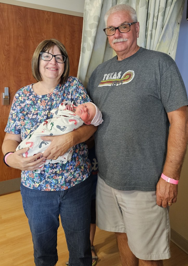
The first is the happy birth of our newest granddaughter, Eleanor Ann, to be called Ella. She was born just in time for the Paris Olympics three weeks early, July 24. Despite her early birth, she weighed in at 7 pounds and 3 ounces. She and her parents are well. The whole family, including her older brother and sister, are over the moon with delight at their new addition!
We brought the children to the hospital for our first look at our new grandbaby Ella.
Her siblings wanted to hold her right away.
My joy is tempered a bit with another event, though. My sister Linda passed this week, four days before what would have been her 76th birthday.
We were a family of ten children, six brothers and four sisters. Linda was nine and a half years older than I, and she doted on me. That bond has remained to this day. You can see her here, looking on attentively at the left while I sat on our oldest sister’s lap on the occasion of my first Easter.
Two of our brothers have already passed, and the last time us eight remaining siblings were together was in 2017. Unusually for us, we are not standing in this picture in age order. Linda and I are in the center.
Together, Linda and I shared many interests and our lives were similar in many ways. Like all of us sisters, we love to read. More than that, though, we both love travel, and we traveled together to China, Guatemala, and other destinations. Here we are at Pacaya Volcano in Guatemala:
I visited her in Turkey when she, her husband, and their oldest – a baby back then – lived there. Likewise they visited us in Germany during both of the times Cal was stationed there. Later, her family lived with or nearby ours for five months in Germany when her husband became ill. Despite four adults and the same number of little girls in one apartment, it worked. In retirement, she traveled often, and visited all of the countries in Europe but one. I enjoyed following her travels vicariously while I still toiled away at work.
She struggled with many health issues, though. Her life, beginning in her forties, had more than its share of grief and loss. Just a week prior to her death, I was concerned about her after a recent short hospital stay. Within a period of less than 48 hours, I was on a plane to New Orleans. Her needs were great but yet we visited and laughed and enjoyed our time together. We went out to eat for every lunch and dinner. She enjoyed her favorites: country fried steak, po-boys, and seafood. We went out to lunch with her oldest and out to supper with a special friend of hers. And, we got her nails done. She loved to feel pretty. How precious that I had that time with her, although I had hoped we would have more.
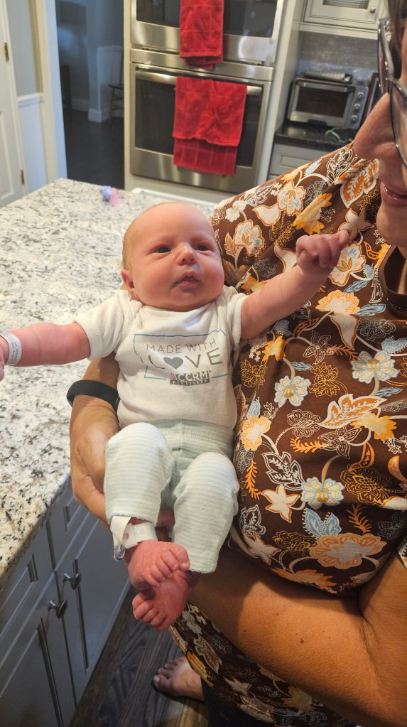
So, there is a layer of sadness mixed with joy by this wonderful new life that we all have in baby Ella. And with her, I have discovered a panacea for grief: holding a beautiful little baby by the hour as she sleeps. There’s not much that can be done except to gaze at her. Time disappears. She wakens and regards me seriously, trying to figure out just where I fit in her new life. She purses her lips into a tiny “O”, goes back to sleep.
From the day we arrive on the planet
And blinkin', step into the sun
There's more to see than can ever be seen
More to do than can ever be done...

In the circle of life, it's the wheel of fortune
It's the leap of faith, it's the band of hope
'Til we find our place on the path unwinding
In the circle, the circle of life.
--Sir Elton John
Before I came to the San Luis Obispo area, I knew nothing about what there is to see or do. Somewhere in the back of my mind, though, I’d heard of Morro Rock, which sits in the ocean about ten miles away from where we were staying at Camp San Luis Obispo. That was where we headed for another look at the Pacific Coast.
At Morro Bay State Park we received our first view of the bay. At the visitors center there is also the small Museum of Natural History. We admired the views, and this statue, while we waited for it to open up.
“Seasons Come and Seasons Go”
Interestingly, the state park was once a country club, opened just a few months before the stock market crash of 1929. The state of California purchased it not too long afterward, and the Civilian Conservation Corps of the 1930’s transformed it into the park that it is today.
Enjoying a short hike on one of the CCC’s rock-lined trails
Down below this point, there is a marina and the Moro Estuary National Preserve. We took another little hike on its boardwalk, but there weren’t too many bird sightings for us on this day.
Looking over the bay from the estuary, you can just see the CCC trail.
Back in the truck again, we drove through the town of Morro Bay–
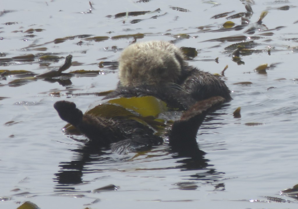
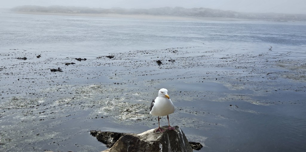
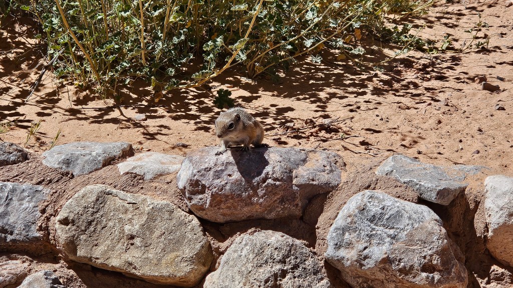
–and out to Morro Rock Beach. Here was a surprise – sea otters! I had never seen so many in their natural habitat.
Meanwhile, the ground squirrels were everywhere, trying to wrest food from the tourists and entertaining us with their Chip-and-Dale-style antics.
The dunes beyond the water were lost in a marine layer that had settled over everything.
And still we wondered…”where’s the rock?”
We hiked out to the end of the beach, where it turns into impassable huge boulders. We studied a park map. And then we realized…it was right next to us! It had been shrouded in the dense fog all morning.
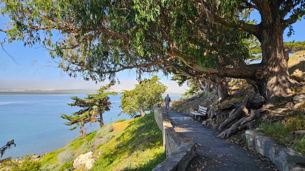
Cal walking on the beach trail right next to Morro Rock
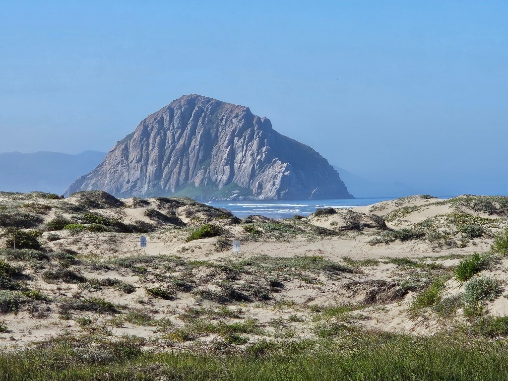
Morro Rock is a volcanic plug, which means that it was created from magma inside a vent on an active volcano 23 million years ago. The rock was quarried from the late 1800’s until as late as 1969, when it was declared a California Historical Landmark. Today, even just climbing on it is not allowed.
We received a better look at the whole rock the next day as we were driving up the coast. On this day there was no marine layer.
Morro Rock – we had been on the other side of it the day before.
We had lunch at a restaurant on the dock from where I’d taken the picture of the town of Morro Bay. Our server said that on days when the marine layer is heavy, the main question that he gets is “Where’s the rock?”
Morro Bay lies to the west of San Luis Obispo. Just south of the town is Montana de Oro State Park, and there the coastline takes a turn eastward. The other two beaches we visited here lay to the south of us.
Our stay happened to coincide with Mother’s Day. When we are not far from the ocean, this Mother wants to eat seafood. Even though I’d had excellent clam chowder and grilled fish at Morro Bay, another chance for seafood was not an opportunity to pass up.
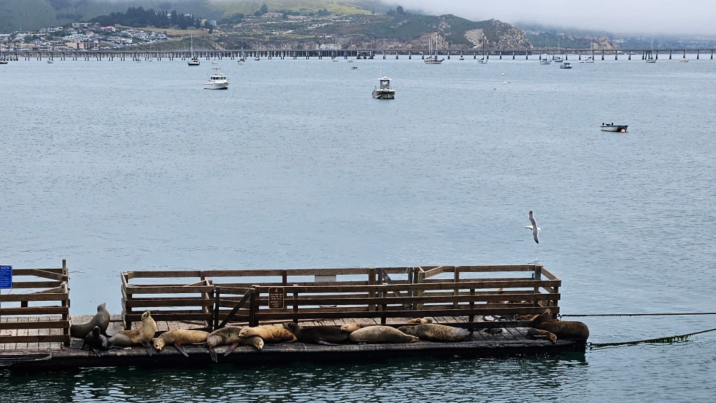
Mersea Restaurant sits at the end of a long pier on Avila Beach. As we walked down the pier, I was delighted to see seals in the water.
The seals at Avila Beach
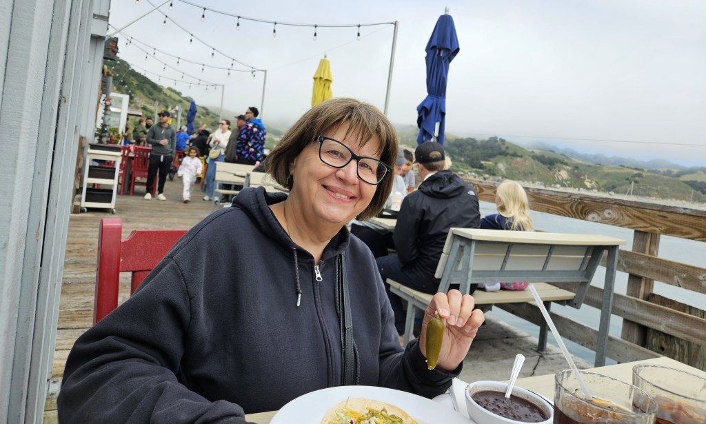
The seals were swimming below us as I had my excellent lunch of fish tacos. This picture didn’t quite capture my whole lunch, but you can see I that I would have shared my jalapeno with anyone who wanted it. This made a perfect, although a little chilly, setting for a Mother’s Day meal.
I looked nice for Mother’s Day, really. We had been to church earlier. My pretty clothes were all under that toasty warm sweat jacket!
From the pier, we could see Avila Beach has a small sandy beach. We also admired an RV park going up the hill, and another one alongside the water. But otherwise, it seemed more like a place for the locals. Certainly fine by us.
Tools of the trade on the Avila Beach pier
The beautiful green Pacific coastline
Pismo Beach is just down the road from Avila Beach and seems to be the greater attraction for families and tourists. On this Mother’s Day, parents huddled on lawn chairs and under blankets and canopies while the children chased the waves. It was a happening place.
As we walked on the sandy beach, there were many small blue jellyfish that had washed up, as well as several purple sand dollars. I have learned that the purple ones are still alive, so when I can I throw them back into the water.
There’s a boardwalk at Pismo Beach, as well as hotels, restaurants and shops.
You wouldn’t know it, but away from the beach it was a clear sunny day. You can see the blue sky behind the hills in the picture above. On this day, the marine layer later crept in almost all the way in to where we were staying.
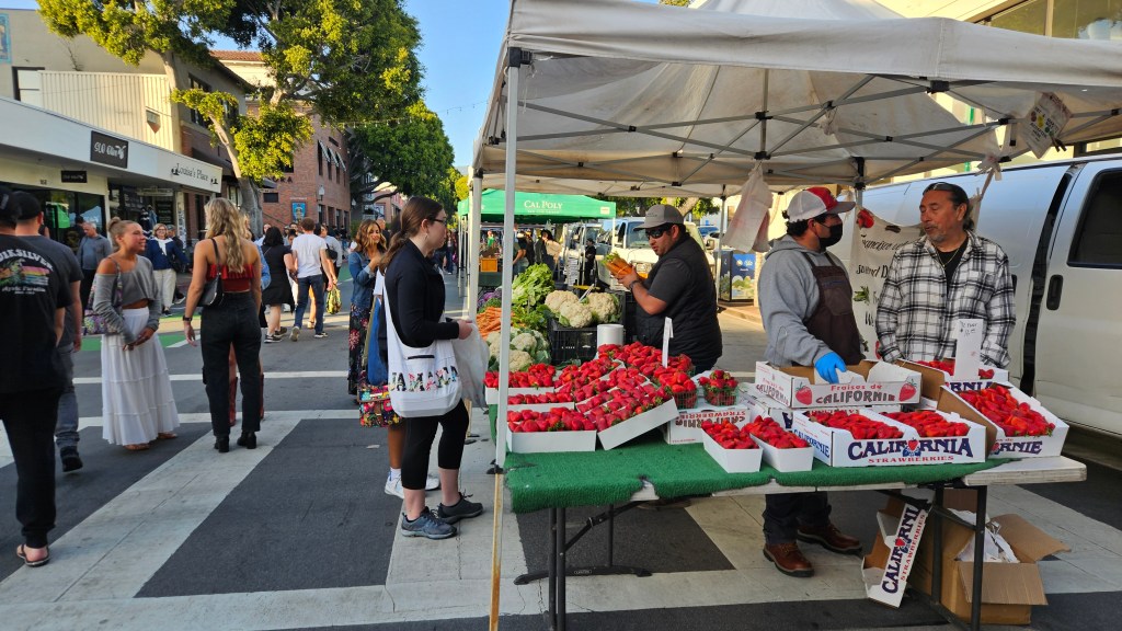
San Luis Obispo is a college town. Cal Poly (officially: California Polytechnic State University) is here, and so is Cuesta College. As we drove to the pretty tree-lined downtown area, students were everywhere walking or riding bikes with backpacks and iced coffees in hand. The streets close every Thursday night for the Downtown SLO Farmers Market. The students queued up for all the places that were serving food, met and chatted in groups, and shopped at the crafter’s tents.
At the market, we realized that in the nearby Central Valley, strawberries were in season. There were tables heaped with them. We bought some at the market and they were a sweet, delectable opposite of the strawberries that you buy in the grocery store.
Our time here was short, and I would have loved to explore more of the town and what there may have been to see away from the beaches. Certainly, with more time, I would have gone to Paso Robles and done some wine tasting. But we had one more place to see, which in actuality was the whole reason why we were here at all.
A lunch stop at the first rest area inside California
I have one note to add before I jump into this post: we are now actually in Denver for the summer. We’re in our RV at the local state parks, and getting ready for a blessed event! Yes, we are expecting our third grandchild within another month, and helping out the busy parents to (literally!) get their house in order by doing a lot of babysitting for the older two. The most traveling that we are doing these days is to shuffle between the two state parks every two weeks.
There are still plenty of memories to record for this trip. Once we were into the month of May in Las Vegas, the weather started getting very warm. Long rows of RV sites at our park stood empty. Did we stay in Vegas too far into the spring? As we traveled through California and beyond, there were times when I thought so. There were other times, though, when I was glad we waited.
Counting Desert Eagle at Nellis Air Force Base in Las Vegas, we had three military RV park stays back to back, with just a one-night stop at a KOA thrown in between for good measure. That’s rare for us. We traveled southwest from Vegas back into California on Interstate 15. We were farther north than we had been earlier in the season, but still traveling through the Mojave Desert. Our second military park was the tiny Marine Logistics Base just east of Barstow.
The black shield in the middle of this marker reads “Barstow 66″ for the legendary road
Cal was very excited about this stop as it was our first Marine Corps base. The only military branch we haven’t stayed with at this point is the Coast Guard. This base once sat on the old Route 66. The RV park wasn’t much, just a solitary road with a dozen or RV sites on either side, but it was OK for a night.
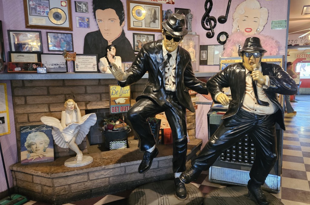
The real reason for being here is that I wanted to go to Peggy Sue’s Diner. I had found it on Harvest Host and it looked like a fun place to eat and then stay for the night. Harvest Host stops already have one strike against them in Cal’s mind, since they don’t have RV hookups. Add in a huge potholed concrete lot on the side of the highway where truckers also like to stop, and that’s two strikes. So, after unhooking truck from RV, we headed out for dinner.
You can’t miss Peggy Sue’s. With billboards back as far as Las Vegas, it is an I-15 institution. The place was opened in 1954, and this is the original diner:
These tables were full, but no worries: there are several more dining rooms. After we found a table and ordered, I was entertained by getting up to look around at all the rock-n-roll memorabilia while I waited for my dinner.
There’s even an outdoor garden:
We indulged our appetite for fried chicken, and the portions were huge enough to take home for another meal and then some. By not eating all of the dinner, we saved room to share a slice of delicious strawberry-rhubarb pie with ice cream.
There’s one more thing to note about this stay: in the morning, we walked over to the commissary for a few groceries. I saw this, for the very first time in my life:
Perhaps you’ve seen these before, especially if you live in California. It is a solar-powered electric charging station. Having one environmentally friendly power source charged by another is brilliant. Perhaps I’m being a bit of an idiot and they are everywhere. Later, in California, we found ones that were much bigger. It’s the wave of the future, recorded here! Is this the first time you’ve seen this?
We’d seen huge solar farms farther south and in Nevada as we’d traveled. The places I’ve lived in the past don’t have enough sun for a solar farm, so for me they are novel.
Moving on further west, there was the usual desert driving, more Joshua trees, and finally we climbed a mountain. At Tehachapi we entered a valley and that was the end of the Mojave Desert. When we parked at the Bakersfield KOA, we had grass on our site. That was a marvel! The grass was so soft. We thought hard about it and decided it was the first grassy site our RV had been parked in since we’d left Colorado the previous November.
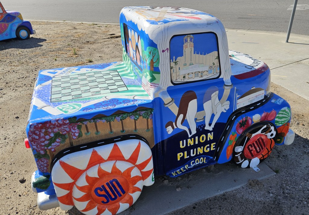
We didn’t disconnect truck from RV in Bakersfield, so for some entertainment we walked down to the Camping World store about a quarter of a mile away. Across the road from the KOA were car dealerships lined up, one next to another. Each one had one of these cute little Bakersfield-themed pieces of art in front of them:
After Bakersfield, we entered the Central Valley of California. In the distance we could see barren hills. But in the valley were miles and miles of orchards. I don’t know what kind of trees for sure, but we saw signs for almond and pistachio. There were ranches with cattle and a couple of beautiful flower fields. Closer to Paso Robles, we began to see vineyards and many wineries. Now we turned south and the hills started to close in and become green with a smattering of trees. And then, all the hills became tree covered. Everything was kalaidoscopic green. Having been in the desert for seven months, I felt like we’d reached the Emerald City!
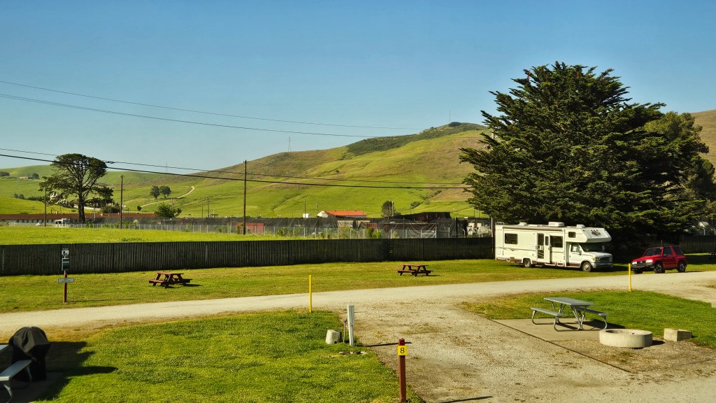
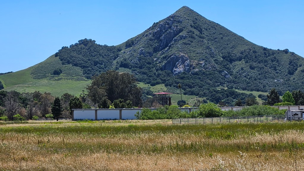
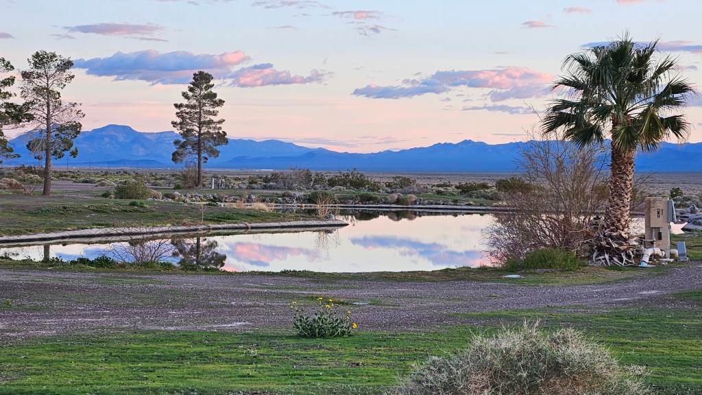
We stayed at a National Guard post outside of San Luis Obispo for several days. Everything looked like it had been built in the 1940’s and not much improved since then. Here, though, we found a place that we absolutely loved. There is only space for 12 RV’s, plus more room for dry camping around the edges, at Camp San Luis Obispo. The sites are wide and grassy. The whole time we were here there were probably less than five other RV’s sharing the park with us, plus the camp host.
Here’s a view to the green hills of San Luis Obispo:
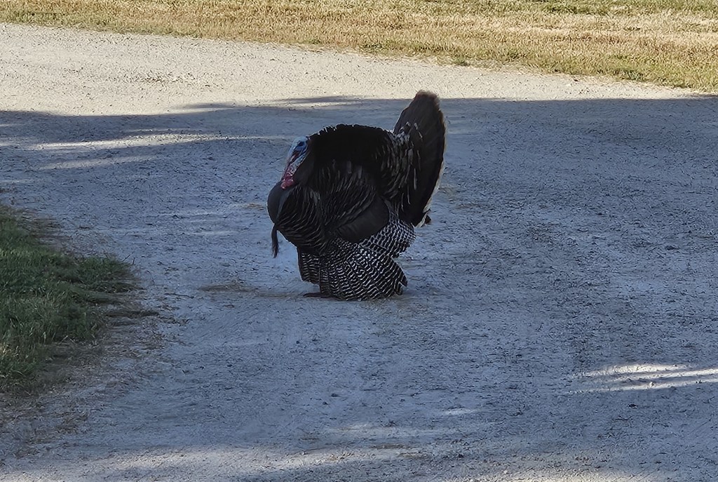
An afternoon bike ride here felt like a ride through the countryside. And back at our site, there was plenty of wildlife to entertain us: a whole scurry of ground squirrels that resided in the field behind us, one or two deer strolling through, and a pair of turkeys that regularly visited.
On the last couple of days of our stay, a marine layer (fog) crept in over the hills, for the ocean was just on the other side.
We are learning that all of the military branches have diverse places to stay across the US. But near San Luis Obispo there are other places for RVer’s to stay. Why would anyone want to come here? I’ll explain in my next two blogs.
Next time – the Pacific seaside near San Luis Obispo
Have you ever been to the Grand Canyon? If you have, chances are that you’ve been to the South Rim of the National Park. Grand Canyon National Park also includes the North Rim, which not as many people visit. It doesn’t usually open until mid-May and it’s harder to get to.
There is also Grand Canyon West, which is a commercial enterprise run by the Havasupai Indian Tribe on their reservation land. About fifteen years ago, they constructed a skywalk out over the Grand Canyon. We’ve been to the South Rim several times, so I thought this might be a different way to go. The distance from our RV at Nellis AFB to Grand Canyon West was 125 miles. Thinking that we might appreciate a little overnight road trip after spending so many weeks in Las Vegas, I booked us into one of their cabins for a night. It was to be our last night in Arizona for the 2024 winter and spring.
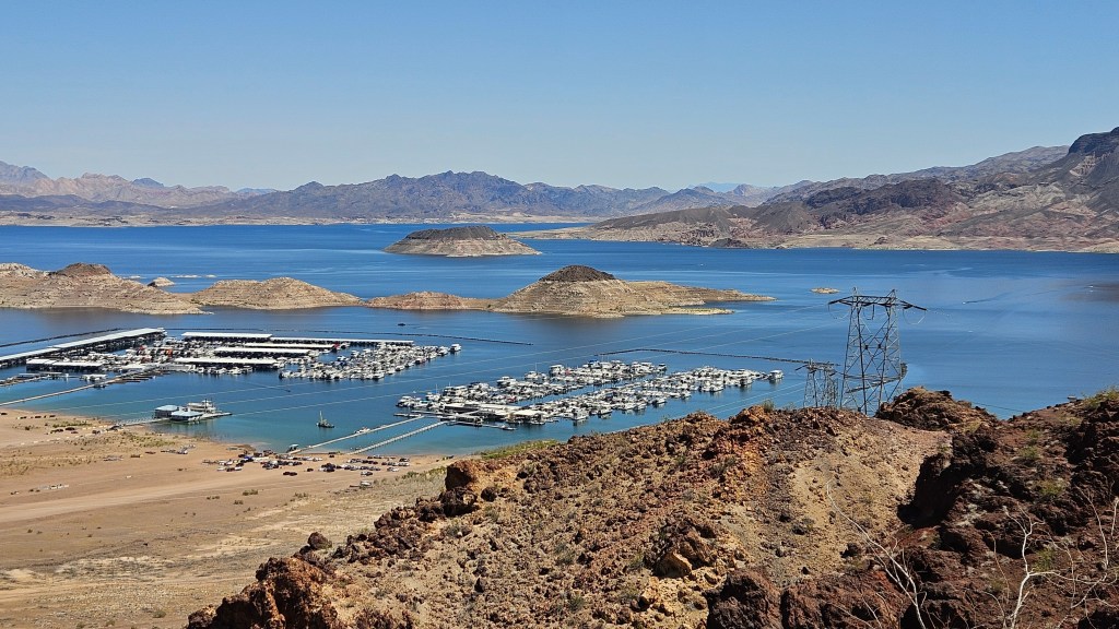
Driving out to Grand Canyon West, we drove though Lake Mead National Recreation Area. The lake shimmered in the sun. The lake level is still a little low, although not as bad as it had been.
A surprise treat was in store for us as we drove through Arizona. Joshua trees! Miles upon miles of them. We thought their height and sheer beauty rivaled what we had seen weeks earlier at Joshua Tree National Park. Some were in the desert or tucked into sloping mountain canyons. Some looked to be at least thirty to forty feet tall with trunks as large as regular trees.
As we drew closer to Grand Canyon West, the Joshua trees began to intersperse with juniper trees and pinon pines until, finally, they were gone. The juniper and pines, too, eventually gave way to a prairie-style desert with cacti and beautiful orange-blooming flowers.
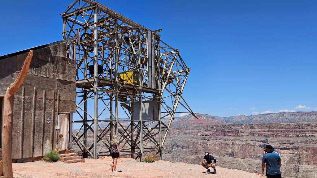
When we arrived, we first stopped into the visitors center to pick up our tickets. A shuttle takes visitors to the first stop, Eagle Point. All of these places are very important to Hualapai culture.
Do you see the eagle in the rock with its wings in flight? It was spectacular to receive not only the first glimpse of the Grand Canyon here, but also to see the eagle.
The views of the canyon are no less grand for being on the west side.
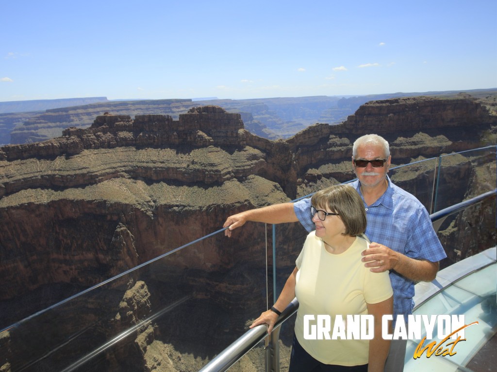
Looking to our left from here, we could see the Skywalk.
When the Skywalk was completed in 2007, it was the world’s biggest glass cantilever bridge. It extends 70 feet over the Grand Canyon, has a glass bottom, and can hold 800 people at once. By now the length has been superseded by a bridge in China.
Here’s the thing: you have to pay, of course, to step out on the bridge. (The whole day is not a cheap proposition. We supported the Hualapai quite well.) But you cannot take any possessions out onto the bridge. That includes phones and cameras. The reason given is to protect the canyon from things dropped or intentionally thrown from above. There are folks right there on the bridge to take your picture, of course. It costs $50 to purchase the photo package.
Our photographer arranged us in several cheesy poses. Afterwards, I noticed people could ask their photographer to take pictures in poses of their choosing, and I wish we had done that. I would have liked a photo of our feet down through the glass floor.
After our photoshoot, there was plenty of time to look at the canyon below our feet and all around.
I purchased the photo package because it came with the scenic photos that I was not able to get from the bridge. When I first went out to the website for the photos, I glanced at them and figured I’d download them later. I did download the photos of us. But then as the days after our visit went on, we were busy and traveling, and I never quite got around to downloading the scenic photos. When I did, they were gone: they are only out there for 30 days. Live and learn. If you visit, and spring for the package, don’t be Julia: download your pictures immediately! Better yet, just enjoy the view and have a passing tourist take your picture in front of Eagle Point for free.
Outside of the bridge, we walked to the Native American Village. Here, we could see various types of Native housing and sweat lodges.
This “wikiup” is made of the juniper trees that are plentiful here and can come in many different sizes. There must be a native person (or many) skilled in making these here because I saw at least three of them like this in various places. They can be bare of the greenery or have animal skins on the ground, and can be large enough to house an entire family.
After a good lunch at Sky View Restaurant, we walked over to the shuttle stop for the ride to to Guano Point. As we waited, we listened to this gentleman chant. I was intrigued with his combination of native and current day dress. He has next to him on the bench burnt sage in a shell. For the people, the rising smoke has spiritual meaning, and the shell that the sage sits on does as well.
The Hualapai have always lived here and a small piece of their land includes the Grand Canyon. They are not subsidized by the US Government. Years ago, they started trying to generate revenue with a casino, but realized that what people really wanted was to see their land. They make a fine living off the tourism offered here.
Guano Point is so named for an enterprise that operated in the mid-century to extract what was supposed to be 100,000 tons of bat guano from a cave. The guano was used in that time for fertilizer, dynamite and (yikes!) makeup. A tramway was built over the canyon to ferry the workers over and bring the guano back. But there was actually only 1,000 tons to be mined and it played out quickly. A US Air Force jet crashed into the cable, damaging it, and it was never repaired.
Remains of the bat doo-doo cable system and extraction enterprise
More interestingly to me, this is also a sacred site for the Hualapai. There was a time when the US Government tried to round them up and place them in a central camp in La Paz. The Hualapai call this the “Long Walk”. Many Hualapai jumped off the canyon to escape, and the people call them “the lost souls”.
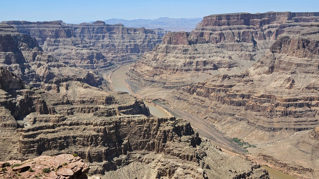
Just below the bat guano operation, the Grand Canyon offers an extraordinary view of the Colorado River far below. All around Grand Canyon West, there are no fences to keep anyone from going over the edge.
The day was getting on, so we rode back to the truck and drove to another GCW area where the Hualapai operate cabins, and checked in. It’s set up like a Western town, which is really weird considering this is reservation land. There’s not much here that’s open, save for a tourist shop and a place to purchase tickets for the zip-line. There is a restaurant, but we opted to save that for breakfast. Instead, we drove back down the road off-reservation, enjoying the view at “golden hour” with the canyons and hills bathed in a warm glow from the setting sun.
Grand Canyon Western Ranch has a variety of acommodations and also a restaurant. It’s small with less than a handful of tables, but the tables are large and different groups are expected to share it. Many evenings they have a guitar player singing songs. The restaurant closes at 8 PM and the resort does a campfire with s’mores, to which we were invited. We were fairly early and didn’t stay as we had other plans, but we ordered their barbeque ribs and the food was good. It would have been a great alternative to staying with the Hualapai on the reservation.
Returning to the reservation and cabin area, there are two trails that lead out onto the prairie. I wanted to do a sunset walk on the shorter, 1/2 mile trail. Arriving at the edge of the canyon, we had the view all to ourselves for a very long time, and it was magnificent. Like Red Rocks outside of Las Vegas that I wrote about in my previous blog, it was totally quiet. All was still except for some birds soaring over the canyon.
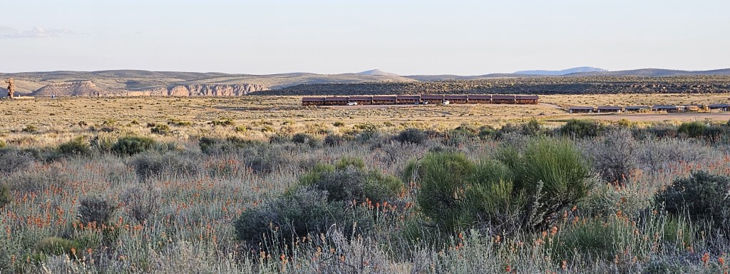
Off in the distance you can see the cabins at Grand Canyon West, strung out like a wagon train
We rose early the next morning to hike on the longer, 1.75 mile trail. Needing to get on with our day, we only walked about a mile through the prairie before turning around. At our turnaround point we finally reached the start of the canyon, but this part of it was green with hills folded into hills.
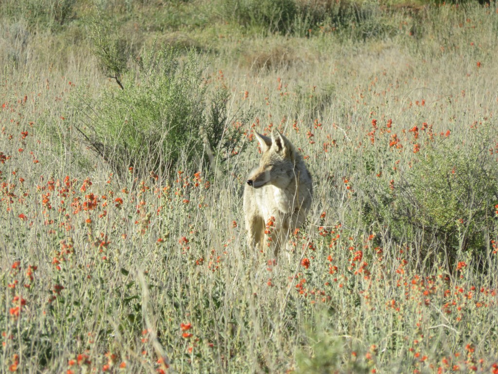
The prior evening we noted that there was a whole warren of rabbits running around. This morning, we watched a coyote unsuccessfully on the hunt for one of them. Those are wily rabbits.
Returning toward Las Vegas, we stopped just below the Lake Mead Visitors Center in Boulder, Nevada to ride our bikes on the Historic Rails to Trails. As the title implies, this is an old rail line which leads 3.7 miles to Hoover Dam. Many people were hiking it but they seemed mostly to be going the other way. It was a good thing they started early because the day was getting hot. It wasn’t too bad on e-bikes.
There are five old train tunnels on this trail. Each one is very exciting to ride through.
Looking ahead to one train tunnel while inside another
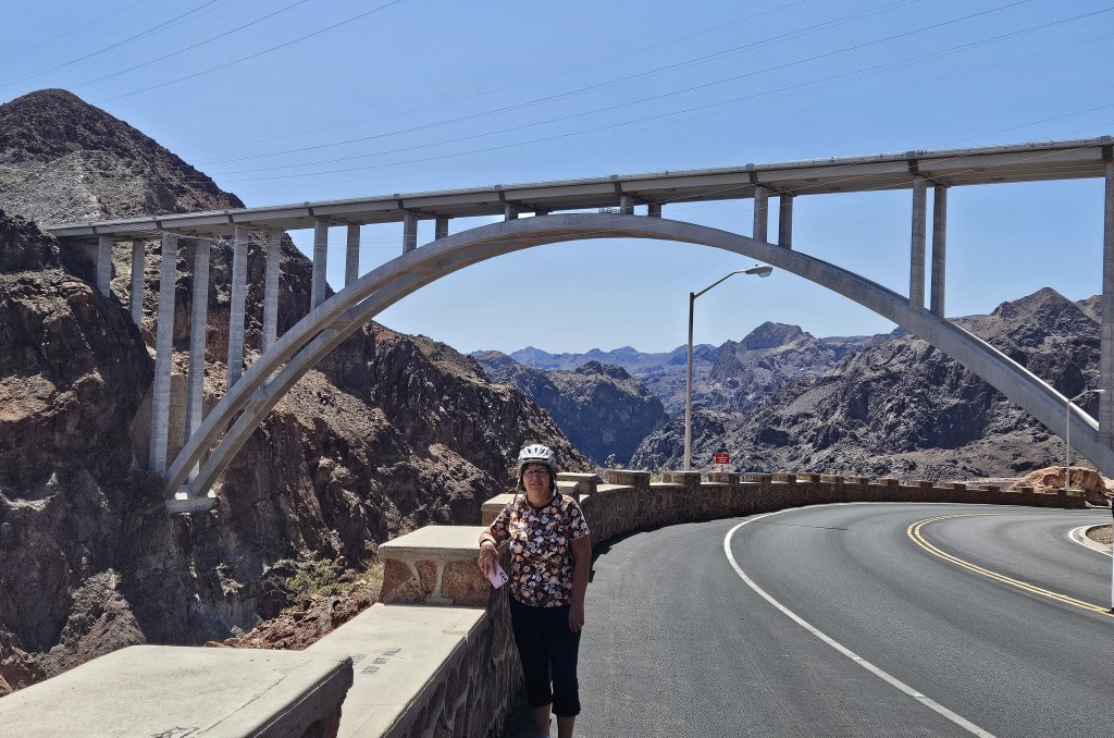
When the trail ended, we jumped on the state route for just a bit and stopped at a turnoff to view Hoover Dam.
This was a novel view for us. We have been on this road many times in years past; it used to be the only way to get from Arizona to Nevada. Cal remembers us touring Hoover Dam for $1.00. Having visited the dam in earlier times, we did not feel the need to go any closer.
From here, we could turn around and see the new bridge that bypasses this whole area. It was built between 2005 and 2010. When we drove on the bridge, we would have never have known that Hoover Dam was below. It’s not possible to see anything with the concrete barriers. I really think it’s too bad they’ve “lost the view” in the construction of the bridge, as wonderful as it may be for safety and bypassing a congested area.
With our added little side trip to Hoover Dam, we logged in 11 miles on this ride, plus had a great chat with a young German couple at a rest stop.
This trip completed our time in Las Vegas; we left just a few days later with a whole lot of great memories.
One of the things that made for a good stay at the Nellis AFB RV Park, Desert Eagle, was that there is actually an event coordinator here by the name of Lori. She and her husband, Troy, who also works at the park, were an awesome team who headed up the events Lori planned. We went to a chili cookoff, and then the next event was a hike at Red Rock Canyon National Preserve.
This park requires entrance tickets, which Lori took care of. It receives local visitors and tourists from the Strip alike, since it isn’t all that far from the city, so it can get busy. It was nice not having to drive, as Lori has a large van at her disposal.
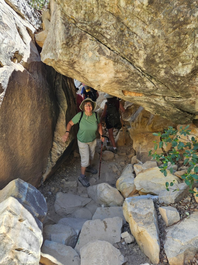
The Willow Spring Trail at Red Rocks is rated moderate and is 1.5 miles one way. There were some tight spots–
— and a bit of rock scrambling —
— but we enjoyed the trail and meeting our fellow RV’ing hikers in the group. Coincidentally, several were from Alaska. Military folks get sent, and put down roots, in a lot of varied places.
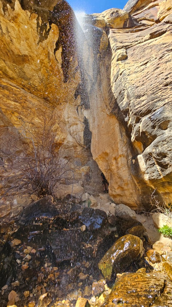
The trail took us to a pretty waterfall.
An unexpected treat near the end of our hike was a native American agave roasting pit. It is to the right of this picture, and you can see the soot marks on the hollowed limestone rock. Underneath, rocks were placed and heated, and the heated rocks formed an oven. These seasonal roasts were a time of feasting and gathering for dances and religious ceremonies.
If you can zoom in, and you would like a little “seek and find”, you can look for the ancient hand prints to the left of the top of the crack that rises up from the ground, near left center of the picture.
After our hike, we had the picnic lunch that we’d brought along at a shelter. There was a spontaneous second walk on a boardwalk loop trail nearby before returning to Nellis.
We returned to Red Rocks another day with our ebikes. The park road goes one way in a loop for 13 miles, and is recommended for biking. We arrived at 8:15 AM, with park entrances in hand. We saw no other bikes and only a handful of cars, so it was perfect timing. In a natural park like Red Rocks, the uphills are steeper but easily tackled by ebikes. And the downhills – wheee! I had my bike up to 25 mph, which would normally be too scary for me. The road was empty of traffic, though, and the surface smooth.
Seeing the park at our normal biking speed of 10 mph gave us a slower view of the scenery, including those red rocks for which the park is famous.
Sitting to take a break, the silence was profound.
We took another of Lori’s excursions to Springs Preserve. This park is much closer in to the city. It is on the site where a spring with water was originally found and the city of Las Vegas was born. There is a whole exhibit here about water, and the Charleston Heights pump station is here. Most of Las Vegas’s water comes from Lake Mead.
That’s not all there is to Springs Preserve, though. There is a botanical garden, a butterfly house, a train that goes to a recreated Western boomtown, the Nevada Museum, the Origens Museum, and a tasty cafe overlooking the park where we had lunch. I’m sure I’m forgetting something. It is not hard to fill up a day here.
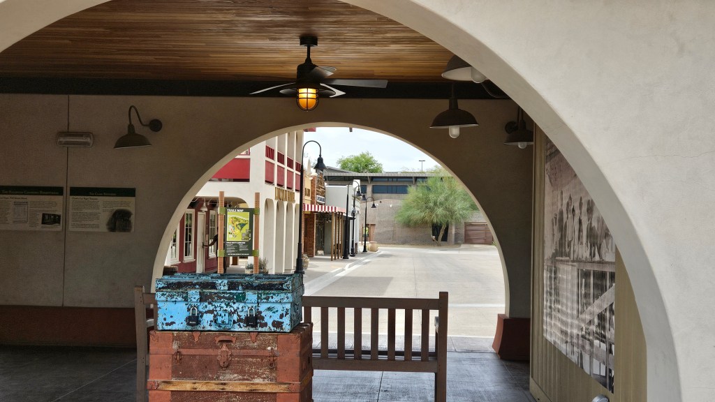
This is the Western Town, from the train station. It was still early in the day and not many people were about.
At the train station, I found the old photos of Las Vegas to be fascinating.
In the Western Town, there were period homes to visit:
And things I never heard of were here, too:
This is a solar chimney, which is used to cool a room. The sun heats the air in the chimney, causing a draft, which draws warm air up and out of a room. Native plants (that you don’t see in the picture) cool and dampen the air, which is also pulled into the chimney.
The Origen Museum here was great for several short movies in various rooms as you walked through. The flash flood exhibit is everyone’s favorite. There is a video on the screen with two rangers walking around in the desert, talking about the dangers of the heat and other desert-related information. Then, all of a sudden, 5,000 gallons of water are coming at you! The water goes right under a bridge under your feet and does a great job of informing the visitor about just how fast a flash flood can come up.
The last thing we saw here was the Liberace Room in the Nevada Museum, with Liberace’s piano, chandelier, and other assorted items on display. Liberace was a flamboyant pianist and singer who had concert residency in Las Vegas. Besides Liberace, you can see a dinosaur fossil, listen to stories of Nevada miners, and hear about Nevada’s part in atomic history in this museum.
We did a fair amount of bike riding while in Vegas, besides Red Rock Canyon. Nellis Air Base was interesting in and of itself. The Thunderbird flying team is here, and we saw them lined up on the airfield.
They did zoom over us at the RV park a couple of times, but mostly they were out of town doing shows. We were delighted to discover a small museum dedicated to the Thunderbirds near their parking spot.
The Las Vegas Upper and Lower Wash Trails provided a chance for a longer ride. What the trails lacked in beauty, they made up for in urban interest. Going from east to west, it was all suburbia, starting at the prettily landscaped Centennial Park. As we got more into the city, it became more industrialized and gritty.
We rode on what seemed like the longest pedestrian bridge ever, over the rail yard and the highway with a view of the Strip. The end of the bridge can be seen on the left center above.
The only thing about this trail is that their trail maps are miniscule and not well placed. Peering down to see where we were was always a challenge!
Another day, we drove out to artwork in the desert south of the Strip called Seven Magic Mountains. The artwork is by Ugo Rondinone, and has something to do about the continuity and solidarity between man and nature. I captured six of the seven “mountains” in this photo.
This little boy laboriously building his own Seven Mountains was more inspiring to me.
Last, but certainly not least: we have family everywhere, it seems. Cal found a distant cousin a few years ago who lives in Las Vegas. He had met Andy on an earlier trip to Vegas, but it was my first time meeting him, his wife Iris, and their son Daniel. We went out for dinner one night and got to know one another better. Daniel took this picture of us. I could for sure see the family resemblance between Cal, Andy, and others in his family.
I’ve covered a lot of ground here, and haven’t even noted everything we did while staying in Las Vegas. The city surprised us with all that it had to offer, and the RV park at Nellis, Desert Eagle, certainly lived up to its reputation as a great place to sojourn for a little while.
Something different…a highway viewfrom the Upper Wash pedestrian bridge
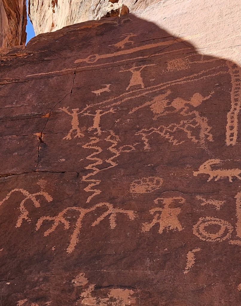
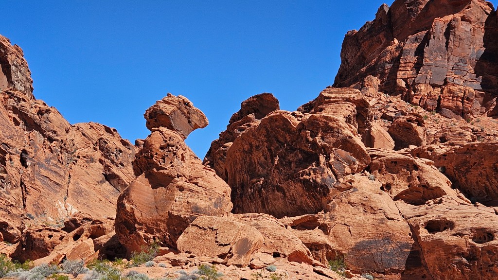
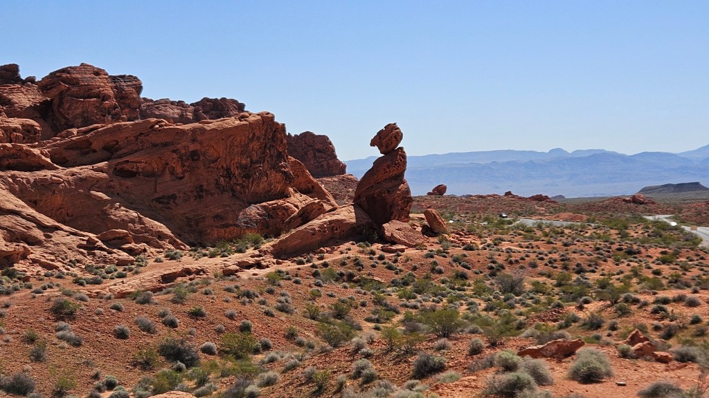
Valley of Fire State Park lies about 45 miles from where our RV was parked in north Las Vegas. It’s considered to be a geologic park. The additional thing that drew me to it was the promise of seeing petroglyphs. These messages left from ancient peoples are fascinating and I like to think about the people who drew them. So, we packed a picnic and headed out.
A hint of sights to come is the bright red rocks that greet you as you enter the park.
The first stop just after entering Valley of Fire is Atlatl Rock. Here, the petroglyphs are high up on the boulders. The stairs up to them presented the first challenge, but the reward is great for those who make the climb.
Petroglyphs offer a window into the lives of the people who lived here long ago. An atlatl is a primitive spear. Here, near the top, the artist drew a picture of one as well as a person with an atlatl in his hand. There are also some big- horn sheep scattered around. It’s interesting to speculate what else the artist, or artists, may have been thinking of when creating these.
The artwork covered much of the tall rock slab. We marveled at how they might have gotten up there to accomplish it.
At the Visitors Center, there are descriptions of the rocks. Valley of Fire’s rocks come in many colors. They are mostly sedimentary, meaning they come from liquid rock that is deep within the earth, compressed and formed into new rock. They then metamorphose into new forms such as dolomite (from limestone) or quartzite (from sandstone).
This formation of rocks can be seen just after leaving the Visitor’s Center.
What is intriguing about the rocks is that just by moving your perspective, you receive a whole different view. After driving around a corner of the road, the above formation is also pictured below. The small rock perched on another looks like it might fall right off in a good windstorm!
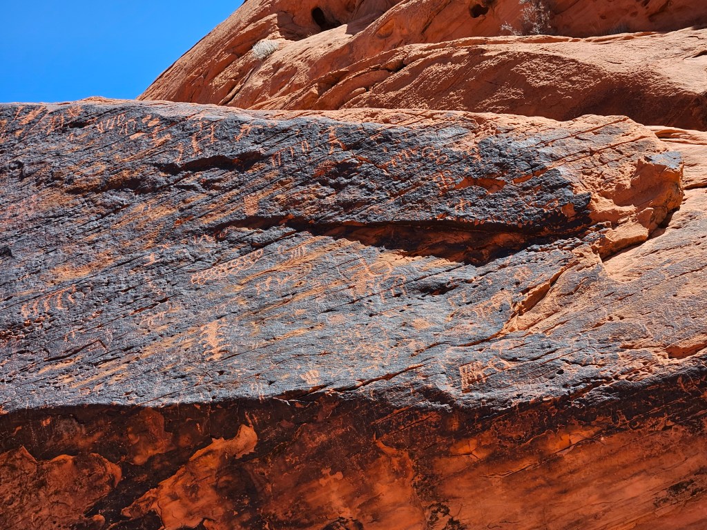
We hiked Mouse’s Tank Trail, which starts out with sand for the feet and orange boulders rising up on the side. There are petroglyphs here, too, and it was like an Easter egg hunt to find them as we walked.
Another thing I learned in the Visitor’s Center is that a dark staining of some of the exposed sandstone walls is called “desert varnish”. Valley of Fire has a lot of desert varnish, and this is what the natives preferred for their petroglyphs.
Still another definition for you – a “tank” is a pool of water formed when rocks form a sort of bowl which holds rainwater. The early peoples and later travelers greatly benefited from these water pockets. We learned about these when we unsuccessfully tried to find a tank on a trail at Capitol Reef National Park a while ago. I was happy to see this one.
Supposedly, Mouse is the name of the Indian fellow who found it. I’d venture to say he wasn’t the first.
Our other trail for this day was White Dome Trail, with two huge white domes of rock as the entrance portals. On this trail there is a piece of a movie set.
What looks like an old ruin was actually built in 1965 for the movie “The Professionals”.
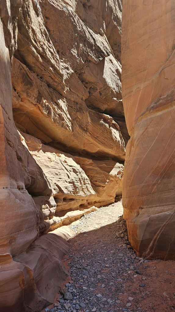
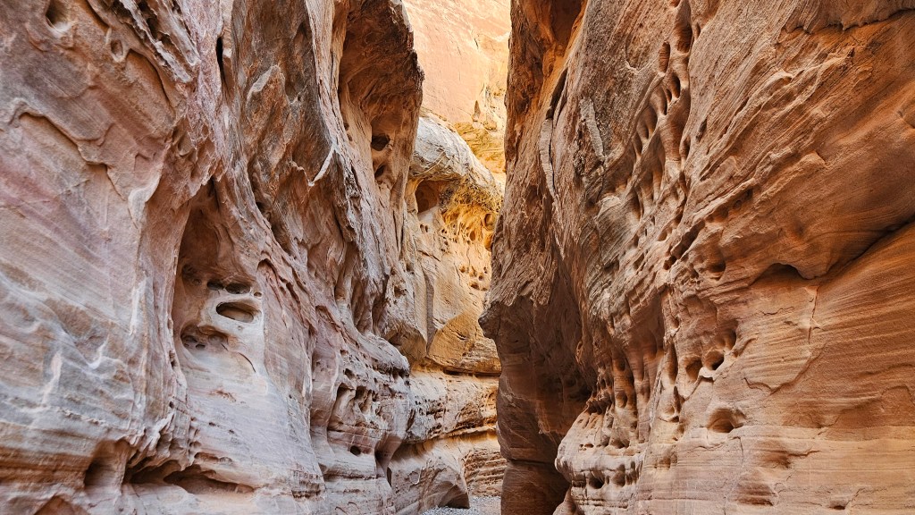
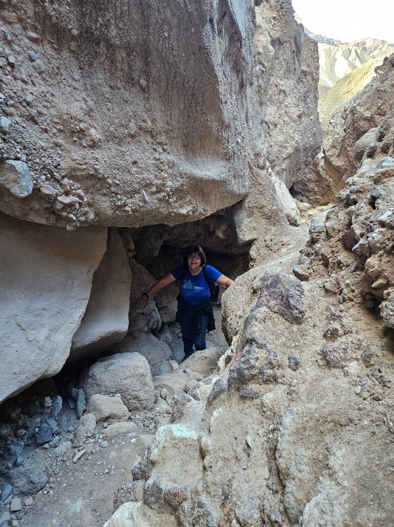
Still on this same trail, and shortly after the movie set, we entered a slot canyon.
After walking in to it, the air was suddenly cool and we were shaded from the sun.
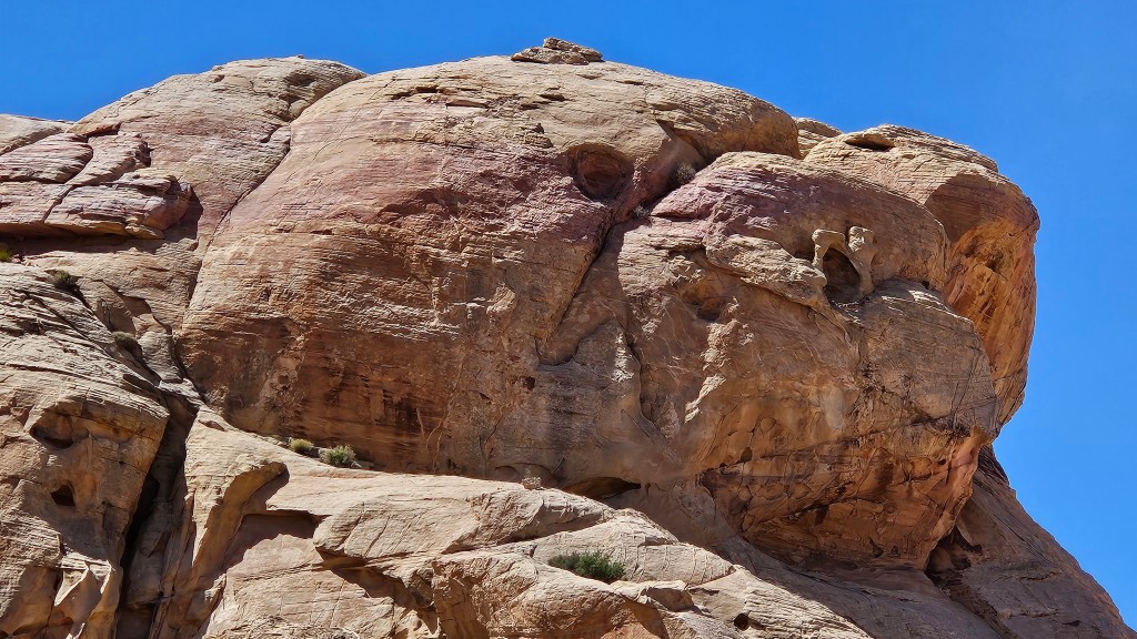
Coming out of the slot canyon, the walk was level and the rocks were so pretty. I saw what looked to me like a giant tortoise head in this formation:
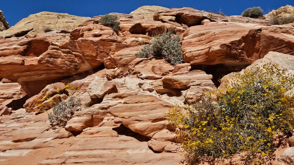
And, the colorful striated rocks for which the park is known, in pinks and reds and whites, along with some spring flowers blooming:
We found a picnic area for our lunch. It turned out to be a stage for a nest of chipmunks who were all vying for a piece of our lunch. I don’t feed the critters anymore, and no one should, but people do. They were very entertaining as they scampered about.
Here’s more photo of Valley of Fire, showing a deep contrast between the colors of weathered rock and desert varnish:
Coincidentally, the morning news on the same day as our visit here did a feature on the Clark County Fair. I looked up the location and found it was only a little distance from Valley of Fire.
We had come into the state park on the west side. To get to the fair, we needed to go through the park – which we were doing anyway – go out the east side, and turn north for a little while. We enjoyed the different view along the way. The east side emerges just north of the northernmost reach of Lake Mead. The landscape was other-worldly. There were dry mesas with lofty tables miles long, yet the valley was green with trees.
Inside the fair gates, I was ready for a treat and our mission was to find funnel cakes and lemonade to share. I couldn’t remember when I’d last had one, although we’d had plenty of opportunity. There was a grove of trees with a large patch of grass and we soon joined everyone else taking a break from the sun. It beat hard on this day and felt hot, even though the temperature was barely eighty degrees.
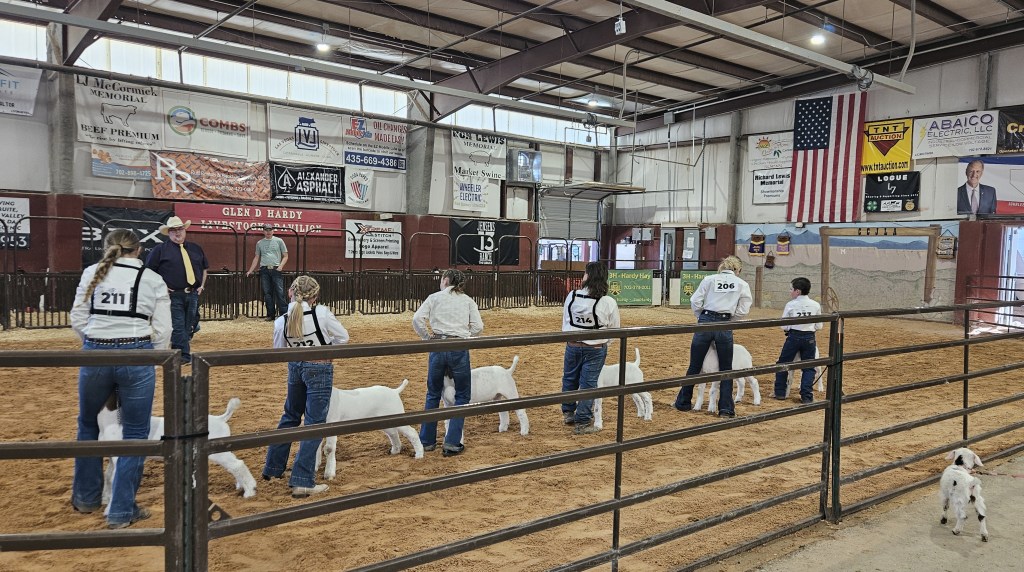
Only small animals were being judged at this fair. There were no cows or horses here, although there were one or two on display. There was a mama sow with her piglets and other animals such as this group of llamas:
We watched the goat judging. These kids work so hard taking care of their goat all year long, and then making sure they and their goat are looking their best for the big day. The judge had a lot to say as he checked them all out. The goats and their owners are evaluated in groups of six. All of the goats are then in their pens for the duration of the fair, and ribbons proudly displayed.
When the judging was done, the kids could enjoy the carnival at the fair to provide some stress relief. There was also a handful of buildings to walk through. I always enjoy the fine arts building at fairs in order to view the needlework, paintings, and other creativity on display. This is an embroidered piece with a multitude of French knots that form the background and the tablecloth for the vase of flowers. I’m sure it was a lot of work!
From here, it was an easy drive a little further north to hop on the interstate for the drive back to Vegas. I counted this day as one of the highlights of our time here.
“Just listen to the music of the traffic in the city, linger on the sidewalk where the neon signs are pretty, how can you lose? –Petula Clark
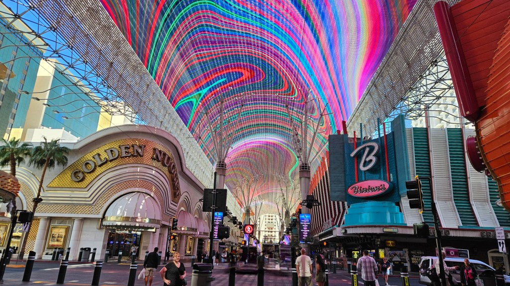
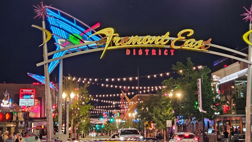
The place that used to be hopping with the main casino activity in Vegas is downtown on Fremont Street. After our fine hotel stay on the Strip that I wrote about in my last post, we came here after checkout. Since it was morning, things were pretty quiet. Change was immediately evident since the last time I was here. The street has been permanently blocked off and made into a pedestrian zone. Something called a Viva Vision canopy now covers the whole thing. It is the largest LED canopy screen in the world. Free light shows happen on the hour. There is even a zip line that goes from one end to another. It has been dubbed “the Fremont Street Experience.”
As I first stepped on what was formerly known as the Strip, a wave of nostalgia washed over me. I was here, days before my 19th birthday, with my best friend who has since passed. She had purchased a car from her uncle who lived here, and I flew to Vegas to meet her and help her drive it back to Texas. Of course, we dressed up to the nines to go out on the town. We played the slots, but I’m sure we didn’t spend more than some of our quarters. A decade later, Cal and I also visited here a couple of times when we had family living in town.
On a side street, I could almost feel the old Vegas.
Cal and I remember when people would stand outside the casinos handing out coupons for free sodas, a room, a low-cost meal. Breakfast was especially cheap. Anything to get you inside. If you played, they gave you free drinks. What I didn’t know then, I know now: in those days, the Mafia ran Vegas with a tight fist. They are credited with developing the city into what it is today, both good and bad. People with money ran hand in hand with those who had no money but had expertise.
Two things happened to change things: law enforcement cracked down on traditional organized crime, and new Nevada laws were passed to ease the way for corporations to own and operate casinos. Add to that, all of the newer casinos out on the Strip are not in the city of Las Vegas. They are in an unincorporated township named Paradise.
Here in downtown Las Vegas, on Fremont Street, no one passes out coupons anymore. It seems smaller to me, but someone I talked to said it really is not. Some of the smaller casinos have been swallowed up by bigger ones, though, so there are less of them.
If you are interested, you can get more of the history by visiting the Mob Museum in downtown Vegas. We didn’t visit it this time.
There is a show on TV called Pawn Stars. Occasionally, when Cal is flipping channels, he stops on this show to watch something that catches his interest. On the show, people bring in things they want to sell. Many times they are antiques or oddities and the owners then consult experts to check the value. It is interesting to see what the experts tell about the history of the item and to find out how much they think it is worth, and then see how much the pawn shop owners give the seller for it. Sometimes a deal is struck, sometimes not. Usually the seller receives much less than they said they originally wanted.
The shop that the Pawn Stars own is Gold and Silver Pawn. We walked down to it from Fremont Street.
It was strange to be in a place we’d only seen on TV. The counter is familiar as the place where people set their treasures for evaluation and sale. There was nothing we would have been interested in buying, though, and some of the collectibles were very expensive. I’d call this “Upscale Pawn”. Do they have good luck selling this stuff? Well, there are buyers for everything, and the store is also on-line so you don’t need to come to Vegas to shop.
After digging around, I discovered the shows we’d watched are reruns. The show has been off the air for two years. The shop is owned and run by three generations of men and one of their friends, but scandal and legal issues surrounded them. The store is still a popular place to visit, judging from all the people coming and going.
Walking from Fremont Street to the shop, we passed a pretty wedding chapel:
We made one more visit downtown. I wanted to see the Neon Museum. We took an Uber back downtown for an excellent dinner at Nacho Daddy’s. From there it is a 3/4 mile walk to museum. It wasn’t the nicest walk. I suppose walking isn’t the main way people get there, and I think it’s too bad that the city can’t do something to clean this up just a little bit.
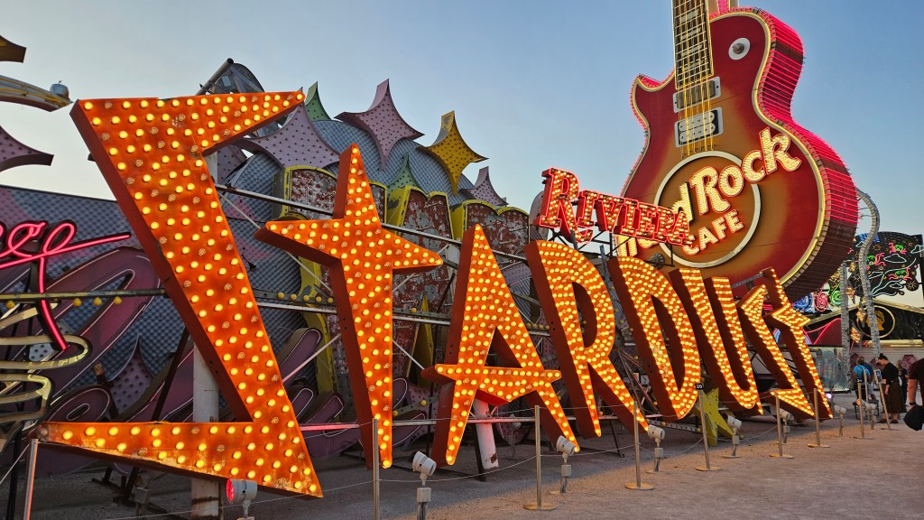
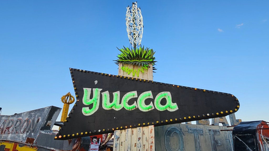
The Neon Museum is a graveyard for many of Las Vegas’s old signs. There is a lot of history to be seen just by looking at them.
The Stardust Casino opened in 1958 and the hotel was the world’s largest at the time. As a child, I remember it being one of the iconic scenes of Las Vegas that you would see on TV or movies. The design of the sign is a nod to the beginning of the space age that was happening at the time. The resort closed in 2006.
I was surprised to see the Hard Rock Cafe sign behind it. How can a Hard Rock be out of business? It was here for only five years before being purchased by Richard Branson and rebranded as Virgin Hotels. Word is that a new Hard Rock will be opening in 2027.
Argon makes the light in this sign, which dates back to the early 1950’s. The light that argon produces is blue, but the colored glass used for the words changes it to green. This was a motel sign.
Neon, however, is what put Vegas on the map. The museum’s oldest operating sign is the Chief Motel Court which dates to 1940.
The Golden Nugget, built in 1946, is one of the oldest casinos. Today there are six Golden Nugget resorts in five states. I suppose this sign doesn’t work any more.
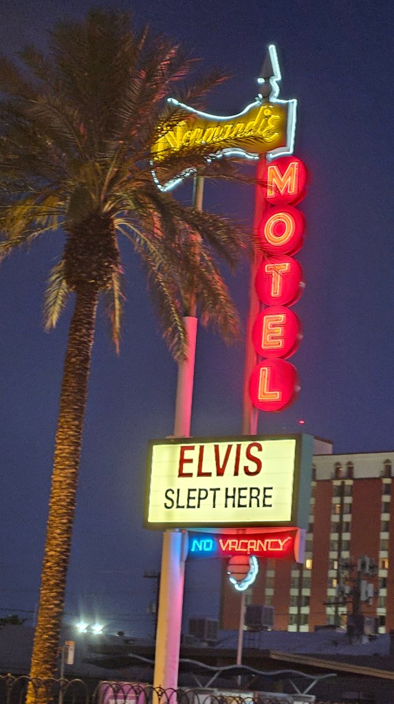
The Neon Museum has placed some of the old motel signs in the median on some streets downtown. Of course, the Normandie Motel is long gone.
I’d want to sleep here if I could. Maybe I’d get the same room Elvis had?
Walking back to Fremont Street, we noticed that we could have happy hour at the Gold Spike at 4 AM. That’s handy.
The Strip in Las Vegas today uses LED lighting, but the neon lights (and light bulbs) are all still aglow on Fremont Street. When we arrived back after visiting the Neon Museum, the place was hopping. It was a drastically different scene than we’d encountered on our morning visit.
The East side of Fremont street doesn’t have the covering over it and traffic is allowed on the street.
Visiting the city of Las Vegas was a whole lot of fun but it didn’t take many visits for us to decide we were done. We talked to many locals while here, and every one of them said that they only go down into the city when they have company. What else could there possibly be to see and do? I’ll be exploring that in the next couple of posts.
Why would an outdoor loving, RV’ing couple that doesn’t gamble and isn’t particularly into night life opt for a six week stay in Las Vegas?
There were two reasons: mainly, we wanted to wait a few weeks for the Sierra Mountains in east California to warm up before we headed in that direction. The second was that Nellis Air Force Base has an RV park there that a lot of folks in the military RV’ing world talk about as being one of the best. And, a bonus reason: it was an easy flight to Denver for some time with our family there. So really, only our RV was there six weeks. We were in Denver for ten days out of that time.
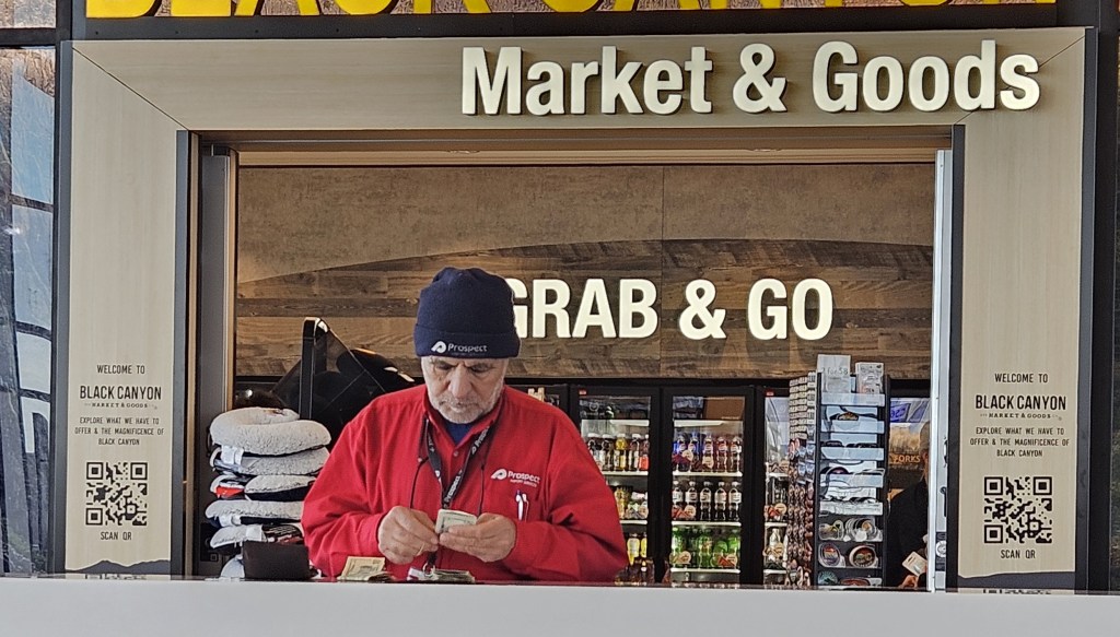
At our gate at the Denver airport and waiting for our flight back to Las Vegas, we watched this gentleman counting his cash before boarding. It was quite an involved process.
Ready to hit the casinos?
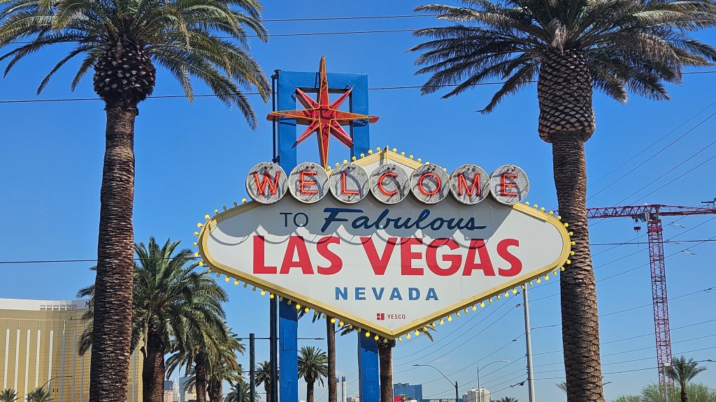
We’ve both been to Vegas, together or with others. Our memories are centered around the old Strip, or what is now called “Downtown”. I’d heard a lot over the years about all the changes in the city, and was curious to see them.
Someone flying into Vegas for a few days of fun might have a hotel in one of the casinos on the Strip or near it. There’s no need to rent a car, since one can simply walk out the door from one casino right next door to another one. And so on down the street. For anywhere further, there’s always Uber. We weren’t dropped right onto the Strip, so where to start?
Nellis Air Force Base, and our RV, were a fair distance north from the Strip. We did not know where to park our massive truck, and there was also the question of security. We opted to Uber whenever we went there. I loaded an on-line walking guide onto my phone, and we had our Uber driver drop us off at the New York-New York Hotel and Casino for a daytime stroll on the Strip.
New York-New York tries to hit all the highlights of the Big Apple: inside, there is a street that looks like Broadway and Times Square. There is a New York-style deli that looked great but we were too early for lunch. Outside were the Brooklyn Bridge and even the Statue of Liberty:
New York? No, this lady’s on the Strip in Las Vegas
Outside, the colorful turrets and towers of Excalibur beckoned.
We walked through a casino floor, although I’m not sure now which one this was.
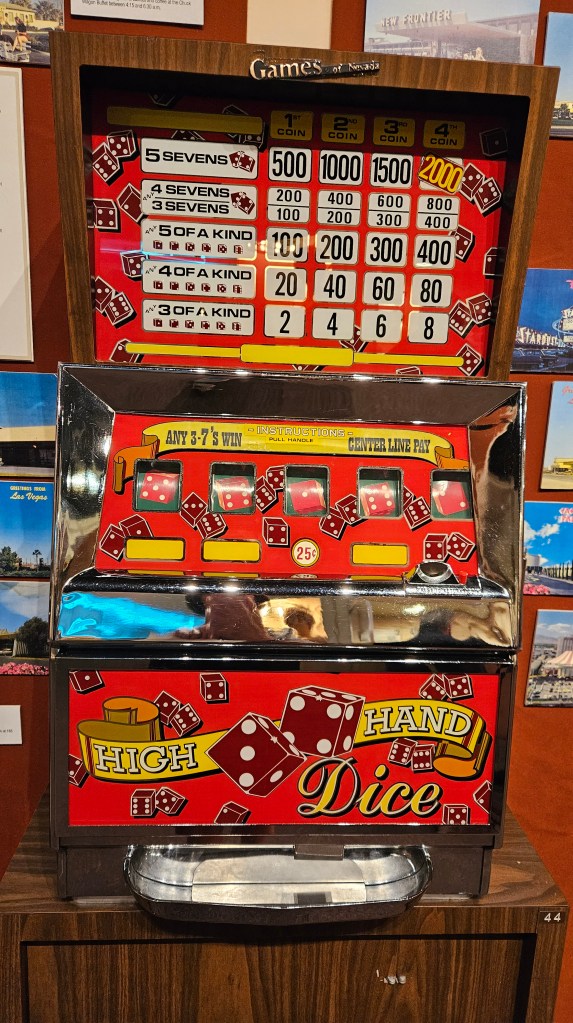
The slot machines don’t look like ones we remembered. This is what we remember:
This beauty is at the Clark County Museum, Las Vegas
Oh well, I guess I’m showing my age!
We thought we might do some shopping, but these stores weren’t really my style.
There is a feast for the senses out on the street, even though Vegas hadn’t quite woken up yet when I took this photo.
All of a sudden, we were transported to Paris in the spring:
I’ve been to the real thing for most of the sights in Vegas. I was prepared to not be impressed, but I was. They’ve copied the world’s treasures, jammed them into the Strip, and it seems crazy but it works. It’s all a facade, but it brings in the crowds and the revenue and I’m sure that’s the general idea.
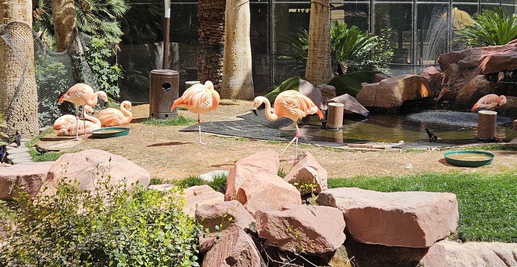
We lunched at the Flamingo. Outside, there were real flamingos.
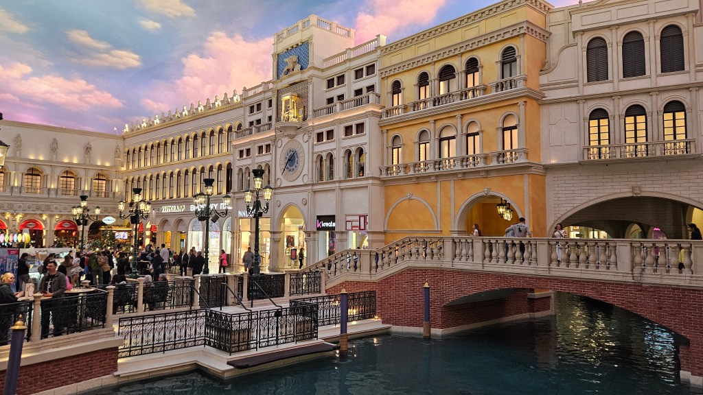
I wanted to see the canals of “Venice”, since we were actually in Venice less than two years ago. This is a reimagined Bridge of Sighs from that city in the Venetian, with everything not quite where it would be in reality:
When you are inside, it feels like you are still outside. I didn’t get a picture of the gondolas going down the canal, but the gondoliers are in their traditional costumes, and they are singing. They don’t even do that in Venice any more! The canals and Venice-style buildings cloak what is really just a shopping mall.
We walked by the new Sphere, but I wished it was night time so we could see it lit up. The design changes frequently.
I wanted to see a show, but couldn’t decide what I wanted to see. There were many big-name performers in town, but none that either of us wanted to spend a lot of money on. Going down the highway one day, I saw a billboard for Penn and Teller. That’s it! Their nightly show starts at 9 PM. Whew, I didn’t know what time we’d get back to North Las Vegas afterwards. We found a $99 special at the Rio Hotel and Casino, where they perform, and a couple of days later we checked in.
We wandered around the casino floor and hotel. If you wanted to, you could get married here, as there is a chapel. Since we are already married, we stopped for a pre-dinner glass of wine. As we sat, the animated lady in this slot machine beckoned us over to play. It wasn’t all that hard to resist her charms.
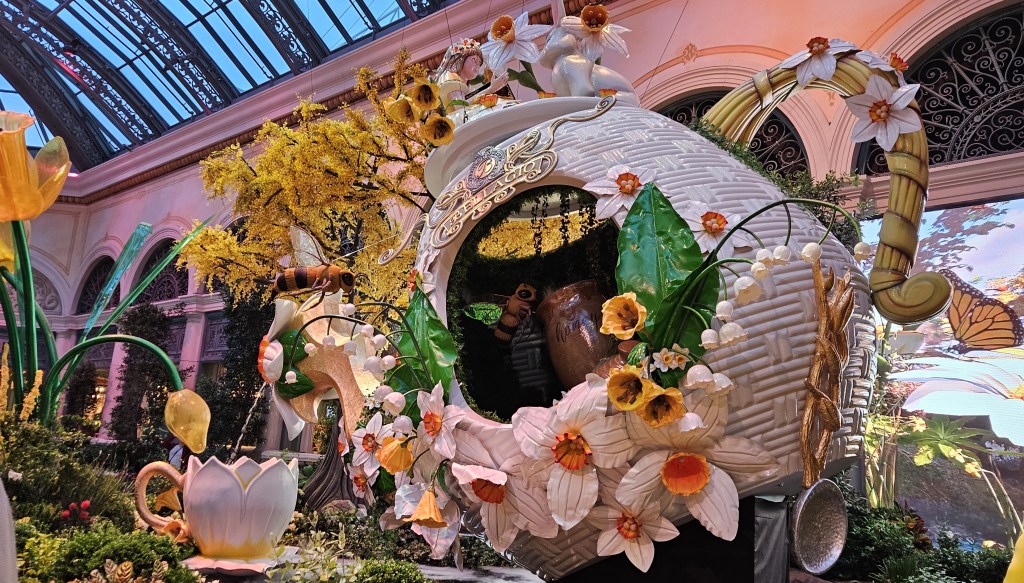
Rio Hotel is not right on the Strip. Although it’s not far, it’s not walkable either. Since our show didn’t start till later, we Uber’d down to the Bellagio. I wanted to see Bellagio and the city lights.
Entering the Bellagio, there is Chihuly glass on the lobby ceiling. That is another thing I wanted to see here, and Mr. Chihuly didn’t disappoint. He never does. It is spectacular.
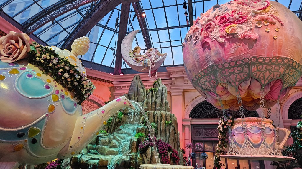
The Bellagio has a free-to-all conservatory and botanical gardens with installations that change five times a year – one for each season and Lunar New Year. The exhibit for spring was “Tea and Tulips”.
I wish I could put the smell of all the spring flowers on display in this blog for you. It was intoxicating.
While I’m wishing for things, I also wish I could be transported right here every time the exhibit changes.
We walked for a bit on the gaming floor. There were blackjack, craps, roulette, and other games I’m not familiar with going on, with some large stacks of chips being exchanged. Even for a Sunday night, everything was rolling.
Outside of the Bellagio, I had one wish fulfilled: to see the lights on the Strip. Just a little. The Sphere peeked out from around the corner of the Flamingo.
It is said that the fountains at the Bellagio are not to be missed. We didn’t realize that they are on a timed show, and had to wait a while for it to start. It was windy and cold, but we waited. Behind me, I watched limos pull up to the Bellagio in a steady stream. Finally music began to play – Celine Dion’s “My Heart Will Go On” – and the water danced to the music.
This doesn’t capture the whole thing, but the “Eiffel Tower” in the background sure was beautiful. The water soars 460 feet in the air and the fountain spans a distance of 1,000 feet. Funny thing, though, Cal and I both later agreed that we were a little disappointed in the fountain show. I don’t know what either of us expected.
By now, we needed to hurry back to the Rio for our show. Penn and Teller were excellent. They do a comedy and magic routine. Teller never speaks, but his actions do all the talking for him – he is very funny and they both made us laugh. They are the longest-running show at the same hotel in Las Vegas history. We really enjoyed seeing it. And what a treat, afterwards, to just ride the elevator up to our room for bedtime!
Anywhere that we put our slides, awning and lawn chairs out is home – for a few days, anyway
By the words and pictures of my blog, it may look like Cal and I are always running around from here to there and seeing everything there is to see. That’s not exactly true. There are stretches of time where we are just living life, same as everyone.
It’s not often that I write about one single RV stay, but that will be what this post is about. And the question is, what makes a perfect place to park our RV?
When we started out RV’ing, the answer was simple. A state park or Corps of Engineers park, out in nature, with full hookups, or at least with water and electricity is a must. Then, a nice level spot with lots of shade, and preferably not in close sight of our neighbors. Places to walk are also important. These sorts of places weren’t hard to find where we lived in Missouri. But we’ve only been in Missouri once in the past three years of full time RVing.
The RV park for Death Valley was full before I could even blink. Of course there weren’t any state parks nearby, and not even many commercial parks to choose from within spitting distance of the park. That led me to “Longstreet Hotel Casino and RV Resort”. This was a novel idea. The pictures looked good, reviews okay. I’ve long ago learned to take the “Resort” part of an RV park with a grain of salt. We would be in Death Valley for a good part of the time, anyway.
The building only has two stories, and the RV “resort” was around back. The gentleman at the desk assigned us a site and said we could move if we didn’t like it. That is a rare offer.
The casino is out in the middle of nowhere, and this was the view out our window. For our first two days, there were RV’s in these sites with ATV’s parked next to each. If I had my druthers, we would have moved, preferring instead to have been in the first row facing the mountains. Cal was happy with the site, though, so we stayed. It was interesting watching the ATV’ers head out for jaunts into the desert; after two days, they were gone. No one ever moved into these sites again, leaving us with a perfect view.
We thought maybe the green space might have been a golf course at one time, and the pond a part of it.
On our first evening we took a long walk down a narrow gravel road leading straight into the desert and alongside the mountain. There is no cacti here, just sagebrush and scrub.
We put a rest day in between each of our visits to the park. Those days had long miles in them, both for the truck and on our feet. At home, we caught up on chores, all the stuff one normally does in life. Here, Cal is attending to something on the roof. All we had here was a gravel spot in a parking lot. It was nice that the park was always less than half full.
Someone was in that site next to us only one or two nights. On the other side, there was another 5th wheel with a gentleman who left for work early every morning and went inside his RV when he came home.
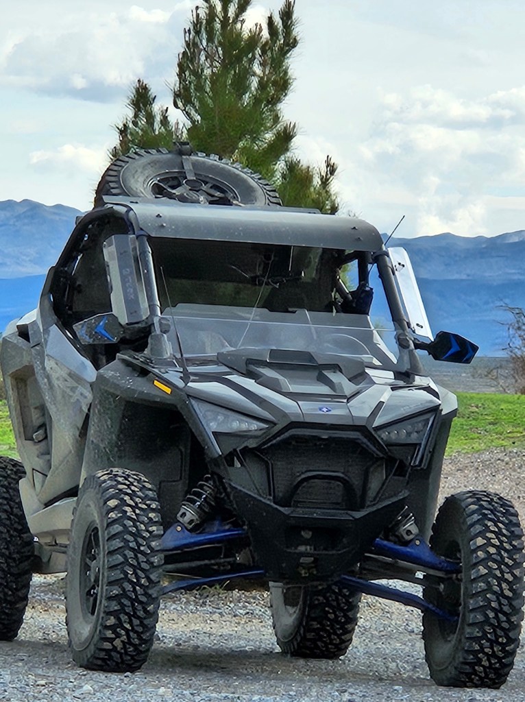
Cal was really impressed with his ATV.
On our “off days”, when I needed to stretch my legs, I could walk out to California. And then, back again to Nevada.
The wildflowers were just starting to come out. How can they grow in the harsh desert terrain?
The inside of the casino is typical of many casinos. Longstreet has a gaming floor, an area with couches, a restaurant, a convenience store, and a bar. With the exception of the store, everything is in one big room. A country band played on the weekends. I thought I’d be tempted to eat in the restaurant more than we did but we only had one lunch there. It was a rare treat to just walk over from the RV.
Walking around the building, there were many things to see. I could admire the old conveyances out front.
The old with the new
There is a petting zoo, with animals that mostly didn’t want to be petted. The zoo also includes a bull, a goat and a sheep.
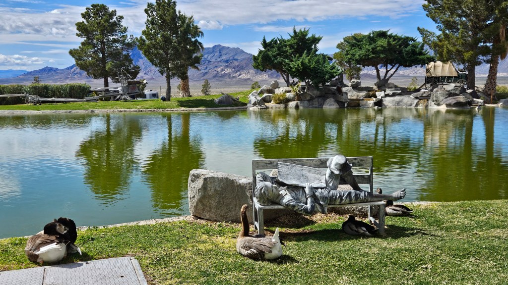
The back rooms to the hotel had patios and balconies which looked out onto another pond. This one is nicely landscaped and there are sculptures and many interesting artifacts set out to look at. This pair of geese would fly from one pond to the other daily, honking along the way for good measure.
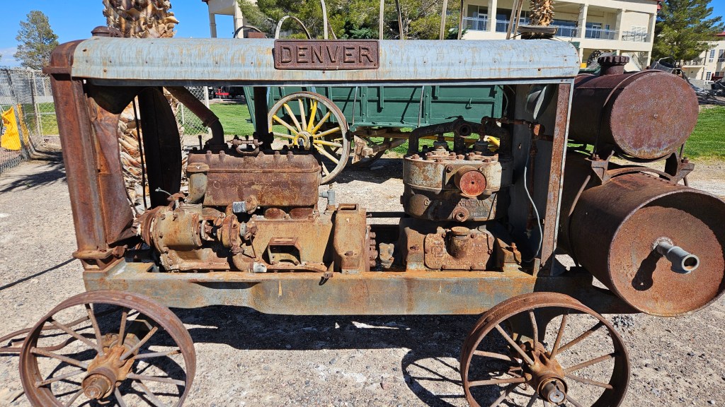
I’m not sure what this is, but I liked that it said “Denver”.
When the sun started to set, we would put our lawn chairs out on the (not) golf course, and watch the mountains turn red. We would puzzle over why the owner thought he needed the enormous cow out front, and where it may have come from. And, of course, we could ponder the meaning of life and let ourselves be swallowed up into the silence.
So, back to what makes a perfect RV spot?
The road has shown us that there is no one simple answer. The spot that we are initially disappointed in may reveal its secrets to us later. It could be the friendly folks at the park or some fun events that they held, a great trail to walk on, an interesting neighbor to hang out with, or a resident cat. We don’t tend to use a lot of the amenities that parks like to advertise.
A concrete pad here might have been nice, but gravel is the way of the desert. No, Longstreet wasn’t perfect. Only a select few sites have ever won that title for us. Longstreet did, however, score points with both of us for 1) the view into the desert, 2) lots of delightful places for me to walk and get my steps in, 3) a slight quirkiness with all the various little things to see, and 4) being quiet and peaceful.
In the end, we can’t ask for too much more.
When we passed our first night in San Diego, I was very excited to put a California sticker on my map. And then, in Boulder City, I could add the one for Nevada. It had been almost two years since we’d been able to add new stickers. You can see that we have covered the Southwest. Which state will be next? Even we, the Twosna Travelers, don’t have the answer to that question at present.
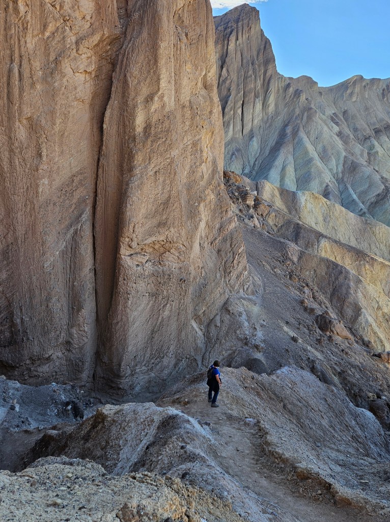
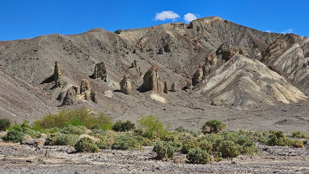
After our first visit to Death Valley I could not wait to come back. We returned to Death Valley for an early morning hike on the Golden Canyon and Red Cathedral trails with abundant sunshine. The canyon lives up to its name; in morning light it holds a golden glow.
The golden rocks on our canyon trail and the red rocks in the “cathedral” above
It was a bit of a scramble up to the pinnacles of Red Cathedral. At one point I looked up, saw Cal, and could not figure out how he got up to where he was. He was scaling the rocks like a mountain goat.
“How did you get up there??”
Meanwhile, he took a picture of me from his perch.
The heights at the top were a bit dizzying, especially since the rock pinnacles are so tall here.
The view at the end of the trail is nothing short of spectacular.
We sat here by ourselves for a good long time just resting and enjoying the view. Another couple from Massachusetts came up from a different trail and we chatted for awhile. We discovered many things in common, particularly once we started discussing international travel. It’s funny who you meet in the wilderness and how easily conversations can start.
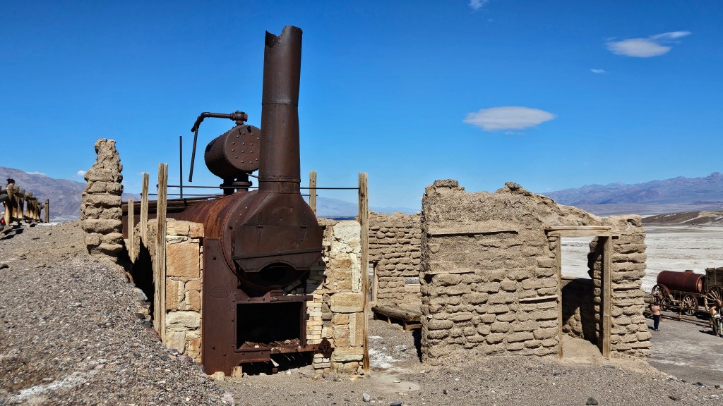
For a different angle on this magnificent park, we visited the Harmony Borax Works. I remember my mother always having a box of 20 Mule Team Borax on hand, but I never gave a thought as to where the product came from. Turns out that in the late 1800’s, borax was mined right here in Death Valley. You can see the white borax on the ground in this view, along with ruins of the housing for the Chinese workers in the distance.
Borates, or salt minerals, were deposited in ancient lakebeds long ago and eroded into the Furnace Creek Badlands of Death Valley. Water mixed with the borates and carried the borax ore here. Borax has many uses around the home. My mother used it in the laundry as a whitener and stain remover before “Shout” was available, but borax can also kill weeds, unclog drains, and remove rust. In the late 1800’s miners, blacksmiths, and morticians also used borax. It is a multi-purpose product, and even more so in the days before many chemical alternatives were invented.
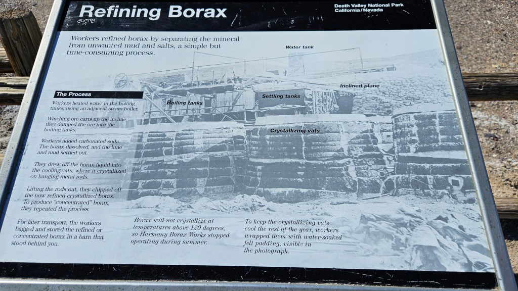
It was cheaper in those times to refine the borax ore right on the spot, and it is the ruins of the processing center that you can still see at Death Valley today.
Here, the borax was separated from mud and salts. I won’t get in the weeds about how it was done, but if you are interested, I’ve included a picture of the signboard here that details the process.
It took ten days for a team of twenty mules to pull the wagons of borax 165 miles out of the desert to Mojave, where there was a railroad. The round tank that you see here held the water supply needed to make the trip out of the desert. This is one set of only two remaining original wagons. I could only imagine the mule team hitched up and on their way!
An actual photo of the mule team; the picture hangs at Death ValleyInn
The mine wasn’t profitable, and only had a six year run. Borax was discovered elsewhere in California where the processing costs weren’t so high. In 1889 the Harmony Borax Works closed for good. But the logo of the twenty-mule team still graces boxes of Borax sold today.
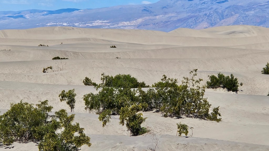
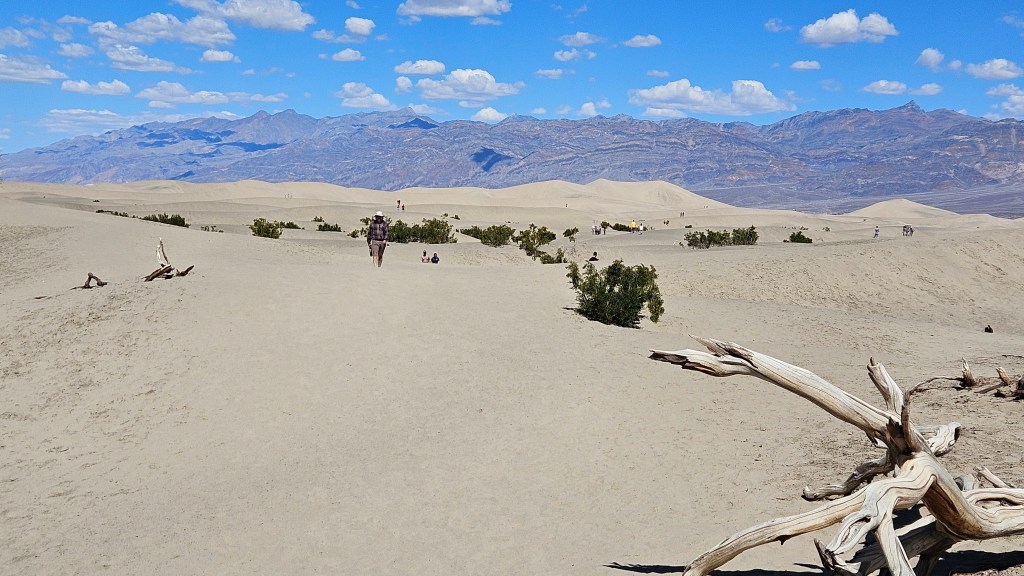
Mesquite Sand Dunes was our furthest-north stop on this day. By now it was afternoon, and was getting hot. Death Valley is the hottest place on earth. In 2020 and in 2021, the temperature reached 130 degrees, the 5th and 6th hottest days ever recorded anywhere. Of course, that would have been summer time, but even on this late winter day it still felt very warm and the temperature was hovering around the 90’s.
Although it doesn’t look like it from this picture, there were a lot of people here. The dunes seemed to swallow them all up.
We made one more stop on this day, to the Inn at Death Valley where I took a picture of the mule team. My driver was sorely in need of a rest. I had seen these ruins and wanted to explore while Cal took a break in the hotel lobby before the drive back home.
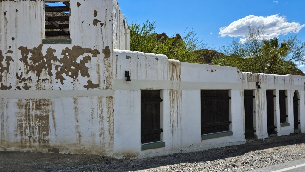
I couldn’t find much out about this building. I do know that the original adobe inn was constructed in 1927 with natural materials onsite. This building is across the street from the inn. As I walked inside, I noticed several partitions that looked like horse stalls. A stable for the inn, maybe? Well, who knows. It’s shabby on the outside. Perhaps it has purposefully been left that way.
Once you go inside, though, it is a different and beautiful story. Past the horse stall ruins that may not be horse stalls, there is an inner courtyard. And perhaps the “horse stalls” were actually small inn rooms back in the day which led into this main area. In current day, it looks like it is being used as a venue for special events.
Of course, this is Death Valley, so right next door to this is are some interesting rock formations.
From here, I walked down to the spot that is considered to be the entrance to the valley. A small marker memorialized a group of one hundred emigrants who in 1849 tried to cross Death Valley as a shortcut and instead met thirst and starvation. We forget about how difficult this terrain is for those who weren’t Shoshone natives and didn’t have speedy vehicles equipped with air conditioning, heat, or comfortable seating. Nor did they have plastic water bottles.
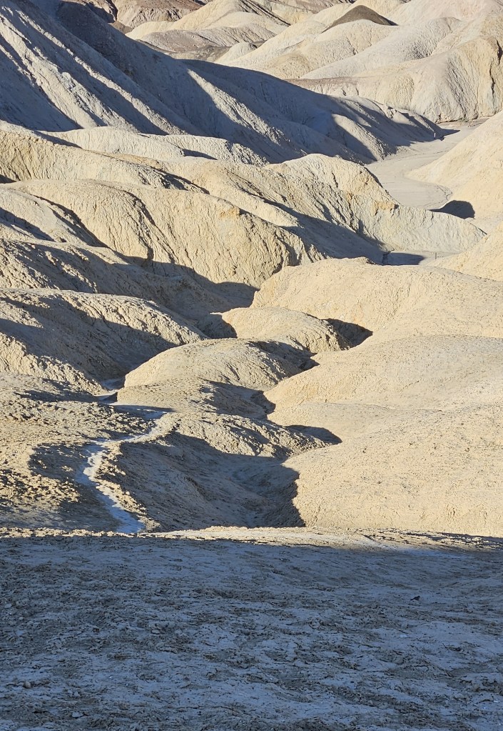
We had time for one more morning hike, and chose the closest one from home. This was the Badlands Loop at Zabriske Point. It was more open and even more desolate than anything we’d encountered earlier.
I marveled that anything at all could grow here.
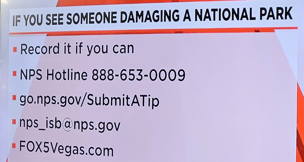
I will leave you with a public service announcement. Days after our Death Valley visit, we were watching the evening news when there was a segment about a couple of people lifting the largest boulders that they could and tossing them off of a cliff while visiting a national monument. It was caught on camera, thankfully, and the perpetrators were arrested. The news station then posted the contact numbers and web addresses for the organizations that you can notify if you ever see some one desecrating our national parks and monuments like this.