USTravel

Joshua Tree National Park, California

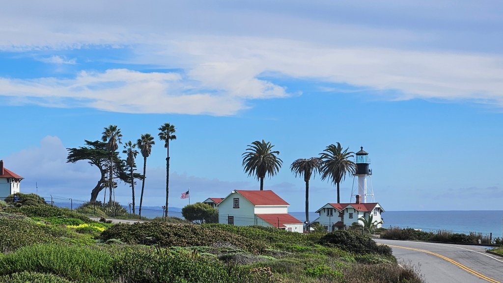
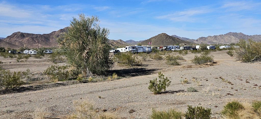
Up the road from San Diego and east of the Los Angeles sprawl lies the 50-mile-wide Coachella Valley. It’s roughly bounded by the cities of Palm Springs on the west side and Indio to the east. Palm Springs lies to the south of I-10, and Desert Hot Springs, where we stayed for a few days, is to the north. Joshua Tree was one of big stops here, where there are large swaths of the Seuss-like plants.

It was hard for me to get back into “national park mode”: getting up at 5:30 in the dark and cold morning so we could leave at 6:30. From our RV park, an hour’s drive of beautiful early-morning scenery greeted us as we drove up and around to the other side of the Little San Bernadino mountains. Our first Joshua trees were to be seen in the aptly named town of Joshua Tree.

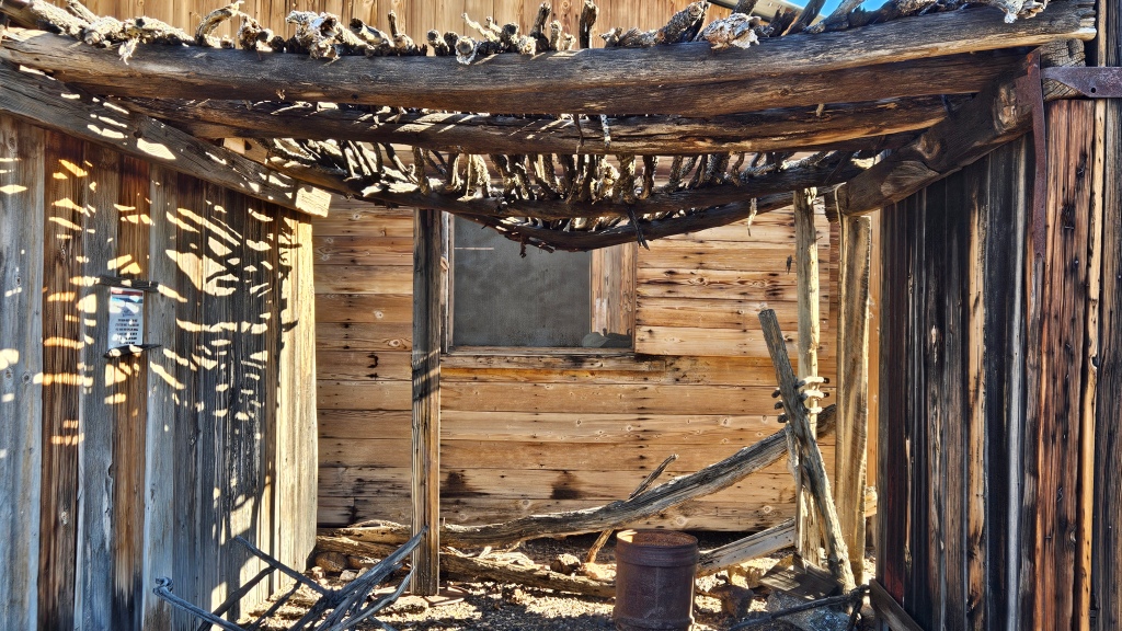
Further down the road, we had a bit of a mix-up getting into the park. A visitors center lies right in the town of 29 Palms which, unlike every other national park I’ve been to, is a couple of miles outside the entrance gate. The center is new enough that an old park map I was following didn’t show it. I thought I knew better than GPS, so I didn’t listen to what it was telling me. We went into the gate and then backtracked into town. Once in town, Cal was distracted by a jelly doughnut place and purchased two to eat later.

Oasis of Mara

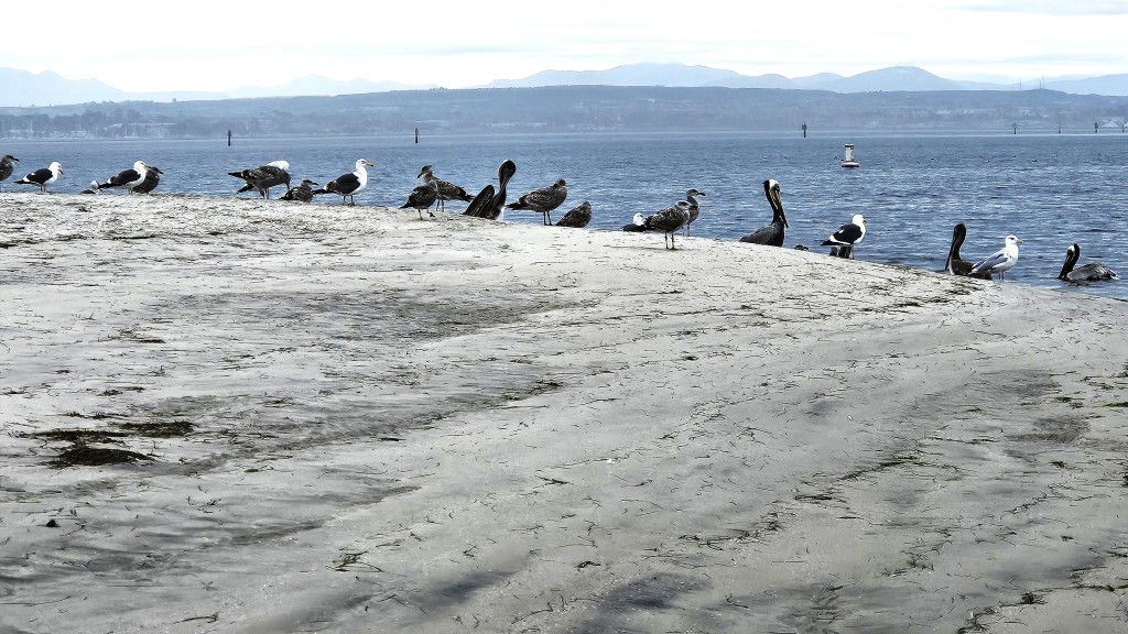
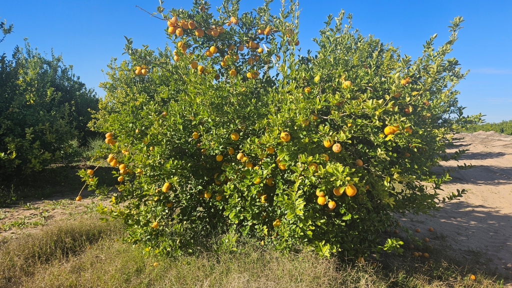
One of the stops I wanted to make was also outside the gate, adding to my initial confusion. The Oasis of Mara was once a bubbling spring surrounded by grasslands. The Marra’yam people’s legend goes that the women were failing to produce baby boys, so a medicine man told them to go into the desert and stop at the first place they found water for a new place to live. This venture was so successful that the men of the tribe planted a fan palm tree for each boy born, twenty-nine in all. Not all trees have survived but to these people, the trees are their ancestors.

As you can see below, I was dwarfed by these palms. What did it look like when all of the palms were still standing?

Oh, and that bubbling spring no longer exists. Over time, it trickled down. It finally completely disappeared in the 1940’s, when new development lowered the water table.

Past the gate and further down the road, some Joshua trees came into view. The short cactus that you see on the right of this picture is called Mojave Cactus.

Joshua trees aren’t really trees at all – they are in the agave family of succulents. When the Mormon settlers saw them, the upraised arms of the trees reminded them of the Biblical Joshua, with his arms raised up in supplication to God. They are slow-growing and can live to be 150 years old, although older ones have been found.

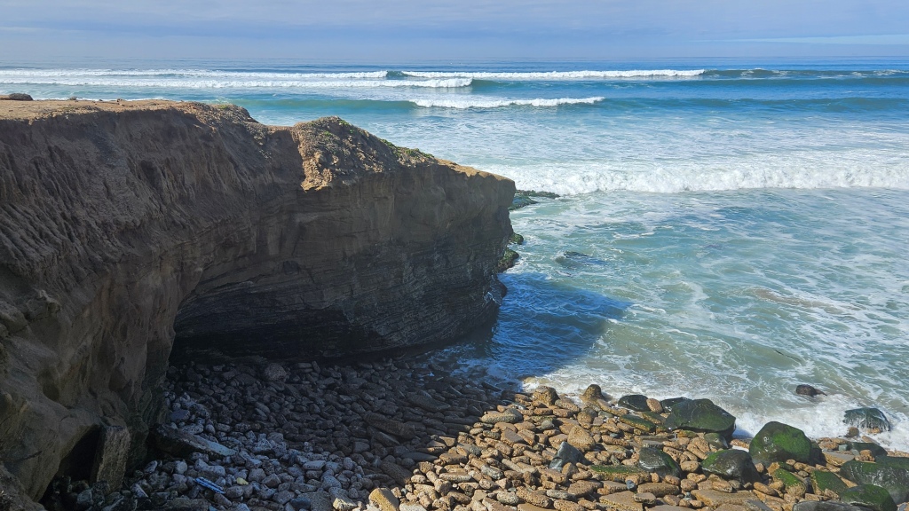
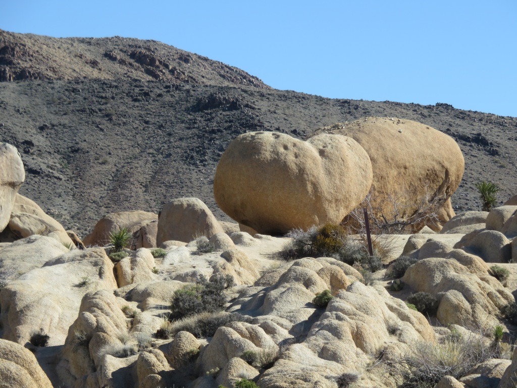
On my park map, I thought Arch Rock might be interesting, so we made a stop. The hike to it was longer than I thought it would be, but the rocks that we encountered here were totally unexpected.

We took a little detour to Heart Rock. But if you don’t see the heart on the left of the two boulder-sized rocks, you might think they look like a couple of potatoes.

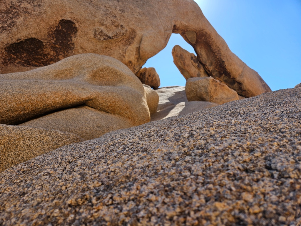
We finally found the arch. It was a little hard to photograph, with many tall rocks all around. In comparison to the others, the huge one in the foreground had an interesting texture. The surface was bumpy but it looked like it should have been smooth. Tiny gravel pieces were firmly embedded all around it.

The biodiversity of Joshua Tree is what was surprising to me, and interesting to learn about. I thought our day would be full of Joshua trees, but not so. We began our exploration in the Mojave Desert, but as we drove further south on the park road, the road went up and then skirted the Hexie mountains through Wilson Canyon. This marked the transition from the Mohave Desert to the Colorado Desert. The Colorado borders the Sonora Desert, where we had been for a good part of the winter in Arizona. From here, I could look down into the Pinto Basin, which was once a huge inland sea.

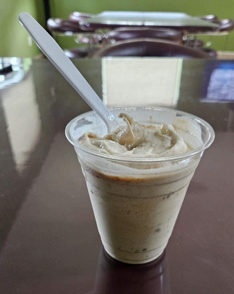
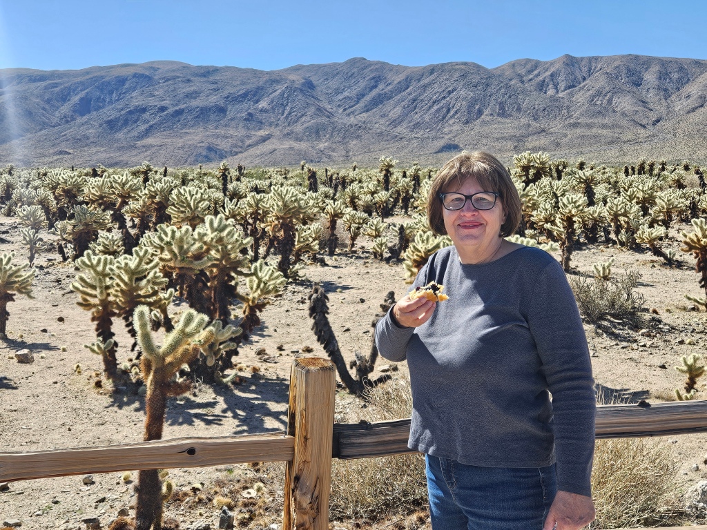
In the Colorado desert, Joshua trees and Mohave cactus disappeared. We stopped to look at Cholla Cactus Garden. The cholla seemed to go on forever. While we gazed, we munched on our delicious blueberry jelly doughnuts. This was a too-long-delayed event, in Cal’s opinion.

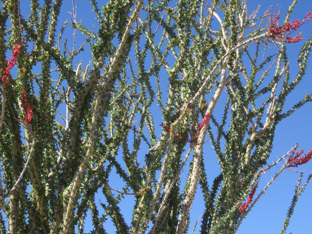
Further down the road, we came to the Ocotillo Patch. I love ocotillo for the way they metamorphose from dead-looking brown branches to green leaves, and then red flower blooms looking like a flag on top. I was hoping to see a large number in bloom. No such luck, but I did see one or two. The rest had their green leaves on, probably since the desert has received a lot of rain this past winter.

An interesting fact that I learned here, thanks to a National Park signboard, is that ocotillo are not season dependent, but rain dependent. They can grow or drop leaves as much as five times a year.

I’m always fascinated by how certain cactii varieties grow together, to the exclusion of other ones. We’ve noticed that slight changes in altitude can affect what grows where.

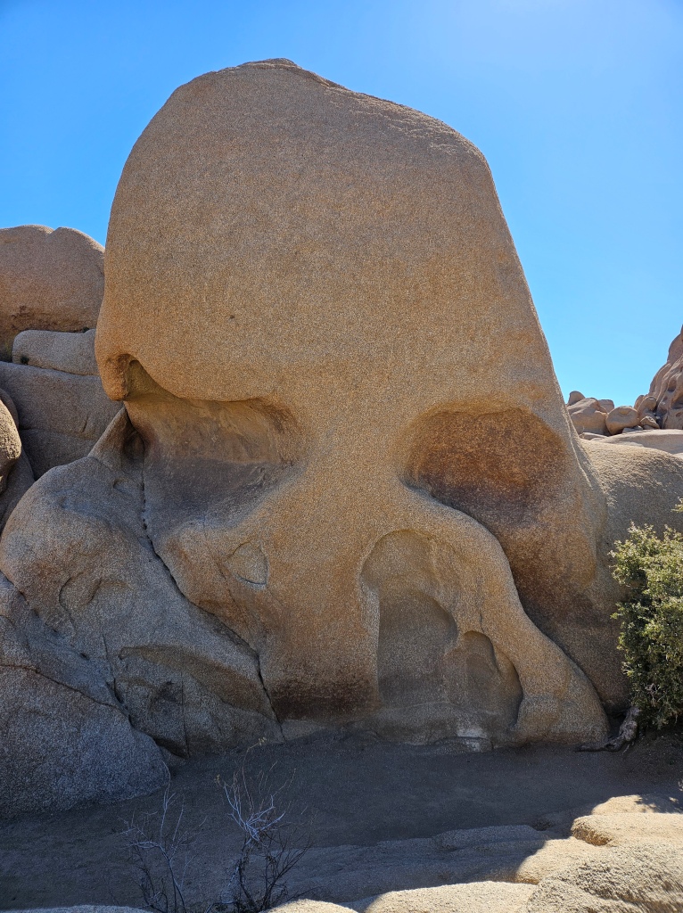
We turned around here and drove many miles back to Park Boulevard, where we took a left and stopped to see Skull Rock. I had read in more than one place that this would be a “don’t miss” stop. It must be everywhere on social media, judging from all the cars spilling out from a small parking lot and onto the roadway. At Ocotillo Patch, we’d had the parking lot almost to ourselves. Neither of us were much impressed by Skull Rock, but maybe that’s because we had to climb over so many people.

From here there were some tempting trails, though, and fun rock climbing if I were just a bit less cautious.

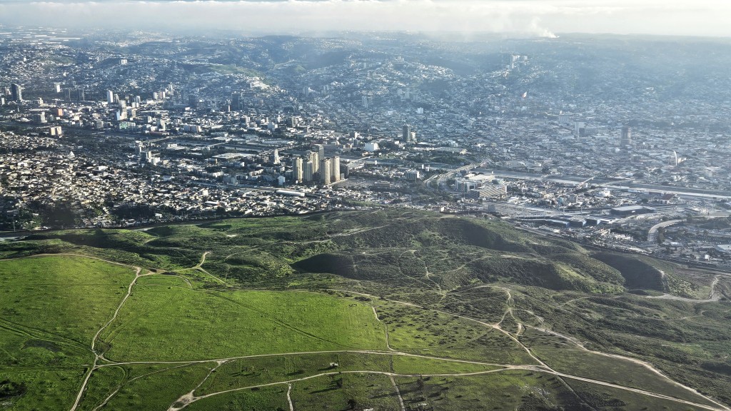
Further down the road, we took a twenty-minute detour upward to Keys View. This is an overlook that, at 5,185 feet above sea level, provides a gorgeous, if somewhat hazy, view of the Coachella Valley and the surrounding mountains.

It was lunchtime, but the picnic shelters we saw were full. Cal never has a problem with that. We parked at a small trailhead, pulled out our lawnchairs, and had a picnic lunch in full view of the great Mojave desert.

It was getting on to mid-afternoon, but there was one more stop to make. Hidden Valley trail is reputed to be the best hike in the park. Unfortunately everyone else knew that too, so the trail was very crowded. This is why we get up early to go to National Parks. We had seen the crowd level rise through the day, but up to Skull Rock and this stop it had been manageable.

I could see why the trail is so popular, because it is beautiful and not too long. One enters a portal of rocks, and then it opens up into a tiny valley surrounded by rock. Bandits used to hide stolen horses in here, but in later times the portals were blasted open by a rancher and it was no longer a secret.

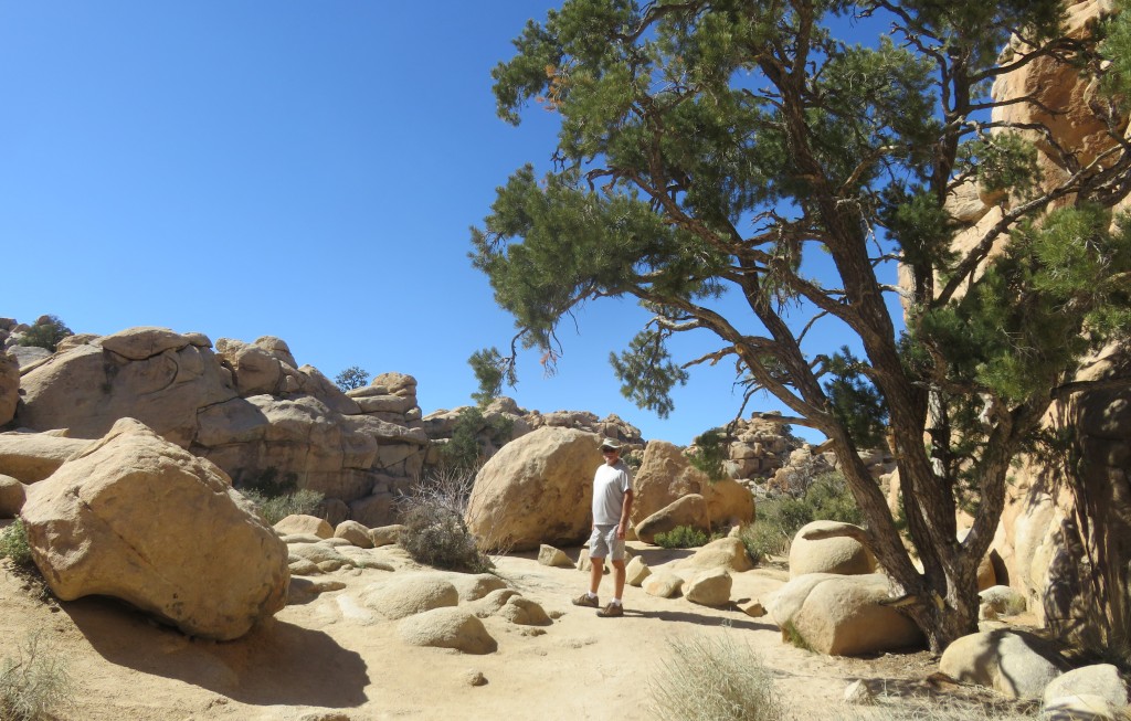
This is considered to be a “transition zone” between the Joshua tree forest and pinyon-juniper tree woodlands.

I thought the rock in the picture below looked like the south end of a gnome going north. But then again, maybe I was just getting hot and tired.

Opposite the trail area, a Joshua tree “forest” can be seen.

We were glad to have seen the park and that we didn’t die on any of the trails.

Memory is a funny thing. Years ago, we took my Mom on a trip to Los Angeles from where we were living at the time in southeastern Arizona. I’m pretty sure we traveled on I-10 going west and I remember seeing the Joshua trees out my window. I was so impressed that I have always since then wanted to come here for a visit. The southern reaches of the national park do go down to I-10. But we traveled the entirety of I-10 through the Coachella Valley, and there are no Joshua trees to be seen! Now I’ve learned that that part of the park is the Colorado Desert, not the Mojave, so of course they wouldn’t grow there. Where did I see those trees? I couldn’t have imagined them. It’s a mystery which may or may not be solved some day.

Next time – Palm Springs

USTravel

A Ship, A Flight, and Family in San Diego

The city of San Diego as seen from Shelter Island Park

We have a nephew Mike, who is a pilot for the Navy. He had to do some operations time on a ship, so he was deployed on the aircraft carrier Carl Vinson for several months on a jaunt around the Pacific. Toward the end of our San Diego stay we watched the ship come back into port with his wife, Emily.

To get a good view, we met her at Shelter Island and enjoyed some time at the park while we waited. The ship was still a long ways off before we arrived and appears only as a dot on the center horizon in the picture below.

As the ship came closer to view, we could see all the sailors lined up on deck. It was an exciting and moving sight.

Unfortunately, I had to shoot all the pictures into the sun.

Mike was not on top, but stood by the rails on the open lower part of the ship which is the hangar deck. We could just barely see him with the binoculars.

The large ship was assisted into port by two tug boats.

The Carl Vinson aircraft carrier was part of the Carl Vinson strike force. Many various ships had been out to sea as part of this group, and they were all coming back to port during the days that we were here. It was interesting to see what was in the harbor on any given day.

We did not see Mike on this day, but two days later we had lunch with him and Emily.

Mike had some plans for us. We were able to return to the Carl Vinson for a visit when he had 24-hour duty a few days later. We picked up some take out with Emily and had dinner with him in the Officer’s Mess. He then gave us a tour all over the ship. We saw his room on ship, his office and also the bridge. We walked on the flight deck and saw the immense hangar below. There were so many flights of steps, passageways, and turns. It would be very easy to get lost! It was reminiscent for me of touring the Midway, although that ship is thirty years older than the Carl Vinson.

The Navy doesn’t take kindly to people taking photographs on board their ships, so we only have this one of us together with Mike.

The ship looked very festive as we left, brightly lit for the evening.

Mike has over a thousand hours of flight time, but needs a few more for post-Navy employment plans. He belongs to a flight club at a small nearby airport where he can “check out” a plane when he wants to fly. So, one afternoon we went up in the air with him.

I was in the back seat of the little Cessna. Looking at my pictures now, I don’t always know exactly where we were when I took them. This one is somewhere north of San Diego, looking out to the Pacific.

We flew over Mission Bay…

to just safely north of the Mexican border. We flew over our RV and Mike’s apartment. This is looking over the border to Tijuana.

Besides flight hours, a pilot also needs to log time taking off and landing a plane. Mike found several nearby airports where he put the wheels on the runway briefly and then we were up again. I was happy when I learned we were done going up and down in that little plane.

All too soon, we were permanently back on the ground. Cal helped Mike push the plane back into its parking spot.

What a fun flight!

I have another nephew in San Diego, a cousin to Mike. Marcus is married to Bekki and both are Lutheran pastors at different churches. We alternated between the two churches on Sunday mornings while we were in town. Bekki’s church is right across the street from Sunset Cliffs on the Pacific side of northern Point Loma.

As it happened, we were in town for a very special event – baby Isaak’s 1st birthday. His big brother Elijah was very excited about the party too.

We never know who we’re going to find on our travels. Cal has an Army buddy, Ed, who served with him in Greece. He wasn’t able to make it to the reunion in Thessaloniki a couple years ago, but he was in town at the same time as we were. Ed was the person who introduced us to Liberty Station, as we tried to have lunch at Cocina 35. There was a two hour wait! It was President’s Day and everyone was out in the beautiful sunny weather.

We passed on that, but went instead to a restaurant called El Indio, an order-at-the-counter place for Mexican that has been there for 40 years. The food was delicious. It was the first time I’d met Ed. He and Cal enjoyed catching up.

As if any of this could possibly get any better, we also were able to see our daughter Katie. We had actually already left San Diego when she came into town for a business trip. We drove 75 miles south to Temecula, California just to meet her for dinner. She had a slightly shorter drive up from San Diego. It had only been a couple of months since we’d seen her at Christmas time, but it was still great to have a short visit.

Figuring that we were missing the Texas barbeque that we had enjoyed so much a year earlier, she picked out the Swing Inn, another restaurant that has been in place forever. She has a talent for picking out good places to eat, as the barbeque was delicious.

I was sad to leave San Diego, but the high cost of living – even in our RV lifestyle – precluded a stay of any longer than three weeks for us. So we said farewell to this city and the folks that had shown us such a good time. Perhaps another year the road will lead us back.

Next time – we visit Coachella Valley

USTravel

Exploring San Diego: Point Loma, Old Town, and Balboa Park

Buckle up your seat belts, because you’re in for a ride all around San Diego!

We explored the city over a period of three weeks. We went many places, walked many miles, and I took hundreds of pictures. Any one of these destinations could be placed into one blog by themselves. But I’m going to do my best to condense, because time has passed since we were in San Diego. I have many more fantastic places to tell you about.

In my last post, I mentioned a harbor tour that we had taken while here. On that tour, we passed the USS Midway Museum, an aircraft carrier that missed World War II by one week. It is the longest-serving aircraft carrier, only having been decommissioned in 1992. I highly recommend touring this ship if you ever visit San Diego; we did it on our one previous visit a few years ago. Here, you can also see the back of the statue depicting the famous picture of a sailor kissing a nurse in New York Times Square on V-J day.

Point Loma is a place we frequently found ourselves in, near, or viewing from a distance. You can see the eastern side of it in the picture at the top of this post. Like Coronado, it is a long peninsula. Unlike Coronado, it hangs down from San Diego from the north instead of pointing up from the south. No one calls it an island: there is no part of it that is low enough to be at sea level for miles. It is high and rocky.

At the very top of Point Loma, where it merges with the city, is Liberty Station. This place was formerly a Navy trainee center. It has closed and the buildings have all been recycled and repurposed. This has been done in a way that respects its history but provides a multitude of various uses. The former barracks have artist studios and venues. There are both exclusive and casual restaurants as well as a food hall, and mixed with these is a high school, church, a Trader Joe’s and other commercial stores, an improv theatre, open air space for festivals, and I’m sure a whole lot more that I’m not mentioning. It’s all in a beautiful setting. The painting decorating this breezeway stood out among the more austere buildings.

We met my nephew’s wife, Emily, here for lunch while he was on deployment with the Navy. We could each have our own idea of a good lunch in the food hall, and all of it was delicious. The food hall looks a bit like it could formerly have been a mess hall. She and I lost ourselves at Sea Hive Station, a large vintage and maker’s store. We decided that the building had maybe been a gym in its earlier life.

I’m sending my readers a postcard from Liberty Station:

Farther down the coast, we had a view of Point Loma from the water on our harbor tour, and enjoyed seeing many sea lions alongside the coast.

In our truck, we drove down to the tip of Point Loma to visit Cabrillo National Monument.

This statue commemorates Juan Rodriguez Cabrillo, who was the first European to set foot in present-day California. He explored the coast in 1542 from what is now Mexico, on behalf of the Spanish Empire.

Besides the visitor’s center, there is also the Old Point Loma Lighthouse to visit.

This lighthouse served from from 1855 to 1891, when a new lighthouse was built. We were not able to climb the tower.

From both the lighthouse and the statue, sweeping views were to be seen. We could look back at Coronado Island and San Diego harbor.

From this area, we drove down closer to the water, and could look at the new lighthouse. It’s still in operation, so it belongs to the Coast Guard and can’t be visited.

There are tide pools here which I wanted to see. To investigate them, one needs to visit the ocean at low tide. The first time we were here, we hit it squarely at high tide. We went down again after our visit to Liberty Station, right at low tide, and the area was closed for a sewage leak! Oh no!! Instead, we took the coastal path and enjoyed a walk along the mighty cliffs.

The National Park Service calls the dramatic cliff rocks here a “seven-layer sediment cake”. There are of course more than seven layers, which were formed millions of years ago when they were 3,500 feet under the sea.

Moving on from Point Loma, we go now up to the city of San Diego. On two different days, we visited Old Town San Diego and Balboa Park. We followed advice given to us and used public transportation. For Old Town, we took an Uber to the ferry at Coronado, and rode it over to the harbor area. We had the ferry mostly to ourselves on an early weekday morning.

When we got off the ferry, a short walk took us to light rail which, in San Diego, is called “The Trolley”. It took us right to Old Town San Diego State Historic Park.

Old Town dates back to San Diego’s earliest days. It is the first European settlement in what is now California. Some of the buildings here are museums, and this part of it is the state park. Some of the buildings have been turned into shops or Mexican open-air craft markets. There are countless restaurants, and all of them that I saw are Mexican. Whatever your idea of a fun day is, you can have it here. Many of the old buildings line a pleasant park in the middle. And admission is free, including the museums.

One of our first stops was to the La Casa de Machado y Stewart Museum, where the table was set for dinner. There were lots of beans, which looked pretty good to me.

We also visited the first newspaper and printing office.

The other building to the left of the printing office is a rock and gem shop, which, I might mention, is also a great place to wander though.

Here is the inside of the printing office:

The building housing the printing office was actually constructed in Maine, and shipped around the Horn in 1851. The first edition of the San Diego Union newspaper came out in 1868.

We also saw the earliest courthouses, an 1860’s restaurant, and other historic structures. We made the mistake of visiting on a Monday, and many of the museum buildings are closed on that day. There was still plenty to see, though, and the shops were mostly open.

After our excellent Mexican lunch (which did include beans), and having visited the buildings that we could, we wandered over to the Whaley House. It is considered to be the most haunted house in America because of family deaths in the house. Not only that, before its construction it had been the site of public town executions…right under the arch in the parlor.

Hauntings aside, it was a fascinating look at early San Diego and the Whaley family. Thomas Whaley was an extremely enterprising man and built the house big enough so that he could rent out parts of it at various times for a courtroom, a general store, and a theatre.

We visited Balboa Park just a few days later. We were getting better with public transportation at this point and caught a bus not far from our park. It took us over the Coronado Bridge and into downtown San Diego. We only had to transfer to another bus and ride two stops to get there.

Balboa became a park way back in the 1800’s, but then it hosted two world’s fairs – in 1915 and in 1935. Its layout and many of its buildings are the direct result of those fairs. There are eighteen museums to suit anyone’s interest – from Comic-Con to art, cars, railroads, air and space, and the Museum of Us, to name just a few. There are many various gardens, attractions, plus the usual things that you’d expect in a park: a golf course, a pool, baseball and soccer fields and the like. The world-renowned San Diego Zoo is here. The whole thing covers 1,200 acres, bigger than New York’s Central Park and Chicago’s Millennium Park combined.

We thought for this visit we would mainly wander and explore. Right away, I liked the feel of being in Europe as we entered the park.

Plaza de Panama was built for the 1915 Panama California fair, which celebrated the completion of the Panama Canal.

At lunch-time, I tried my first-ever Vietnamese banh mi sandwich at one of the park’s cafes near this plaza, and it was delicious.

Continuing on, this fig tree was planted for the same World’s Fair, and we wandered around under its canopy.

It’s a Moreton Bay strangler fig with a trunk that is 16 feet around. Although it still stands, its surroundings have completely changed in the over one hundred years since its planting.

We walked through a desert garden, and the Japanese garden which we had to pay to get into. Most gardens are free, but that one was not.

The Japanese garden had an impressive display of bonsai trees. This one is a 45-year-old “juniper forest”.

Like the gardens, some museums are free and some not. We went into two of the free museums, one being the San Diego History Center. They had a collage of the murals in that are in Chicano Park, exciting to see since we had ridden through it on the bus.

We spent the better part of a day in Balboa Park and only scratched the surface. I wanted to come back to concentrate on a museum or two or perhaps visit some sections that we missed. That was not to be, but just maybe we will be back another time.

San Diego provided us with a wealth of things to do, and after being here I still feel like I’ve only just begun to explore.

Next time – family fun during our San Diego stay

USTravel

A Stay on Coronado Island, California

After going as far south as we could go in Yuma, Arizona, we then traveled as far west as we could go. It is 150 miles from there to this place, where we bumped into the San Diego Bay.

We stayed in a Navy-run RV park, Fiddler’s Cove, on the Silver Strand of Coronado Island. It is a lovely place, one of the best of the military family camps, and we greatly enjoyed the three-week stay.

Coronado Island runs north and south. The northern tip of it is a Navy base. Directly south of that is the beautiful resort town of Coronado. The Silver Strand is a narrow stretch of land which leads south from Coronado, with the San Diego Bay on one side and the Pacific Ocean on the other. The town was so close to us that we could ride bikes there on trails that led directly from our park and looped around the city.

Hotel del Coronado, or “Hotel Del” as it’s called in local lingo, was built in 1888. It had electricity when it was built, a novelty at the time, and supplied power to the little city around it. Presidents and celebrities have stayed here. Frank Baum wrote three books in his Wizard of Oz series while in residency at the hotel. Marilyn Monroe filmed “Some Like it Hot” here in 1958.

We took a stroll through the lobby, and then wandered around to the beach out back. From here, the hotel’s lighthouse-style cupola stands out like a beacon.

We took a harbor tour of the San Diego Bay, so some of my pictures will be from that boat ride. This picture of the bridge from Coronado Island to San Diego was taken on the boat.

I always received a beautiful birds-eye view of San Diego while riding in our truck on the bridge.

Do you see the yellow ship in back of this picture? It’s a banana boat!

On our harbor cruise, our captain told us that the Dole ships supply bananas to Western-$state grocery stores weekly from Central and South America. That’s 2 billion bananas annually for San Diego alone!

Another day, a Naval hospital ship was being assisted into port by a couple of tug boats.

On the harbor tour we caught the destroyer USS Stockdale coming in to dock, and waved to the sailors on deck.

Our time here wasn’t all about ships. Back at the park, we enjoyed views of the mountains across the bay and would check to see if there was snow on top.

We were on the very edge of our park, and could see a tall pole with an osprey nest on top from out our window. A pair of them resided in the nest and we delighted in watching them fly about or cuddle in their nest. I’m not a wildlife photographer, but I did get a hyper zoom on them one day.

To me, a great RV park has ample space for long walks. I could go right out our door to walk either along the beach on the bay or on the path directly behind it. You can see it in the picture on top of this post. If I had time for a longer walk, the path would lead to Silver Strand State Park where there were always birds hanging about.

The path had a tunnel under the road and then I could be right on the Pacific side of the state park, where people would be fishing, surfing, or just enjoying the beach.

We also walked over across the road one night to watch the sun go down over the Pacific.

The funny thing is, Coronado Island is not really an island. It’s a peninsula. The town of Imperial Beach sits at the southern end. Our bike path went that direction, too, and led into a nature preserve at the south end of the bay.

Imperial Beach enjoys the distinction of being most southwesterly point in the United States, as the restaurant at the end of its pier proudly points out.

The next city south of Imperial Beach is Tijuana, Mexico. At night, we could see the lights of the city on the hills in the distance. On a cool overcast day, we could just spot it from the pier. We also enjoyed watching a few surfers who are probably out in any kind of weather. I caught this guy right at the beginning of the crest of his wave.

Just before we were to leave our park, the wildflowers went into bloom along the path. Could there be any better sendoff than that?

Next time – visiting San Diego

USTravel

Yuma, Arizona – What’s in Your Salad Bowl?

When we arrived in Yuma, trucks were suddenly everywhere. Several were lined up at an intersection, we were following one or two more, and we thought perhaps our next RV stay was going to be in an industrial park. Happily, not so. But what was up with these trucks?

It wasn’t long before we figured it out: lettuce! Most of the lettuce you’ve been eating this winter comes from Yuma. We’d follow trucks filled with boxes of romaine and iceberg lettuce. We saw fields of broccoli and cauliflower too. The fields are fertile, the weather warm, and there is an ample supply of pickers just over the border in Mexico. Dole and Sunkist are major employers.

During our first days in the town, we visited the Yuma Territorial Prison State Historic Park. It is the main tourist attraction in this town and a very interesting place. It dates back to the days before Arizona was a state.

The guard house at Yuma Territorial Prison

A few days later, we saw the prison again from the bike trail, which runs for three and a half miles along the Colorado River. On the bike trail, we were able to see the Ocean to Ocean Highway Bridge. It was built in 1915 and was the last link in the “new” interstate highway system. Previously, a ferry shuttled travelers across the river. Now it is only used for local traffic and a massive highway bridge serves for drivers on I-8.

The Colorado River had been dammed up in the early days of the city’s growth. The fertile valley and wetlands that the natives had enjoyed into prehistory was destroyed. I’m glad to see the wetlands brought back with native trees and grasses.

The bike trail wasn’t long, and eventually it went on to a country road. We rode it for some miles and eventually ended up in an iceberg lettuce field.

Across the road, another field was being harvested.

The bus with the porta-potties behind, which carries the pickers, is also a common sight around town.

It’s not just lettuce, though. Our RV park was miles down a country road. Getting to town, we would pass many orange and lemon groves. It seemed like they had mostly been picked earlier in the month. I took a longer-than-usual walk one afternoon and wandered through rows of lemon trees. There was a soft whisper of lemon scent in the air.

Inexplicably, there was one loaded orange tree in this orchard. Is anyone going to come and pick them?

Dates are also grown in Yuma. It’s not the season for harvesting dates so I’m not sure how it is that this palm tree has some hanging down. But I wouldn’t know; we tried unsuccessfully twice to tour Martha’s Gardens Date Farm. If you ever show up there, know that they do not do tours on Monday, even though they are open.

We settled for a date shake in their little cafe while watching a video about the farm. It was delicious!

If we had toured the farm, I was hoping to find out why there are groves of palm trees planted in many areas around Yuma. It’s still a mystery to me.

A crop of something we couldn’t identify was being newly grown in the fields behind our RV, with green shoots just peeking out of the ground. The irrigator made for some great sunset pictures.

Yuma has a huge winter snowbird population. I wanted to see what it was all about, and the produce production was pretty interesting aspect of our stay. I’m not sure that I would want to stay much longer than the two weeks that we were here, though. Many RVers have their special winter spot, but we are still looking for ours!

Next time – moving further west to the big city!

USTravel

Castle Dome Ghost Town, Arizona

In our continuing futile search for warmer weather, we moved our home just as far as we could go and still stay in the United States – to Yuma, Arizona. If we had gone any further south we would have been in Mexico. Our RV park was only fourteen miles away from the border.

While in Yuma, we had an incredibly interesting and fun day at Castle Dome Ghost Town.

The town takes its name from the mountain range behind it. Castle Dome is the peak that looks a bit like a knob on top of the peak on the left. We could always see it clear back to Yuma. And I say “clear back” because it is a bit of a drive to get here. After the forty mile or so trip, there is a three mile stretch of pavement on the turnoff, and then about seven miles on a rough dirt road through Kofa Wildlife Preserve. A good ghost town is never easy to get to – at least not the ones we have seen.

The actual name of this place, Castle Dome Mine Museum, is owned by a couple by the name of Stephanie and Allan Armstrong. They salvaged original town artifacts from the desert and the surrounding abandoned mines. Around 60 buildings have been resurrected and furnished. What I liked is that everything is open – no peering through dusty windowpanes here – and for the most part there are no display cases or ropes to stand behind.

Inside one of the many saloons, where a good card game has seemingly just been abandoned. I could almost hear the piano playing some old-time tunes.

Cal found a bigger saloon to hang out in. This one belonged to the hotel and stagecoach stop. Is that a ghostly apparition in the mirror behind him?

Meanwhile, I tried to work the cash register in the general store.

There were once over three hundred mines here, and this is the longest worked mining district in Arizona. Both silver and lead were mined as late as 1979. Galena was the primary ore and the minerals were extracted from the rock, but when silver prices plummeted the mines finally closed. There are other minerals too, including gold, but the gold mostly played out before the 1900’s. The late 19th century was the heydey of mining in Castle Dome.

The town of Castle Dome was once larger than Yuma, and its main drag stretched for miles.

During and after the civil war, people came here in search of a better life. Other people were disillusioned by the California Gold Rush and came back east a bit to stake a claim. They would set up some cactus or tree branches from the desert, throw a blanket over the top, and call it home until their fortunes turned.

Tools of the trade

There were some areas that are restored back to the eras of the 50’s to the 70’s, since people were living here then, too. But I liked wandering a little further out from the restored town and looking at remains that are still sitting the way they were left.

In case the sign is hard to read, this is the encampment of Rita, who came here in 1883 looking for “the right man”. She built the stone steps to her cabin and the rock pillar with which to do her cooking. She always had a pot of beans and cup of coffee at the ready, and all were welcome.

There are actually four mines in this picture. Can you find them all?

It’s possible to tour one of the mines in Castle Dome. I will admit that, to us, it is outrageously expensive at $70 per head, but we are on the road to see and do all we can. We decided ahead of time that we’d plunk down the money and not look back!

We were in a large golf cart with only three other people plus the guide for the mine tour, and he was a fount of information. And this is where it got a little weird. Turns out Alan, the owner, has come into the treasure of someone who is liquidating their metal sculpture business. It’s not something that is advertised, but they are being set up everywhere out back. In between listening to the bits of information our guide was giving us, there was this to look at:

The pre-teen in our group was very impressed. I decided that this would really make the tour fun for kids (or adults) who might need a bit of a diversion from rocks and mining. And to be fair, there is more to the metalwork than just dinosaurs: there are animals and birds of the desert, a miners camp, and other scenes. Another adult in our group took picture after picture of the sculptures, so I guess she enjoyed them too.

We finally arrived at the mine and discussed mining equipment. While our guide was talking, I took a picture of the view. Just ignore the little coyote on the far right. It was impossible to take pictures without these things popping up.

Our golf cart went right into the mine, 100 feet down. We stayed on this level, but there are actually seven levels to the Castle Dome mines, and all mines feed into the main passageways. Out of the seven levels, five are under water. When the mines were in operation, the water was being continually pumped out.

Once down in the mine, we were out of the golf cart.

The mines are no longer in use because prices have dropped and the cost of extraction and production would erase any profit. We looked at this chunk of galena. It contains about 60% lead and 40% silver, and there is fluorite wrapped around it. Its value is estimated at about $5,400, but there would really be no value in processing it.

Our guide highlighted a vein of silver, which shows up more easily with his blue light.

Besides the minerals, there is a treasure trove of items left behind by generations of miners. The climate of the mine preserves them perfectly. Outlaws hid their plunder down here, and there was once a blacksmith shop. Miners wore out their jeans quickly and needed replacements on the job, and many pairs have been found. We looked at some Levi’s that were over a hundred years old:

To us, the thing that made this mine absolutely worth what we paid for the tour was the view we received with the lights off and the high-powered black lights on. The mine is full of fluorescent minerals and these lights cause them to glow.

The reds are calcite or halite. Chalcedony, hyalite, or opalite causes the greens. The blues are mostly fluorite, but could also be hydrozinite. It is literally a feast for the eyes, each picture that I took a work of art. With the lights, the mine becomes a wonderland.

When our guide turned the lights off and we entered a totality of darkness, the rocks still glowed. They would continue to do so, he said, for about an hour.

This naturally-occurring “Karaoke Cat” was still glowing after the lights went out.

Our tour was done soon after that, because of course, the phosphorescence was the highlight. The tour lasted an hour and a half.

Inside the mine, our guide had discussed the shifting rocks that are pushing upward under the surface. Mountains were caused eons ago by this shifting rock. We could see the shape of the rocks that come together underground, and once above ground on the way back, could see the effect of those same rocks on the small hill in the picture below. Yes, the one the dinosaur is standing on.

Our guide stopped so we could have a little fun, too. He compared this to one of those tourist places where a picture can be taken with a fake background. Let me assure you, the background here is absolutely the real thing.

What a time we had here! If I’d loaded up all the pictures I took or enlightened you with all the other things I learned, we’d be here all day. So I’ll stop for now, and maybe do one more post about our stay in Yuma later.

Next time – what’s in your salad bowl?

USTravel

A Quartzsite Day

An RV sits on BLM land near Quartzsite, Arizona

Boondocking in the desert with nothing but the stars all around! Isn’t that the great RVer’s dream? 

Except that three and a half years into RV ownership, we know now that we are not boondockers. So no, that is not our RV in the picture at the top of the page. We may boondock (stay self-contained in an RV or van with no connection to electric, water or sewer) for an occasional night at a winery or other such idyllic enterprise, and even that throws Cal into a frenzy of planning: checking out the generator, filling up with fresh water, and whatever else might have to be prepared. Having hookups for our RV home makes life easier and everyone happier. I booked us into an RV park thirteen miles down the road in Brenda, Arizona.

In the months of January and February, Quartzsite, Arizona is a boondocker’s mecca. It is a little town with a population of 2,413 which swells during these months. The place attracts all types of RVers, drawn by the warm weather and sunny skies. The area is surrounded by miles of government Bureau of Land Management desert, which is free and open for people to set up camp if they are willing to tent or boondock . It is also called “dispersed camping”.  

It’s not just the boondocking experience here that draws everyone. At various times throughout these months, the town hosts a large RV show, several rock and gem shows and the Rubber Tramp Rendezvous, which is an annual gathering for van dwellers.

Our first stop for our day in Quartzsite was to pay homage to Hi Jolly. One hundred and twenty two years after his death, he is still a larger-than-life personality.

Hi Jolly originally had two names: Philip Tedro and Hadji Ali. He was brought here from the Middle East with a group of camels as part of a failed US Army experiment to use camels for cargo transport across the southwest desert. The camels terrified the accompanying burros and horses, the Civil War broke out, and funding for the project dried up. Hi Jolly had several other enterprises throughout his life and made his home in Quartzsite.

If you didn’t know this story, you would wonder why so many businesses in Quartzsite are named “Hi Jolly” and why there are camels decorating everything in town, including the welcome sign.

The reason why we were in Quartzsite this particular week was for the RV show. While many RV shows are understandably only about the RV’s, Quartzsite’s is more about the “stuff”. We wanted to see what it was all about.

The show is free, and right away when coming in, there is a huge vendor tent. 

There area vendors for RV accessories, RV parks and resorts, and all kinds of other stuff both RV and not RV related. It reminded me just a bit of the vendor tents I’ve seen at state fairs. Cal was a little disappointed to not see vendors with more useful stuff for the RV or people to answer particular questions that he had. 

We were taken in by this vendor. You can make toasty grilled cheese sandwiches in only three minutes in the microwave!

We purchased it, and have since tried it, and–it’s great! I think it will be handy when we have the grandkids over for lunch this summer.

Outside of the tent, there are around 200 RV’s to be seen. Of course, we are most interested in the Montanas, because that is what we own.

There is a new 2024 Montana with an ebike compartment that we’ve heard about, and would have liked to see it. But that RV is too new for this show. We did enjoy looking at the various Montana models, including a newer version of our own.

It was also interesting going into some of the RVs that we’ve seen in RV parks. The Voltage at right in the picture below is called a “toy hauler”. The back flips down, and there is space to store a motorcycle or an ATV. Many people convert these to an extra bedroom or office. The RVs where Cal is standing are all 5th wheels.

We stepped into many, many RVs. In the end, we concluded that we still like ours best.

After we finished with the RV area, we walked across the street and discovered acres more of vendors, mostly selling crafts but also related RV supplies. We’d been at the show for four and a half hours, including a break back in the truck for lunch. Enough! Our feet were tired.

We were here on this particular day not only for the RV show but also to go to a party. We are members of an RV club called Escapees. There are many good aspects to having a membership with them, the most important for us being a mail center which holds and sends us our mail. On this day, they were having a gathering far out in the desert. 

There was music, free hotdogs, and some information tables. After awhile, though, I got up to take a walk down the BLM road to further check out the boondocking scene.

Many boondockers huddle in groups like this. Some are organizations that are having a gathering, and some are just people who know each other. And maybe some people feel that there’s safety in numbers. It looks too much like being in an RV park to me. Boondockers also tend to converge close to a main road.

I took this picture because the RV is a Montana. But you can see another boondocker close by. Do they know each other? If I was boondocking, I would not want someone even this close to me unless I knew them. To me, that is the magic of boondocking – to be out there all on your own.

As much as I’m attracted to the idea of boondocking, I think that the reality might not be quite so fun. So we headed back to our RV park in Brenda where the desert and mountain views were every bit as spectacular. We just had to walk behind the park to get to them.

Next time – we visit a ghost town

USTravel

Life in the Phoenix area

We spent a total of about two and a half months in the Phoenix area this winter, save the ten days that we returned to Denver for Christmas. Although I’m acclimated to desert living by now, I think once in awhile about how different life is here compared to life in the Midwest.

Everyday, mundane things, such as how it’s not unusual to find the parking lot at the grocery store with a covering over it. 

It’s not any covering, either. Those are solar panels. So the cars stay nice and shaded while they’re parked in the hot summers, and the panels help provide energy. The birds love it, as evidenced by all the tweeting coming from above. By the way, the grocery store is a Fry’s, a brand of Kroger’s, which is the main option here.

The highway berms are completely finished off with beautiful desert landscaping. The barrier walls and exit tunnels are decorated with desert or native designs. Two enormous lizards playfully climb up a column on an overpass near Goodyear, and a large cute bug graces a tunnel entrance nearby. Near where we were staying in Gold Canyon, a quail family marches along an exit berm in colored gravel, and a roadrunner is on the opposite side.

Of course, when we are on the highway, I can’t very well yell at my husband to stop so I can take a picture. But on an ambitious walk from our park in Goodyear one day I was able to photograph one of these.

The design on this particular exit bridge and tunnel is of cotton. That is because it is right next to Cotton Road, or because cotton has been traditionally grown around here. Or perhaps for both reasons.

Development is booming here. Subdivisions are going up everywhere. They bring in the road crew to add more lanes to an existing old desert road, then add sidewalks, desert landscaping, and a five-foot high decorative cement brick wall around the subdivision. I don’t know why every one has to have a wall. A new subdivision is going in kitty-corner from our park, and the empty stretch of land across from it will also be developed at some point soon, I’m sure. Signs from home builders about new developments are on every corner.

It’s not only homes, but also shopping centers. Of course, everyone needs a grocery store, but all the chain stores and restaurants are being built too.

We rode bikes one Sunday afternoon and tried without a lot of success to push past all the development. Our ride went like this: we were on the narrow edge of road pavement, then a new sidewalk, then a dirt path, then a stretch of prettily landscaped walkway between the walls of two communities, then a new subdivision road, then a path again, then a busy rural road. 

I’m afraid that, at some point not long in the future, family farms like this one will go the way of the dinosaur. 

How can this lush green field exist in the desert?

The answer lies in irrigation from the canal system that crisscrosses this city. In antiquity, the Hohokam peoples cultivated the Salt River valley with a system of hand-dug canals for farming. Centuries later, the European settlers noticed the old canals, and began digging them up themselves. I’ve learned that there are 180 miles of canals in the Phoenix area. 

It’s not only for irrigation, of course. These canals provide drinking water, and the city could not survive without them. Water rights, preservation and distribution are an ongoing struggle here.

Roosevelt Canal lies next to our park. In one subdivision farther down the canal, they’ve built a sidewalk next to it that goes on for about a quarter mile.

The city of Tempe, Phoenix’s first suburb, calls a wide spot in the canal “Tempe Lake”. They have built a park, complete with a bike trail, next to their stretch of canal. This part of it dams up the Salt River.

Although the valley that Phoenix is in is very flat, it is also surrounded by a mountain range, and every now and then an individual mountain pops up. The city has simply built around them, as evidenced by this mountain popping up behind the sparkly buildings on Tempe Lake.

We rode the bike trails around Tempe Lake, but only one of them really went anywhere. It took us to the Phoenix suburb of Scottsdale. The trail followed the canal for awhile, but then closer to Scottsdale it went through a series of parks and golf courses. We greatly enjoyed this ride.

Speaking of Scottsdale, the Arizona Canal goes through the Old Town area. At Christmas time, the lights are very pretty on the canal.

Another suburb with water is Fountain Hills. Their water is not a canal, but Fountain Lake. A beautiful paved walking path goes around the whole of it. The lake is effluent, meaning that it receives its water from a groundwater flow system. That’s about all I understand about that.

The centerpiece of this lake is a fountain. And not just any fountain, but the world’s fourth-tallest at 560 feet, and the second-tallest in the United States. It only goes off for 15 minutes on the hour.

Flying back in to Phoenix from our Christmas in Denver, we were able to see the fountain from the air. It rose up from the lake like a great white feather.

There are many fascinating sculptures along the path.

We went up to another suburb, Sun City West. There was no water to be seen here, but something much better: an afternoon spent with my brother and sister-in-law Marcus and Heidi, while they were visiting their son-in-law’s mother Joy. Their mutual family lives in Hawaii, and Marcus and Heidi had just returned from there. Joy graciously invited us to her home for lunch and we all had a lovely afternoon visit. 

From left to right: Heidi, Joy and Marcus
Marcus, Cal, Julia (that’s me), and Heidi

While we visited, we watched hummingbirds repeatedly visit at Joy’s feeder, and a family of Gambel’s quail playing around on the golf course behind her patio. Just before that visit, I was delighted to see a covey of them walking around our RV. It’s very hard for me to get pictures of them; they skitter around so fast. This time, they didn’t know I was watching them from inside.

At our RV, Cal would often see a roadrunner making its way to somewhere further into the park. Later in the day, it would make its way back through our site again.

The thing I really liked about our stay in Goodyear was that there were citrus trees in our park, and the fruit was ours for the picking as residents. At any time, I would help myself to oranges, tangerines, lemons and grapefruit. This was my favorite grapefruit tree:

There are two regional Maricopa County Parks near Goodyear: Estrella Mountain, and White Tanks. We got in a couple of hikes when the weather warmed.

Estrella Mountain Regional Park
Yours truly in the rocks at White Tanks
Cal at White Tanks between the cholla cactus

A winter in Arizona is certainly different from the Midwest, especially when I think about the landscape there in January. We’ve done our share of complaining about the chilly temperatures, but we know we have nothing to complain about when everyone up north is shivering with snow and ice.

Next time – Quartzsite!

USTravel

A Visit to the Capitol of Arizona

Just over a week before Christmas, we moved to Goodyear, on the west side of Phoenix. Two days later, we were on a plane to spend the holidays with our family in Denver. We were back in our RV for the New Year, ready to go and find out just what’s on this side of the city.

Except…we came back to Goodyear with long lingering colds, and Arizona was having its winter. It was chilly, and we spent a lot of time in the RV. One day, I was ready to get out, but we needed to go somewhere indoors. We hadn’t yet visited Arizona’s capitol building, so we headed back east to downtown Phoenix.

This may seem like an odd choice, but we have visited many capitol buildings, and they are usually pretty interesting. There is something different about each one. 


Right away, I spotted the difference in Arizona’s capitol building. It’s a museum. The state grew out of its building pretty quickly, and in 1960 constructed both a house and a senate building. 

This image has an empty alt attribute; its file name is 20240105_095334.jpg

From where I was standing to take the Capitol building picture, the House of Representatives and the Senate buildings were on my right and left.

A Capitol docent was on hand as we stepped into the building. He made sure we knew that there is no fancy architecture here or impressive sculptures as in other state capitols. During the time of its construction in 1900, money was tight and the entire cost of the construction was a mere $135,000.00. Arizona was only a territory until statehood came in 1912. Even the copper dome on top was just painted on for its first 75 years, until the Arizona Mining Association donated the material for the real deal. This was a low budget build.

We walked through the original senate room, where the statue of a man presided over an empty room. Empty, that is, except for Cal over there on the right. Together, they look like they’re studying something up on the balcony.

This image has an empty alt attribute; its file name is 20240105_103925.jpg

I thought this was a little strange, but a small plaque on his desk told me who he was: none other than George W.P. Hunt, first governor of Arizona. He also served in both houses of the Arizona Territorial Legislature. Interesting piece of trivia – his burial spot is in a gleaming pyramid on a hill in Papago Park overlooking the Phoenix Airport. Jets are flying right over him in perpetuity.

Other than the legislature, the rooms on all four floors are for exhibits now. The first one we came to was a room dedicated to the USS Arizona, a battleship that was sunk during the attack at Pearl Harbor. Although it is now at the bottom of the sea and part of the memorial there, a piece of it is right here in the capitol building.

Across the hall is an exhibit dedicated to Buffalo Soldiers. They were the first African American soldiers to serve at Fort Huachuca back in the late 1800’s. Having spent time at that military post both when Cal was in the Army and at the RV park there two years ago, it was like greeting old friends. 

We looked at the exhibit, and then went into a room where they detailed the lives of some of the soldiers. I was interested in one in particular: Private Cathay Williams. It turns out that Cathay was a woman, although her picture is a fictionalized version of what she was thought to look like.

Born into slavery, Cathay experienced great discrimination and oppression in her life. Only being able to cook and clean after emancipation, she joined the military to be able to make her own way. Being 5’9″ tall, she was able to conceal her identity for a full two years, until a smallpox outbreak put her in the hospital. She was then discharged. The military denied her a pension even though she suffered ill health for the rest of her life as a result of her service. If she didn’t receive the honor she deserved in life, I’m glad her story is here in the Capitol for all to learn about.

A model railroad is set up in another room. The train runs the length of the state of Arizona in the exhibit. One of the engineers was on hand to point out the points of interest in various “towns” and natural features – including the Grand Canyon – that the train passes.

The life of Sandra Day O’Connor is also highlighted in the capitol building. She was the first female Supreme Court justice, and she grew up on a family cattle ranch near Duncan, Arizona.

When we visited, there was also an art exhibit of paintings solely by Arizona women artists. I liked this painting, called “Laughter in Creases”, by Christina Carmel.

The results of the 1912 election are written on the wall on the first floor. It was the first election after statehood, and in this election, women were given the right to vote. Nationally, this did not happen until 1920.

When we reached the top floor, we could look all the way down to the first floor and the mosaic of the state seal.

There were many other items of interest here which I haven’t covered. We found this to be a great way to pass a dreary and cool winter morning.

Next time – wrapping up our Phoenix-area stay

USTravel

Saguaro Lake and the Wild Horses of the Salt River, Arizona

The distance from our abode at Lost Dutchman State Park to our next stay at Gold Canyon RV Park was a grand total of eight miles away. For all that, our forty-day stay there might have been a world away in comparison. We enjoyed happy-hour music on the bistro patio while watching the Superstition mountains turn red, a golf-cart Christmas parade and a choir concert, and watching folks playing (or trying to play) glow-in-the-dark golf one evening as we took in our evening walk. It is a fun and welcoming place, which is why we returned. We’d stayed here two years ago.

We are already gone from there, though. Joe Friday from Dragnet comes to mind with the quote: “Just the facts, ma’am, just the facts.” In this case, “just the highlights”. When I think of the highlights from our Gold Canyon stay, it is the the wild horses of the Salt River that I think of first.

During our last stay at Gold Canyon, I’d heard about the horses and wanted to see them, but didn’t know where to find them. This time, I received information on two possibilities. 

We headed east a little bit before driving north of Mesa into the Tonto National Forest, leaving the Superstitions behind us and going into the Four Peaks mountain area. This was new territory to us and we enjoyed the drive. 

Our first stop this day was Coon Bluff Rec Area. It is a pretty spot with mesquite trees lining the high banks of the Salt River. Many bird watchers were out on this sunny day. I don’t know if they were successful in their bird sightings, but we didn’t have luck seeing the horses here. Still, it was pretty enough for a picture, horses or no.

Our second lead for possible horse sightings was Blue Point Rec area. We continued down the road, and just as we were on the bridge before the turnoff I saw them: several beautiful horses in the river! We turned into the Pebble Beach area across the road from Blue Point.

Except for one thirsty horse, they came up from the river soon after our arrival. We discovered there was a group of about eight, although they didn’t stay together.

They seemed aware of us but not afraid, moving not too far away as they munched their way up into the desert.

The horses are descendants of those brought here by the Spanish missionaries in the 1600’s when they were establishing their new churches. They are wild, but of course not indigenous. As such, they have had a long and fraught history. Their numbers multiplied more than local ranchers and the government would have liked, so they have been hunted and their numbers culled. Because of the dense vegetation along the river where horses could hide, however, many survived.

Several of them came up from the riverbank and I sat down on a rock to watch the show. They were unafraid of us but I did not want to come too close.

Today, the horses of the Salt River are protected and managed. It is thought that there are around three hundred of them, maybe more. There is an effort, through birth control, to reduce the herd down to one hundred. The horses do have predators: I was briefly a member of their Facebook group, and one of the new colts had just fallen prey to a mountain lion.

As we walked back to the car, the horses seemed to follow us.

We weren’t ready to head home yet after all that excitement, so we moved up the road a short way to Saguaro Lake. We turned into the marina and drove around to a fishing dock where a blue heron was perched.

I usually can never, ever get a shot of a heron from this distance. They are aware of me long before I can focus my phone. I soon discovered the reason why this one was sticking around. A fisherman was throwing his small unwanted catch over to the heron.

We watched as he did this. A hopeful crow fluttered down next to the fish, but waited for the heron first. Snap! That fish was gone quick as a flash!

We returned to Saguaro Lake a few weeks later to ride its tour boat, the Desert Belle. For an hour and a half, we were treated to pretty mountain and desert views as we circled the lake.

A forest of saguaros grows on a hillside on one corner of the lake, where the sun and moisture are most favorable.

As the boat rounded the back of the lake, we found one of those most elusive of saguaros: the crested saguaro. For every 200,000 saguaros that there are, there is only one that is crested. We saw two or three during our last winter in Arizona, so now we can add this one to our list.

At the beginning of this blog, I noted that we were in the Four Peaks region of the Tonto National Forest. From the lake, we could see those peaks off in the distance.

The captain told us that there is an amethyst mine nestled below the peaks.

Bighorn sheep live here, but there were none to be seen today. We did, however, see eagles, and I switched my phone out for my camera to get this shot of one high on the rocks.

He also told us that there are actually four lakes created by damming the Salt River. From where we were, at Saguaro Lake, they go off to the east. If you think of the dams as a “scar” on the land, you can remember the names of the lakes that way: Saguaro, Canyon (in the Superstition Mountains), Apache, and Roosevelt.

One last shot of the lake for you – if you can see it, there is a rock formation that looks like an elephant. Appropriately, it is called Elephant Rock.

There were other adventures during our Gold Canyon stay, but I’ll save them for another time, perhaps. We’re on the move!

Next time – visiting Arizona’s Capitol Museum